



Paddling the Green River to report on Western water issues – Water Buffs Podcast...
Journalist Heather Hansman floated the Green River to explore water issues in the American West, then wrote a fascinating book about her journey.

Photos: Parker Dam, February 2021
This page features photos of Parker Dam, located along the Colorado River on the Arizona-California border.
Built between 1934 and 1938 by the Bureau...
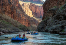
Photos: Grand Canyon rafting, fall 2019
This page features photos of the Colorado River in Grand Canyon National Park during a rafting trip in fall 2019.
The Colorado River carved the...
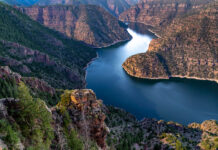
Photos: Flaming Gorge Reservoir, June 2021
This page features photos of Flaming Gorge Reservoir, which impounds the Green River in Wyoming and Utah. The Green River is the most significant...

Map: Explore drone, aerial and terrestrial imagery from The Water Desk
Use this interactive map to browse our expanding collection of free-to-use photos and videos captured by drones, planes and ground-based photographers.