Restoring the Colorado River Delta
In Mexico, where the Colorado River approaches the sea with barely a trickle, conservationists are working to restore the natural habitats of the river’s dry delta. Gary Strieker reports...
Solving water insecurity on the Navajo Nation – Water Buffs Podcast ep. 7 – Kaitlin...
About one-third of Navajo Nation residents lack running water in their homes and water pollution remains a serious issue in the region. We talk to Kaitlin Harris of DigDeep’s Navajo Water Project about solutions to these pressing problems.
Photos: Grand Canyon rafting, fall 2019
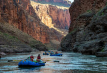
This page features photos of the Colorado River in Grand Canyon National Park during a rafting trip in fall 2019.
The Colorado River carved the Grand Canyon over eons, but...
Photos: Santa Cruz River in Tucson, February 2021
This page features photos of the Santa Cruz River in Tucson, Arizona. The Santa Cruz begins in southern Arizona, dips into northern Mexico, and meets the Gila River, a...
Crop-switching in the megadrought
Farmers in Arizona are hoping that guayule, a hardy plant that produces natural rubber, can become a profitable crop requiring far less water than alfalfa, corn and cotton. Gary...
Proposed Tusayan development threatens Grand Canyon National Park
As a developer seeks an easement in the Kaibab National Forest, the character of surrounding towns and parks could drastically change.
The megadrought hits Lake Powell
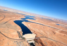
In the 1960s, Glen Canyon Dam created Lake Powell, the 186-mile-long reservoir intended to store Colorado River flows from the Rocky Mountains. With the flows reduced by drought and...
Map: Explore drone, aerial and terrestrial imagery from The Water Desk
Use this interactive map to browse our expanding collection of free-to-use photos and videos captured by drones, planes and ground-based photographers.
Drone videos and photos: Gila River near Winkelman, Arizona
See download info
This page features drone footage and still imagery of the Gila River, near Winkelman, Arizona, just upstream from its confluence with the San Pedro River. The Gila...
Drone videos and photos: Salt River near Theodore Roosevelt Lake, Arizona
This page features drone footage and still imagery of the Salt River, near Theodore Roosevelt Lake in Arizona.
The Salt River, which runs for about 200 miles, is a...


