



Photos: Salton Sea aerials, October 2018
This page features aerial imagery of the Salton Sea in Southern California.
The Salton Sea is a shallow, highly saline lake bordering southern California’s Imperial...

Photos: San Pedro River, Arizona
This page features photos of the San Pedro River in southeast Arizona, a hotspot for biological diversity.
The San Pedro River originates about 10 miles...

Photos and videos: Rio Grande Headwaters, April 2021
This page features drone-captured and ground-based photos and videos of the Rio Grande near its headwaters in southern Colorado.
The Rio Grande...
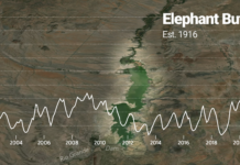
Data viz: Elephant Butte Reservoir levels
Last update: October 2026
Percent of total capacity
Source: US Bureau of Reclamation

Navajo water
Many residents on the Navajo Reservation are now enjoying clean, running water and solar power in their homes, benefiting from DigDeep’s ambitious project to...
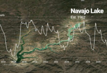
Data viz: Navajo Lake levels
Last update: September 21, 2022
Percent of total capacity
Source: US Bureau of Reclamation

Photos: Central Arizona Project
This page features photos of the Central Arizona Project (CAP) canal, a cornerstone of Arizona's water supply.
Created in 1968 by the Colorado River Basin...

Photos: University of Arizona Laboratory of Tree-Ring Research
This page contains photos from the Laboratory of Tree-Ring Research in the University of Arizona’s College of Science.
The Laboratory of Tree-Ring Research is a...

Video story: Navajo water (full length)
Many residents on the Navajo Reservation are now enjoying clean, running water and solar power in their homes, benefiting from DigDeep’s ambitious project to...

Map: Rio Grande drought tracker
This map depicts data from the National Drought Mitigation Center. Drought intensity categories are based on numerous indicators and local reports from more than...