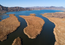
Photos: Bill Williams River National Wildlife Refuge and Parker Strip
This page feature drone-captured imagery and ground-based photos of Bill Williams River National Wildlife Refuge and Parker Strip, both located along the Colorado River and the Arizona-California border.
The Bill...
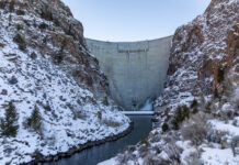
Photos: Morrow Point Dam, December 2020
This page features photos of Morrow Point Dam and the Gunnison River on Colorado's Western Slope.
Constructed from 1963 to 1968, Morrow Point is 469 feet tall and was the...
Photos: Labyrinth and Desolation Canyons along Green River
This page features photos of the Green River in Labyrinth and Desolation canyons in eastern Utah.
The Green River, the main tributary of the Colorado River, flows through some of...
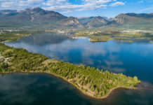
Photos: Dillon Reservoir aerials, July 2021
This page features drone-captured imagery of Dillon Reservoir in Summit County, Colorado.
Created by a 231-foot-tall earth-fill dam, Dillon Reservoir contains over 250,000 acre-feet of water when at full capacity....
Photos: Laguna Grande Restoration Area, Mexico
This page features photos of the Laguna Grande Restoration Area in Baja California, Mexico.
The Laguna Grande Restoration Area is a 1,200-acre plot of land located on the Colorado River’s...
Photos: St. George, Utah and the Virgin River
This page features aerial and ground-based photos of St. George, Utah and the Virgin River outside of Hurricane, Utah.
St. George in a city in southwestern Utah on the Arizona...
Photos: Salton Sea aerials, October 2018
This page features aerial imagery of the Salton Sea in Southern California.
The Salton Sea is a shallow, highly saline lake bordering southern California’s Imperial County. The lake was created...
Photos: San Pedro River, Arizona
This page features photos of the San Pedro River in southeast Arizona, a hotspot for biological diversity.
The San Pedro River originates about 10 miles below the international border, just...
Photos and videos: Rio Grande Headwaters, April 2021
This page features drone-captured and ground-based photos and videos of the Rio Grande near its headwaters in southern Colorado.
The Rio Grande begins in the San Juan...
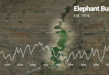
Data viz: Elephant Butte Reservoir levels
Last update: September 21, 2022
Percent of total capacity
Source: US Bureau of Reclamation


