Video story: When in drought, call the beavers
Beaver reintroduction and restoration can help with some of the West's most profound water problems, both in terms of quantity and quality. A trial program is underway at Caribou Ranch in Boulder County.
The value of water
With population growth around Denver prompting fierce competition for water, investors want to import a new supply from the San Luis Valley, but many farmers and ranchers who depend...
Cooling the river
As climate change brings warmer weather, Westerners are looking for ways to protect the region's rivers and streams. In a special report for The Water Desk, Jerd Smith of...
Video story: Cooling the Yampa river (full length)
As climate change brings warmer weather, Westerners are looking for ways to protect the region’s rivers and streams. In a special report for the Water Desk, Jerd Smith of Fresh Water News explains a strategy for safeguarding Colorado’s Yampa River.
Videos and photos: Green Mountain Reservoir and Colorado/Blue confluence drone flight, October 2019
View this gallery for high-resolution downloads »
This page features drone-captured imagery of Green Mountain Reservoir and the confluence of the Colorado River and Blue River, near...
Photos: Colorado River headwaters flight, October 2019
This photo gallery features images shot during a Lighthawk flight to the Colorado River headwaters and surrounding areas.
The flight began at Rocky Mountain Metropolitan Airport in Broomfield, proceeded...
Video and photos: Captain Jack Mill drone flight, July 2019
This photo gallery contains images taken by drone for our story on acid mine drainage in Colorado, which featured the Captain Jack Mill Superfund site near Ward, Colorado.
DateJuly 18,...
Photos: Gross Reservoir aerials, May 2019
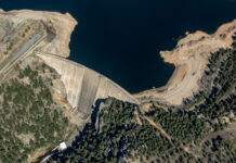
This photo gallery features images shot during a Lighthawk aerial photo flight over Gross Dam and Reservoir, west of Boulder.
Denver Water has proposed raising the dam by 131...
Data viz: explore our interactive dashboards for drought, precipitation and snowpack
These maps and visualizations let you interact with vital data on our water supply.
Photos: Colorado River and tributaries, April 2019
This photo gallery features images shot during a road trip along the Colorado River and two of its tributaries in Colorado: the Blue River and White River.
DateApril...


