Utilities with goals of producing 100 percent renewable energy in Colorado must figure out how to reliably deliver electricity when relying upon resources, primarily wind and sunshine, that aren’t always reliable.
The answer may lie in water, and some of that water may come from Colorado’s Yampa River.
Colorado’s two largest electrical utilities, Xcel Energy and Tri-State Generation and Transmission, are talking about the potential for green hydrogen and other possible storage technologies associated with their existing coal-fired power plants, at Hayden and Craig, in the Yampa Valley. Both plants are scheduled to shut down, with Hayden slated to close by 2028 and Craig by 2030.
Duane Highley, the chief executive of Tri-State, told member cooperatives in a meeting Aug. 4 that Tri-State and the State of Colorado have partnered in a proposed Craig Energy Research Station.
Hydrogen has been described as the missing link in the transition away from fossil fuels. It can be produced in several ways. Green hydrogen, the subject of the proposal at Craig, is made from water using electrolysis. The oxygen separated from the H2O can be vented, leaving the hydrogen, a fluid that can be stored in tanks or, as is in a demonstration project in Utah, in salt caverns. The hydrogen can then be tapped later as a fuel source to produce electricity or, for that matter, put into pipelines for distribution to fueling stations.
How much water will be required to produce green hydrogen isn’t clear. But the Yampa Valley’s existing coal-fired plants have strong water portfolios that could be used to create green hydrogen or another storage technology called molten salt. The latter is the leading candidate at the Hayden plant, co-owned by Xcel Energy and its partners.
Craig Generating Station in 2021 is projected to use 7,394 acre-feet of water, according to a Tri-State filing with the Colorado Public Utilities Commission. By 2029, the last year of coal generation at Craig, Tri-State projects water use will decline to 4,270 acre-feet.
Xcel Energy also has water rights associated with its somewhat smaller two-unit Hayden Generating Station.
When Tri-State first announced last year its plans to close its coal units, some hoped the utility would allow the water to continue downstream, aiding fish and habitat in the Yampa Valley. The Yampa, arguably Colorado’s least trammeled river, since 2018 has been plagued by drought. In early August, water managers placed a call on the middle section of the Yampa River for only the third time ever.
Western Resource Advocates, which works in both energy and water, has supported the green hydrogen proposal. But there’s also hope that a water dividend will still be realized in this transition, resulting in more water available for the Yampa, which is a major tributary to the Colorado River.
“If we do it right, we have the chance to equitably share the impacts and solutions to climate change all across Colorado and the West, with benefits for communities, economies and the environment,” says Bart Miller, director of the Healthy Rivers Program for Western Resource Advocates.
Green hydrogen, similar to wind and solar in the past, has a cost hurdle that research at Craig, if it happens, will seek to dismantle. The federal government’s Energy Earthshots Initiative announced in June hopes to drive the costs down 80% by the end of the decade. That is the program in which Tri-State hopes to participate.
Tri-State’s Highley suggested at the meeting last Thursday that the Craig site should swim to the top of the proposals, because it is an existing industrial site, and the Craig and Hayden units also have high-voltage transmission lines. This is crucial. Those lines dispatch electricity to the Front Range and other markets but they can also be used to import electricity from the giant wind farms being erected on Colorado’s Eastern Plains as well as solar collectors on rooftops and in backyards.
In addition, Craig and Hayden have workforces that, at least in theory, could be transitioned to work in energy storage projects.
Western Resource Advocates, in a June 30 letter to the Department of Energy, made note of that consideration. “A green, zero-carbon hydrogen project at Craig Station is an opportunity to demonstrate how the clean energy transition can also be a just transition for fossil fuel-producing communities,” said the letter signed by Erin Overturf, the Clean Energy Program director.
Several state agencies will likely play a role, said Dominique Gomez, deputy director of the Colorado Energy Office, including the Office of Just Transition that was established in 2019 and the Office of Economic Development and International Trade.
At Craig, the vision is “to provide researchers access to the key resources necessary to perform their research, including water, transmission and site space,” Tri-State spokesman Mark Stutz said in an e-mail. “As the initial step, Tri-State and the state plan to engage a group of stakeholders to facilitate the development of the center.”
The Department of Energy has not indicated when it expects to announce the finalists or grant funding.
At Hayden, where the coal units are scheduled to close in 2028, Xcel Energy says it is in the early stages of studying potential for molten salt, the leading energy storage technology at this time, but also green hydrogen.
Water use will depend upon the size of the projects, said Xcel representative Michelle Aguayo in a statement. “It’s important to remember the amount of water used in power generation in Colorado is relatively small, representing 0.3% of water diversion in the state.”
Xcel already participates in a hydrogen pilot project in Minnesota, its home state for operations, and has proposed natural gas plants in North Dakota and Minnesota that are to be designed to use hydrogen technology when it becomes viable and cost-effective.
“As we’ve said before, we’re focused on identifying and exploring technologies that will allow us to bring our customers carbon-free energy by 2050, technologies that are not available or cost effective today,” she said.Long-time Colorado journalist Allen Best publishes Big Pivots, an e-magazine that covers the energy and other transitions in Colorado. He can be reached at allen@bigpivots.com and allen.best@comcast.net
Fresh Water News is an independent, nonpartisan news initiative of Water Education Colorado. WEco is funded by multiple donors. Our editorial policy and donor list can be viewed at wateredco.org.
The Water Desk’s mission is to increase the volume, depth and power of journalism connected to Western water issues. We’re an initiative of the Center for Environmental Journalism at the University of Colorado Boulder. The Water Desk launched in April 2019 with support from the Walton Family Foundation. We maintain a strict editorial firewall between our funders and our journalism.
The Water Desk is now accepting applications for grants of up to $10,000 to support media outlets and individual journalists covering water issues related to the Colorado River Basin.
The deadline for applications for the 2021 grants is Monday, November 1, 2021, at 11:59 pm Pacific.
This grantmaking program is only open to journalists (freelance and staff) and media outlets.
The Water Desk is interested in supporting a wide variety of media and journalistic approaches: newspapers, magazines, websites, video, television, radio, podcasts and other channels.
The Water Desk will support journalism that focuses on water issues involving the seven states of the Colorado River Basin—Arizona, California, Colorado, Nevada, New Mexico, Utah and Wyoming—as well as the borderlands of Northwest Mexico.
The deadline for applications for the 2021 grants is Monday, November 1, 2021, at 11:59 pm Pacific. This grantmaking program is only open to journalists (freelance and staff) and media outlets.
Proposals related to areas that lie outside of the hydrologic boundaries of the Colorado River Basin’s watershed must have a strong connection to the basin and its water resources.
Because water is intertwined with so many issues, we are open to proposals covering a broad spectrum of topics: climate change, biodiversity, pollution, public health, environmental justice, food, agriculture, drinking water, economics, recreation and more. For this year’s grantmaking, we are especially interested in stories that explore inequities in our water systems related to race and/or income.
Funding for these grants comes from the Walton Family Foundation. As a journalistic initiative, The Water Desk maintains a policy of strict editorial independence from our funders, as well as from the University of Colorado Boulder. Funders of The Water Desk have no right to review nor influence stories or other journalistic content that is produced with the support of these grants.
Boaters at Cedar Springs Marina on Flaming Gorge Reservoir. The reservoir’s levels are expected to drop 2 feet a month under an emergency release of water designed to keep Lake Powell’s hydropower system operating. July 22, 2021 Credit: Jerd Smith
By Jerd Smith
Dutch John, Utah: John Rauch and his family have operated the Cedar Springs Marina here since 1986. But three weeks ago, when the federal government suddenly ordered millions of gallons of water to be released from Flaming Gorge Reservoir down the Green River to Lake Powell, Rauch wasn’t prepared.
“It was a total gut punch,” he said on a recent hot, sunny morning. As visitors trekked down to rent his pontoon boats, and others slid their fishing craft into the reservoir, Rauch and his employees were already planning which boat docks and ramps would have to be relocated to keep them afloat. The reservoir is projected to drop as much as 2 feet a month through the fall as water is released.
Drought has plagued the Colorado River Basin for 20 years, but it hit crisis proportions this summer, pushing lakes Powell and Mead to historic lows and triggering, for the first time, emergency releases of water from Utah’s Flaming Gorge, Colorado’s Blue Mesa, and New Mexico’s Navajo reservoirs.
All told, 181,000 acre-feet of water are to be sent to Lake Powell by the end of December. Powell has dropped so low that its hydropower plants, which supply millions of homes with electricity and generate revenue for such things as a critical Colorado River endangered species program, may stop operating as early as next year if water levels continue to drop as they have been. The U.S. Bureau of Reclamation estimates there is a 3 percent chance of this occurring next year and a 29 percent chance of this occurring in 2022. But given the speed of the Powell’s decline, no one wants to risk a hydropower shutdown.
Savings accounts
Since their construction in the 1960s these reservoirs, known as Reclamation’s Colorado River Storage Project reservoirs, have acted as a giant savings account, helping ensure that if a crisis erupted on the river, the Upper Colorado River Basin states of Colorado, Wyoming, Utah and New Mexico would have enough water on hand to fulfill their legal obligation to deliver water to Nevada, Arizona and California, known as the Lower Basin states.
Colorado’s Blue Mesa Reservoir, part of the Aspinall Unit, is already low, at just 43 percent of capacity as of last month. Fed by the Gunnison River, a major tributary of the Colorado, the reservoir is tourism hot spot on Colorado’s West Slope.
Kathleen Curry, a former Colorado lawmaker, sits on the Colorado River District Board. She said she understands the need for the releases, but she said the changes in the shoreline at Blue Mesa aren’t going unnoticed.
“It’s taking residents and visitors by surprise, just because I don’t think anyone was expecting it,” she said.
The releases come under a special Upper Basin Drought Contingency Plan approved by Colorado, Wyoming, Utah and New Mexico in late 2018. A similar drought plan is in place for the Lower Basin, and they have been cutting back withdrawals from Lake Mead for the past two years.
Still the river system is drying out. And water leaders in Colorado are deeply worried that their carefully protected savings account is going to dry up too quickly to solve the Colorado River’s long-term problems.
Will it work?
“I understand and support the necessity of the Secretary [of the Interior] taking this action,” said Jim Lochhead, CEO of Denver Water. “The major concern I have is that Reclamation says the 181,000 acre-foot release will raise Lake Powell three feet. But I don’t know that they can even show that. I don’t know that they have accounted for transit losses and other losses.
“It’s important when these releases are made that they are accounted for, that we know where this water is going. If it doesn’t actually get down to [Lake Powell] to accomplish what it was designed to do, we should have kept it in that savings account,” Lochhead said.
Becki Bryant, a spokesperson for the U.S. Bureau of Reclamation’s Upper Colorado River region, said the agency is working to create a hydropower buffer in Lake Powell and believes the releases are adequate to accomplish that. But Reclamation is not yet doing the kind of precise tracking and accounting known as water “shepherding,” to ensure flows make it downstream, that Lochhead is requesting.
On Aug. 1, Lake Powell’s elevation stood at 3,553.8 feet above sea level. The action point, or so-called target elevation is 3,525. When that point came close in July, Reclamation moved quickly to order the emergency releases.
Powell’s hydropower plant stops generating power when it drops to 3,490 feet in elevation, according to Reclamation.
“Reclamation expects the additional release of water will be sufficient to protect Lake Powell’s target elevation through 2021. That target elevation provides a 35-vertical-foot buffer designed to minimize the risk of dropping below the minimum power pool elevation of 3,490 feet, and balances the need to protect the infrastructure at Powell’s Glen Canyon Dam.
“Shepherding water would be beneficial but is challenging on many levels for Colorado River Basin states,” said Bryant via email.
Bleak forecasts
Bryant said Reclamation will continue to consult with the Upper Basin states as it monitors reservoir levels and weather forecasts. Should conditions deteriorate further, the agency could examine whether to declare the releases futile and stop them, as it is allowed to do under the 2018 Drought Contingency Plan.
The water being released is so-called “system water,” meaning that it isn’t owned by a particular user.
Held by the federal government for the benefit of the Upper Basin states, the amounts of water specified in the release plan are jaw-dropping: 125,000 acre-feet from Flaming Gorge; 36,000 acre-feet from Blue Mesa; and 20,000 acre-feet from Navajo. An acre-foot of water is enough to cover one acre of land to a depth of 12 inches.
If that same amount of water were going to cities, it would be enough to serve more than 362,000 homes for one to two years. If going to farms, it could irrigate more than 113,000 acres, depending on the crop.
If the historic, 20-plus-year drought cycle doesn’t end soon, refilling those reservoirs is going to be difficult. And that has water managers worried.
“My level of concern is quite high,” said Becky Mitchell, director of the Colorado Water Conservation Board, the state’s lead water planning and policy agency. She also sits on the four-state Upper Colorado River Basin Commission, which advises Reclamation on river issues.
“And I can’t tell yet if [the releases] are going to do the trick,” she said. “But we have to respond to the levels in Powell.”
Legal reckoning?
Under the 1922 Colorado River Compact, Colorado and the other Upper Basin states must deliver 7.5 million acre-feet (maf) of water to the Lower Basin on a 10-year running average. Right now, the Upper Basin is delivering roughly 9.2 maf, Mitchell said, meaning that there is still time to help the system come back into balance before the Lower Basin states could legally call for more water than they currently receive.
Lake Powell is the Upper Basin’s largest storage pool on the system and is designed to be the four Upper Basin states’ major source of protection. Because of their legal obligations, Colorado water users are closely monitoring this year’s plunge in Powell, with the threat to hydropower production being seen as a dangerous antecedent to a compact call.
“That the system continues to deteriorate is concerning,” Lochhead said.
Roughly half of Denver Water’s supplies are derived from water rights it owns on the Colorado River system. While one portion of its portfolio dates back to 1921, and would therefore trump a 1922 compact call, several other rights were established later, meaning the utility might have to stop pulling from those water sources if Colorado were forced to cut back in order to meet compact obligations.
Other Front Range water providers, who also have Colorado River rights, are even more vulnerable, including the Pueblo-based Southeastern Colorado Water Conservancy District.
Southeastern’s rights date only to 1957.
Contingency v. reality
Lee Miller, Southeastern’s attorney, said the Colorado River crisis remains a long-term problem for his agency.
The rapid deterioration this year, however, is prompting everyone to rethink how much time they have to balance the massive river system as drought and a warming climate, as well as population growth, continue to sap its flows.
“Both the Upper and Lower Basin have now had to initiate elements of their drought contingency plans. When we passed it a couple of years ago everyone thought, “It’s good to have a contingency plan.’ But I don’t think anyone thought we would have to use the plans this quickly. It’s gone from being a contingency to being a reality, and that’s concerning.”
Back up at Flaming Gorge, John Rauch is watching the levels drop and making his own contingency plans.
“We are planning for the worst,” Rauch said. “For the foreseeable future, the outlook is dry. If it ends up that by the end of all of this that the reservoir becomes a river channel, we will be down there at water’s edge selling worms.”
Jerd Smith is editor of Fresh Water News. She can be reached at 720-398-6474, via email at jerd@wateredco.org or @jerd_smith.
Fresh Water News is an independent, nonpartisan news initiative of Water Education Colorado. WEco is funded by multiple donors. Our editorial policy and donor list can be viewed at wateredco.org.
Despite a stubborn, 20-year drought and reservoirs whose supplies are below normal, Colorado communities remain split on whether to impose permanent outdoor watering restrictions, according to a Fresh Water News analysis of local watering rules.
According to the analysis, which examined rules in 15 cities representing the state’s different geographies and major population centers, eight of the cities surveyed have enacted permanent restrictions. Seven cities have not, opting instead to enact variable, temporary watering rules each year.
But when communities do impose permanent rules, rather than adjusting them each spring depending on snowpack and reservoir levels, significant savings occur, with some communities seeing reductions of more than 40 percent in peak summer water demand, according to a recent study by Alliance for Water Efficiency, a nonprofit representing water and wastewater utilities across North America.
Credit: Chas Chamberlin
Those kinds of statistics helped Steamboat Springs last spring make the move to permanent water restrictions. Steamboat limits customers to watering their lawns three days per week based on the last digit of their address — even numbers can water on Sundays, Tuesdays and Fridays, while odd numbers can water on Mondays, Thursdays and Saturdays. The new rules also limit outdoor watering to between 6 p.m. and 10 a.m.
After years of variable outdoor watering rules that fluctuated depending on drought conditions, Steamboat Springs residents embraced the new permanent schedule right away, according to Kelly Romero-Heaney, the city’s former water resource manager who earlier this month became Assistant Director for Water at the Department of Natural Resources.
“Coloradans are ready to take this step,” said Romero-Heaney. “There really is no reason to water irrigated sod every day, unless it’s getting heavy use like you would see at a soccer field or a community park. It just makes perfect sense. We also recognize that it’s not fair for us to say to the Front Range utilities, ‘You need to conserve more, you need to conserve more, that’s your problem,’ if we’re not conserving ourselves. We wanted to lead by example.”
For its permanent watering rules, Steamboat Springs drew inspiration from the handful of other Colorado cities — both on the Front Range and in the mountains — that have made outdoor watering rules the norm, instead of the exception.
Some city and utility leaders say the watering rules help residents to permanently change their outdoor watering behaviors, given the aridification of the West and the accelerating pace of climate change. Others continue to monitor drought conditions throughout the summer months and adjust their watering rules depending on the current severity.
Permanent watering rules have indeed helped some Colorado cities reduce their outdoor water use, which can represent as much as half of all domestic water use. Castle Rock, for example, has seen a 20 percent reduction in per-person, per-day water use since enacting its permanent watering rules in 1985.
But city leaders also view permanent watering rules as just one tool in a broader water conservation toolbox, along with education and outreach, water-wise landscape and fixture incentives, tiered rate structures, and strict enforcement measures.
Conservation experts agree, noting that permanent watering rules aren’t a silver bullet and that there’s no one-size-fits-all approach to water supply and demand management.
“You can’t prescribe a blanket strategy across every water provider typically,” said Bill Christiansen, director of programs for the Alliance for Water Efficiency. “It’s not fair to say a certain strategy would work for every water provider. You have to do what makes sense for your area.”
Why watering rules?
In the broadest sense, watering rules — both permanent and temporary — help utilities manage peak demand, the period of time when water use is the highest. In most communities, peak demand occurs during the summer, when residential and commercial customers water their lawns and gardens. These rules help ensure that utilities have enough supply to meet the needs of their customers. During drought, when water supply is low, many communities enact or tighten watering rules to help lower the demand for water.
“Outdoor water use can often represent a very large percentage of a water provider’s portfolio, and the capacity of a system is built to meet peak water use,” Christiansen said. “If outdoor water use can be reduced, it can be a very effective way to reduce water consumption. It can also be very helpful if a community is facing the need to expand their capacity — they can lower that peak and avoid or downsize any capacity or expansion projects. That can save ratepayers a lot of money if a large investment can be avoided.”
In a recent study, the alliance found that mandatory watering restrictions of all kinds lead to significant decreases in water demand. Some cities involved in the study saw up to a 42 percent reduction in peak monthly demand. Meanwhile, voluntary watering restrictions produced no statistically significant difference in water demand.
When comparing permanent versus temporary watering rules, the study found that water demand rebounded after cities lifted temporary drought restrictions, while cities that made watering restrictions permanent saw very low levels of rebound. Strong messaging and enforcement, as well as drought surcharges, were also important for reducing demand.
“Increasing rates is often the most effective tool for achieving water savings,” according to the study.
“New” water supply for development
Some growing Colorado cities view permanent watering rules and other conservation measures as a “new” source of water, because these measures help buy them more time before they have to seek out other, often costly new water supplies in advance of future development.
That’s been the case for Aurora since 2002, when the city first enacted its permanent rules limiting residents to watering no more than three days a week and, from May 1 to Sept. 30, to watering before 10 a.m. and after 6 p.m.
But watering rules are just one piece of the puzzle in Aurora. The city also has a tiered rate structure, enforcement measures for violators and many financial incentives for water-conserving landscaping and devices; Aurora also re-uses much of its water through its innovative Prairie Waters system. These and other conservation efforts appear to be working, too. Since the early 2000s, Aurora’s water use has declined 36 percent, resulting in some of the lowest per-person water use on the Front Range.
“Aurora is not fully developed,” said Marshall Brown, general manager of Aurora Water. “We’ve got water supplies that are conservatively or easily able to meet the demand of our existing population. But we do have to continue to acquire supplies to meet future growth and demands that we know are coming our way. So with that, probably the easiest water supply we have is to extend our existing supplies. That’s the least costly option for us.”
“Sustained nutrition”
Other city leaders view permanent watering rules as a way to change their residents’ and businesses’ behaviors. Instead of flip-flopping between various watering schedules and rules throughout the summer, residents simply adapt to the new norm and move forward.
That was one big reason Thornton adopted permanent watering rules in March, where watering is limited to three days per week between 6 p.m. and 10 a.m. At the same time, the city also updated its code to include beefed-up enforcement measures for leaks and other water-wasting behaviors.
“Planning for drought is one thing — we’ve got these short-term strategies where we reduce demand or grab extra water, but one of the real strains on all of our systems is the aridification of the region,” said Emily Hunt, deputy infrastructure director for Thornton Water, which also has a tiered rate structure and various water-wise incentive programs. “We’re becoming progressively drier and warmer and that’s a challenge to plan for. We have to be able to rely on consistent behavior change from our customers and just a consistent ethic and not this, ‘Oh, we’re in a drought we’re in an emergency,’ like the crash-dieting approach. We need more of a sustained nutrition approach.”
The same is true for Colorado Springs, which enacted its permanent watering rules in January 2020. After years of messaging and education around droughts, the city’s customers immediately adapted to the new watering rules, said Julia Gallucci, water conservation supervisor for Colorado Springs Utilities.
“We started communication on May 1 and by the first week in July, we could see by usage that the majority of our customers were all watering no more than three days a week, which was really encouraging,” Gallucci said.
In the first year under the new rules, Colorado Springs saw a 1 percent reduction in commercial irrigation and a 4 percent to 5 percent reduction in residential irrigation, Gallucci said. Those initial numbers were right on target with the city’s goal of contributing 11,000 to 13,000 acre-feet to its supply through conservation over the next 50 years through the watering rules and other measures.
“This is one of the best ways to implement a water conservation ethic across the community, because instead of being really mindful of drought in drought years, we’re mindful of it year after year,” Gallucci said. “Unlike drought response, when you’re trying to manage a dearth in water supply for a shorter period of time, these are planning well out into our future. It was kind of amazing how quickly and supportively our community responded to our water-wise rules last year.”
Storage questions
Of course, if cities are conserving water for future use, they need to have somewhere to store it, Gallucci pointed out. Water storage projects can be expensive and unpopular among some residents, but they’re an important piece of the equation.
“Conservation can only contribute so much to supply,” Gallucci said. “If you use none, you’ll have all of that to use later. But when you curb your water use by 5 percent each year, you have to have the storage to keep that additional water to use later on. Conservation and storage is this really careful and important balance in Colorado. Every large provider is considering different ways to expand their storage as a form of taking care of their supply.”
That’s the main reason Durango has not enacted permanent watering rules, according to Jarrod Biggs, the city’s assistant utilities director.
“We did a pretty thorough and thoughtful evaluation of this when we were developing our drought management plan,” Biggs said. “It seems like a rational exercise, it drives conservation. But we’re a surface supply city, we don’t have significant reservoir space to speak of and so if we enact watering restrictions, we’re just letting the water go by us. There’s the old adage that canals move water in space and reservoirs move water in time. We don’t have enough of that time machine in the City of Durango and we’ve built our policies around that.”
That’s not to say that Durango encourages residents to use water needlessly. In fact, the city has some “pretty punitive” tiered pricing for heavy users, Biggs pointed out. In the meantime, Biggs is pursuing other ways to boost supply in Durango, including using water from Lake Nighthorse, part of the Animas-La Plata Project.
“I’ve got a two-pronged approach,” Biggs said. “Let’s push and strive and discuss and encourage conservation because that will push out the investment that we need to make in additional water supplies, but at the same time, let’s pursue those investments in water supplies because we know they’ll only be more expensive in the future.”
The City of Boulder also continues to make outdoor watering decisions each spring, looking at drought indicators and the city’s water supply status after May 1. Instead of permanent watering rules, the city relies on tiered water prices, customized water budgets for customers, and incentives and education to encourage conservation.
“So far, while current conditions are drier than normal, our snowpack and reservoir levels are looking sufficient enough to not require restrictions,” said Kim Hutton, Boulder’s water resources manager. Still, she said, “Due to drier conditions, we continue to encourage water customers to use water efficiently.”
Looking ahead
Since Colorado communities are at different points in their water conservation journey and are facing their own unique challenges, the path forward will look different for every city.
Some communities are installing automated metering infrastructure systems, which they hope will help water users track and better manage their water use in real-time. Others are providing grants to homeowners’ associations and working with developers to encourage more water-friendly landscaping in neighborhoods.
But according to conservation experts, even those cities with the most robust water-saving initiatives underway must keep working, as a good water year here and there isn’t likely to alleviate the West’s long-term drought.
“All the strategies we have at our disposal for water conservation and efficiency fall along a spectrum,” says Waverly Klaw, director of resilient communities and watersheds for the Sonoran Institute, a Tucson-based conservation organization. “It’s important to keep moving in the same direction of greater and greater water savings. Some communities might have permanent watering schedules and that’s great, and that will save them a certain amount of water, but they should continue to look forward and look at additional opportunities and strategies to go beyond that. One tool or strategy doesn’t solve the whole problem.”
Sarah Kuta is a freelance writer based in Longmont, Colorado. She can be reached at sarahkuta@gmail.com.
Fresh Water News is an independent, nonpartisan news initiative of Water Education Colorado. WEco is funded by multiple donors. Our editorial policy and donor list can be viewed at wateredco.org.
The Water Desk’s mission is to increase the volume, depth and power of journalism connected to Western water issues. We’re an initiative of the Center for Environmental Journalism at the University of Colorado Boulder. The Water Desk launched in April 2019 with support from the Walton Family Foundation. We maintain a strict editorial firewall between our funders and our journalism.
A Colorado Parks and Wildlife officer heads out on patrol at Chatfield Reservoir. A $171 million redesign at the popular lake is now complete, providing more water storage for Front Range cities and farmers. Last week the Colorado Water Conservation Board approved a settlement that will pave the way for an environmental water plan to help offset the impacts of the new storage. Credit: Jerd Smith
Colorado water officials have reached a settlement removing one of the last barriers to a new environmental water program in Chatfield Reservoir.
The agreement settles a dispute among water agencies about who could use storage space in a special environmental pool in the reservoir.
The agreement is one of the final steps in the re-operation of the recreational site just southwest of Denver and comes after years of permitting disputes and lawsuits.
The federally owned reservoir was built in 1967 and was initially designed for flood protection in years when the South Platte River surged beyond its banks.
But as drought and climate change, as well as population growth, increased pressure on urban and agricultural water supplies on the Front Range, federal, state and local agencies began working to convert a portion of Chatfield’s flood storage to municipal and agricultural water storage. The reallocated storage space totals 20,600 acre-feet, of which 2,100 acre-feet is designated as the environmental pool.
The new storage will give south Denver metro area cities such as Highlands Ranch more protection against drought and diminishing groundwater supplies, and will give farmers on the Eastern Plains the ability to use stored water to irrigate crops late in the season when flows in the South Platte River run low. Water from the environmental pool will be used for releases to boost streamflows downstream, improving water quality and providing other environmental and recreational benefits. Downstream irrigators will also benefit from those releases.
The physical work on the re-operation was completed last year after the project won federal approval and a major lawsuit against it failed.
The latest legal dispute stems from a disagreement between Centennial Water and Sanitation District, which serves Highlands Ranch, and the Greeley-based Central Colorado Conservancy District, over whose water rights could be used to fill the environmental storage space and whose space would be filled first.
Centennial’s and Central’s boards must still approve the settlement, according to Lauren Ris, deputy director of the Colorado Water Conservation Board, which negotiated the deal. [Ris also serves on the Board of Trustees for Water Education Colorado, which sponsors Fresh Water News.]
“There was a disagreement among the parties about which water rights could be used,” Ris said, with ultimately Colorado Parks and Wildlife giving up some of its storage space to settle the dispute between the water agencies.
Central officials could not be reached for comment.
Centennial Water Resources Manager Rick McLoud said his agency had spent millions of dollars and more than 20 years to ensure that the new Chatfield plan would serve Highlands Ranch well, and that its ability to store water there would not get bumped too far down the priority list.
“We spent 27 years working to get it and more than $55 million. We did not want to lose out,” McLoud said.
Environmentalists, including the Denver Chapter of the Audubon Society, had long battled the re-operation of the reservoir because it inundated the existing shoreline and resulted in a loss of bird habitat, among other issues.
New habitat has been set aside farther downstream for birds and other species, and water from the environmental pool will help maintain streamflows and habitat as it is released.
Abby Burk, an Audubon Society official, said her group is still deeply worried about the loss of habitat.
But she said the fierce drought and ongoing shortages of water for environmental purposes make the Chatfield habitat water critically important.
“Chatfield was a hard go. We lost some strong riparian areas for birds,” Burk said. “But anytime we can have environmental benefits, particularly in a challenging drought year, we have to go for it.”
Jerd Smith is editor of Fresh Water News. She can be reached at 720-398-6474, via email at jerd@wateredco.org or @jerd_smith.
Fresh Water News is an independent, nonpartisan news initiative of Water Education Colorado. WEco is funded by multiple donors. Our editorial policy and donor list can be viewed at wateredco.org.
The Water Desk’s mission is to increase the volume, depth and power of journalism connected to Western water issues. We’re an initiative of the Center for Environmental Journalism at the University of Colorado Boulder. The Water Desk launched in April 2019 with support from the Walton Family Foundation. We maintain a strict editorial firewall between our funders and our journalism.
Lake Powell is shown here, in its reach between where the Escalante and San Juan rivers enter the reservoir, in an October 2018 aerial photo from the nonprofit environmental group EcoFlight. Colorado water managers are considering the implications of a program known as demand management that would pay irrigators on a temporary and voluntary basis to take less water from streams in order to boost water levels in Lake Powell, as an insurance policy against compact curtailment. CREDIT: ECOFLIGHT
The crisis on the Colorado River is not waiting for the state of Colorado to develop a program to avoid water shortages.
That was the message that Colorado Water Conservation Board members received from some commenters at their regular meeting Wednesday. The state water board is investigating the feasibility of a program known as demand management, which would pay irrigators on a temporary and voluntary basis to not irrigate and instead use that saved water to meet downstream obligations on the Colorado River.
James Eklund, former head of the CWCB and one of the architects of the Drought Contingency Plan, which allows for the possibility of a demand-management program, urged the board in the public-comments portion of the discussion to take swift action on what he called arguably the largest water crisis Colorado has ever faced.
“Time is not your or our collective out. If you wait, that’s a decision that you make to determine whether or not we have a hand on the steering wheel as we move forward with this river,” he said. “The waiting is, I think, folly.”
The state received the comments in response to a draft framework released in March of what a demand-management program could look like, with three tiers of implementation options, guiding principles, threshold issues, trade-offs and equity considerations. The framework matrix is based on the findings of nine workgroups assigned to tackle different aspects and challenges of a potential program.
In addition to written comments, Trout Unlimited Colorado Water Project’s director, Drew Peternell, also told board members at the meeting that the group has concluded that demand management should be one tool Colorado uses to avoid compact curtailment.
“We realize you are taking on some very tough issues, but I also want to urge you to pick up the pace,” he said. “Hydrology on the West Slope is not good. Additional shortages on the system are likely. They would be painful. Now is the time to get something done.”
Gail Schwartz, who represents the main stem of the Colorado River basin on the nine-member board, noted the gravity of the situation and invoked the warnings of 19th-century explorer and river runner John Wesley Powell, after whom the second-largest reservoir in the country and ground zero for many of the basin’s most pressing problems is named. In 1893, the prescient Powell said the American West was “piling up a heritage of conflict and litigation over water rights, for there is not sufficient water to supply these lands.”
“I think that we are at this extraordinary moment in time,” Schwartz said. “This is a desert and we are going to empty every bucket, we are going to empty every river, and this is the inevitable unless we can develop the courage and the ability to step forward.”
The controversial water-banking program, which some fear could harm agriculture on the Western Slope, has sparked a lot of discussion but little agreement over the past two years. Some have expressed frustration with what they say is the state’s slow pace of a program rollout and want to begin pilot projects to test the program’s feasibility. Mark Harris, general manager of the Grand Valley Water Users Association, urged the board in his comment letter to take aggressive action.
“The only way to really raise the important questions and to identify the positive and negative consequences of our actions is to try something,” Harris said. “There is no other way to advance the agenda without taking some well-considered risk.”
Water from the Government Highline Canal pours into Highline Lake in Mack. Water from the Government Highline Canal pours into Highline Lake in Mack. The Grand Valley Water Users Association – the group that regulates water flow in the canal – is calling for the state to take more aggressive steps to test out the concept of demand management. CREDIT: BETHANY BLITZ/ASPEN JOURNALISM
Drought Contingency Plan
Under the 2019 Drought Contingency Plan, signed by the seven Colorado River basin states, the Upper Basin (Colorado, Utah, New Mexico and Wyoming) can develop a program to send up to 500,000 acre-feet of saved water downstream to Lake Powell as a kind of insurance policy to bolster levels in the reservoir and help meet Colorado River Compact obligations. If the Upper Basin states were not able to deliver the 75 million acre-feet of water over 10 years to the Lower Basin (Nevada, Arizona and California), as required by the 1922 agreement, it could trigger what’s known as a compact call, which would force involuntary cutbacks in water use.
Over the past two decades, climate change has been robbing the Colorado River system of flows, and levels in the river’s two largest reservoirs, Lake Powell and Lake Mead, have plummeted to record lows. Federal officials have begun making emergency releases from Upper Basin reservoirs to prop up levels in Lake Powell and preserve the ability to make hydroelectric power. But some water managers say unless this Upper Basin reservoir water is replenished with big snow next winter, the releases may be a one-time, stopgap solution.
In addition to the urgency imposed by the worsening hydrology, the clock is ticking on the storage agreement laid out in the Drought Contingency Plan, which allows for the development of a demand-management program. It expires in 2026, when a new round of negotiations begins. All four Upper Basin states must agree to move forward with a demand-management program; Colorado cannot go it alone.
The “bathtub ring” at Lake Powell evidences lower flows coming into the reservoir. Federal officials are making emergency releases from upper basin reservoirs to prop up levels and Lake Powell and preserve the ability to make hydroelectric power. CREDIT: BRENT GARDNER-SMITH/ASPEN JOURNALISM / ASPEN JOURNALISM
Decision making roadmap
Despite the sense of urgency expressed by some members, the CWCB did not approve the next step forward that was recommended by staff: adopting a decision making roadmap, which sets out a timeline for determining if demand management is achievable and worthwhile for Colorado. Tackling whether demand management is achievable was set to tentatively begin in September, and looking into whether the program is worthwhile for Colorado was supposed to begin in November.
Schwartz made a motion to adopt the roadmap but later withdrew it after some board members said it was too broad, left too many questions unanswered and did not incorporate feedback from the board.
“I feel this roadmap is incomplete, and until I see the roadmap with the comments from the board, I don’t feel comfortable moving forward,” said Jackie Brown, who represents the Yampa and White river basins.
This field in lower Woody Creek is irrigated with water that eventually flows into the Colorado River. The state of Colorado is exploring how to fund a program that would pay irrigators to reduce their consumptive use in order to send water downstream to a savings account in Lake Powell.CREDIT: BRENT GARDNER-SMITH/ASPEN JOURNALISM
River District’s interests
Demand management was also a topic at the Colorado River Water Conservation District’s quarterly board meeting in Glenwood Springs on Tuesday. Amy Ostdiek, the CWCB’s deputy section chief for interstate, federal and water information gave a presentation on the state’s progress.
The River District, which represents 15 counties and advocates to keep water on the Western Slope, is conducting its own investigation into the feasibility of demand management through meetings with water users and plans to release a report of its findings. The River District has not yet taken a position on the potential program.
“My personal view is that we are going to keep pushing to protect the River District’s interests in a demand-management program, but we realize this is something necessary to move forward sooner rather than later,” said Peter Fleming, River District general counsel.
Board president Marti Whitmore, who represents Ouray County, asked staff to come up with a proposal with specifics on a demand-management program.
“The time is right to come up with something to put on the table for discussion purposes,” she said. “I’m just looking to break the logjam here, so we are talking some substance instead of just frameworks and process. It could be an opportunity for the River District to provide some leadership.”
CWCB board members plan to continue discussing demand management at an Aug. 18 workshop.
The Water Desk’s mission is to increase the volume, depth and power of journalism connected to Western water issues. We’re an initiative of the Center for Environmental Journalism at the University of Colorado Boulder. The Water Desk launched in April 2019 with support from the Walton Family Foundation. We maintain a strict editorial firewall between our funders and our journalism.
Beaver dam on the Crystal River in Colorado. Beavers are being eyed as an important eco-builder because of their abilities to construct and restore natural wetlands, increasing storage. Credit: Sarah Marshall, Colorado Natural Heritage Program
By Jason Plautz
Colorado could need more than 750,000 acre-feet of new water supplies by 2050 to meet the demands of a growing population. But how to store that water, something historically done using dams and reservoirs, some massive in scale, isn’t clear. And cities, water planners and environmentalists, from Steamboat Springs to Sterling, are looking way beyond concrete to find new storage alternatives that minimize evaporative losses, enhance the environment, and provide security for the region in the face of chronic drought.
But the challenges are large. Increasing environmental and social concerns, limited geographic locations, and even more limited water rights have made water storage increasingly difficult. On top of that, long-range forecasting — to figure out how much water is going to be available to be stored — has become especially complicated due to climate change.
An April 2020 study published in the journal Science found that the American West’s current drought is as bad or worse than any in the past 1,200 years of tree-ring records. Ordinarily, storage would be the obvious solution to drought and dry years. You collect moisture in wet years and save it for times of need. But climate change has created a catch-22. Storage may be necessary, but it has become more challenging to build and less water is available to capture.
Dan Luecke, former director of the Environmental Defense Fund’s Rocky Mountain office, says these challenges have upended a philosophy long built on risk analysis to one defined by “decision making under uncertainty.”
“For a long time, we’ve known there’s risk but we could look to the historical record to manage it,” says Luecke. (Luecke also serves on the Board of Trustees for Water Education Colorado, which sponsors Fresh Water News.) “With climate change, that record is called into question … the nature of the game has changed.”
The cascading challenges of climate change have led water managers to think creatively about alternatives to traditional infrastructure. Greeley, for example, replaced a plan to expand an existing reservoir with one that will store water underground. Front Range districts collaborated to reallocate the space in Chatfield Reservoir, a flood storage basin, raising the water level to add permanent water storage supply. As part of the Basin Implementation Plan for the Yampa/White/Green River Basin, water managers are exploring putting reservoirs high in the mountains to limit evaporative loss.
Decision making under uncertainty makes it all the more complicated for water providers to meet Colorado’s water needs and has caused many to reexamine what a smart storage project is made of — one that can help meet water supply goals for many water users while respecting the environment, one that is also acceptable to stakeholders, and one with minimum impacts so that it can make its way through the permitting process. Water managers are growing increasingly innovative, out of necessity, to develop water storage projects that will work.
Reservoirs under climate change
It’s not simply a matter of how much water is available to store. Everything from the location and size of reservoirs to the timing for capturing runoff and for making releases is being reviewed. Various climate models, including those used by the Colorado Water Conservation Board for state water planning, project warmer temperatures that will affect evaporation rates in rivers and reservoirs and seasonal shifts in precipitation, including reduced mountain snowpack and earlier runoff. Earlier and reduced flows could, for instance, necessitate dams releasing water earlier to meet demand.
Temperature rise, too, makes storing water a challenge. Any pool will lose water through evaporation, and more during hot, dry times, but the loss is worse for reservoirs at lower elevations with more exposed surface area. The science used to estimate evaporative loss is imprecise — estimates could be off by as much as 20% to 30%, according to the U.S. Bureau of Reclamation, which is conducting a study to refine its methods. Even so, a 2018 Bulletin of the American Meteorological Society study estimated that losses from Lake Powell and Lake Mead could total as much as 15% of the annual upper basin allocation among Colorado River Basin states, or five to six times the annual water use of Denver. The same study said that summer evaporation rates may have risen by as much as 6% over the last 25 years.
The Fourth National Climate Assessment, published in 2018, states that climate change is fueling stronger storms that could overwhelm dams and infrastructure designed to capture more moderate storm surge flows. It’s also intensifying wildfires that destroy landscapes, load reservoirs with sediment, and threaten water delivery infrastructure.
The 2019 Technical Update to the Colorado Water Plan lays out a number of alternatives to new traditional storage projects, including rehabilitating existing infrastructure, reallocating flood storage to active storage, and using below-ground aquifer storage alternatives. While the options are vast, the update says that to meet the state’s goals, “at least some new large reservoirs are needed.”
But building those reservoirs also requires water to fill them, says Brad Udall, senior water and climate research scientist at Colorado State University. Water rights are not as easy to come by in an era of constraint. Any new water rights claimed today are junior in the state’s legal priority system, making storage necessary to capture peak flows after all senior water rights are satisfied. But as climate change shifts the timing and magnitude of peak flows, reservoirs may not be as effective a tool for managing junior water rights.
“A dam is a bit like opening a bank account, there has to be something to put in it,” Udall says. “Ultimately, everything bends to the hydrological realities of what the supply is.”
The jigsaw puzzle
The era of uncertainty doesn’t just make individual storage projects a puzzle — the long-range plans that help utilities figure out what storage they need are now a tangle of variables. Balancing climate-complicated precipitation projections with population and water use trends, regulatory changes, and competition for resources can make the standard planning process a head-spinning endeavor.
When Colorado Springs Utilities started updating its 2017 Integrated Water Resource Plan (IWRP), the utility wanted a “comprehensive view” that would take a hard look at risk analysis, says water planner Kevin Lusk. Colorado Springs doesn’t sit on a major river system and relies on storage in remote watersheds to manage its variable supply. In the early 2000s, the utility’s water yield saw a 600% difference between the driest and wettest years.
Realizing that a backward-looking dataset might no longer apply to a present and future defined by climate change, the utility took a state-of-the-art new approach to its planning process. Recently, Colorado Springs partnered with the consulting firm Black and Veatch, which expanded the multi-objective evolutionary algorithm (MOEA) to utilities to help them assess the complexities in planning. The machine learning tool can project thousands of possible futures using precipitation, temperature and hydrological factors, then help planners narrow down their range of possible options.
“As these plans get so big, it’s hard for the human mind to comprehend them,” says Leon Basdekas, a private consultant who worked at Colorado Springs Utilities, then Black and Veatch, designing and managing the utility’s IWRP. “This tool allows you to evaluate complex planning options in ways that would be impossible to do otherwise.”
Leon Basdekas, pictured beside Monument Creek, worked with Colorado Springs Utilities using a machine learning tool to help the water provider assess complex future water supply and demand scenarios and evaluate where new water storage could be beneficial. Photo by Matthew Staver
More than anything, Lusk says, the advanced modeling helped the utility gain a better appreciation for the full scope of storage and transmission. The “a-ha moment,” he says, is seeing how one individual new reservoir may not mean as much for the system as, say, shoring up existing pipelines to make the already-built system run more efficiently.
“We can’t just look at storage on its own, it’s a package deal with supply and conveyance,” Lusk says. “This is a complex jigsaw puzzle.”
Mitigation meets enhancement
To the north, the Northern Integrated Supply Project, or NISP, has been moving through a decades-long process to obtain the necessary permits and to gain the favor of local stakeholders. NISP has been reshaped, with operational changes and environmental improvements now built in, in response to stakeholder concerns.
The project, spearheaded by Northern Water, if fully approved, will build two reservoirs, one northwest of Fort Collins off the Cache la Poudre River and another northeast of Greeley, to deliver nearly 40,000 acre-feet of water a year to 15 communities and irrigators along the Front Range. With the population of northern Colorado expected to double by 2050, backers say that such a large shared storage project is necessary to efficiently serve booming towns like Erie, Windsor and Severance. Through water exchanges with farmers — which will average about 25,000 acre-feet per year — and the purchase of conservation easements on farms, Northern Water says the project will also help farmers reduce the negative impacts of buy and dry by keeping water on farms while serving the growing Front Range population.
But supplying those growing towns will have impacts. NISP will involve constructing the 170,000 acre-foot Glade Reservoir (to accommodate the reservoir, seven miles of U.S. Highway 287 will be relocated) and the 45,600 acre-foot Galeton Reservoir. Northern Water will also build another forebay reservoir, five pump plants, and 80 miles of pipeline.
That kind of construction worries environmentalists and some communities, with major concerns centering on the impact of taking water out of the already-stressed Poudre River, reducing its crucial spring peak flows, which flush sediment downriver and restore habitat.
Several environmental reviews as part of the permitting process concluded that the need for storage was there, even after accounting for planned water conservation savings. With so many communities involved, scrapping the collaborative project, as some environmental groups advocated for, would leave them all competing for limited resources.
“I think quite a few participants who saw [NISP] as a [potential] future supply are now looking at this as the future,” says Christopher Smith, general manager of the Left Hand Water District and chairman of the NISP participants committee. “I don’t think anyone is left who is speculating on this. It’s necessary.”
So Northern Water started looking for what project manager Carl Brouwer calls “the wow factor.”
“We really changed our perspective to thinking about how we could put water back and be a part of the preservation of the Poudre River,” Brouwer says.
The Cache la Poudre River through Fort Collins encounters many small diversions and has historically faced dry-up points. Through the Northern Integrated Supply Project (NISP), Northern Water, though diverting water upstream, has committed to stream channel improvements and revegetation, E. coli and nutrient reduction measures, year-round streamflows, and more. Photo by Flickr user JeffreyJDavis
Project proponents added an estimated $60 million in mitigation and enhancement measures, bringing the total estimated project cost to about $1.1 billion. The idea is that water would be released from Glade Reservoir year round and no water will be diverted to storage when flows dip below 50 cubic feet per second (cfs) in the summer and 25 cfs in the winter to eliminate spots where the river already dries up. Collection operations will be adjusted to keep peak flows in the Poudre River two out of every three years, and 90% of the time little or no diversion will take place during peak flows. Organizers will also build new fish passage structures and improve 2.4 miles of stream channel near a Colorado Parks and Wildlife (CPW) fish hatchery north of Fort Collins.
The mitigation and enhancement plan received unanimous approval from CPW and the Colorado Water Conservation Board in 2017, and the Colorado Water Quality Control Division approved the project’s 401 Water Quality Certification in 2020.
Karlyn Armstrong, water project mitigation coordinator for CPW, says that the flow program will be a benefit to the river. “Currently the river goes dry in places — once the program comes online, the river will have water 365 days a year through the conveyance flow reach,” Armstrong says. “Aquatic life will benefit from sustained minimum flows.”
Critics remain. In August 2020, the Fort Collins City Council voted 5-1 to oppose the project, citing the potential loss of spring flows, and some environmentalists say communities should explore options with less of an environmental footprint.
But Brouwer says that the project, combined with Northern’s efforts on conservation and water exchanges, should set the new standard for infrastructure in the state with its environmental focus.
“What really changed was embracing the enhancement part of mitigation and enhancement. We can make it better,” Brouwer says. “We’ve set the bar pretty high and I do think this will become the norm.”
Addressing demand
Improved or not, some still say a large storage project like NISP shouldn’t happen at all. Boulder-based Western Resource Advocates has been a long-time opponent of NISP and in 2012 released an alternative plan it said could meet the needs of Front Range communities without the footprint of new infrastructure. The nonprofit’s “Better Future” alternative included conservation tools that would offset 20,482 acre-feet of use by 2060 and apply reuse technology to another 4,905 acre-feet. Combined with flexible water sharing agreements between agricultural users and municipalities and more thoughtful expansion onto previously irrigated agricultural land that could come with water rights, WRA says their plan reimagines what adding supply could look like.
“We know we need more storage going forward, but new storage doesn’t have to be connected to new development,” says Laura Belanger, water resources engineer at Western Resource Advocates. “Alternative supply portfolios that include reuse or conservation can mean storage that optimizes existing supplies more efficiently.”
WRA’s plan as an alternative to NISP was rejected in 2018, as were all other alternatives proposed during the public comment period, when the U.S. Army Corps of Engineers issued NISP’s Environmental Impact Statement, saying that these options “did not meet the project’s purpose and need and practicability screening criteria.” WRA says it relies on different calculations than the economic reports backing NISP and has continued to update its alternative in a series of recent comments on the NISP proposal.
Whether or not it could replace NISP, the “Better Future” model represents how some are thinking about limiting demand as a way to reduce the need for additional storage. Aggressive conservation has started to decouple water use from population growth in some cities across the West; a survey of 20 Western cities published in the journal Water found that between 2000 and 2015, total water use dropped 19% while populations increased by 21% on average. Denver Water has reduced per capita water use by 22% over the past decade.
Still, Belanger says that the strain on resources under the drought makes it necessary for all municipalities to embrace conservation.
“The more efficient existing and new development is, the more water you can have in the supply,” Belanger says. “Managing the demands of your community produces sustainable savings.”
Can restoration double as storage?
Some advocates say it’s time to think beyond cement and instead embrace natural watershed restoration as a storage solution.
In 2016, the California legislature declared that source watersheds would be considered “integral components of water infrastructure,” putting reviving watersheds on essentially the same level as building new dams or pipelines. While Colorado hasn’t adopted similar language yet (Montana is the only other state to do so), there is increased attention to restoring watersheds as an ecological tool with water storage benefits.
“Our water has so much to do, we should give it a longer reach and take advantage of all the benefits,” says Abby Burk of the Audubon Society. “When water is in rivers instead of sitting in reservoirs, there are so many more benefits that support healthy, thriving ecosystems.”
Snowmelt and storm events, for instance, flash quickly through incised streams that are disconnected from their floodplains. Healthier connected floodplain-riparian areas can restore plant life, recharge underground aquifers, preserve flows for aquatic species, and even reduce flood risk. Water in the ground also won’t evaporate like it does from reservoirs. However, it’s less clear if this restoration work can provide the kind of material storage benefits providers want to see.
“We’re careful about saying that restoration of floodplains and wetlands does not produce more water, but it can change the timing,” says Jackie Corday, a consultant working with American Rivers on healthy headwaters issues. “The water can be attenuated [by absorption into the restored floodplain], the runoff is slowed when it’s stored as groundwater, then it slowly gets released throughout the summer instead of all at once.”
A series of beaver dams span much of the Middle Fork of the South Platte River in the Placer Valley, pooling water and spreading the river’s flows. Beaver systems like these store water and provide refuge for other species, even during low flow and drought conditions. Photo courtesy EcoMetrics
Stretching natural runoff releases into the hot summer months could help farmers irrigate for longer growing seasons without storing water above ground, but little research has quantified that potential. Researchers are eyeing projects meant to mimic beaver structures to see how they change flows. A project that is currently underway to restore floodplains and wetlands upstream of Grand County’s Shadow Mountain Reservoir could offer a good model; preliminary assessments from that project are expected by the end of the year.
According to Melinda Kassen, senior counsel for the Theodore Roosevelt Conservation Partnership, restoration fits into a more natural philosophy of water systems. She hopes to see more municipalities begin to view natural infrastructure as just as valid as traditional infrastructure.
“You just have to remember that there is an alternative, and sometimes that’s hard when you’ve done something one way for 150 years,” Kassen says. “When we talk about water storage now, one of the first things we say is that we should be looking at green infrastructure instead of gray.”
Thinking system-wide
A bigger way of thinking is taking hold in the South Platte River Basin, home to approximately 70% of the state’s population and its largest projected water supply gap. The 2019 Technical Update to the Colorado Water Plan projects that the entire state could need more than 750,000 acre-feet in new municipal water to meet the growing population’s needs by 2050. The South Platte Basin Implementation Plan, completed in 2015 to inform the state water plan, showed that, with the basin’s population expected to reach 6 million by 2050, there could be a maximum annual water supply gap of 540,000 acre-feet.
The “status quo” strategy to fill that gap for cities is buy and dry, says Joe Frank, general manager of the Lower South Platte Water Conservancy District in northeastern Colorado. Frank has always worked on behalf of the water users in his district, but as water stresses increase, he is thinking more creatively about the future of agriculture by “providing water security for both” farms and cities.
There are more water rights on the South Platte River than there is water to fulfill them in most years, which is why buy and dry — where cities purchase senior agricultural water rights, drying up a farm and gaining the priority to divert that water when flows are low — has been attractive to municipalities. As an alternative, new storage might help. Some flows are available for capture, just not every year. The South Platte Storage Study, ordered by the Colorado Legislature in 2016 and completed in 2017, found that while flows were extremely variable between 1996 and 2015, a median flow of 293,000 acre-feet per year in excess of South Platte River interstate compact obligations crossed the state line into Nebraska. The amount of water that could be put to use in Colorado is much less, the study found, but additional South Platte storage could help with a variety of things — from compact compliance to water sharing agreements to river flows and to better utilizing reusable return flows from upstream municipalities. It also found that a combination of storage pools working conjunctively up and down the river could be more beneficial than individual reservoirs.
To explore ways to move beyond individual reservoirs to close the gap, Frank and other water managers throughout the basin are collaborating on the South Platte Regional Opportunities Water Group, or SPROWG, and working toward a system-wide approach to storage and water use.
In a feasibility study published in March 2020, SPROWG members identified four alternative concepts that could help close the supply gap without diverting additional water from the Western Slope or buying up valuable water rights from local farmers. The study analyzed the potential to store between 215,000 and 409,000 acre-feet of water in various generalized locations between Denver and the Nebraska state line. New storage would rely on available flows not obligated to existing water rights, water that can be reused, or temporary lease agreements with farmers. Stored water would then be used locally, transported through a pipeline for regional use, or exchanged between locations.
The idea, said SPROWG advisory committee member Lisa Darling, was to think regionally instead of by district, to move water where it’s needed at any given time.
“Maybe there was this sort of older water buffalo thinking in the past, but I think we know now that we can’t develop projects in a vacuum anymore,” says Darling, the executive director of the South Metro Water Supply Authority. (Darling also serves as president of the Board of Trustees for Water Education Colorado, which sponsors Fresh Water News.) “There’s a holistic system and that’s the prism we have to look through now.”
Dan Luecke, who fought multiple large infrastructure projects across the state, says he’s been encouraged by an increase in innovation where cities and growers are thinking more collaboratively on both storage and use. In an era of constraints, he says, it will take all users — even those across state lines — working together to think about creative and efficient approaches to the storage dilemma.
“If we could get cities and irrigators to agree to some kind of combined management scheme, we might need more storage but we could look at it in a more integrated and efficient context,” Luecke says. “It’s not about storage for this user or that area, it’s about an entire system that’s more flexible.”
A version of this story first appeared in the Spring 2021 edition of Water Education Colorado’s Headwaters magazine.
Jason Plautz is a journalist based in Denver specializing in environmental policy. His writing has appeared in High Country News, Reveal, HuffPost, National Journal, and Undark, among other outlets. He can be reached at jason.plautz@gmail.com.
Fresh Water News is an independent, nonpartisan news initiative of Water Education Colorado. WEco is funded by multiple donors. Our editorial policy and donor list can be viewed at wateredco.org.
The Water Desk’s mission is to increase the volume, depth and power of journalism connected to Western water issues. We’re an initiative of the Center for Environmental Journalism at the University of Colorado Boulder. The Water Desk launched in April 2019 with support from the Walton Family Foundation. We maintain a strict editorial firewall between our funders and our journalism.
Las Vegas, known for its searing summertime heat and glitzy casino fountains, is projected to get even hotter in the coming years as climate change intensifies. As temperatures rise, possibly as much as 10 degrees by end of the century, according to some models, water demand for the desert community is expected to spike. That is not good news in a fast-growing region that depends largely on a limited supply of water from an already drought-stressed Colorado River.
With this in mind, the Southern Nevada Water Authority (SNWA), the wholesale water provider to more than 2 million people in the Las Vegas metro area, is seeking to drive down daily per capita water use (now at about 112 gallons), through wide-ranging, innovative and permanent conservation methods. The goal is to reduce daily water use to 98 gallons by 2035, even as projections indicate per capita water use could increase by nine gallons a day as the climate warms.
Meanwhile, the Colorado River Basin plunges deeper into historic drought that seems certain to lead to water supply curtailments for Nevada and Arizona. Cities in the arid Southwest for years have sought to drive down water use to stretch supplies. Now, a warming climate, continued population growth and increased water demand have raised the stakes.
In response, SNWA aims to wring more water savings out of everything from ice machines and grassy medians to industrial cooling towers, an aggressive conservation effort that could provide examples for communities throughout the Southwest.
“We have been extremely successful helping the community embrace living in the desert and adopting a conservation mindset,” said Marilyn Kirkpatrick, chair of SNWA’s board of directors. “However, we have more work ahead to continue helping the community – especially new residents – use water as efficiently as possible.”
A warming basin
Arguably the hardest-working river system on Earth, the Colorado River helps meet the water needs of 40 million people, farms and ecosystems across a huge landscape. Premised on an annual flow that was overestimated and overallocated, the river is under extreme stress as climate change drives warming temperatures.
Drought in the Colorado River Basin has pushed the water level in Lake Mead, Southern Nevada’s main water source, to a historic low. (Source: Southern Nevada Water Authority)
According to the Bureau of Reclamation’s January 2021 Colorado River Basin SECURE Water Act Report to Congress, 2000 to 2019 was the driest stretch in more than 100 years of record-keeping. Average annual temperatures are creeping up and the past 20 years were likely warmer than at any time in the past 2,000 years, the report said. Of the 20 warmest years on record, 17 have occurred since 1994. The trend shows no sign of abating.
A warming climate has major implications for water supply in the Colorado River Basin. A warmer atmosphere sponges up more water from the land surface and water bodies, leaving less to run off or flow to downstream reservoirs. Everything – people, wildlife and vegetation – is left thirstier.
Writing in their 2020 report, Climate Change and the Aridification of North America, climate scientists Jonathan Overpeck and Brad Udall explained the phenomenon of aridification: “Soils dry out in a straightforward manner understood by anyone gardening on a hot day, and they dry out faster the warmer it gets.”
Overpeck, at the University of Michigan, explained that hotter temperatures are robbing moisture from the Colorado River Basin. The drought in the Basin, he wrote in a May 18 Twitter post, “is really an ongoing temperature-driven aridification, that if combined with a true precip-dominated megadrought, will get much worse.”
SNWA’s 2020 Water Resource Plan notes that the impacts of climate change on water supply can no longer be considered as something that might happen later. Instead, “evidence supports the fact that climate change is happening now and that it will have a lasting effect on the availability of Colorado River water supplies.”
Already in the midst of a decades-long drought, conditions in the Colorado River Basin dramatically worsened in 2021, with record low inflows into the anchor reservoirs of Lake Powell and Lake Mead. Over the last 20 years, Lake Mead’s water level has dropped about 130 feet. As Mead’s level continues to fall, water supply reductions increasingly kick in.
Ensuring water security
Lake Mead, filled by Colorado River water, is Las Vegas’ mainstay. Ninety percent of the area’s water supply comes from the lake. Nevada’s Colorado River allocation is 300,000 acre-feet per year. In the past 10 years, SNWA’s take from Lake Mead has been about 445,000 acre-feet. However, factoring in the approximately 220,000 acre-feet of treated effluent returned to Mead each year means the average net consumptive use of Colorado River water has been 225,000 acre-feet.
A hotter climate is expected to drive up Southern Nevada’s per capita water use just as its primary water source, the Colorado River, is shrinking. Map: Water Education Foundation Created with Datawrapper
SNWA’s water conservation campaign has helped cut its Colorado River consumption by about 23 percent between 2002 and 2020 even as 780,000 new residents arrived.
But the thermometer is inching up. Clark County, home to about 75 percent of Nevada’s population, is projected to warm by as much as 10 degrees Fahrenheit by the end of the century, according to SNWA. That means incorporating warming temperatures into water accounting with greater intensity and urgency.
“We have acknowledged that warming is going to go on in the valley for a very long time,” said Colby Pellegrino, SNWA’s deputy general manager for resources.
“Two years ago, we started taking a more serious approach to defining the conservation programs that would be necessary to meet our goal,” she said. “We have done a lot of work on what local temperature projections would look like in the future. While we’ve been making progress … there are going to be these upward pressures on demand occurring at the same time.”
Like some other Southwest cities that depend on the Colorado River, SNWA has an aggressive water conservation program that pairs education and outreach with financial incentives. The agency relentlessly pursues saving water wherever possible, from urging restaurant customers to forego the complimentary glass of drinking water (and all that gets saved as a result) to rebates for turf removal and ensuring the efficiency of all water-using machinery.
Colby Pellegrino, Southern Nevada Water Authority’s deputy general manager for resources. (Source: Southern Nevada Water Authority)
Kathryn Sorensen, director of research at Arizona State University’s Kyl Center for Water Policy in Phoenix, said Las Vegas and Phoenix have pursued similar approaches in that they are desert cities that emphasize certainty and the preservation of reliable water supplies.
“Both of these cities are held to a really high standard compared to other cities across the United States in terms of water security,” said Sorensen, who previously served as director of the city of Phoenix’s Water Services Department. “They are very risk-averse and spend a large amount of money and go through a very large effort to make sure that they are planning methodically for what might come.”
In Phoenix’s case, she said, that meant devising a water rate structure that charges users more for water in the summer than in the winter. Sorensen called it a “direct financial signal” for people to get rid of their lawns and lush landscaping without employing a rebate program. As a result, grass landscaping at single-family homes in Phoenix fell from about 85 percent in the 1970s to about 10 percent in 2021, she said, noting that turf for median strips has been prohibited since the 1990s.
One of the big water users targeted for reduction are the evaporative cooling towers that keep Las Vegas’ commercial and industrial buildings cool. (Source: Southern Nevada Water Authority)
Rewarding innovation
Southern Nevada’s hunt for water savings knows no limits. The uses may seem miniscule, but they add up. A glass of water not served at a restaurant saves about three gallons, when considering the amount used for dishwashing, ice production and filling the glass, said Patrick Watson, SNWA’s conservation programs administrator. SNWA subsidies for new ice machines at the region’s many golf courses saves 3 million gallons a year. The list goes on.
“We reward innovation,” Watson said. “If you have a project and it involves a new technology or an innovative way to save water, we’ll take a look at it.”
Case in point, the Ocean Spray bottling plant in Henderson. An engineer there devised a process in which industrial water is used three times during production before it gets sent out as wastewater.
“We never saw something like that before,” Watson said. “We studied it for six months, determined what the water savings was and ended up paying them an incentive.” Ocean Spray received $45,600 for saving 5.7 million gallons a year through that engineering change. Ocean Spray pursued two other water-saving innovations for which they were rewarded $27,000 by the agency, Watson said.
One of the big water users targeted for reduction are the evaporative cooling towers that keep Las Vegas’ commercial and industrial buildings cool. Transitioning that technology to other cooling processes such as air conditioning is one way to save water, more than two gallons per person per day, according to SNWA.
SNWA subsidizes tunnel washers, an amazing piece of hardware that uses less than a gallon of water per pound to wash 150 pounds of laundry in 90 seconds. Tunnel washers reduce the amount of water used per pound of laundry by three gallons, a considerable figure considering that commercial laundries in Las Vegas can wash as much as 1 million pounds of laundry each month.
The agency is now targeting homes that are on septic systems to connect them to the wastewater stream, where the effluent can be cleaned and reused or returned to Lake Mead.
Goodbye grass
One of the highest-profile conservation tactics is the war on turf. Outdoor landscaping is the single largest consumptive water user in Southern Nevada. Las Vegas’ desert environment is an unlikely place for lush, water-guzzling lawns more suited for the Midwest and East Coast. In the hot and dry West, average customer demand for water (mostly for outdoor irrigation) can be 50 to 80 percent higher than in the humid East, according to the Water Research Foundation. Limiting outdoor irrigation is critical in a region where 4 inches of rain is considered a good year.
The Southern Nevada Water Authority offers rebates for $3 for every square foot of grass replaced with water-smart landscaping. (Source: Southern Nevada Water Authority)
Grass requires about 73 gallons per square foot, per year, while drip-irrigated landscaping only consumes about 18 gallons, according to SNWA.
The agency for years has preached that turf only belongs where it’s regularly used, such as in parks and athletic fields. In 2003, local municipalities in Southern Nevada adopted ordinances that prohibited the installation of grass in front yards of new homes and limited backyard grass to 50 percent of the area. Grass was also prohibited in commercial developments.
For yards with existing turf, SNWA pays homeowners $3 for every square foot of grass replaced with water-smart landscaping. The money applies to as much as 10,000 square feet per site per year and $1.50 per square foot thereafter. It’s a popular program that’s removed more than 4,500 acres of grass, amounting to about a quarter of the turf in the Las Vegas Valley, saving about 11 billion gallons of water every year. SNWA also offers incentives for installation of artificial turf on athletic fields.
Southeast of Las Vegas, the city of Henderson adds funds to the SNWA rebate to promote turf replacement for swaths as large as 40,000 square feet in commercial, industrial and multifamily housing areas.
“We know it’s important to replace natural turf in areas where it doesn’t make much sense… so we built our program to accelerate conversions there,” Henderson’s conservation supervisor Tina Chen said on SNWA’s Water Smarts podcast. “We believe the additional incentive will entice more businesses to participate and streamline their operating costs.”
Henderson’s assistance means participants can receive as much as $120,000 for those large conversions.
A new law prohibits using Colorado River water to irrigate so-called nonfunctional (or ornamental) turf, indicated by the red circles in this photo. (Source: Southern Nevada Water Authority)
Now, the focus is on eliminating as much turf from Southern Nevada as possible, with an emphasis on reshaping parts of the urban landscape installed years ago and modeled after American communities much wetter than Las Vegas.
A bill passed by the Nevada Legislature and signed into law in early June will prohibit Colorado River water from being used to irrigate ornamental grass on non-residential properties starting in 2027. Of the more than 12,000 acres of turf in the Las Vegas Valley, 5,000 is considered nonfunctional.
“It’s only being walked on by the person that’s mowing it,” said Pellegrino, SNWA’s deputy general manager for resources.
Clinging to turf
While turf removal has been successful, enthusiasm for it may be waning, said Tom Warden, senior vice president with Summerlin, the largest master planned community in Nevada. Warden, a Las Vegas resident of more than 30 years, said a renewed emphasis is necessary because water rates are likely to jump and SNWA’s rebate will eventually vanish.
“It is safe to say there are folks who resist it,” said Warden, who interacts with the homeowner associations and sub associations that are part of the 22,500-acre Summerlin development. He said initially many people didn’t like the idea of not having turf everywhere, but they have come to accept the much-improved desert landscape designs.
“Southern Nevadans understand that we all have to embrace a more sustainable approach,” he said. “They are getting the picture. It’s the growth of stewardship.”
Still the conservation ethic has changed significantly since the days before the drought when Lake Mead was full and spilling water.
Back then, “nobody was thinking about conservation,” Warden said. “They were building other master planned communities that were wall-to-wall turf without a thought.”
But ornamental turf is still a part of many neighborhoods.
Water use in Southern Nevada is on the rise after years of decline. (Source: Southern Nevada Water Authority)
“Homeowner’s associations in Southern Nevada are still watering more than 64 million square feet of non-functional turf,” SNWA’s Watson said. “That’s close to five billion gallons of water every year to maintain grass for purely visual effect.”
SNWA’s turf replacement has reached residents but business participation has been more challenging, SNWA spokesman Bronson Mack said. Many owners of business parks, strip malls and shopping centers are out of state and disconnected from the community.
“They don’t hear the same conservation messages on a regular basis, and they are not attuned to desert living or the need to replace grass,” Mack said.
The road ahead
Climate change and the plummeting Colorado River, where a 20-plus year drought is forcing unprecedented adaptation measures, are pushing desert cities toward more aggressive water management. Anticipating drier times, SNWA in 2015 took the extraordinary step of building a third intake deeper into Lake Mead, at a cost of nearly $1 billion, to ensure it could continue to draw water from a dropping reservoir. Phoenix spent $500 million to move Salt and Verde River supplies to areas of its service territory that historically have been entirely dependent on the Colorado River.
The actions signal that both cities are able to ensure reliable water deliveries, come what may on the Colorado River, said Sorensen, with Arizona State’s Kyl Center. Increased demand management and extended use of recycled water are areas “where there’s still a lot that can be done.”
John Berggren, water policy analyst with Western Resource Advocates in Boulder, Colo., said that as municipalities realize their irrigation demand is going to go up because of warming temperatures and their water is becoming scarcer, they’ll begin taking a hard look at landscapes to see what’s expendable. It’s important to note that the effort doesn’t stop with getting rid of ornamental turf.
Berggren said more attention is being focused on gray water reuse, where types of household wastewater from dishwashers, sinks and the like can be used to irrigate outdoor landscaping.
“All communities around the West can find more ways to be water efficient, both on the indoor and outdoor side of things,” he said. “The banning of non-functional turf is a great step on an already well-developed conservation path for Nevada, but the path is long, and I hope they continue to push the envelope. I hope more states and more water providers take that step.”
Halting irrigation to ornamental turf can free up quite a bit of water that provides a cushion for future growth, Berggren said, and even allows for putting water back into rivers.
Kirkpatrick, chair of the SNWA board, said it’s up to community leaders to push the water conservation message and get people to participate in rebate programs.
“We’ve made a lot of very impressive gains over the past 20 years, but we have more work to do, she said. “Any efforts on the part of Clark County and other municipalities to implement policies that increase sustainability will help us meet the challenge together.”
This article was supported in part by a grant from The Water Desk, an independent journalism initiative based at the University of Colorado Boulder’s Center for Environmental Journalism, and the U.S. Bureau of Reclamation.
Firefighters clear debris around a water diversion structure in the White River National Forest as part of an effort to protect it from the Grizzly Creek Fire in 2020. Courtesy, City of Glenwood Springs.
Western governors told top federal officials that it was time to dramatically rework programs to help states recover from wildfires, thin overgrown, drought-ravaged forests, and protect mountain water systems.
Governors representing 17 states gathered last week for the virtual Western Governors’ Association conference, which included sessions on forest health, climate change and broadband initiatives, among other policy concerns.
Because the federal government owns vast swaths of land across the West, expanding shared stewardship programs, building in more flexibility to distribute more cash in new ways, and creating a new “green” timber industry to help thin ailing forests and reduce wildfire risk are all needed quickly, according to Colorado Gov. Jared Polis, who addressed a roundtable meeting with U.S. Secretary of Agriculture Tom Vilsack.
“With the federal government owning a big part of our state, it’s a shared responsibility to address forest health and fire mitigation,” Polis said. “Shared stewardship agreements are a valuable tool. But these need to be reimagined and re-upped given this new normal.”
The Western Governor’s Association represents 19 western states, as well as Guam, American Samoa and the Northern Mariana Islands.
The federal government owns roughly 30 percent of Colorado’s land and even more in other states, such as Idaho and Montana.
Thinning forests and protecting mountain watersheds is an often daunting, cross-boundary exercise between the U.S. Forest Service, the U.S. Bureau of Land Management, and state and local agencies.
Congress has been working on a massive infrastructure bill that has some bipartisan support and which will, if approved later this year, provide millions of dollars in new spending for roads, bridges and rural broadband networks, and may also include new funding to help deal with the devastation from wildfires across the West.
Governors made clear to federal leaders that forest health needs to be included in that definition of infrastructure, in part because of its importance to the West’s water supplies. In Colorado, for instance, approximately 80 percent of the drinking water for all residents flows off of forested watersheds.
“We have to have more treatment and to do that we will need more resources,” said Idaho Gov. Brad Little. “Hopefully we can get Congress to understand that as they are working on infrastructure [funding] for bridges and roads, we need to invest in our forests as well.”
Vilsack told governors he was hopeful that the new infrastructure bill as well as other federal legislation, such as the Great American Outdoors Act, would deliver funding and new programs that would help the West cope with a warming climate, water shortages and more frequent wildfires.
“We’re aware of the fire issue and we know the importance of having additional money on the treatment side, as well as ways to create more markets for the wood we produce [when forests are thinned],” Vilsack said.
“But I see a lot of opportunity, especially if we innovate and create voluntary programs and encourage people to take advantage of the income crops that are going to be created,” Vilsack said.
Jerd Smith is editor of Fresh Water News. She can be reached at 720-398-6474, via email at jerd@wateredco.org or @jerd_smith.
Fresh Water News is an independent, nonpartisan news initiative of Water Education Colorado. WEco is funded by multiple donors. Our editorial policy and donor list can be viewed at wateredco.org.
The Water Desk’s mission is to increase the volume, depth and power of journalism connected to Western water issues. We’re an initiative of the Center for Environmental Journalism at the University of Colorado Boulder. The Water Desk launched in April 2019 with support from the Walton Family Foundation. We maintain a strict editorial firewall between our funders and our journalism.
This Parshall flume, which was installed in the Yampa River basin in 2020 and is shown in this August 2020 photo, replaced the old, rusty device in the background. State engineers are developing rules for measuring devices, which would apply to the entire Western Slope. CREDIT: HEATHER SACKETT/ASPEN JOURNALISM
By Heather Sackett
State officials are preparing for a future with less water by developing rules and guidance for water users to measure how much they are taking from streams.
State Engineer with the Colorado Division of Water Resources Kevin Rein is planning a rule-making process on measurement devices that includes stakeholder input. Although state engineers in each water division have the authority to enforce the requirement of measurement devices, Rein said drafting more formal rules through an administrative rule-making process, instead of an ad hoc push like in the Yampa River basin, would affirm that authority. Rules would also include specific technical guidance on the best types of flumes, weirs and meters to use for different types of diversions.
“The idea about rule-making is that we would have consistent guidance across the basin, developed through a formal process,” Rein said. “One thing I’ve found is that when you have stakeholder involvement in the development, then you have stakeholder buy-in during the implementation.”
Sprinklers and a ditch irrigate this section of Crystal River Ranch outside of Carbondale on Wednesday. According to state officials, about 95% of diversions in the Crystal and Roaring Fork River basins already have measuring devices. CREDIT: HEATHER SACKETT/ASPEN JOURNALISM
Yampa/White/Green river basin
Division 6 Engineer Erin Light is still taking a lenient stance with water users in the White and Green river basins while the measurement rules are developed. In fall 2019, Light ordered nearly 500 water users in the Yampa River basin to install measuring devices to record their water use and initially received some push-back from agricultural water users unaccustomed to measuring their diversions.
In March 2020, Light issued notices to water users in the White and Green, but decided to delay sending formal orders after the COVID-19 pandemic disrupted the economy. Orders are still on pause while Rein’s office develops the measurement rules, which would apply across the Western Slope.
“It made more sense to wait for the measurement rules to at least get started, maybe not necessarily get completed, but allow Kevin to get out and start doing the stakeholder meetings and encourage these structures to be installed without orders,” Light said.
Compliance is gradually increasing across the basin, but at a slower pace than Light would like. In January 2020, 49% of diversions in the Yampa River basin did not have a measuring device; as of April 2021, 42% were still without one. White River basin compliance has improved from 83% without a measuring device to 68% over the same time period; water users in the Green have gone from 69% to 49%. As a whole, Division 6 has gone from 55% of diversions without measuring devices to 46%.
“I would have hoped that we would have had more compliance at this point,” Light said. “I look at those numbers and think we still have some work in front of us and how are we going to accomplish our goal, which is to assure that all of these structures that we maintain records on have operable headgates and measuring devices.”
In some basins on the Western Slope, nearly all diversions already have measuring devices. For example, in the Roaring Fork and Crystal river basins, about 95% of the structures have devices, according to Colorado Department of Natural Resources Communications Director Chris Arend. That’s because there has traditionally been more demand and competition for water in these basins, he said.
Scott Hummer, water commissioner for District 58 in the Yampa River basin, checks out a recently installed Parshall flume on an irrigation ditch in this August 2020 photo. Compliance with measuring device requirements has been moving more slowly than state engineers would like. CREDIT: HEATHER SACKETT/ASPEN JOURNALISM
Water shortages drive measurement push
The push for Western Slope diverters to measure their water use comes down to impending water shortages. Division 6, in sparsely populated northwest Colorado, has traditionally enjoyed abundant water and few demands, but as climate change tightens its grip on the West, there is less water to go around. Calls by senior water users have gone from unheard of to increasingly common in just the last few years.
“We definitely have systems on call that have never been on call,” Light said of current conditions in the Yampa.
A call occurs when a senior water rights holder is not getting their full amount they are entitled to. They place a call with state engineers, who shut off more junior water rights users so the senior user can get their full amount. Under Colorado’s prior appropriation system, the oldest water rights have first use of the river.
“If you don’t have a measuring device during a call, we are shutting you off, period,” Light said.
As the threat of a Colorado River Compact call and the possibility of a state demand-management program grow, state officials say the need to measure water use grows, too.
A compact call could occur if the upper-basin states — Colorado, Utah, Wyoming and New Mexico — were not able to deliver the 75 million acre-feet of water over 10 years to the lower basin states — California, Arizona and Nevada — as required by the 1922 compact. Colorado water managers desperately want to avoid this scenario, in part because it could trigger mandatory cutbacks for water users.
If a compact call were to play out, measuring devices would be crucial, because as Rein says, you can’t administer what you can’t measure.
“We need to better measure what has been diverted, so having measurement rules and therefore measuring devices in place will be critical to prepare for and implement compact administration, should it happen,” he said.
The state is also currently exploring a potential demand management program, which would temporarily pay irrigators to not irrigate and leave more water in the river. The goal would be to boost water levels in Lake Powell and avoid a compact call. But in order to participate in the voluntary program, feasibility of which is still being evaluated, irrigators need to first measure their water diversions.
“We would have to know how much they were using in the years before, before we can give them credit for not using it,” Rein said.
Sprinklers irrigate this section of Crystal River Ranch outside of Carbondale on Wednesday. State engineers are creating rules that will lay out guidelines for water users to install measurement devices for their diversions from the river. CREDIT: HEATHER SACKETT/ASPEN JOURNALISM
Low interest in grant funding
One of the reasons Light originally paused enforcing the measurement device requirement in the White River basin was to give conservancy districts time to secure grant money to help irrigators pay for the potentially expensive infrastructure. But there was not much interest from water users in getting grant money, according to Callie Hendrickson, executive director of the White River & Douglas Creek Conservation Districts.
“We did not proceed with (securing grants),” she said. “We didn’t hear from very many people that they were seeking funding.”
The story was similar on the Yampa. The Upper Yampa Water Conservancy District had a $200,000 pot of money — half of it state grant money and half from the district — to reimburse water users for installing measuring devices. Irrigators can get 50% of their costs covered, up to $5,000 through the first tier of the grant program. According to Public Information and External Affairs Manager Holly Kirkpatrick, despite a very simple application process, the program has doled out just under $40,000 so far for about 20 projects.
“I had certainly hoped to have more interest in the first year of the program,” she said.
As Rein plans for webinars and meetings with water users later this summer and fall, the situation in the Colorado River basin grows more dire. The Bureau of Reclamation this week began emergency releases from Upper Basin reservoirs to prop up levels in Lake Powell to try to maintain the ability to produce hydroelectric power at Glen Canyon Dam.
“I recognize the value in having measurement rules as soon as possible because, yes, they would be extremely helpful if we need to take measures toward compact administration,” Rein said. “Having more data sooner rather than later is important.”
The Water Desk’s mission is to increase the volume, depth and power of journalism connected to Western water issues. We’re an initiative of the Center for Environmental Journalism at the University of Colorado Boulder. The Water Desk launched in April 2019 with support from the Walton Family Foundation. We maintain a strict editorial firewall between our funders and our journalism.

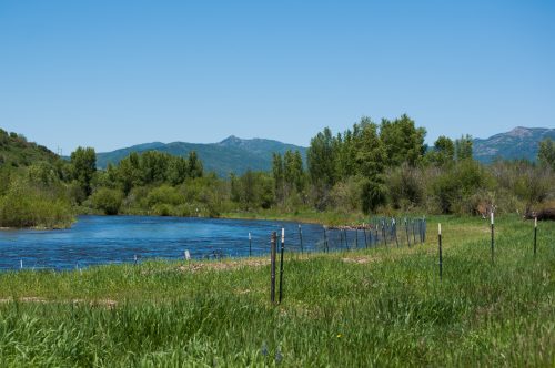

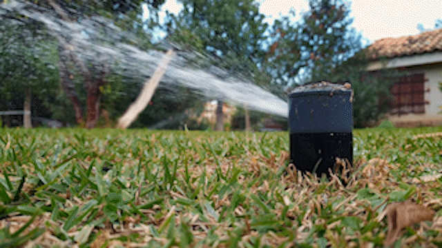
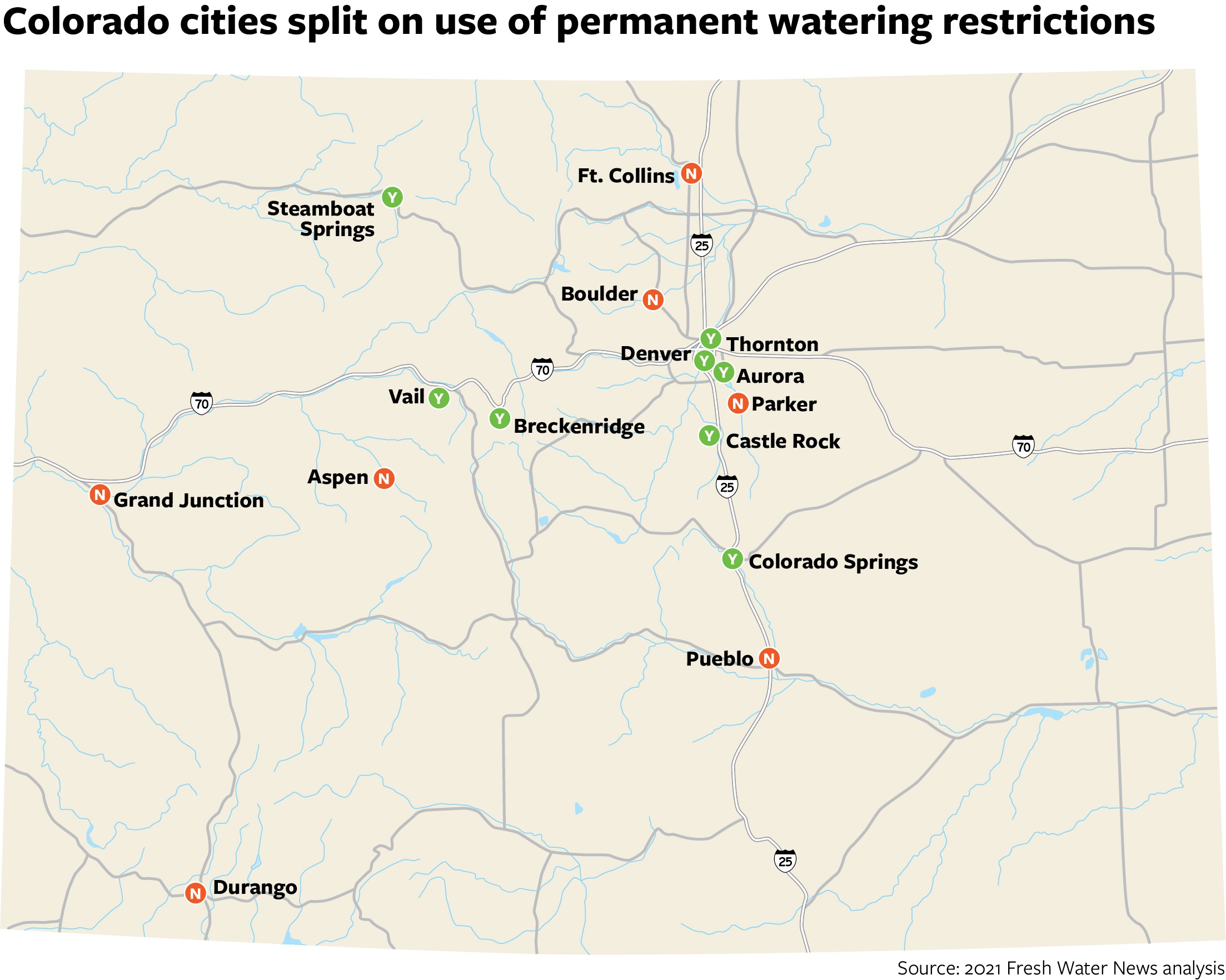

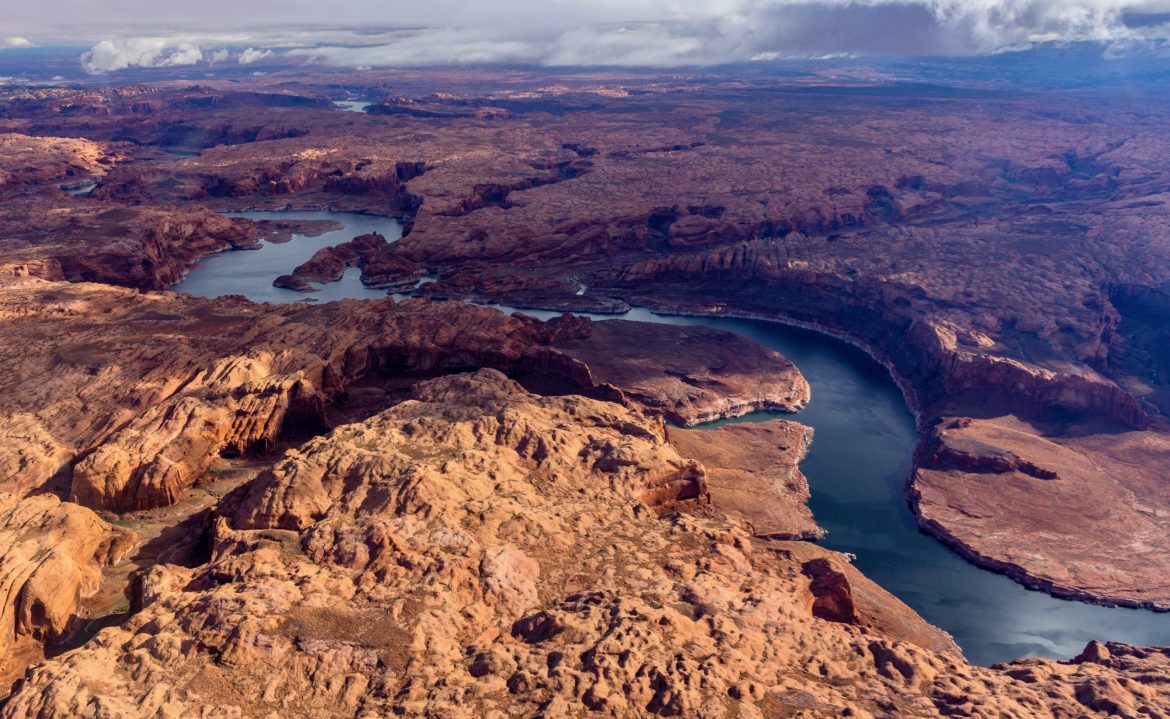
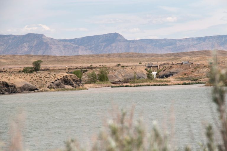
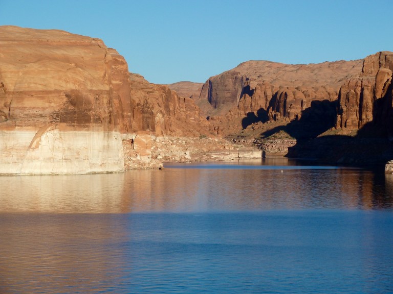
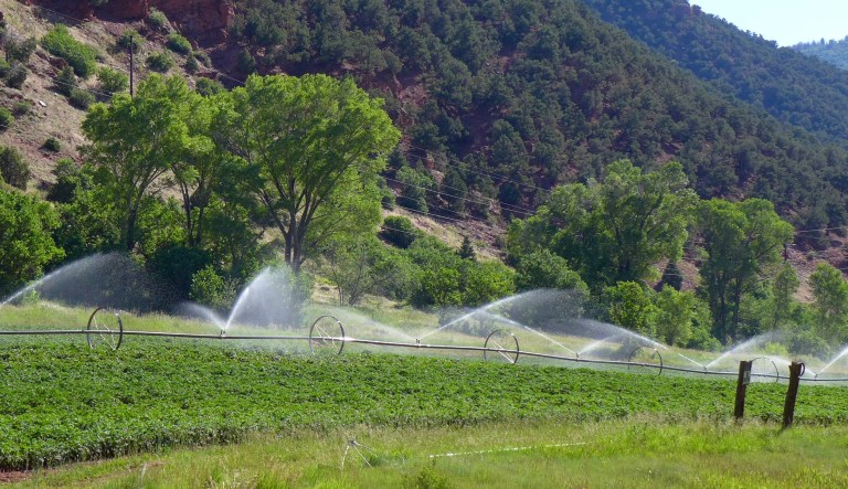


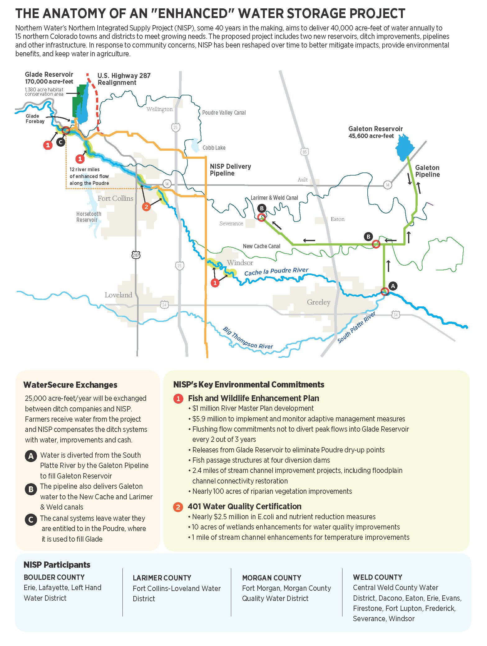
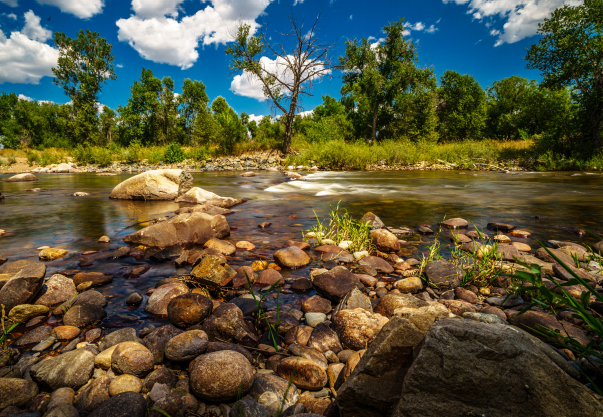
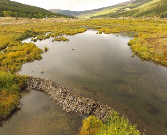
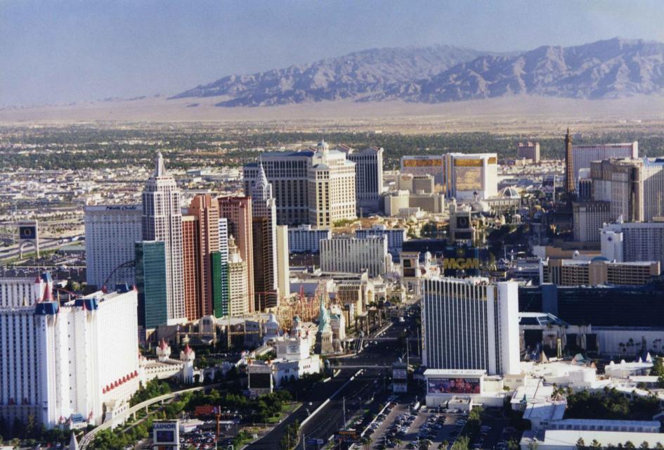
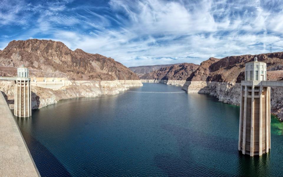


")