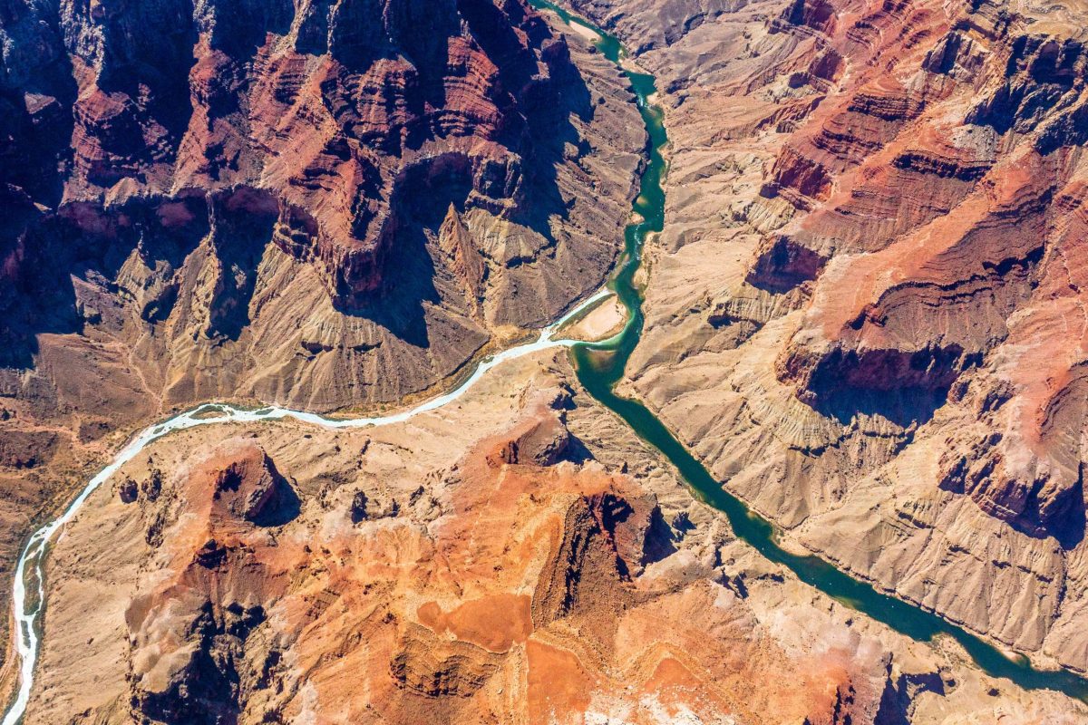
The confluence of the Colorado and Little Colorado rivers in the Grand Canyon, shown here in a September 2020 aerial photo from Ecoflight, represents an area where the humpback chub has rebounded in the last decade. That progress is now threatened by declining water levels in Lake Powell, which could lead to non-native smallmouth bass becoming established in the canyon. CREDIT: JANE PARGITER/ECOFLIGHT
As climate change continues to shrink the nation’s second-largest reservoir, water managers are scrambling to prevent the release of an invasive fish into the Grand Canyon.
Smallmouth bass, a voracious predator and popular game fish, have been introduced into reservoirs throughout the Colorado River basin, including Lake Powell. The looming problem now is that as lake levels drop to historically low levels, the invasive fish are likely to escape beyond Glen Canyon Dam, threatening endangered fish in the canyon, whose populations have rebounded in recent years.
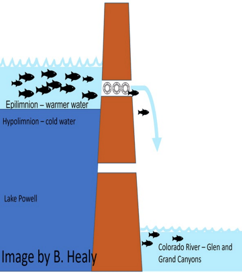
Smallmouth bass are a warm-water-loving species, hanging out in the top part of the water column, which is warmed by the sun. Until recently, the intakes for turbines at Glen Canyon Dam had been lower in the water column, where colder temperatures kept the fish away. But as the lake level falls, the warmer water band containing the smallmouth bass is sinking closer to the intakes, making it more likely that they will pass through the dam to the river below.
Warmer water below the dam also means a more ideal environment for the bass, which thrive in temperatures above 61 degrees Fahrenheit (16 degrees Celsius).
“With the levels we are expecting to get to this coming year, water temperatures are going to be warmer than they’ve been in 52 years in the Grand Canyon,” said Charles Yackulic, a research statistician with the U.S. Geological Survey’s Grand Canyon Monitoring and Research Center.
The research center has been modeling the likelihood that smallmouth bass will become established below the dam under different scenarios and providing that information to decision-makers and water managers.
Jack Schmidt, a Colorado River researcher at Utah State University and former director of the research center, co-wrote — along with Yackulic and others — a March 2021 paper that sounded the alarm that future warming is likely to disproportionately benefit nonnative fish species to the detriment of native species. The problem from which all others stem, including the changing fish communities, and the reason Powell is so low in the first place is the climate-change-driven supply-demand imbalance, Schmidt said.
“If we are going to continue to load the atmosphere with carbon such that the atmosphere warms and the runoff in the Colorado River keeps getting lower and if we are going to keep consuming water, … then you can only play this game of staving off the inevitable for so long before it’s game over,” he said.
This infographic shows how as Lake Powell water levels decline, warm water containing smallmouth bass gets closer to intakes delivering water through the Glen Canyon Dam to the Grand Canyon downstream. CREDIT: U.S. GEOLOGICAL SURVEY
Threat to humpback chub
Although the trout fishery and other native fish around Lees Ferry would also be hurt by the bass, the biggest risk would be to the fish listed under the Endangered Species Act (ESA), including the humpback chub.
“The biggest concern for a lot of stakeholders is how it could affect humpback chub and razorback sucker,” Yackulic said. “Over 90% of humpback chub are found in the Grand Canyon reach, and they have been doing really well over the last 10 years.”
So well in fact that in 2021 the U.S. Fish and Wildlife Service down-listed humpback chub’s status from endangered to threatened, a decision based partly on the thriving populations in the Grand Canyon. The down-listing means the chub still retains some ESA protections, but it is no longer at immediate risk of extinction.
Scientists think that smallmouth bass are responsible for decimating humpback chub populations in the upper basin — for example, near Echo Park, at the confluence of the Green and Yampa rivers.
“We are very concerned that if they get into the Grand Canyon, they could have a similar impact on the humpback chub and, through predation and competition, could jeopardize that new listing of being threatened,” said Melissa Trammell, a fisheries biologist with the National Parks Service. “Our efforts to try to restore that species in the canyon would definitely be impacted.”
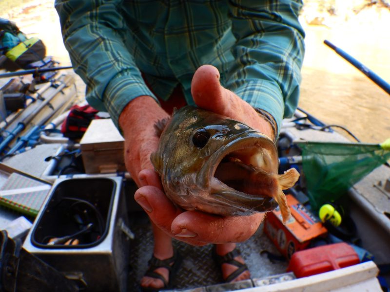
This invasive smallmouth bass is eating a native flannelmouth sucker. The smallmouth bass is a predation threat because it can eat fish up to half their own length and become fish-eaters when they are only a few inches long. CREDIT: MELISSA TRAMMELL
‘No low-hanging fruit to prevent this’
The Glen Canyon Dam Adaptive Management Program has formed a technical work group subcommittee to address the problem. Several ideas have been floated: installing a bubble curtain that could keep fish away from the dam intakes; electro-fishing and removal of smallmouth bass below the dam; selective withdrawal devices that allow dam operators to pull from different parts of the water column; or releasing colder water from the deeper jet tubes once a week to make the temperatures below the dam inhospitable to the invasive fish. This, however, would mean bypassing the turbines that make hydropower.
Clarence Fullard, acting program manager for the Bureau of Reclamation’s Glen Canyon Dam Adaptive Management Program, said they are considering all options to prevent smallmouth bass from becoming established, but there is still a lot of uncertainty about a way forward.
“There’s really no low-hanging fruit to prevent this,” he said. “The scale of Glen Canyon Dam and Lake Powell make it hard to come up with solutions. We don’t know what we could do operationally.”
One thing that has seen some success on the Green River below Flaming Gorge Dam is something called a flow spike. A carefully timed, short, high-flow release from the reservoir can knock the fish off their nests and wash their eggs downstream. According to Trammel, this tactic has reduced the reproduction of smallmouth bass in that area by about 30%.
“The extra water being released from Flaming Gorge to go down to Powell is actually being reshaped to help endangered fishes in the upper basin,” Trammell said. “We would not have had that experimental flow this year without the DROA.”
For now, members of the technical work group are creating a strategic plan, a draft of which will be released in August. Scientists will continue monitoring in places where the smallmouth bass are likely to try to establish. Each year for the past decade, Yackulic said, monitoring efforts have caught up to three smallmouth bass who made it through the turbines and ended up below the dam.
“The thing about fish is for every one you catch, there’s probably quite a few you don’t catch,” he said.
Still, scientists don’t think the fish have become established enough yet for there to be a reproducing population below the dam. But time is of the essence.
Although the invasive-fish issue may get overshadowed by the crush of bad news surrounding the Colorado River — record-low reservoir levels, shortages, emergency federal actions, potential loss of hydropower — scientists say there is still an urgent need to act on it.
“The long-term cost of trying to control that species maybe doesn’t feel as urgent as losing hydropower at Glen Canyon Dam, but once they are established, it is almost impossible to get rid of them,” Trammell said. “There’s no agency in the world that says, ‘I wish I had waited a little longer to try and control this invasive species.’”
But any operational changes to combat an invasion of smallmouth bass in the Grand Canyon are likely to be just a stopgap measure.
“We should never forget that the fundamental problem is much bigger than how to operate Glen Canyon Dam; it’s about the balance between watershed runoff and consumptive use,” Schmidt said. “And until we get consumptive use matching the available supply, we are always going to be flirting with disaster. We can only hold off these changes for so long before we lose the battle.”
The Water Desk’s mission is to increase the volume, depth and power of journalism connected to Western water issues. We’re an initiative of the Center for Environmental Journalism at the University of Colorado Boulder. The Water Desk launched in April 2019 with support from the Walton Family Foundation. We maintain a strict editorial firewall between our funders and our journalism.
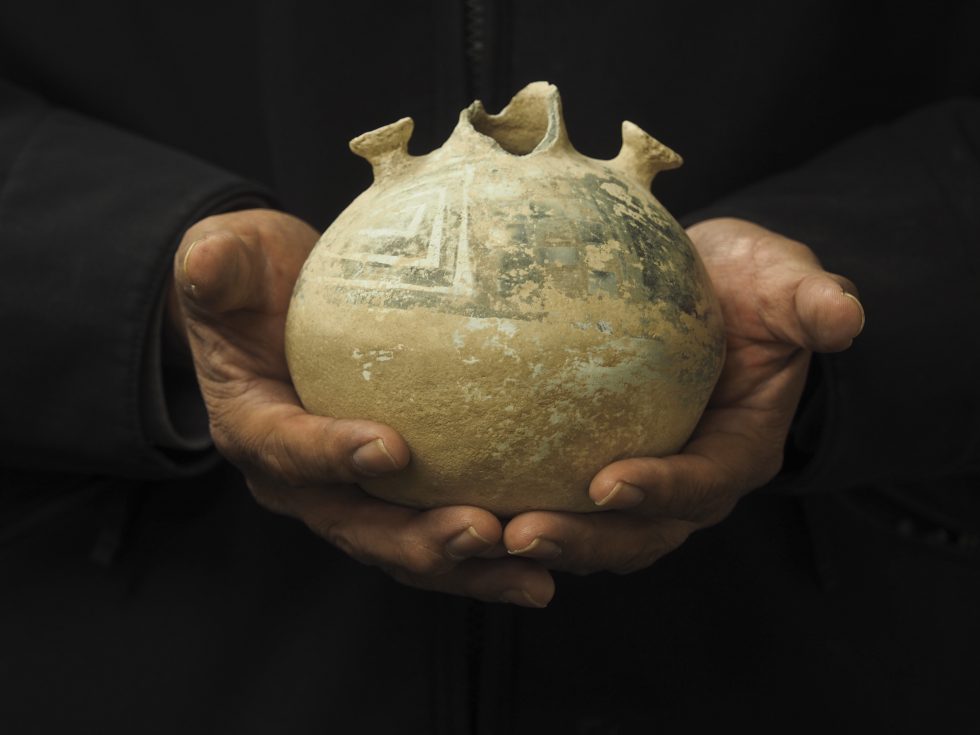
Eric Whyte, Hay Manager for the Ute Mountain Ute Farm & Ranch Enterprise near Towoac, Colo., holds a pot that was used to hold water by the Anasazi People in the Four Corners area of Colorado thousands of years ago. The pot was found in a field when work began clearing land for the farm and ranch enterprise. Credit: Dean Krakel, special to Fresh Water News
Low snowpack and soaring temperatures made 2020 the third-driest year on record in Colorado. When similar conditions repeated in 2021, tribal farmers in southwest Colorado had to scramble, fallowing thousands of acres of land and laying off workers at the Ute Mountain Ute Tribe’s farm and ranch outside of Cortez.
“It made me very aware that our farm is in the desert. We have to look at it that way,” says Simon Martinez, general manager for the Ute Mountain Ute Tribe Farm and Ranch Enterprise and the Bow and Arrow Brand non-GMO cornmeal business. The 7,700-acre farm is located on the tribe’s 553,008-acre reservation in southwest Colorado, less than 20 miles from the Four Corners.
When Dolores River flows below McPhee Reservoir were reduced to just 10% of normal in 2021, the tribe was able to operate only eight center pivot sprinklers, compared to its usual capacity of 110 sprinklers. A single center pivot sprinkler system irrigates circles of crops ranging from 32 to 141 acres in area. Lack of water meant fallowed acres, leaving the tribe to use only 500 acres in 2021, compared to 4,500 acres of alfalfa alone grown in 2020.
Without irrigation water, the farm’s ability to grow its mainstay crops of alfalfa and corn was majorly reduced, and without crops to harvest, employment, too, was cut to 50%. Twenty farm workers lost their jobs.
This year the tribe is expecting slightly more water, 20% to 25% of its normal allocation, or roughly 6,000 acre-feet of water, according to Mike Preston, president of the Weenuch-u’ Development Corporation, which oversees the farm’s operations. But some 6,000 acres of its 7,700-acre farm remain fallowed, a situation that requires the tribe to spend millions of dollars to keep weeds in check.
There is also hope in rising wheat prices, which are expected to reach $11.16 a bushel by December, according to Wall Street Journal crop pricing data. Preston said the tribe hopes to plant a late wheat crop this year to capitalize on the world-wide wheat shortages triggered by the war in Ukraine.
Overall, the tribe’s farm and ranch enterprises operate for economic empowerment and employment. And operations are largely successful—before the drought, the farm had been productive and profitable since it began operating in the late 1980s.
For Bow and Arrow Brand, operations didn’t slow, even last year. The cornmeal operation was launched years ago in order to stretch the shelf life of the tribe’s corn. Fresh sweet corn can last about two weeks, but by creating cornmeal, the produce remains profitable for around 18 months. Even during the drought and pandemic, sales continue. Full staff employment has been maintained.
Sustaining everything has been a challenge, but Martinez is up for the challenge, as he must be, he says. “We’re going to do our best to keep employment.”
Some help and funding is available to make up for losses, such as drought impact funding. And Martinez is working to help the farm adapt. He’s spreading the limited amount of water as far as possible through work with the Natural Resources Conservation Service to upgrade sprinkler nozzle packages and continued consultations with agronomists on crop selection for increased drought tolerance. But those efforts can only go so far.
Martinez is hopeful that McPhee, the third-largest reservoir in Colorado, which serves the tribe, will see its water levels restored to meet tribal needs.
“We’re kind of teetering on the brink,” says Preston. The Dolores River watershed relies entirely on snowpack. But conditions aren’t looking great—100% of Montezuma county remains in severe or extreme drought, according to the National Drought Mitigation Center. Forecasts for the Dolores River Basin, as of June 1, project 45% to 60% of water supply availability this year, according to the Colorado River Basin Forecast Center.
What seems clear to many in the region is that desert-like conditions are likely to continue and that means the Ute Mountain Utes must shift their operating plans to accommodate drier conditions.
“We’ve got to adapt,” Martinez says.
An earlier version of this article appeared in the Spring 2022 edition of Headwaters magazine. Additional reporting was contributed by Fresh Water News Editor Jerd Smith.
Rachelle Todea is Diné and a citizen of the Navajo Nation. She is a freelance reporter based in Westminster, Colo., who reports on climate change and Indigenous peoples.
Fresh Water News is an independent, nonpartisan news initiative of Water Education Colorado. WEco is funded by multiple donors. Our editorial policy and donor list can be viewed at wateredco.org.
The Water Desk’s mission is to increase the volume, depth and power of journalism connected to Western water issues. We’re an initiative of the Center for Environmental Journalism at the University of Colorado Boulder. The Water Desk launched in April 2019 with support from the Walton Family Foundation. We maintain a strict editorial firewall between our funders and our journalism.
This Parshall flume on Red Mountain measures the amount of water diverted by the Red Mountain Ditch. Pitkin County commissioners approved a roughly $48,000 grant to pipe the last 3,600 feet of the ditch in the Starwood neighborhood. CREDIT: HEATHER SACKETT/ASPEN JOURNALISM
The Pitkin County Board of County Commissioners has approved one year of funding toward completing a ditch piping project with the aim of keeping more water in Hunter Creek.
Over the past two decades, the Red Mountain Ditch Company has been working to pipe the entirety of its 12-mile ditch system — a $3.8 million cost so far — paid for by the ditch share owners. But to complete the final 3,600 feet, the ditch company is turning to public sources of money because they say the project will have the public benefit of keeping between 0.5 and 1 additional cubic feet per second of water in Hunter Creek.
The Pitkin County Healthy Rivers board recommended the county grant nearly $48,000 toward the project in April and county commissioners approved the request on Tuesday.
“I think this is the first time when I’ve been on the board that I’ve seen this type of project and I really think it’s valuable,” said commissioner Kelly McNicholas Kury. “It’s a conservation-first type of program and to me this is the way I think the treatment of ditches should head in the future around the Western Slope.”
Red Mountain Ditch, whose horizontal scar across Red Mountain features prominently in the view from across the valley, has senior water rights that date to 1889. It irrigates about 380 acres of grass pasture on Red Mountain and in the exclusive Starwood subdivision with water from Hunter Creek.
A herd of elk feast on a sprinkler-irrigated meadow in the Starwood subdivision. The area is irrigated with water from Hunter Creek via Red Mountain Ditch. CREDIT: HEATHER SACKETT/ASPEN JOURNALISM
More water in Hunter Creek
Jim Auster, who has managed the ditch since 1983, said before the capital improvement project, the high-maintenance, open ditch lost water to seepage and evaporation and had problems with blow outs and beaver activity that caused flooding. Now that the majority of the ditch is piped underground, he said it’s easier to get water during low-flow times of year and the company has reduced the amount it diverts from Hunter Creek by up to 6 cfs.
Auster said before the piping project, the ditch used to divert about 14 cfs on average; now it takes about 8 to 9 cfs. Numbers from the Colorado Division of Water Resources indicate the ditch has in fact diverted less in recent years.
“Technologically, we are progressive,” Auster said. “I don’t know of any other ditch company that is doing 100% piping like we are. It’s certainly the future. Open ditches are obsolete.”
Recent ditch inventories conducted by conservation districts across the Western Slope hint at widespread problems, disrepair and inefficiencies with irrigation infrastructure. Environmental groups often back irrigation efficiency projects because they could result in reducing the amount irrigators need to divert, thereby leaving more water in the river to the benefit of the environment.
But repairs and upgrades are often expensive. And most projects don’t put a number on how much water will be left in the stream. In most cases, paying irrigators for their extra water is the only way to ensure an environmental benefit.
Aaron Derwingson, water projects director for The Nature Conservancy’s Colorado River Program, has worked on efficiency projects with irrigators. He said it can be hard to quantify a project’s environmental benefits and success often depends on the willingness of the irrigators.
“I think the challenge with our team that we run into is we are never going to have enough money to buy the water to really make a difference for a lot of streams and where does that leave us?” Derwingson said. “That’s why some of these efficiency projects can be great because it’s a one-time investment and you get continued benefit.”
This is part of the open ditch through properties in the Starwood subdivision that would be piped if Red Mountain Ditch company can secure the funds. Manager Jim Auster said up to an additional 1 cfs could be left in Hunter Creek if the last 3,600 feet of ditch is piped. CREDIT: HEATHER SACKETT/ASPEN JOURNALISM
How to protect the water
McNicholas Kury brought up an unanswered question in Tuesday’s discussion: how to legally protect the water the piping project leaves in Hunter Creek. Under Colorado water law, another water user could pick up that water and put it to beneficial use, canceling out any environmental benefit to the stream. And as stream flows continue to dwindle due to climate change, an environmental benefit may be short-lived, especially if the water is not legally protected.
“I have some concern about the water that is going into Hunter Creek,” McNicholas Kury said. “That is fantastic; I don’t want others to pick it up along the way.”
McNicholas-Kury suggested the Red Mountain Ditch Company look into an agreement with the non-profit Colorado Water Trust, which helps water rights holders lease their water rights for the purpose of boosting environmental streamflows.
In addition to finishing the piping, Auster said $25,000 of the grant money will go toward installing remote monitoring and headgate controls, which will allow him to be more precise and reduce the amount of excess water that is run through the system.
Auster said the total cost of the project for the final 3,600 feet of piping is $680,000, and the ditch company is also applying for grants from the Colorado River Water Conservation District and the National Resources Conservation Service. The ditch company may return to the county in 2023 and 2024 to request additional funding.
Board of County Commissioners Chair Patti Clapper and Vice-Chair Francie Jacober questioned whether the residents of one of Aspen’s wealthiest subdivisions couldn’t pay for their own ditch piping project, but in the end, backed the grant request.
“The best interest of this community is keeping water in our rivers and that is a benefit to everyone,” Clapper said.
Editor’s note: Aspen Journalism is supported by Pitkin County’s Health Community Fund. Aspen Journalism covers water and rivers in collaboration with The Aspen Times. This story ran in the May 28 edition of The Aspen Times.
The Water Desk’s mission is to increase the volume, depth and power of journalism connected to Western water issues. We’re an initiative of the Center for Environmental Journalism at the University of Colorado Boulder. The Water Desk launched in April 2019 with support from the Walton Family Foundation. We maintain a strict editorial firewall between our funders and our journalism.
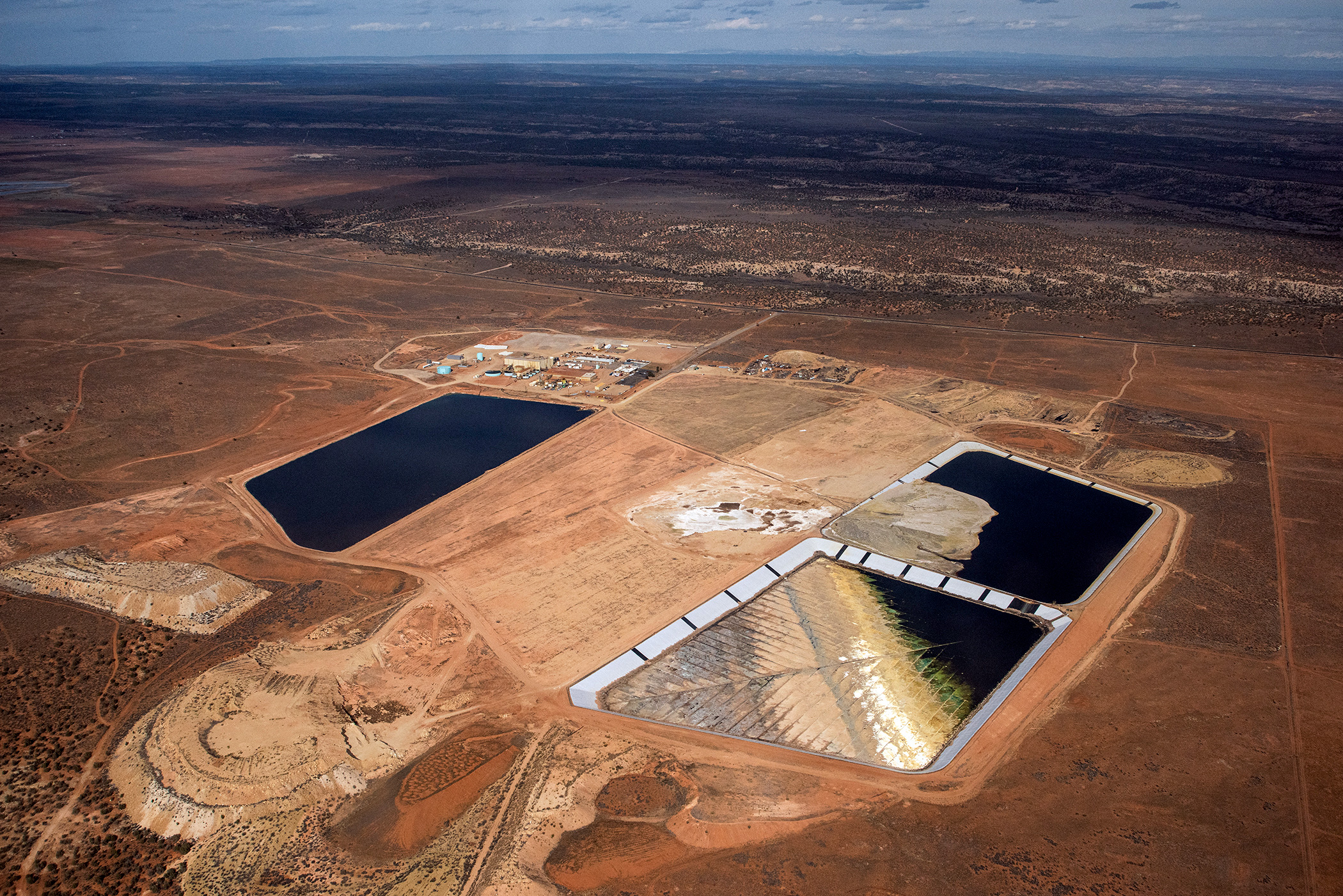
Exposed radioactive waste in tailing ponds at White Mesa mill, pictured in early April.Tim Peterson/EcoFlight.
By Miacel Spotted Elk
In White Mesa, Utah, at America’s last uranium mill, a pool of toxic waste is emitting dangerous amounts of radon to the surrounding communities, among them the Ute Mountain Ute Tribe. This isn’t news: In November 2021, High Country Newsreported on the improperly stored waste and its impacts on the community, and in December — thanks to EcoFlight’s aerial photography and a proactive tribal government — the Environmental Protection Agency issued a notice to Energy Fuels Resources, ordering it to address the issue. Five months later, however, the improper storage practices persist.
In March, follow-up aerial shots from EcoFlight revealed a noticeable difference between the photograph taken in August 2021; the tailings cells, which consist of radioactive waste typically submerged in liquid from the uranium processing, have since decreased even further, increasing the amount of exposed toxic compounds. The visual evidence arrived two months after EPA representatives visited the site on Jan. 13. At the time, it was estimated that 60% of Cell 4B was uncovered. In a March letter from the EPA, the agency reported that Energy Fuels’ explanation of this decline is due to water conservation practices and extracting vanadium from the liquid, a rare earth mineral, for profit.
While efforts are currently underway to hold the mill accountable, Scott Clow, the Ute Mountain’s Environmental Programs director, says that the company wants to be in business until it is no longer profitable.
“There is a lot of uncertainty. We do know that when, eventually, the owners of that mill find it is no longer profitable to operate, and they will close it, they will be required to spend what they have set aside in a bond to do as much as they can for reclaiming it safely,” Clow said. “And then it’ll be the responsibility of the Department of Energy under their legacy program — and our tax dollars — to pay for it.”
Complicating matters is the possibility that the Biden administration’s Department of Energy will establish a strategic uranium reserve, which would increase the domestic stockpile of uranium — but at a cost. Uranium mines would be able to begin operating and funnel ore to the White Mesa mill for processing. According to Amber Reimondo, the energy policy director at the Grand Canyon Trust, it doesn’t immediately pose problems for White Mesa residents, but might present long-term ecological and community health problems. Reimondo doesn’t believe it makes sense for uranium mines in the U.S. to begin extraction when the quality of the uranium here is lower, and it’s more expensive than it would be coming from countries like Australia or Canada.
“We did a lot of work at the beginning of the Biden administration trying to help decision-makers understand the implications of something like that,” Reimondo told HCN. “Especially because so (many) of the uranium deposits in the United States are either on or near tribal lands.”
This would further compound the concerns of local residents — concerns that are echoed throughout the Southwest. The Pinyon Plain Mine, located near the Havasupai Tribe and close to the Grand Canyon, is also owned by Energy Fuels. The Pinyon Mine recently received approval from Arizona for an aquifer permit. Carletta Tilousi, who served on the Havasupai Tribe’s council in Arizona, told HCN that if the strategic uranium reserve is established, the Pinyon Plain Mine would resume operations.
“If the uranium from Pinyon Plain mine goes (to White Mesa) and contaminates people, we feel responsible — Havasupai people feel responsible — because if we don’t stop it from our end, then it’s going to contaminate other human lives,” Tilousi said. “And that’s something that the Havasupai elders would always stress, that we can’t just sit back and not say anything on this end in the cycle of uranium process.”
Tilousi added that Havasupai communities have previously experienced negative impacts from the mine, including onsite water contamination and destruction of the nearby sacred mountain Red Butte.
In an Energy and Natural Resources Committee hearing in late March, Sen. Joe Manchin, D-W.V., voiced his support for prioritizing domestic mineral supply chains to curb U.S. reliance on Russian minerals, including uranium. “They don’t understand that human life, water and animal life is so important here,” Tilousi said.
Meanwhile, Clow’s department has secured a small grant from the EPA that will enable the tribe to find a qualified candidate to design an epidemiological study of the direct and indirect health effects the White Mesa Mill has had on local residents, as well as its environmental impacts on the land. The study will look at the impacts of living in close proximity to the mine; for example, it will calculate the economic cost to community members who have to purchase bottled water because the local water supply is undrinkable. It will also examine how Native residents are affected when they are forced to cease traditional activities, such as picking plants for medicine.
Ultimately, the community will end up having to bear the costs of far-off industries, both nationally and globally, whether the nuclear waste comes from countries like Japan and Estonia or from nuclear power plants on the East Coast. “The initial mass and impact on the environment and public health are here,” in the West, Clow said. “And then the end impact is here” — also in the West.
The Water Desk’s mission is to increase the volume, depth and power of journalism connected to Western water issues. We’re an initiative of the Center for Environmental Journalism at the University of Colorado Boulder. The Water Desk launched in April 2019 with support from the Walton Family Foundation. We maintain a strict editorial firewall between our funders and our journalism.
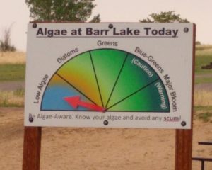
Read the label on your lawn fertilizer bag and help save your favorite lake or reservoir from those smelly, pea-green algae blooms that shut down summer watering spots for weeks at a time.
That’s the message from water quality officials and city water utilities this year as the summer lawn and recreation season gears up.
Algae blooms, long common in the Eastern United States, are becoming more frequent in Colorado lakes and reservoirs as a 20-year mega-drought reduces water levels, 90-plus degree days occur more often, raising water temperatures, and growing numbers of homeowners add phosphorous-laced lawn fertilizers to their grass.
Blue-green algae produces toxins that can harm people and pets, and can also create odors and tastes that degrade water quality.
The problem surfaced at Aurora’s Quincy Reservoir in 2020. Since then the city has taken the lead on trying new treatment methods, such as installing aeration devices that inject oxygen into the water. It has also spent millions on other treatments such as hydrogen peroxide and alum, which kill certain types of toxin-producing algae and, with alum, weigh the phosphorous down so that it falls to the bottom of the lake and becomes encased in silt and mud.
But the biggest issue, by far, says Sherry Scaggiari, an environmental services manager at Aurora Water, is the increasing amount of phosphorous that finds its way from lawns into stormwater, and then into streams and lakes.
“We are trying to get people to use less phosphorous on the grass. You need nitrates, but you don’t need phosphorous,” Scaggiari said.
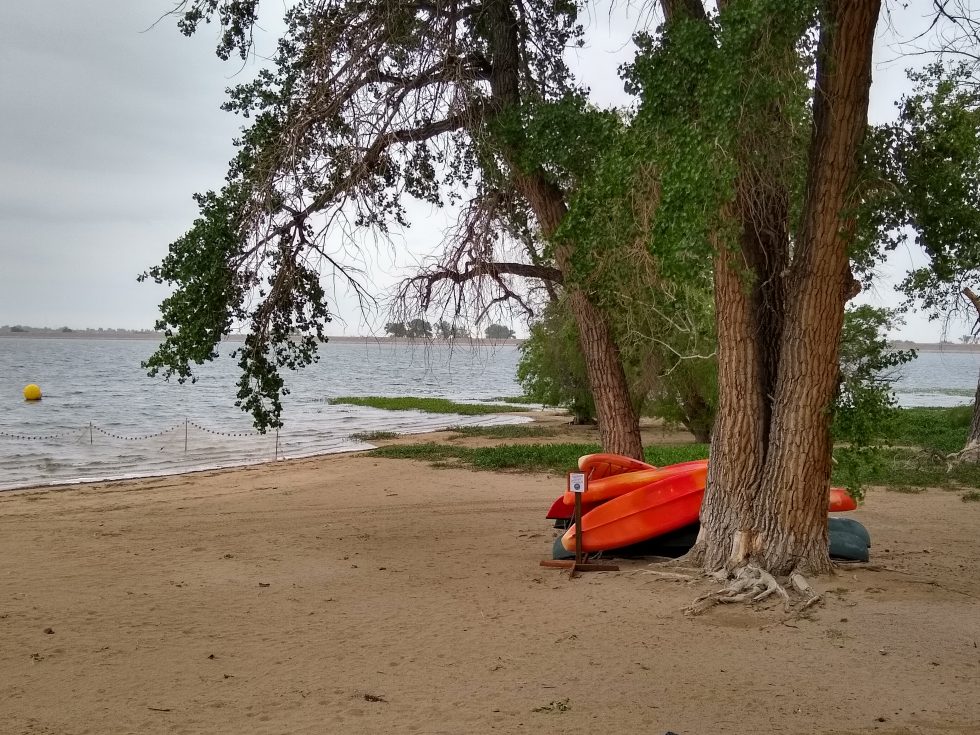
At Barr Lake State Park near Brighton the problem has triggered several efforts to clean up Barr and Milton Reservoir, which are owned by a private irrigation company. Steve Lundt, a scientist who sits on the board of the Barr-Milton Watershed Association, has been monitoring the watershed for some 20 years.
Beach at Barr Lake, where agencies are working to remove toxic algae. May 31, 2022. Credit: Jerd Smith, Fresh Water News
“People always ask, ‘Why is there so much phosphorous in these reservoirs?’ Well, there are 2.5 million people living in the watershed. That is half the population of the state.”
Fixing Barr and Milton is a major undertaking. Treatments such as alum work best in water bodies, such as natural lakes, where water supplies aren’t released annually for irrigation. Much of the Barr-Milton system is used to irrigate farm lands on the Eastern Plains as well as to supply municipal drinking water. It drains and fills every eight months, roughly.
“We would be adding alum almost continuously,” Lundt said, an expensive process that also expands the park’s carbon footprint because the alum has to be mined.
Aurora, however, hopes it only needs to treat Quincy once every 10 years or so, according to Greg Baker, spokesperson for Aurora Water. But if phosphorous levels continue to rise, it may have to be done more frequently.
Lundt is also using a method known as bio-remediation to remove some 8,700 carp, or roughly half of the local carp population, from Barr Lake since 2014. The invasive species is known for stirring up the sediment, releasing phosphorous into the water and creating a situation ripe for algae growth.
This month the association plans to hold a fishing competition with a $2,000 prize for the angler who removes the most carp.
And Aurora and Barr-Milton are looking at extensive planting programs along waterways leading to their reservoirs that will use plants, such as cattails, that are effective at removing phosphorous from water.
Still, water officials say, the best tool, and perhaps most cost-effective, is to begin slashing the use of phosphorous-based lawn fertilizers.
The Barr-Milton Watershed Association has been leading a campaign, called the P-Free Lawn Fertilizer campaign, to encourage consumers to omit phosphorous from lawn care for several years. And Water ’22, a year-long campaign to educate Coloradans on water issues, is also highlighting the issue. [Water ’22 is being led by Water Education Colorado, which sponsors Fresh Water News].
Lundt said some 12 states have already outlawed phosphorous-enriched fertilizers’ use by homeowners unless they can prove their soils are short of phosphorous.
Major fertilizer makers, such as Scott, have removed phosphorous altogether.
“Fertilizer companies are on board, it’s a matter of just changing the culture of how we fertilize our lawns,” Lundt said.
Jerd Smith is editor of Fresh Water News. She can be reached at 720-398-6474, via email at jerd@wateredco.org or @jerd_smith.
Fresh Water News is an independent, nonpartisan news initiative of Water Education Colorado. WEco is funded by multiple donors. Our editorial policy and donor list can be viewed at wateredco.org
The Water Desk’s mission is to increase the volume, depth and power of journalism connected to Western water issues. We’re an initiative of the Center for Environmental Journalism at the University of Colorado Boulder. The Water Desk launched in April 2019 with support from the Walton Family Foundation. We maintain a strict editorial firewall between our funders and our journalism.
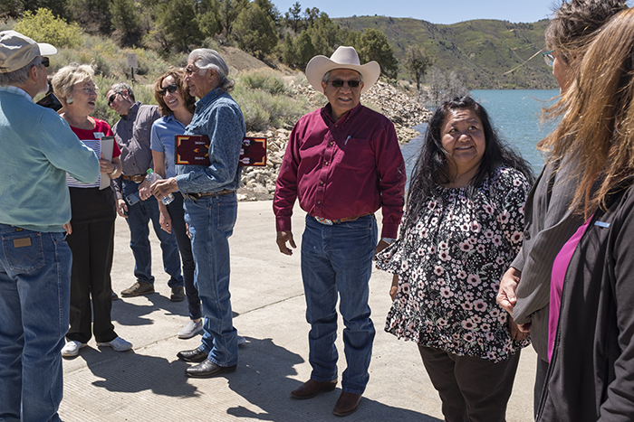
Ute Mountain Ute Tribal Councilman Lyndreth Wall stands on the reservation, with Ute Mountain in the distance. Wall spent his childhood summers at his grandparents’ sheep camp on Ute Mountain, where the water was sweet and well taken care of in the 1970s, in contrast to the water in Towaoc, which made people sick at the time. Photo by Marysa Frost
By Kalen Goodluck
In August 2021, federal officials issued the first-ever shortage declaration on the Colorado River, resulting in substantial cuts to Arizona’s share of Colorado River water and giving more power than ever before to the 30 Native Tribes, including two in Colorado, who control roughly 25% of the water in the seven-state river basin.
Everyone in the basin sees the confluence of unfortunate events that have brought the Colorado River crisis to a head. There is less water than ever before with the basin ensnared in a 22-year megadrought, the worst in the past 1,200 years, according to a recent study published in the journal Nature Climate Change.
Guidelines approved in 2007 to help manage shortages are set to expire in 2026 so negotiations to craft the next guidelines are underway and tribal nations are pushing hard to finally be included in those negotiations.
But even today, 12 of the basin’s tribes (most in Arizona) have unresolved water rights claims, and eight of those 12 have unquantified rights—meaning the amount of water they have a right to is not yet determined. Simply securing those water rights remains a time-consuming and arduous endeavor, in costly settlement negotiations amidst a scrum of other water users staking claims.
The water held by the basin tribes who have legally quantified water rights amounts to no small sum: 22 tribal nations retain 3.2 million acre-feet of water, or an estimated 22% to 26% of all annual water supplies in the basin, according to a 2021 brief from the Water and Tribes Initiative. This amount will likely increase over the years once more tribal water claims are resolved.
Even for tribes with settled or adjudicated water rights, some can’t access the full extent of that water because of lack of infrastructure or funding, or both. In total, just under half, or 1.5 million-acre-feet, of settled or adjudicated tribal rights have not yet been put to use by the tribes.
When adding together that unused water and unquantified water, and considering that tribes plan to fully develop and use their water, other water users in the basin wonder how it will look to integrate expanded tribal water use with existing water uses as water supplies continue to dwindle.
Lack of representation
The 1922 Colorado River Compact, the formative agreement to carve up flows of the Colorado River, divided the river into an upper and lower basin, apportioning the rights to consume 15 million acre-feet of water—their estimation of average annual river flow at the time—between the seven U.S. basin states: Colorado, New Mexico, Utah and Wyoming of the upper basin, and Arizona, California and Nevada of the lower basin, with the opportunity for lower basin states to develop an additional 1 million acre-feet from tributaries below Lee Ferry, Ariz. No plans were made for apportioning any share of water to Native American tribes.
Members of the Colorado River Commission stood together at the signing of the Colorado River Compact on November 24, 1922. The signing took place at the Palace of the Governors in Santa Fe, New Mexico, with Secretary of Commerce Herbert Hoover presiding (seated).
Since the beginning of U.S. tribal water law, sovereign tribal nations have been excluded from cornerstone water management decisions despite having senior title to water. Native American water rights were first officially recognized in 1908, over a decade before the Colorado River Compact was signed, with the U.S. Supreme Court’s Winters v. United States decision. The court found that when the federal government “reserved” territories known as reservations, it had to “reserve” sufficient water to fulfill the purposes of the reservations.
But having the right to reserved water didn’t mean that the tribes had access to actual “wet” water or the legal representation to quantify their water rights.
When the 1922 compact was signed, tribes were surviving a multitude of disastrous living conditions and forced assimilation produced by federal Indian policy, established after U.S. violent colonial expansion. Indigenous peoples weren’t recognized as U.S. citizens until 1924, tribal governance wasn’t federally recognized until 1934, and Native Americans couldn’t vote in every state until the 1960s. “We were surviving here on government rations in 1922 when the Law of the River was created,” says Vigil.
Tribes gained some ground when, in 1963, tribal water policy and Colorado River policy intersected in the U.S. Supreme Court’s Arizona v. California decision. Lengthy litigation led up to the decision, with Arizona filing suit in the U.S. Supreme Court to determine how much Colorado River water it could use. To answer that question, the U.S. found it had to assess what reserved water rights were needed for some of the tribes in the lower basin. A special master for the case determined the future needs of each reservation by assessing the amount of practicably irrigable acres and reserving water to irrigate that land rather than considering the reservations’ populations. In his proposed decree, which was upheld by the Supreme Court, the special master entered a quantified water right for five reservations on the mainstem of the Colorado River, granting 905,496 acre-feet of water for 135,636 irrigable acres.
As federal tribal water policy evolved, so too did Colorado River policy. After the 1922 compact, a series of layered agreements—including Arizona v. California and other court decisions, congressional acts, legal settlements, treaties and compacts—known collectively as the “Law of the River” have come to govern the way water is managed and divided throughout the basin.
In 2007, in response to years of drought, the U.S. Secretary of the Interior adopted the Interim Guidelines for Lower Basin Shortages and Coordinated Operations for Lake Powell and Lake Mead. The Interim Guidelines outline a method to balance the amount of water available between the upper and lower basins. In 2019, upper and lower basin Drought Contingency Plans (DCPs) were developed as additional frameworks to address water shortages and water-saving rules.
Most of these guidelines were crafted without tribal input.
Vigil, who is also water administrator for the Jicarilla Apache Nation from New Mexico, joined the Water and Tribes Initiative in 2017 to facilitate tribal discussions, protect water rights, and unify tribal interests within the Colorado River Basin. Their tribal leader forums helped spur a coalition of tribes to call for inclusion in water framework negotiations.
When new guidelines are developed to govern river management beyond 2026, how will they affect existing tribal water rights or unresolved water claims? “Those are questions that are not yet clear to the Ute Mountain Ute Tribe and probably other tribes,” says Leland Begay, water attorney for the Ute Mountain Ute Tribe, which has adjudicated water rights in Colorado but has not yet resolved its water rights in New Mexico and Utah.
Water that sickened
During the hot summers of his childhood, Lyndreth Wall of the Ute Mountain Ute Tribe would take refuge on Ute Mountain in southwestern Colorado, herding livestock at his grandparents’ sheep camp. They spoke only Ute to him, which he picked up fast, at least conversationally. In those days, the 1970s, the water on Ute Mountain was delicious. “The tribe took care of the water there,” Wall says. But his home tap water in Towaoc tasted like metal. It was “disgusting,” he says, and could make you sick. In White Mesa, their western tribal community in Utah, the water was worse—contaminated by radioactive waste.
For young Wall, his neighbors, family and livestock, the journey to procure drinkable water would be a 30- to 120-mile round trip excursion from Towaoc to Cortez or Mancos, even Durango, Colo. Wall remembers his parents packing buckets in their family pickup—the Wall’s buckets mixed with those of neighbors. This supply would last a few days before they would need more.
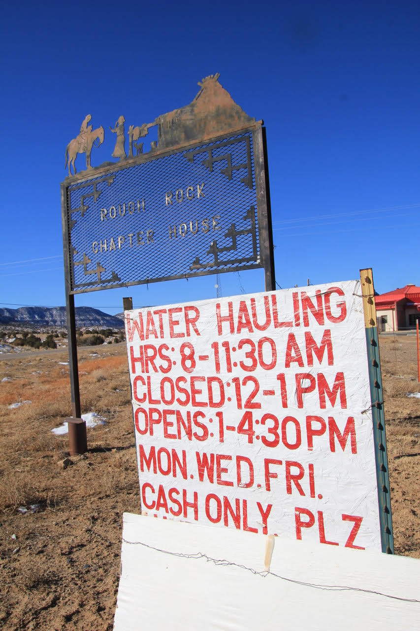
Water hauling hours and instructions are posted at the Rough Rock Chapter House on the Navajo Reservation, on the road between Kayenta and Many Farms, Ariz. An estimated 40% of Navajo Nation residents lack running water. Photo by Allen Best
Today, more Ute Mountain Ute tribal members have water for drinking and irrigation thanks to the 1986 Colorado Ute Indian Water Rights Final Settlement Agreement, followed two years later by a federal settlement act, and by amendments in 2000, all of which they share with the Southern Ute Indian Tribe. The settlement places the Colorado Ute tribes among the four tribes in the upper Colorado River Basin that have completed water rights settlements, which also means that the State of Colorado is no longer negotiating any tribal settlement agreements.
For the Ute Mountain Ute Tribe, the settlement meant access to Dolores Project water, an entitlement to Animas-La Plata Project water, and rights to over 27,000 acre-feet of water from rivers that flow near or through their reservation. Most years, the Ute Mountain Ute Tribe can access their 25,100 acre-foot water storage allocation from the Dolores Project’s McPhee Reservoir in southwestern Colorado. Water from McPhee began to flow to the Ute Mountain Ute Tribe in 1994 delivering clean drinking water to the tribe for the first time in their history and supporting the development of a hotel, travel center and casino, which provide vital tribal employment and income. The tribe’s new irrigation water from the Dolores Project, up to 23,300 acre-feet per year, supported the development of the highly productive 7,700-acre Ute Mountain Ute Farm and Ranch Enterprise and Bow and Arrow corn mill.
For the Southern Ute Indian Tribe, the settlement wasn’t quite as momentous. “We have seven sources of water, seven rivers, that run to the tribe, so the tribe had been accessing those waters pre-settlement,” says Kathy Rall, head of the water resources division for the Southern Ute Indian Tribe. Before the settlement, the tribe didn’t have quantified rights to that water, Rall says. “Those rights were hammered out and solidified through the settlement,” she says. The Southern Ute Indian Tribe also received an allocation of Animas-La Plata Project water—but the infrastructure was never built for either tribe to access that water.
“Ever since [the Animas-La Plata Project] was constructed, we’ve never used a drop of it, yet we have a certain percentage, not only to us, but also our sister tribe, the Southern Ute,” says Wall, who is now a tribal councilman for the Ute Mountain Ute Tribe. The project allocated more than 60,000 acre-feet per year of municipal and industrial water to the Ute Mountain Ute Tribe and the Southern Ute Indian Tribe, but a series of obstacles has made this water inaccessible.
Nighthorse “lite”
The settlement authorized the construction of Lake Nighthorse, just south of Durango, to store Animas-La Plata water for tribal water uses. The project was envisioned to bring water for irrigation, municipal and industrial uses to the tribes and non-tribal water users. But environmental and fiscal concerns resulted in the project being downsized.
A lawsuit halted the construction of Lake Nighthorse’s Ridges Basin Dam in 1992. Groups including the Environmental Defense Fund, Sierra Club, and the Taxpayers for the Animas River argued the dam’s cost was an undue burden for taxpayers and that its construction would threaten the Colorado pikeminnow fish population, which was federally listed as endangered at the time. Christine Arbogast, lobbyist for the Ute Mountain Ute Tribe, Southern Ute Indian Tribe, and neighboring water districts and municipalities, remembers a meeting where an environmental advocate said that with the amount of funding required to build the reservoir project, they could supply the tribe with bottled water for life. “That was the kind of mentality on the side of the environmental community,” says Arbogast.
Southern Ute and Ute Mountain Ute tribal council members stand alongside U.S. Bureau of Reclamation, state and city officials for a 2018 ribbon cutting at Lake Nighthorse. The reservoir’s construction was authorized to meet tribal water needs but, though it began filling in 2009, the tribes are still unable to access their water. Photo by Jeremy Wade Shockley / Southern Ute Drum
To carry out the Animas-La Plata Project, a 2000 settlement amendment restricted the water in Lake Nighthorse to municipal and industrial use, excluding irrigation. Now referred to as “Animas-La Plata Lite” there was no longer any plan to construct the irrigation canals that would have connected Lake Nighthorse to the tribes and even neighboring water districts and municipalities that were counting on these water supplies throughout the negotiations. The tribes scrapped their plans to expand farmlands as a result. “It was heartbreaking to every single one of them, including the tribes, when we had to make the decision to shelve the irrigation component in order to get this settlement,” Arbogast says.
Some positive outcomes resulted from the settlement, including quantified and adjudicated water rights for the Southern Ute Indian Tribe, access to Dolores Project water for the Ute Mountain Ute Tribe, and funding for both tribes, Rall says. But ongoing lack of access to water stored in Lake Nighthorse and the inability to use that water, if accessed, for irrigation, was “disastrous” she says.
When the project was downsized to the “lite” version “we just kind of said, ‘OK, we’re going to get what we get,’” Rall says. “The tribe went, ‘If we don’t settle now, who knows what we’ll end up with.’”
The settlement is a step forward, says Amy Ostdiek, who oversees Colorado River issues for the Colorado Water Conservation Board.“But there are still critical needs in terms of infrastructure and access to clean drinking water.”
As the settlement stipulates, the moment the tribes begin to use water from Lake Nighthorse, they will each inherit an annual bill of around $800,000 in operations and maintenance costs for the dam and pumping facilities that the federal government is currently footing. At the moment, there is still no infrastructure to deliver the water to the tribes, and the tribes are not prepared to take on those costs, so they haven’t used any of their water. This may change due to the $2.5 billion earmarked in the 2021 Infrastructure Investment and Jobs Act for completion of authorized Indian water rights settlements. Both Colorado Ute tribes are pursuing that funding, with full support from the State of Colorado, according to the Colorado Water Conservation Board (CWCB), but whether they will receive it remains to be seen. Information sessions on the bill between tribal nations and the U.S. Department of Interior are ongoing.
Ours by God
“We’re trying to find alternatives and ways that we can utilize our water in [Lake] Nighthorse. We want it and it seems like we’re having a water war,” says Wall. “What’s rightfully ours is ours by God. We need to continue to save it for the future of our tribe.”
As Colorado River water supply diminishes, and as more tribes settle their water rights, those tribal water rights could comprise a larger percentage of available senior Colorado River water resources. Take the Colorado River Indian Tribes, consisting of four tribes, the Mohave, Chemehuevi, Hopi and Navajo, with a reservation along the Colorado River at the border between Arizona and California. These tribes hold rights to more than 700,000 acre-feet of mainstem Colorado River water, with more than 660,000 acre-feet of that water in Arizona. These are the most senior water rights in the lower basin, making them the most secure in times of shortage.
In January 2022 the Jicarilla Apache Nation, New Mexico Interstate Stream Commission and The Nature Conservancy announced a new deal to lease up to 20,000 acre-feet of water per year from the Jicarilla Apache Nation to the stream commission to support threatened, endangered and vulnerable fish and to increase water security for New Mexico. The tribal nation subcontracts some of its other water to users outside the reservation, providing a valuable source of income.
The Colorado Ute tribes and the State of Colorado are wondering whether a similar agreement or lease deal could put their unused Animas-La Plata Project water to work, says Peter Ortego, general counsel for the Ute Mountain Ute Tribe. (Ortego also serves on the Water Education Colorado Board of Trustees.) “The tribes have been eager to see solutions to these problems and the state has been helpful in working with us to find a consumptive use for that water,” says Ortego.
Talks are preliminary and confidential, and the tribes’ settlement legislation is somewhat narrow, Ortego says, specifying that the tribes water can be leased but must be used for municipal or industrial needs within Colorado. Because Lake Nighthorse is in the southwest corner of the state, so close to the border with New Mexico, that doesn’t leave room for a lot of Colorado users to step in and lease water. However, some nearby communities are running short on water and could benefit from the supplies stored in Lake Nighthorse, if an agreement is reached. “I think we’re starting to understand now that if we can all work together to utilize that water, it will be best for the entire region,” Ortego says. “The ultimate goal is to basically keep water in Colorado to help Colorado meet its other obligations.”
Collective tribal clout
Vigil and others want to see tribes collectively bargaining and negotiating the new interim guidelines.
“Why wouldn’t you include 30 [tribal] sovereigns who own 25% of the volume of the Colorado River?” says Vigil. “Why wouldn’t you include 30 tribal sovereigns who have been here for millennia?”
As water managers begin to plan, negotiate and draft the next interim guideline, 20 of the basin tribes have formed an ad hoc group for all 30 of the tribes called the Colorado River Basin Tribal Coalition. As negotiations unfold over the next two years, the coalition is calling to work together with federal agencies and states as soon as possible. While the next set of guidelines will not affect the status of settled tribal water entitlements, many tribes are concerned that they could affect unresolved water claims, which could still take decades to settle, and their ability to plan for their future.
Rebecca Mitchell, director of the CWCB, has been meeting with the Ute Mountain Ute and Southern Ute Indian Tribes to develop a sovereign-to-sovereign framework, a process for tribes and the State of Colorado to engage on equal ground throughout water management negotiations.
“The scope of the interim guidelines will be limited to operations of the major reservoirs, so it is important to recognize that we cannot resolve all of the issues in the basin throughout that negotiation process,” Mitchell wrote in a statement via email. “Still, it will be imperative to include tribal nations in the process.”
For Leland Begay with the Ute Mountain Ute Tribe, early involvement in negotiating the new guidelines is going to be critical for tribes to determine their future—to participate in decisions they were excluded from in years past. “In the past, there’s been a lot of shortcomings on behalf of the Bureau of Reclamation in engaging with tribes at an early stage,” says Begay. “This is an opportunity for Reclamation to meaningfully engage with tribes on how the interim guidelines impact tribes and their water rights and their land.”
Kalen Goodluck is a Diné, Mandan, Hidatsa and Tsimshian journalist and photographer based in Albuquerque, N.M. His work has appeared in High Country News, The New York Times, Popular Science, National Geographic – Travel, NBC News and more.
Fresh Water News is an independent, nonpartisan news initiative of Water Education Colorado. WEco is funded by multiple donors. Our editorial policy and donor list can be viewed at wateredco.org
The Water Desk’s mission is to increase the volume, depth and power of journalism connected to Western water issues. We’re an initiative of the Center for Environmental Journalism at the University of Colorado Boulder. The Water Desk launched in April 2019 with support from the Walton Family Foundation. We maintain a strict editorial firewall between our funders and our journalism.
A hydroelectric turbine at Glen Canyon Dam is serviced. Typically, water passes through at a high velocity and pressure that spins the turbine and the generator above it. Courtesy of Pete Kelsey.
By Jonathan Thompson
Thirty-nine years ago, due to record-breaking snowfall in the Upper Colorado River Basin, Lake Powell rose substantially, catching river managers off-guard. By late June, the reservoir was nearly overflowing, forcing operators — for the first time ever — to rely on the spillways. Instead of giving relief, that precipitated a new crisis, as a phenomenon called cavitation sent shockwaves through the spillways’ innards, tearing through the concrete and then the sandstone, putting the colossal Glen Canyon Dam in peril.
The spillways were repaired, and the dam survived. But now it is threatened yet again, only this time for the opposite reason. In March, Lake Powell’s surface level dropped to within 33 feet of the minimum needed to generate hydropower, for the first time since it was filled in the 1960s. If — or when — it hits that critical point, the Southwest power grid will lose one of its biggest electricity generators, as well as an indispensable backup power source. And, it might even lead to a sort of low-water repeat of the 1983 incident.
When the reservoir is full, Glen Canyon Dam’s eight giant turbines have 1,300 megawatts of capacity, equivalent to a large coal power plant. The dam serves as a “baseload” power source, cranking out a steady stream of juice, which the federal Western Area Power Administration (WAPA) sells at below-market prices to Southwestern utilities, tribal nations and municipalities. It is also valuable as a “load-following” resource, meaning operators can ramp output up quickly to meet a spike in demand or a sudden loss of supply, contributing to grid resilience and helping to smooth fluctuations in wind and solar generation. Glen Canyon Dam was originally constructed primarily to store water during wet times and release it during dry periods. It also provides flood control, acts as a silt catchment basin for Lake Mead, and is a watercraft playground, drawing as many as 4.5 million visitors per year. But its role as a power source has risen to the top of its uses over the years.
Over the last two decades, climate change-induced drought and increasing water demand have depleted Lake Powell substantially: It is now less than one-fourth full. As water levels drop, so, too, does the potential energy of the falling water. That, in turn, lowers the turbines’ generating capacity and power output. In the 1990s, the dam produced as much as 7,000 gigawatt hours per year, enough to power nearly 600,000 homes. Last year, it was down to just 3,000 gigawatt hours.
This chronic decline in generating capacity is about to become more acute. As the reservoir approaches the 3,490-foot minimum power pool, air could get entrained in the turbine-feeding penstocks, wreaking all kinds of havoc. At that point, operators have no choice but to stop sending water through the turbines, killing power generation and depriving the grid of enough electricity annually to power about a quarter of a million Arizona homes. It would also drain between $100 million and $200 million annually from dam electricity sales, a chunk of which goes to fund endangered species recovery, salinity control and water studies on the Colorado River.
That would force WAPA to purchase more expensive power, including electricity generated from natural gas or even coal, to supply its millions of customers. The average utility customer might not even notice the dollar or two this adds to their monthly bill, but it could amount to a substantial price hike for the tribal nations that rely on WAPA for most or all of their power. The Navajo Tribal Utility Authority’s yearly power bill could jump by as much as $1.3 million, according to a 2016 consultant’s study, and nine other tribes would also see significant cost increases.
Equally worrisome is how grid operators will fill the generation void left when the dam goes offline. New wind and solar power, paired with batteries or other energy storage, can replace some or all of the baseload power. But any extra generation capacity is going to be in high demand as big coal and nuclear plants retire in the next few years. Meanwhile, solar and wind can’t follow loads like a hydroelectric dam, so utilities are likely to turn to greenhouse gas-emitting natural gas plants instead.
Over the last few months, federal officials have attempted to stave off the power plant’s obsolescence by increasing releases from upstream dams and by sending less water downstream. But that failed to buoy reservoir levels, so now they have embarked on an effort to install turbines river outlet tubes lower on the dam, which would allow hydroelectricity generation to continue below minimum power pool — for a while.
That approach brings its own challenges, however, since the tubes have only been used for short stints and were never intended for long-term use. No one knows what will happen if they become the only release valve for the reservoir’s water. Running the dam at such low levels raises a lot of “operational uncertainties,” Tanya Trujillo, the Interior Department’s assistant secretary for water and science, told attendees at a seminar last year. She even harkened back to the 1983 spillway tunnel deterioration and the resulting near-disaster. “The engineers use words like cavitation,” she said ominously, “and that gets my attention.”
The Water Desk’s mission is to increase the volume, depth and power of journalism connected to Western water issues. We’re an initiative of the Center for Environmental Journalism at the University of Colorado Boulder. The Water Desk launched in April 2019 with support from the Walton Family Foundation. We maintain a strict editorial firewall between our funders and our journalism.
The Roaring Fork River seen here on May 24 near the Catherine Store Bridge in Carbondale. Downstream at Glenwood Springs, the river peaked for the season on May 20, early and outside the window of what’s considered normal. CREDIT: HEATHER SACKETT/ASPEN JOURNALISM
Rivers in western Colorado have already peaked for the season, creating challenging conditions for reservoir managers and rafting companies.
Fueled by spring windstorms that deposited snow-devouring dust on the mountain snowpack, most streams saw their peak flows between May 19 and 21 for this year, according to data from the Colorado Basin River Forecast Center.
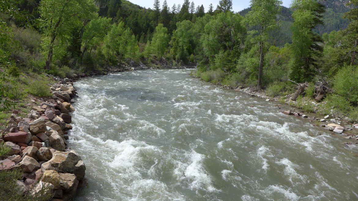
On May 19, the Crystal River near Avalanche Creek hit its high mark for the spring at about 1,870 cubic feet per second. On that day in the southwest part of the state, the San Miguel River at Placerville peaked at 823 cfs; and the Yampa River in Steamboat Springs hit its high mark of 2,915 cfs..
On May 20, the Roaring Fork River just above its confluence with the Colorado River in Glenwood Springs peaked at 4,450 cfs; the Eagle River at Dotsero peaked at about 4,950 cfs.
On May 21, just upstream of major agriculture diversions to the Grand Valley at a location known as Cameo, the Colorado River peaked at about 10,730 cfs. At the Utah state line, streamflows peaked at 16,130 cfs.
The peak streamflow volumes for these locations were within the range of what’s considered normal.
Although there may be a second, smaller peak in coming days as summer temperatures return, forecasters say most of the snow below 11,000 feet has already melted out, meaning not enough is left to fuel a bigger peak than the one that has already happened.
For several locations — the Roaring Fork at Glenwood, the Crystal, the San Miguel and the Colorado at Cameo — the peak came so early that it was outside the window of what’s considered normal. The rest of the locations — the Yampa, the Eagle and the Colorado at the Utah state line — were inside the normal range, although on the earlier side.
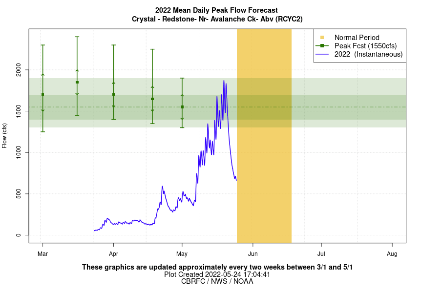
The graph shows the hydrograph for the Crystal River near Redstone through May 24, with the orange-shaded column representing the “normal range” during which the river’s peak historically has occurred. This year’s peak around May 19 occurred well before even the early boundaries of that normal range. NOAA updates this chart every two weeks.
Dust on snow
These conditions can be partly attributed to dust on snow, which causes the snowpack to melt earlier and faster.
“Dust on snow has played a pretty big role this year,” said Cody Moser, a senior hydrologist with the CBRFC. “It really allows the energy from the sun to get absorbed into the snowpack much more than if you have this white, clean snow surface.”
According to Jeff Derry, executive director of the Silverton-based Center for Snow and Avalanche Studies, a total of 11 dust events occurred in April and May. A total of six or seven occur during a normal year.
This spring has been unusually windy, which has kicked up dust from northern New Mexico and Arizona and deposited it on Colorado’s snow-capped peaks; the San Juans Mountains, in the southwestern part of the state, were the hardest hit. Each year, the center ranks the severity of the dust storms.
“A number of those were really nasty events,” Derry said. “This is the first time since 2013 that we have said it’s a severe dust year.”
The Crystal River just below Avalanche Creek on June 3. Streamflows near this location peaked on May 19 at 1,840 cfs according to data from the Colorado Basin River Forecast Center.
Early runoff brings challenges
The early runoff is a challenge for Blazing Adventures, a rafting company based in Aspen and Snowmass that runs trips on the Roaring Fork River. According to owner Vince Nichols, they usually try to run the Roaring Fork through the Fourth of July before heading to other sections of the Arkansas and Colorado rivers that see higher flows later in the summer. This year, it will be closer to mid-June, he said.
“It’s certainly been a strange runoff this year,” Nichols said. “We came out of the ski season with some optimism, but when we mixed in those high winds and dust, it ran off a lot faster than we were anticipating.”
The early runoff could also have implications for reservoir managers, who may have to begin releasing water earlier in the summer to meet downstream calls. A call happens when a senior water right is not receiving its full amount of water and junior upstream water users must cut back in order to send water to the senior user downstream.
This may end up being the situation with Green Mountain Reservoir, which is on the Blue River, is operated by the U.S. Bureau of Reclamation and is affected by the call from the Shoshone hydropower plant in Glenwood Canyon. The call comes on most years in midsummer, but this year, it may be earlier.
“I may have to start making storage releases earlier,” said Victor Lee, an engineer with the Bureau of Reclamation. “That’s pretty typical of dry years, but with this early runoff, the call might come much earlier than what I expected.”
The same may happen at Ruedi Reservoir, on the Fryingpan River. Ruedi is also operated by the Bureau of Reclamation and is affected by the call at Cameo, which comes on most summers.
Although Ruedi had been forecast to fill by the skin of its teeth this year, Bureau of Reclamation hydrologist Tim Miller said he now thinks it will end up 1,000 to 6,000 acre-feet short. He said he will continue releasing the minimum required flow of 110 cfs until downstream calls come on and he has to release more stored water.
“I always like to point out that our snowpack is a natural reservoir and if that reservoir releases its water earlier than what’s normal, you can kind of imagine the disruptions and problems that occur,” Derry said. “It makes reservoir management a little bit more complicated if you have the water coming down earlier than what you expected.”
The Water Desk’s mission is to increase the volume, depth and power of journalism connected to Western water issues. We’re an initiative of the Center for Environmental Journalism at the University of Colorado Boulder. The Water Desk launched in April 2019 with support from the Walton Family Foundation. We maintain a strict editorial firewall between our funders and our journalism.
Construction workers build a single family home in Castle Rock. The community needs new surface water supplies to reduce its reliance on non-renewable groundwater. Credit: Jerd Smith
Douglas County officials said Tuesday they would not use their COVID-relief funding to help finance a controversial $400 million-plus proposal to export farm water from the San Luis Valley to their fast-growing, water-short region.
In a statement the commissioners said the federal rules would not allow the funds to be spent to help finance early work on the proposed project, and that it faced too many legal hurdles to justify the time and money the county would need to devote to it.
The county made public Tuesday two extensive legal memos, based on its outside attorneys’ review of engineering, and legal and regulatory requirements the project would have to adhere to in order to proceed. The memos formed the basis for the county’s rejection of the funding request.
“The Board of Douglas County Commissioners has made the decision, based on objective legal recommendations from outside counsel, that American Rescue Plan Act (ARPA) funds are inapplicable to the RWR proposal and that RWR has significant additional hurdles to overcome in order to demonstrate not only a ‘do no harm’ approach, but also a ‘win-win’ for Douglas County and the San Luis Valley,” the board said.
The proposal comes from Renewable Water Resources (RWR), a well-connected Denver development firm that includes former Colorado Gov. Bill Owens.
Among other things, the memos said that RWR’s claim that there was enough water in the valley’s aquifers to support the export plan, was incorrect, based on hydrologic models presented over the course of several public work sessions.
The county’s attorneys also said the proposal did not comply with the Colorado Water Plan, which outlines how the state will meet future water needs. That lack of compliance means that Douglas County would likely not win any potential state funding for the export proposal.
County Commissioner Lora Thomas came out against the idea early, with Commissioner Abe Layden joining her this week in voting against the proposal. Commissioner George Teal voted for the proposal.
“I am ecstatic that I got a second vote to stop it,” Thomas said. “The hurdles are too steep for us to get over. I don’t see a future for it.”
RWR declined an interview request regarding the decision, but in a statement it said it planned to continue working with the county to see if the legal concerns raised could be resolved.
“Our team is eager to address the county’s remaining questions as raised in the legal analysis. We are confident in our ability to mitigate any areas of concern,” it said.
Opposition to the proposal sprang up quickly last December after RWR submitted its $10 million funding request to the commissioners.
Critics, including the Rio Grande Water Conservation District in Alamosa, argued that no water should be taken from the San Luis Valley because it is already facing major water shortages due to the ongoing drought and over-pumping of its aquifers by growers. The valley faces a looming well-shutdown if it can’t reduce its water use enough to bring its fragile water system back into balance.
RWR said its plan to shut down agricultural wells could help the valley, but many disagreed.
State Sen. Cleave Simpson, who also manages the Rio Grande Water Conservation District, said in a statement that he was pleased with Douglas County’s decision. “This is good news for the San Luis Valley and it speaks to the hundreds and perhaps thousands of people who spoke out against this unviable proposal.”
Environmental groups also came out in opposition, as have numerous elected leaders including Democrats Gov. Jared Polis, Attorney General Phil Weiser, U.S. Sens. John Hickenlooper and Michael Bennet, as well as Republican U.S. Rep. Lauren Boebert, who represents the valley.
Douglas County does not deliver water to its residents, but relies on more than a dozen individual communities and water districts to provide that service. And they are all facing the need to develop new water supplies.
But two of the largest providers, Parker Water & Sanitation District and Castle Rock Water, have said they would not support the RWR proposal because they had already spent millions of dollars developing new, more sustainable, politically acceptable projects. Those projects include a South Platte River pipeline that is being developed in partnership with farmers in the northeastern corner of the state.
What comes next for RWR’s proposal isn’t clear yet. RWR spokeswoman Monica McCafferty said the firm’s attorneys were still reviewing the legal memos the county released Tuesday.
RWR has said previously that it might ask lawmakers to change state water laws to remove some of the legal barriers to its proposal.
Jerd Smith is editor of Fresh Water News. She can be reached at 720-398-6474, via email at jerd@wateredco.org or @jerd_smith.
Fresh Water News is an independent, nonpartisan news initiative of Water Education Colorado. WEco is funded by multiple donors. Our editorial policy and donor list can be viewed at wateredco.org
The Water Desk’s mission is to increase the volume, depth and power of journalism connected to Western water issues. We’re an initiative of the Center for Environmental Journalism at the University of Colorado Boulder. The Water Desk launched in April 2019 with support from the Walton Family Foundation. We maintain a strict editorial firewall between our funders and our journalism.
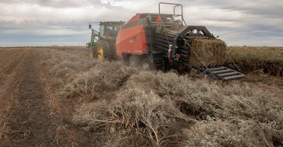
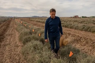
Paul Sanchez drives the custom guayule bailer from the Bridgestone Guayule Research Farm to harvest a field of guayule on a test field outside Stanfield, Arizona. The bailer is designed to cut through the woody stem of the guayule plant that would otherwise destroy a traditional bailer. Bill Hatcher
On a spring day that would have seemed abnormally hot anywhere else, I went rumbling down dirt roads south of Phoenix in search of an answer to a question that had been dogging me. The West is mired in a water crisis that’s difficult to fully comprehend. More than 40 million people in seven states and two countries depend on the Colorado River, and its waters are depleting at a terrifying rate. Since the 1900s, flows have decreased by 20 percent, a drop largely associated with climate change. Experts say the situation will only get worse.
For decades, leaders have sought a way to equitably share what’s left of the shrinking supply, but there has always been one stubborn sticking point: Farmers consume three-quarters of the region’s precious water, often to grow thirsty, inedible crops like cotton and hay. Many of them have been here for a century or more, and they aren’t about to leave. So, why can’t they grow something that sucks less water?
Outside Eloy, I drove past miles of empty fields riddled with Land for Sale signs. These farms had been hit hard by recent cutbacks in the delivery of Colorado River water, upon which they had relied since the 1980s. Those who were still in the game were scraping by and bracing for more rationing. Eventually, I came to a chain-link gate with a warning: “Watch out for snakes.” Behind it, I found a 300-acre desert laboratory operated by the Japanese-owned Bridgestone Corporation where a small team was toiling away, in some sense, on the same question.
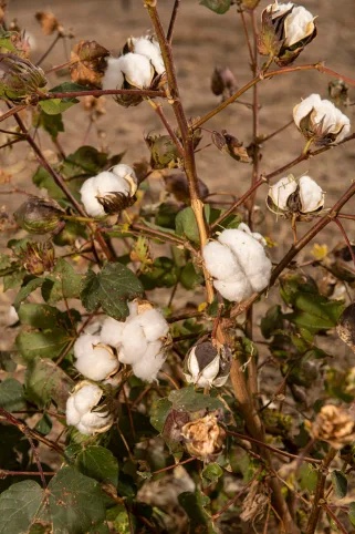
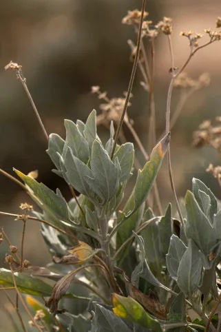
The compound was nothing like the farms of fluffy cotton and bright green alfalfa I was used to seeing in central Arizona. A ring of barbed wire contained a stucco building with offices, meeting rooms, and a greenhouse where geneticists in white coats peered through microscopes. Out back, rows of ragged shrubs grew at varying heights. This was guayule (pronounced why-oo-lee), a plant native to Southwestern deserts that happens to produce latex. From this unassuming outpost, Bridgestone was trying to establish the country’s sole domestic source for the kind of high-grade natural rubber used in airplane tires and surgical gloves—and they were doing it with a crop accustomed to drought.
“This is a big investment,” said Dave Dierig, the farm’s trim and stoic manager, though he stopped short of naming a number.
Dr. David Dierig walks along a row of guayule plants at the Bridgestone Guayule Research Farm. Bill Hatcher
The company intends to disrupt a supply line that has for more than a century been milking rubber from musty tropical forests and shift it to the middle of the searing desert. To succeed, this laboratory will have to develop a wundercrop that produces high rubber yields with relatively minuscule amounts of water. But that’s just the start. Bridgestone will also have to develop guayule-specific farm equipment and convince Arizona’s farmers—who cling proudly to their role in providing food and fiber for American families—to produce something that can be neither eaten nor worn. Many companies and the US government have already tried and failed.
“You can’t do it and make a buck. Good luck to the guy who says he can. But I think he’s dreaming,” Goodyear spokesman Hank Inman told the Los Angeles Times in 1988, the same year his company threw in the towel on its own guayule scheme.
And yet Dierig, who is also a plant breeder, was adamant that this time would be different. Bridgestone produced the first tires made entirely of guayule rubber back in 2015, and a couple years later received a $15 million grant from the USDA to continue its research. In 2021, the company announced an extension of those laboratory experiments, a breakthrough in its genetic research, and a commitment to opening a commercial processing facility in Arizona by 2026.
Squinting across a sea of teal shrubs, I thought: This is what adaptation to climate change looks like in Arizona. While coastal cities erect seawalls, river towns construct wetlands to absorb floods, and Californians thin their forests of tinder, desert farmers search for a crop that can survive 114-degree days on less than four inches of rain a year and still throw off enough cash to run their air conditioning.
And if this crop wasn’t it, well, then understanding exactly why might still help thousands of farmers—and the agriculture industry as a whole—carve a path toward sustainability in the desert.
Dierig bent over a guayule bush, tore off a woody stem, and showed me the dense hairs and waxy coating that keep moisture from escaping its leaflets. “There’s no other crop like guayule,” he explained. “It’s a true desert shrub” that just happens to produce latex. Beneath our feet, the densely planted shrubs sent their taproots 20 feet down toward moisture, a trick that allows them to survive prolonged periods without rain. Guayule needs about 3.5 acre feet of water each year (an acre foot is enough to cover one acre of land a foot deep), which is at least half a foot less than cotton and nearly two feet less than alfalfa. Dierig’s team is working to shave off another six inches while also increasing yield.
A thousand years ago, people indigenous to the Sonoran Desert chewed the shrub’s stems to release their latex and collected it in balls they might have played with. Archeologists found one of those at a dig just a few miles away. Considering that latex accounts for little more than 8 percent of the plant’s total biomass, it is astonishing that, within the hundred or so acres of guayule spread out before us, we were looking at enough rubber to make about 1,000 tires.
There are hundreds of plants that produce rubber, most likely as a defense against disease or parasites, but just a few that produce the kind of rubber needed to make tires and high-grade latex. Of those, guayule is the only plant adapted to arid environments. Today, about 90 percent of America’s natural rubber comes from hevea trees planted across some 27,000 square miles in Southeast Asia, accounting for three quarters of the world’s total production. This concentration exposes global stocks to disease and U.S. companies to market fluctuations. It’s not surprising, then, that Americans have been trying to drum up a domestic supply for some time.
In the 1920s a blight hit Brazil’s hevea tree plantations and the U.S. government started growing guayule, but it soon gave up the effort. In 1940, when Japan invaded Indochina and blocked access to that region’s hevea, the U.S. government planted about 30,000 acres of guayule, then burned 21 million pounds of it when the war ended and it became clear that tapping foreign stocks was far easier, in the short term, than establishing a domestic supply. Thirty years later, during the Arab oil embargo, the U.S. gave the shrub another abbreviated attempt in search of synthetic polymers. On each occasion, guayule projects were abandoned in favor of other more attractive crops or as soon as the price of imported rubber dropped. Sustainable production never took root.
Now, Bridgestone has made significant genetic breakthroughs and desert farmers are more desperate than ever for a way to stay in business. Might things be different this time around?
Rimjhim Aggarwal, a sustainability researcher at Arizona State University, told me that the region hasn’t taken alternatives seriously in the past. “Now that the water restrictions are here, I think we need to look deeper into other options,” she said. And in light of the food shortages seen in Phoenix during the pandemic, Aggarwal said it’s critical that agriculture doesn’t disappear from the central valley. Even if you can’t eat it, guayule is a high-value crop with a buyer in the wings, and it might provide a cash stream that keeps farmland in production.
In August of 2021, the U.S. Bureau of Reclamation announced the long-dreaded news: Cutbacks of Colorado River water were necessary to avert a larger catastrophe, and thanks to a byzantine web of 20th-century water laws, and a running list of court decisions and backdoor agreements, hundreds of farmers in central Arizona had drawn short straws. In 2023, this sliver of the state’s $23-billion agriculture industry would lose its entire allotment of river water.
The farmers knew this was coming. Those who haven’t sold out are fallowing (leaving unplanted) as much as 40 percent of their fields. Some have invested in drip irrigation systems, high-tech field moisture monitoring, and less-thirsty varieties of staple crops. Many more are, for the first time in decades, pumping groundwater—with limitations—from already stressed aquifers. And a few have even tried planting alternatives like barley and hemp. But so far, no new crop has lived up to its boosters’ hype, and most growers are sticking with what they know, as long as the water flows.
“There’s no point in growing something you can’t sell,” said Gary Deen, and he should know. From silver mining to cotton farming, Deen’s family has cashed in on some of rural Arizona’s most lucrative industries. I met him at the entrance to his 400-acre farm beneath a tree filled with so many warbling meadowlarks that I could hardly hear him recap the past hundred years of the state’s economic evolution.
Deen began growing Bridgestone’s guayule in 2015, but he hasn’t yet uprooted his wheat, cotton, or hay. The company planted 40 acres of its experimental crop on his land, managed the weeds, harvested the shrub, and paid him for the yield as if it were cotton. Bridgestone has been careful about setting farmer expectations too high, though.
Farmer Gary Deen walks a flooded irrigated field in Eloy, Arizona, where he once grew guayule that is being prepared for a cotton crop. Bill Hatcher
Past attempts put the cart before the horse, Dierig said. They gave experimental seeds to farmers prior to ensuring a long-term market. Now, working from seeds preserved at a national seed bank in Colorado and with two additional proprietary varieties, his team has mapped the DNA of different guayule strains to identify and select for traits like drought tolerance and the highest yield. Bridgestone also grows shrubs at satellite outposts to find varieties that can withstand frigid winters in upper elevations, since guayule takes two years to mature and the company intends to grow in Texas, California, and Mexico.
While Deen showed me around his farm, a custom-made prototype baler tore through a field of the stuff, which looked like an unruly weed beside his rows of orderly wheat. Guayule’s woody stems easily throttle conventional balers, so Bridgestone is also developing new harvesting equipment tailored to the shrub. Even the seeds, which are five times smaller than rice, needed a special wax coating to keep them from glomming together during planting.
Bridgestone has navigated these upfront hurdles because it sees so much potential on the back end, Dierig said at his laboratory. Domestic production will reduce the $1.4 billion a year that’s currently spent importing natural rubber to the U.S. But tires are just part of the picture. Bridgestone is building an ecosystem of markets, which includes the largest chemical company in Italy, to ensure farmers have plenty of reasons to grow lots of guayule.
Once completed, its new Arizona processing facility will be able to transform 1,000 tons of biomass daily into multiple high-value products, including latex for use in hypoallergenic surgical gloves (a $28-billion global industry), resin for use in adhesives, binders for asphalt, and terpenes for insecticides. Once these chemical compounds are separated, the remaining woody fibers, which account for about 80 percent of a shrub’s total mass, will end up as biofuel.
A cotton plant outside Eloy, Arizona a town in Southern Arizona that was almost renamed Cotton City in the early 1900’s. Bill Hatcher
For Deen, whose arrangement with Bridgestone ended after the company switched to using farmland closer to the desert lab, the best part of the deal was getting paid up front. That level of certainty is rare in a world where crop prices fluctuate and acts of God seem to be happening more often. Still, Bridgestone is scrambling to enlist enough growers.
“We’re paying a premium because we’re new,” Dierig said, but the company expects guayule to soon stand on its own—no premium, and no support for cultivation and harvest. To meet and sustain his commercial production goals, Dierig needs to have 10,000 acres in the ground by 2024 and another 10,000 acres the next year. There are only about 200 acres planted now.
“If we could find a crop that’s a low-water user, like guayule, that we can make money on, year in and year out, we’re going to be all over it,” said Dan Thelander, an elder statesman of Arizona agriculture whose family grows on about 5,000 acres in the central valley. They will plant around 40 acres for Bridgestone this spring.
Said Thelander, who has been involved in discussions of water shortages for years, “Everybody’s feeling the pain, but I can tell you that agriculture in Pinal County is gonna feel a lot more pain than anyone else.” As farmers fallow land, he explained, “there will be more laborers not getting paychecks; then they’re not buying things in stores—the fertilizer, the seed, the pesticide, the tractors, equipment, and repair.” A crop like guayule might lessen the strain on farmers and also buoy this weary community.
The Thelanders could handle 1,000 acres of guayule, but Dierig wants to keep initial production spread across many small parcels to hedge his bets against the region’s patchy rainfall patterns. That means winning buy-in from a small army of farmers accustomed, over the generations, to growing either cotton or hay, which they steadily sell to local dairies and ranchers, or to overseas customers who pay set rates for cheap grass.
Dierig and his team give presentations at Bridgestone’s farm to win new converts, and they’ve garnered a commitment from the Gila River Indian Community, whose tribal growers are entitled to more Colorado River water than any other central valley farmers. Cropping decisions are often determined by tradition, however, which puts guayule at a distinct disadvantage.
Farmer Will Thelander stands in a field of guayule south of Phoenix, Arizona. Bill Hatcher
When Eloy was established, in 1918, locals lobbied to name it “Cotton City.” A century later, the lucrative crop is still a winner: in 2019, farmers planted 85,500 acres of cotton in Pinal County, bringing in $92 million in revenue. Pinal ranks 10th among the nation’s cotton-growing counties. At his farm’s office, Deen proudly displayed a fibrous cotton tuft atop a hunk of silver ore. This cultural inclination presents an obstacle for Bridgestone, but so do the economics.
Tractors, fuel, seed, fertilizer, water—everything has grown more expensive lately, but land most of all. Thanks to Arizona’s fervent drive to build tract housing and strip malls, its average price of cropland, at $7,700 an acre, surpasses that of all Mountain West states (Idaho is a distant second at $4,450 an acre). And because most central Arizona farmers lease rather than own the land they grow on, many are hesitant to take risks that might delay their rent payments, especially with developers circling the perimeters, licking their chops. That said, as long as Bridgestone is paying cotton prices and guayule uses less water than cotton, farmers could grow more guayule than cotton on what water they have and make more money.
But it’s not that simple.
Pinal farmers also receive more federal funding than do farmers in any other Arizona county, and water-loving cotton is more heavily subsidized than any other crop in the state. Nationwide since the early 2000s, direct subsidies—paid at a set rate every year regardless of conditions—have largely been replaced by federally funded (and taxpayer supported) crop insurance payments, which compensate farmers if they experience a loss in crop yield or a decline in revenue. From 2000 to 2020, crop insurance paid to Pinal farmers rose from $3.2 million to $24.6 million, according to data collected by the Environmental Working Group. Three quarters of that money was paid to cotton growers to cover their losses, and half of those losses were caused by a “failure of irrigation supply.”
Might this government support nudge a farmer toward sticking with water-intensive cotton despite the extreme drought?
“Crop insurance is not intended to discourage or encourage the plantings of specific crops, but is simply there as a tool for growers of these crops,” explained Jeff Yasui, the USDA’s director of risk management for the Southwest. “The availability of the program does not consider water issues or the disbursement of subsidies.”
Leaves and dry flower stalks of guayule plants at the Bridgestone Guayule Research Farm in Eloy, Arizona. Bill Hatcher
In recent papers, however, agricultural economists have argued that the USDA’s crop insurance program disincentivizes experimentation with measures that might help farmers adapt to climate change. Even programs that encourage climate-smart tactics, like planting cover crops, can be less lucrative than insurance claims. Last year, Stanford University researchers reported that 14 percent of the $140 billion in crop insurance paid to farmers between 1991 and 2017 could be attributed to losses associated with temperature increases.
If the government is serious about helping desert farmers adapt to drought, it might invest as much in adaptation as it does in subsidizing the status quo. In the latest Farm Bill, the USDA provided support for some projects aimed at climate adaptation—like the $15 million Bridgestone received to help with research—and President Biden’s infrastructure bill earmarked more than $8 billion to update and augment water infrastructure in the West. But once Bridgestone stops paying its current premium, there will be little incentive for farmers who want to swap bags of cotton seeds for tiny grains of guayule.
I didn’t expect to find a silver bullet for the West’s water crisis at Bridgestone’s desert laboratory, and I didn’t. Clearly, guayule has enormous potential, otherwise the tire company, the US government, public universities, and so many others wouldn’t bother with it. It’s also true that Arizona’s farmers are heavily invested in crops that make little sense in a landscape facing megadrought. But decades of dam building, canal laying, deal striking, and subsidy paying have made the desert hospitable enough. And 300 days of sun make it a hell of a place to grow just about anything, anyway.
As one farmer explained after a long day of harvesting hay, “We have so many more costs here, but we can produce better yields per acre, and we can produce better quality because of our climate. If I was a supreme ruler of the world, there wouldn’t be anybody living in this goddamn state except farmers and ranchers.”
In the cities and suburbs, I’ve met many who would similarly like to have Arizona to themselves. For the time being, though, we all have to share it. And as long as that’s the case, we’d be better off designing a sustainable future together rather than holding our breath until the water runs out.
This article was supported by The Water Desk at the Center for Environmental Journalism, University of Colorado Boulder.
The Water Desk’s mission is to increase the volume, depth and power of journalism connected to Western water issues. We’re an initiative of the Center for Environmental Journalism at the University of Colorado Boulder. The Water Desk launched in April 2019 with support from the Walton Family Foundation. We maintain a strict editorial firewall between our funders and our journalism.