
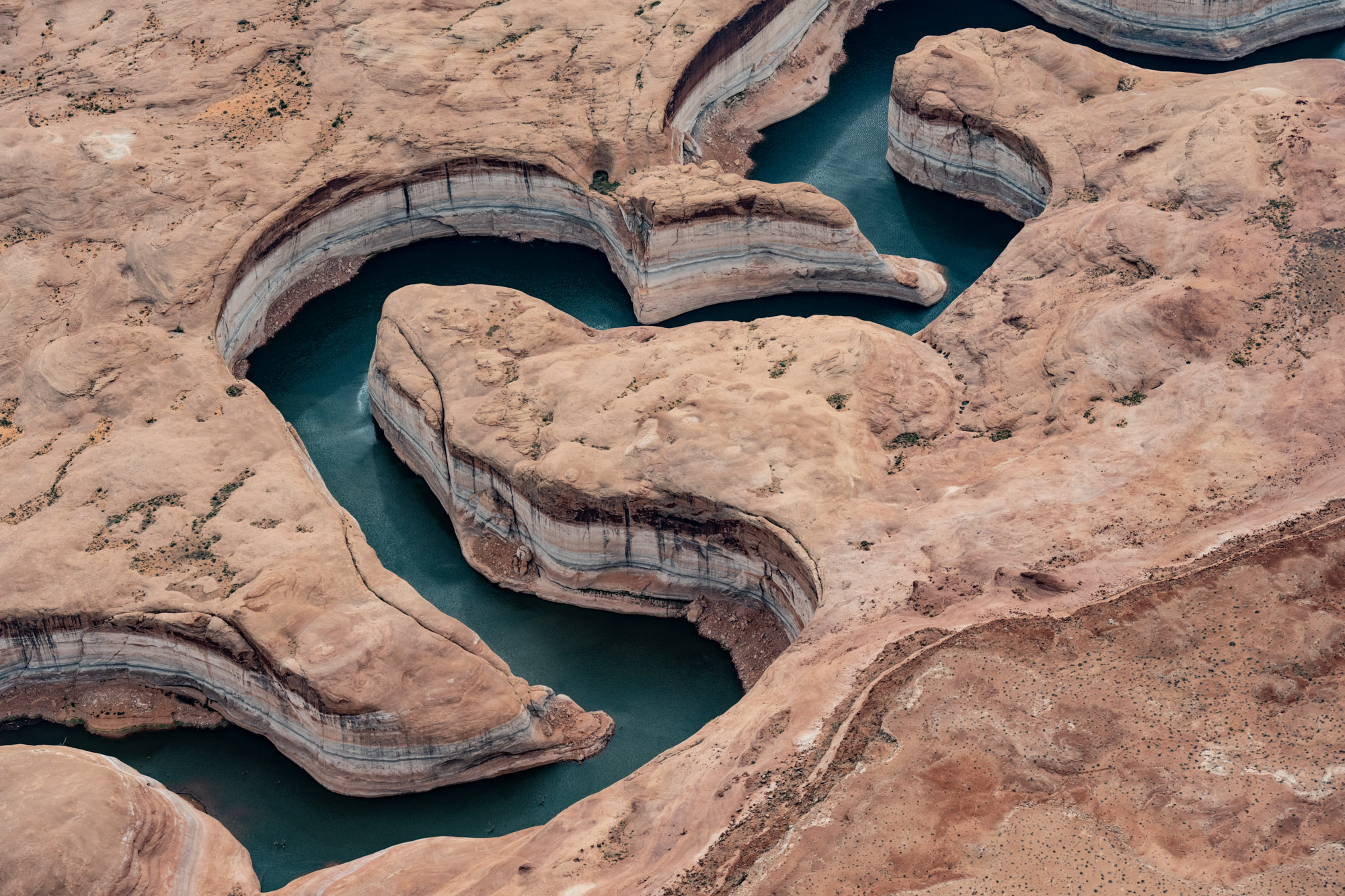
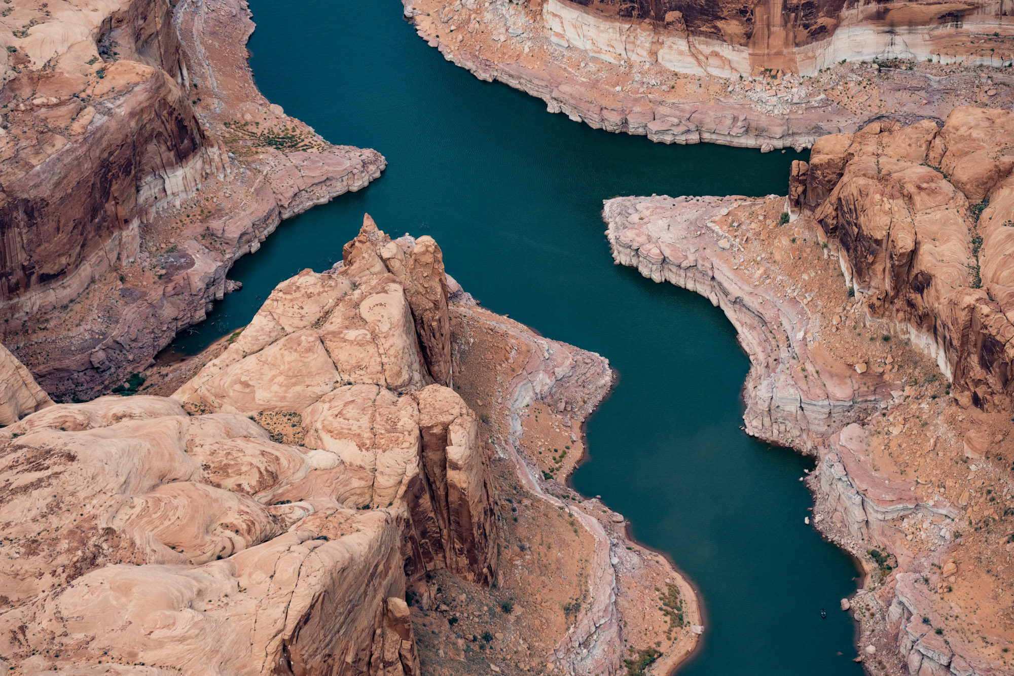
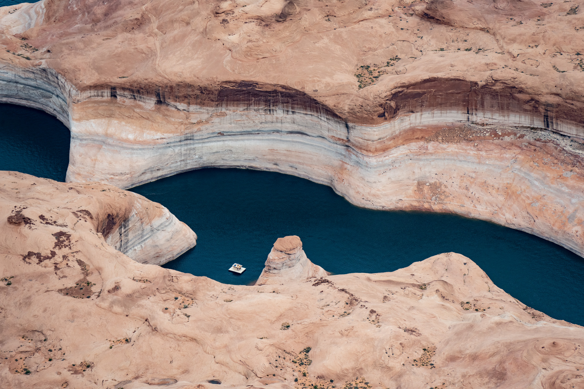
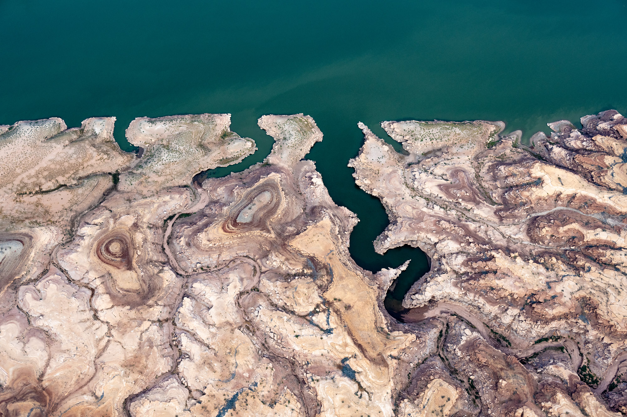
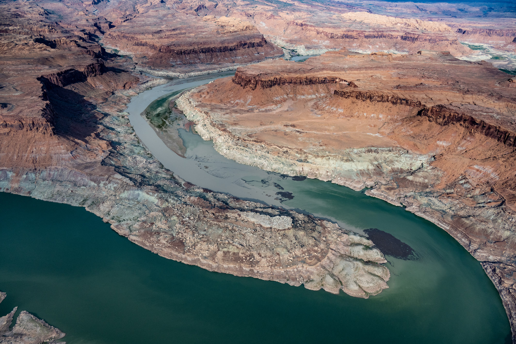
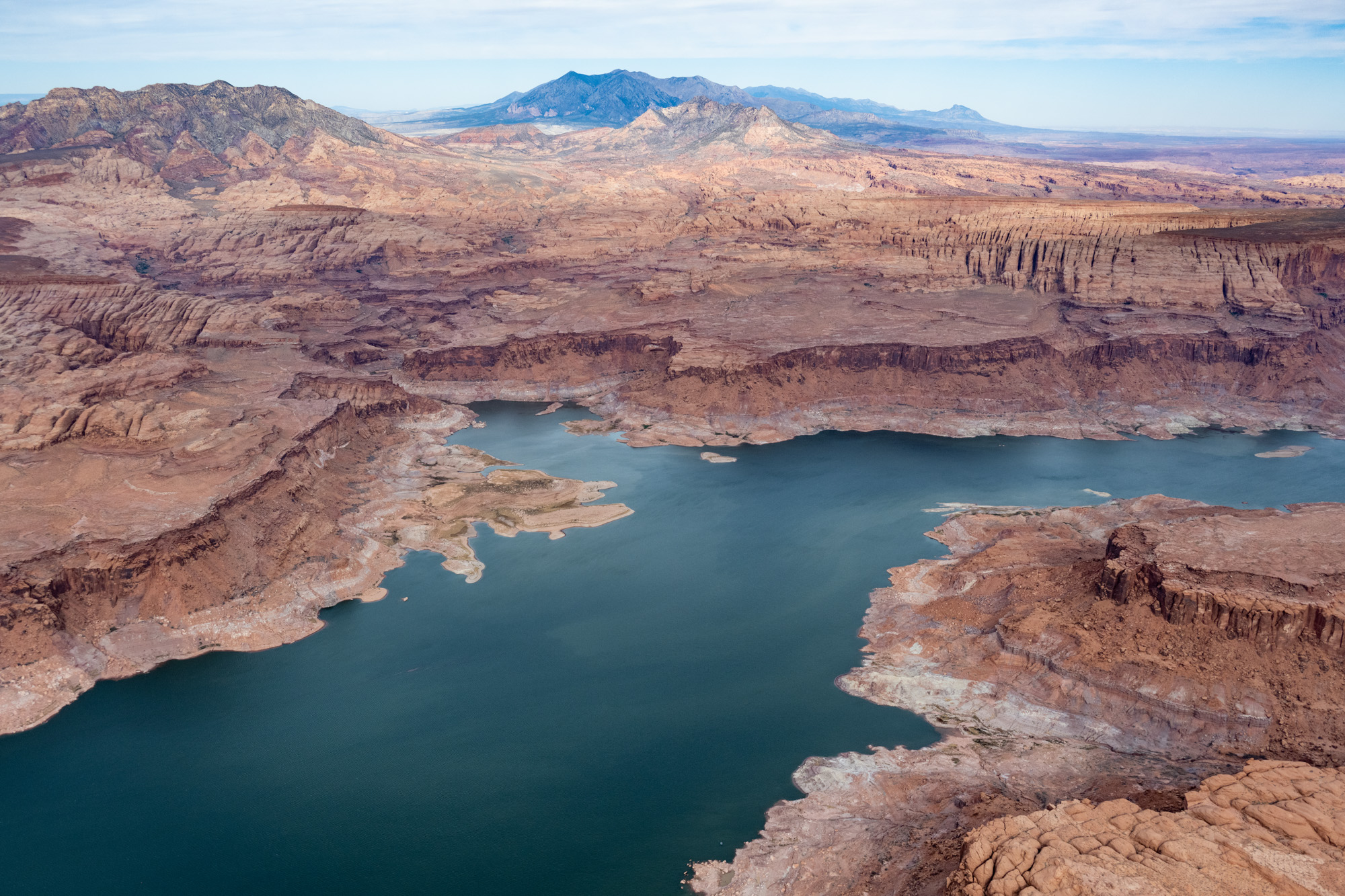
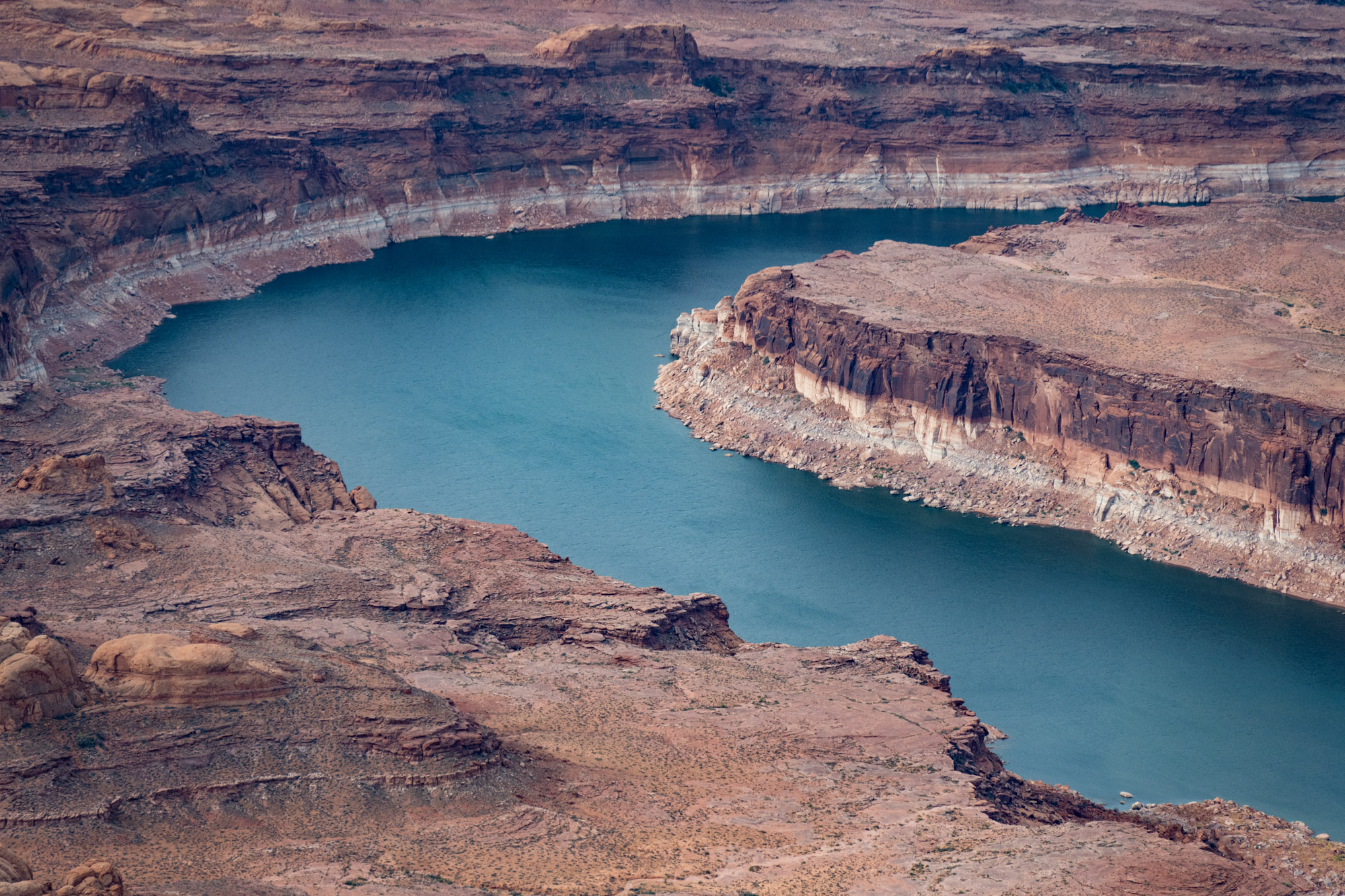
This page features aerial photos of the northern end of Lake Powell in Utah.
Lake Powell is the second-largest reservoir in the nation by capacity and began to fill with Colorado River water in the 1960s with the completion of Glen Canyon Dam.
The ongoing megadrought and human demands upon the river have caused Lake Powell’s elevation to plummet to levels not seen since the days when the reservoir was filling for the first time. The precipitous drop in the reservoir has threatened hydropower at the dam and led the federal government to demand significant water cutbacks among the seven states of the Colorado River Basin.
For aerial photos of the south end of Lake Powell, please see this page.
| Date | October 2022 |
| Location | Lake Powell, Utah (map) |
| Credit | Alexander Heilner/The Water Desk with aerial support from LightHawk |
| Rights | Free to reuse under Creative Commons license. |
Selected images from the gallery
Click to enlarge


To use these images
Please read and consent to the terms and license below for access to the download page.
To help us continue to offer this free material, we ask that you please:
- Credit the original photographer and the Water Desk as the source
- Email us a link to the published story at waterdesk@colorado.edu
- Consider sending The Water Desk your ideas for future content that we could add to the library
- Keep supporting professional photojournalists by hiring them for assignments


