Crisis on the Colorado Part V: Bringing New Life to a Stressed River
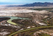
The Colorado River has been dammed, diverted, and slowed by reservoirs, strangling the life out of a once-thriving ecosystem. But in the U.S. and Mexico, efforts are underway to revive sections of the river and restore vital riparian habitat for native plants, fish, and wildlife.
Crisis on the Colorado Part IV: In Era of Drought, Phoenix Prepares for a...
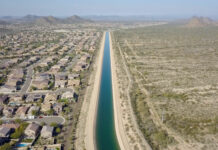
Once criticized for being a profligate user of water, fast-growing Phoenix has taken some major steps — including banking water in underground reservoirs, slashing per-capita use, and recycling wastewater — in anticipation of the day when the flow from the Colorado River ends.
Crisis on the Colorado Part III: Running Dry– New Strategies for Conserving Water
Communities along the Colorado River are facing a new era of drought and water shortages that is threatening their future. With an official water emergency declaration now possible, farmers, ranchers, and towns are searching for ways to use less water and survive.
Crisis on the Colorado Part II: On a Water-Starved River, Drought Is the New...
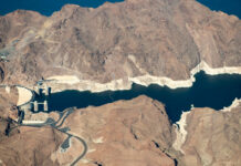
With the Southwest locked in a 19-year drought and climate change making the region increasingly drier, water managers and users along the Colorado River are facing a troubling question: Are we in a new, more arid era when there will never be enough water?
Crisis on the Colorado Part I: The West’s Great River Hits Its Limits– Will...
As the Southwest faces rapid growth and unrelenting drought, the Colorado River is in crisis, with too many demands on its diminishing flow. Now those who depend on the river must confront the hard reality that their supply of Colorado water may be cut off.
Videos and photos: Green Mountain Reservoir and Colorado/Blue confluence drone flight, October 2019
View this gallery for high-resolution downloads »
This page features drone-captured imagery of Green Mountain Reservoir and the confluence of the Colorado River and Blue River, near...
Efforts to relocate an ancient wetland could help determine the fate of a water...
The cities of Aurora and Colorado Springs are looking to develop additional water in Eagle County and divert it to Colorado's Front Range.
Study: Colorado River water crisis could dry out Front Range, West Slope cities and...
If drought and climate change continue to sap the Colorado River, and a legal crisis erupts with downstream states, six of Colorado's eight major river basins could be forced to give up water.
The dam nobody wants just won’t go away
Dams can stop the natural flow of sand and silt to the sea—resulting in coastal wetland loss and disappearing beaches—as well as preventing fish from reaching vital spawning grounds.
Monitoring will make sure Aspen snowmaking doesn’t harm creeks
A monitoring program is trying to ensure that Aspen Skiing Co.’s increased water use for snowmaking won’t harm area creeks.


