The Colorado River in Marble Canyon in northern Arizona. Photo by Ted Wood/The Water Desk
The Water Desk is excited to announce the recipients of new grants to support water journalism connected to the Colorado River Basin.
The grantees will be reporting on a range of critical water issues facing the region, including climate change, pollution, growth, biodiversity, agriculture, energy and water rights. Many of the journalists will be exploring equity issues in the water sector.
The 17 awards, up to $10,000 each, are being funded thanks to the support of the Walton Family Foundation. A total of $90,969 has been approved in this round of grantmaking.
The recipients of The Water Desk’s 2022 Colorado River grants (in alphabetical order):
The Water Desk maintains strict editorial independence from its funders and the University of Colorado. Funders of The Water Desk have no right to review or to otherwise influence stories or other journalistic content that is produced with the support of these grants. For more about our editorial independence, please see our funding page.
Congratulations and best of luck to our grantees. We look forward to seeing the water journalism they produce!
The Water Desk’s mission is to increase the volume, depth and power of journalism connected to Western water issues. We’re an initiative of the Center for Environmental Journalism at the University of Colorado Boulder. The Water Desk launched in April 2019 with support from the Walton Family Foundation. We maintain a strict editorial firewall between our funders and our journalism.
This beaver dam analogue, with posts across the creek and soft, woody material woven across, was built by environmental restoration group EcoMetrics, keeps water on the landscape by mimicking beaver activity. Some water rights holders worry that these types of projects could negatively impact them. CREDIT: JACKIE CORDAY
By Heather Sackett
State officials are working to address a tension that has arisen alongside the growing popularity of stream restoration projects that aim to keep water on the landscape by mimicking beaver activity.
There’s no doubt that North America’s largest rodent is good for riparian ecosystems. By building dams that pool water, beavers can transform channelized streams into sprawling, soggy floodplains that recharge groundwater, improve water quality and create areas resistant to wildfires and climate change. Beavers create natural storage ponds in the headwaters which slows the rate that water is released and can help boost late-summer base flows and prevent downstream flash flooding. Basically, beavers rehydrate a dry sponge.
The engineers of the forest are so good at what they do that environmental groups sometimes copy beaver activity in stream restoration projects, building what are called beaver dam analogues. These temporary wood structures usually consist of posts driven into the streambed with willows and other soft materials woven across the channel between the posts. The idea is that by creating appealing habitat in areas that historically had beavers, the animals will recolonize and continue maintaining the health of the stream.
These types of low-tech, process-based restoration projects have been growing more popular in recent years in part because they are relatively cheap and because beavers — which were once hunted almost to extinction — are having a moment as more people recognize their many benefits to an ecosystem. But there is a growing concern that these projects, which often take place on small, headwaters streams, could negatively impact downstream irrigators.
Under Colorado water law, older water rights have first use of the river, and if these stream restoration projects prevent them from getting their full amount, it could be problematic. Some are concerned that if the projects create numerous ponds in the headwaters, it could slow the rate of peak spring runoff or create more surface area for evaporation, which could negatively affect downstream water users.
According to Kelly Romero-Heaney, assistant director of water policy for the Colorado Department of Natural Resources, some water rights holders are concerned that projects that mimic beaver activity could be considered an out-of-priority diversion of water.
“If that’s a diversion, then it would potentially need a water right or a plan of augmentation,” Romero-Heaney said. “I would say both the water rights community and river health community are collectively unsettled over the issue.”
This concept, taken to its logical extreme, raises the question: Could beavers need a water right?
This stream restoration project on Trail Creek, in the headwaters of the Gunnison River, mimics beaver activity. Some worry that projects like this have the potential to negatively impact downstream water rights.CREDIT: JACKIE CORDAY
Reducing barriers, protecting water rights
The issue cropped up at the Colorado Water Congress summer conference in Steamboat Springs in August during the meeting of the Interim Water Resources Committee, part of the Colorado state legislature. Terry Scanga, general manager of the Upper Arkansas Water Conservancy District, presented an overview of the issue to lawmakers. His district is home to a pilot project that aims to explore the risks of these stream restoration efforts to water rights holders.
“One of the big concerns is that in these types of stream restoration projects, as important as they are to the habitat and so forth, they can still cause impacts to water rights that are negative and actually depleting water to downstream users,” he said.
Sen. Jeff Bridges, who represents Arapahoe County, called the presentation strange and surreal.
“Who are we taking to water court in these cases if beavers move in?” he asked. “It seems to me beavers would probably have the most senior water rights of anyone in the state.”
DNR is currently working on a solution — which could take the form of legislation — to address the issue. The goal would be to reduce barriers to stream restoration projects while still being protective of water rights. If project proponents were required to spend years in water court securing a water right and spend money on an expensive augmentation plan, in which water is released to replace depletions caused by the project, it could have a major chilling effect on projects that nearly everyone agrees are beneficial to the environment.
“I think DNR’s concern is that if stream restoration projects end up routinely needing a plan of augmentation, that could be an insurmountable barrier, particularly for the low budget, low tech projects that are high in the watershed far from diversions downstream,” Romero-Heaney said.
Under current guidelines from the state Department of Water Resources, division engineers could issue orders to discontinue a diversion, release water that has been stored or clear streams of dams that restrict the flow of water if a project is causing injury to water rights.
A beaver dam on Maroon Creek near Aspen. The state of Colorado is working on a solution to resolve tension between stream restoration projects that mimic beaver activity and downstream water rights holders.CREDIT: BRENT GARDNER-SMITH/ASPEN JOURNALISM
No measurable harm
Jackie Corday, a natural resources consultant and former head of water resources for Colorado Parks and Wildlife, has been working on a study to engage West Slope agriculture in headwaters restoration. The study, commissioned by environmental group American Rivers, was funded in 2021 by a Colorado Water Conservation Board Water Plan grant.
According to a draft of a white paper Corday wrote as part of the study, her research did not find any documented cases where process-based restoration projects resulted in measurable harm to water rights from increased evaporation or riparian vegetation sucking up the water.
The goal of process-based restoration projects is to return conditions in the headwaters to what they were before waterways were harmed by mining, cattle grazing, road building and other human activities that may have confined the river to a narrow channel and disconnected it from its floodplain.
There are ways to ensure a project is done right and won’t harm downstream water users, Corday said. These include using aerial photography to make sure a project stays within the floodplain’s historic footprint and doesn’t create new wetlands; doing projects only on the upper reaches of small tributaries; making sure the structures are porous and will allow water to still flow through them; and creating transparency around the project by including local stakeholders and addressing their concerns.
“All indications thus far are that if properly done and in the right location, with the right design, no it does not decrease the streamflow to a degree that you could measure it at the stream gauge downstream of the project,” Corday said.
For now, DNR staff is continuing to gather information from stakeholders who have expressed interest in the topic, like environmental groups and Front Range cities, and deciding how to move forward. It’s very unlikely Colorado will see a beaver in water court. But there is a sense of urgency to resolve the issue, Romero-Heaney said.
Water managers are starting to see worsening impacts of climate change and wildfires on watersheds and water supplies, and how restoration projects can lessen those impacts. The western U.S. is also poised to receive money dedicated to headwaters restoration work from the federal infrastructure bill and the Inflation Reduction Act.
“That funding won’t be around forever,” Romero-Heaney said. “That’s where we have that sense of urgency of managing the barriers to stream restoration work in Colorado.”
The Water Desk’s mission is to increase the volume, depth and power of journalism connected to Western water issues. We’re an initiative of the Center for Environmental Journalism at the University of Colorado Boulder. The Water Desk launched in April 2019 with support from the Walton Family Foundation. We maintain a strict editorial firewall between our funders and our journalism.
Denver Water crews replacing a lead service line at 1657 Vine Street. Jan. 12, 2021. Credit: Jerd Smith
By Jerd Smith
Hundreds of thousands of Coloradans exposed to drinking water tainted by lead from aging, corroded city pipes or so-called “forever chemicals,” will see clean water faster thanks to a historic infusion of $500 million from the federal government.
The money, largely from the new Bipartisan Infrastructure Law, is being funneled through the Colorado Department of Public Health and Environment over a five-year period and will allow miles of lead water delivery pipes to be replaced in towns across the state much faster than cities with little access to cash could achieve.
It will also be used to remove a set of chemicals known as PFAS, or poly and perfluoroalkyl substances, that are present in household and industrial products, such as Teflon and fire-fighting foam. The substances have been unregulated to date, although states and the federal government are writing new regulations to address the contaminants.
CDPHE officials said the money will double the agency’s capacity to fund its water quality safety work.
“The federal money is big,” said Nicole Rowan, director of the CDPHE’s Water Quality Control Division. “It’s a once in a generation opportunity to improve our infrastructure here in Colorado.”
To date, 67 Colorado water districts and communities, including the Academy Water and Sanitation District north of Colorado Springs, Limon, Louisville and Grand Junction, have expressed an interest in and are eligible for the funds, according to documents on file at the CDPHE.
Denver Water has been awarded $76 million to fast-track its lead pipe replacement program. The infusion will allow Denver to shave 1.5 years off the 15-year program, according to spokesman Jose Salas.
The City of Englewood also plans to apply, and will ask for $79 million to replace 8,000 lead service lines, according to Sarah Stone, deputy director of business solutions for Englewood Utilities.
Stone said the federal infrastructure funding will provide a critical boost to its efforts to remove lead from Englewood’s drinking water delivery system, if the city’s application is approved.
“We were extremely worried,” Stone said. “This means we can fund the program.”
Cities across the country, including Denver, Flint, Mich., Pittsburgh, Penn., Newark, N.J., and Washington, D.C., have been dogged by an increase in lead contamination as service lines age and corrode, allowing the lead to comingle with drinking water supplies, eventually reaching taps.
Denver Water, which is Colorado’s largest municipal water utility, has known lead was present at the tap in some of its customers’ homes since it appeared in routine sampling in 2013. The levels exceeded the benchmarks set under the Safe Drinking Water Act.
For several years, the utility ran pilot tests and negotiated with CDPHE and EPA over how best to eradicate the harmful metal. Though the amounts of lead found in Denver’s tap water samples varied, no amount of lead is considered safe to ingest, especially for young children.
The CDPHE issued an order in 2018 requiring Denver to begin adding phosphorous to its water, one of the most effective ways to reduce corrosion in pipes. But phosphorous is also a pollutant and causes problematic algae blooms in lakes and rivers. Adding it to the municipal drinking water supply would also make it harder for wastewater treatment operators to meet their own obligations to keep phosphorous out of rivers and streams.
Due to those concerns, Aurora, Metro Water Recovery, The Greenway Foundation, and eventually Denver, sued the CDPHE in 2018 to stop the order from taking effect.
The dispute was settled after Denver was able to obtain a rare variance under the Safe Drinking Water Act in exchange for agreeing to invest some $68 million over 15 years to replace lead service lines, offer free water filters to residents as they wait for the new lines to be installed, conduct community education programs, and increase the pH of the water supply to also help reduce corrosion in pipes.
Several cities and water districts are hoping the federal funding will allow them to mitigate their ongoing issues with PFAS contamination.
Roy Heald manages the Town of Security’s water utility. The town has been hard-hit by PFAS contamination attributed to Peterson Air Force Base. The PFAS chemicals from fire-fighting foam contaminated its groundwater.
Though the military facility has built a remediation plant for Security, it is considered a temporary facility, Heald said. With $450,000 in federal money from the American Rescue Plan Act approved earlier this year, Security is converting the plant to a permanent facility, one capable of operating for the decades it will likely take to clean up the groundwater.
“We’re happy to get it,” Heald said. “This work has to be done, and it’s $450,000 our ratepayers won’t have to pay.”
Jerd Smith is editor of Fresh Water News. She can be reached at 720-398-6474, via email at jerd@wateredco.org or @jerd_smith.
Fresh Water News is an independent, nonpartisan news initiative of Water Education Colorado. WEco is funded by multiple donors. Our editorial policy and donor list can be viewed at wateredco.org
The Water Desk’s mission is to increase the volume, depth and power of journalism connected to Western water issues. We’re an initiative of the Center for Environmental Journalism at the University of Colorado Boulder. The Water Desk launched in April 2019 with support from the Walton Family Foundation. We maintain a strict editorial firewall between our funders and our journalism.
EL RITO, New Mexico – The drying American West needs all the high-quality water it can get. It also needs adequate funds to protect its forests, the wellsprings of the region’s rivers.
But massively destructive, high-intensity megafires that now burn millions of acres and inundate the West’s rivers with ash and debris are punishing the beneficial relationship between forests and watersheds.
Here in the mountains surrounding this tiny community in northern New Mexico’s Rio Grande basin, fresh approaches to water management, fire, forest health, and project funding have converged to present an effective solution.
One of the West’s iconic waterways, the Rio Grande stretches nearly 1,900 miles from Colorado to the Gulf of Mexico. But the river stopped flowing for five miles through Albuquerque in July, the first time it ran dry in that reach in four decades.
Forest health is part of the reason, experts say. National forests are only 19 percent of the region’s land area but they supply 46 percent of its surface water while also filtering pollutants. Federal and state foresters now recognize what Indigenous land managers have long known: that forests in the Southwest — stands of ponderosa pine, white pine, Douglas fir — need low-intensity fire to rejuvenate. Several generations of fire suppression, together with a warming climate, have instead produced the conditions for catastrophic combustion that harms water supply.
In January, the U.S. Forest Service acknowledged its past mistakes and charted a new course for correcting the dire circumstances its forebears helped create. The agency issued a new wildfire strategy that aims to accelerate and expand the area for “prescribed burning” at four times the current rate. That means deliberately setting managed fires on an additional 20 million acres of U.S. Forest Service land over the next 10 years. The strategy anticipates treatments on another 30 million acres of other federal, state, tribal, and private lands. Central to this work is managing the “fireshed” — forest and rangeland units of roughly 250,000 acres that, if wildfire erupted, could damage homes, watersheds, water supplies, utility lines, and other critical infrastructure.
The U.S. Forest Service will soon have more resources to pay for the work. The Bipartisan Infrastructure Law, signed last November, provided $3.5 billion for programs to prepare communities for wildfire and to reduce surplus trees, brush, and understory. The Inflation Reduction Act, signed in August, added $1.8 billion more.
It’s an important step by Congress and the Biden administration to correct a century of wrongs in forest fire management. But it’s still not enough to pay sufficient numbers of workers needed to manage millions of acres of the West’s perilously dry forests. The government needs partners.
That’s the entry point for an ambitious eight-year-old forest restoration initiative called the Rio Grande Water Fund. Inspired by the principles of collaborative resource management and catalyzed by a wildfire in 2011 that shut down Albuquerque’s use of the Rio Grande for drinking water for more than two months, the Rio Grande Water Fund channels public and private dollars into forest restoration projects in southern Colorado and northern New Mexico that reduce the risk of catastrophic fires in the state’s largest and most essential watershed.
Those risk-reduction principles were on display this summer on a hot, windy day in Carson National Forest, just north of El Rito.
The high-severity Midnight fire, ignited by lightning on June 9, was sprinting through stands of handsome but tightly packed ponderosa pine in a mountainous area an hour north of Santa Fe. The weather that afternoon was “nightmarish,” Mary Steuver recalled: a blustery red flag day with single-digit humidity — the sort of hair dryer conditions that set a forester’s nerves on edge. Moderating rains from the Southwest monsoon, which sweeps through the region in July and August, had yet to arrive. New Mexico was coming off its sixth driest spring in the last 128 years. The forest, overgrown and dehydrated, was primed to burn.
Cheerful and forthright, Stuever is the Chama District Ranger for the New Mexico Forestry Division. Fresh on her mind was the Hermits Peak/Calf Canyon fire, which had ignited two months earlier but was still smoldering in Santa Fe National Forest, east of Santa Fe. Hermits Peak/Calf Canyon ended up burning 341,314 acres, in the process becoming the largest fire in state history. Monsoon rains then added to the misery, flushing ash and debris from burn scars into the Gallinas River watershed, wrecking the water filtration system for the city of Las Vegas, where residents have spent months using bottled water. Mayor Louie Trujillo told the New York Times that building a new system, if it comes to that, would cost $100 million.
Stuever and colleagues from local, state, and federal agencies worried that the Midnight fire had the potential to do similar damage in Carson National Forest. “I didn’t believe we’d get it under control,” she said while standing at the edge of the fire line on a bluebird day in September.
And yet, despite the adverse weather, the Midnight fire was corralled by the end of June, and less than 5,000 acres had burned. This result was not just a stroke of luck. Fire crews were able to wrangle the Midnight fire because of foresight and planning. Prescribed fires and a carefully managed natural fire in recent years helped to halt the Midnight fire before it could morph into a land-wrecking colossus.
The landscape, in other words, was prepared. The Midnight fire burned in a northeasterly direction, right into the path of an earlier lightning ignition, the Francisquito fire. The U.S. Forest Service had allowed it to burn in 2019 because conditions at the time were favorable for letting fire do what fire naturally does in ponderosa forests: clear out surplus trees and allow the forest to rejuvenate. The U.S. Forest Service, in turn, let the Francisquito fire burn because it bordered an area where crews had purposefully used prescribed burns enabled by the Rio Grande Water Fund in 2018.
The outcome validated the objectives of the Rio Grande Water Fund, a Nature Conservancy project that bundles money from governments, businesses, and utilities and directs it to forest restoration in the headwaters of the Rio Grande and San Juan-Chama basins. Collectively those rivers provide drinking water to a million people in the state and support endangered species like the silvery minnow.
Though it is neither the largest nor first of its kind, what distinguishes the Rio Grande Water Fund is the breadth of its partnerships — from pueblos and federal agencies to private landowners, soil districts, and city water utilities. At a time of deep drought, increasing aridity, and severe disruptions to water supply in the American West, 100 organizations in New Mexico have pledged support for the fund.
From its launch in 2014 through 2021, the Rio Grande Water Fund has shepherded $52.8 million in public funding, not only from the U.S. Forest Service, but also from the Albuquerque Bernalillo County Water Utility Authority, the Middle Rio Grande Conservancy District, and other agencies. It has combined that with $5.2 million in private dollars. Those funds have supported thinning and prescribed burns on 148,905 acres in the watershed.
“It is the seminal water fund in the sense of having the public-private partnership at scale,” said Cal Joyner, who was the head of the U.S. Forest Service’s southwestern region from 2013 to 2020 and served on the fund’s executive committee.
By thinning and burning dense stands of ponderosa pine and mixed conifer and restoring the water-storage capacity of floodplains, the goal of the collaborative venture is to reduce fire risk on 600,000 acres of forest over 20 years.
“What is the water fund?” said Matt Piccarello, who now manages the project for The Nature Conservancy. “In one way it’s downstream users paying for the upstream treatments because that’s where the faucet is.”
Thanks to his U.S. Forest Service role, Joyner had a front-row seat to watch the Rio Grande Water Fund develop. The fund’s architect is Laura McCarthy, a former wildland firefighter who is director of the New Mexico Forestry Division. At the time she started the fund McCarthy worked on government relations for The Nature Conservancy out of its Santa Fe office.
McCarthy drew her inspiration from Conservancy’s work abroad. She read an article in the organization’s magazine about an ambitious conservation finance model in Ecuador. Established in 2000, the Fund for the Protection of Water aimed to protect the high-altitude watersheds that supply 2.6 million people in Quito with drinking water.
FONAG, as it is known in Spanish, was also distinguished by the diversity of its partners and its watershed approach. As non-governmental organizations, the Nature Conservancy and the Antisana Foundation were cornerstones of the project. So were the Swiss Agency for Development and Cooperation and the U.S. Agency for International Development. They were joined by local utilities — the Quito Electrical Company and the Municipal Drinking Water and Sewerage Company of Quito — that raised money from user fees. The basic idea was watershed unity. Since water flows downstream, money to protect it should move the opposite direction.
Though it took several years to build capital before it could initiate projects, FONAG has evolved into an influential financial model for conservation and restoration of water-producing wetlands, forests, and grasslands at risk of degradation from urban growth, grazing, and fire.
McCarthy recognized a model that could be transplanted to the Southwest. Santa Fe, she thought, would be an ideal test bed. The municipal watershed was relatively small and contained mostly lands managed by the U.S. Forest Service. Plus, the city owned the water utility and it already had an environmental impact statement in place for forest thinning.
In 2011, the first year of a four-year contract, Santa Fe spent $700,000 in a fifty-fifty cost share with the U.S. Forest Service for restoration work in the Santa Fe watershed. Proof of concept in hand, McCarthy knew she had a winning idea. The contract has been renewed ever since.
“It’s been a hugely successful project,” said Alan Hook, Santa Fe’s water resources coordinator and manager of the municipal watershed program. He added: “It’s the fire-water relationship in the Southwest. With low-intensity fire you are getting a healthier forest and better water quality.”
But a piecemeal approach targeting small watersheds would not remedy a statewide forest crisis. The window had to widen. “The problems that we’re solving today you have to have a systems approach or you’re not going to solve anything,” McCarthy said. “You’re just going to whack down one mole only for another one to pop up.”
The Rio Grande watershed was an obvious choice for expansion. Cleaving the state lengthwise, the river and its tributaries provide drinking water to half of New Mexico’s people, including residents of Albuquerque and Santa Fe. Big, high-intensity fires in the watershed produce smoke, spew carbon emission, destroy houses, and take lives. They also fundamentally change how the watershed functions.
Academic work confirms McCarthy’s concerns. A group of notable researchers in climate, hydrology, and forest ecology recently investigated the consequences of large-scale wildfires in the western United States. Published in February, the study measured changes in river flow in forested basins after big fires. Though the basins they analyzed were mostly small, the results were striking, showing that more fires are “unhinging” post-fire watersheds from their historical behavior.
Water runoff increased by 30 percent in severely burned forests where more than 20 percent of the basin was torched. This was the case for roughly six years after the fire. Why the change? Trees that cycled moisture from ground to air were dead, their biophysical rhythms eliminated. Canopies that used to intercept water were gone. Soils that had absorbed moisture and released it slowly into rivers now repelled it.
From one angle, this outcome could be perceived as a benefit: more water in a parched region means fuller reservoirs. But the drawbacks of a radically altered hydrology are just as prominent, not only for physical assets like roads and drinking water infrastructure but also for ecosystems. As in Las Vegas, New Mexico after the Hermits Peak/Calf Canyon fire, turbid, high-volume runoff laden with debris and sediment has damaged water intakes, clogged reservoirs and road culverts, triggered harmful algal blooms, increased landslide risk, and compromised the water treatment process.
Just look at Carson National Forest: weeks after the Midnight fire, the area was pelted by heavy monsoon rains. Debris plugged culverts and forest roads were washed out. The evidence — uprooted sagebrush and mudflows drying by the roadside — was still present a month later. “This ground wants to move,” Davidson said.
Basic assumptions about how the watershed functions — things like flood risk and bridge design standards — come undone after a big fire. Coupled with an altered climate, the past is no longer a guiding light.
“When the whole watershed goes, that’s when you end up with dramatic, almost overnight hydrological changes,” McCarthy said. “Because you’ve got vast areas that cannot hold water anymore.”
On a warm, Sunday afternoon in early September, the East Fork of the Jemez River is teeming with leisure. On the day before Labor Day, families picnic along grassy streambanks shaded by rock pinnacles. Halfway up the pinnacles, rock climbers test their strength and flexibility.
The scene was much less benign in June 2011. Just over the ridge to the south, the Las Conchas fire ignited on the southwest flanks of Valles Caldera, a remnant volcano that is now a national preserve. The fire burned 156,593 acres, with one-quarter of the damage done in the first 24 hours. At the time, it was the largest wildfire in state history. Now it ranks fourth.
That August the monsoon arrived, uncorking floods on the newly denuded slopes. Black water poured into Cochiti Reservoir and the Rio Grande. Albuquerque Bernalillo County Water Utility Authority shut down its drinking water intake from the river for 64 days, relying instead on groundwater.
The aftermath of Las Conchas, in retrospect, was the push that Laura McCarthy needed for the Rio Grande Water Fund.
“It was the precipitating event for these conversations,” observed Kimery Wiltshire, the executive director of Confluence West, a nonprofit that works to solve complex environmental challenges in the western states. The organization held a convening in 2014 that brought together many of the water fund’s initial partners.
Albuquerque Bernalillo County Water Utility Authority provides $200,000 dollars a year to the water fund. The authority’s board recently signed an agreement to commit to that funding level for the next decade.
The water utility’s funds are earmarked for forest restoration work in the headwaters of the San Juan River, a watershed in southern Colorado from which there is a diversion to the Rio Grande. Before that diversion Albuquerque relied on a shrinking aquifer for its water supply. Now it has a surface water source that it wants to protect.
“There’s needs all up and down the river, but we’ve chosen to prioritize those areas, because that’s where all our surface water comes from,” said Mark Kelly, the utility’s water resources division manager. “It’s really important that we be able to use this surface water treatment plant. It’s bad enough that we have climate change altering how much we can use it. If we can prevent fires and have the healthiest watershed up there, then that’s what we want to do, too.”
Beyond dollars, acres, and signatories, environmental outcomes from the fund’s projects are meticulously tracked. Fuel loads are monitored, along with changes in water quality. Aerial photos before and after a fire show where crown fires dropped to the ground, becoming less severe. The Nature Conservancy is in the process of compiling these data into an assessment report.
But even with successes there are challenges.
The U.S. Forest Service has never been completely trusted in the region, especially among Hispanic and native groups who chafe at restrictive policies that can hinder their traditional use of forests for collecting wood for home heating, construction, and fence building. Smoke from prescribed burns can also irritate a public that is not adequately prepared for them.
Luis Torres, who has worked in forests in northern New Mexico for more than 50 years, said that the agency needs to improve its community outreach. Ernie Atencio, who planned projects for the Rio Grande Water Fund in 2015-16, said that conservation organizations need to continue their shift away from transactional relationships with local groups and move toward “true reciprocal collaboration” that goes beyond a single project.
Terrible missteps by the U.S. Forest Service this spring may have widened the rift. The Hermits Peak fire was sparked by an agency prescribed burn in April that grew out of control. Randy Moore, the U.S. Forest Service chief, paused prescribed burns in national forests nationwide while reviewing the incident. Agency guidance released in September allows prescribed burns to resume, but under stricter regulation.
Even seemingly insignificant bureaucratic details can be a hurdle when incorporating agencies from multiple levels of government. Simple things like mismatched fiscal years. New Mexico turns the page on its accounting calendar on July 1 each year. The federal government does so three months later, on October 1. The misalignment means that federal agencies are closing out their projects while state agencies are ramping up. There is the risk that work stops in the interim and contractors leave for other work.
Private funds, in this case, provide a source of much needed flexibility to bridge the calendars and keep workers on the job. It’s “plug the gap money,” McCarthy said.
Other schedules are out of whack, too. October is typically prime time for prescribed fire work in New Mexico. Temperatures have started to drop, and the monsoon has just ended, moistening the landscape. That month also happens to be prime firefighting season in the rest of the West. The result: the U.S. Forest Service often does not have the budget or the workers to do both. Firefighting takes priority.
The Rio Grande Water Fund uses its relationships to fill that gap. The All Hands All Lands team, which assisted with the prescribed burn in Carson National Forest that calmed the Midnight fire, is a project of the Forest Stewards Guild, which is financially supported by the Rio Grande Water Fund. An agreement facilitated by The Nature Conservancy also allows the All Hands All Lands team to work with the U.S. Forest Service on prescribed burns.
“It’s become apparent it’s necessary to work on a landscape scale,” said Esmé Cadiente, the Southwest regional director for the Forest Stewards Guild. “The partners share the same objective. With the mechanisms now in place it’s easier to collaborate.”
Building a coalition is one task. Maintaining it is another. McCarthy said her approach followed a simple mantra: “don’t be boring.” In meetings she would use a timer or cut people off if the pace lagged. Presenters were told to bring slides and McCarthy would proof them beforehand. “I think the water fund came to be known as a place to show up, because you are going to benefit from it personally,” she said. “You are going to learn stuff, you are going to meet interesting people, and you are going to get to advance your own work.”
The pandemic has been hard, said McCarthy, who also serves on the water fund’s executive committee, which is in charge of selecting projects for funding. “You can’t sustain that kind of energy without having some face-to-face time.”
Coalition maintenance and growth is now the task of Matt Piccarello, who took on the role at The Nature Conservancy in May. Piccarello came to the position from the Forest Stewards Guild, where he was the Southwest regional director and worked with many of the water fund partners.
Piccarello said the fund has reached a point where the partners have a sense of each other’s capabilities. They are more comfortable asking for assistance. When the U.S. Forest Service calls us, he said, “That’s success.”
The Rio Grande Water Fund is just one network in an assemblage of land management partnerships within the waters and forests of New Mexico and its greater watersheds. There are U.S. Forest Service restoration programs in the Rio Chama and Jemez River watersheds, as well as the 2-3-2 Partnership, which extends into the forests of Colorado. Local forest councils are part of the mix, too.
It’s all part of an American West that is evolving in response to imposing environmental change. Politicians like to promote dams, canals, and machinery to remove salt from sea water as solutions to the region’s water problems. Those may have their place. But just as important is the social infrastructure that builds relationships. The Rio Grande Water Fund channels dollars to forest restoration. It also connects people.
In Cal Joyner’s mind, that lesson ought to be broadcast to the region’s water and land managers. As with the wildfire crisis, problems like the shrinking Colorado River cannot be managed from spheres of isolation.
“You’re starting to link together the cities,” he said, “the farmers, the ranchers, everybody’s coming together, saying, ‘If we collectively work on this, none of us has to suffer too much. If we don’t collectively work on it, we’re all going to suffer some and some people are really going to be flat out of luck.’”
The Water Desk’s mission is to increase the volume, depth and power of journalism connected to Western water issues. We’re an initiative of the Center for Environmental Journalism at the University of Colorado Boulder. The Water Desk launched in April 2019 with support from the Walton Family Foundation. We maintain a strict editorial firewall between our funders and our journalism.
The Maybell Ditch headgate in the lower left pulls water from the Yampa River for irrigation. A major reconstruction project will fix the diversion structure to create better passage for fish and boats. CREDIT: HEATHER SACKETT/ASPEN JOURNALISM
By Heather Sackett
The Maybell Ditch is the largest diversion on the Yampa River and irrigates about 2,500 acres of grass and alfalfa in northwest Colorado. But the remote and antiquated headgate, along with a hazardous diversion structure and 18 miles of nearly flat canal, create problems for irrigators, boaters and endangered fish alike.
Now the Maybell Irrigation District and The Nature Conservancy are working together on an ambitious project to rehabilitate and modernize the historic structure with the goal of improving conditions for all the water users on this stretch of river. So far, TNC has secured about $3.5 million in funds for the project, which it hopes can begin next summer.
The Yampa River flows from the Flat Tops Wilderness, through the city of Steamboat Springs, then turns west and eventually joins with the Green River in Dinosaur National Monument. Along the way it turns the semi-arid landscape of Routt and Moffat counties into a ribbon of green, irrigated meadows.
In recent years the Yampa has started experiencing issues that have long been a part of other river basins like over-appropriation, calls and water shortages.
“That reach has seen declines in water levels over time with drought and long-term climate impacts,” said Jennifer Wellman, TNC project manager. “(The Maybell Ditch project) was one of those that rose to the surface where we could hopefully work with the water users to have a greater impact in that basin … . That whole reach is really special, and it warrants more water if it’s available, especially during the low flow periods.”
This map shows the 18 miles of the Maybell Ditch, which irrigates land with water from the Yampa River. The Nature Conservancy is planning an overhaul and modernization of the headgate and diversion structure.CREDIT: THE NATURE CONSERVANCY
Challenges for irrigators, boaters, fish
Maybell Irrigation District manager Mike Camblin said historically some ranchers couldn’t get their full amount of water unless the ditch, which was constructed in the 1890s, was running full blast.
“We had one field where if the ditch wasn’t full, they couldn’t get it wet because there wasn’t enough elevation to it,” he said. “It was too flat.”
That meant more water was being sent through the ditch as “push water” to make sure flows make it to dry fields. It also meant more water was flowing back into the Yampa River at the end of the approximately 18-mile-long ditch, known as tailwater. If there’s too much tailwater, that can mean a ditch is taking more out of the river than it is able to use, a no-no according to the state Division of Water Resources.
A first round of improvements to the ditch added a liner to reduce seepage and check structures, which slow the flow of water. Those measures only partially addressed the issues.
The project that is now being proposed is much more extensive and involves reconstructing the diversion and modernizing the headgate, which controls the flow of water from the river into the ditch. By fixing a grade control structure — essentially arranging boulders in mid-stream that push up the water in the river upstream of the headgate — it creates more elevation to allow gravity to move water into the ditch, which should reduce the need to push water. It will also smooth out a passage for both fish and boats.
The twin, circular headgates of the Maybell Ditch are rusted, antiquated and must be open and closed manually. A modernization project includes plans to make it possible to operate the headgate remotely.CREDIT: HEATHER SACKETT/ASPEN JOURNALISM
Remote location
The twin, circular, century-old headgates are rusted and hard to operate.
“There’s no way those things are easy to adjust,” said Erin Light, Division 6 engineer at the state Division of Water Resources. “Quite frankly, if the water commissioner had to adjust it, I don’t think he or she could. We would have to rely on (the irrigation district) to do that, which is not preferred.”
The remote location of the headgate — a three-mile round trip hike down the rugged Juniper Canyon off an already-remote dirt road — is a challenge for the district. When all the headgates on the ditch are opening and closing according to the differing schedules and water needs of the irrigators, it can be hard to coordinate the manual operation of the main headgate. The new headgate will be automated and controlled remotely.
“That’s a four- or five-hour deal by the time you drive up there, walk up there, adjust it and drive home,” Camblin said. “The automation on that will be huge. As far as management, it will be our biggest tool.”
But construction won’t be easy. Heavy equipment can’t make it down to the river along the ditch and will have to access the diversion using newly constructed roads on Bureau of Land Management land. The BLM considers the ditch a cultural resource and project proponents will have to be careful to avoid impacts to it.
Western Colorado Area Manager for JUB Engineers Luke Gingerich explained the complexities of the project on a site visit in July.
“They are going to have to create a couple miles of nice road to get in,” Gingerich said. “It will be a large disturbance and we’ve got to come back and make sure we return this as close as we can to the condition it was in before.”
According to Camblin, it was the federal Upper Colorado River Endangered Fish Recovery Program that first pushed the district to take a look at where it could manage its water better. That stretch of river is designated critical habitat for species of endangered fish. Water is released out of the upstream Elkhead Reservoir for the fish, and the new automated headgate will allow the Maybell Ditch to more easily let that water flow past it, to get to where it’s needed.
The Maybell Ditch diversion, located in Juniper Canyon in northwest Colorado, takes water from the Yampa River to irrigate hay fields. The Nature Conservancy is fundraising for a project that would overhaul and modernize the diversion structure and headgate.CREDIT: HEATHER SACKETT/ASPEN JOURNALISM
Boon for boaters
The diversion reconstruction project will also be a boon for boaters. River advocacy nonprofit Friends of the Yampa said in a letter of support for the project that the Maybell Diversion is the most significant barrier for safe, passable recreation along a 200-mile stretch of the Yampa River. Boaters often have to get out to portage the rapid formed by the diversion structure. The new diversion will create a boat passage, connecting two sections of boatable river.
At July’s site visit, recreation and education coordinator for Friends of the Yampa Kent Vertrees said he’s grateful for the collaboration between the agriculture, recreation and environmental water users.
“As a recreation person, I’ve said all along we get the dregs of all the other water users,” Vertrees said. “We rely on agriculture more than anyone to make sure there’s water in the river. It’s really great, our partnerships in northwest Colorado.”
But that partnership was a bit of a hard sell at first, Camblin said. Some Maybell Ditch irrigators were skeptical about a project spearheaded by an environmental group. Tensions can sometimes run high between irrigators, who take water out of rivers, and environmental groups, who want to leave water in rivers. Camblin said the district held several meetings between irrigators and TNC to assure water users their water rights or how they manage their ranch wouldn’t be threatened.
“One of our goals we talked about when we started this was, we wanted to show people the agriculture community can work with groups they don’t normally work with,” Camblin said. “We are hoping other ag communities say, ‘Hey, you know what? Some of this stuff is possible. I might have to reach across the table to make it work but this will be a beneficial project to so many people.’”
The headgate and diversion reconstruction could come with a hefty price tag and TNC is still fundraising for what could end up costing more than originally thought due to supply chain interruptions and inflation. The project has secured almost $3.5 million so far, nearly $2 million of which comes from a Bureau of Reclamation WaterSMART grant. The Colorado Water Conservation Board has contributed about $1 million so far; the Colorado River Water Conservation District will give $500,000; $40,000 will come from the Yampa River Fund and the irrigation district is also contributing money and in-kind resources. However, the total final price tag remains unknown and is likely to be higher than what’s already been secured. Wellman said some of the additional funding needed will also come from the National Resources Conservation Service.
Aspen Journalism covers water and rivers in collaboration with The Aspen Times. This story appeared in the Sept. 11 edition of The Aspen Times, the Sept. 13 edition of the Craig Press.
The Water Desk’s mission is to increase the volume, depth and power of journalism connected to Western water issues. We’re an initiative of the Center for Environmental Journalism at the University of Colorado Boulder. The Water Desk launched in April 2019 with support from the Walton Family Foundation. We maintain a strict editorial firewall between our funders and our journalism.
Water Desk grantees Cynthia Graber and Nicola Twilley of the Gastropod podcast recently explored the importance of alfalfa to Western water issues and dairy products.
Graber and Twilley “talked to farmers, economists, plant experts, journalists, and exporters about where this surprisingly important plant fits in to a warming world—and how we can prevent a future lacking in lactose without also drying up the West.” Below you can listen to the episode, which was originally published on September 27, 2022.
This episode was supported by a grant from The Water Desk, an independent journalism initiative based at the University of Colorado Boulder’s Center for Environmental Journalism.
The Water Desk’s mission is to increase the volume, depth and power of journalism connected to Western water issues. We’re an initiative of the Center for Environmental Journalism at the University of Colorado Boulder. The Water Desk launched in April 2019 with support from the Walton Family Foundation. We maintain a strict editorial firewall between our funders and our journalism.
With 25 years of experience working on the Colorado River, Chuck Cullom is used to responding to myriad challenges that arise on the vital lifeline that seven states, more than two dozen tribes and the country of Mexico depend on for water. But this summer problems on the drought-stressed river are piling up at a dizzying pace: Reservoirs plummeting to record low levels, whether Hoover Dam and Glen Canyon Dam can continue to release water and produce hydropower, unprecedented water cuts and predatory smallmouth bass threatening native fish species in the Grand Canyon.
“Holy buckets, Batman!,” said Cullom, executive director of the Upper Colorado River Commission. “I mean, it’s just on and on and on.”
Cullom is keeping tabs on the river’s rapidly growing list of issues while guiding the Upper Basin states of Colorado, Wyoming, Utah and New Mexico in talks with other water users on how to save a river system that is crashing under the weight of drought and climate change. Demand continues to greatly outstrip supply and now state officials, water users and tribes are hurrying to craft a new drought plan and avoid intervention from the federal government.
The Upper Basin has proposed a plan built around paying users to reduce water consumption. Though it doesn’t include mandatory cuts for water users, Cullom and the commission have made it a focal point of their negotiations with the Lower Basin.
Cullom spent the last two decades viewing issues on the river through a Lower Basin lens, managing drought strategies and mitigation plans for the Central Arizona Project. Now, in his first year at the commission, Cullom has the chance to use his dual-basin perspective to help the seven states and 30 federally recognized tribes hash out ways to divide the river, which continues to shrink swiftly.
In an interview with Western Water, Cullom explains the importance of communicating effectively on the river, why the Upper Basin’s five-point plan doesn’t require mandatory water cuts or offer potential savings amounts and the push to make the Lower Basin responsible for evaporation losses at Lake Mead.
WESTERN WATER: How has your previous experience in the Lower Basin prepared you for your current position as you switch your focus to the significant challenges facing the Upper Basin?
CHUCK CULLOM: One of the things that I learned over the course of my experience in the Lower Basin was that while we may want to isolate issues or challenges in one basin or another, we are tied together. So that was very important as I transitioned from Lower Basin to Upper Basin, recognizing that while we may want to isolate the issues between Upper and Lower, they cascade in both directions.
I understood early on that the Lower Basin perspective on how the system operates is different and unique from the Upper Basin. Water uses and management in the Upper Basin reflect and are driven by annual hydrologic circumstances, meaning that the hydrology and inflows that occur influence water management decisions year over year. Whereas the Lower Basin relies principally on storage in Lake Powell and Lake Mead. When your perspective is so distinct and different, you have to be very careful about what you say and how you say it.
WW: Can you expound on the difficulty of communicating on such a large river system?
CULLOM: I had an experience in the early days of the system conservation pilot program in Arizona. The words we were using to describe how we were managing our uses, while useful and appropriate for what we were doing internally to Arizona, was offensive and inappropriate for the Upper Basin because it implied things that weren’t true. And the Upper Basin folks thoughtfully reached out and communicated directly … and then we figured out how we were going to work together. When you experience the world differently because you’re upstream or downstream of Glen Canyon Dam, communication becomes very important.
And it’s the same with tribal engagement. … The Upper Division [Basin] commissioners met with the tribal leaders for the six Upper Basin tribes and had a very thoughtful, frank and open discussion about the importance of working collaboratively on interstate Colorado River issues and what is helpful and unhelpful in that context. And it was a very useful conversation.
WW: In moving from the Lower Basin to the Upper Basin, has anything involving the Colorado River surprised you? How has your perspective changed?
CULLOM: One thing that surprised me is that the technical capacity in the Upper Basin is on par and in some instances higher than what I anticipated; it exceeds some of the capacity in the Lower Basin. Folks up here are super smart, super talented and lots of modeling expertise is engaged every day.
WW: In June, Reclamation Commissioner Camille Calimlim Touton called on the seven Basin states to devise a plan to reduce use of the river to protect Lake Powell and Lake Mead. She also indicated that all users will have to take cuts. Are Upper Basin states preparing to take cuts? And how might these cuts play out?
CULLOM: I don’t think the question is about are we prepared, it’s how effective our actions will be. The magnitude of contributions in the Upper Basin is limited by the tools we have, the hydrologic and geographic circumstances and what happens in the Lower Basin. So, for the five-point plan to be effective, it needs significant actions in the Lower Basin. But we are moving forward with our plan with the expectation that everyone will contribute in a meaningful way.
WW: What is the goal of the Upper Basin’s five-point plan and what has been the response from Reclamation or the Lower Basin?
CULLOM: The plan includes tools that lead to additional conservation in the Upper Basin on top of what is inflicted by hydrology in dry years, plus contributions that have been made through the 2019 Drought Response Operating Agreement.
The one criticism that we’ve received is “why didn’t you quantify your system conservation program?” We didn’t know if we would have funding and support from Reclamation and we didn’t know what the appetite of water users would be to take on even more reductions. So we didn’t think it would be appropriate to speculate on what we might achieve as an aspiration; we’re focused on delivering results rather than projecting what might be.
Two of the Lower Basin states (California & Arizona) have questions, Nevada is supportive and Reclamation has expressed support and provided resources to help us implement the plan.
WW:The five-point plan talked about reviving work on a demand management plan that was supposed to be part of the 2019 Drought Contingency Plan (DCP). Earlier this year, the Colorado Water Conservation Board halted work on such a plan because, it said, Colorado was much further ahead on investigating the concept than the other Upper Basin states (New Mexico, Utah and Wyoming). Is demand management a viable concept for the Upper Basin and what’s been done?
CULLOM: Colorado’s so-called pause on demand management is not that. The interstate work through the commission is continuing and will be completed in the fall and it will provide a report by the end of the year. I think Colorado was indicating that they had enough information and didn’t need any additional consultants or studies as they complete their own homework.
WW: How can Congress and the federal government help in facilitating a plan to keep the river system from crashing?
CULLOM: Congress has been very helpful. They passed the DCP and they passed the Inflation Reduction Act funding. We’re appreciative and trying to put that funding to very good use.
For the long-term perspective, Commissioner Touton identified tools that she is going to explore and develop and potentially implement in the Lower Basin, including appropriate accounting for evaporation and [transmission] losses. There’s about 1.2 million acre-feet of water that is unaccounted for in the Lower Basin that contributes to the imbalance between supply and demand. And the impact of that imbalance is higher releases from Glen Canyon Dam at a time when Glen Canyon Dam is in jeopardy. We support her efforts to try and bring the Lower Basin system into balance just like the way the Upper Basin accounts for evaporation and transmission losses. We think the secretary has significant authority to do that.
WW:With aridification shrinking the river supply and the disparity in use between the two basins, do you think re-apportioning the river is a serious possibility in the future?
CULLOM: I don’t think it’s warranted or helpful.
WW: In the short term or it’s just a concept that’s just absolutely not in play?
CULLOM: Well, folks can want to talk about it but trying to reconfigure [river apportionments] right now seems like you would create more uncertainty than you’re trying to resolve. In addition, there are the folks who would be most at risk from that conversation in underserved communities and tribes. There are significant tribal water rights that are confirmed but undeveloped.
I think there is significant room for flexibility to adapt to the ongoing drought and for aridification, climate change or whatever you want to call a hotter, drier future. And we need to work within the within the regulatory framework we have because otherwise it becomes a discussion about brute political force rather than what the system needs collectively.
WW: Looking ahead to the renegotiation of the 2007 Interim Guidelines, what are some of the main priorities for the Upper Basin?
CULLOM: We absolutely need a new set of rules. Extending rules that are under stress is not, I don’t believe, a viable option. A significant goal for the next set of rules is to bring the Colorado River uses into balance. By uses I mean including evaporation and losses. We need to bring the system depletions into balance with the available supply every year and rebuild the resiliency in the system by replacing the depleted storage. I think that’s the framework that the Upper Basin is seeking to explore.
The Water Desk’s mission is to increase the volume, depth and power of journalism connected to Western water issues. We’re an initiative of the Center for Environmental Journalism at the University of Colorado Boulder. The Water Desk launched in April 2019 with support from the Walton Family Foundation. We maintain a strict editorial firewall between our funders and our journalism.
The Jim Bridger coal plant in Point of Rocks, Wyo., powers more than a million homes across six Western states. It consumes more water than any other coal plant in the West, according to the federal government. Julia Simon for NPR
Driving through the Wyoming sagebrush west of Cheyenne, the clouds of dust rising from the road give way to giant plumes of steam shooting into the warming sky.
This is the Jim Bridger power plant, one of the largest coal-fired power sources in the nation and an enormous emitter of carbon dioxide pollution. At the plant’s edge there’s a reservoir, lined with rocks and clumps of drying grass. The plant sucks up about 16 million gallons of water each day, using it to power more than million homes across six western states, all the way to Oregon.
But there’s a problem that looms for the coal plant operator and the customers that rely on it for electricity. This water is piped here from the Green River, a tributary of the rapidly shrinking Colorado River. Now, amidst a decades-long drought and a shortage of water downstream across the Southwest, future conservation in the basin could mean industrial users like Jim Bridger see their water shut off, says Wyoming State Engineer Brandon Gebhart.
“They would be likely the first one shut off. Unless they were able to find a different source of water, we would have to just shut off their water and not allow them to divert,” Gebhart says.
The western U.S. hasn’t been this dry for more than 1,200 years, but 30 western coal plants continue to suck up 156 million gallons a day of the region’s scarce water, according to the Energy Information Administration. Now the very plants whose emissions help drive climate change are at risk of shutdowns, because the water they need to operate has fallen to unprecedented levels.
Some utilities are already sending warnings, telling federal regulators that the drought could threaten coal plant operations. But there’s uncertainty at the state level over which officials are responsible for managing drought risk to power plants and the threat of brownouts and blackouts.
Old coal plants like Jim Bridger have for decades been critical to the grid, says David Eskelsen, spokesman for Rocky Mountain Power, a division of PacifiCorp, which operates the Wyoming plant. “With all the concerns about the use of fossil fuels, climate change, and the use of water in this way,” Eskelsen says, “that has to be balanced against the role that these particular power plants play in the stability of the regional transmission system.”
But rising water scarcity in the West means the stability of coal plants like Jim Bridger is no longer a sure thing, says Joe Smyth, research manager at the Energy and Policy Institute, a utility watchdog group.
“If you don’t have water to cool it, you can’t run it, right? Like it’s not a minor risk. It is a very disruptive event,” he says, “If you’re not aware of those risks, then you are not really operating your power plants responsibly.”
The coal plant sources its water by pipeline from the Green River, a tributary of the shrinking Colorado River. Julia Simon for NPR
Who ensures that coal plants have enough water?
Drought threatens coal plant operations and customers across the US. Earlier this year in its reliability assessment, the North American Electric Reliability Corporation issued a warning that drought in the Missouri River Basin could affect power plants, including coal plants, that use river water for cooling. In the west, the risk of low water is leading to new alerts for Wall Street investors.
In its latest filing with the Securities and Exchange Commission, New Mexico utility PNM outlines the risks of drought to its coal plants on the San Juan river, a tributary of the Colorado. “If inadequate precipitation occurs in the watershed that supplies that region, PNM may have to decrease generation at these plants,” the utility writes, “Drought conditions or actions taken by the court system, regulators, or legislators could limit PNM’s supply of water, which would adversely impact PNM’s business.”
But for a coal plant like Jim Bridger, it can be unclear who is regulating this risk at ground-level, where power shortages could affect millions of Americans.
The Wyoming Public Service Commission (PSC) officially regulates plant operator Rocky Mountain Power, but the PSC’s chief counsel John Burbridge tells NPR his office has not taken steps to ensure there’s enough water to keep the power on. He says the PSC defers to the state engineer. “We trust that once [the utilities] have the state engineer’s permit they do have enough water,” Burbridge says, “You know it’s the old Ronald Reagan thing, ‘Trust, but verify.'”
But the state engineer Gebhart says a water right isn’t a promise of water forever for coal plants. “The granting of a water right does not guarantee an amount of water,” he says. “It allows them to use water when it’s available.”
Rocky Mountain Power spokesperson David Eskelsen says the Jim Bridger coal plant uses water mostly for the cooling cycle. The plant uses about 16 million gallons of water each day. Julia Simon for NPR
Gebhart’s office gave Jim Bridger its water rights from the Green River in 1968 – the coal plant started operating in 1974. In the scheme of Wyoming’s Green River Basin, that isn’t very old. Some local farms have water rights dating back to the 1880s, and they would have the seniority to keep their water over relatively newer users like Jim Bridger, Gebhart says.
Last week Wyoming and other upper basin states of the Colorado River missed the federal government’s deadline to propose cuts to help with the low water levels downstream at Lake Powell and Lake Mead.
It’s still unclear when this possible diversion of Colorado River water from the upper basin could happen. Eskelsen notes that Jim Bridger has a “contingency” at another nearby reservoir – although it, too, is on the Green River and also could be at risk. Ultimately while coal plants like Jim Bridger can ask the state engineer for guidance, they’re on their own to make sure they have water supplies to keep operating into the future, says water expert Patrick Tyrrell, the former Wyoming state engineer. “That’s not the state engineer’s job,” he says, “The primary responsibility is on them themselves.”
Jim Bridger doesn’t plan to close until 2037. It’s considering new technology to capture carbon emissions. The utility tells regulators that carbon capture would use about 35-40% more water. Julia Simon for NPR
Future plans for Western coal plants
The Jim Bridger coal plant isn’t scheduled to close for good until 2037. The Biden administration is aiming for a fossil-free electric grid by 2035. While some Western states like Colorado have committed to shutting down all their coal plants in the next decade, others are considering a different direction.
States like Wyoming, which produces about 40% of the country’s coal, hope to keep their coal plants running using new technology that would compress and trap their carbon emissions underground before they escape and cause global warming. In recent years, Wyoming’s legislature has mandated that utilities with coal plants explore installing “carbon capture and sequestration” technology. And landmark federal climate legislation features new incentives for carbon capture and storage, including upping the tax credit for storing carbon emissions underground from $50 to as much as $85 per ton.
But installing this technology in a mega-drought that shows no signs of relenting poses serious risks, says Avner Vengosh, professor of environmental quality at Duke University. Carbon capture requires even more water than these Western coal plants already use. In a recent filing with the Wyoming Public Service Commission, PacifiCorp estimates that carbon capture increases a coal plant’s water usage by about 35-40%.
Regardless of what happens with carbon capture and storage, Rocky Mountain Power plans to convert two of Jim Bridger’s four units from coal to natural gas in 2023. But even with gas as a fuel instead of coal, the plant would still use the same amount of water, says Eskelsen. “The boiler is still the same and the cooling cycle is still the same,” he says.
The Buckboard Marina on the Green River in Wyoming is about 50 miles southwest of the Jim Bridger coal plant. The sagebrush turns to sand marking where the Green River water has fallen. The falling water also means the marina owners must continuously adjust the ramp to the boats. Julia Simon for NPR
Locals push for less water-intensive energy
About 50 miles southwest of the Jim Bridger coal plant on the Green River is the Buckboard Marina. Families drive their boats down a long steep road to get to the shore.
Because of the drought, the water has dropped about six feet from a year ago, says Tony Valdez, co-owner of the marina, pointing to the old waterline where the sagebrush abruptly turns to sand. Now Valdez and his wife and co-owner, Jen Valdez, must continuously gauge the water to adjust the ramp to the boats. “It’s just straight down,” she says. “It’s like a slip and slide.”
Last month, the Valdez family attended a meeting at a local middle school with farmers, ranchers, and another marina owner about the shortage of water in the Colorado River Basin. “With our water dropping, you know our concern is, where’s our marina go?” Tony Valdez asks, “Where’s the water come from, if it ain’t falling from the sky?”
This drought has forced new questions about the water intensity of energy sources throughout the Colorado basin, says Wahleah Johns, the director of the office of Indian energy policy at the Department of Energy. She says that’s particularly true in the Navajo or Diné Nation, which is shifting away from coal. The Four Corners power plant, not scheduled to close until 2031, draws from the San Juan River, part of the dwindling Colorado River basin. Johns says as the Diné consider alternative energies, they’re thinking about the legacy of coal, water, and pollution.
“The biggest question that communities had is, ‘How much water is this gonna use?’ And particularly around solar power in comparison to coal.” While solar needs some water in the production of the panels, it doesn’t have a water footprint once it is installed. “We had to show, you know, very little water is gonna be used.”
Johns is a member of Diné nation, “My family, we haul water, we don’t have access to water. I mean [close to] 40% of my nation has to haul water every other day,” she says, “Those folks have an understanding of how precious water is.”
Earlier this year in a filing to federal regulators New Mexico utility PNM wrote that their coal plants, including the Four Corners Coal Plant, “may have to decrease generation” because of the drought. Susan Montoya Bryan/AP
Back at the marina in Wyoming, Tony Valdez remembers his life working in coal plants, including Jim Bridger. “My dad worked in ’em, my brother worked in ’em, I worked in ’em.” Valdez knows how much water coal plants use and says that’s why he’s interested in renewable energy.
“So why are we still pushing that sh*t up in the air when we have wind, we have solar, we have all this stuff that does not impact water?” he asks, “We’re pumping water through pipes to power plants to produce power, when there’s so many other things that you could possibly do.”
This reporting was supported with a grant from The Water Desk at the University of Colorado Boulder.
The Water Desk’s mission is to increase the volume, depth and power of journalism connected to Western water issues. We’re an initiative of the Center for Environmental Journalism at the University of Colorado Boulder. The Water Desk launched in April 2019 with support from the Walton Family Foundation. We maintain a strict editorial firewall between our funders and our journalism.
Brad Lancaster, author and expert on water harvesting, talks to Mitch Tobin about how individuals and communities can make the most of rainfall and greywater to stretch local supplies.
The supplementary images in this podcast were reproduced with permission from “Rainwater Harvesting for Drylands and Beyond” by Brad Lancaster and www.HarvestingRainwater.com, where you can purchase Brad’s books.
Episode highlights
Brad Lancaster, water harvester Brad is a teacher, consultant, designer of regenerative systems, and the author of the book series “Rainwater Harvesting for Drylands and Beyond.”
If you’re interested in appearing on the show, please contact Water Desk Director Mitch Tobin at mitchtobin@colorado.edu. If you’d like to share your comments and questions, you can reach us at waterdesk@colorado.edu, or on Twitter and Facebook.
San Diego has shored up its water supplies by upgrading the All-American Canal, which takes Colorado River water to California’s Imperial Valley. TED WOOD
In the rolling hills around San Diego and its suburbs, the rumble of bulldozers and the whine of power saws fill the air as a slew of new homes and apartments rise up. The region is booming, its population growing at a rate of about 1 percent a year.
This, in spite of the fact that Southern California, along with much of the West, is in the midst of what experts call a megadrought that some believe may not be a temporary, one-off occurrence, but a recurring event or even a climate change-driven permanent “aridification” of the West. The drought is so bad that last year federal officials ordered cuts to water provided to the region by the Colorado River for the first time in history.
Water officials in San Diego, though, say they are not worried. “We have sufficient supplies now and in the future,” said Sandra Kerl, general manager of the San Diego Water Authority. “We recently did a stress test, and we are good until 2045” and even beyond.
San Diego is not alone. While the public image may be that booming southwestern cities such as San Diego, Phoenix, Las Vegas, and Albuquerque are on the verge of a climate apocalypse, many experts agree that these metropolitan areas have enough of a water cushion to not only survive, but continue to grow into the surrounding desert for the foreseeable future, even during the worst drought in 1,200 years. Regardless of what the future holds, the search for water savings and more supply has so far been largely successful.
Major cities in the U.S. Southwest have so far been able to decouple the need for more water from growth.
It’s a remarkable case of adaptation to climate change that flies under the radar — the result of a quiet revolution in recent years in how these cities source and conserve their water supplies. From replacing water-guzzling lawns with native vegetation, to low-flow plumbing fixtures, to water recycling and desalination, to the shift of agricultural water to cities, governments in arid western regions are pursuing an all-of-the-above strategy.
“When we had severe drought in the 1980s and early 90s we lost 32 percent of our supplies for 13 months,” said Kerl. “It had a devastating impact on our economy. And San Diego said, ‘Never again.’”
These major cities have reduced their use of water so much through conservation measures, as well as creating new high-tech supplies, that they have so far been able to “decouple”the need for more water from growth. To be sure, the drought is taking a widespread toll on agriculture throughout the region, as well as on cities and towns that lack aggressive conservation measures and have only a single source of water, whether the Colorado River or groundwater. Page, Arizona, a town of roughly 7,500 people, could lose its municipal water supply if water levels in Lake Powell — already at historic lows — drop too far.
Compliance office Michelle Peters tests filtered water at the Carlsbad Desalination Plant, which provides water to San Diego County.
There are also profound ecological effects of taking so much water out of a stressed system. “The [Colorado] river itself is bearing a huge burden for this, in terms of the environmental flows of the river,” said John Fleck, writer-in-residence at the Utton Center at the University of New Mexico School of Law. “Perhaps that’s the biggest cost, because we tend to give that part of the system short shrift. The environmental cost is substantial and probably not going away.” Among other things, low flows and warmer water often lead to the drying of riparian wetlands, endangering fish and wildlife.
San Diego provides perhaps the best example of what cities are doing to make themselves drought-proof to continue business as usual in the face of deep water uncertainty. While such growth comes with serious problems — from traffic gridlock, to air and water pollution, to the destruction of nature — running out of water is not now on that list for most of the larger cities of the West.
Beginning in the 1990s, the San Diego region embarked on one of the most aggressive water conservation plans in the country. An analysis last year showed that the city’s water use dropped from 81.5 billion gallons in 2007 to 57 billion gallons in 2020 — a 30 percent decline. Nine cities surveyed in the Colorado River Basin lowered their water demand in the range of 19 to 48 percent between 2000 and 2015.
San Diego County has seen a 43 percent decline in per capita water use.
San Diego has pursued a multi-pronged approach. The city now requires an array of water-saving technology in new homes, such as low-flow toilets and showerheads. Perhaps the single biggest piece of the conservation solution is paying homeowners to tear out yards full of Kentucky bluegrass and replace them with far more water-efficient landscaping. The city-run program pays up to $4 a square foot for as much as 5,000 square feet, and so far has replaced 42 million square feet of water-thirsty lawns.
Melanie Buck of Encinitas, a suburb of San Diego, tore out a grassy lawn and replaced it with a collection of desert plants, including asparagus ferns and several types of cactuses. “It’s quite a lot of maintenance,” moving plants around as they grow, she said. “But our water bill is 50 percent less.”
Phoenix credits a similar program for its precipitous drop in water use. “In the 1970s, 80 percent of single-family homes had lush landscaping,” said Kathryn Sorensen, the former water services director for Phoenix and now research director at the Morrison Institute for Public Policy, a think tank on water issues. “Today that number is 10 percent. It’s been a wholesale change in how people use water.”
The key marker for residential use is gallons per capita per day. Right now, the average number of gallons used by homes that source their water from the San Diego County Water Authority is 135 gallons per capita per day, indoor and out, down from 235 daily gallons per capita in 1990 — a 43 percent decline.
Melanie Buck tends to desert plants in her yard in Encinitas, California.
The new water future is not just about residential conservation — the overall strategy is diversification. “Just like you don’t want to put all of your eggs in one basket in your investment portfolio,” said Kelley Gage, director of water resources for the San Diego County Water Authority, “you shouldn’t do the same with your water portfolio.”
At the time of the 1980s drought, San Diego had just one main source of water: the Metropolitan Water District, which brought Colorado River water to the city — across 242 miles of the Colorado River Aqueduct — to supply 95 percent of the San Diego region’s total. The rest came from local surface water.
Officials embarked on a search for other sources. The agricultural sector uses about 80 percent of the water in the Colorado River, and so it is the place many cities and suburbs have turned to find more.
San Diego’s single biggest source of water, secured two decades ago, is what is known as an ag-to-urban transfer. California was taking more of the Colorado River than its entitlement, and in 2003, as part of an agreement that reduced California’s reliance on the Colorado River, San Diego agreed to fund water-saving irrigation improvements for the Imperial Irrigation District — the single largest user of Colorado River water — and to lease the water that was saved.
San Diego County has made large investments in preventing leaks in the pipes that keep water flowing.
San Diego paid to line with concrete the 82-mile All American Canal — the largest irrigation canal in the U.S. — and the Coachella Canal. Unlined canals lose up to 50 percent or more of their water to seepage, and lining can reduce that loss by 95 percent.
San Diego also paid farmers to switch from flood to drip irrigation. All told, these measures freed up about 280,000 acre-feet of water. (An acre-foot provides two families with a year’s worth of water.) That transfer of savings from agricultural conservation is now the San Diego region’s largest single water source, about 55 percent of its supply. Colorado River water is only 11 percent of the total these days.
The San Diego County Water Authority has made large investments in “asset management” — the pipes that keep the water flowing. The county has 310 miles of large-diameter pipes — some of them up to 10 feet across — which deliver 900 million gallons of water a day. A major leak could spill large volumes of water in a short time, so monitoring the pipes and keeping them in good repair is an important part of conservation. Acoustic listening devices are a growing technology for saving water.
“We can go to a fire hydrant and listen for leaks,” said Martin Coghill, an operations and maintenance manager at the San Diego County Water Authority. If a leak is detected, technicians insert cameras, and in the case of the big pipes, they can lower someone in to inspect and do repairs.
This facility in Oceanside, California turns recycled water into potable water by running it through filtration tubes.
The concrete pipes the county uses have a fiber optic cable that runs inside the pipe. If any of the strengthening wires embedded in the concrete snap or otherwise break, the cable is designed to detect that sound and notify headquarters.
Water recycling is also playing an increasing role in water supply, in San Diego and elsewhere. Los Angeles has pledged to recycle all of its wastewater by 2035. Although San Diego’s climate is arid, with just 10 or fewer annual inches of precipitation, when it does rain the region captures 90 percent of the runoff in 24 reservoirs and treats that precipitation to drinking water standards.
A growing amount of wastewater is also being recycled to drinking water standards. The city of Oceanside, near San Diego, just opened the first advanced water purification facility in the region that allows so-called “toilet to tap” recycling, using ultrafiltration, reverse osmosis, and advanced oxidation to create 3 million gallons a day, about 20 percent of the city’s needs. The city of San Diego plans to have 40 percent of its potable water from similar advanced recycling by 2035.
San Diego County’s ace in the hole is North America’s largest desalination plant, capable of turning seawater into fresh water in about two hours to create 50 million gallons of potable water a day. The water is so pure that minerals have to be added to improve the taste. The downside is that it’s extremely energy intensive to operate, a big part of why it is almost twice as expensive as imported water — $2,725 for an acre-foot, versus $1,090 for imported water. Desalination also comes with serious environmental problems, including killing large numbers of fish, fish eggs, larvae, and plankton when the facilities suck in seawater.
A growing amount of sewage wastewater is being recycled to drinking water standards.
Las Vegas, where only 4 inches of rain falls each year, has dramatically upped its conservation game, and Clark County, which includes Las Vegas, has a robust cash-for-grass program that pays more than $32 a square meter. It also uses a series of hydrophones in its pipes to listen for leaks and repair them quickly. The technique was created by WaterStart, a Nevada-based think tank established by the Desert Research Institute designed to accelerate the development of innovative water technology and help startup companies that work on water conservation technology become viable.
Agriculture is also changing the way it does business. John Burr is a longtime avocado grower in Escondido, the heart of avocado growing in California. As he stood on a bluff above his avocado orchard, with a commanding view of the valley below, he explained how he and his daughter, Kyrsten, have brought precision agriculture to avocado growing.
First, they planted a high-density avocado orchard — 400 trees per acre instead of 100 — which cuts water needs in half. Dendrometers on the trees measure how much water the tree is taking up and how much it is losing to transpiration.
On Sunday mornings, John Burr looks at a spreadsheet on his computer. The California Irrigation Management Information System has 145 weather stations and two satellite systems that tell growers of all types how much water their crops have lost. “It pops out with how many inches of water we need to replace what was lost,” says Kyrsten Burr. “Then we can add precisely that much,” with micro jets that only spray water around the tree. “It’s not only more accurate, it also makes sure we are getting what the plant needs.”
Farmer John Burr next to his avocado orchard, which uses micro jets to spray water around the trees and funnels water directly to the roots.
Use has come down so much in California that Newsha Ajami, director of urban water policy at Stanford’s Water in the West program, says continued declines could upset water economics. “Everybody is still talking about investing in infrastructure,” she said. But officials need to better understand the demand for water, she says, which will continue to decrease as technology evolves.
For example, she said, California is “moving closer to small-scale recycling.” In San Francisco every commercial building over 100,000 square feet has to have an on-site recycling system that turns graywater from sinks and showers, not including sewage, into non-potable water for toilets and irrigation. One building, the Salesforce Tower, treats both graywater and sewage, saving 30,000 gallons a day. And home water recycling units are now in the picture. Water use may drop so far “that utilities could end up with stranded assets or extra capacity that isn’t utilized,” Ajami said.
How low can it go? “The decoupling can go on for a very long time,” says Fleck, especially in the U.S. where governments can afford the capital costs to assure alternative supplies. Las Vegas, for example, spent $1.5 billion to add a new outlet and massive pumps to assure a water supply from Lake Mead as levels drop. “I don’t think we know how long it goes on.” The question, he said “is at what point do cities become less livable because we have less green space around us.”
With all of these water conservation efforts, experts say that the future of cities like Phoenix, Las Vegas, and San Diego is a sufficiently wet.
“We know it’s a desert and we plan accordingly,” said Arizona’s Kathryn Sorenson. “Phoenix can survive dead pool” — the term for a nearly empty Lake Mead — “for generations. We have groundwater, we have done a good job of conservation and diversifying our portfolios. Desert cities are the oldest cities, and we will withstand the test of time.”
Correction, April 29, 2022: An earlier version of this article incorrectly identified the Desert Research Institute as part of the University of Nevada. The Desert Research Institute is part of the Nevada System of Higher Education but not associated with the University of Nevada.
The Water Desk’s mission is to increase the volume, depth and power of journalism connected to Western water issues. We’re an initiative of the Center for Environmental Journalism at the University of Colorado Boulder. The Water Desk launched in April 2019 with support from the Walton Family Foundation. We maintain a strict editorial firewall between our funders and our journalism.

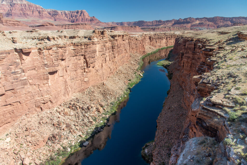
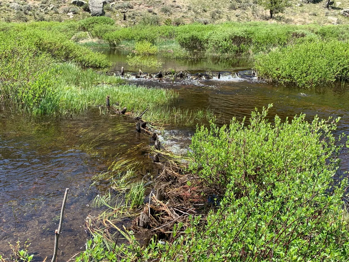
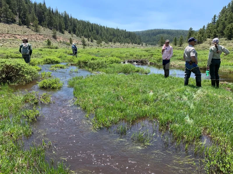
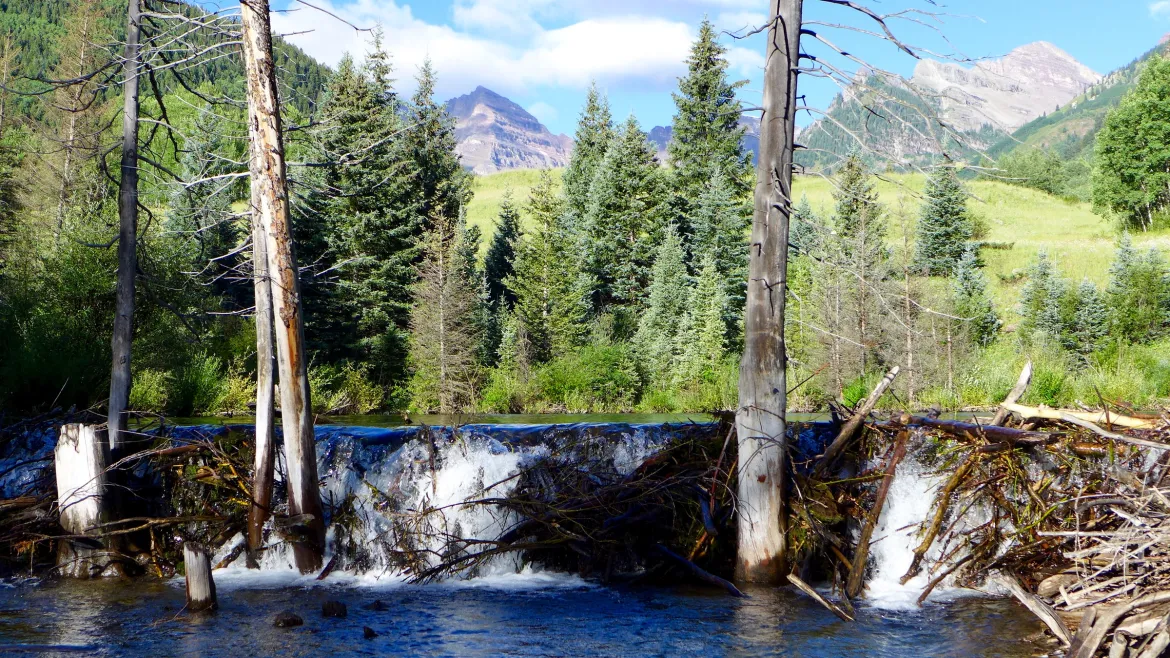
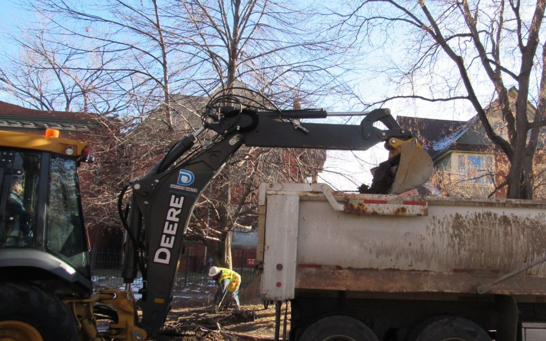

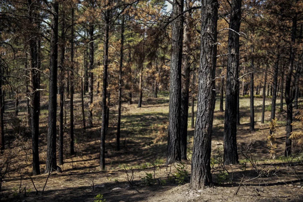

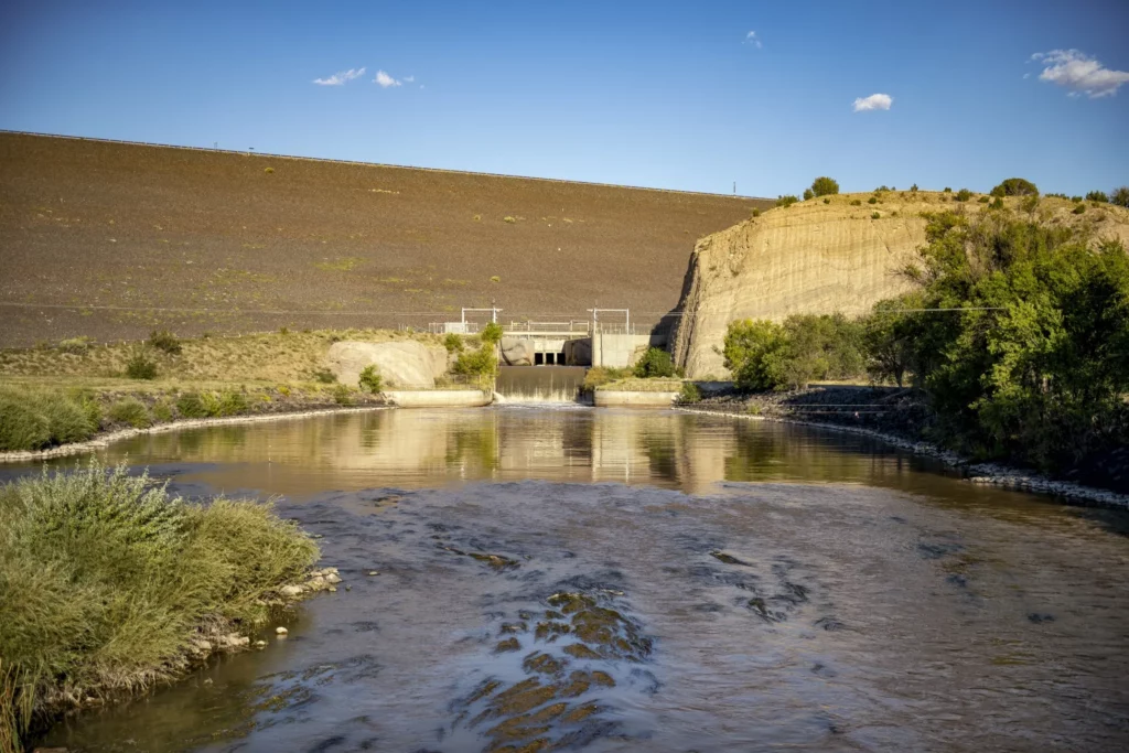
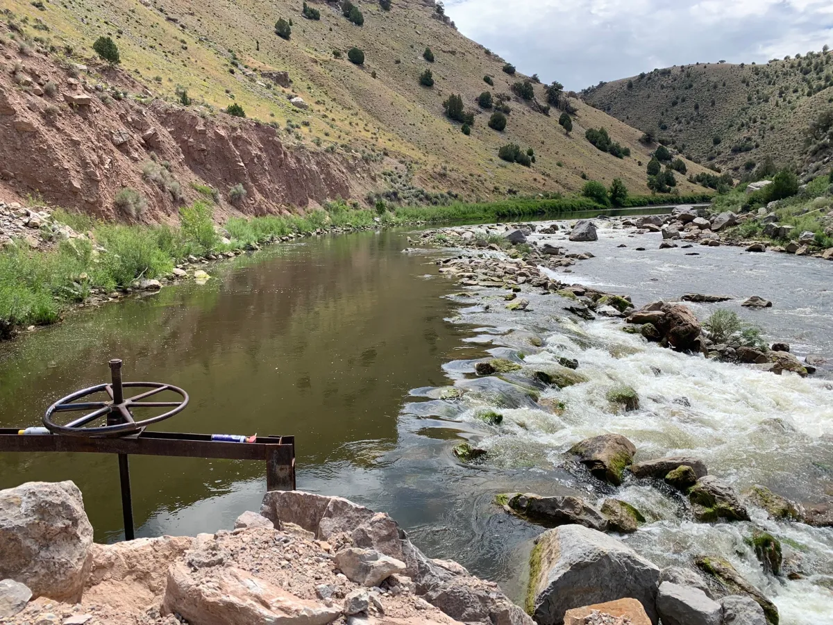
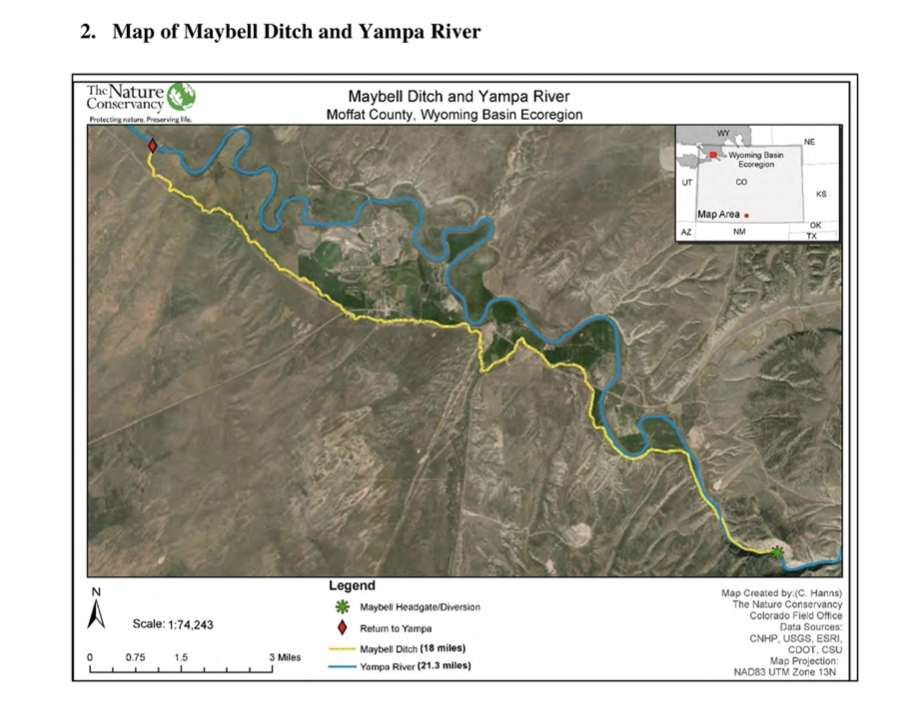

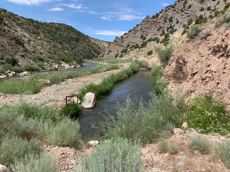


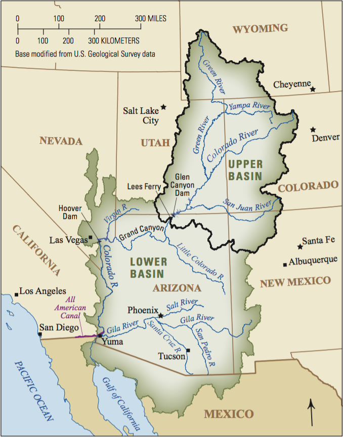
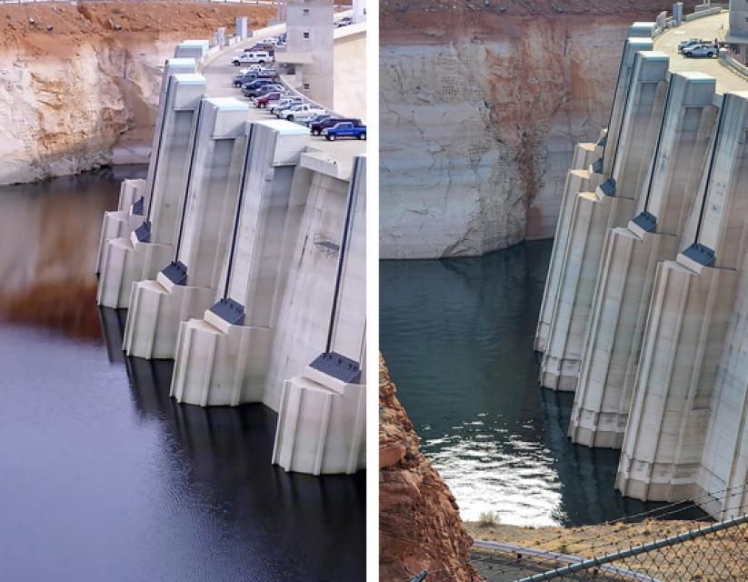