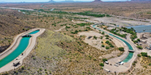
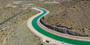
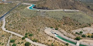
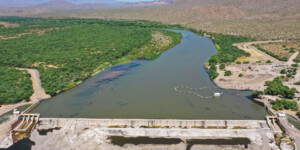
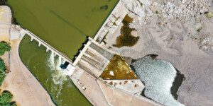
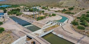
This page features aerial photos of Arizona’s Granite Reef Diversion Dam, along the Salt River near Mesa.
Completed in 1908, the dam is only 29 feet high but 1,000 feet long. It was constructed “to divert water released from storage dams on the Salt and Verde Rivers to Salt River Project canals,” according to the U.S. Bureau of Reclamation, which built the structure. “The Arizona Canal serves the north side of the project; the South Canal serves the south side. From these two main canals, water is diverted to secondary canals, then to laterals through which water is delivered to farms, cities, and Indian tribes.”
The dam is now operated by the Salt River Project (SRP). “A key piece of infrastructure located near the dam allows Colorado River water to be a viable supplement to the Greater Phoenix area’s water supply,” according to SRP. “The CAP-SRP Interconnection Facility (CSIF) allows Colorado River water to be split off from the Central Arizona Project (CAP) canal and enter the SRP system where it is delivered to water treatment plants, irrigation customers and underground recharge projects.”
See this page for photos of the Granite Reef Underground Storage Project, a water-banking facility near the dam that stores water for future use.
| Date | June 2023 |
| Location | Granite Reef Dam, Arizona (map) |
| Credit | Alexander Heilner/The Water Desk |
| Rights | Free to reuse under Creative Commons license. |
Selected images from the gallery
Click to enlarge
To use these images
Please read and consent to the terms and license below for access to the download page.
To help us continue to offer this free material, we ask that you please:
- Credit the original photographer and the Water Desk as the source
- Email us a link to the published story at waterdesk@colorado.edu
- Consider sending The Water Desk your ideas for future content that we could add to the library
- Keep supporting professional photojournalists by hiring them for assignments


