This story was originally published by The Spectrum on June 3, 2021.
By Joan Meiners
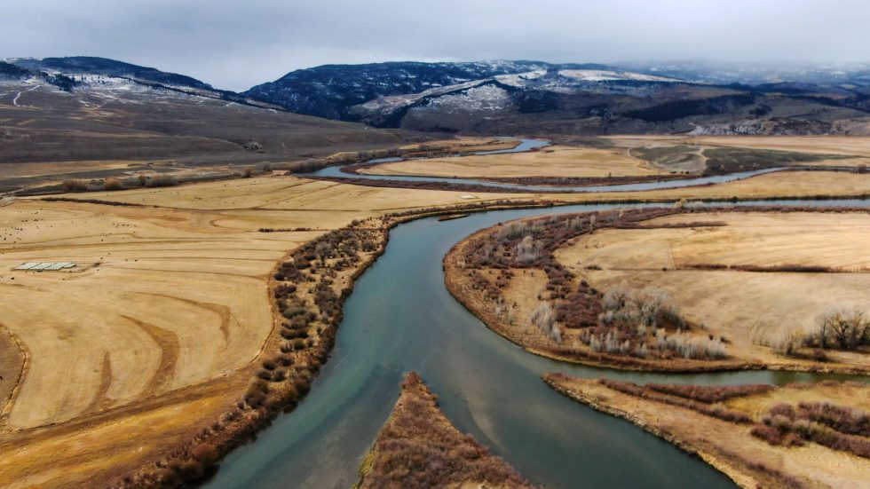
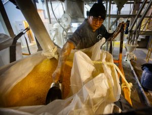
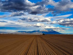
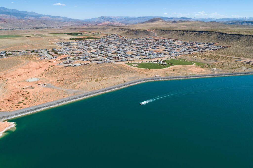
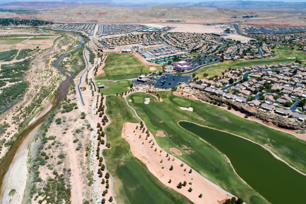
Drive in any direction through Washington County, Utah and you’ll soon see yellow bulldozers piling up mounds of red dirt and black lava rock to make way for yet another housing development. According to the recent U.S. census, Utah was the fastest-growing state in the nation between 2010 and 2020, increasing its population at a blisteringly fast rate of 18.4%. And in its southwest corner, Washington County, with its stunning vistas, National Park access, recreation opportunities and warm, sunny climate led the state in that trend, attracting nearly 50,000 new residents over the last decade, a 36% increase over its 2010 population.
Water Desk Grantee Publication
This story was supported by the Water Desk’s grants program.
Those 50,000 new people are just the beginning of a growth pattern projected by the Gardner Institute to flood Washington County with 321,000 additional residents over the next 45 years, to reach a local population of 509,000 by 2065. That number of people — 80% of the current population of Las Vegas — will require a lot of water in this desert landscape, more than is locally available at our current rate of use.
A Growing Dilemma
In 2019, Washington County locals used, on average, 159 gallons of water per person per day from the domestic public supply (indoor and outdoor home use). This is according to the most recent calculation by the Washington County Water Conservancy District (WCWCD), the entity charged with securing the region’s future water access. This number is hotly disputed, however, with St. George City’s own Water Services Director recently quoting a daily per person water use average of 241 gallons and other sources calculating per capita use at 248 gallons per day across Utah and as high as 325 daily gallons for residents of arid Washington County.
Water use across a community is notoriously difficult to measure and compare due to different methods of metering and accounting for reabsorption. But nationwide estimates using data collected by the U.S. Geological Survey suggest the average American uses only 88 gallons of water per day at home, half of the most conservative calculation for Washington County residents.
The Water Tap: What a St. George water tank project reveals about local priorities
Whatever the specific reality, Utah — the second driest state — has long been criticized for having among the highest rates of water use in the country. Despite the WCWCD recently celebrating a 30% reduction in per capita water waste since 2000, conservationists say the state could do much more.
A bit of math shows why this may be beneficial.
Even at the lowest estimate of 159 gallons of water per person per day, by 2065 Washington County will need access to more than 29 billion gallons per year to quench the thirst of its population, businesses, farms and landscaping. At the upper estimate of 325 gallons per person per day, the county would go through more than 60 billion gallons of water each year.
Yet in 2021, the WCWCD reported that the reliable local supply of potable water currently tops out at 22.8 billion gallons per year, down from the 23.8 that was reported in a 2018 presentation by the WCWCD.
A Solution?
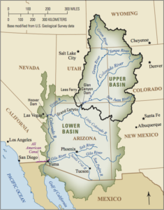
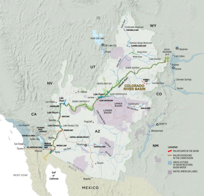
The WCWCD, along with the Utah Division of Water Resources, saw this problem coming as early as the 1990s, and started making plans to import Colorado River water from Lake Powell via a buried pipeline that would stretch 140 miles through rocky desert terrain, crossing some tribal lands and sensitive habitats. The project has inched its way forward over the decades since, finally advancing its federally-required Environmental Impact Statement through the public review process during the Trump administration, which identified the pipeline as one of its infrastructure priorities.
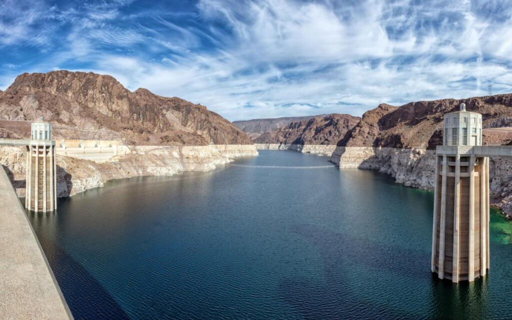
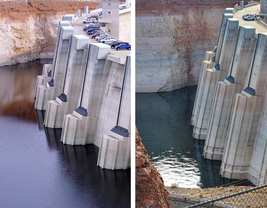
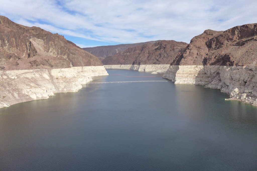
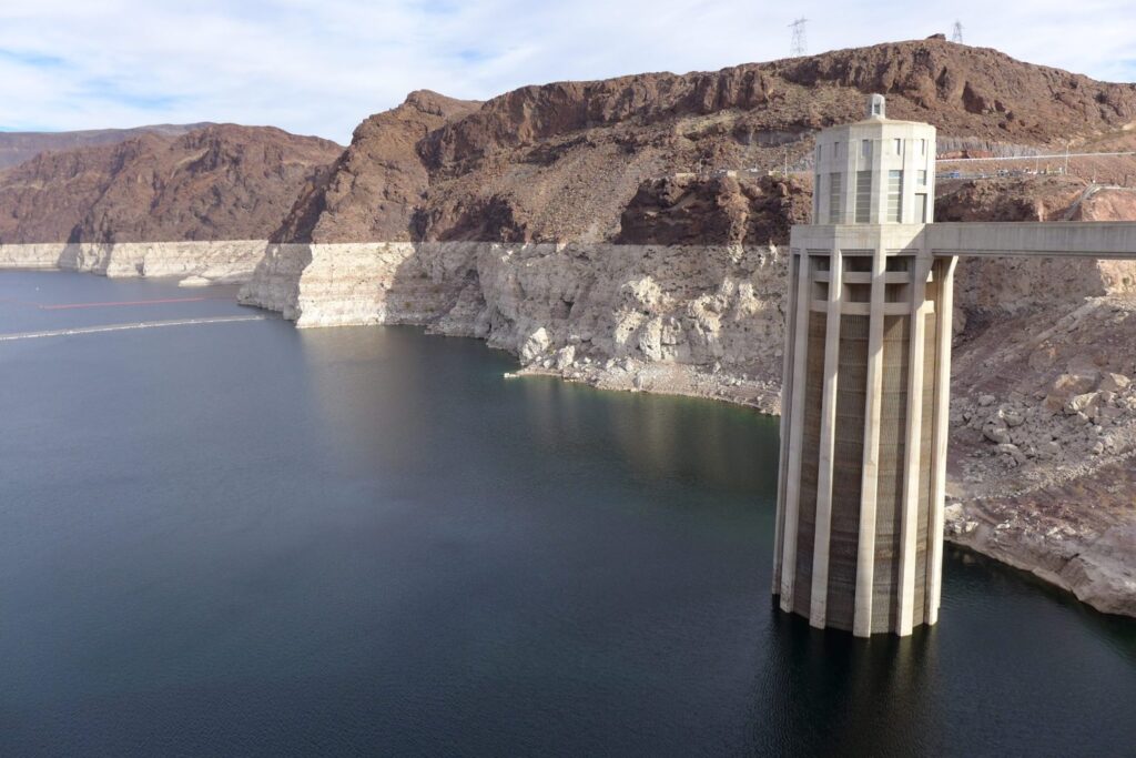
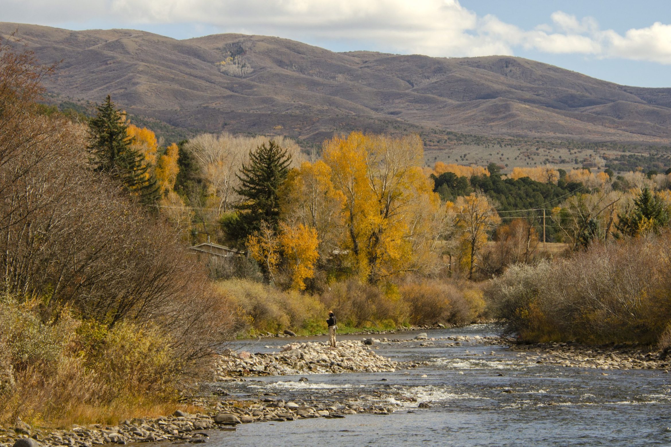
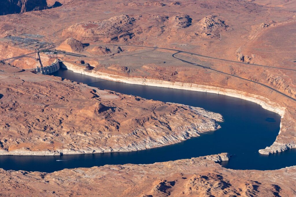
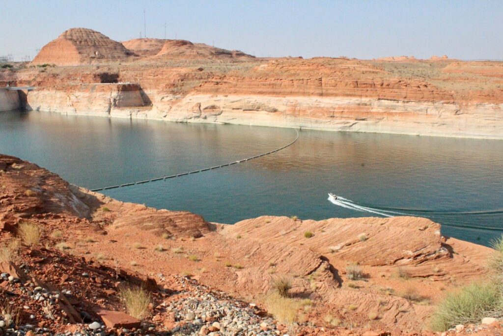
But the project has also been mired in controversy since its inception, with objections raised about its economic feasibility, its environmental consequences and whether there will even be enough water in the Colorado River to fill the pipeline once it is built given recent record-setting droughts and ongoing climate-related flow declines. The Colorado River is currently the main source of water for 40 million people across the Southwest. But as the region’s population has grown and climate change has taken its toll, the river’s two main reservoirs have dropped dramatically, exposing white layers of rock that had been submerged since the dams were built.
Controversy and science in the Colorado River Basin
As of late May, the U.S. Bureau of Reclamation reported that Lake Powell and Lake Mead were at 34% and 37% capacity, respectively. And that’s not expected to improve any time soon amid extreme drought and a dismally low snowpack at the river’s headwaters. Management of these two reservoirs, affecting access to diminished Colorado River flows by seven western states, is set to be renegotiated by 2026, which has incentivized states to create controversial governmental bodies charged solely with strategizing on their behalf, such as Utah’s new 6-member Colorado River Authority.
Right now, though, the state of Utah still has untapped legal rights to water from the Colorado River per the original Colorado River Compact agreement of 1922. It intends to claim a portion of them via the Lake Powell Pipeline.
The Water Tap: Climate change and climate denial on the Colorado River
Conservation groups like Conserve Southwest Utah (CSU), a local nonprofit environmental advocacy group, say an abundance of recent science proves this plan is “unrealistic and irresponsible.” And a letter issued last fall from the six other states that rely on the Colorado River urging the secretary of the interior to hold off on approving the pipeline foreshadows widespread pushback against its construction.
“It’s just not sustainable management to continue to build projects to take water out of the Colorado river,” said CSU board member Jane Whalen. “We know the river was over-allocated back in 1922 with the compact. There’s not enough water flowing in the system to fill all the allocations.”
WCWCD’s General Manager, Zach Renstrom, however, argues that climate change is exactly the reason the pipeline should be built, since local water sources will also suffer declines that make them less capable of meeting the county’s growing needs.
“Some of the more extreme models show that the Virgin River will have severe impacts from climate change,” Renstrom said last fall. “If we have that Biblical drought, the Virgin River is dry. Being able to tap into a larger project makes our supply here more reliable and safe.”
Still, opponents heartily dispute the need for a second source given unexplored options to conserve and reuse more water locally. They claim that the original project needs assessment submitted to the Federal Energy Regulatory Commission in 2011 is based on an over-inflated population estimate that there would be 860,000 people in Washington County by 2060 and paltry water conservation goals that only expected residents to reduce daily use from 294 gallons in 2009 to 241 in 2060.
“Washington County Water District has plenty of capital to pick the lowest hanging fruit in water conservation and water demand reductions,” said Zachary Frankel, the Executive Director of the Utah Rivers Council, a non-profit organization that seeks to protect Utah’s watersheds. “They just refuse to because they’re focused on big ticket items and they need to keep water use high to justify the need for the Lake Powell Pipeline.”
On which side of the pipeline is the grass greener?
Environmentalists also point to other desert communities like Las Vegas which, after suffering legal losses over plans for a similar water pipeline that would have imported groundwater from near Nevada’s border with Utah’s Millard and Beaver Counties that the city spent $330 million developing, pivoted instead to make large conservation gains by ripping out turf grass and to reinforce infrastructure leading to their main existing source, Lake Mead.
Additional evidence suggests that reducing the amount of water spent on outdoor landscaping (60% of local home use, by WCWCD’s estimate) could free up a lot of Washington County’s local supplies for future residents. A 2020 study out of the University of Virginia looked at how 63 western counties had managed to reduce their overall water consumption between 2000 and 2015 despite growing populations. They found turf removal programs and rebates for updating home appliances to be the winning strategies. Indeed, California, Nevada and Arizona offer homeowners up to $3 per square foot of grass that they replace with desert-friendly landscaping.
The Water Tap: What's happening with water conservation rebates here and elsewhere?
Utah does offer rebate programs to incentivize residents to upgrade to water-wise toilets, washing machines and outdoor irrigators. But local water officials have repeatedly said that turf removal is just not a good fit for the beehive state. Reasons cited include the high cost of such programs, an argument that the presence of grass serves as a buffer against future water cutbacks because you could instantly have more water available later by restricting outdoor watering, possible increases in urban temperatures from removing grass, government overreach and Utah’s historical, cultural adherence to a mission of “greening the desert.”
“Most folks in Utah like the grass. And for a water manager to say you can't have grass, in my mind, is a little overbearing and beyond what we have the authority to say,” said Gene Shawcroft, Utah’s newly-appointed Colorado River Commissioner. “So first of all, it's a cultural issue.”
What is most important to today's Utahns?
Despite these sentiments about Utah’s cultural values driving water infrastructure decisions, there has never been a widespread, unbiased attempt to poll existing Washington County locals on their thoughts about the pros and cons of the Lake Powell Pipeline project and whether they are willing to bear its approximately $2 billion cost. So The Spectrum & Daily News, with funding from The Water Desk, designed and commissioned a survey to do just that.
Getting Answers
Survey data were collected by the Utah-based market research firm Dynata, hired based on their reputation and reasonable cost quote. Employees of this company randomly selected residents of Washington County to contact for a phone survey and received responses from 400 of them. Respondents represented a balanced range of ages, gender, household income levels and length of time they had lived in Washington County. The results presented below have been weighted slightly by Dynata to best reflect the actual demographic makeup of the county.
Knowledge is lacking
Of the 400 people surveyed, nearly a quarter (22%) said they had never heard of the Lake Powell Pipeline, despite the fact that this is a decades-old project that will have major financial and lifestyle implications for all Washington County residents. 35% felt they “knew a little about it” and 12% felt they “knew a lot about it.” Only 52% of those surveyed said they felt they knew enough about the project to have an opinion on it.
Support is high
Support for the project outweighed opposition to it, with 59% expressing some level of support for it and 35% expressing some level of opposition to it. A majority held relatively mild views on the project, but 35% of all respondents were “very supportive” and 19% were “very opposed.”
But few want to pay
This high level of support, though, did not carry through to a willingness to help fund the project, which has been estimated to cost anywhere between $1.1 and $2.4 billion, to be initially bankrolled by the state and then repaid over 50 years by Washington County residents. In fact, some already-implemented increases in impact fees, property taxes and water rates are currently being put towards project expenses. The WCWCD estimates that the state has already spent around $40 million on planning costs and feasibility studies.
Only 40% of survey respondents answered yes to the question of whether, “knowing what you do about the project, and that the pipeline is proposed as a way to address potential water shortages in the future, are you willing to help fund it, either through increased water rates, higher taxes, or higher fees charged for new water hookups.” 44% answered no to that question and 15% declined to answer.
Among that 40% of people willing to help fund the project, just 8% said they would pay anything more than $50 per month in fees for it, though some estimates suggest the actual cost may be much higher than this. 22% of those who initially answered both that they supported the project and would be willing to help fund it then said that they would not be willing to contribute anything or refused to answer a question about specific amounts.
Overall, then, 50% of all surveyed residents indicated at some point — either in response to the initial funding question or when asked about specific amounts — that they would not be willing to contribute financially to the project at all, despite the fact that some fees are already being collected county-wide to support it. An additional 18% of all those surveyed said that they were unsure about contributing or refused to answer the question. Less than 1% were willing to pay amounts in the highest tier.
Instead, they show a willingness to conserve
In 2011, the Utah Division of Water Resources submitted a 256-page study to the Federal Energy Regulatory Commission detailing how their water needs assessment justified pursuing the Lake Powell Pipeline project. In it, they outline how much water conservation they determined was “feasible for this area based on local conditions, development types, cost and public acceptance.” Conservation options that were considered but not deemed feasible to adopt included turf removal and some appliance rebates.
Survey results, however, indicate perhaps an increased willingness over the past decade to voluntarily adopt stricter water conservation measures.
When asked if they would be “willing to adopt any conservation practices in your own home or accept fewer amenities in your community if it would help avoid construction of the project,” 63% of survey respondents said they would, including 48% of those who had expressed support for the project. Only 26% said they would not be willing to conserve more water and 11% said they didn’t know.
Specific measures respondents said they would be willing to adopt included high levels of support for conservation measures previously ruled out by state and local officials as conflicting with Utah’s traditional cultural values:
- 75% of people who were amenable to conserving more water said they would reduce the size of their lawn.
- 88% were willing to take shorter showers.
- 75% were in favor of requiring desert-friendly landscaping in new housing developments.
- 67% thought we should stop building water features in parks and public places.
- 83% would support scaling back lawns in public places or on golf courses.
- 78% would be willing to update their home appliances.
- 76% supported increasing water rates/accelerating a tiered pricing structure.
Over the next several weeks, The Spectrum & Daily News will be publishing additional stories in this series examining these survey responses in more detail. Watch for an in-depth look at the finances behind the Lake Powell Pipeline and a breakdown of water conservation attitudes.
Summary
Overall, results of our independent survey indicate that Washington County residents generally support the idea of the Lake Powell Pipeline project despite feeling that they don't know much about it. But few want to contribute to it financially and instead they expressed a greater willingness to adopt new water conservation practices than has previously been recognized.
The people of Washington County have spoken.
Mara Carabello, a public relations specialist working with Gene Shawcroft at Utah’s Colorado River Authority put it this way:
“Letting the desert blossom like a rose has been Utah’s mantra for 200 years. We have such an interesting appetite [for green spaces] in Utah. We've got to start changing how we think of ourselves and how we think of this land.”
Joan Meiners is an Environment Reporter for The Spectrum & Daily News through the Report for America initiative by The Ground Truth Project. Support her work by donating to these non-profit programs today. Follow Joan on Twitter at @beecycles or email her at jmeiners@thespectrum.com.
The Water Desk’s mission is to increase the volume, depth and power of journalism connected to Western water issues. We’re an initiative of the Center for Environmental Journalism at the University of Colorado Boulder. The Water Desk launched in April 2019 with support from the Walton Family Foundation. We maintain a strict editorial firewall between our funders and our journalism.
Longform Story CSS Block