
Water Desk Grantee Publication
This story was supported by the Water Desk’s grants program.
In this era of climate change and water scarcity, one dry winter can change everything. As of this week, 95 percent of California is in a state of extreme or exceptional drought. Sierra snowpack is rapidly fading to rock, and reservoirs across the state are at a fraction of their normal levels. This has dire consequences for the state’s waterways.
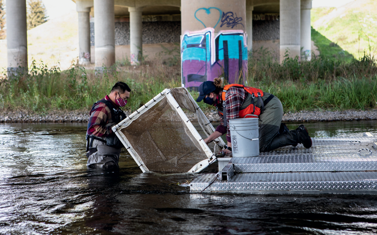
In early June, water administrators who manage the San Joaquin River watershed announced that they will curtail flows from Friant Dam into the San Joaquin River until September, allowing it to dry up in a long section that environmentalists and federal water managers have worked hard over the past decade and a half to restore. The reduction in water doesn’t bode well for the river’s spring-run Chinook salmon, which spend the summer in the river below Friant Dam before laying their eggs in the fall. Adequate water is the key ingredient in an ambitious restoration program that, for the past 15 years, has sought to remake the river and bring back its vanished runs of Chinook salmon.
The loss of water impacts other animals as well. “The drying river is an unfortunate loss to the downstream reaches where riparian vegetation has started to take root and other non-salmon fish species have begun to repopulate the [once] dry sections,” said Don Portz, the manager overseeing the San Joaquin restoration for the Bureau of Reclamation. “These fish species have sustained intermittent drought conditions for centuries. But it’s man’s intervention that makes it more sudden and drastic—and that affects them the most.”
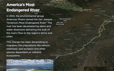
In a little over 350 miles—from its headwaters in the Sierra to its endpoint at the San Francisco Bay Delta—the San Joaquin River passes through some of the most intensively cultivated, hydrologically altered, and polluted landscapes in the world. In the few places where it runs freely in this terrain of 10,000-acre farms, it is a whisper of the wild river that, a century ago, could accommodate steamboats and held salmon runs so prolific that people living along its banks were said to have been kept awake at night by the sound of fins slapping on the water.
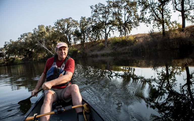
I wanted to see for myself what this intensively managed waterway looked like and how the restoration efforts had changed it, so last July I toured the San Joaquin with river guide and activist Tom Biglione. At the time, the state’s reservoirs and rivers were faring far better. There was enough water for us to traverse 25 miles by canoe. I discovered a river that is heavily damaged—particularly in its lower reaches—but that to my surprise, still has natural stretches that feel almost wild, evoking the faint promise of what the river could be like when the restoration project is completed—that is, if there’s the water to sustain it.
I met Biglione on a hot July morning at a dirt pullout on the outskirts of Fresno. A volunteer “river ambassador” for the Sacramento-based nonprofit Friends of the River, Biglione is a large man, 6’2″, with the baritone voice of a newscaster. He grew up near the San Joaquin’s banks, on a ranch in the town of Clovis. For the past five years, since retiring from the insurance industry, he’s led river trips to help the public understand the story of the San Joaquin. He believes that the more people get to know the river’s hidden beauty, the more likely they are to become advocates for its protection and restoration. “Most people assume that it is nothing but an agricultural ditch,” he said. “You’ll see after we’re done that this is not the case.”
The two of us hoisted his canoe from the top of his truck and carried it into a wide stretch of the river. The water was surprisingly cold and clear. Less than a mile upstream, the concrete curtain of Friant Dam towered above us—a stark reminder that the river here was carefully controlled and moderated by the Bureau of Reclamation.
We loaded our gear into the boat, and Biglione made a few short strokes, pulling us into the flow. Suddenly, the canoe caught the current and we charged ahead, toward a small rapid. “Draw right, draw right!” Biglione barked as the boat surged through a brief section of churning whitewater and into a stretch of calm, deep water. Below us we could see the outlines of darting fish. “We’re through,” he said, dragging an oar through the blue-green water.
The canoe glided downstream and into a lovely tree-lined section of the San Joaquin. The river here had the feel of a large creek rather than that of California’s second-largest waterway. Its flow during our journey, a modest 400 cubic feet per second, is a tiny fraction of what the San Joaquin carried before the great impoundment and irrigation projects of the 20th century. And yet it was a marked improvement of the San Joaquin of years past, which was reduced to little more than a trickle filled with agricultural pollutants. For years, one 60-mile stretch of the river (the same section set to go dry again this summer) had been erased entirely, its water siphoned away by unchecked agricultural withdrawals.
“It’s actually amazing that we can even get a canoe out here,” Biglione said. He mentioned the landmark 2006 settlement that forced the Bureau of Reclamation to provide enough water to sustain Chinook salmon populations downstream of Friant Dam and to restore critical sections of spawning habitat. “Before the Bureau of Reclamation was forced to put water back into the channel, this would have involved dragging the canoe through long stretches of river. A lot of time you’d end up in the blackberry bushes.”
Though pleasant, the section we were drifting through was a far cry from the upper San Joaquin River—an idyllic waterway, born of hundreds of small alpine streams, each fed, in turn, by rivulets of snowmelt. The river’s official birthplace is Thousand Island Lake, considered by many a backpacker on the John Muir Trail to be the gem in the ragged crown of the High Sierra. At 10,000 feet, one has the sense of being in a connected and ecologically intact system. “When you’re up there standing on the Sierra crest, looking down on the creeks feeding into the main stem of the San Joaquin, it all makes sense,” said Peter Vorster, a hydrologist with the Bay Institute who was involved in the 2006 settlement. “It’s easy to forget what happens to the river just a short distance downstream.”
Unlike the upper river, the lower San Joaquin leaves one with disparate images and impressions rather than a holistic sense of a connected and ecologically functional waterway. But here and there the river retains traces of its wild past. Ahead of Biglione and me, a great blue heron launched from the riverside vegetation. Tall sycamores and oaks shade the river and provide roosts for kingfishers and ospreys. These small riparian sections, which comprise critical spawning habitat for salmon, are also understandably coveted by people, many of them living in low-income communities lacking access to nature.
In one deep run fed by a fast riffle—a stretch that seemed particularly well suited to spawning salmon—we watched a group of roughly a dozen teenagers launch wildly from a rope swing into the river. Just downstream, beneath an overpass, three men in snorkels armed with spear guns patrolled the river. Further on, in a beautiful, slow-moving part of the river, we spoke with two bikini-clad women on horseback who coaxed their thousand-pound animals into the flow. “It’s so hot,” one woman said. “This is really the only place in town to escape the heat.”
Within an hour, the silhouette of the Highway 99 bridge loomed, and we paddled through a long stretch of slack water toward our exit point. As we dragged the canoe out of the water and onto shore, I told Biglione that I was sad to be leaving the river.
“I told you it was beautiful,” he said.
The next day, Biglione and I abandoned the canoe. To see the sections below the Highway 99 bridge downstream to the San Joaquin’s confluence with the Merced River, we drove a maze of roads winding through agricultural lands.
In one section accessible only by a dirt road running along the perimeter of a sprawling almond orchard, the river surged through heaps of garbage and homeless encampments. We pressed on, to the outskirts of the farming community of Mendota, where subsistence fishermen were defying warning signs—one read “Prohibido El Paso”—and casting their lines into murky irrigation canals.
The farther downstream we went, the more disorienting and dehumanizing the landscape became. On the outskirts of Los Banos, Biglione and I tried to decipher a knot of side channels, several of them completely dry, before realizing that the river’s flow had been shunted into an arrow-straight channel called the Eastside Bypass, which faded to a vanishing point in an endless sea of almond orchards.
On our last stop, near the San Joaquin’s confluence with the Merced River, we parked on the narrow shoulder of a two-lane highway as a steady stream of cars whooshed unnervingly past us. Biglione and I ducked onto a path littered with garbage and picked our way carefully down an embankment. Below, the San Joaquin slithered beneath an overpass, its flow almost imperceptible. The water was tinged a eutrophic green and smelled stagnant, almost dead. I could hardly believe this was the same crystalline, wilderness waterway I’d hiked and fished in the High Sierra numerous times over the years.
We walked over heaps of broken concrete to the river’s edge. On a piece of clear plastic lay a weathered knife and several mutilated baitfish teeming with flies. I told Biglione that it felt like we had stumbled onto a crime scene.
“It is a crime—a crime against nature,” he said. “The question is whether or not anyone cares if justice is served.”
In this series
| Can we save the San Joaquin’s salmon? | Tour the San Joaquin River | Floating down the San Joaquin River |
 |
 |
|
Jeremy Miller is a writer in Richmond, California. His recent work has appeared in publications including Harper’s, Orion, and Pacific Standard. Follow him on Twitter @jeremyj_miller.
Longform Story CSS Block