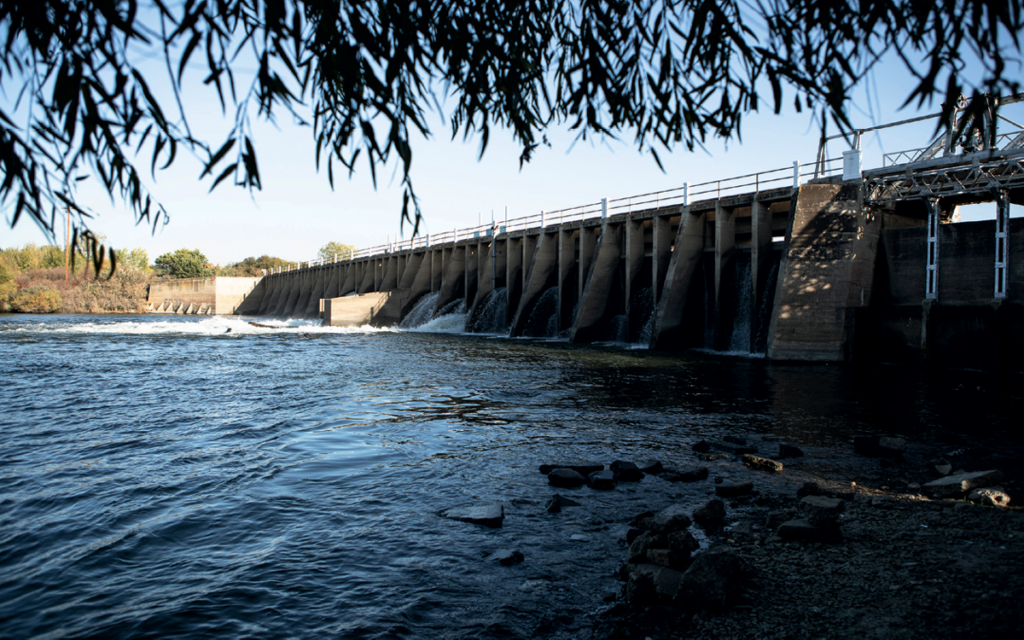
FRIANT DAM, just outside Fresno, California, is a sprawling structure, 319 feet tall and two-thirds of a mile across. It’s not the tallest or the longest dam in the United States, but measured by the impact on the river that it constrains, it looms larger than most.
Constructed just after the Great Depression, Friant Dam was devised to control the San Joaquin River, California’s second-longest waterway. The river’s raucous flow, fed by snowmelt from the Sierra Nevada, was corralled in a 4,900-acre reservoir called Millerton Lake (named for the small town it drowned). From there, it was divvied up and shunted into a vast network of canals to supply water for millions of acres of farmland and the Central Valley’s growing cities. For decades, one 60-mile section—beginning 38 miles downstream of Friant Dam and stretching to the San Joaquin’s confluence with the Merced River—ran dry. Parts of the river where water still flowed were blighted with pesticides and fertilizer, creating massive algal blooms and dead zones.
The intensive engineering of the river exacted a huge toll on its native ecosystems. No species suffered more than the Chinook salmon, whose epic migration from the Pacific Ocean to its spawning grounds in the High Sierra was cut short by numerous choke points, not the least of which was Friant’s impenetrable barrier of concrete.
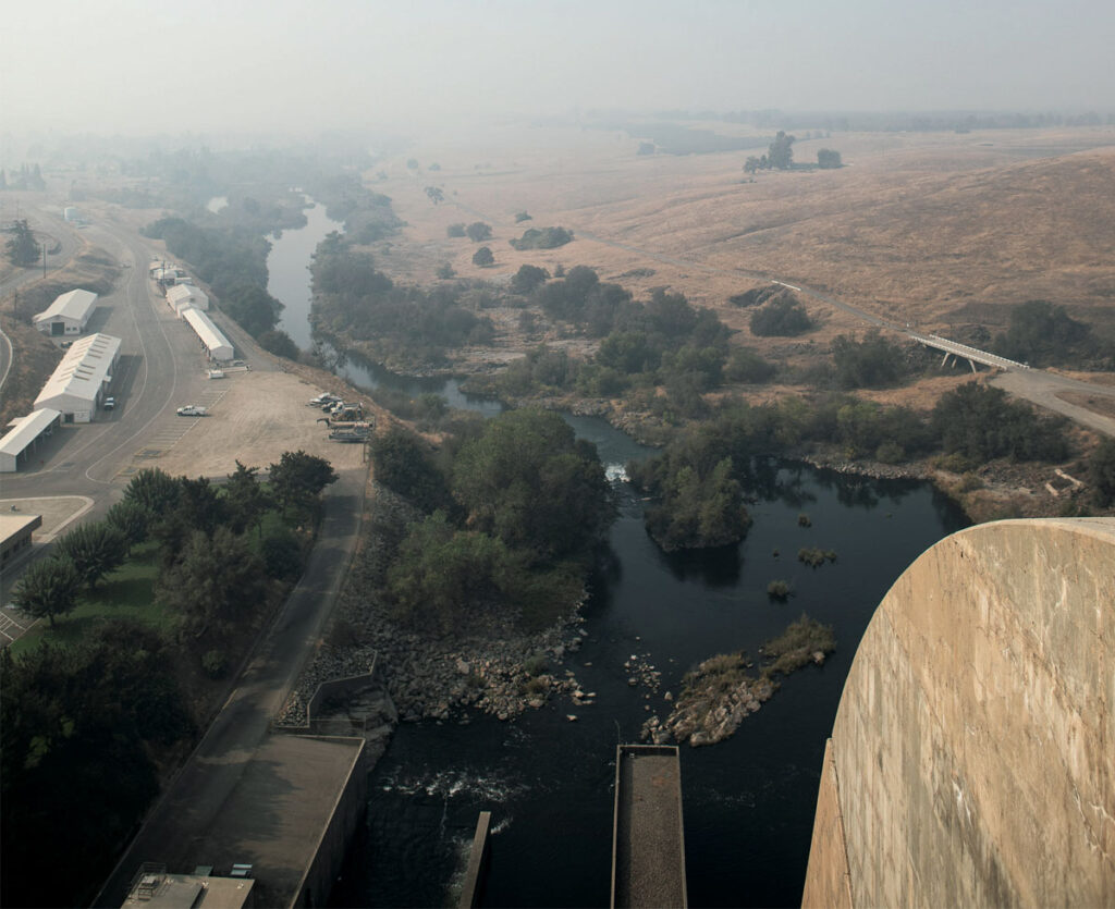
Millerton Lake as seen from the top of Friant Dam. Smoke from the nearby Creek Fire cloaks the Sierra Nevada.
In 1988, environmental groups including the National Resources Defense Council, the Bay Institute, and the Sierra Club used a statute in the California Fish and Game Code to argue that the US Bureau of Reclamation had failed in its duty to maintain flows below Friant Dam to support Chinook salmon. In 2006, a landmark settlement was reached, allocating nearly $900 million to repair 150 miles of river below the dam and to reestablish a self-sustaining population of Chinook salmon.
Rife with compromises, the settlement mandated that a mere fraction of the San Joaquin’s historic flow be restored. The river’s many dams would remain, but alternative passages would be built and new spawning areas added in the lower river. In other words, the settlement sought to give the salmon a chance to survive within a massive water management scheme that favors industrial-scale farming.
Last October, I visited Friant Dam to meet Don Portz, the restoration program manager at the Bureau of Reclamation, to see how, nearly 15 years later, the restoration was coming along. Portz’s job is to ensure that the terms of the settlement are met—namely, that the salmon, which were reintroduced to the river in 2012, can get around the many obstacles on their way up to the stretch below Friant Dam where they can spawn.
We stood at the top of Friant Dam looking out at Millerton Lake, which was swathed in smoke from the Creek Fire. Portz told me that the point of the restoration is not to remake the river of the past but to create something new—a human-mediated river capable of supporting fish while also delivering farmers and cities their share of water. “The goal of all these projects,” Portz said, “is to allow the volitional passage of adult Chinook salmon and other fishes upstream to spawning habitat below Friant and the successful return of their offspring back to the ocean.”
In plain terms, “volitional passage” means that the fish can migrate and complete their life cycle without human intervention. Ironically, accomplishing that goal has required—and will continue to require—major human intervention. Some of the projects planned for the years ahead will rival in scale and complexity the construction of Friant Dam. As California’s population grows, water shortages deepen, and the impacts of climate change intensify, the restoration program is an expensive and resource-intensive gamble. Can the San Joaquin and its salmon really be engineered back into existence?
—
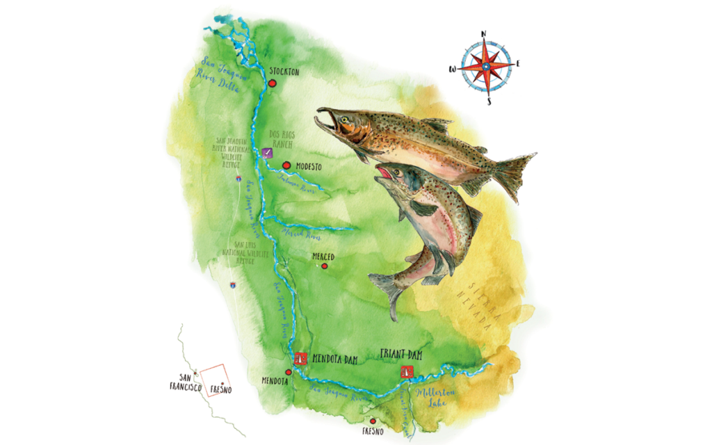
Map by Simone Tieber
IN THE MID-19TH CENTURY, an estimated 1 million salmon would swim up the San Joaquin River each year to spawn as part of North America’s southernmost salmon run. They were exquisitely adapted to survive the extremes of the 300-plus-mile journey from the Pacific Ocean and the maze of tidal channels in the Sacramento–San Joaquin Delta, along the slow, meandering waterways and oxbow lakes of the Central Valley, to the frigid streams of the Sierra thousands of feet above the valley floor. To endure the grueling migration, the salmon ate voraciously at sea and could weigh up to 50 pounds.
Come spring, the San Joaquin, swollen with snowmelt, would overtop its banks and spill out onto the valley floor. “In June 1847,” wrote the explorer John Charles Frémont, “the Joaquin was nowhere fordable. . . . All the large tributaries, the [Merced], To-wal-um-ne, Stanislaus, and Mo-kel-um-ne, required to be boated and were pouring down a deep volume of water from the mountains, one to two hundred yards wide.” In these vast marshes and shallow lakes, baby Chinook, known as fry, found refuge from predators, and juvenile salmon on their way to sea gained in size and strength. The Chinook swam high into the Sierra foothills—to a minimum of 1,500 or 2,500 feet, depending on the time of year. Historical accounts suggest that they may have traveled much higher. “It is a fact well known to the fish culturists,” reads an 1890 report from the California Fish Commission, “that the winter and spring run of salmon, during the high, cold waters, go to the extreme headwaters of the rivers, if no obstructions prevent, into the highest mountains.” Chinook in the Merced River swam deep into the granite canyons on the western margins of today’s Yosemite National Park, and might have even reached as far as Yosemite Valley, to lay their eggs in the crystalline pools below Vernal Falls.
For centuries, the Miwok, whose territory encompassed several major tributaries of the San Joaquin, relied on the delicate flesh of the kosum—the Miwok word for salmon. Early European explorers found it easier to shoot the hefty fish with rifles than to bother with trying to snag them on a hook or a spear. During the gold rush, Chinook salmon provided miners with an easy-to-harvest food source, and by the 1860s a flourishing fishery had sprung up, with 175 boats supplying 19 canneries in the delta. But the practice of hydraulic mining, which relied on water cannons to blast hillsides into a slurry, unleashed sediment and other toxic materials into the rivers, and this, along with overfishing, agriculture, and logging at higher altitudes, had greatly diminished salmon stocks by the late 1880s. The destruction of the San Joaquin’s salmon fishery followed a human holocaust along the river that had begun in the 1830s, when cholera and smallpox brought by white settlers wiped out an estimated 60,000 people, roughly three-quarters of the Indigenous population of the San Joaquin Valley.
In less than a century, the San Joaquin River was transformed from a free-flowing salmon superhighway into a corridor of agriculture and commerce.
The large-scale water-engineering schemes of the early- and mid-20th century—what writer Marc Reisner called “the worst disruption of salmon habitat you can find anywhere on Earth”—were the fatal blow to California’s salmon runs. The California State Water Project and the Central Valley Project rejiggered California’s natural hydrology on a mass scale, delivering water from the wetter and sparsely populated northern reaches of the state to the arid but highly populated southern reaches. The San Joaquin’s sinuous meanders were straitjacketed in concrete channels, and its massive wetlands and lakes were drained to make way for farms. The final cataclysmic stroke came with the commissioning of Friant Dam in 1942.
In less than a century, the San Joaquin River was transformed from a free-flowing salmon superhighway into a corridor of agriculture and commerce. By 1950, its salmon were all but extinct. George Warner, an employee of the California Fish and Game Department (today’s Department of Fish and Wildlife), recounted trying to save the last members of the San Joaquin’s spring run that year:
Only thirty-six salmon were counted at the ladder, and many of these were so weak they could barely swim from one pool to the next. . . . Some could just make it to the ladder, and I had to use a dipnet to carry them, one at a time, up the bank to release them in the canal. Probably none of the thirty-six lived to spawn.
—
“THE DAMAGE DONE in the last century to this river is extensive,” Portz said, peering out at the San Joaquin where it snaked through a parched landscape of golden hillsides. “There’s no easy fix.”
Together we walked Friant’s long promenade, the dam dropping away from us like a tombstone-gray curtain. Tall and affable, Portz has angular features and closely cropped hair. His accent is inflected with traces of upstate New York, where he grew up along the banks of the Hudson River. A self-proclaimed fish geek with a PhD in fish ecophysiology from the University of California, Davis, Portz took a job as a fish biologist with the Bureau of Reclamation almost 20 years ago. While the bureau was focused on operating and maintaining its vast and aging inventory of dams, Portz was devising better ways to help fish get around them. In 2018, he assumed the role of restoration manager. “I think it says a lot about where we want to go as an agency that they entrusted a fish biologist to take over the helm of the restoration,” he said.
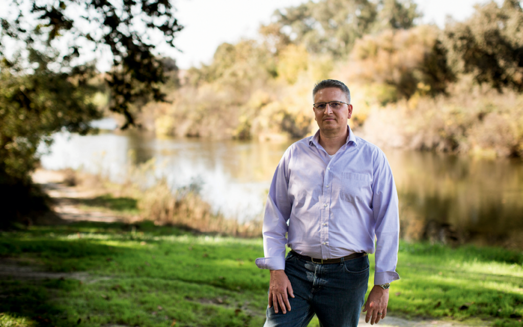
Fish biologist Don Portz oversees the San Joaquin River Restoration Program.
Portz gestured to where a concrete channel diverges from the San Joaquin’s main waterway. This is the beginning of the 152-mile-long Friant-Kern Canal, which delivers irrigation water to a million acres of farmland and drinking water to a quarter million people in the southern region of the Central Valley. Though its flow varies depending on the demand of farms, the canal siphons as much as 5,300 cubic feet per second from Millerton Lake—more than 13 times the amount of water flowing through the San Joaquin’s main channel on the day of my visit.
One of the critical early successes, Portz explained, has been eliminating the San Joaquin’s long dry stretch. In all but the driest years, water now flows along the entirety of the river’s length. But the amount of water is still far less than what is called for in the 2006 settlement, which dictates that the San Joaquin eventually be returned to a maximum flow of 4,500 cubic feet per second. The problem is that the San Joaquin’s network of channels and levees was built to handle intermittent flooding but not a constant volume of water. A steady flow of 4,500 cubic feet per second from Friant Dam could cause a catastrophic failure of the earthen dikes or damaging “seepage” into the root zones of orchards planted along the river.
The insufficient flow has meant that fish need a lot of help navigating the San Joaquin’s lower reaches. Since the salmon’s reintroduction in 2012, California Department of Fish and Wildlife (CDFW) workers have captured fish in the lower river each spring and hauled them by truck around the river’s various choke points to a roughly 25-mile stretch below Friant. Portz pointed to a pool of water at the dam’s base. No more than a hundred yards across, it is continuously refreshed by cold water coursing from the bottom of Millerton Lake, providing an area where salmon can “hold” through the heat of summer until they are ready to lay eggs in the fall. The surge from the dam’s penstocks also supplies what elevation used to—water cold enough to sustain salmon eggs, which perish at water temperatures higher than 60°F. It was unnerving to realize that the survival of this once-mighty species now depended on such a minuscule pool of water.
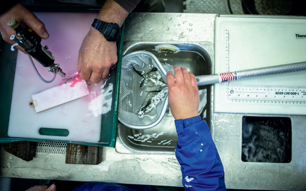
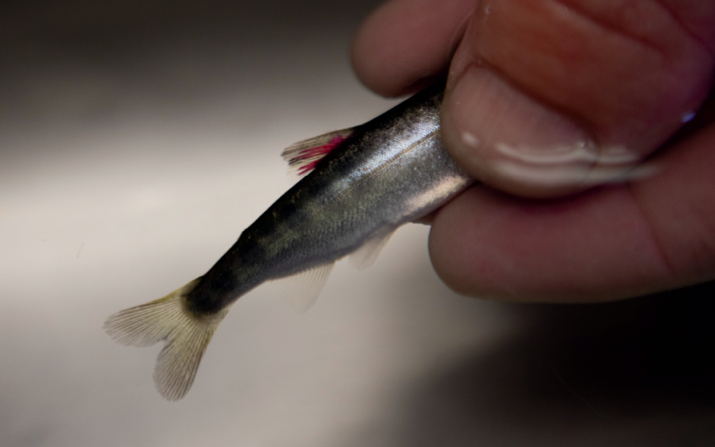
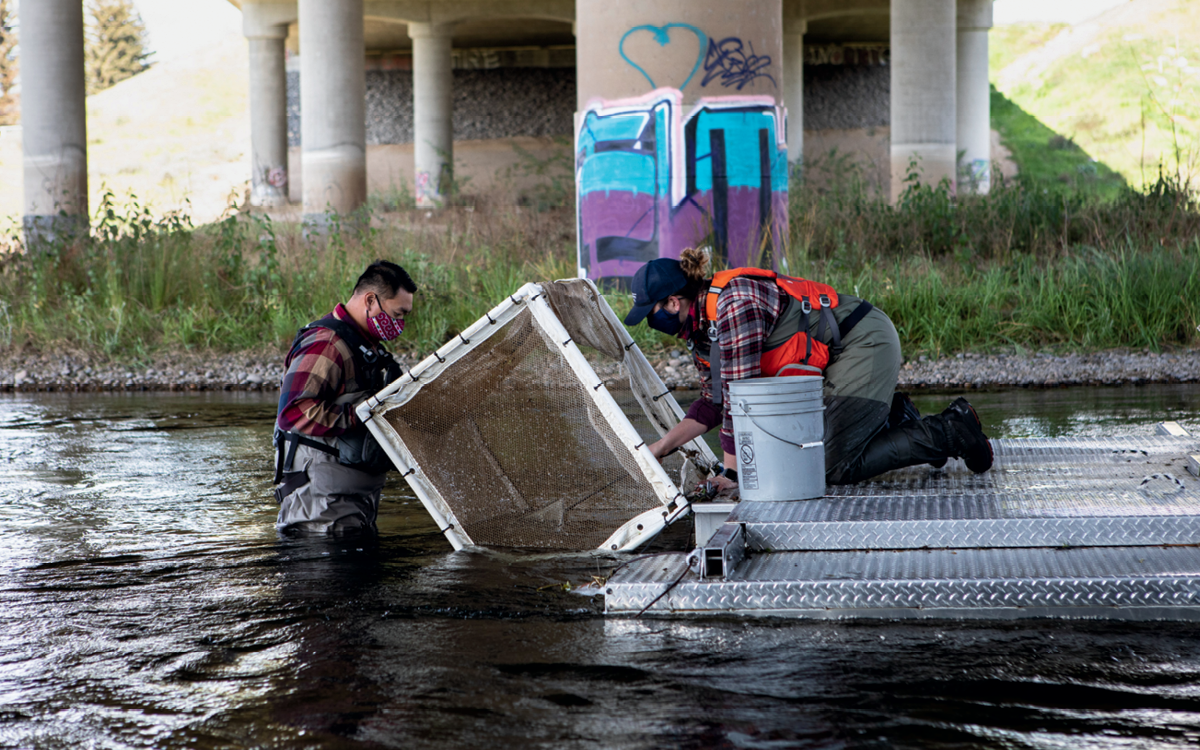
Last spring, fish biologists captured juvenile salmon and tagged them with dye and tiny microchips to track their progress through the lower river and delta.
In spite of the limitations, the salmon have shown tantalizing signs of revitalization. In 2014, 60,000 juvenile spring-run salmon, raised in a hatchery on the Feather River, were introduced below Friant Dam. Three years later, something incredible happened: Heavy runoff transformed large stretches of the San Joaquin’s lower floodplain into a massive wetland. In this watery landscape, some of these Chinook salmon made it on their own, without the aid of traps and trucks—volitionally—from the Pacific Ocean to the base of Friant Dam for the first time in more than a half century. The river was so swollen that year that biologists were not able to capture these fish, but their journey was verified through genetic analysis of their offspring, which began to show up in Bureau of Reclamation traps in late fall 2017. The presence of these baby salmon marked another critical milestone—the first time spring-run Chinook had successfully spawned in the San Joaquin in more than 60 years.
There is a lot more being protected here than salmon. It’s other animals and endangered species. It’s ecosystems. It’s water quality. It’s everyone living in the valley.
Portz and I left the dam and headed about a mile downstream to see a short section of the river used by salmon for spawning. At a dirt pullout we met Mike Grill, a CDFW environmental scientist, dressed in well-worn hip waders. The three of us walked over a bridge on Route 206 that vibrated unnervingly with each passing car. Below us, near a massive slab of cast-off concrete, we saw what looked like a ribbon of clear plastic undulating in the blue-green water. Then the outline revealed itself, bone white, defiantly wriggling against the current. “That one is pretty beat-up,” Grill said. “It’s probably done spawning and on its last legs.”
To Grill, the nearly expired fish was an indication of the river’s improving ecological health. Earlier in the season, the CDFW had captured 57 adult fish near the San Joaquin’s confluence with the Merced River and released them below Friant Dam. An additional 285 “brood stock” (biological jargon for hatchery-raised adults) were added to the population of spawning fish. Grill said that in the previous weeks, his team had counted close to 75 fish nests called redds: concavities of river stones cleared by female fish to deposit their eggs. Those numbers, however, were down sharply from 2019, when biologists had counted 200 redds.
Portz suspects that this year’s lower numbers were the result of several factors, including a lower survival rate of juvenile fish in the delta and poor ecological conditions in the Pacific, but that the main variable was low precipitation. By comparison, the number of redds was higher in the 2016–17 and 2018–19 seasons, when surplus snowpack significantly boosted the San Joaquin’s flow. But lower snowpack and rainfall in 2017–18 led to a reduced runoff, which translated to a more arduous upstream journey for salmon.
When the hatchlings emerged in spring, Portz told me, some of them would be captured and tagged with dye and tiny microchips to track their progress through the lower river and delta. “We’re still trying to figure out how to create conditions in the river that are best for salmon,” he said. “But every year we are learning and getting better at it.”
The point of the entire effort is to establish a self-sustaining population of 500 Chinook salmon—a tiny fragment of a population that once numbered in the hundreds of thousands. The hope is that these fish will multiply until their numbers resemble the great schools of the past.
Later that day, Portz and I traveled farther downstream to look at another major impediment for migrating salmon—an antiquated structure called Mendota Dam. We drove an hour west of Fresno, through tangles of new construction in the town of Mendota and then across a large public park filled with rusting picnic tables. A few hundred yards beyond, the river channel appeared. Myriad side channels were hacked into the dirt, each carrying a fraction of the San Joaquin to an individual water district miles away.
Built in 1919, Mendota Dam is an ungainly edifice of concrete. Portz noted the primitive concrete fish ladder extending from the dam’s midsection. “It’s poorly designed,” he said. “Totally useless. No way a salmon is getting up through that.” In all but the largest floods, salmon and other fish become marooned at the base of the dam. To make matters worse, on the upstream side of the dam, its small reservoir was covered in an impassible tangle of invasive bright-green water hyacinth. And juvenile fish easily become lost in the side channels. “They feel all of these canals and say, ‘Hey, that way is to the delta; that way is to the ocean.’ But it’s not,” Portz said.
The bureau is in the process of acquiring land to build a nearly mile-long bypass channel that will be wider than the San Joaquin itself and will allow salmon and other native fish, including sturgeon, to circumvent Mendota Dam and its reservoir entirely. Known as Reach 2B, it is the largest and most technically complicated part of the San Joaquin restoration, as well as the most expensive—carrying an estimated price tag of $336 million.
To ensure that fish choose the correct path and don’t get trapped in the side channels or sucked into pumps, Reach 2B will incorporate an intricate series of passageways, pipes, and screens; nevertheless, it’s meant to be intuitive and easy to navigate. “This is a two-way street,” Portz said. As spawning adults are migrating upriver, juveniles from the previous year are swimming out to the Pacific. “You’ve got to let the fish and Mother Nature do it on their own.”
Portz’s prediction, that with the right human ingenuity the salmon will someday be able to “do it on their own,” seems to be bearing itself out. This past April, he called me to share the news that the restoration team had once again captured adult Chinook at the confluence of the Merced and the San Joaquin. I could hear the excitement in his voice. Despite a disappointingly dry winter and subsequent reduced flows from Friant, returning salmon had, for the fourth time in five years, made it across the delta and up to the confluence. “We’re seeing a lot of resilience,” Portz said, “even in years with less water.”
—
BYPASSES WON’T MATTER much if the fish can’t reach them, so recovering some of the Central Valley’s former wetlands is also a crucial part of the restoration. The largest and most promising of these efforts is the Dos Rios Ranch project—a 2,100-acre parcel roughly 50 miles downstream from Mendota Dam that was acquired in 2012 with $21.8 million in federal, state, and local funds.
The Mendota Dam is virtually impassable for salmon. A soon-to-be-built bypass channel is the restoration program’s most complicated project to date.
To date, 1,600 acres of the Dos Rios allotment have been restored. On a chilly, overcast day in February, I drove out to the property to meet with Julie Rentner, president of the Chico-based River Partners, the nonprofit heading up the project. The restoration, she explained, involves breaching and in some cases removing infrastructure such as levees and berms in order to put water back onto the land. A similar effort is underway at the Yolo Bypass. But unlike the Yolo, which provides habitat in the midst of active farms, the Dos Rios project aims to retire farmland and “give it back to the river,” Rentner said.
The property sprawls along the floodplain of the Tuolumne and the San Joaquin—the eponymous dos rios. Former farm fields had been stripped of crops and were dotted with small plastic sleeves, each encasing a hand-planted native grass, shrub, or tree, a mosaic including sedge, willow, and valley oak. “We’re just sort of throwing it all out there and seeing what takes,” Rentner said.
We snaked atop a series of levees to a vantage point upstream of the confluence. The area was once part of a sprawling Mexican land grant known as El Pescador (“the fisherman”), a not-so-subtle historical reminder of the aquatic life that once thrived here. Rentner hopes that the Dos Rios project will be the first in a series of strategically placed wetlands for juvenile Chinook along the course of the San Joaquin, providing critical habitat for them to grow and gather strength. “Wetlands are full of nutrients and insect life,” Rentner said, “all the things young salmon need to prepare for their eventual journey to the Pacific.”
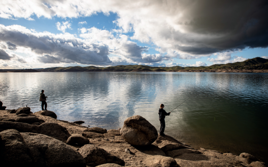
California’s San Joaquin River below the salmon barrier of Friant Dam.
The benefits, however, extend far beyond salmon, Rentner said. Since restoration work began here nine years ago, many dozens of species of birds and mammals have returned, a number of which are listed as endangered. The riparian brush rabbit was rediscovered a few years ago, after it was thought to have been extirpated by the New Year’s Day flood in 1997. (The rabbits survived that and subsequent floods, Rentner speculated, by climbing to elevated parcels specially designed for wildlife in the preserve.) Dos Rios is also located along the Pacific Flyway and provides critical habitat for the endangered Aleutian cackling goose.
While our side of the river was being given back to nature, across the water we could see the self-interested, slapdash engineering that, over the decades, has transformed much of the valley into an agricultural wasteland. Huge slabs of concrete and asphalt had been dumped onto the Tuolumne’s steep riverbank in an attempt to stave off erosion. “It’s well known around here that if you have concrete debris, you give it to farmers on the riverbank,” Rentner said. “Of course, this violates at least eight environmental-protection laws on the books in California, but there is zero enforcement capacity.”
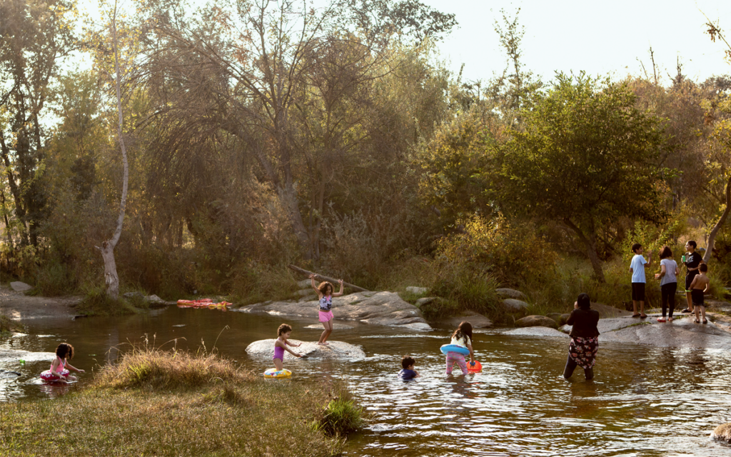
Wetlands like these benefit not only animals, Rentner said, but also the surrounding human communities—even the concrete-dumping farmer across the river. We stood at the epicenter of the New Year’s Day flood, one of the worst in state history, which inundated much of the Central Valley and left parts of the nearby city of Modesto under 15 feet of water. A more robust array of floodplains could have mitigated the damage. Wetlands also moderate a river’s behavior, making it less susceptible to wild swings of drought and flood. And while groundwater monitoring and models are still evolving, permanently retiring farmlands to restore wetlands may be key to addressing two of the Central Valley’s most pressing problems, groundwater overdraft and land subsidence, particularly as climate change bears down. “If we really think about all the public outcomes of moderating floods and improving environmental conditions for wildlife and enhancing water quality,” Rentner said, “it’s likely they will greatly surpass the value of the crops produced in those fields.”
The salvation of the San Joaquin and its salmon, Rentner believes, will ultimately depend on replacing the “siloed and segregated” water policy that has dominated California for decades with a more holistic, ecosystem-based form of management. “Somehow we need to get past the idea that putting water in the river for the fish is ‘too expensive,'” Rentner said. “There is a lot more being protected here than salmon. It’s other animals and endangered species. It’s ecosystems. It’s water quality. It’s everyone living in the valley.”
As inspiring as the work to restore the San Joaquin River is, the truth remains that it is unfolding in a human-ravaged landscape, one that forces Chinook salmon to spawn at elevations lower than what they have adapted to. In the meantime, attitudes about the West’s big dams have started to shift. Numerous dams in the Pacific Northwest—including those on the Elwha, Sandy, and Rogue Rivers—have been demolished, leading to an almost immediate rebound in salmon populations. Earlier this year, Representative Mike Simpson, an Idaho Republican, proposed a $33.5 billion plan to begin removing four major dams on Idaho’s Snake River in 2030. If federal regulators are serious about saving the San Joaquin’s salmon runs, is it time to begin thinking about removing the largest obstacle on the river, Friant Dam?
I followed up with Portz by email to ask this question. He replied with an emphatic no, noting that above Millerton Lake the San Joaquin does not flow unobstructed but is interspersed with a series of other dams and reservoirs. “Spawning habitat is poor, and the risk of stranding for summer holding is high in this stretch,” he wrote. “Dam removal on the San Joaquin River would be cost-prohibitive, eliminate water storage in an already drought-prone environment of the state, and impact thousands of acres of farmland with no guarantee of a fully rebounded, self-sustained Chinook salmon population.”
All of which means that for the foreseeable future, the Chinook of the San Joaquin will be swimming upstream against a nearly insurmountable flow of human self-interest, striving to sustain themselves in the whisper of river we have left them.
Mette Lampcov is a Danish documentary photographer based in Los Angeles. Funding for this story was provided through a fellowship at the University of Colorado Boulder’s Water Desk.
Funding for this story was provided through a fellowship at the University of Colorado Boulder’s Water Desk.
To learn more about today’s San Joaquin and the restoration challenges, go to sc.org/san-joaquin.