Ruedi Reservoir on the Fryingpan River as seen on March 24. The reservoir is at its lowest level in nearly two decades, but U.S. Bureau of Reclamation officials say if forecasts hold, it should still be able to fill in 2022. CREDIT: HEATHER SACKETT/ASPEN JOURNALISM
Ruedi Reservoir is at about its lowest level of the year — and also of the past 19 years — according to numbers from the Bureau of Reclamation.
As of Wednesday, the reservoir on the Fryingpan River contained 54,914 acre-feet of water and was about 54% full. And according to U.S. Bureau of Reclamation data, outflow is currently slightly more than inflow, meaning levels may not have bottomed out yet.
The last time the level was this low was in the drought year of 2003 when Ruedi hit 46,117 acre-feet, according to Timothy Miller, a hydrologist with Reclamation, which operates the reservoir. Many reservoirs across the West are at their lowest levels of the year right before spring runoff starts, and water managers will start to see in the next month what this year will bring and whether it’s enough to fill depleted storage buckets.
Despite the current low levels, Miller said forecasts show Ruedi should be able to fill this year — but just barely. The most recent forecast from the Colorado Basin River Forecast Center shows that spring inflow for Ruedi will be about 96% of average.
“If we continue to get average precipitation, we should be able to fill by the skin of our teeth,” he said. “We won’t have any extra water. It’s going to be a tight fill.”
In 2021, Ruedi, which has a capacity of about 102,000 acre-feet, was only about 80% full after spring runoff.
Ruedi Reservoir was 54% full as of March 24, 2022 — its lowest level in nearly two decades. CREDIT: LAURINE LASSALLE/ASPEN JOURNALISM
“April hole”
Something that may influence if and how Ruedi fills this year is a phenomenon called the “April hole.” Agricultural irrigators downstream in the Grand Valley usually begin filling their ditches around April 1, and if irrigation ramps up faster than the snow melts in the high country, there may not be enough water to meet their demand.
Grand Valley irrigators, with large senior water rights dating to 1912, can command the entire Colorado River and its tributaries in western Colorado by placing a call. This means water users with junior water rights have to stop taking water so that the Grand Valley irrigators can get their entire amount of water to which they are entitled. When these irrigators put a call on the river, known as the “Cameo call,” it can control all junior water rights upstream of their diversion at the roller dam in DeBeque Canyon.
The Cameo call doesn’t come in April of every year, but it did in 2021 and lasted for 16 days — the longest April hole ever. Dry soils and hot temperatures in 2020 and 2021, fueled by climate change and drought, robbed the river of flows and created conditions never before seen by water managers.
“Last year was definitely the extreme,” said James Heath, Division 5 Engineer for the Colorado Division of Water Resources. “We never had a call in April last that long. The prior longest was in 2002, with five days of call.”
Instead of curbing their water use when the Cameo call is on, some water users simply release water from Ruedi that they have bought and store there as part of an augmentation plan. The problem, Heath said, is that many of these water replacement plans counted on a call lasting at most seven days.
“What we are finding is a lot of the plans were originally decreed for a worst-case call scenario of seven days in April,” he said. “Last year, they were diverting out of priority and injuring the downstream water rights.”
Heath said his office is still figuring out how to address these shortfalls and analyze different entities’ augmentation plans. He said Ruedi had to release about 1,300 acre-feet of water last year to satisfy the Cameo call in April.
The dam on a frozen Ruedi Reservoir as seen on March 24. Last year, an “April hole” where downstream irrigations demands outpaced snowmelt resulted in a Cameo call and extra releases from Ruedi. CREDIT: HEATHER SACKETT/ASPEN JOURNALISM
Hydropower production
A consequence of low levels in Ruedi is a reduced capacity to generate power at the hydroelectric plant, which is operated by the city of Aspen. Steve Hunter, utilities resource manager with the city, said the bottom line is this: the less water, the less power that is able to be produced. Hunter said if water levels fall below 7,700 feet elevation, utilities staff may decide to shut the unit off because the water pressure may not be generating much power. Ruedi was at 7,708.7 feet Wednesday. When Ruedi is full, the surface elevation is 7,766 feet above sea level.
When hydropower production decreases, Hunter said Aspen fills its all-renewable portfolio by buying more wind power.
“When hydro goes down, wind picks up the slack,” he said. “We are not in a terrible place right now. We are not Glen Canyon Dam.”
Hunter was referring to water levels in Lake Powell, which last week dipped to their lowest ever, hitting a target elevation of 3,525 feet, just 35 feet above the minimum level needed to generate hydropower at the dam.
“Hydropower across the board in the West is being affected by drought,” Hunter said. “This is crunch time, just watching what happens in the next month as we approach peak snow-water equivalent and see what the snowpack does.”
The Water Desk’s mission is to increase the volume, depth and power of journalism connected to Western water issues. We’re an initiative of the Center for Environmental Journalism at the University of Colorado Boulder. The Water Desk launched in April 2019 with support from the Walton Family Foundation. We maintain a strict editorial firewall between our funders and our journalism.
The Water Desk is excited to announce the recipients of new grants to support water journalism connected to New Mexico and the Rio Grande Basin.
From the Rocky Mountains to the U.S.-Mexico border, the grantees will be reporting on a range of critical water issues facing the region, including climate change, public health, population growth and biological diversity. Many of the journalists will be exploring equity issues and environmental justice in the water sector.
The 12 awards, up to $10,000 each, are being funded thanks to support from the Thornburg Foundation and Water Funder Initiative. A total of $76,913 has been approved in this round of grantmaking.
The recipients of the grants (in alphabetical order):
We’re grateful to the Thornburg Foundation and Water Funder Initiative for their support of this program. The Water Desk maintains strict editorial independence from its funders and the University of Colorado. Funders of The Water Desk have no right to review or to otherwise influence stories or other journalistic content that is produced with the support of these grants. For more about our editorial independence, please see our funding page.
Congratulations and best of luck to our grantees. We’re excited to see the water journalism they produce!
The Water Desk’s mission is to increase the volume, depth and power of journalism connected to Western water issues. We’re an initiative of the Center for Environmental Journalism at the University of Colorado Boulder. The Water Desk launched in April 2019 with support from the Walton Family Foundation. We maintain a strict editorial firewall between our funders and our journalism.
Construction workers build a single family home in Castle Rock. The community needs new surface water supplies to reduce its reliance on non-renewable groundwater. Credit: Jerd Smith
Castle Rock’s building boom has barely slowed over the past 20 years and its appetite for growth and need for water hasn’t slowed much either.
The city, which ranks No. 1 in the state for water conservation, will still need to at least double its water supplies in the next 40 years to cope with that growth. It uses roughly 9,800 acre-feet of water now and may need as much as 24,000 acre-feet when it reaches buildout.
With an eye on that growth and the ongoing need for more water, Douglas County commissioners are debating whether to spend $10 million in federal American Rescue Plan Act funding to help finance a controversial San Luis Valley farm water export proposal.
Thirteen Douglas County and South Metro regional water suppliers say they have no need or desire for that farm water, according to Lisa Darling, executive director of the South Metro Water Supply Authority. [Editor’s note: Lisa Darling is president of the board of Water Education Colorado, which is a sponsor of Fresh Water News]
“It is not part of our plan and it is not something we are interested in,” said Mark Marlowe, director of Castle Rock Water. “We have invested hundreds of millions of dollars in our long-term plan and we are pursuing the projects that are in that plan. The San Luis Valley is not in the plan.”
Renewable Water Resources, a development firm backed by former Colorado Gov. Bill Owens and Sean Tonner, has spent years acquiring agricultural water rights in the San Luis Valley. It hopes to sell that water to users in the south metro area, delivering it via a new pipeline. In December, RWR asked the Douglas County commissioners for $10 million to help finance the $400 million plus project.
Tonner did not respond to a request for comment for this article, but he has said previously that the water demands in south metro Denver will be so intense in the coming decades, that the San Luis Valley export proposal makes sense.
Opposition to the export plan stems in part from concern in the drought-strapped San Luis Valley about losing even a small amount of its water to the Front Range. But RWR has said the impact to local water supplies could be mitigated, and that the proposed pipeline could help fund new economic development initiatives in the valley.
Stakes for new water in Douglas County and the south metro area are high. In addition to demand fueled by growth, the region’s reliance on shrinking, non-renewable aquifers is putting additional pressure on the drive to develop new water sources.
Marlowe and other water utility directors in the region have been working for 20 years to wean themselves from the deep aquifers that once provided clean water, cheaply, to any developer who could drill a well. But once growth took off, and Douglas County communities super-charged their pumping, the aquifers began declining. Because these underground reservoirs are so deep, and because of the rock formations that lie over them, they don’t recharge from rain and snowfall, as some aquifers do.
At one point in the early 2000s the aquifers were declining at roughly 30 feet a year. Cities responded by drilling more, deeper wells and using costly electricity to pull water up from the deep rock formations.
Since then, thanks to a comprehensive effort to build recycled water plants and develop renewable supplies in nearby creeks and rivers, they’ve been able to take pressure off the aquifers, which are now declining at roughly 5 feet per year, according to the South Metro Water Supply Authority.
The goal among Douglas County communities is to wean themselves from the aquifers, using them only in times of severe drought.
Ron Redd is director of Parker Water and Sanitation District, which serves Parker and several other communities as well as some unincorporated parts of Douglas County.
Like Castle Rock, Parker needs to nearly double its water supplies in the coming decades. It now uses about 10,000 acre-feet annually and will likely need 20,000 acre-feet at buildout to keep up with growth.
Parker is developing a large-scale pipeline project that will bring renewable South Platte River water from the northeastern corner of the state and pipe it down to the south metro area. Castle Rock is also a partner in that project along with the Lower South Platte Water Conservancy District in Sterling.
Redd said the San Luis Valley export plan isn’t needed because of water projects, such as the South Platte Water Partnership, that are already in the works.
“For me to walk away from a project in which we already have water, and hope a third party can deliver the water, just doesn’t make sense,” Redd said.
The costs of building two major pipelines would also likely be prohibitive for Douglas County residents, Redd said.
“We would have to choose one. We could not do both.”
Steve Koster is Douglas County’s assistant planning director and oversees new developments, which must demonstrate an adequate supply of water to enter the county’s planning approval process.
Koster said small communities in unincorporated parts of the county reach out to his department routinely, looking for help in establishing sustainable water supplies.
He said the county provides grants for engineering and cost studies to small developments hoping to partner with an established water provider.
“All of them are working to diversify and strengthen their water systems so they are sustainable. Having a system that encourages those partnerships is what we’re looking at,” Koster said.
Whether an RWR pipeline will play a role in the water future of Douglas County and the south metro area isn’t clear yet.
Douglas County spokeswoman Wendy Holmes said commissioners are evaluating more than a dozen proposals from water districts, including RWR, and that the commission has not set a deadline for when it will decide who to fund.
Jerd Smith is editor of Fresh Water News. She can be reached at 720-398-6474, via email at jerd@wateredco.org or @jerd_smith.
Fresh Water News is an independent, nonpartisan news initiative of Water Education Colorado. WEco is funded by multiple donors. Our editorial policy and donor list can be viewed at wateredco.org.
The Water Desk’s mission is to increase the volume, depth and power of journalism connected to Western water issues. We’re an initiative of the Center for Environmental Journalism at the University of Colorado Boulder. The Water Desk launched in April 2019 with support from the Walton Family Foundation. We maintain a strict editorial firewall between our funders and our journalism.
The main boat ramp at Wahweap Marina at Lake Powell was unusable in December 2021 due to low water. Lake Powell is set to dip below the target elevation of 3,525 feet between March 11 and 15. CREDIT: HEATHER SACKETT/ASPEN JOURNALISM
Despite emergency releases from three upper basin reservoirs last summer and fall aimed at propping up Lake Powell, levels in the reservoir are projected to dip below a critical threshold in the coming days.
The second largest reservoir on the Colorado River is predicted to fall below the target elevation of 3,525 feet between March 11 and 15, according to Becki Bryant, public affairs officer with the U.S. Bureau of Reclamation. The dip is temporary and levels are expected to rise above the threshold again in May when snowpack runoff gets underway. As of March 10, Lake Powell was at 3,525.66 feet.
The 3,525 feet number is important because that was the elevation set in the 2019 Drought Response Operations Agreement (DROA). That number gives water managers a 35-foot buffer in which to take action before water levels reach the minimum level needed to generate hydropower for millions of people in the southwest: 3,490 feet.
“All of us sort of picked 3,525 as a cushion to give us some maneuvering room in case the negotiations took time or the forecasts were off,” said Eric Kuhn, author and former general manager of the Glenwood Springs-based Colorado River Water Conservation District and one of the crafters of the Drought Contingency Plan. “If you’re going to preserve power pool a year from now, you need a number of months to get that job done.”
Last summer and fall the Bureau of Reclamation released 161,000 acre-feet from the upper basin reservoirs to prop up Powell, including 36,000 acre-feet from Blue Mesa Reservoir in Gunnison County, 125,000 acre-feet from Flaming Gorge and 20,000 acre-feet from Navajo Reservoir. The releases were expected to boost Powell by about 3 feet.
Some Colorado water managers criticized the move for what they said was a lack of advanced notice, which cut short the summer recreation season on Blue Mesa. Some also questioned the timing of the releases. Hot, dry weather in late summer and fall means more transit losses because plants and soils will pick up more of the additional water, with fewer acre-feet making it all the way to Lake Powell.
“I think that is a valid criticism,” said Dave Kanzer, an engineer with the River District. “We have concerns about the timing of the release.”
According to Bryant, without the releases — plus a second DROA action of holding back 350,000 acre-feet in Powell to be released later this spring — Powell levels would be 8.5 to 9 feet lower than they are now.
“Those two actions combined have prevented the drop in elevation from being deeper and longer in duration,” she said.
But the releases came at the cost of depleting Blue Mesa, which on March 9 sat at 29% full, down from 48.5% on March 9, 2021. As this angered some in Colorado, and the amount of water is proving to be the proverbial drop in the bucket, questions of the impact of the releases and were they worth it generate debate.
“That’s a difficult question,” said Rebecca Mitchell, director of the Colorado Water Conservation Board. “You have to look at the past few years and what the future will hold for us. So that’s going to be a difficult question.”
Director of the Upper Colorado River Commission Chuck Cullom said criticism of the reservoir releases is fair, but that in the end, they did what they were intended to do: Prop up Powell to give water managers time to hammer out an annual operating plan.
“I think the data supports that the 2021 actions, although imperfect, were beneficial to prop Lake Powell up,” he said.
New framework coming for emergency releases
Representatives from the upper basin states — Colorado, Utah, Wyoming and New Mexico — along with Bureau of Reclamation officials are working on an annual framework for sending water to Powell that would avoid a repeat of 2021’s emergency releases.
“As early as May we will have completed the DROA plan for May through April of 2023 releases with the same intent: to keep Lake Powell above 3,525 if we can, but certainly to keep it above power pool of 3,490,” Cullom said.
Mitchell said water managers coming together to figure out a path forward with annual drought operations, which came about as a result of the federal government stepping in with last year’s emergency releases, is valuable.
“That includes a full analysis of potential options and implications of the various options, so we have an opportunity now to fully consider timing impacts and any other matters,” Mitchell said. “I think that’s going to be helpful.”
Glen Canyon Dam in Page, Ariz., forms Lake Powell. Water levels in Powell are declining and projected to hit a critical threshold in the coming days, just 35 feet above the elevation needed to maintain hydropower production.CREDIT: HEATHER SACKETT/ASPEN JOURNALISM
DROA public comments
Glen Canyon Dam is what’s known as a “cash register” dam. The power it produces is used to repay the cost of building the project and provide power to millions of people in the southwest, including Colorado. Lake Powell is also a strategic bucket for the states of the upper basin — Colorado, New Mexico, Utah and Wyoming — which allows them to meet their water delivery obligations to the lower basin under the Colorado River Compact. Water managers have many good reasons for wanting to preserve this system.
But during the public comment period for the DROA plan framework, which closed on Feb. 17, some questioned the wisdom of trying to preserve Powell at all, especially in the face of the worsening impacts of climate change. William Lipscomb, a climate scientist with the National Center for Atmospheric Research in Boulder, said the DROA draft does not adequately address the long-term challenges posed by climate change. As hotter temperatures and drought continue to rob the river of flows, lakes Powell and Mead are at less than one-third full, their lowest levels since filling.
“Given that Lake Powell is approaching dead pool, I hope you will consider the eventual phasing out of Lake Powell as a reservoir,” he wrote in a comment letter. “Storage could be consolidated in Lake Mead, opening more of Glen Canyon for restoration.”
Sixty-one comments, 55 of them form letters, shared this sentiment, urging federal officials to consolidate storage in Lake Mead or remove Lake Powell.
But the vast majority of comments — 698 — came from people asking Reclamation officials to fill Lake Powell. Nearly all of these were form letters and said the target elevation of 3,525 is too low for recreation. Some recounted fond family boating experiences on the human-made lake. The low water levels have led to the closure of marinas and boat ramps in recent months.
“While maintaining Lake Powell at higher elevation levels will require tradeoffs elsewhere in the Colorado Basin, Lake Powell should be given preferential treatment,” read one form letter from Hannah Cook. “It is a national treasure for outdoor recreation, vitally important for local economies, the reservoir and dam provide clean energy and water certainty for downstream users.”
A single comment from a southern Utah resident and boatman on the Green and Colorado rivers named Phoebe Brown argued that decision makers should value the long-term ecological implications over economic needs or power generation.
“Thinking about my life and my future, the only hope I see in the West is maintaining the ecological integrity of river corridors, and I want to see Lake Powell managed for sedimentation and making sure there is healthy water and a livable future for young Westerners like myself,” she wrote.
Aspen Journalism covers water and rivers in collaboration with The Aspen Times. This story ran in the March 11 edition of the Craig Press, Steamboat Pilot & Today, March 12 edition of The Aspen Times, the March 14 edition of the Vail Daily.
The Water Desk’s mission is to increase the volume, depth and power of journalism connected to Western water issues. We’re an initiative of the Center for Environmental Journalism at the University of Colorado Boulder. The Water Desk launched in April 2019 with support from the Walton Family Foundation. We maintain a strict editorial firewall between our funders and our journalism.
A lush lawn outside a home in a Thornton, Colo. subdivision. The state legislature is considering a bill that would create a statewide program providing cash incentives for property owners who remove non-native turf and replace it with water-wise, drought-resistant landscaping. CREDIT: BRENT GARDNER-SMITH/ASPEN JOURNALISM
Colorado could soon have a program that would pay property owners to get rid of one of the largest water uses for Western Slope water providers: grass.
A turf replacement bill, which passed unanimously this week out of the House Agriculture, Livestock & Water Committee, would require the state water board to develop a statewide program to provide financial incentives for the voluntary replacement of irrigated turf with water-wise, drought-resistant landscaping. Local entities that already have turf-replacement programs could apply to the Colorado Water Conservation Board for money to help increase the rebate to property owners. In areas where a program doesn’t currently exist, the CWCB would have to hire a contractor to administer a program.
The drafters of House Bill 1151 say it is aimed at efficient water use and would increase communities’ resilience to drought and climate change, reduce the sale of agriculture water rights to meet increased demand in cities, and protect river flows. Sponsors are asking the program to be funded with $4 million from the general fund. The bill’s next stop is the House Appropriations Committee.
Colorado would be following in the footsteps of other states that take water from the dwindling Colorado River by expanding these so-called “cash for grass” programs. Some Colorado municipalities and water providers already have lawn buy-back programs; the bill could increase the incentives they give to customers.
According to bill sponsor Rep. Dylan Roberts, who represents Routt and Eagle counties, nearly 50% of the water used between the municipal and industrial sectors goes to the outdoor watering of non-native turf grasses.
“That’s not the type of activity we should be doing in our state when we are facing such a drought,” he said. “If this bill can help incentivize folks to make the right decision about water conservation in their community, that’s a win.”
The turf on the city of Aspen’s golf course, shown here in July 2017, requires 190-acre feet of water a year to irrigate. Outdoor watering is often the largest use of water for Western Slope municipalities.CREDIT: BRENT GARDNER-SMITH/ASPEN JOURNALISM
Western Slope outdoor water use
If it becomes law, the bill could give a boost to some Western Slope domestic water providers that have focused on reducing outdoor water demand.
On the Western Slope, using less water indoors has only a tiny effect on river flows; roughly 95% of the water that comes out of an indoor tap goes down the drain to a wastewater treatment plant where it is filtered, disinfected and returned back to the river.
In contrast, according to Diane Johnson, communications and public affairs manager with the Eagle River Water & Sanitation District in Vail, an average of only about 25% of outdoor water use in the district returns to the river because the majority of it is consumed by the plants.
Since the onset of the drought that has gripped the region beginning in 2002, the district has focused nearly all its water conservation efforts on outdoor use because that’s where it finds the biggest bang for the buck.
“If what you are concerned about are streamflows and the overall water supply — our higher goal here is taking care of our aquatic environment and the riparian areas and the things we all moved here to enjoy — where do we actually find the most water? It’s in our outdoor use,” Johnson said.
Eagle River Water & Sanitation has a pilot rebate program for turf replacement, which could be expanded with state money, if the bill passes. Rebates could double from about $1 a square foot of lawn replaced to about $2.
The district has developed a tiered rate system that charges more as water use goes up. But even higher prices aren’t always enough to deter wealthy property owners from using lots of water on their lawns.
“People think, ‘Well just bill me for the water; I’ll pay for it,’” Johnson said. “Our point is, we don’t want the money; we want the water. It’s more important to us that you use less. It’s not about the money; it’s about the resource.”
For the city of Aspen, outdoor water use makes up roughly 70% of annual water use, according to Utilities Director Tyler Christoff. Although the city has a strict outdoor landscaping ordinance, rebate programs like turf replacement are still in their infancy. But turf replacement will probably be one of the areas the city looks at as it explores enhanced conservation measures, which are outlined in the city’s recently adopted integrated water resource plan.
“These types of state programs are how we as Coloradans are going to solve our long-term conservation issues and goals,” Christoff said.
The bill has received support from Colorado Cattlemen’s Association, Front Range municipalities and water providers and environmental groups. Several people testified in support of the bill at Monday’s committee hearing, including Zane Kessler, director of government relations for the Glenwood Springs-based Colorado River Water Conservation District. The River District’s board, which is charged with protecting and developing Western Slope water, unanimously supported the bill at its February meeting.
“One thing we know is that in a hotter, drier future, we are going to have to use less water,” Kessler said. “So promoting the efficient use of Colorado’s water resources by decreasing areas of non-essential irrigated turf is an easy way that we can take pressure off West Slope agriculture. It’s also a way that we can reduce pressures on our rivers that drive our economies on both sides of the Continental Divide.”
Last year, in recognition of the exceptional thirstiness of grass, Nevada lawmakers passed a bill outlawing “non-functional turf,” meaning grass that lines street medians and office parks for purely aesthetic reasons.
“This is an opportunity for Colorado to do some things that have been done in the deserts,” said Montrose Republican and bill sponsor Marc Catlin. “Las Vegas, places like that have had very much success with this.”
Aspen Journalism covers water and rivers in collaboration with The Aspen Times. This story ran in the March 4 edition of The Aspen Times and the Craig Press.
The Water Desk’s mission is to increase the volume, depth and power of journalism connected to Western water issues. We’re an initiative of the Center for Environmental Journalism at the University of Colorado Boulder. The Water Desk launched in April 2019 with support from the Walton Family Foundation. We maintain a strict editorial firewall between our funders and our journalism.
The East Troublesome Fire in Grand County burned down to the shore of Willow Creek Reservoir, one of the reservoirs in Northern Water’s collection system in Grand County. Dec. 13, 2020. Credit: Jerd Smith
As forecasters call for a warm summer ahead in Colorado, threatening to further weaken the state’s water supplies, water and fire officials plan a major two-day confab later this month in Grand Junction, in hopes of bringing more people together to understand and plan how best to protect the state’s vital mountain watersheds.
Like other Western states, Colorado derives the majority of its water for cities, farms and industry from mountain snowmelt, a resource that is coming under increasing pressure due to drought and climate change.
“Before the Fire: Protecting the Water Towers of the West,” is designed “to frame the issue around challenges, and demonstrate the impacts of unhealthy watersheds and inaction,” said Christian Reece, executive director of Grand Junction-based Club 20, an economic development group that is sponsoring the conference.
Representatives of the U.S. Forest Service, the Colorado State Forest Service, and other experts will be presenting at the conference, slated for March 24 and 25.
The summit comes as Colorado and other Western states prepare for what may become another rough wildfire season.
Colorado’s snowpack is resting at average for this time of year, and whether traditional spring snows will materialize to boost it above average remains unclear.
Peter Goble, a climate specialist with the Colorado Climate Center at Colorado State University, said the weather outlook for the spring could go either way, but warm summer temperatures could leave the state under fire threat again.
“There is not as clear a picture as we would like,” Goble said. And though the near-term forecasts for March indicate the state could receive good snow, the runoff forecasts for the spring and summer are likely to be lower than average.
“The way temperatures are trending, we’re more likely to have a warmer summer and we need to factor that in,” he said.
The seven-state Colorado River Basin, suffering under what is considered to be the worst drought in 1,200 years, will need several back-to-back years of mega snowpacks in order to recover, according to the Colorado Climate Center.
“The 1,200-year drought is not good news,” Reece said. “But it helps make the case for why watershed work is so critical.”
After the catastrophic Marshall Fire burned 25 miles north of Denver on Dec. 30, the state has been on edge, unnerved by the emergence of urban wildfires and a winter fire season.
“Here in Colorado, after our 2020 fire season and now the Marshall Fire, I truly believe we have to change how we tackle wildfires,” said Dan Gibbs, executive director of the Colorado Department of Natural Resources, via email. Gibbs will be presenting at the conference.
Among the topics on tap is how to utilize tens of millions of dollars in federal and state funding that is being set aside to reduce fuel loads in mountain watersheds and to help restore the water systems that lie within the burn areas.
“We’ll try to break down the silos and elevate the importance of watersheds,” Reece said. “We hope we inspire people so much that they leave the summit and decide that they want to take on watershed protection work when they get home.”
Jerd Smith is editor of Fresh Water News. She can be reached at 720-398-6474, via email at jerd@wateredco.org or @jerd_smith.
Fresh Water News is an independent, nonpartisan news initiative of Water Education Colorado. WEco is funded by multiple donors. Our editorial policy and donor list can be viewed at wateredco.org.
The Water Desk’s mission is to increase the volume, depth and power of journalism connected to Western water issues. We’re an initiative of the Center for Environmental Journalism at the University of Colorado Boulder. The Water Desk launched in April 2019 with support from the Walton Family Foundation. We maintain a strict editorial firewall between our funders and our journalism.
The Fetcher Ranch in northwest Colorado was started by John Fetcher in 1949. His son, Jay, says his dad was passionate about water issues. CREDIT: HEATHER SACKETT/ASPEN JOURNALISM
CLARK — Northern Colorado rancher Jay Fetcher looked out over the snowy fields of his family’s sprawling ranch 20 miles north of Steamboat Springs.
Cows grazed on hay on a bright, frigid February morning in the tiny settlement of Clark. Fetcher has been ranching the 1,400 acres of hay meadows and pastures in view of the Mountain Zirkel Wilderness for most of his life.
Fetcher’s late father, John, was a legend in the Steamboat area, who moved there to ranch in 1949. A founder of the Steamboat Ski Resort, he was also on the board of the Upper Yampa Water Conservancy District and a director of the Colorado Water Conservation Board.
“He was crazy passionate about water,” Fetcher said.
One of his legacies was putting the family ranch under a conservation easement, meaning the land would never be developed.
“If we chose to develop it, we could put 70 homesites, but now, it will stay open space forever,” Fetcher said. “It feels good knowing there won’t be golf courses out here.”
The land also has ample water rights. The ranch is flood-irrigated by a system of ditches that pull water from Sand Creek, McPhee Creek, Cottonwood Creek and the Elk River. But Fetcher is facing a complicated situation regarding one of the smaller, more junior rights in the portfolio that state officials believe has been “abandoned.”
Abandonment is the official term for one of Colorado’s best-known water adages and concepts: “use it or lose it.” Every 10 years, engineers and water commissioners from the Colorado Division of Water Resources review every water right — through diversion records and site visits — to see whether it has been used at some point in the previous decade. If they don’t see evidence of use, they could place the water right on the abandonment list and a water court could make it official.
Abandonment means the right to use the water is essentially canceled and ceases to exist. The water right goes back to the stream where another user can file an application to claim it and put it to beneficial use.
Fetcher’s water right that is in jeopardy is 2.5 cubic feet per second from the Hoover Jacques Ditch that dates to 1972. This ditch pulls water from the Elk River and flood-irrigates a pasture. In a letter to Fetcher, officials from the Colorado Division of Water Resources say that aerial imagery and their data suggest that the land has not been irrigated in quite some time.
Fetcher admits that it has been challenging to get water from the diversion point to the pasture five miles away through an unlined ditch, and the 40-acre pasture that it irrigates doesn’t produce much hay anyway. Fetcher often couldn’t take his full amount because the water just wasn’t available, but he hesitated to place a call because it didn’t seem worth it, he said.
Water users who aren’t receiving their total share can place what’s known as a call, which forces upstream junior users to cut back so the senior water right can get its full amount. Older water rights get first use of the river.
“It was really hard to get water through all our neighbors to actually use it,” he said. “By the time water gets there, it’s a trickle. And we just didn’t have time to run up there and irrigate a little bit of pasture.”
The Fetcher property has eight different ditches, and a huge amount of work is necessary to maintain them, he said.
“We want to make sure we don’t fall on the abandonment list with these other ditches,” he said. “We try to limit the labor on the ranch to make it profitable, so how does someone taking care of 800 cows have time to run around and make all of them work?”
Still, Fetcher isn’t sure walking away from the water right and letting it become abandoned is in his best interest. He filed an objection in April 2021 to the initial abandonment listing. His situation is complicated by the fact that the easement on the property, with the Colorado Cattlemen’s Agricultural Land Trust, has a provision that says the landowner shall not abandon or otherwise separate the water from the property.
According to attorney David Kueter, Cattlemen’s has filed objections to the abandonment listings of almost 50 water rights statewide that are on properties with conservation easements, including the Fetcher Ranch.
“It goes back to the idea of preservation of working agriculture lands and in cases where land has been hayed through the years, the water rights are going to be crucial to that and if you take the water off the property, some of those historic uses can’t be accomplished anymore,” Kueter said.
Extremely friendly and curious cows show no fear of humans on the Fetcher Ranch. Officials at the state Division of Water Resources have listed one of the ranch’s water rights on the 2020 abandonment list.CREDIT: HEATHER SACKETT/ASPEN JOURNALISM
Abandonment process
Under Colorado’s abandonment process, once a water right ends up on the abandonment list, the water-rights holder can object. They have up to one year to file an objection with the division engineer.
In Division 6, which encompasses the Yampa, White, Green and North Platte river basins in the northwest corner of the state, there were initially more than 700 water rights on the most recent initial abandonment list, which came out in July 2020, according to Division 6 Water Resources Engineer Erin Light.
After working through all the objections and, for the most part, giving the benefit of the doubt to water rights holders — for example removing those water rights that had new owners who hadn’t been able to use the water yet — Light whittled the revised list down to 302. It was filed with the water court in December.
Water rights holders still have another opportunity to protest their inclusion on the revised abandonment list, and Light expects at least 30 people will do that by the June 30 deadline. It’s common for people to fight to keep their water right, she said.
“I hate to use a word so strongly as ‘fight,’ but they are going to protect their water right,” Light said. “This is their property right, and whether they can use it or need it, they are still going to try.”
Light’s comments point to an interesting and unresolved question for Colorado water users: What is the value of a water right that is not being used?
Jay Fetcher stands outside a barn on the Fetcher Ranch in northwest Colorado. Fetcher has decided to protest the listing of one of the ranch’s water rights on the state’s 10-year abandonment list.CREDIT: HEATHER SACKETT/ASPEN JOURNALISM
Value of water
Under Colorado water law, one must put water to “beneficial use,” meaning use the water for what a water court has decreed it. And only the amount of water that is actually used — not the amount granted by the decree — is what matters. Sometimes, those two numbers match up; other times, they don’t.
Some irrigators may divert the entire amount in their decree in an effort to prevent ending up on the abandonment list, whether they can actually use or need the entire amount of water. They “use it” to avoid “losing it.” But a bigger water right isn’t necessarily worth more if all of it can’t be put to beneficial use.
“What actual value do you lose if you never needed that amount in the first place?” said Peter Fleming, general counsel with the Colorado River Water Conservation District. “On paper, it looks just as valuable as the portion of the right you are actually using, but if you went into court to try and capitalize on that value, you might find you get cut back and you never really had the value anyway.”
In Colorado, a water right is a property right that can be bought and sold and generally increases the value of land. So some water rights holders may be reluctant to pare back the amount of their right, even if they can’t use all the water to which their decree entitles them on paper.
“Most water users see there is value in simply having the right,” Light said. “If they go to sell their ranch, they feel their ranch is going to be worth more with a 10 cfs water right, even though seven is all they can divert and beneficially use.”
That leads water users to fight to keep the extra 3 cfs off the abandonment list. But Light said the perception of the value of water may be slowly evolving to match what the law actually says. She said ranchers, real estate agents and attorneys now often call and ask for records of water use on pieces of property for sale.
“That’s a change,” Light said. “We are seeing a swing in the pendulum. It’s not just about the 10 cfs water right — it’s about you only use 7.”
Light said that in many instances, an abandonment listing is a case of over-adjudication. This means that years ago someone filed for a water right without much proof that they actually needed that amount and the court approved it. But the full amount may have never been used. In some cases, more water may have been awarded than the ditch can physically hold.
Light’s office’s placing a partial water right on the abandonment list is an attempt at ground truthing and resolving the difference between the amount in the original water court decree and the amount that is actually needed.
This map shows the number of abandoned water rights by region on the 2020 revised list the state filed with the water court. For the past two decades, pre-1929 water rights in the four Western Slope basins (divisions 4, 5, 6 and 7) have been exempt from abandonment.CREDIT: LAURINE LASSALLE/ASPEN JOURNALISM
Pre-compact rights protected
This question about the value of unused water rights is one that rises to a statewide level. For the past two decades, Colorado’s top water engineer at the Department of Water Resources has instructed his division engineers and water commissioners to leave the Western Slope’s oldest water rights — most of which are agricultural — off the abandonment list. That means water rights that date to before the Colorado River Compact became effective in 1929 enjoy an extra level of protection from abandonment, whether they are being used or not.
It’s still unclear exactly what political benefit there may be to inflating Colorado’s consumptive-use tally with water rights that only exist on paper.
“It doesn’t add water,” Fleming said. “It’s not like you make molecules by claiming something is precompact when it’s never been used anyway. You still have the current level of use within the state.”
Since pre-compact rights on the Western Slope are exempt from abandonment, Fetcher says perhaps properties with conservation easements should be also, in an effort to keep water rights tied to the land. According to Kueter, there is an existing statute, which protects from abandonment water rights used on land enrolled in federal land conservation programs, which may include conservation easements.
“We are in the process of researching and assessing how to make that argument in this protest period,” Kueter said.
Fetcher is now grappling with questions about the value of his water right and considering the lengths to which he should go to try to preserve it. Getting water from the ditch has sometimes proved more trouble than it’s worth. But a future landowner may be able to put the 2.5 cfs from the Hoover Jacques Ditch to beneficial use.
For now, Fetcher plans on filing a protest with the water court, aiming to stop his water right from being abandoned.
“(Abandonment) is not the end of the world,” he said. “It’s more of a philosophy thing and a real value to the ranch.”
The Water Desk’s mission is to increase the volume, depth and power of journalism connected to Western water issues. We’re an initiative of the Center for Environmental Journalism at the University of Colorado Boulder. The Water Desk launched in April 2019 with support from the Walton Family Foundation. We maintain a strict editorial firewall between our funders and our journalism.
The South Adams County Water and Sanitation district is one of several water providers around the state now treating to remove PFAS from its drinking water supplies. Nov. 23, 2021. Credit: Jerd Smith
The Colorado health department is investigating a contaminated underground plume issuing from land next to the Denver Fire Training Academy to determine whether it is responsible for high levels of so-called “forever chemicals” in the raw water supply of an Adams County water district that serves more than 65,000 people in the north metro area.
The contamination was discovered in 2018, and since then, officials said, the City of Denver’s fire training center has stopped using the fire-fighting foam containing hazardous PFAS, or poly- and per-fluoroalkyl substances. The compounds have long lifespans and have been linked to certain cancers. Contained in such common substances as Teflon and Scotchguard, they are also widely used to fight fires.
A spokesperson for the fire academy declined to comment on the investigation and referred media inquiries to the Denver Department of Public Health and Environment, which said via email that it was working with the state to address the problem. It declined an interview request.
Jennifer Talbert, a hazardous materials expert overseeing the investigation for the Colorado Department of Public Health and Environment (CDPHE), said she expects the investigation to be done later this year, at which time decisions on how to clean up the contaminants will be made.
“They did discover PFAS within a certain region of the [fire academy] site, but we need to do more sampling and investigation. We’re developing the plume boundary now,” Talbert said.
The four contaminated wells owned by the South Adams County Water and Sanitation District were shut down quickly in 2018 after testing showed extraordinarily high PFAS levels, 2400 parts per trillion (ppt), in the raw water, according to Kipp Scott, manager of water systems at the district.
The U.S. Environmental Protection Agency’s health advisory standard for PFAS says levels should be no higher than 70 ppt.
Since then the state and the Tri-County Health Department have issued alerts to private well owners in the area, notifying them not to drink the contaminated water. Other residents in the region are served by the South Adams County district, whose water is being treated to reduce PFAS levels to 35 ppt, a level that is considered safe under the existing voluntary federal guideline.
Anyone concerned about potential contaminants in their drinking water can have free testing done.
The CDPHE’s Talbert said it hasn’t determined who is responsible for the contamination and won’t be able to do so until its investigation is finished.
But Scott said no other PFAS sources within the district have been identified other than those found at the fire academy, whose site is less than a half mile from the contaminated wells.
“We infer that that is the largest source in the area that is affecting our groundwater supply,” Scott said. “There are no other sources identified.”
Little was known about the unregulated PFAS chemicals in Colorado until 2015 when national news began appearing about their links to cancer, their prevalence in fire-fighting foam used at military bases and fire-fighting centers, and their presence in groundwater.
Two years ago, as more testing revealed more contaminated sites, the CDPHE vowed to boost its oversight. Since then the Colorado Legislature has provided the health department with more authority and money to combat the problem. CDPHE’s approach has included conducting surveys to identify contaminated sites and affected drinking water systems, spending as much as $8 million to buy contaminated firefighting foam and store it, and helping communities whose water has been tainted by the compounds with testing support and grants to help cover treatment costs.
Dozens of fire departments, military facilities, water utilities, and commercial properties as diverse as hotels and apartment complexes are now monitoring and testing for the substances.
As Colorado ramped up its oversight, last year the EPA announced it would begin work on a regulation that will, for the first time, set an official limit on PFAS compounds in drinking water. It is set to be available for public review this fall and would be finalized by the fall of 2023.
In the meantime, Scott said the South Adams County Water and Sanitation District has spent $5 million to build a sophisticated testing and monitoring lab, and to strengthen its treatment program enough to comply with the 70 ppt federal health advisory limit.
But that won’t be enough long-term to ensure its customers have access to safe drinking water, Scott said, so the district is preparing to install an advanced $70 million treatment system to reduce PFAS levels even further. That price tag is almost three times the size of the district’s annual $26 million budget.
“If the health advisory number should go lower, and we think it will, we don’t have enough capacity to go to a lower number,” Scott said. “And we need that raw water from the wells we shut down to meet future demand.”
Who will pay to correct the situation isn’t clear yet, but Scott said the cost should not fall on his district. “We’ve spent around $5 million treating for this contaminant that is in our water supply, and we did not put it there. But that $5 million cost is being paid by each one of our residents through higher rates and fees.”
CDPHE’s Talbert said cleaning up the contamination near the fire training facility and other sites will likely be complicated because the chemicals have never been regulated and, as a result, methods and technologies for clean-up are still being developed. But she said most residents in the region have access to treated drinking water through their water utilities.
“The science is new,” Talbert said,” and we don’t know the extent of the contamination. If we find that people have an exposure we will get them on bottled water and/or a reverse osmosis system.”
Jerd Smith is editor of Fresh Water News. She can be reached at 720-398-6474, via email at jerd@wateredco.org or @jerd_smith.
Fresh Water News is an independent, nonpartisan news initiative of Water Education Colorado. WEco is funded by multiple donors. Our editorial policy and donor list can be viewed at wateredco.org.
The Water Desk’s mission is to increase the volume, depth and power of journalism connected to Western water issues. We’re an initiative of the Center for Environmental Journalism at the University of Colorado Boulder. The Water Desk launched in April 2019 with support from the Walton Family Foundation. We maintain a strict editorial firewall between our funders and our journalism.
For more than 20 years, Tanya Trujillo has been immersed in the many challenges of the Colorado River, the drought-stressed lifeline for 40 million people from Denver to Los Angeles and the source of irrigation water for more than 5 million acres of winter lettuce, supermarket melons and other crops.
Trujillo has experience working in both the Upper and Lower Basins of the Colorado River, basins that split the river’s water evenly but are sometimes at odds with each other. She was a lawyer for the state of New Mexico, one of four states in the Upper Colorado River Basin, when key operating guidelines for sharing shortages on the river were negotiated in 2007. She later worked as executive director for the Colorado River Board of California, exposing her to the different perspectives and challenges facing California and the other states in the river’s Lower Basin.
Now, she’ll have a chance to draw upon those different perspectives as Assistant Secretary of the Interior for Water and Science, where she oversees the U.S. Geological Survey and – more important for the Colorado River and federal water projects in California – the Bureau of Reclamation.
Trujillo has ample challenges ahead of her. For two decades, drought – fueled in no small part by climate change – has gripped the Colorado River Basin, starving the huge reservoirs of Lake Powell and Lake Mead of runoff. Drought plans in place since 2019 failed to stop the decline of these critical reservoirs. New operating guidelines for the river are now being discussed and the Basin’s 30 tribes, which have substantial rights to the river’s waters, want to make sure they get a seat at the negotiating table.
The Department of Interior faces still other water challenges: For example, in southeastern desert of California, the ecologically troubled Salton Sea has nearly upended past Colorado River negotiations involving drought contingency planning.
Trujillo talked with Western Water news about how her experience on the Colorado River will play into her new job, the impacts from the drought and how the river’s history of innovation should help.
WESTERN WATER:You’ve worked on Colorado River issues for years, both in the Upper Basin (as a member of New Mexico’s Interstate Stream Commission) and Lower Basin (as executive director of the Colorado River Board of California). How is that informing your work now on Colorado River Basin issues?
TRUJILLO: I’m very appreciative of having had several different positions that have allowed me to work on Colorado River issues from different perspectives. As the general counsel of the New Mexico Interstate Stream Commission, we were finalizing the 2007 Interim Guideline process [for the Colorado River] and I very much had an Upper Basin hat on at that time. That was also right in the middle of our work in New Mexico on negotiating the Indian water rights settlements with the Navajo Nation. Both the Guidelines and the Navajo settlement work really expanded the notion of flexibility in the Basin with respect to the existing statutes and the existing regulations.
“I’m very appreciative of having had several different positions that have allowed me to work on Colorado River issues from different perspectives.” ~Tanya Trujillo, Assistant Secretary of the Interior for Water & Science
I had a Lower Basin perspective when I was working for the state of California on Colorado River issues with the Colorado River Board of California although I was working with a lot of the same people and there were a lot of familiar legal and operational questions. But for the other half of the job, I was brand new to California and was having to learn the whole Lower Basin perspective from scratch.… It was great just to learn the perspective of the Lower Basin and because there are quite a few challenges just within the Lower Basin that are independent of what’s going on in the Upper Basin.
WW:It’s pretty clear the Colorado River Basin is in trouble – too little snowpack and runoff, too little water left in Lakes Powell and Mead. Are we headed toward a Compact call? Or are there still enough opportunities to protect Powell and Mead and meet obligations to the Lower Basin and Mexico without draining upstream reservoirs?
TRUJILLO: I think in some respects it’s the wrong way to think about this question…. A better approach is to focus on the strategies the Upper Basin develop to continue to protect the water resources and communities and economies that rely on that water. There’s a lot to build off of. Going back to the ‘07 guidelines, we were thinking about building off of the existing regulations that described the operating criteria. We were thinking about how to protect those resources in the Upper Basin, even when there is a drought, even when there is less water that’s naturally occurring in the system on a continual basis.
But that translates into concerns about how to protect the system in the context of the lower reservoir levels, including the impact on hydropower generation. Each of the Upper Basin states is carefully watching that not only from a power supply perspective, but because if there’s less [hydropower] production, there’s less funding coming in and the funding supports programs that are very important and beneficial to the Upper Basin, like the salinity control program and the [endangered] species recovery programs in the San Juan Basin and the Colorado Basin.
So I know those are concerns that the states have, to protect the elevations at Lake Powell. And another important concern that we specifically agree on is the need to be very careful with respect to the infrastructure and the structural integrity of the [Glen Canyon] dam itself. We may have to operate the facilities at levels that we haven’t experienced before. So we have no operational experience with how the turbines are going to function – and not only the turbines but also how the structures are going to function if we have to use the jet tubes if the turbines are not available.
WW: So there’s concern about how the structures function in terms of getting water from one side of the dam to the other? Or in terms of the physical structure itself?
TRUJILLO: I’m a lawyer and not going to be opining on the actual engineering situation. But we have lots of people who are working in the Upper Basin and Denver Technical Center who are dam safety engineers and they have not had experience in working at this facility under those low water levels. And so that’s where there’s uncertainty. We don’t know how the structures will function under those conditions and that means that people are concerned about that uncertainty because that’s such a critical piece of the infrastructure. [That is] additional motivation among the Upper Basin states for trying to think proactively about how to make sure that the supply and the flows that extend down to Glen Canyon Dam can be maintained.
WW: Given how drought and climate change have left far less water in the Colorado River than the 1922 Compact assumes, is it time to rethink that Compact? Or do you think the Compact and the rest of the Law of the River has the flexibility to accommodate the current realities? And how?
TRUJILLO: I might take the liberty of quarreling a bit with the context of the question because I think the focus should be a forward-looking focus as opposed to rethinking the situation that existed 100 years ago. Even just looking at the past 20 years, we’ve been able to be very innovative and very focused on continued efforts to improve the [weather] prediction capabilities and continued efforts to make sure we have additional flexibility, additional tools, and additional conservation options that can help us work at a multi-faceted level. There are multiple layers of innovations and flexibilities that we have been able to successfully pull together, and my expectation and hope is that will be the same kind of approach that we will continue to work through.
WW: In July, you toured portions of western Colorado to discuss drought and water challenges across the Upper Colorado River Basin. What did you hear? What did you tell them?
TRUJILLO: That was a great trip. The basis of that trip was a listening session that was co-hosted with the governor of Colorado and our Interior Secretary, Deb Haaland. It was an opportunity to hear updates and perspectives from a wide variety of water users in Colorado…. I personally was able to visit quite a few communities in the West Slope, starting in Grand Junction, and see some of the innovative agreements that are coming together in that area with respect to some upgraded hydropower facilities. So it’s great to have the aging infrastructure issues being addressed in that area.
There is obviously a lot of strong, productive agricultural communities that are clearly watching with respect to any drought developments. I was also able to visit the Colorado River District board meeting and heard a discussion about the different perspectives relating to support for additional infrastructure and funding different infrastructure projects. There was a USGS proposal that was being approved by the River District, and they were able to really showcase the tremendous contribution that USGS is able to provide to some of their cooperative investigations. I also met with representatives from Northern Water and the Arkansas Valley Conduit Project, so it was a great opportunity to get an overview of the many important projects that are underway in Colorado.
WW:Did they tell you anything that surprised you?
TRUJILLO: No, I don’t think so. I have a pretty good base of background with some of the challenges that exist in that area. Maybe one way to sum up that that week of visits is that the broad variety of examples there in Colorado can be replicated in other states as well. It was great to just see a diversity of projects that are that are in place there. I would go back there in a second. It was the first trip for me in my tenure as assistant secretary and it was very informative.
WW: As you know, the Salton Sea has been a festering environmental problem for years, and it threatened to upend California’s participation in the 2019 Lower Basin Drought Contingency Plan when Imperial Irrigation District insisted that the sea’s ills needed to be addressed as part of the DCP. What can — or should — Interior and the Bureau of Reclamation do to help find a sustainable solution for the Salton Sea?
TRUJILLO: The Salton Sea has had a long history over the past century and is a dynamic and changing terminal lake. For decades there has been a recognition that the changing conditions at the Salton Sea needed to be addressed. The Bureau of Reclamation, other entities within the Department of the Interior and other federal agencies have been involved in the Salton Sea for many decades.
There are various types of federal lands surrounding the Salton Sea, the Sonny Bono National Wildlife Refuge provides a sanctuary and breeding ground for migrating birds, and Reclamation plays an important role as a partner with respect to ongoing habitat and air quality projects in support of the state of California’s Salton Sea Management Program and the Dust Suppression Action Plan. Reclamation also works in partnership with Imperial Irrigation District to implement the Salton Sea Air Quality dust control plan. Since 2016, for example, Reclamation has provided approximately $14 million for Salton Sea projects, technical assistance and program management. Reclamation and its federal partners participate in a number of state-led committees and processes, providing technical expertise on activities related to the long-term restoration of the sea.
Tanya Trujillo
Education: Bachelor’s degree from Stanford University, law degree from the University of Iowa College of Law.
Current job: Assistant Secretary for Water and Science at the U.S Department of Interior, confirmed by the Senate on June 17, 2021.
Previous jobs: Member, New Mexico Interstate Stream Commission; Project director with the Colorado River Sustainability Campaign; executive director of the Colorado River Board of California; senior counsel to the U.S. Senate Energy and Natural Resources Committee; counsel to the Interior Department’s Assistant Secretary for Water and Science; general counsel, New Mexico Interstate Stream Commission.
Fun Fact: Trujillo notes that she is a proud native of Las Vegas – the other Las Vegas, in northeastern New Mexico.
The Water Desk’s mission is to increase the volume, depth and power of journalism connected to Western water issues. We’re an initiative of the Center for Environmental Journalism at the University of Colorado Boulder. The Water Desk launched in April 2019 with support from the Walton Family Foundation. We maintain a strict editorial firewall between our funders and our journalism.
The Morrisania Mesa Ditch runs through agricultural land south of Battlement Mesa. The ditch was part of a ditch inventory in western Colorado paid for, in part, with state grant money. CREDIT: HEATHER SACKETT/ASPEN JOURNALISM
Inventories of irrigation ditches across the Western Slope have become common in recent years and water managers say they have merit.
But there is no requirement that the individual studies — which look at things such as efficiency and opportunities for repairs and upgrades — be made public, even though they are often paid for with public money. This doesn’t sit well with some who say the public has a right to know exactly how taxpayer dollars are being spent and how one of the West’s most precious and dwindling resources is being used.
“(Agriculture) is where 80% to 90% of the water gets used, and if we were more efficient, we could leave more water in the river — that’s the bottom line,” said Ken Ransford, recreation representative to the Colorado Basin Roundtable and who also acts as Aspen Journalism’s legal adviser. “If you can’t see how 80% to 90% of the water is being used, then you will never be able to say whether you’re using water efficiently or not.”
Ditch-inventory projects have the support of many water-user groups and, in recent years, have been done in several Western Slope river basins and sub-basins: the Yampa, the Eagle and the Colorado. Agricultural groups say they are necessary to assess the needs of irrigators and connect them with resources should they want to improve and upgrade their infrastructure. Environmental organizations say they have value because the more improvements there are to irrigation efficiency, the more water that can be left in the stream to the benefit of the ecosystem.
In some ways, the issue boils down to whether one sees water as a private property right or a public resource. In Colorado, it’s both. The right to use water is treated as a private property right. People can buy and sell water rights as part of a real estate transaction and change what the water is allowed to be used for, as long as a water court approves. And to maintain a water right’s value, the water must be put to use.
But the right to use water isn’t the same as owning the resource itself, which belongs to the people of Colorado. Ransford said there’s an obligation for water users to use it responsibly and efficiently.
“To say nobody has a right to see how it’s being used when it’s a public resource, there’s a conflict there,” he said. “We all own the water. It’s a public good.”
The Bookcliff, South Side and Mount Sopris conservation districts, took part in a project to inventory some of the ditches in their boundaries. Because they are not available to the public, it’s unclear exactly which ditches were included. CREDIT: LAURINE LASSALLE/ASPEN JOURNALISM
Middle Colorado ditch inventories
In 2018, the Colorado Basin Roundtable recommended approval of a $100,000 funding request from the Book Cliff, Southside and Mount Sopris conservation districts for an agricultural water plan for Garfield County. It was part of a larger stream-management plan, undertaken by the Middle Colorado Watershed Council. The 2015 Colorado Water Plan calls for developing stream-management plans on 80% of rivers in the state.
The funding for the agricultural portion — part of an overall $330,000 budget for the plan — was approved by the Colorado Water Conservation Board, the state entity charged with protecting and developing Colorado’s water.
As part of the agricultural water plan, the conservation districts hired Rifle-based Colorado River Engineering to conduct ditch inventories, which provide water rights owners with an overall assessment of their diversion infrastructure, measuring devices and conveyance channel. The study focused on ditches that have old and large water rights — prior to the 1922 Colorado River Compact — and carry more than 10 cubic feet of water per second. The goal is for owners to use the inventory as a tool to prioritize projects on the ditches and aid in securing funding for future ditch improvement projects.
In October, the conservation districts submitted to the CWCB a final report, which includes a broad overview of the project. The 59 individual inventories completed were not included in the information submitted to the state, although each water rights owner got a copy of their own inventory. It is not clear which ditches across the three conservation districts were inventoried as part of the project.
Aspen Journalism began making inquiries about seeing the completed inventories in March, and the conservation districts made one inventory available: the study of the Schatz Ditch on Dry Hollow Creek near Silt, which irrigates 69 acres of grass pasture. The ditch has two water rights, which date to 1965, and are decreed for 2.5 cfs each.
The 44-page inventory includes information about the water rights associated with the ditch, publicly available diversion records from the state Division of Water Resources database, and many pages of historic decrees and documents associated with the ditch. It does not include names of ditch owners, water rights owners or water users.
It lists main concerns as a lack of current diversion records after 2001, overgrowth of vegetation and unstable soils near the end of the ditch. Potential treatment includes removing overgrowth, routine maintenance, lining or piping the ditch, and self-reporting diversions to the Division 5 Water Resources office.
The inventories are a good way to maintain institutional knowledge and keep track of historic ditch information when there is a change in ownership, said Emily Schwaller, manager of the conservation districts. She said the districts made the Schatz inventory available because the owner or owners gave permission for the information to be public, but she declined to disclose who the owners are.
“Our hope is that these binders are living documents that get updated and maintained by the ditch companies and owners,” Schwaller said in an email. “These inventories give the (ditch owners) a baseline of the condition of the ditch and are a start of the background of the ditch that will be used by future generations and ditch owners.”
The Schatz Ditch irrigates nearly 70 acres of land south of Silt, according to a ditch inventory by Colorado River Engineering. The ditch is one of 59 inventoried in the Middle Colorado region of western Colorado. CREDIT: HEATHER SACKETT/ASPEN JOURNALISM
CORA request denied
But neither the CWCB nor the Colorado Basin Roundtable has a policy that allows the public to have access to the inventories, even when public money is used to fund their creation.
In May, Aspen Journalism submitted a Colorado Open Records Act request to see the rest of the 59 inventories. The conservation districts denied the request, saying a federal law supersedes the state’s sunshine laws. Because the conservation districts partnered with the National Resources Conservation Service on the inventories and a federal law protects personal and geospatial information of property owners who work with NRCS, the districts said they would have to review what information could be released and redact any private information.
CORA lets the public inspect records of state and local government entities — unless inspection is prohibited by a state law or a federal statute or regulation. The 2008 Farm Bill may prohibit the release of information regarding agriculture practices.
“It’s not clear what information in the ditch inventories can and cannot be provided to the public under the 2008 Farm Bill,” said Jeff Roberts, executive director of the Colorado Freedom of Information Coalition, a nonprofit group that works to ensure the transparency of state and local governments by promoting freedom of the press and open access to government records. “The conservation districts should explain this in more detail, and the best way to do that is with an example ditch inventory and a log that describes why each redaction is required by federal law.”
After working with the boards to get a cost estimate for redacting, Schwaller on Dec. 13 provided a cost estimate of nearly $2,200 for redacting the engineering reports and almost $16,400 for the engineering reports and records. Aspen Journalism has asked Schwaller for a cost estimate for redacting the Schatz Ditch inventory to see an example of what information would be left after redacting and whether it would be worth it to pay for the rest of the documents with redactions. Schwaller had not replied to multiple requests as of press time.
Sara Leonard, director of CWCB marketing and communications, said that it would be inappropriate for the state to ask for a ditch owner’s personal information and that the state and roundtables support property rights and landowner privacy.
“The state’s role here is to provide funding and help identify the best projects, as supported by the basin roundtables,” Leonard said in an email. “We look for collective results and analysis of individual data to show the success of a project, but we don’t require individual data points as they are not needed by the state (in this case, individual ditch inventories).”
Dylan Roberts, who represents Eagle and Routt counties in the Colorado legislature and sits on the Water Resources Review Committee, said it sounds like the inventories have incredible merit and could be useful. If the state has decided to put money behind them, then the public should have access to them, he said.
“As a matter of principle, if public money is being used, there absolutely should be some level of transparency and public access to any data or information that is generated from these surveys,” he said.
An irrigation expert with NRCS talks with water users about the irrigation infrastructure on the Morrisania Mesa Ditch. Conservancy districts hope ditch inventories, which have become increasingly common in recent years, will result in improvement projects for irrigation infrastructure. CREDIT: HEATHER SACKETT/ASPEN JOURNALISM
Summary outlines ditch problems
According to the final report from the three Colorado conservation districts submitted to the CWCB in October, 59 ditches were inventoried on the section of the Colorado River and tributaries from Glenwood Canyon to De Beque. The individual inventories include a summary of the water rights, diversion records, irrigated acreage, a list of concerns, potential treatments and funding opportunities to address those concerns. This information is withheld from public view.
The report listed main areas of concern, including erosion prevention; seepage; aging infrastructure; routine maintenance; diversion/lateral structural improvements; phreatophytes, which are sometimes-invasive, water-sucking vegetation with deep roots; and bank stabilization.
According to a report produced last year as part of the Middle Colorado Integrated Water Plan on agricultural water use, engineers recommended phreatophyte removal for 71% of the inventoried structures; piping or lining ditches for 55% of them; and bank stabilization for 51%. Improvements to measuring devices were recommended for 35% of the ditches inventoried.
Though broad generalizations, these findings in the summary report and the Middle Colorado plan hint at widespread issues with the region’s irrigation ditches, headgates and canals.
“We have a huge issue with aging infrastructure here on the Western Slope,” said Jason Turner, chair of the Colorado Basin Roundtable and senior counsel with the Colorado River Water Conservation District. “There are billions of dollars’ worth of projects in the Colorado basin alone, and I bet that doesn’t even scratch the surface.”
Privacy maintained
These types of inventories have a history of being shielded from public view, even though they are paid for with state grant money.
In 2016, the Eagle County Conservation District conducted what it called an irrigation-asset inventory of 25 ditches within the district’s boundaries. It was funded with a $54,000 grant from the CWCB. Although a summary report of the findings was made public, the 25 individual binders with information specific to each ditch went to the ditch owners and were not, despite a request from Aspen Journalism under CORA. The summary said irrigators in the district were dealing with problems such as rusted, leaking and clogged culverts, unstable headgates, sinkholes and erosion.
Proponents say the promise of privacy is often key to getting irrigators to participate in these studies. Maintaining privacy is important for irrigators because they may not want to invite what they feel is unfair scrutiny — and, perhaps, criticism — of their operations.
“I think the only way these guys are going to participate in these kinds of things is if they feel like their information is not going to be shared everywhere,” Turner said. “They recognize that they own and use the lion’s share of water in Colorado, and it just seems like they feel heavily scrutinized for what they feel is their best ranching practices for their piece of property.”
The report from the inventories in the Book Cliff, Southside and Mount Sopris conservation districts said this culture of privacy is a challenge. Earning the trust of water rights owners so that they would give their permission to do the ditch inventories took additional time and was a larger factor than originally anticipated.
“Another noteworthy obstacle was obtaining permission from water and landowners to walk the ditch and develop the inventories,” the report reads. “This ranged from not having up-to-date records of owners, neighbor conflict and a general distrust in allowing outside eyes on the properties.”
This Parshall flume measuring device is being installed on a ditch on Morrisania Mesa. Ditch inventories, funded in part with state grant money, are becoming popular in western Colorado. CREDIT: HEATHER SACKETT/ASPEN JOURNALISM
Yampa River assessments
On the Yampa River, environmental organizations have acknowledged the potentially problematic lack of transparency that comes from paying for private inventories with taxpayer money and have taken steps to skirt the issue by directly funding the studies themselves. Trout Unlimited and The Nature Conservancy paid nearly $68,000 to do an assessment of diversion infrastructure on the Yampa with the goal of identifying places for multibenefit projects.
“We were aware of the Eagle River situation, but there are a bunch of reasons (that environmental groups) took the lead on the assessment,” said Brian Hodge, northwest Colorado director for Trout Unlimited and the environmental representative to the Yampa/White/Green Basin Roundtable.
Of 45 irrigation structure owners who participated in the study, 36 opted to make those reports public. The other nine chose to keep their reports confidential, citing disagreement with the structure assessment or discomfort with the process. A few structure owners did not respond to outreach after their report was delivered.
In a final report, produced by Wilson Water Group and JUB Engineering, the structures were scored based on the opportunities for improvements for four categories: current use, fish passage, recreational boating and river health. Each category had a maximum score of 5 for a total possible structure score of 20. The higher the score, the greater the opportunity for a multibenefit improvement project. The Lower Yampa reach of the river had the most room for improvement overall, with a total score of nearly 8.
Dry Hollow Creek winds its way through fields near Silt. The Schatz Ditch pulls water from Dry Hollow Creek. CREDIT: HEATHER SACKETT/ASPEN JOURNALISM
Improvement projects not publicly tracked
It is also not always clear whether these studies actually result in improvements to irrigation infrastructure, which is listed as an end goal. In some cases, neither the conservation districts nor the funding organizations keep track of how many subsequent projects come about as a direct result of the inventories.
And unless the ditch owner comes back to a granting organization, such as the roundtable, with a request for funding, there is no way to know whether ditch owners actually use the inventories to improve their operations, especially if they pay for upgrades out of their own pocket.
Turner said the roundtable would have no way of knowing unless an irrigator referenced the inventory in a subsequent grant application.
Leonard, the CWCB spokesperson, said she is not aware of anyone tracking projects that come out of the inventories.
“Again, potential projects that will likely come out of the inventory assessment will hopefully lead to multipurpose/multibenefit projects that can be supported by CWCB funding, but we don’t mandate projects as a result of investigations we fund,” she said in an email.
The report from the Book Cliff, Southside and Mount Sopris conservation districts said ditches with completed inventories have applied for funding from several different sources: the Colorado River Water Conservation District, the state of Colorado, National Resources Conservation Service, and the conservation districts’ cost-share program. Water rights owners have also hired engineering firms to complete the recommendations in the inventories and used the inventories while requesting letters of support from county commissioners, according to the districts. But conservation district representatives did not have a count of exactly how many projects have come about as a direct result of the inventories.
Eagle County Conservation District also does not have a count of projects that resulted from their 2016 inventories, but there is at least one. The Highland Meadow Estates at Castle Peak Ranch Homeowners Association in Eagle County received $25,000 in state money to improve the Olesen Ditch by installing a pipeline.
Mount Sopris Conservation District board member Cassie Cerise owns a ranch outside of Carbondale. She did not participate in the ditch inventory project, but she thinks the inventories were useful for ditch owners and she expects resulting projects to trickle out over the next few years.
“First, the issues can be identified, and second, they can find out about all the different programs that are offered as far as cost share and all the things that could help implement a fix,” she said.
The Schatz Ditch irrigates nearly 70 acres of land south of Silt, according to a ditch inventory by Colorado River Engineering. The ditch is one of 59 inventoried in the Middle Colorado region of western Colorado. CREDIT: HEATHER SACKETT/ASPEN JOURNALISM
Privacy was a roundtable topic
The issue of privacy for landowners when it comes to these ditch inventories was a topic of discussion at the Colorado Basin Roundtable meeting in October. Some said the public may be critical of how ditches are operated.
“There may be reasons why a landowner may not want the public looking at a ditch on their property,” said Carlyle Currier, a rancher in Molina who is president of the Colorado Farm Bureau and has a seat on the roundtable. “It certainly opens the door to some mischief.”
Ransford, the recreation representative to the Colorado Basin Roundtable, said that since water is a public good, there should be a public means of funding irrigation-improvement projects.
“I’ve long thought what we should do is pass a special-district kind of a tax to pay to modernize irrigation structures,” he said. “I don’t think the irrigators should have to do it. It’s expensive. But if we had a public source of funds dedicated to this, to me, that is the bigger picture.”
Some say the end justifies the means. Richard Van Gytenbeek is the environmental representative to the Colorado Basin Roundtable. In his work as Colorado River basin outreach coordinator for Trout Unlimited, one of his goals is to work on collaborative efforts with the agricultural community to keep more water in rivers. He said if the inventories can help do that by facilitating irrigation-efficiency projects, then he doesn’t have a problem with the information remaining private. Trout Unlimited often works with irrigators on projects that benefit the landowner as well as fish and stream health.
“I’ve seen some ditches that are just horrendous, and if we were able to get in there and fix them, people wouldn’t have to take out nearly as much water,” he said. “We are trying to think of ways to have (water) never leave the channel in the first place. Getting people to collaborate and cooperate, it’s the linchpin.”
Aspen Journalism collaborates with The Aspen Times on coverage of water and rivers. This story ran in the Feb. 6 edition of The Aspen Times and the Feb. 7 edition of the Vail Daily.
The Water Desk’s mission is to increase the volume, depth and power of journalism connected to Western water issues. We’re an initiative of the Center for Environmental Journalism at the University of Colorado Boulder. The Water Desk launched in April 2019 with support from the Walton Family Foundation. We maintain a strict editorial firewall between our funders and our journalism.


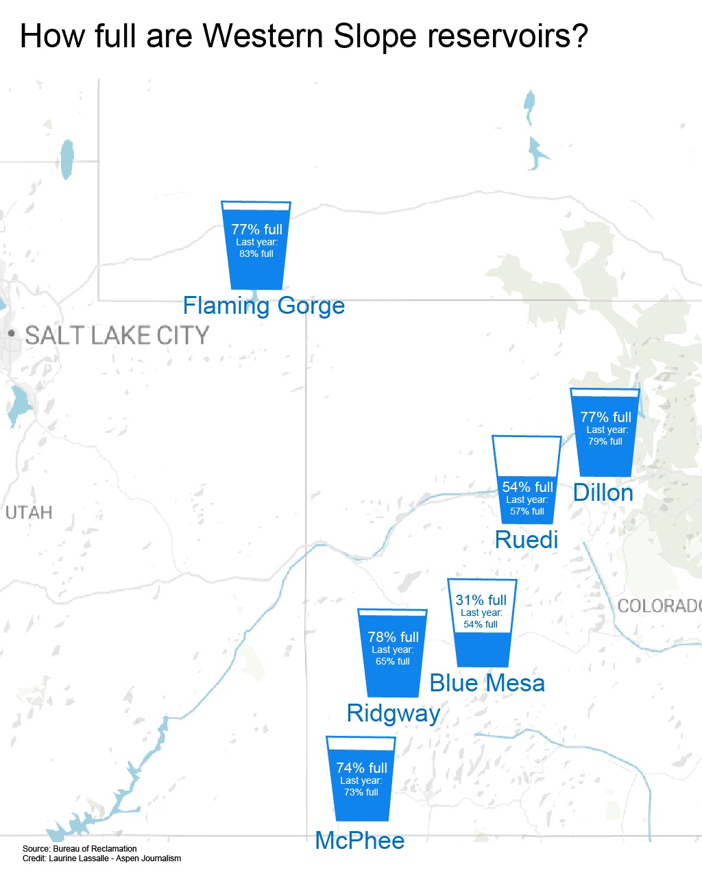
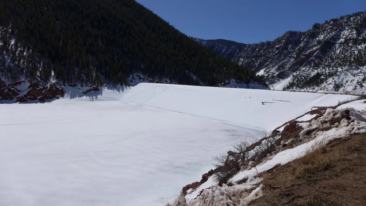
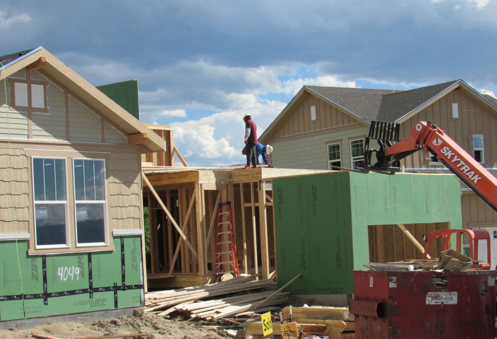
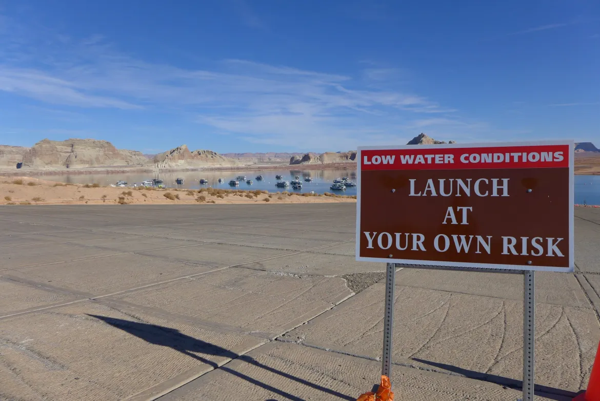
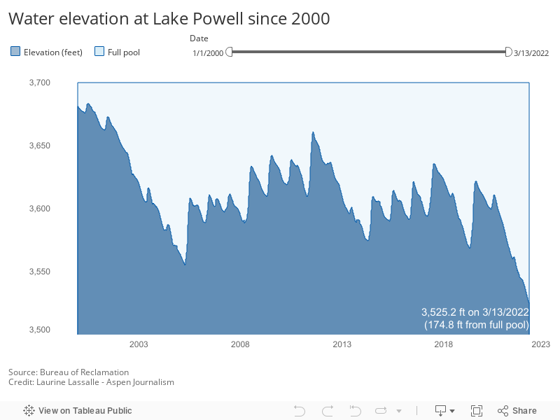
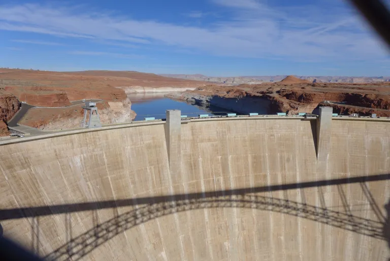


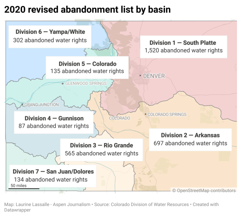


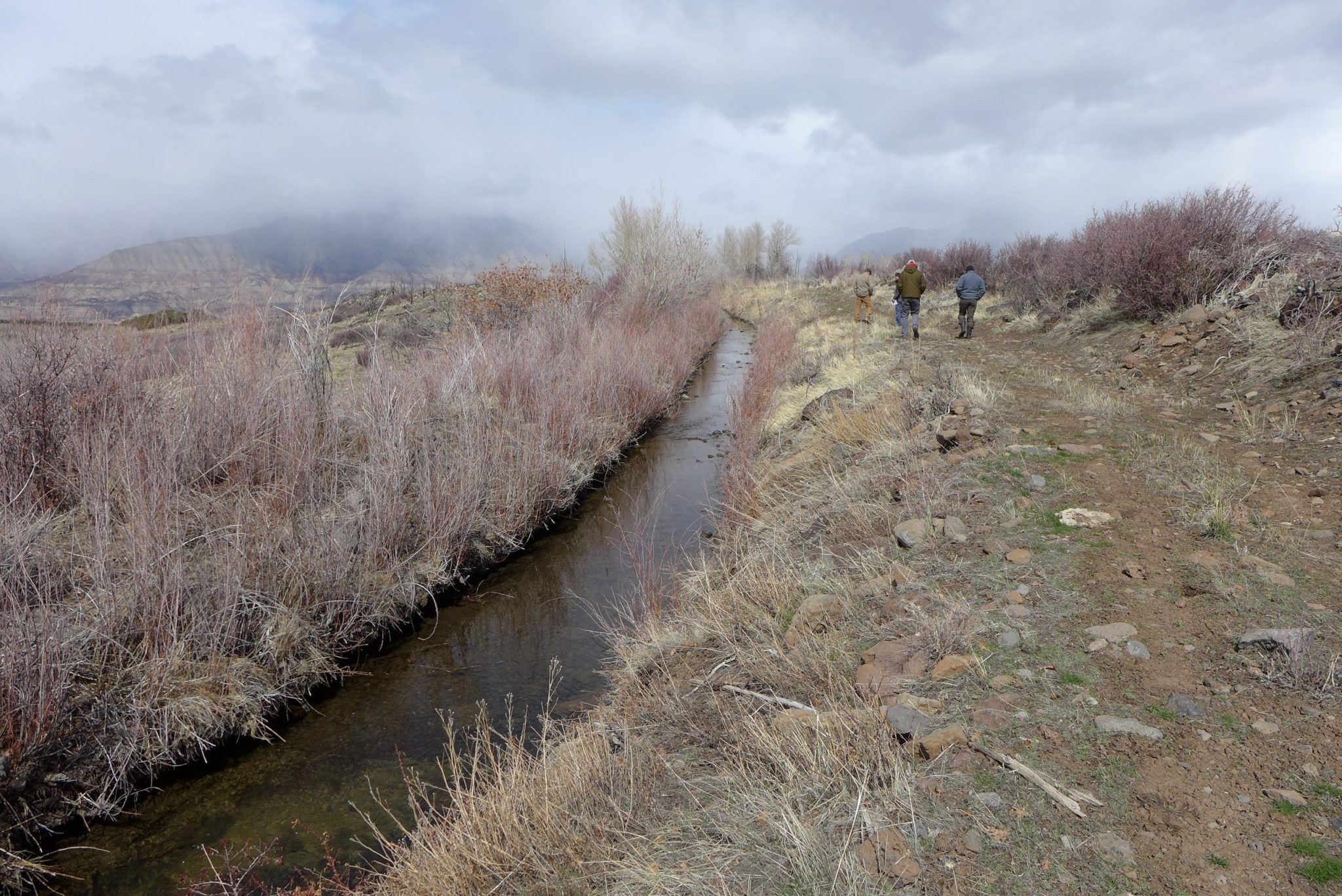
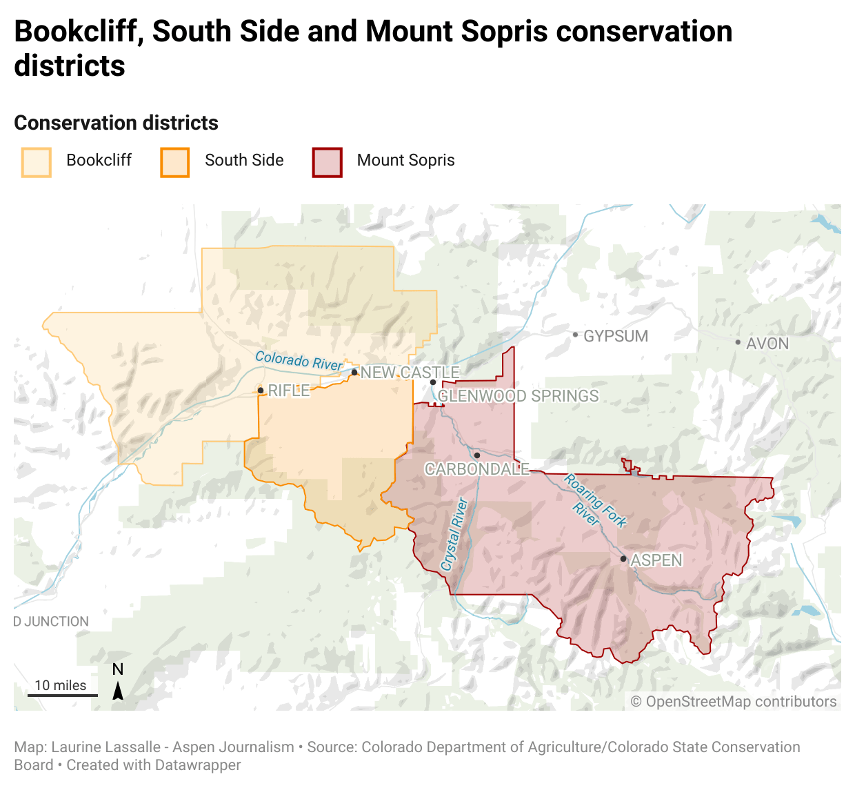
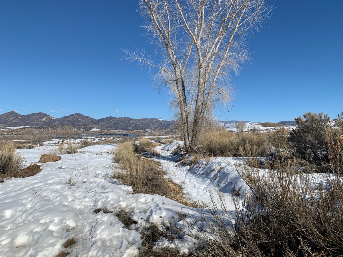
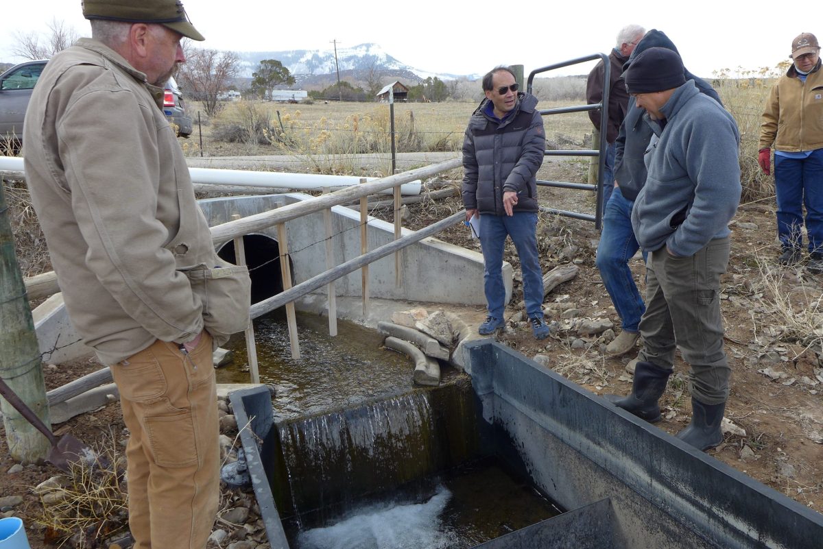
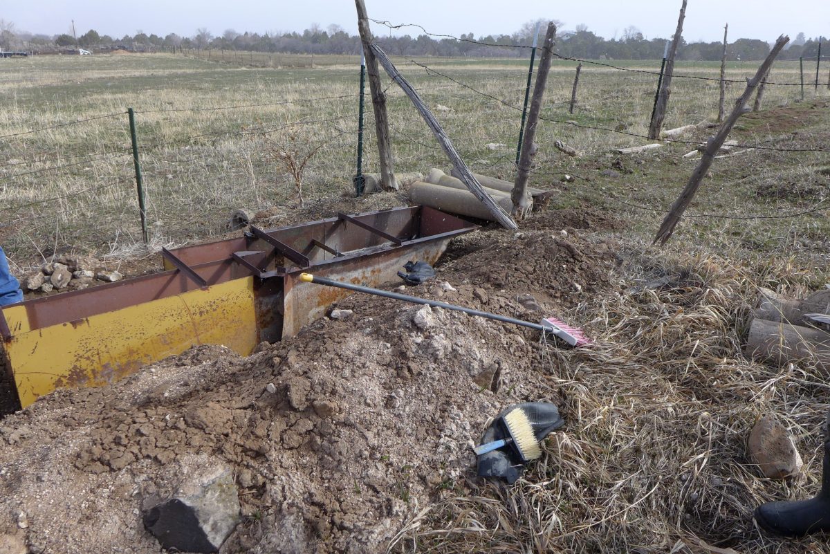
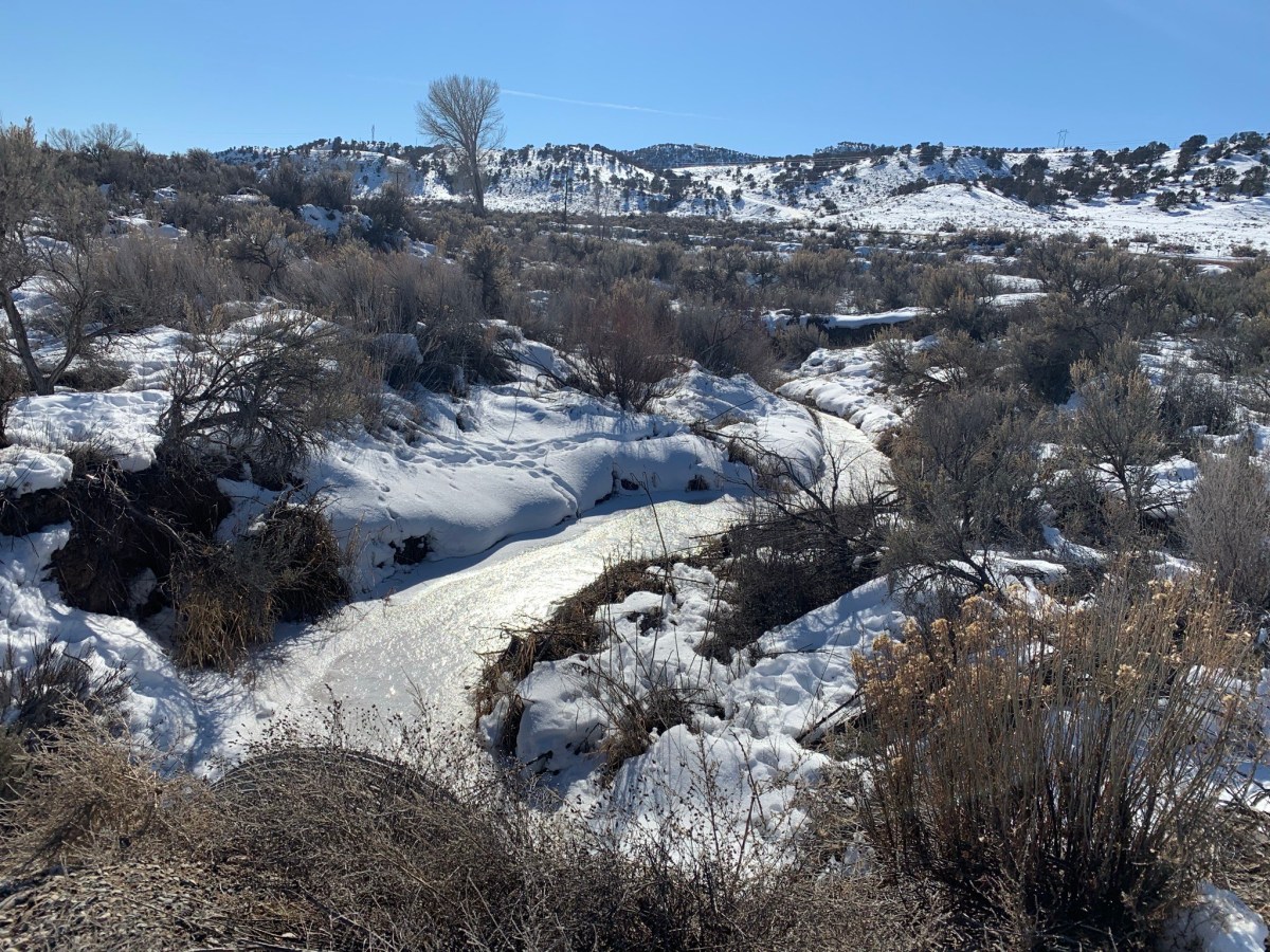
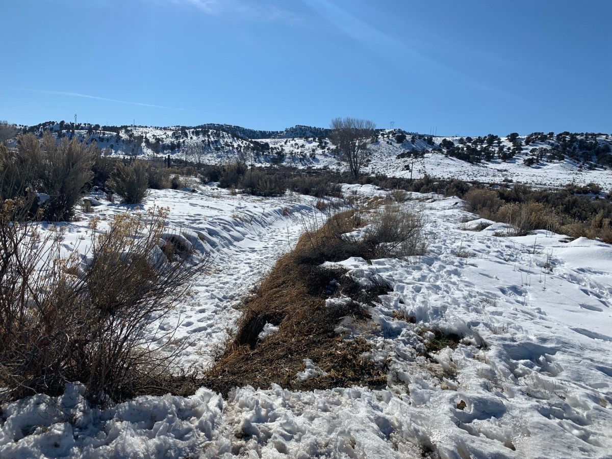


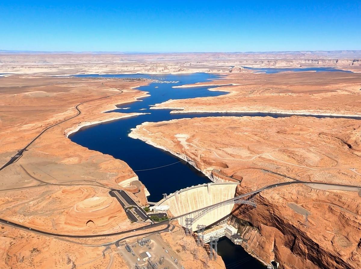
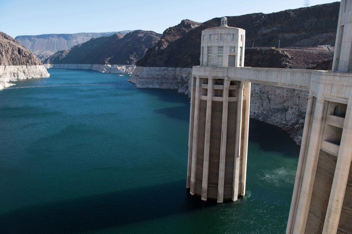
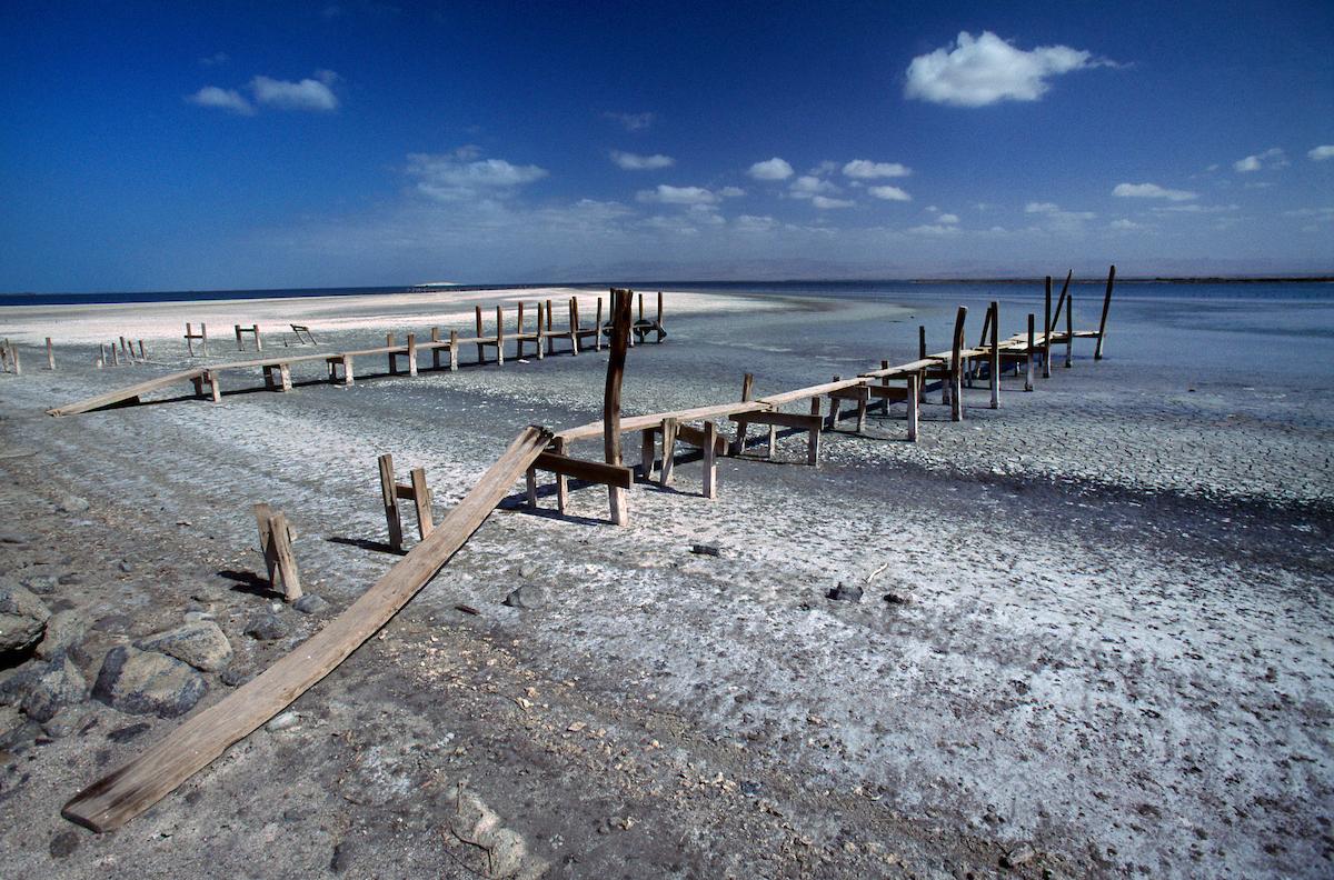