By Jerd Smith, Fresh Water News | Nov 20, 2023
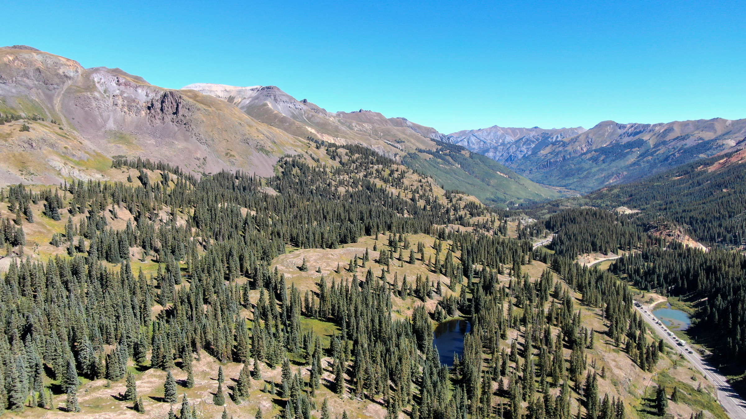
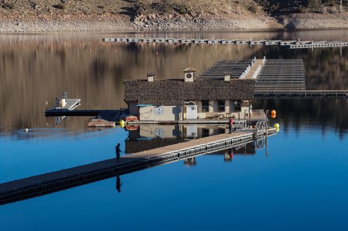
During the drought-choked summer of 2021, Colorado’s largest reservoir, Blue Mesa, was low, its shoreline exposed and dusty like a dirty white collar.
The massive inflows from the Gunnison River, a major Colorado River tributary on which it relied, had shrunk to just 32% of average, the lowest on record.
Still, thousands of boaters and anglers came to the lake near Gunnison, as they always had, more intent than ever on using its cool water to escape the heat.
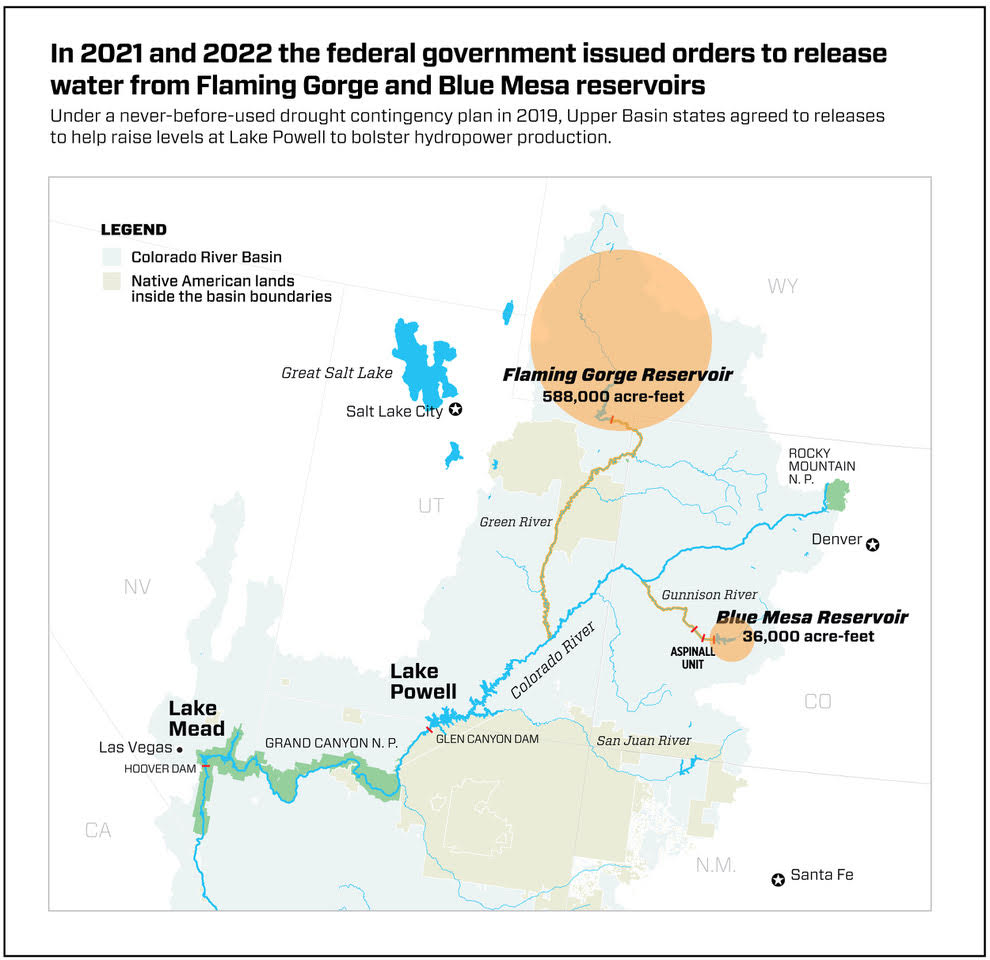
Then, in August of that year, the lake receded even more when Blue Mesa’s federal owner, the U.S. Bureau of Reclamation, issued an emergency order to release millions of gallons of water from Flaming Gorge and Blue Mesa to rescue Lake Powell, their massive sister lake to the south.
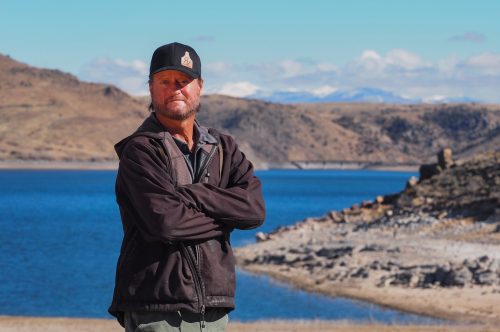
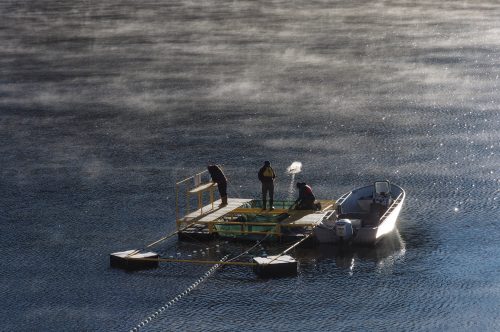
Eric Loken was shocked. He and his family have operated Blue Mesa’s two marinas, Elk Creek and Lake Fork, for decades. Their 2021 season would end three weeks early.
But the truly hard times lay ahead. The next summer, Reclamation closed the two marinas for the entire season, unsure of how much more water would have to be released in 2022 to try to stabilize the crisis-plagued Colorado River System.
For Loken, it would mean his family would lose $650,000 in income in 2022, and the more than two dozen workers they employed each summer would lose their jobs.
“That was 25 to 30 workers and their families, who relied on those incomes,” Loken said. “My family was not the only one affected by this.”
What went wrong? Just how did lakes Mead and Powell, the nation’s two largest storage vessels, almost go dry?
Experts cite a number of failures, including complicated operating systems, competing government agencies running water models tilted by political posturing, rigid guidelines that delayed decisions that could have saved water and, of course, climate change and a megadrought thought to be the worst in more than 1,200 years.
Some blame Arizona in particular for its stubborn refusal to consider deep water cuts until they were ordered by the federal government.
“It’s a story of water management on auto pilot with no emergency off switch,” said Brad Udall, a climate scientist at Colorado State University’s climate center who is an expert on the Colorado River. “Think about gas stations. Oftentimes you’ll see a big red button that has an ‘emergency off’ on it. A gas station, because of the risk of fire, needs that button. Our water management system doesn’t have that.”
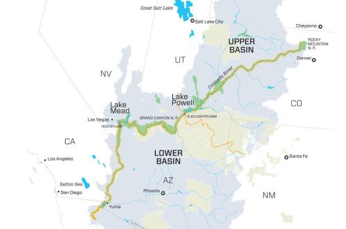
A system divided
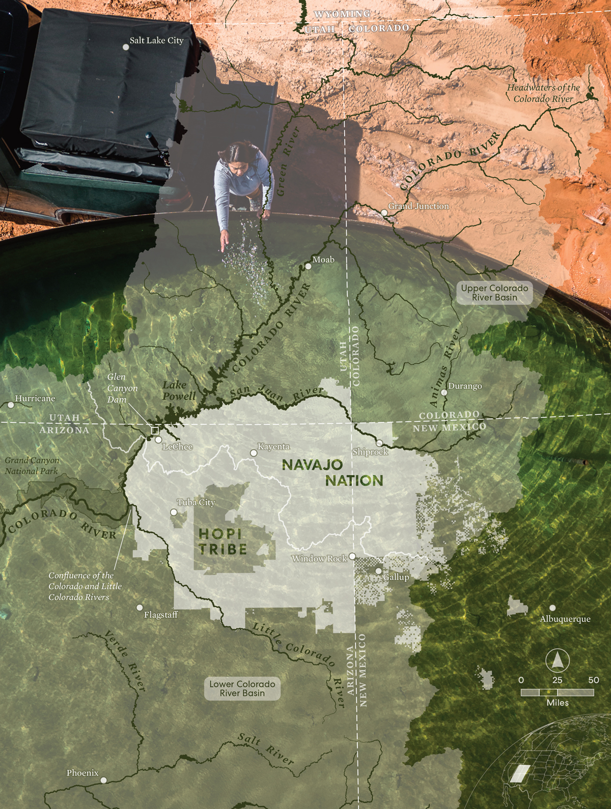
The seven-state Colorado River Basin is divided into two regions that are governed and operated separately. Mexico is also part of the basin, as are 30 Native American tribal communities.
The Upper Basin includes Colorado, New Mexico, Utah and Wyoming. States operate their systems themselves with help from the U.S. Bureau of Reclamation and oversight of the Upper Colorado River Commission.
The Lower Basin is made up of Arizona, California and Nevada. The U.S. Bureau of Reclamation operates this system.
Management of the Colorado River as it moves through seven states, more than 30 Native American communities and Mexico is divided between the Upper Basin and the Lower Basin, which are governed and operated separately.
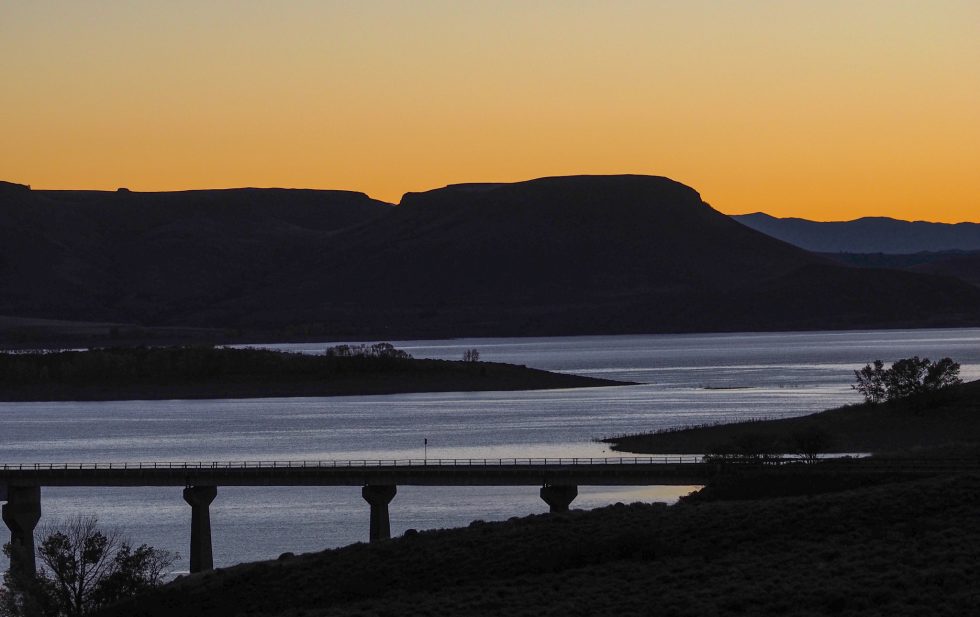
Lakes Powell and Mead are the largest reservoirs in the basin and in the United States. Already ailing in 2020 with just 46% of their normal supplies, by July 2022 they had plummeted to 27% full, according to Reclamation.
Critical to the Southwest, both reservoirs act as liquid savings accounts, storing water to make sure the Upper Basin can deliver water to Lake Powell to meet its legal obligations, while Mead delivers water to cities from Las Vegas, to Phoenix and Los Angeles, as well as tribal communities and farms.
Few believed Mead, built in the 1930s, and Powell, which began to fill in the 1960s just as the American West began a 50-year growth spurt, would face a future where they were in seeming freefall.
For those outside the federal and state water agencies responsible for keeping the giant system afloat, the spectacle of the reservoirs’ near-collapse filled them with dismay.
Ken Brenner, a member of the Upper Yampa Water Conservancy District in Steamboat Springs and often a sharp critic of state and federal water agencies, said the near-disaster reaffirmed his belief that the army of agencies and water users looking after the river were not fail-proof.
The drawdown that took the system to 27% of its capacity in the summer of 2022, “was the most irresponsible thing I’ve ever seen,” Brenner said.
And painful.
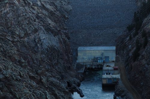
The Bureau of Reclamation is one of the largest producers of hydropower in the U.S., bolstered by giant turbines at the Glen Canyon and Hoover dams, as well as electricity generated at other reservoirs including Flaming Gorge on the Utah-Wyoming border, Colorado’s Blue Mesa, and Navajo, on the Colorado-New Mexico border.
At the height of the crisis in 2022, turbines at Powell, for instance, generated nearly 50% less electricity than they would have otherwise, forcing costs to soar more than 30%, according to the Western Area Power Administration. The agency sells and distributes electricity to utilities across the West, including Colorado’s Tri-State Generation and Transmission Association.
The environment suffered as well. As releases from the lakes dwindled, water that was normally cool warmed up, harming threatened and endangered fish that the U.S. government had spent decades and millions of dollars trying to protect, according to Jack Schmidt, a professor at Utah State University and a noted researcher on the river.
Farm fields went dry everywhere. The Ute Mountain Ute Tribe in Colorado saw its water supply slashed to just 10% of normal in 2021. In the Lower Basin, when water cutbacks were finally ordered, farmers and ranchers were among the first to see their water supplies cut, forcing them to leave crops in the ground and walk away from their fields.
What is now known to be the worst drought in more than 1,200 years seemed like more of a garden-variety Western dry spell when it began in 2000. But by 2005, Powell and Mead had lost half of their water supply.
In response, the states and the federal government, along with dozens of water agencies wrote a set of operating guidelines designed as an emergency backup system to help protect the two reservoirs against drought and integrate their operations.
The 2007 interim operating guidelines, as the rules are known, set up a system of benchmarks and tiers in each reservoir tied to each pool’s water level. It was designed so that during both droughts and recovery periods, the water amounts stored in each reservoir would be more balanced, explained Eric Kuhn, former manager of the Colorado River Water Conservation District and a scholar who has studied the river extensively.
But those tiers would prove highly damaging, experts said. Instead of balancing the reservoirs’ contents, they resulted in the dangerous drawdown of both, in effect almost breaking the powerful river system that serves 40 million people, more than 1 million acres of farmland, and one of the nation’s largest agricultural economies in California.
Sunken boats
Chuck Cullom spent decades as a water manager in Arizona overseeing use on the Colorado River. In January 2022, though, he became manager of the Upper Colorado River Commission in Salt Lake City, the body charged with helping the states run the Upper Basin.
In December of that year, back in the Lower Basin for the Colorado River Water Users Association conference in Las Vegas, Cullom rose at dawn and drove out to Lake Mead. What he saw was heartbreaking.
“That morning I had gotten up early to prepare for a talk. But I realized that I hadn’t actually seen what we [the water agencies] collectively had done to the system … the bathtub rings, the dewatering, the finding of bodies and sunken boats in the lake, the ghosts emerging. I hadn’t seen it, so I got up in the dark and drove out there. It was stunningly low.”
As the conference convened that morning, a visibly distressed Cullom returned to the city and delivered his talk, chastising the hundreds of water managers in the room. “We used almost all of the storage in the system, bringing us to the precipice of a water crisis for 40 million people,” he recalled saying later. “We did not have a backup plan.”
Like others, Cullom says the 2007 guidelines set the stage for the unraveling of a system no one thought could fail.
“Because the rules were put in place when Lake Powell and Lake Mead had substantial amounts of storage, we figured if we were wrong we would use the bank accounts as a buffer. They would insulate the system from crisis,” he said. “What happened is that it was much drier than anticipated and we used almost all of the storage in the system.”
In the year 2000 the system was in fact nearly full. But after plunging in the early 2000s, the lakes struggled to refill. For the next 15 years, communities in the Lower Basin continued to grow and use more water, but good water years were scarce, pushing the lakes down, year after year with few reprieves.
Then in 2020, the drought suddenly deepened, setting off alarms as river flows into the system plummeted. The liquid buffer everyone thought existed in 2007 was long gone.
In 2021, Reclamation ordered emergency releases from the Upper Basin reservoirs for the first time in history, trying to protect hydropower generation at Lake Powell. And in another historic first, it would order cutbacks in water use in the Lower Basin. But there was little relief.
By the summer of 2022, the two giant reservoirs were just 27% full, according to Reclamation, the lowest level ever recorded since they began filling.
Under the 1922 Colorado River Compact, the Lower Basin and Upper Basin each are entitled to 7.5 million acre-feet of water. But the Upper Basin has never fully used its share, and as a result, tries to keep its options open to use it in the future, Kuhn said, regardless of whether it is needed or if it is available as the river system dries out.
“The Upper Basin has always overstated demands because there has been this religious fervor that we are going to use more water [in the future],” Kuhn said.
Kuhn, as well as Udall, say the Upper Basin must take some of the blame for the crisis, because water managers insisted on inflating the amount of future water they would need when the 2007 guidelines and models were being developed. Under these inflated demands, during actual low flow periods (like 2000-2022) the operating guidelines suggested that Powell would have to release just 7.5 million acre-feet of water most years. Instead, as the lakes’ supplies dropped, Powell in several years had to release 9 million acre-feet of water — water that could have been kept in the reservoir had the Upper Basin not inflated its demands in the early 2000s.
The political pressure on water agencies to keep pushing to preserve future water supplies played a major role in inflating the demand forecasts used in the 2007 operating models, Kuhn and Udall said.
“I think the Upper Basin shot themselves in the foot,” Udall said, “because they didn’t really understand what would happen.”
Some, including Cullom, dispute the notion that flawed modeling is to blame. They say the crisis is the result of the tiered system, which they say was too rigid, and a failure to respond fast enough to climate and the drought.

In fact, the tiered system did little to stop the overuse in the Lower Basin until it was almost too late.
Among the issues that led to this were contracts. In the Lower Basin, the Reclamation has contracts with each of its water users, from Las Vegas, to Phoenix, to Los Angeles, which have rights to the river. They are entitled to whatever water those contracts, also based on the 1922 Colorado River Compact, say they can have. And so, even if the entire basin is in megadrought, those water users get their supplies—that is until Lake Mead gets desperately low and the federal government steps in, as it did for the first time in history in 2021.
In the Upper Basin, there are no contracts, only Mother Nature. And there are no huge storage ponds like Powell and Mead that Upper Basin users can tap in a dry year. And so water users must largely rely on whatever the snowpack delivers each year, minus what they must send to others downstream and what little they have in reservoirs, such as Flaming Gorge and Blue Mesa and Navajo. In the Upper Basin, those pools combined can store 6.4 million acre-feet of water, enough to serve roughly 13 million households for one year. But that number is dwarfed by the more than 50 million acre-feet that Powell and Mead hold when full.
Decisions delayed
From her desk in Phoenix, Vineetha Kartha, Colorado River programs manager with the Central Arizona Project, said water managers could have kept more water in the reservoirs if the tiered system had been more flexible. As they watched the lake levels drop, rather than waiting for the next trigger level to be reached to order cutbacks, they could have acted sooner, making politically unpopular decisions about reducing water use that would have kept the lakes fuller, longer.
And early on, as the tiered system was being developed in the early 2000s, negotiators could have insisted that the tiers be set higher, keeping more water in both lakes longer, according to Terry Fulp, the former regional director of Reclamation’s Lower Colorado River Region who also helped negotiate the 2007 guidelines. But that would have meant the Lower Basin states would have had to agree to cut back water use sooner and the cuts would have been deeper, Fulp said.
Instead negotiators agreed to a more conservative approach, in which the tiers would kick in when the lakes were lower and water cuts would come later.
“We looked at different alternatives,” Fulp said. “If we could have delivered less out of Lake Mead, it would have held Mead higher. But the Lower Basin, Arizona in particular, would not agree to that.”
Brenda Burman was commissioner of the Bureau of Reclamation from 2017 to 2020. Now she is the general manager of the Central Arizona Project, the state’s largest user of Colorado River Water. She acknowledges that overuse in the Lower Basin, as well as the wild cards the drought and climate change delivered, drove the crisis.
“The Lower Basin does have a math problem,” she said, referring to the overuse. “But I think what we’ve seen from the last 23 years is that this problem is bigger than that.”
The untidy work of getting more water back into Powell and Mead and finding ways to cut water use permanently is underway. Reclamation is developing two plans to save the river. One is a three-year operating plan that it hopes will keep the system stable in the near term. The second is a long-term plan that will be put into action in 2027, after the 2007 guidelines expire at the end of 2026.
This year, a once-in-a-generation snowpack in the Upper Basin states combined with snow and rain in the Lower Basin have allowed the lakes to recover a bit. But Mead and Powell are still just 35% full.
At the same time, water use in the Lower Basin, thanks to the wet year and cutbacks ordered by the federal government as spelled out in the 2007 guidelines and a special 2019 drought contingency plan, is dramatically lower, with the three states using just 5.8 million acre-feet of their 7.5 million acre-feet allotment.
But will the water users of the Colorado River Basin succeed in reinventing their complicated river system, cutting use dramatically so that it matches annual supplies?
That’s unclear.
“We need to have a system that provides for uses based on actual hydrology so that the amount of water available for use, particularly in the Lower Basin, is a function of actual water availability,” said Anne Castle, a Colorado River scholar at the Getches-Wilkinson Center at the University of Colorado and the federal appointee to the Upper Colorado River Commission.
Speaking as a scholar, Castle said it is clear that the demands of 40 million people and the region’s agricultural users will have to be adjusted down to match the river’s actual supply.
Is she hopeful? “Yes,” she said. “I think we’re seeing a lot more discussion of moving toward an operating system that is based on actual availability.”
Blue Mesa, unlike Powell and Mead, refilled this year, something for which Eric Loken is grateful. But he remains worried.
“This has been a wake-up call,” he said. “I am hopeful they will make changes downstream. But right now there is too much waste and silliness throughout the system that needs to be cleaned up.”
This Fresh Water News story was produced as part of a collaboration between the Colorado Sun and Water Education Colorado and will also appear at coloradosun.com. Fresh Water News was launched in 2018 as an independent, nonpartisan news initiative of Water Education Colorado. Our editorial policy and donor list can be viewed at wateredco.org.
Jerd Smith is editor of Fresh Water News. She can be reached at 720-398-6474, via email at jerd@wateredco.org or @jerd_smith.
The Water Desk’s mission is to increase the volume, depth and power of journalism connected to Western water issues. We’re an initiative of the Center for Environmental Journalism at the University of Colorado Boulder.