
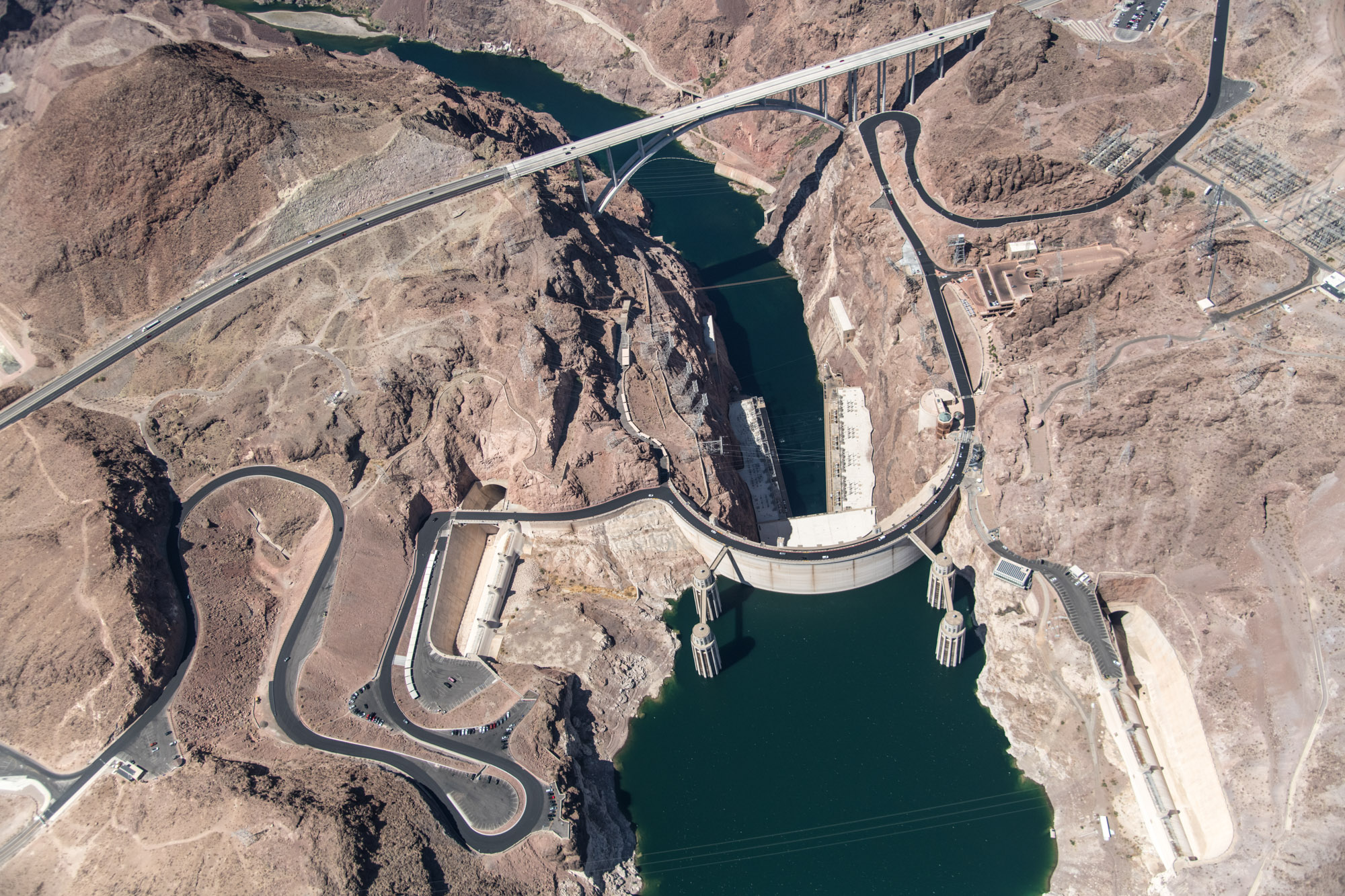
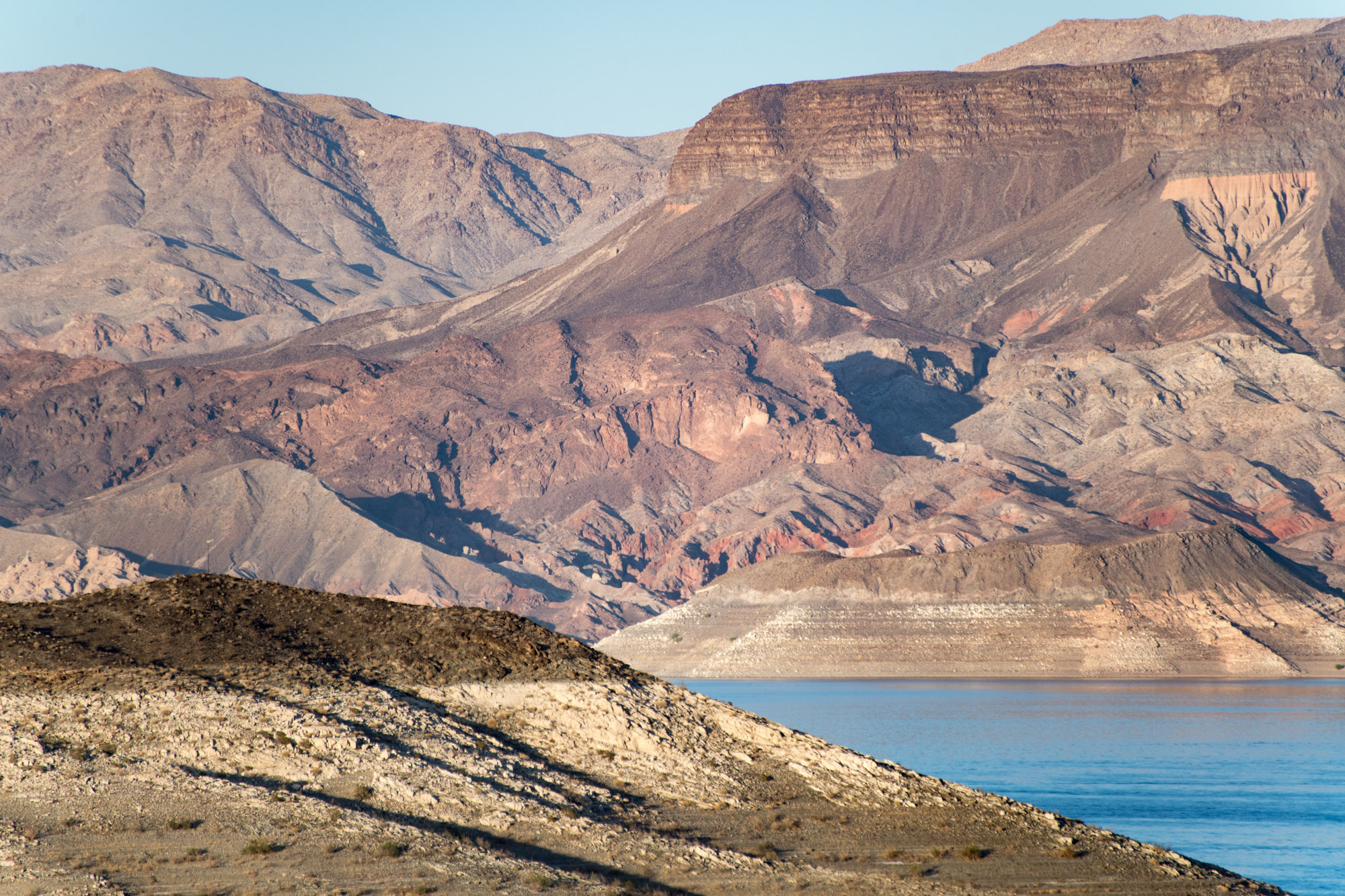
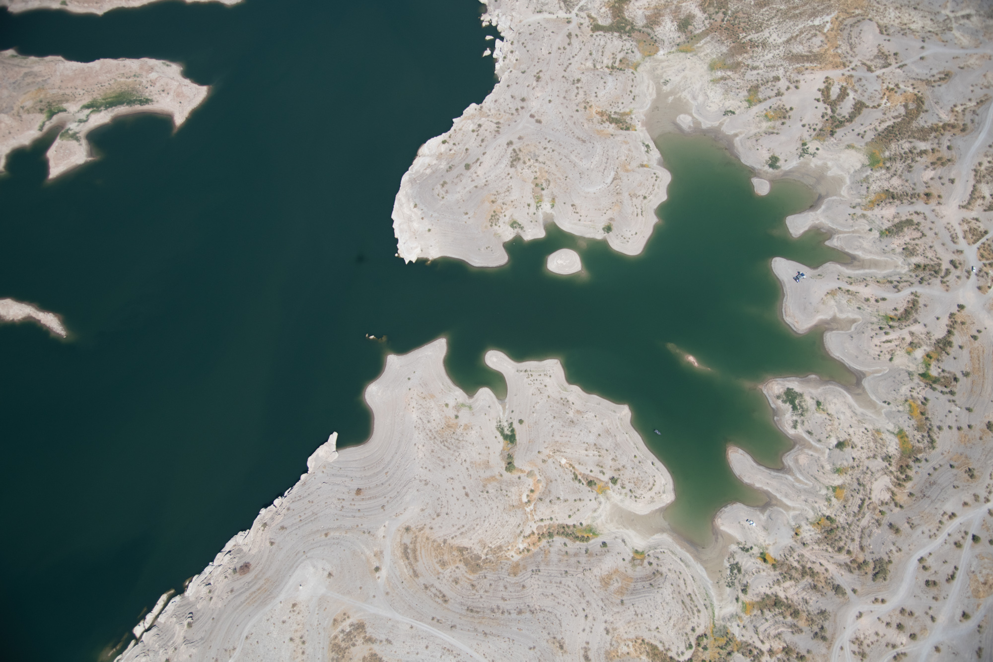
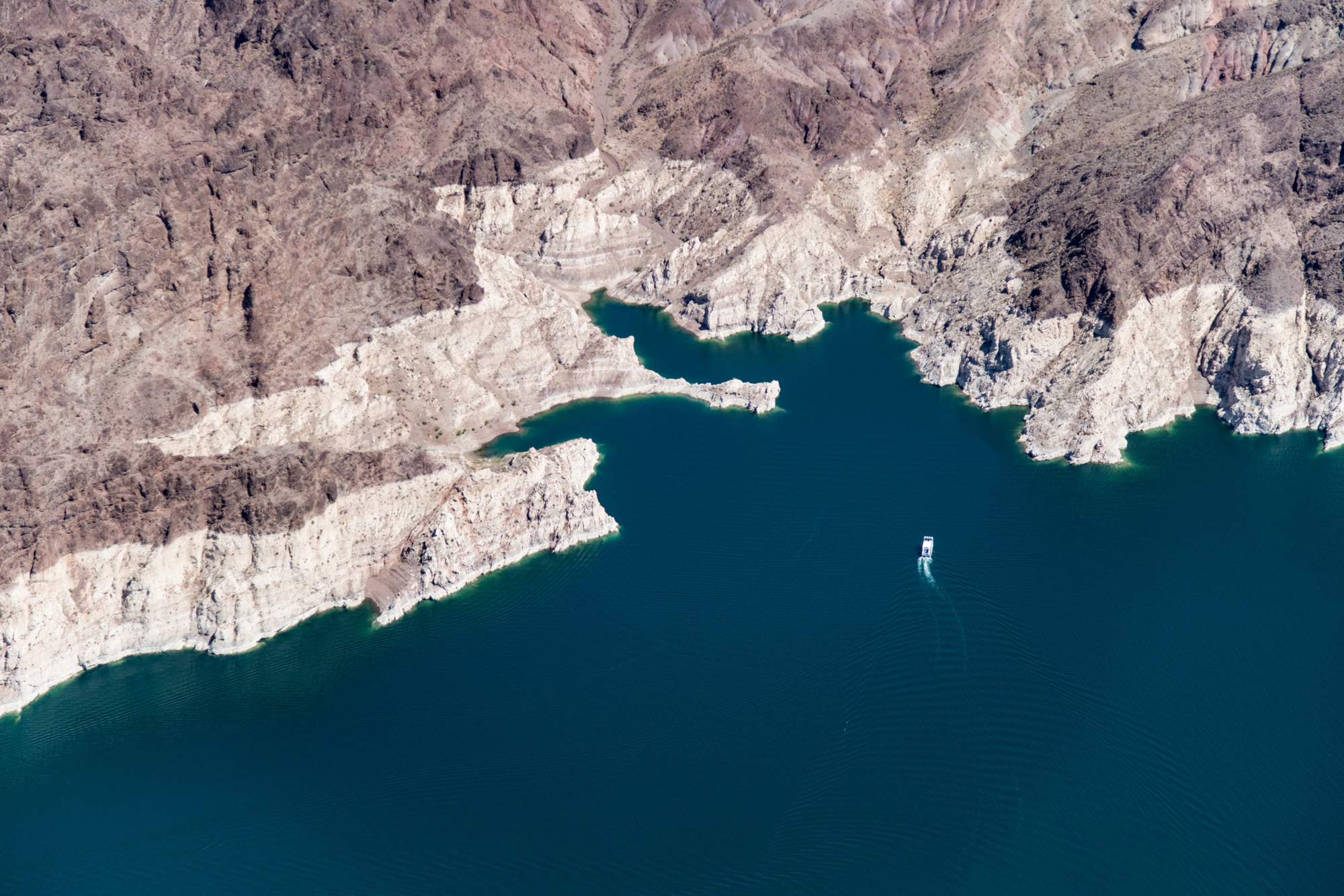
This page features aerial images of Lake Mead and Hoover Dam, along the Colorado River near Las Vegas, Nevada.
Lake Mead is the nation’s largest reservoir by capacity, but its elevation has plummeted in recent years due to a megadrought and human demands upon the Colorado River. Hoover Dam is 726 feet tall and was built from 1931 to 1936. During that time, 96 men were killed in industrial accidents, according to the Bureau of Reclamation, which manages the dam.
See our dams and reservoirs dashboard for more information about Hoover Dam and Lake Mead. We have additional aerial photos of the dam and reservoir on this page.
| Date | May 23, 2021 |
| Location | Hoover Dam and Lake Mead (map) |
| Credit | Alexander Heilner/The Water Desk |
| Rights | Free to reuse under Creative Commons license. |
Selected images from the gallery
Click to enlarge


To use these images
Please read and consent to the terms and license below for access to the download page.
The Water Desk’s photo and video resources are part of our efforts to aid and enrich news coverage of Western water issues. Our imagery is shot by professional photojournalists and is available for free reuse under a Creative Commons noncommercial license.
To help us continue to offer this free material, we ask that you please:
To help us continue to offer this free material, we ask that you please:
- Credit the original photographer and the Water Desk as the source
- Email us a link to the published story at waterdesk@colorado.edu
- Consider sending The Water Desk your ideas for future content that we could add to the library
- Keep supporting professional photojournalists by hiring them for assignments


