
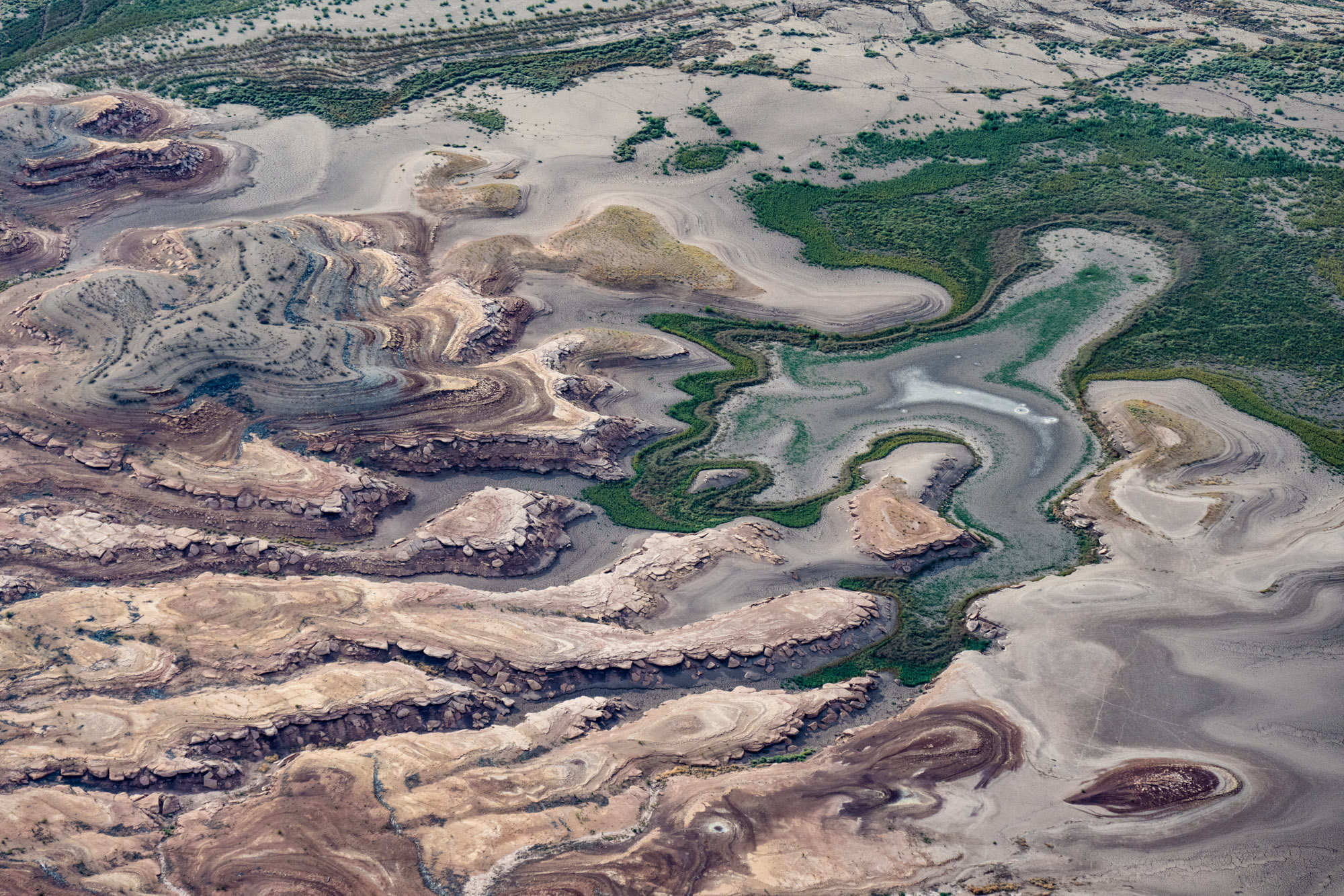
This page features aerial photos of the Colorado River entering Lake Powell in southern Utah near Hite Marina.
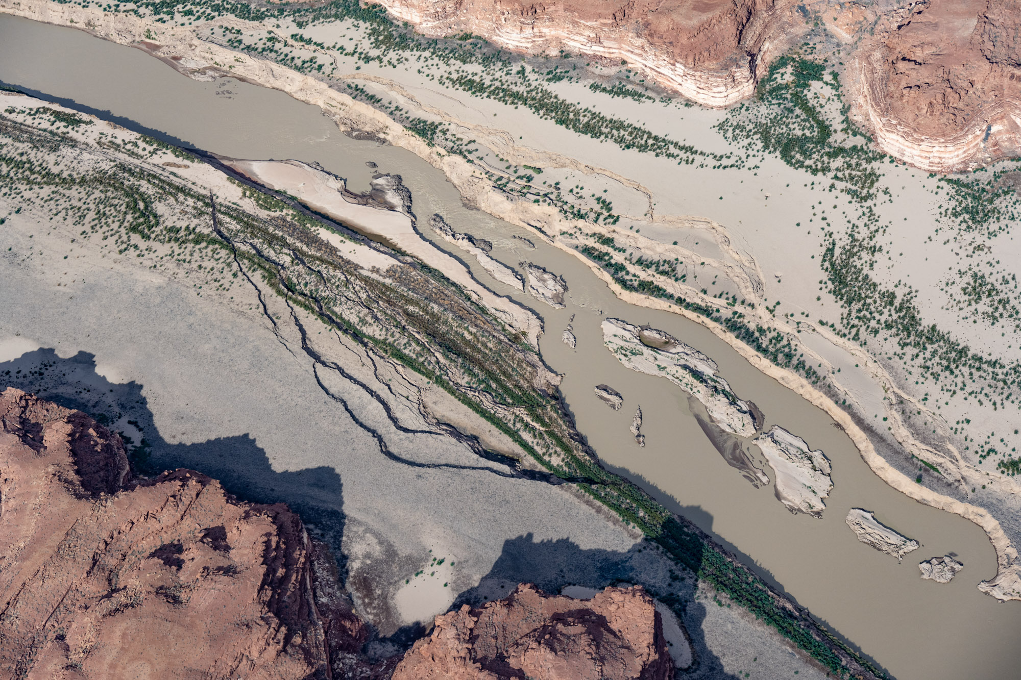
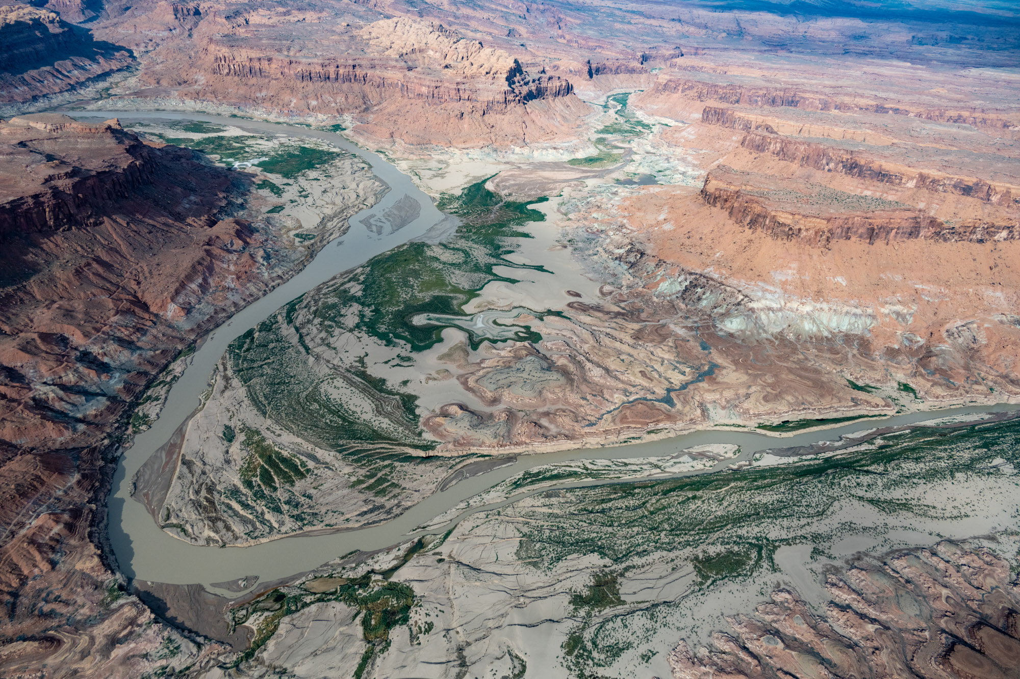
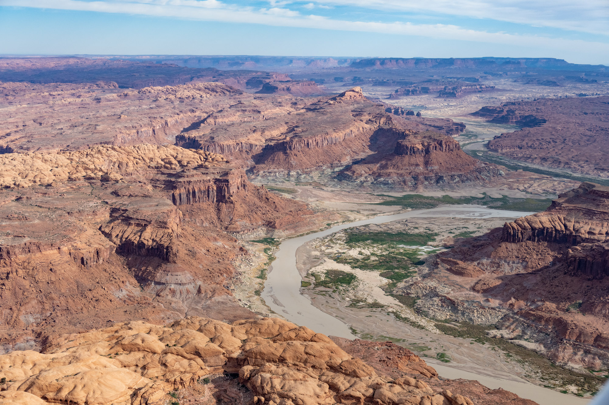
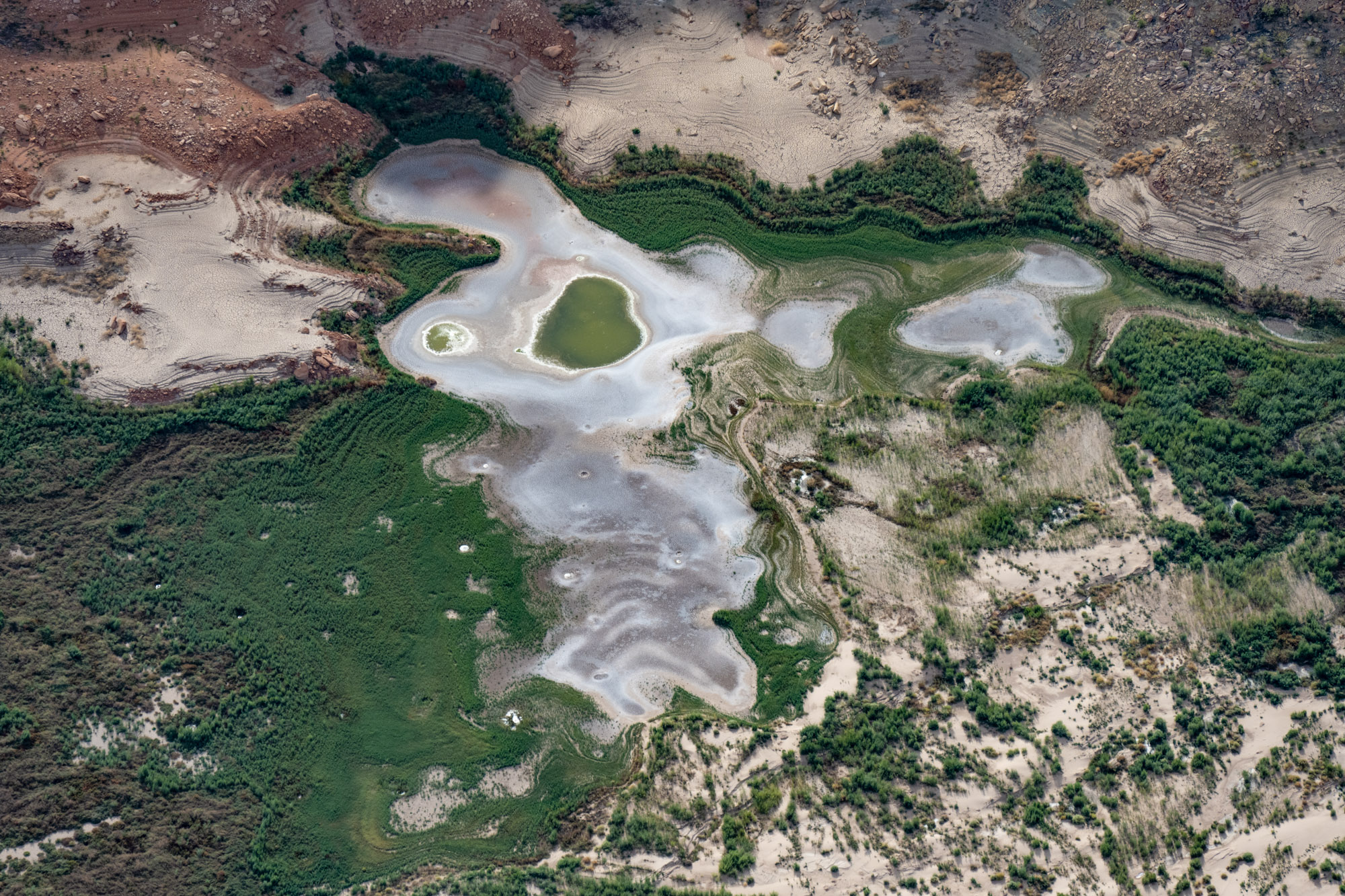
Just south of the inoperable Hite Marina lies an extended stretch of the Colorado River that was “buried” under Lake Powell for 50 years. This was the northernmost stretch of the reservoir, and the place where the river slowed and dropped its enormous cargo of silt from upstream. Now that the lake has receded southward, the river is once again flowing here. But it must cut a renewed path through 50 years of mud and silt, some of which is more than 100 feet deep.
| Date | October 16, 2022 |
| Location | Colorado River near Hite Marina, Utah (map) |
| Credit | Alexander Heilner/The Water Desk with aerial support from LightHawk |
| Rights | Free to reuse under Creative Commons license. |
Selected images from the gallery
Click to enlarge


To use these images
Please read and consent to the terms and license below for access to the download page.
The Water Desk’s photo and video resources are part of our efforts to aid and enrich news coverage of Western water issues. Our imagery is shot by professional photojournalists and is available for free reuse under a Creative Commons noncommercial license.
To help us continue to offer this free material, we ask that you please:
To help us continue to offer this free material, we ask that you please:
- Credit the original photographer and the Water Desk as the source
- Email us a link to the published story at waterdesk@colorado.edu
- Consider sending The Water Desk your ideas for future content that we could add to the library
- Keep supporting professional photojournalists by hiring them for assignments


