
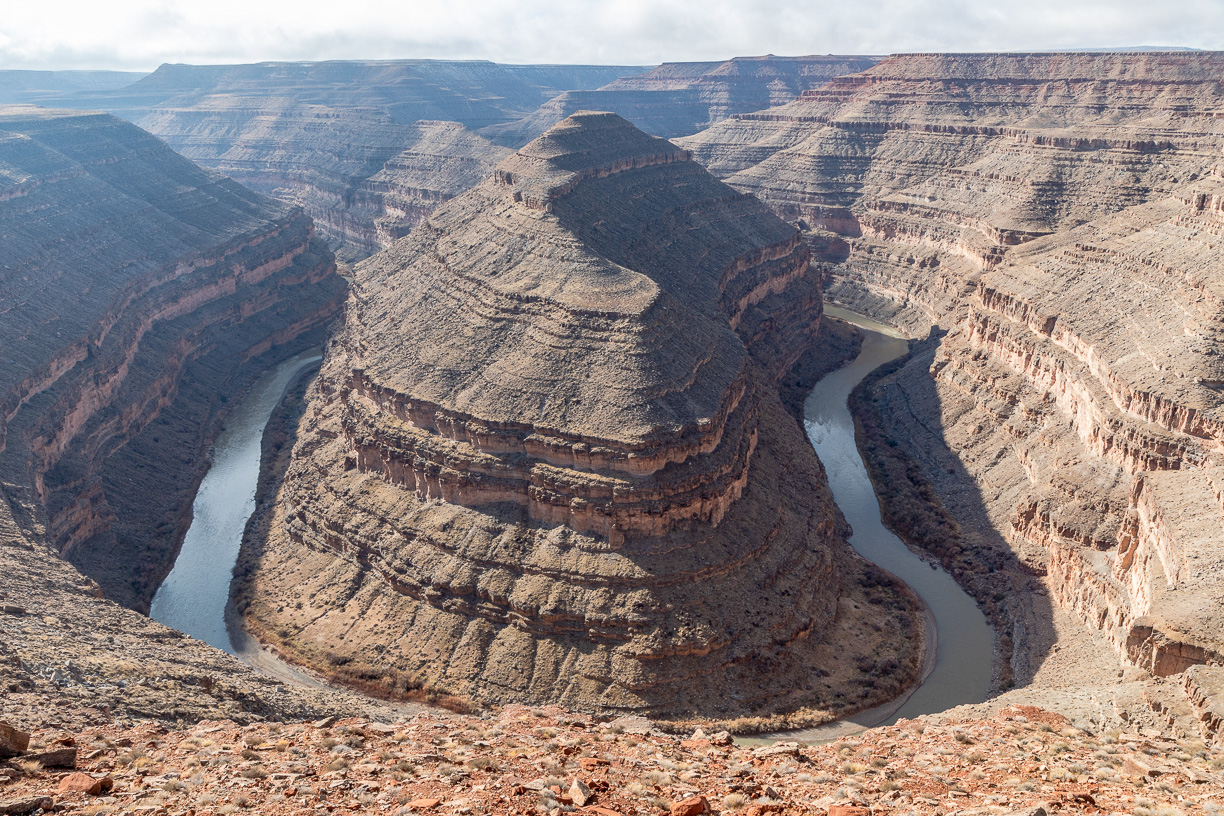
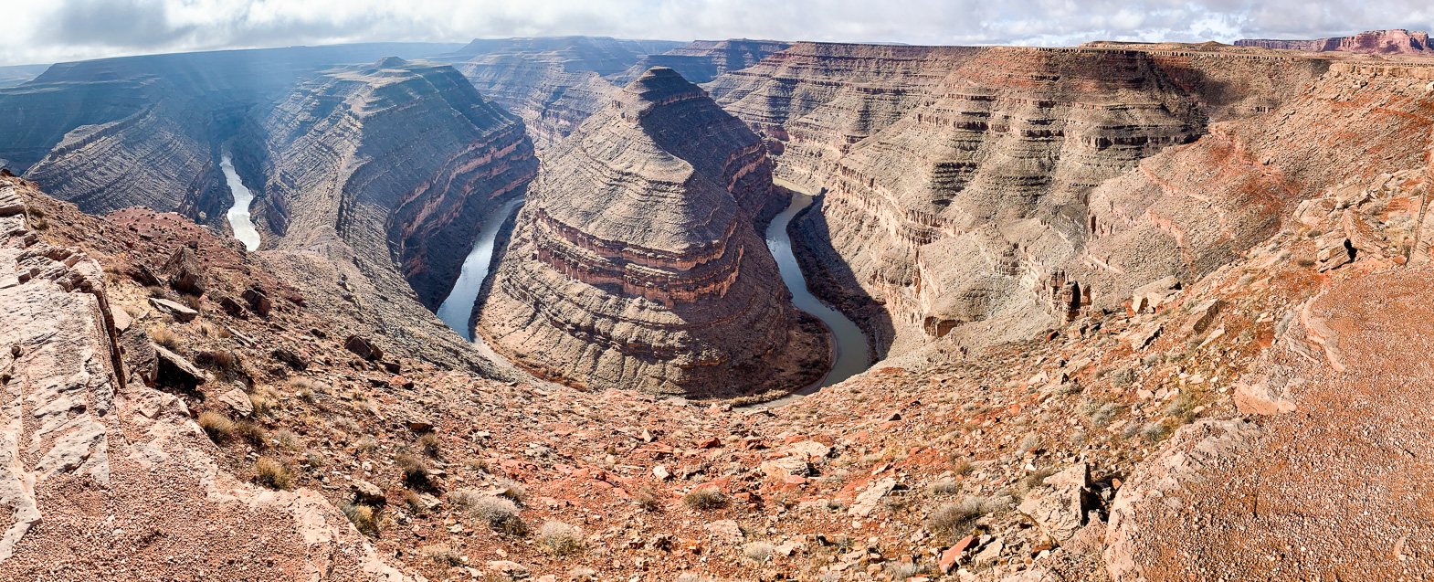
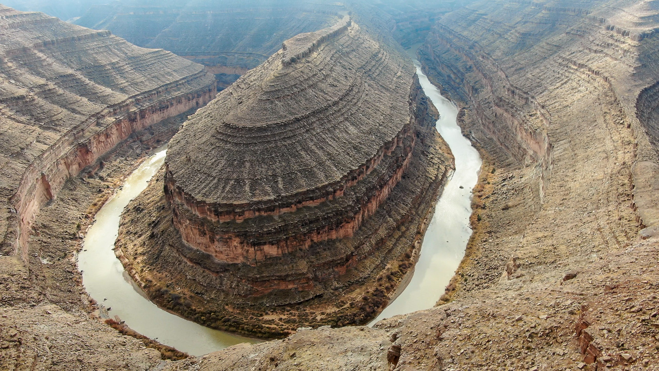
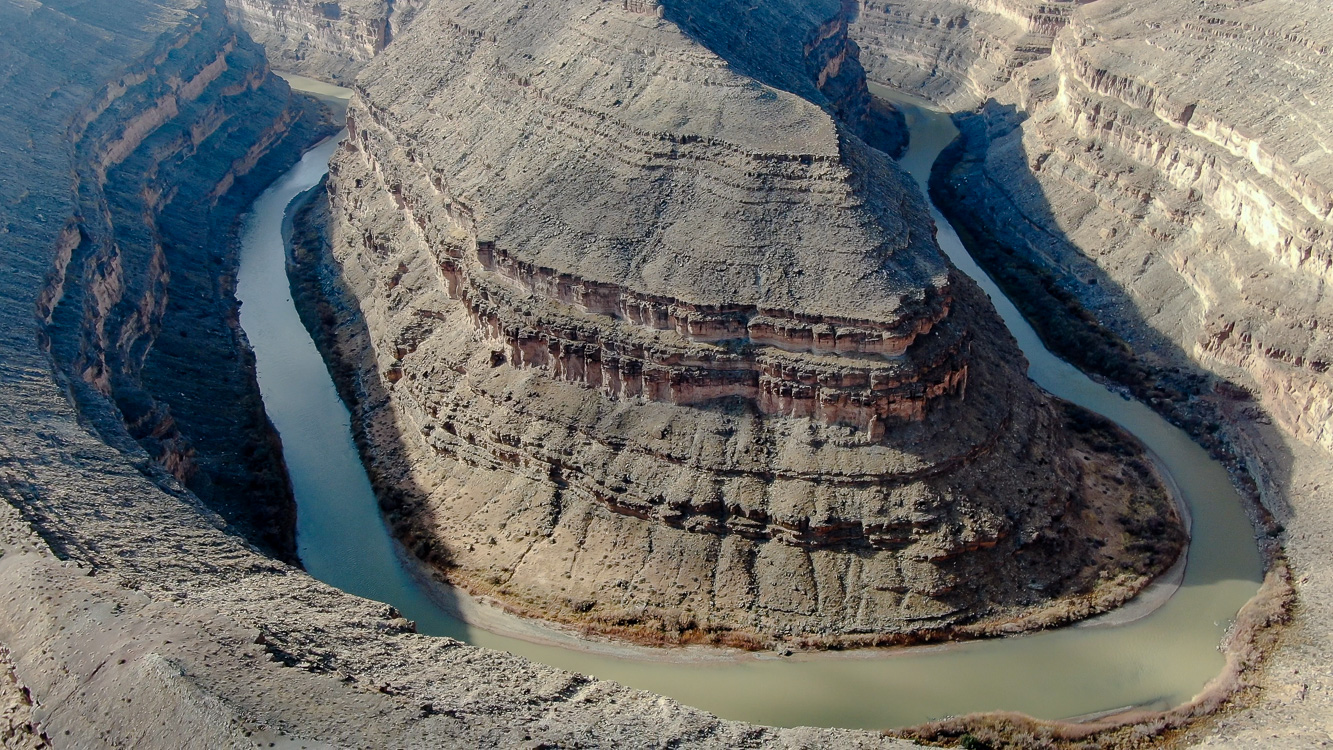
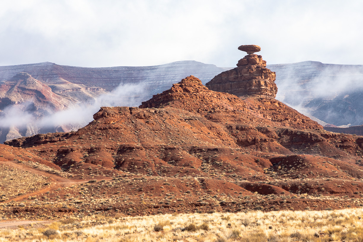
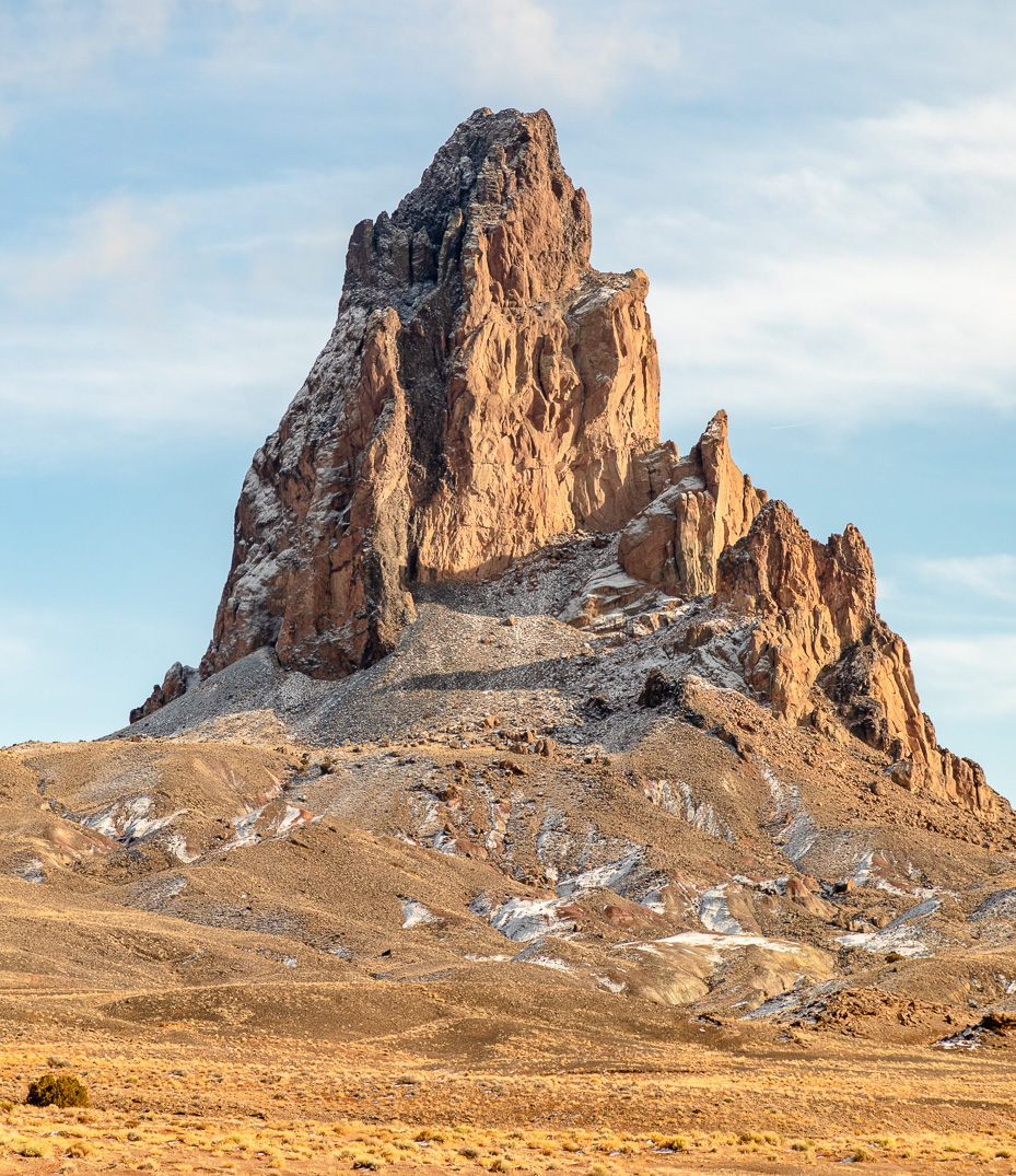
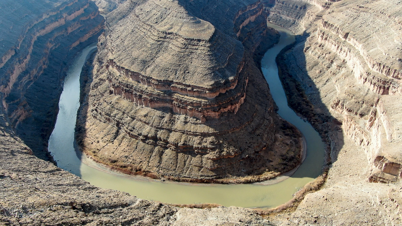
This page features drone footage and still imagery of the Goosenecks of the San Juan River as well as the area around Mexican Hat, Utah and Kayenta, Arizona.
The Goosenecks are a classic example of the entrenched meanders that are incised into the Colorado Plateau and other landscapes where rivers have cut down through tectonic uplift.
View this gallery for high-resolution downloads »
| Date | December 23, 2019 |
| Location | Goosenecks of the San Juan River State Park and Mexican Hat, Utah (map) |
| Photographer | Mitch Tobin, FAA Remote Pilot Certificate #4002345 |
| Organization | The Water Desk at the University of Colorado Boulder |
| Rights | Free to reuse under Creative Commons license, with credit to “Mitch Tobin/WaterDesk.org” |
To use these images
Please read and consent to the terms and license below for access to the download page.
The Water Desk’s photo and video resources are part of our efforts to aid and enrich news coverage of Western water issues. Our imagery is shot by professional photojournalists and is available for free reuse under a Creative Commons noncommercial license.
To help us continue to offer this free material, we ask that you please:
To help us continue to offer this free material, we ask that you please:
- Credit the original photographer and the Water Desk as the source
- Email us a link to the published story at waterdesk@colorado.edu
- Consider sending The Water Desk your ideas for future content that we could add to the library
- Keep supporting professional photojournalists by hiring them for assignments
All of the content in our multimedia library is available for free download and reuse under a Creative Commons license.


