
FLAGSTAFF, Ariz. – Five large wildfires have burned tens of thousands of acres in the forests around this northern Arizona city in the last 15 years. Monsoon floods after those fires closed roads, wrecked homes, and took the life of a 12-year-old girl.
But it is the fire that has yet to burn that most worries City of Flagstaff and Coconino County leaders.
A large blaze in the Upper Rio de Flag watershed, which crosses the heart of the city, would be a deep wound. If it were coupled with intense monsoon rains, a fire that burned the entire 21,500-acre basin could trigger a flood catastrophe.
In a worst-case scenario, the fire-flood combo could cause at least $2.8 billion dollars in economic losses, according to a 2023 assessment from Northern Arizona University’s Economic Policy Institute. Those estimates, which are conservative, include property damage, fire suppression, illness, loss of business revenue, and repair costs. They do not account for potentially expensive impairments to a major BNSF railway and Interstate 40 or effects on Grand Canyon tourism or multiple storms. Even a smaller fire that burns only 15 percent of the watershed could carry a $535 million price tag.
“If that watershed really burns, Flagstaff is in a world of hurt,” said Joe Loverich, who worked on the flood models that supported the economic analysis.
A disastrous outcome, however, is not preordained. With the right mix of data-informed foresight, proactive measures to reduce fuel loads by thinning dense stands of ponderosa pines, and luck, city and county officials hope to avoid the severe wildfire that would wreck the watershed and trigger the dreaded cascade of flood and debris. The risk cannot be eliminated. But it can be estimated. And it can be reduced.
The condition of western U.S. forests has climbed to a matter of national importance as megafires churn through millions of acres annually. The U.S. Forest Service has developed a wildfire strategy to protect critical infrastructure, wildlife habitat, recreation areas, communities, and headwater streams that are the source of drinking water for tens of millions of people. In that strategy, the Flagstaff area was designated a high-risk landscape. At the same time, the Trump administration is promoting logging as risk reduction while also cutting federal programs that help communities prepare for climate hazards.
Though the federal government is experiencing the whiplash of new administration priorities, durable, collaborative models to dampen the risks of severe wildfire and post-wildfire flooding still exist. In the last 15 years, Flagstaff and Coconino County have emerged as leaders in developing these strategies. They are joined in this watershed-focused work by organizations like Denver Water, Rio Grande Water Fund, and Placer County Water Agency.
The playbook developed in Flagstaff includes financial models to fund forest thinning and risk models to inform decision-making. Converting knowledge and money into projects on the ground requires partnerships that extend across local and federal agencies to connect with the private sector and NGOs. And it involves physical restoration of the landscape, both before and after a fire, so that fires are less destructive and floodwaters less perilous.
“The numbers are so clear,” said Lucinda Andreani, administrator of the Coconino County Flood Control District. “You spend so much money post-wildfire and you lose key assets and you lose communities that I think people are more and more understanding that we’ve got to keep investing in forest restoration.”
As more of the American West burns, Flagstaff’s experience is akin to a cairn in the wilderness, a waypoint showing where the rest of the region is heading.
Understanding Risk
As with most public policy shifts, the reckoning in Flagstaff and Coconino County was borne from calamity.
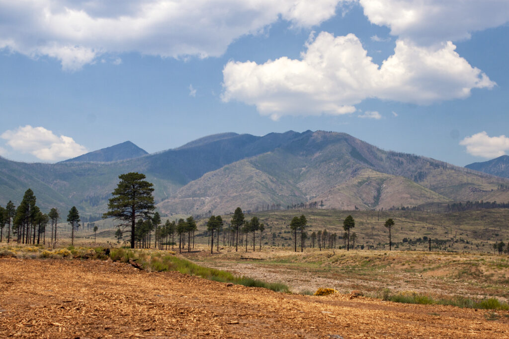
Post-fire flood risk came to the fore after the Schultz Fire, in 2010. Burning about 15,000 acres along the San Francisco Peaks, it was the first large fire near the city in more than three decades.
The fire damage was compounded by subsequent downpours. This area of the Southwest is subjected to stacked hazards: a fire season that overlaps with monsoon season. These punchy rainstorms are short-lived but potent. They can dump several inches in an hour or less. When they occur over a burn scar, which was the case after the Schultz Fire, 20 to 30 times more water can be flushed down a stream channel. If an area is burned again – the 2022 Pipeline Fire, for instance, reburned parts of the Schultz scar – the watershed is even more vulnerable to floods and erosion.
After the Schultz Fire and subsequent floods, Coconino County received a FEMA grant to conduct a countywide assessment for flood and debris risk. JE Fuller, a firm that analyzes landscape hazards in the Southwest, was hired to do the modeling work. In the model, “we basically burned everything,” said Joe Loverich, a project manager at the firm. Then Loverich and his colleagues looked at where debris and water flows would do the most economic damage.
Society has been constructed as layers of fixed assets – roads, bridges, houses, water supply pipes, wastewater treatment plants, landfills – atop a landscape that flexes more than we’d like. When the environment changes, the risk to these assets also changes, Loverich said.
That happens after a severe wildfire, which transforms a watershed into something more dangerous. It shakes society’s physical foundation, not just for weeks but for years. The landscape becomes threatening in a way that it wasn’t before.
“We’re developing the science of understanding what the risk is,” Loverich said. “What it is, who it affects, why you should be concerned about it. And what that can do is then lead to an understanding of what we should do about it.”
In JE Fuller’s model several areas of Coconino County stood out as particularly susceptible to post-wildfire landscape transformations. One was Williams, a town some 30 miles west of Flagstaff. Williams has two water supply reservoirs that could be inundated with debris from post-fire floods originating in the Bill Williams watershed above town. In this flood scenario, the reservoirs could be rendered inoperable until they were dredged. The water supply would be cut off. Downtown Williams, meanwhile, could see “a wall of six feet of water,” Andreani said.
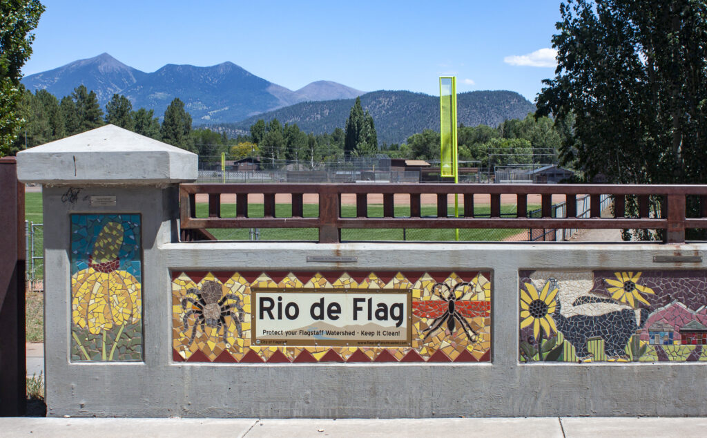
Other high-risk areas are clustered around the Upper Rio de Flag watershed, which crosses Flagstaff from north to south before turning eastward.
Responding to Risk
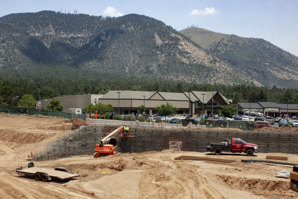
Most of the year, the Rio de Flag is a dry, narrow channel. Only rainfall and snowmelt give it life. On a July day earlier this summer, the section through Thorpe Park, near the city center, was covered in seasonal grasses and brush that hid subsurface drainage structures installed as part of a $122 million Army Corps flood-control project.
The relative calm of a dry channel could be disrupted if the right combination of fire and rain were to hit higher in the watershed.
Some of those punches have already landed in the Flagstaff area. The Schultz Fire, which caused some $100 million in damages, was the first caution sign.
More warnings came later. The Museum Fire, in 2019, burned only about 2,000 acres. But the fire occurred upstream of one of the areas identified as a high flood risk in the countywide modeling assessment. Two years later, ferocious monsoon rains swept through the area and caused substantial flooding in the Sunnyside neighborhood along Spruce Wash, a Rio de Flag tributary. Today, work crews are in the midst of a $26 million project to expand flood channels and retention basins in the neighborhood.
Knowing these potential outcomes, how is a place like Flagstaff to react? The city decided to ask its residents to pay for fire-risk reduction efforts that would take place on national forest land.
Flagstaff residents understood the need. In 2012, city voters approved a $10 million bond proposal to fund the Flagstaff Watershed Protection Project, one of the first such efforts in the country.
Cal Joyner, former Southwestern regional forester for the U.S. Forest Service, called the bond’s passage “a great example of civic environmentalism” that led to a close partnership between the Forest Service and the city.
More funding and collaborations would follow. The Four Forests Restoration Initiative, a project to reduce catastrophic fire risk on 2.4 million acres of national forests in northern Arizona, contributed money and led an environmental assessment that cleared the path for large-scale thinning and prescribed fire projects across the project’s footprint. The state stepped in to facilitate development of a timber mill that could make use of the small-diameter trees that were being cut.
In 2020, Flagstaff increased its contribution by levying a Water Resources and Infrastructure Protection Fee on water bills. The fee of 52 cents per 1,000 gallons (now increased to 53 cents) helps to fund fire mitigation projects in upstream forests. In 2022, voters approved a $26 million bond for the Spruce Wash repairs. Three months later the City Council voted to increase stormwater fees by 12% annually for six years to pay for flood-control infrastructure and maintenance.
“There’s no one organization or municipality or county or anybody that can do all of this by themselves,” said Neil Chapman, wildland fire captain for Flagstaff Fire Department. “And so, partnerships are the way we scale up.”
All told, a mix of public agencies, private firms, and NGOs are raising funds, assessing risks, using computer models to test and refine their designs, and ultimately restoring forests.
“Having efficient organization at the local level to leverage the federal money and the state money that’s available is really key,” Loverich said. “And that’s something the City of Flagstaff and Coconino County have been really good at.”
Just last month the Coconino County Flood Control District partnered with The Nature Conservancy and Coconino National Forest to begin work on a 2,045-acre tree thinning project in the Upper Rio de Flag. The district contributed $2 million while the national forest chipped in $2.5 million.
Investing in Forests
Fire will occur in these high-elevation southwestern forests. The ecosystem has evolved that way. The aim for city and county officials is to prevent the high-intensity, catastrophic blazes that cook the soil and transform the watershed into a high-hazard flood risk.
Reconstruction work after a massive flood, as Andreani knows, is expensive. Some $130 million is being spent on flood-control projects after the Pipeline Fire, which occurred in 2022 and reburned portions of the Schultz Fire. The reconstruction there is a two-part strategy: repair and expand alluvial fans on national forest land. These slow down water and trap sediment and debris. Then, in the neighborhoods, build pipes and culverts to direct water away from homes, roads, and other high-value infrastructure.
That steep cost is why preventative work in the forests is so important, Andreani said. Things like restoring alluvial fans and cutting smaller trees or setting small, low-intensity fires to reduce forest fuel loads.
Though these measures can save money in the long-run, thoughtful action on the front end is not as highly valued. The Coconino County Flood Control District has identified an area in the Upper Rio de Flag that has eroded and could be proactively restored. Rejected for one federal grant, the district is still seeking funds to do the mitigation work.
“I’ll tell you it’s a lot harder to get that money than it is to get the disaster money,” Andreani said.
What money is available for preventative work should go toward forest restoration and forest thinning, Andreani and others said. That provides the most value per dollar. But translating that into a reliable funding stream to match the scale of the problem remains a challenge.
“There are so many benefits that come out of the forest,” Andreani said. They provide water, carbon storage, recreation, and habitat for endangered species. Though Flagstaff is at the forefront of using creative financing to fund forest restoration work, in general the opportunities are limited.
“How do people contribute to this work?” Andreani added. “If you put that across the millions of electric ratepayers, water ratepayers, recreationists, I mean, you add up all the different economic benefits that come from having a healthy forest. I frankly think there’s a lot of money, but we haven’t got the mechanisms in place.”
This story was produced by Circle of Blue, in partnership with The Water Desk at the University of Colorado Boulder’s Center for Environmental Journalism.


