There’s an old catchphrase that Colorado kayak park proponents used in the early 2000s to sell the idea that keeping water in streams mattered just as much as water for big farms or new housing developments: “The greater the flow, the greater the dough.”
“You would have thought it was an Economics 101 class,” said Glenn Porzak, a Boulder attorney who worked on behalf of the city of Golden and the towns of Breckenridge and Vail to secure the state’s first water rights for recreation.
Some towns saw these recreational in-channel diversions, or RICDs, as a way to boost tourism dollars and spur economic development by drawing kayakers and spectators to a whitewater park. So, giving legal standing and recognition to a growing sector of Colorado’s economy — outdoor recreation — was the argument that legal experts focused on.
“The Golden course started somewhat of a transformation of downtown Golden, bringing people into the downtown area, and so we really went in and talked about the economic benefit,” Porzak said.
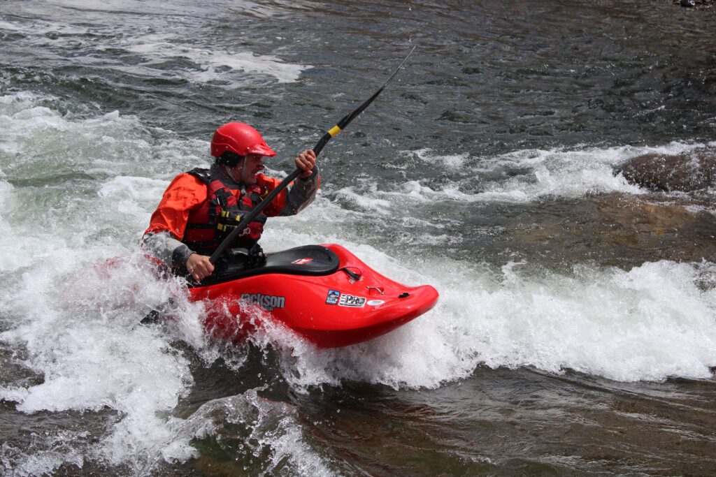
Unlike other traditional uses of water that require taking water out of streams — such as irrigated agriculture, cities and industry — a RICD isn’t really a diversion at all. It is meant to keep water in rivers by tying a water right to a manmade river feature, most commonly the waves in whitewater parks.
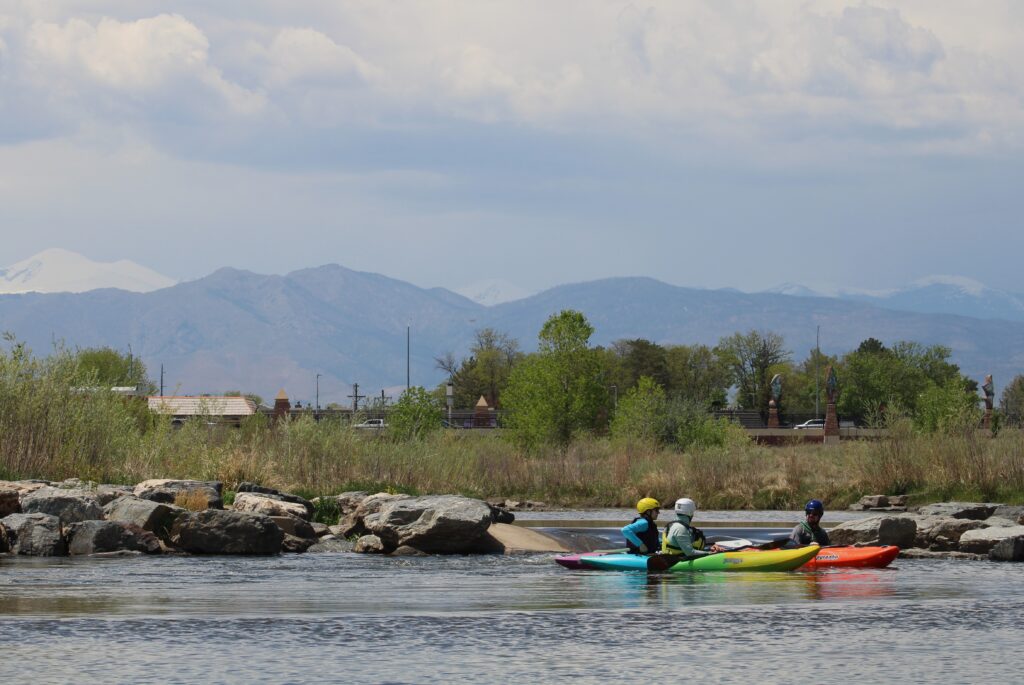
More than two decades after Porzak helped the city of Golden acquire the state’s first RICD, 21 local governments in Colorado now have water rights for recreation. About half of these towns have built whitewater parks around these water rights. The Town of Vail’s RICD has been an integral part of the GoPro Mountain Games, an early-summer celebration of mountain sports competitions, with four kayaking events in the whitewater park in Gore Creek.
Vail’s RICD, which the town secured through the Eagle River Water and Sanitation District, dates to 2000. Instead of building immovable concrete structures in the river, as many other communities have done, the Vail Whitewater Park has a series of adjustable, inflatable bladders that create waves at different flow levels. The games draw thousands of athletes and spectators to Vail each June. And a popular Tuesday night race series brings kayakers from around the region.
But determining the value that these RICDs — or river recreation in general — bring to the state’s outdoor economy is difficult. According to the Colorado River Outfitters Association, the total industrywide economic impact for 2023, the most recent year for which data is available, was $215 million. But that figure is only from commercial river trips.
“We don’t have good numbers on economic benefit data coming from private use,” said Nathan Fey, former director of the Colorado Office of Outdoor Recreation and former Colorado stewardship director at American Whitewater. “People come from all over the West to spend money on gas and food and beer and ice, and those numbers are never captured in an economic impact report.”
Protection from future water development
Some say the value of a recreation water right can’t be measured in dollars, but it’s a legal tool that can be used in other ways. One could be to prevent future water development on a particular stream.
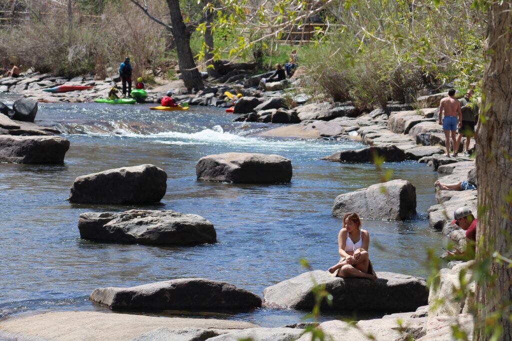
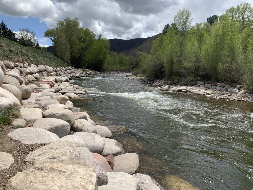
For Pitkin County Healthy Rivers, the main goal of securing a RICD water right for two manmade waves in Basalt was always to keep water in the Roaring Fork River.
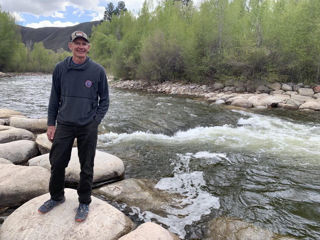
Boater and retired science teacher Andre Wille has been on the Healthy Rivers board, whose mission is to improve water quality and quantity, since its inception in 2008.
“It is true that we weren’t looking to build a whitewater theme park that was just to draw in boaters,” Wille said. “Our primary goal was to get this water right that would keep water in the Roaring Fork in perpetuity.”
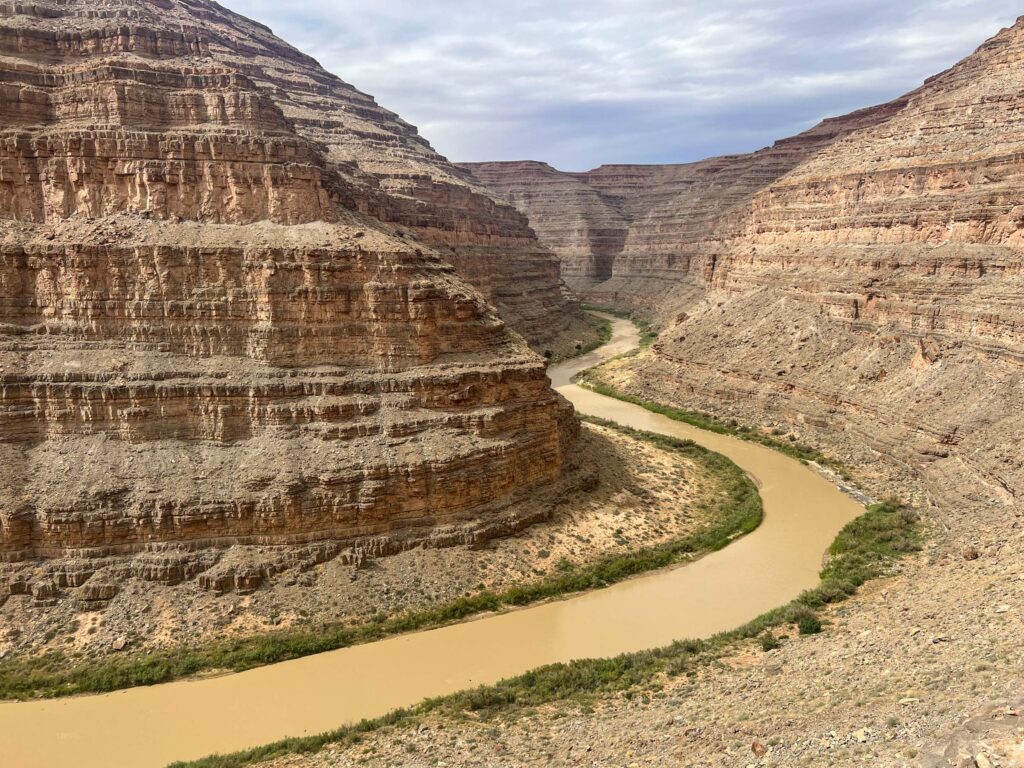
The Pitkin County River Park was one of the biggest and most expensive multiyear projects that the board has undertaken. Keeping water flowing west is an especially important goal for Pitkin County and the communities along the Roaring Fork because about 40% of the river’s flow is taken from the headwaters in what’s known as a transmountain diversion, to be used by cities and farms on Colorado’s fast-growing Front Range.
“The transmountain diversions are one of the biggest threats because of the amount of water that they can divert,” Wille said.
Securing a RICD saves a place in line for recreational water use in Colorado’s system of prior appropriation where the oldest water rights get first use of the river. Therefore, Pitkin County’s RICD could limit how much additional water transmountain diversions can take from the Western Slope in the future because this water is already spoken for.
Challenges and limitations
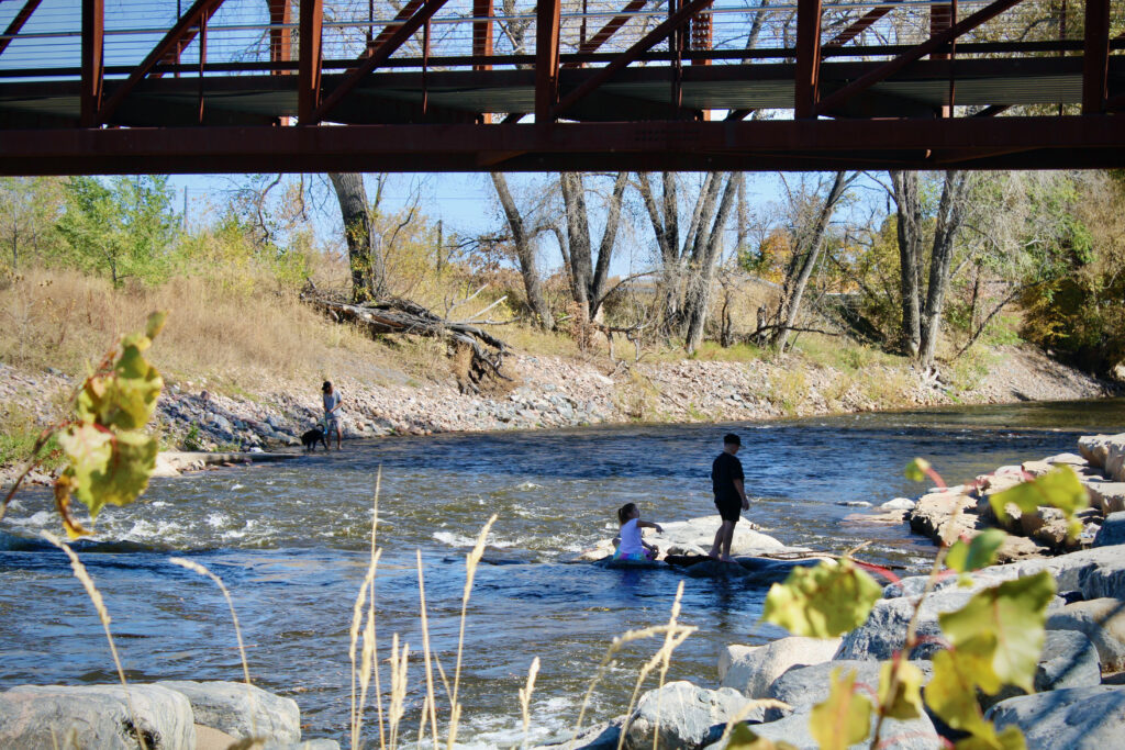
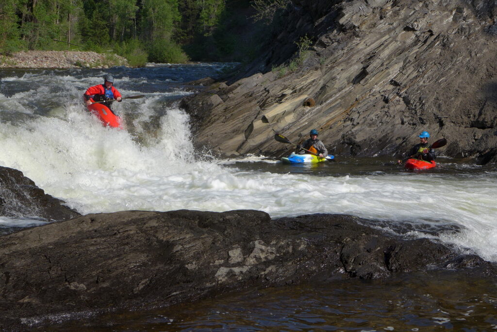
But the road to a RICD hasn’t been easy for Pitkin County. The county has spent more than $3.5 million on the park, an amount that included, among other things, building the waves and then modifying them twice after high flows turned them into dangerous holes that regularly flipped boats.
“We’re doing our best to make it safe,” Wille said. “But at high water, the river changes dramatically, and things that you would never think are dangerous suddenly become dangerous.”
Part of this is simply the unpredictable nature of building concrete features in a dynamic river channel. But it also highlights the limitations of a RICD water right, which must be tied to an artificially constructed wave instead of a naturally occurring rapid or stretch of river. If communities want water for recreation, they must build the costly waves themselves.
“I think the current statute is a bit archaic,” Fey said.
In 2021 and 2022, American Whitewater and other groups twice lobbied the state legislature to expand this narrow definition. First, they proposed tying a RICD to an already existing natural river feature such as a rapid; the next year, they sought to allow municipalities to create a “recreation in-channel values reach,” where they could then lease water to boost flows in the segment during certain times.
These were attempts to adapt the RICD statute to new forms of river recreation — mostly day floats on sections of rivers — that have outpaced the popularity of kayak playboating in whitewater parks.
“The early aughts to, like, early 2010s was where that type of whitewater recreation was popular, this rodeo surf river feature,” said Hattie Johnson, southern Rockies restoration director with American Whitewater. “We’ve seen kind of a big shift away from that.”
But Colorado lawmakers weren’t convinced that the RICD statute should be changed. Both bill proposals failed.
In some cases, if a local government wants to secure a RICD, it must also make concessions to future water users by agreeing to allow a certain amount of development before they can exercise their legal authority to call for water. In Pitkin County’s case, officials agreed to allow 3,000 acre-feet of additional water development to cut them in line. That cap was reached in 2024, effectively pushing the county’s priority date back 14 years from when it filed for the rights in 2010.
Fey said these types of “carve-outs,” which allow for future water development, go against the cornerstone of Western water law: the system of prior appropriation, also called first-in-time, first-in-right.
“There is a subordination clause in many of the decrees associated with RICDs,” he said. “That’s a point of contention for a lot of people in the river conservation space that look at RICDs as a tool for long-term protection.”
Besides limiting future water development, the main way a RICD can keep water in rivers is by using its legal authority to force others to stop using water. When a water right isn’t getting all the water to which it is entitled, it can place what’s known as a call and force upstream junior water users to cut back. The problem is there aren’t that many big water rights younger than RICDs — which carry dates from the late 1990s to 2013 — that could cut back enough to make a difference.
None of the 13 RICDs on the Western Slope have ever placed a call, according to the state Division of Water Resources.
“[RICDs] are very, very close to the end of the line, which means all other uses that are more senior to that date get their water first,” Johnson said. “So the utility of a recreational in-channel diversion really comes in to protect that reach of river from further development.”
Are RICDs worth it?
With all these expenses, challenges and limitations of RICDs — and the difficulty of directly quantifying their economic benefit — it’s worth asking whether they have proved worthwhile for the communities that have gone to the trouble of securing them.
Johnson said the real value of RICDs is in giving a voice to the river recreation community. They may be an imperfect tool, but they are an important one. For the first 150 years of Colorado water management, agriculture and cities held all the decision-making power when it came to how water was used. That may be slowly changing as outdoor recreation becomes more important to Colorado’s culture, identity and economy.
RICDs have expanded cultural perceptions of how Colorado’s water is best used, and water for recreation is now an acknowledged beneficial use of a public resource.
“Both the environment and recreation are extreme newcomers to that table, but have a seat now,” Johnson said. “I think RICDs have helped to do that.”
Despite the challenges and limitations of a RICD water right, Wille said building the Pitkin County River Park was still worth the expense to taxpayers. He feels good about the county’s effort to protect river flows as it confronts a warmer and drier future, and water becomes scarcer.
The project also included upgrades to the Fisherman’s Park boat ramp, a new boardwalk and tiers of large streamside boulders where people can lounge or eat lunch next to the waves. The park represents a connection between the community and its local waterway.
“It’s been, I think, a very wise investment and a very good use of our fund that we have for protecting rivers,” Wille said. “That’s one of our goals: to try and acquire water rights and keep water in the river. This is one of the few ways that we’ve been able to do that. So, yes, I think it’s been money well spent.”
This story is part of a series on river recreation in Colorado, produced by Aspen Journalism, KUNC and The Water Desk at the University of Colorado Boulder.