
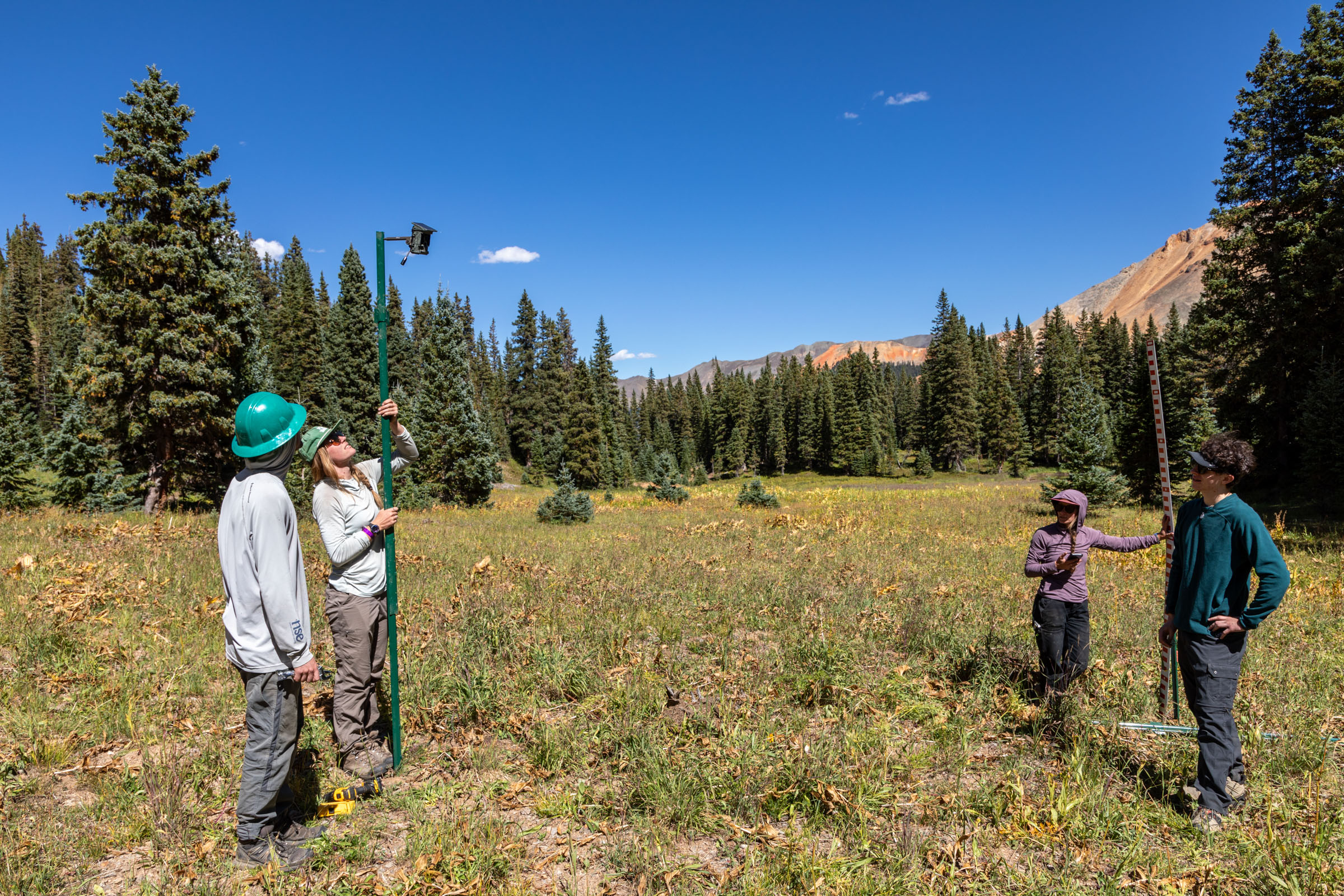
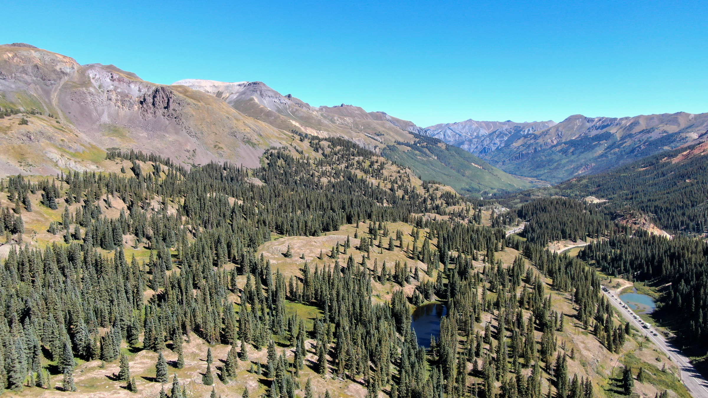
RED MOUNTAIN PASS, COLORADO – On a sunny day in September, with the leaves starting to turn more than two miles above sea level, scientists and volunteers hauled metal stakes, tall measuring sticks and simple trail cameras into Colorado’s high country to seek answers to pressing questions about forests and the snowpack.
Surrounding them were bald peaks, some exceeding 13,000 feet, that would soon be buried in the seasonal accumulation of snow. The snowpack serves as the foundation of the state’s water supply and a critical water source for tens of millions of people in 18 other states and Mexico, plus millions of acres of crops.
Despite the snowpack’s importance in Colorado and elsewhere, scientists still struggle to accurately measure how much snow is out there–and how much water it contains–as climate change threatens to further diminish the frozen reservoir that so many rely on.
In a region with complex weather and roller-coaster topography, each storm dumps a unique pattern of precipitation, favoring some mountains over others, and leaving behind vastly different snow totals due to such factors as elevation and the wind’s direction.
But even in an area as small as a single backyard, how the snow accumulates on the ground–and how long it sticks around–can vary tremendously depending on the presence of trees, shade and other features, posing challenges for traditional monitoring approaches.
“Snow distribution is very heterogeneous, so that means it’s very different within small spatial scales,” said Jake Kurzweil, a hydrologist and associate director of water programs at the Durango, Colorado-based Mountain Studies Institute.
Kurzweil was in a sunny clearing next to a stand of conifers, taking a break as his colleagues arranged stakes and pounded them into the ground of the heavily shaded forest, the sound of clanking metal mixing with the incessant barking of a squirrel.
“If we just move 20 meters to our south here,” he said, “we’re actually going to have quite a different snowpack than where we’re standing right here.”
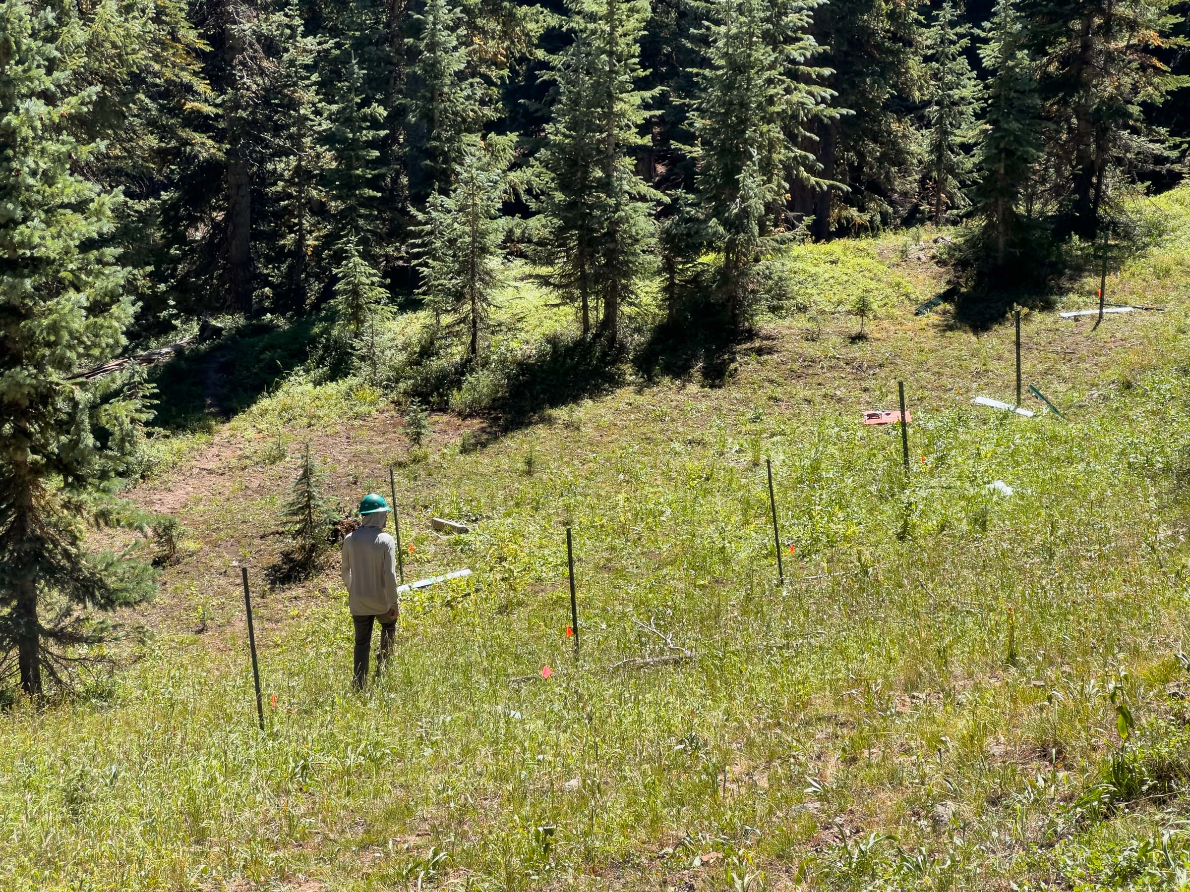
This corner of the rugged San Juan Mountains features a diversity of conditions even without human influences. But in Colorado and around the West, land managers are making their own mark on forests by pursuing projects that remove trees before a wildfire strikes, improve wildlife habitat and support scenic or recreational goals, all of which can affect the way snow accumulates and dissipates.
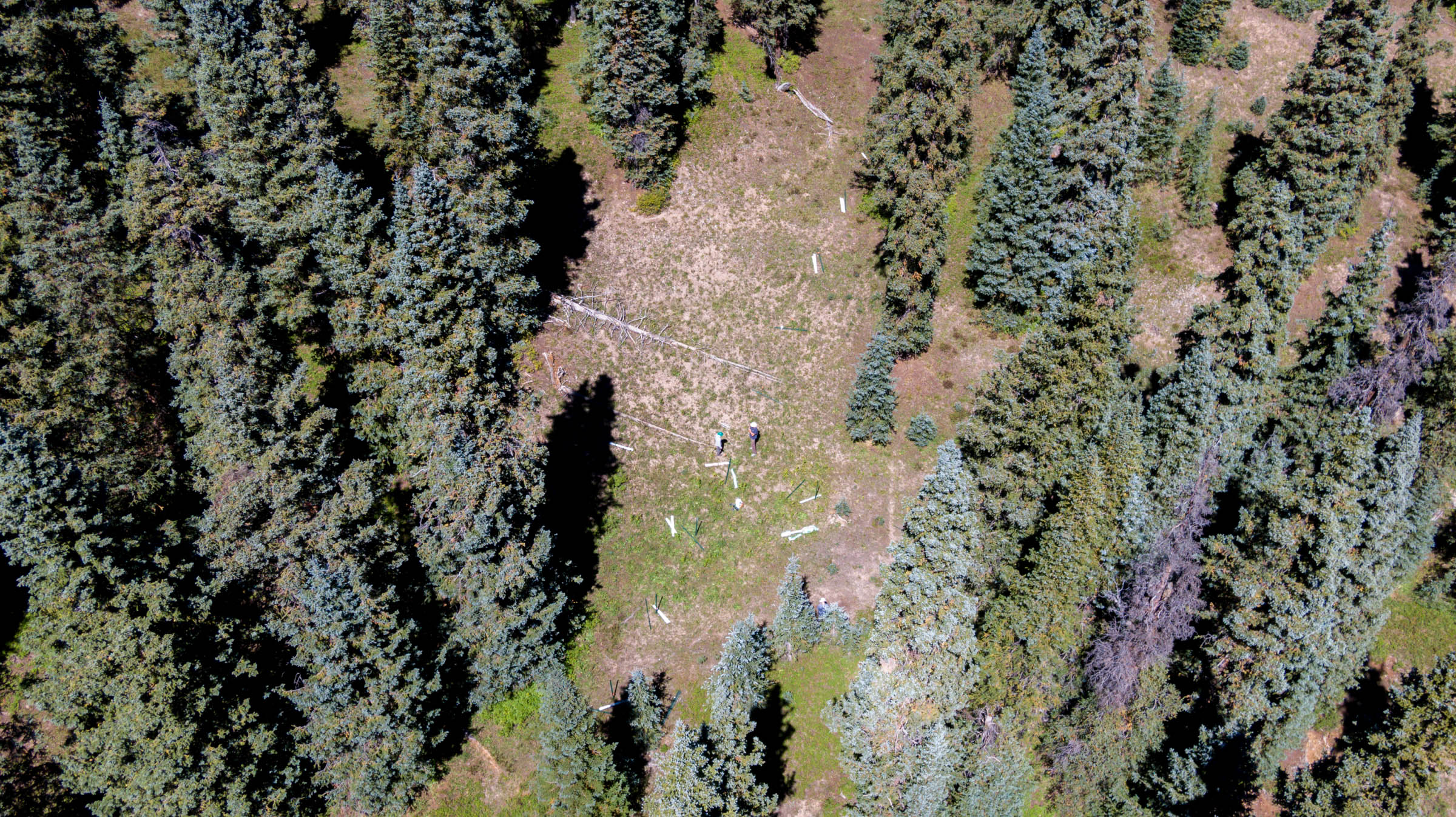
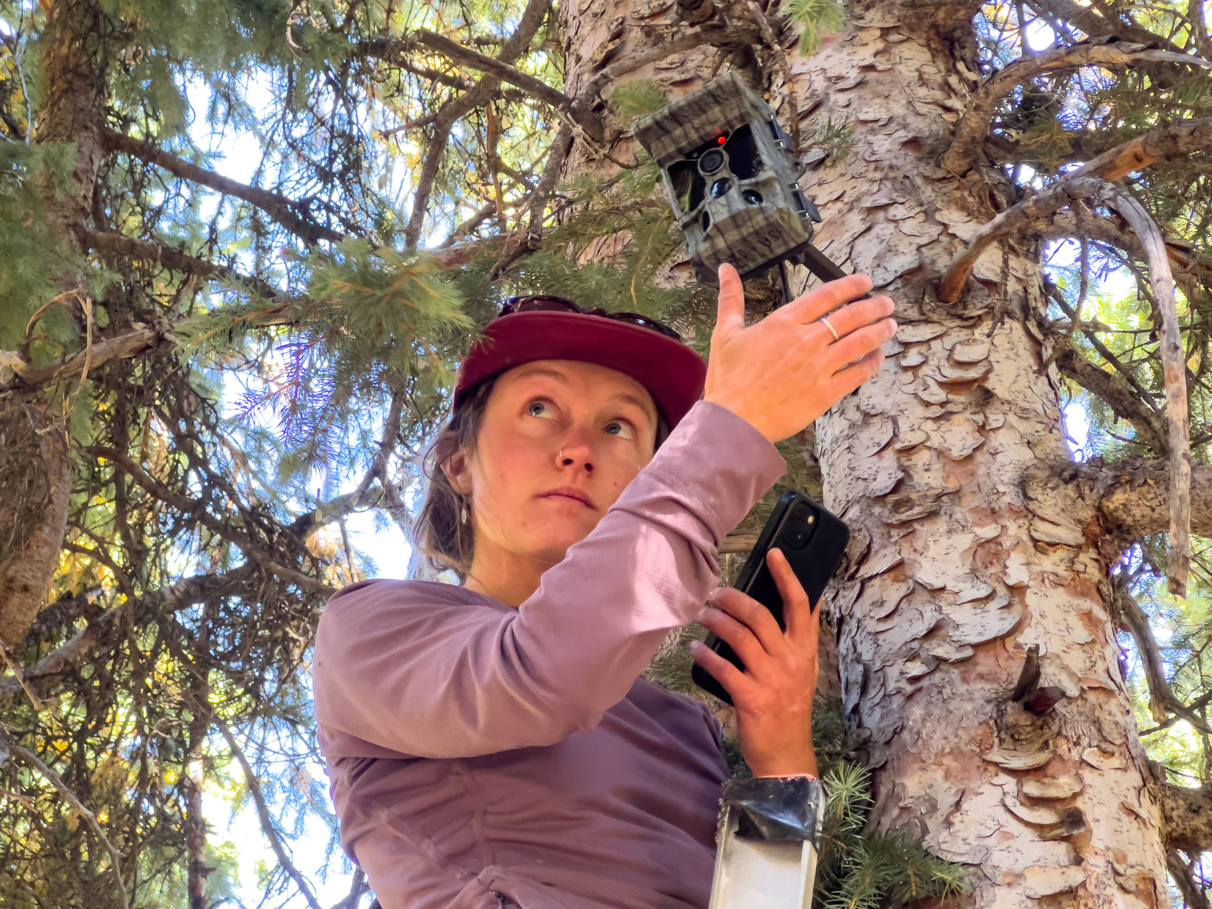
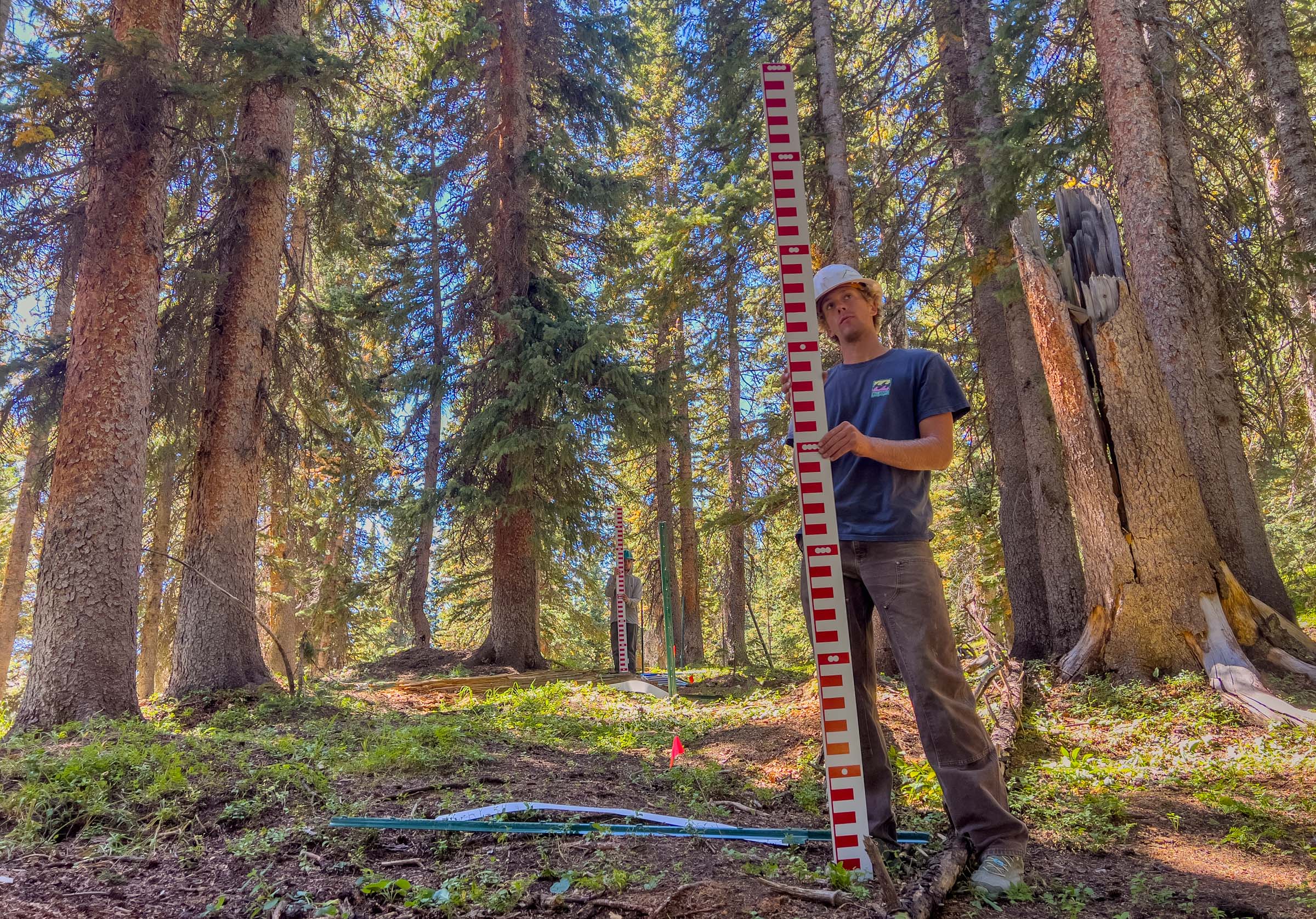
To understand how such treatments influence the snowpack, and to inform land-management decisions, researchers are looking to “snowtography,” an emerging approach that relies on automated trail cameras snapping repeated photos of the snow’s depth across a series of points on a straight line known as a transect.
“Snowtography is not a new technology but rather a novel application of fairly simple components,” according to a 2021 handbook produced by The Nature Conservancy, Western Water Assessment and U.S. Department of Agriculture’s Agricultural Research Service. The free publication explains how anyone can build and install their own snowtography equipment using materials from a hardware store and inexpensive cameras. (The handbook was funded by the Walton Family Foundation, which also supports The Water Desk.)
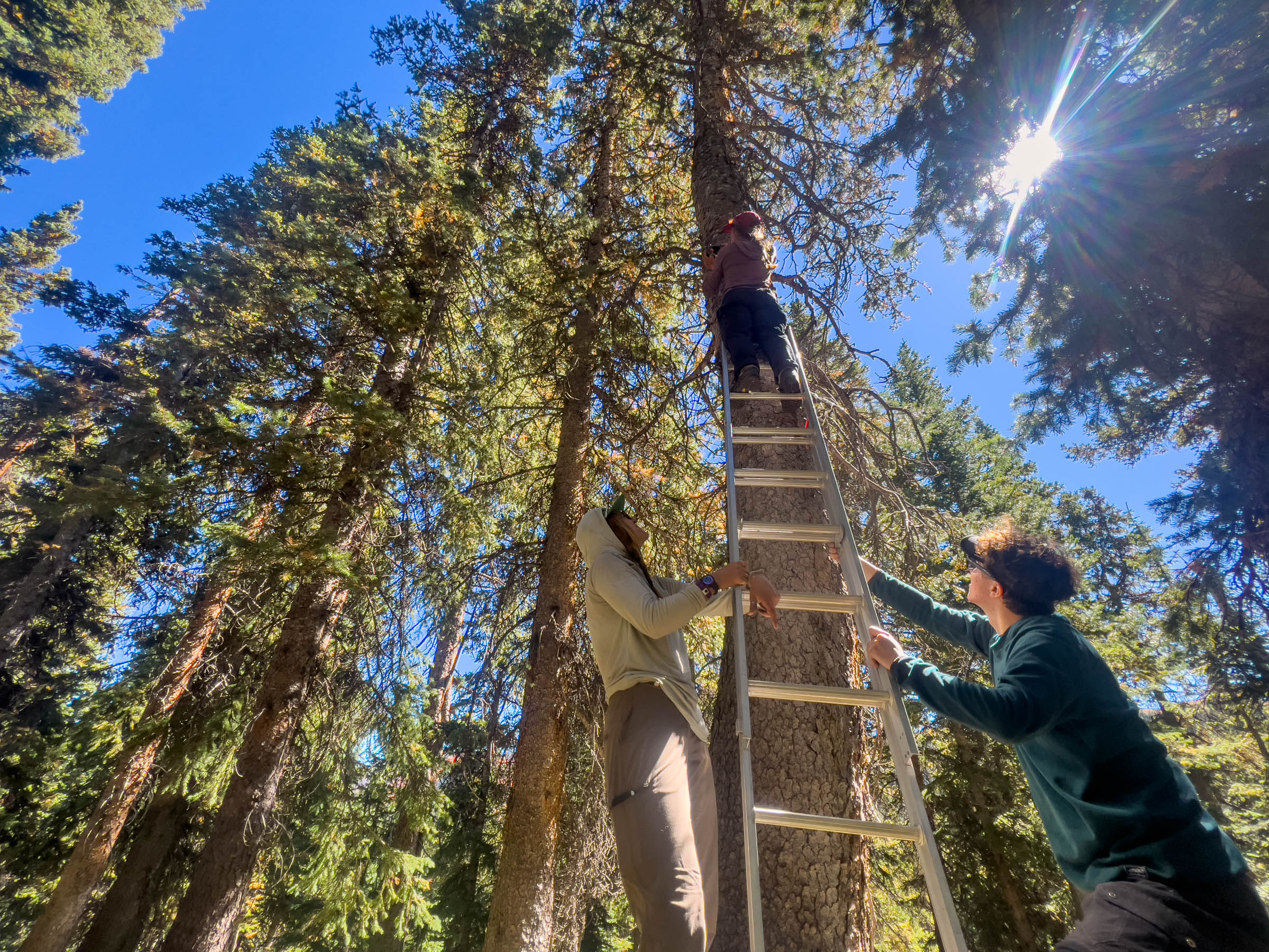
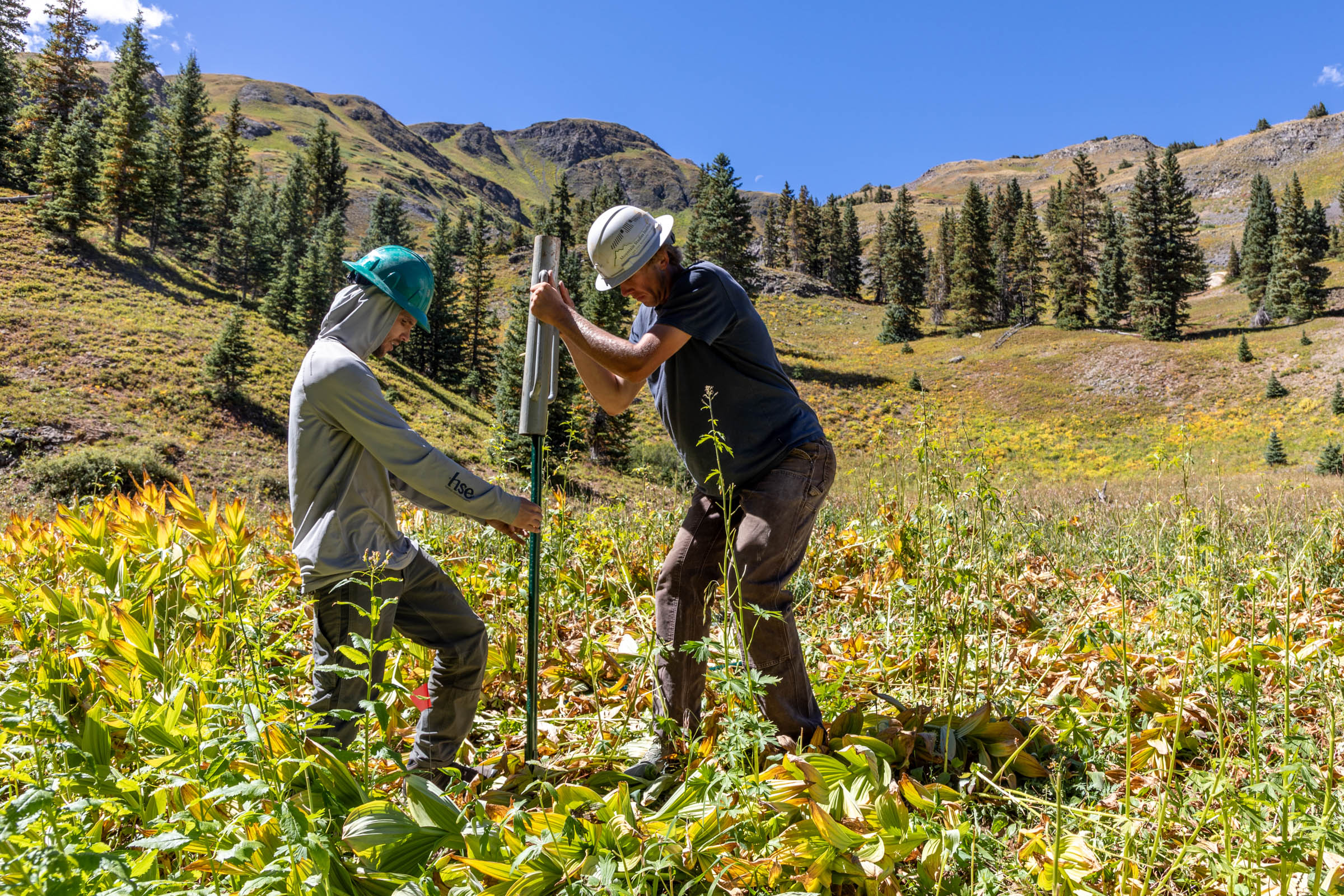
As Kurzweil and others set up the stakes for the measuring sticks along the transects, Haley Farwell, a graduate student at Northern Arizona University, scaled a ladder to gingerly fasten cameras to the trunks of trees with screw-in mounts and carefully adjust the angle of the lenses so they targeted the stakes.
“I have a climbing background, so it’s not so bad for me,” said Farwell, whose master’s thesis will use data from the site to study the connection between forests and the snowpack.
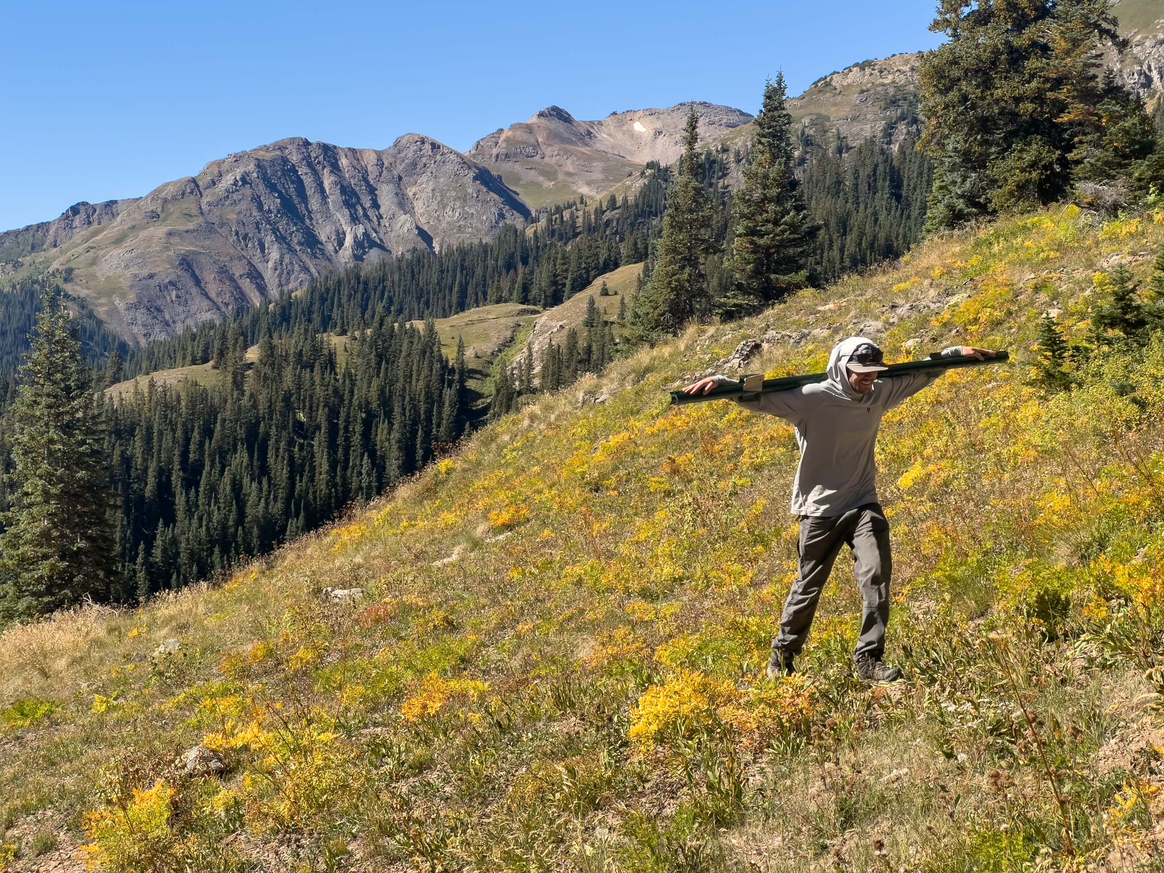
Parker Randles, a sophomore at Fort Lewis College in Durango who is working toward his Snow & Avalanche Studies Certificate, had another demanding job: using a post driver to jam the stakes into the ground, which was sometimes unforgiving due to buried rocks.
“There were some rough spots, but overall it went pretty smooth,” said Randles, a ski patroller who said he was interested in the project because “snow is super cool to me.”
Even if a transect is short enough for someone to throw a snowball from one end to the other, the depth of the snow along that line will be anything but uniform. In fact, the researchers have deliberately chosen sites where conditions change markedly over short distances so they can understand how this variability affects the snowpack.
“Our goals are, one, to improve our understanding of forest dynamics and snowpack, and that’ll help us improve our hydrologic modeling, which will help us improve our water forecasting,” Kurzweil said. “But really the primary goal is to understand and work with forest managers and land managers and the Forest Service to say, ‘Hey, if you’re going to do forest treatments, can we optimize the treatments to accumulate and retain snow?’”
The collaborative effort is meant to complement the existing network of more than 900 automated SNOTEL sites that are scattered across the West and run by the federal Natural Resources Conservation Service. These monitoring stations employ a “snow pillow” filled with antifreeze liquid that can calculate the weight and water content of the snow above. They also measure snow depth and climatic conditions, but the SNOTEL stations can only beam data on a single point, giving a useful yet very limited glimpse at snow conditions.
“Critically, that one location was almost never in the forest. So we had information about snow conditions in open clearings, and not just any open clearings, but usually SNOTELs were located in positions on the landscape where snow persisted for the longest,” said Joel Biederman, a leader in the snowtography effort at the Southwest Watershed Research Center, part of the USDA’s Agricultural Research Service. “Trees have all these effects, and the way that they’re arranged geometrically are what we would call the 3D forest structure. It matters.”
In addition to gathering images from the cameras, scientists will learn about changes in soil moisture and collect data on “snow water equivalent,” the key measure of how much water lies within the snowpack.
“We’re really accountants for water, if you will,” Kurzweil said. “By having these different data points, it really allows us to quantify how much of that snow is going into the ground, how deep into the ground is it going, versus how much is going into the sky versus how much might be running off.”
Researchers also want to understand what happens to snow at lower elevations as warming temperatures due to climate change threaten to decrease snow cover.
“Historically, a lot of good snow science has been done, but it’s been concentrated disproportionately in places that are cold, high-elevation, get lots of snowfall and have what we would call a stable seasonal snowpack,” Biederman said. “There’s an increasing prevalence as winters are warming of ephemeral snowpacks in places that used to have stable snowpack at kind of moderate elevations or lower latitudes, like here in Arizona.”
Across the West, scientists are employing and exploring a variety of technologies to improve the accuracy of snowpack monitoring, including shooting lasers out of planes and using satellites to aid in measurement. But even with a much clearer picture of how much snow is on the ground on April 1, a key date for the Southwest’s seasonal water supply, researchers and water managers still face challenges in predicting spring and summer streamflows, particularly in a place like Colorado where April and May can feature major snowstorms and highly variable weather.
“Even if we have perfect snow information and we could absolutely 100% quantify the snow at any time, we will still have runoff forecast uncertainty from the weather component alone. We don’t know on April 1st how the rest of spring is going to play out,” said Jeff Lukas, an independent climate researcher formerly at the University of Colorado Boulder who isn’t involved in the Colorado snowtography project.
While SNOTEL has limitations, it’s still the “essential backbone of snowpack monitoring and will remain so,” Lukas said. The Rio Grande Basin has been the “classic example in which SNOTEL has not worked as well” in predicting subsequent streamflows, Lukas said, possibly because the monitoring sites don’t capture the variability in the landscape. “Because of where they are and where they aren’t,” he said, “you can get a misleading picture in more years than in other basins where SNOTEL tends to work pretty reliably, at least at peak (snowpack).”
The nearly $250,000 in funding supporting the two new snowtography sites in Colorado, each with dozens of sampling locations, is comparable to the cost of building, permitting and installing a single new SNOTEL station, but the snowtography funding also covers two years of monitoring and scientific research.
Funding for the project comes from the Southwest Water Conservation District, The Nature Conservancy, Town of Silverton, Northern Arizona University, Colorado Water Conservation Board and San Juan Headwaters Forest Health Partnership.
Other partners in the Colorado project include the Mountain Studies Institute, Fort Lewis College, USDA Agricultural Research Service, Dolores Water Conservancy District, Dolores Watershed Resilient Forest Collaborative, Center for Snow and Avalanche Studies and Western Water Assessment.
Researchers also have installed snowtography equipment in other Western states, including Arizona and Wyoming.
“Things are growing rapidly. We now have 15 snowtography stations averaging about 40 or 50 measurement locations. So daily snow depth at 40 or 50 points times 15,” said Biederman. “It’s our goal to get to where we’re actually informing management, but we’re not there yet.”
The Water Desk’s mission is to increase the volume, depth and power of journalism connected to Western water issues. We’re an initiative of the Center for Environmental Journalism at the University of Colorado Boulder.


