Streets are empty in Central City, with casinos shuttered and hundreds of workers laid off. The pandemic is bad news for the state’s new sports-betting tax, which was to have helped fund the Colorado Water Plan. April 21, 2020. (Credit: Jerd Smith)
If you’ve watched TV in Colorado lately, chances are you’ve been bombarded with commercials for various sports betting platforms. Now, as you surf the internet, you might also see ads connecting the state’s newly legalized sports betting industry with funding for Colorado water projects.
The new #WaterWins ad campaign, paid for by the Environmental Defense Fund, aims to solidify the link between sports betting and water in Colorado. The targeted digital advertisements feature phrases like, “Want to help Colorado’s rivers, lakes and streams? You bet,” and, “A surefire winner when you bet on sports? Colorado water.”
Last November, Colorado voters agreed to legalize and tax sports betting with the passage of Proposition DD. The 10 percent tax is paid by sports betting operators based on their profits, not by bettors on their winnings.
The majority of the new tax revenue will help support Colorado’s Water Plan, a comprehensive vision for the state’s water future created in 2015. Some of the revenue will also be used for problem gambling services, including a problem gambling hotline.
“Similar to Great Outdoors Colorado, where there’s a connection between the [Colorado] lottery and parks and open space, we’re working to solidify that connection between sports betting and Colorado’s Water Plan,” said Brian Jackson, senior manager of western water for the Environmental Defense Fund.
Jackson declined to share how much the organization is spending on the ad campaign, but said it was “pennies compared to anything political.”
The goal of the campaign isn’t necessarily to encourage more sports betting, but rather to continue the conversation that Proposition DD started, Jackson said.
“We’re just having a little fun with it,” he said. “Colorado loves its sports. It’s just a different way to talk about water, an issue that’s really, really important to the state, and connect it to the actual law and revenue source itself.”
Sports betting made its Colorado debut on May 1 in the midst of the coronavirus pandemic, which effectively shuttered sports around the world. Even so, Colorado bettors wagered an impressive $25 million in the first month, which netted the state a little more than $96,000 in tax revenue.
Since then, Colorado sports betting has continued to grow in popularity, especially with more and more teams taking the field as coronavirus restrictions are lifted. Colorado bettors wagered $38 million in June, a number that leaped up again to nearly $60 million in July. State gaming officials are still calculating August numbers.
Even though sports betting launched in Colorado during an especially difficult time — when there were very few sports events to bet on — the rapid growth in recent months is promising, said Dan Hartman, director of the Colorado Division of Gaming.
“It shows the entertainment of sports betting is being embraced by Colorado folks,” said Hartman. “I don’t know if they don’t have anything else to do during the pandemic, but they’re certainly embracing it and following the different sports that are available. Overall, it’s been successful and received really well.”
In May, June and July, sports betting sent more than $555,000 in tax revenue to the state. So far none of that money has been funneled into water projects, but that’s not a surprise. The gaming division first needs to pay back the $1.7 million allocated by state legislators to get the new sports betting program up and running.
Tax revenue should begin flowing to water projects and other beneficiaries in the fall of 2021, after a full fiscal year of operations, Hartman said.
Moving forward, the sports betting program’s operating costs will be paid for with fees from licensed sports betting operators in the state. (Today, there are 10 online operators and eight retail operators licensed by the state, with capacity to add more.) This means that more of the tax revenue can go directly to water projects and other beneficiaries, Hartman said.
It’s still too early to say exactly how the revenue will be used, according to Colorado Water Conservation Board spokesperson Sara Leonard, but eventually it will help fund water-related grants within five categories: agriculture; conservation and land use; engagement and innovation; environment and recreation; and water storage and supply.
“If anything, it will take a couple years of actually seeing that revenue come in to really determine how it can be used,” Leonard said.
Meanwhile, the Colorado Water Conservation Board continues to look for creative solutions for more secure and permanent funding for the Colorado Water Plan. Even if sports betting eventually generates the maximum predicted $29 million in tax revenue each year, that’s not nearly enough to close the estimated $100 million annual funding gap for Colorado’s water needs over the next 30 years.
Gov. Jared Polis recently made local water projects one of his “Wildly Important Goals.” He called on the water conservation board to work with partners around the state to create a prioritized database of the costs of 500 ready or nearly ready local water projects by June 2021.
“We are honored that the governor recently prioritized water projects at the basin level as a new Wildly Important Goal,” Leonard said. “We are really now relying on our partners across the state to help us find these creative solutions to funding smaller-scale, local projects using the resources available.”
Sarah Kuta is a freelance writer based in Longmont, Colorado. She can be reached at sarahkuta@gmail.com.
This story originally appeared on Fresh Water News, an independent, non-partisan news initiative of Water Education Colorado. WEco is funded by multiple donors. Its editorial policy and donor list can be viewed at wateredco.org.
A statewide public effort to determine whether Coloradans should engage in perhaps the biggest water conservation program in state history enters its second year of study this summer, but the complex, collaborative effort on the Colorado River has a long way to go before the state and its water users can make a go/no-go decision, officials said.
On Aug. 26, the Colorado Water Conservation Board (CWCB) will hold a virtual public workshop to unveil some of the key findings from the first year’s work, as well as to gather more input on where to go from here. Another meeting is scheduled for Sept. 2 to brief the agency’s board members and discuss next steps. It will also be open to the public.
More than a year ago, Colorado launched the study involving dozens of volunteer ranchers, environmentalists, water district officials, and others to determine if water users should opt to help fill a newly authorized drought pool in Lake Powell. The concept has been dubbed demand management.
Ken Curtis, general manager of the Dolores Water Conservancy District in Cortez, said farmers in his district remain skeptical of the conservation effort primarily because there isn’t enough clarity about how it would work.
“Clearly, one of the themes of our conversations down here has been momentum. There has been a lot of talk but it’s not out there as a policy with well-defined terms that can be read,” he said. “That tells us that we’re nowhere near a demand management program.”
The 500,000 acre-foot pool, approved by Congress last year as part of the historic Colorado River Drought Contingency Plan, would help protect Coloradans if the Colorado River, at some point in the future, hits a crisis point, triggering mandatory cutbacks in the Upper Basin above Lake Powell.
But finding ways to set aside that much water, the equivalent of what roughly 1 million average Colorado households use in a year, is a complex proposition. Although the concept is still evolving, most agree the voluntary program, if created, would need to pay water users who agree to participate. And it would mean farmers fallowing fields in order to send their water downstream and cities convincing their customers to do with less water in order to do the same.
The Colorado River Basin includes seven U.S. states, Mexico, and more than two dozen sovereign tribal nations. Colorado, Utah, Wyoming and New Mexico comprise the Upper Basin, while Arizona, California and Nevada make up the Lower Basin before the river crosses the U.S.-Mexican border.
The drought pool would belong to Colorado, Utah, Wyoming and New Mexico. Each of those states is examining whether filling it is doable and desirable.
In Colorado, eight demand management work groups involving dozens of volunteers and experts on such issues as agriculture, economics, stream health, and water law met throughout the past year. Among the overarching conclusions to date, based on a report issued in July, is the need for equity between rural and urban communities, the need to analyze environmental impacts and benefits, and the need for a multi-pronged approach to funding such a program, which could include taxes, water-user fees, and cash from the federal government. The CWCB is funding and facilitating the process.
“This has never been done before,” said Russell George, a former Colorado Speaker of the House who helped create the state’s hallmark system of local water governance, where each of its eight river basins, as well as the Denver metro area, is represented by a public roundtable.
“What we’re doing is writing the textbook from whole cloth,” he said.
Bart Miller is healthy rivers program director at Western Resource Advocates, which has participated in the work groups. Miller said the first year of work was noteworthy because no one was able to identify “a fatal flaw. No one came up with a reason this can’t be done,” he said.
Despite the pandemic and deep state budget cuts, the CWCB has enough funding to move forward with another year of work, according to Amy Ostdiek, deputy chief of the Federal, Interstate and Water Information Section at the CWCB. The agency spent nearly $268,000 in the last fiscal year, which ended June 30, and has set aside another $396,000 for the current year.
George said the work done to date represents only the beginning of the collaborative search for a statewide drought protection plan on the Colorado River.
“When we started this, we didn’t want to foretell the answer to the question, ‘What does the end look like?’ I don’t think we’re ready to say yet. This is still the beginning,” George said.
Jerd Smith is editor of Fresh Water News. She can be reached at 720-398-6474, via email at jerd@wateredco.org or @jerd_smith.
This story originally appeared on Fresh Water News, an independent, non-partisan news initiative of Water Education Colorado. WEco is funded by multiple donors. Its editorial policy and donor list can be viewed at wateredco.org.
We delve into water news with Heather Sackett, managing editor at Aspen Journalism, which is covering a variety of issues in Colorado. Topics include an investigative series that explores how investors are banking on the West’s water scarcity, a proposed new reservoir that would export water from the Western Slope to the Front Range, and whether cloud seeding can actually increase snowfall.
Episode highlights
Heather Sackett, Water Journalist at Aspen Journalism Heather is managing editor at Aspen Journalism and the editor and reporter on its water desk. Heather has worked as a reporter at the The Denver Post and she earned her master’s degree in journalism from the University of Colorado. Starts at 0:36
If you’re interested in appearing on the show, please contact Water Desk Director Mitch Tobin at mitchtobin@colorado.edu. If you’d like to share your comments and questions, you can reach us at waterdesk@colorado.edu, or on Twitter and Facebook.
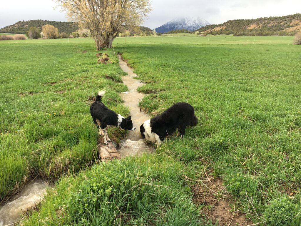
Dogs drinking from a stream on Tony Prendergast’s land in Crawford, Colorado. (Credit: Tony Prendergast)
By Jenna Sampson, Julia Medeiros and Summer Taylor
As the winter snowpack dissolves into spring runoff, Tony Prendergast jumps in his Toyota Tacoma and takes a bumpy ride to the headgate of an irrigation ditch in the West Elk range of southwest Colorado to release its bounty. He’s a cattle rancher and president of a ditch company that manages the water for roughly 2,000 acres, including his own, that have rights to its flow.
Like an old-time sheriff, with a greying beard and calm demeanor, Prendergast patrols the canal and tries to ensure that the ditch operates smoothly and fairly. But there’s no outlaw here to test the speed of his draw, only busy beavers building dams and forest debris in need of excavation.
Seemingly modest and hidden waterways like the ditch that Prendergast manages have become lightning rods since the Trump administration earlier this year issued a new rule that redefines what constitutes “navigable waters,” also known as “waters of the United States,” which are federally regulated under the landmark 1972 Clean Water Act. The new rule also strips away requirements for landowners to secure approval from the Environmental Protection Agency to make certain changes to their private lands.
The Trump administration’s new rule, which went into effect in June, narrows the federal government’s oversight by excluding from federal jurisdiction ephemeral streams and wetlands that are not adjacent to larger, permanent bodies of water. The change is estimated to reduce protections for more than half of all U.S. wetlands and at least 18% of all streams, according to an internal EPA presentation in 2017 that was obtained by E&E News.
In 2015, the Obama administration placed the “ephemeral stream” classification under federal jurisdiction in its “Waters of the United States” (WOTUS) rule, also known as the Clean Water Rule. Ephemeral waterways only run a few times a year, after snowmelt or big rainstorms, but they can be connected to other water bodies, either through underground or surface connections. Regardless of those connections, they are not federally protected by the Trump administration’s Navigable Waters Protection Rule, which effectively repealed the 2015 water rule. The rule-change is one of dozens of rollbacks under the Trump administration of Obama-era environmental regulations.
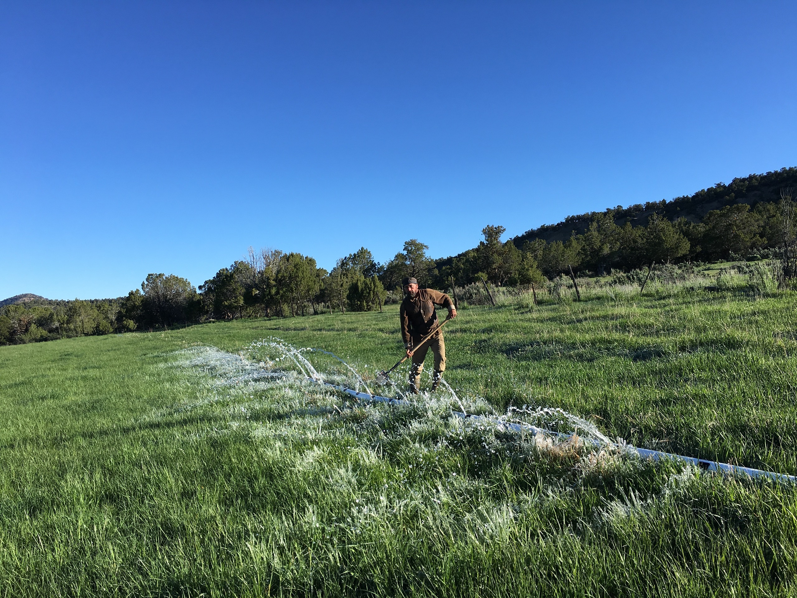
Tony Prendergast irrigating his land in Crawford, Colorado. Water from the ditch on his property flows into the Smith Fork River, a tributary of the Gunnison River, which leads to the Colorado. (Credit: Tony Prendergast)
“I think they’re setting us way back,” said Prendergast in an interview, referring to the succession of new rules enacted by the Trump administration that diminish environmental regulations. “I don’t see any balance in their approach at all. This seesawing of policy and executive orders I think is detrimental to lasting change.” The specific water-rule change, which is now in litigation, so far hasn’t impacted his ditch or on how he runs his ranch, he added.
The new Trump rule has drawn both condemnation and praise. In the Colorado River Basin, environmentalists are concerned that the government is deregulating ephemeral streams, many of which flow from snowmelt in the mountains and contribute a huge portion of the overall water supply.
The EPA’s own Scientific Advisory Board published commentaryon the rule in December 2019, concluding that the then-proposed rule “does not incorporate best available science.” That science includes a comprehensive 2015 EPA reporton the connectivity of streams and wetlands, which directly informed Obama’s WOTUS rule that same year. The report shows that the pollution of ephemeral streams can cause a negative ripple effect throughout watersheds because many of the streams eventually join larger waterways.
“Our nation’s majestic waterways depend for their health on the smaller streams and wetlands that filter pollution and protect against flooding, but the Trump administration wants to ignore the science demonstrating that,” Jon Devine, director of federal water policy at the Natural Resources Defense Council, said in a press release in Aprilannouncing a lawsuit by NRDC and several other environmental groups against the U.S. EPA and U.S. Army Corps of Engineers.
However, many oil and gas developers, ranchers and farmers welcome the Trump administration’s rule as an overdue reprieve from more stringent Obama-era federal restrictions.
“[The new rule] provides clarity and certainty, allowing farmers to understand water regulations without having to hire teams of consultants and lawyers,” said Zippy Duvall, president of the American Farm Bureau Federation, in a press release in January.
Some cattlemen’s groups, represented by the conservative Pacific Legal Foundation, are challengingthe Trump administration’s new rule for not going far enough to protect landowners and developers.
The controversy continues to play out in court. In May, a coalition of over 17 states and citiesfiled a lawsuitagainst the EPA in a bid to overturn the regulatory changes. Legal experts anticipate that the court battles will drag out well beyond Election Day.
Small streams, big waves
The rule change could have particularly large ramifications in the arid and semi-arid Southwest, where over 80% of all streams are ephemeral or intermittent, according to research from the EPA.
Ephemeral streams “flow during big rain events and big snowmelt events and are frequently dry most of the year, but that doesn’t mean they’re not important,” said Darius Semmens, a physical scientist at the U.S. Geological Survey. He is also an author of a seminal 2008 EPA-funded study that examined the importance of these waterways in the American Southwest.
Ephemeral waterways may not be as charismatic or massive as the Colorado, Columbia or Mississippi rivers, but these smaller water bodies can have an outsized impact on wildlife and humans: More than three out of every 10 Americans get some or all of their drinking water from systems that rely at least in part on intermittent, ephemeral, or headwater streams, according to the EPA.
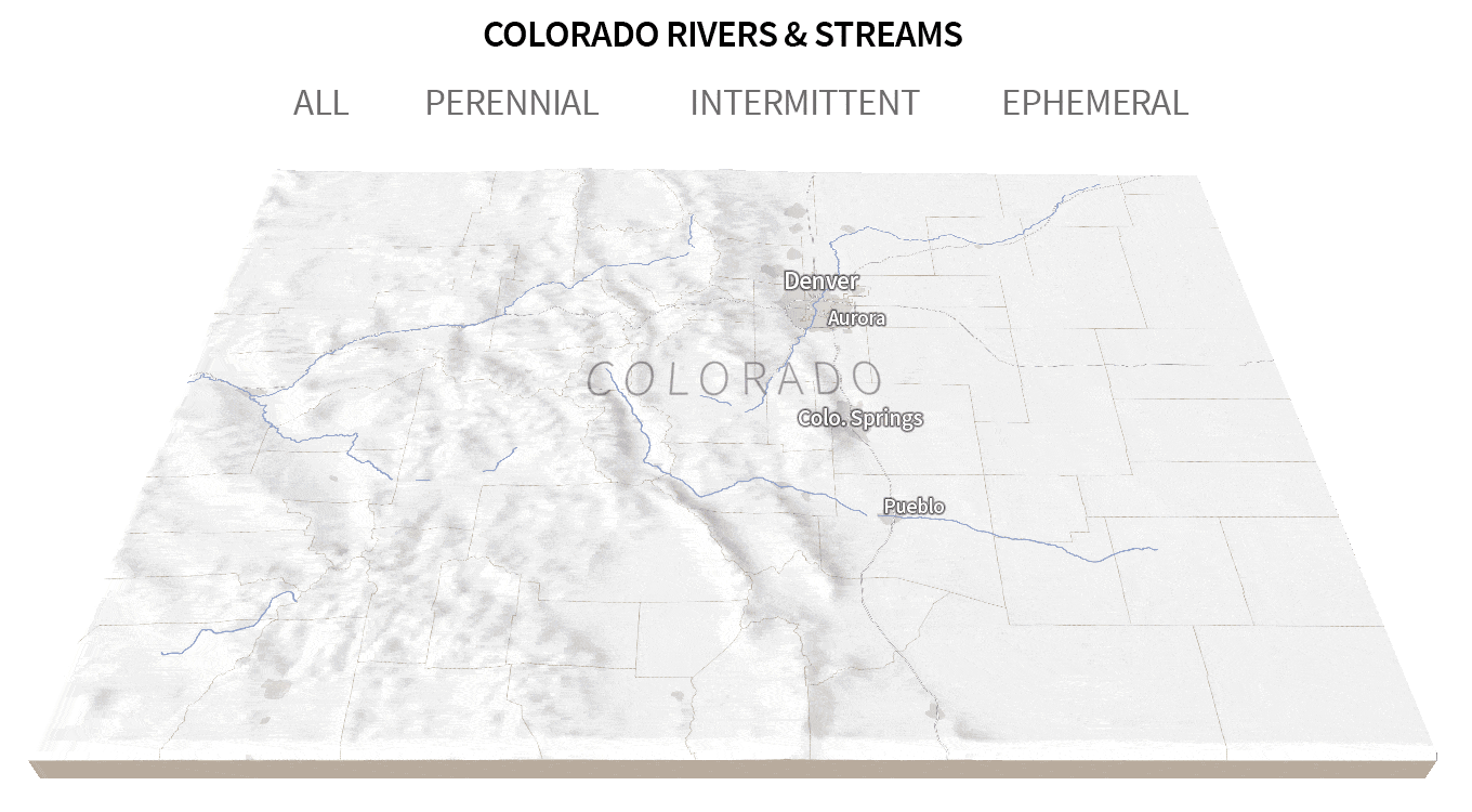
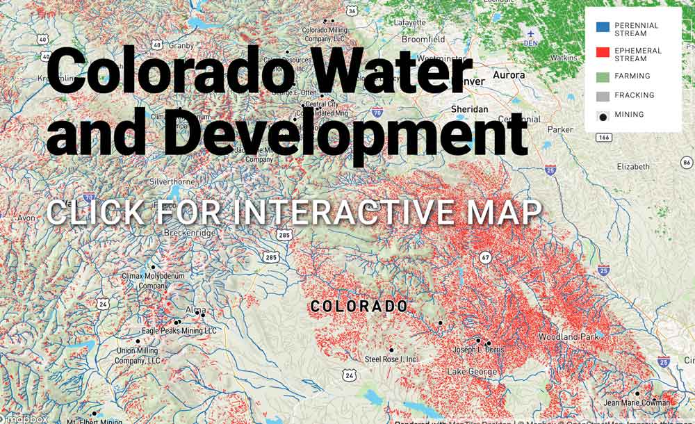
In Colorado, ephemeral streams have mostly only been mapped on U.S. Forest Service land for the purpose of modeling post-fire hydrology. Chris Brown, GIS coordinator for the Division of Water Services in Colorado, says the state has long been concerned about the validity of this data. A separate mapping analysis by Trout Unlimited concluded that ephemeral streams are vastly undermapped across the country. Graphic: The Water Desk; Sources: USGS National Hydrography Data Set; Natural Earth Data.
Semmens and his colleagues concluded in their study that ephemeral streams act in much the same way as their bigger, perennial relatives. They transport nutrients and sediment throughout watersheds, provide valuable animal habitat in otherwise parched places, and recharge groundwater. The abundant ephemeral streams in the Southwest also directly contribute to perennial rivers through runoff, according to Semmens’ 2008 study as well as to more recent research, including a paper published in 2018 in the Journal of the American Water Resources Association.
Many bird species rely on ephemeral streams for refuge in arid regions. The San Pedro River in Arizona is one of these safe havens, a perennial and intermittent waterway supported by a network of ephemeral streams. Birds like the threatened Western yellow-billed cuckoo breed in the biodiversity hotspot of cottonwood-willow forests that the San Pedro and its ephemeral tendrils maintain. An analysis of the Upper San Pedro watershed by Earthjustice, an environmental law organization, estimates that 94% of the stream miles in this watershed will not be protected by the Trump administration’s definition.
“Ecosystem protection would be meaningless and ineffective if these supporting waterways were significantly degraded,” states the 2008 EPA report. The study says these arid ecosystem streams should not be given “second-class status” as compared to the waterbodies of the country’s wetter ecosystems. And yet, environmentalists argue, that’s exactly what’s happening with the new changes.
The ebb and flow of federal authority
The controversy over ephemeral streams taps into long-standing debates over the proper scope of government regulation and whether federal authority over natural resources should be delegated to the states.
“Because water quality, by and large, is regulated by the federal government and water rights are regulated by the state government, you have conflict. So it really touches a lot of hot buttons,” said John Leshy, a professor emeritus at University of California, Hastings College of the Law who served as solicitor of the Interior Department under President Bill Clinton.
Under the Trump administration’s new rule, ephemeral streams fall squarely in the states’ jurisdiction. But some scientists and environmental advocates contest thatstates are not prepared to take on more regulatory responsibility for water quality, and to incur the costs of implementing the regulations.
Darius Semmens at his office in Denver, Colorado. (Credit: Summer Taylor)
“States aren’t geared up to do that management,” said Semmens, the USGS scientist. “They don’t have the necessary expertise and infrastructure.”
The State of Colorado expressed concerns over absorbing this regulatory burden in its commentlast yearon theTrump administration’s revised definition of the WOTUS rule. Some federal funding given to Colorado to carry out Clean Water Act mandates is tied to the amount of water that is federally regulated within the state. A narrower definition of “waters of the United States” could mean less money to do things like issue permits and track compliance. In May, Colorado sued the EPA, arguing that the state expects to take on significant costs to develop its own state permitting program due to the rule change.
The continuous push and pull between federal and state Clean Water Act enforcement stems in part from the language of the act itself. At its inception, the act aimed to protect water quality of “navigable waters,” which it defined as “the waters of the United States, including the territorial seas.” This brief definition left unclear precisely what categories of waterways would be federally protected. Ambiguity has sowed decades of confusion among many farmers, ranchers, real estate developers and fossil fuel producers, as well as states.
Before the Clean Water Act, states oversaw all aspects of water quality and ownership. But in 1970, President Richard Nixon established the EPA in response to public outrage over widespread water pollution and government inaction. Shortly after the Act was signed into law in 1972, the EPA was given the authority to administer the law and implement pollution-control programs—some of which previously had beenregulated by states. For instance, the agency required a permit for any development that could potentially pollute “waters of the United States.”
But the Clean Water Act failed to answer a critical question: What waterways should fall under that federal designation? It’s a riddle that presidential administrations and federal courts have been trying to solve ever since.
The Obama administration’s answer was to create the WOTUS rule to clarify which bodies of water automatically fall under federal protection. The rule placed ephemeral streams and many wetlands within federal jurisdiction. While the preceding George W. Bush administration took a more restrictive approach to Clean Water Act enforcement in some respects, it did not explicitly exclude all ephemeral streams from being federally regulated as the Trump administration’s rule does.
“It goes back and forth and it’s a very important question of who has the authority over water in a state,” said Rebecca Watson, former Assistant Secretary of the Department of the Interior under President George W. Bush. “Some is federal water. Some is managed by the state. Where’s that dividing line?”
Although ephemeral streams are not subject to federal regulation under the new definition of “waters of the United States,” states and landowners must still grapple with the definition of “ephemeral” itself to know which waterways are subject to deregulation and which are not. Could a certain ditch be defined as a tributary, which is federally regulated? Or is it more of an ephemeral stream, which is in the state jurisdiction? Both may have surface connections to bigger, traditionally navigable waters.
This ambiguity makes widespread identification and mapping a challenge. Kurt Fesenmyer, the GIS and conservation planning director for Trout Unlimited, said in a press release earlier this year that a major problem with the Trump administration’s new water rule is “its lack of analysis using good map data to show which streams are subject to the rule change.” He added, “That makes it hard for anyone, whether the administration or the public, to really understand the potential scope of what is at stake.” The organization last year conducted a stream data mapping analysis of the continental U.S., estimating that, on average, one mile of unmapped ephemeral streams exist for every mile of mapped stream in data from the USGS.
Trout Unlimited was one of several outdoors and sporting groups to file an amicus brief in July in support of a lawsuit to overturn the new rule. Because of the gaps in map data, TU claims that the government’s estimate of 18% of stream miles losing protections actually falls woefully short. Scientists from the organization calculated that more than half will be excluded from federal jurisdiction.
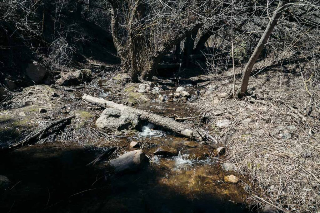
A temporary stream in Colorado. About 44% of Colorado streams are intermittent. These streams are seasonal, but considered more permanent than the ephemeral stream classification. Ephemeral streams only flow episodically, for example after a rain event or with snowmelt. They account for at least 24% of streams in Colorado. (Credit: Summer Taylor)
Confusion flows like water
The murky language of the Clean Water Act opened a floodgate of lawsuits trying to define “waters of the United States.” Some cases have wound their way all the way to the Supreme Court. The most recent major lawsuit in this cascade is Rapanos v. United States, which the Supreme Court took up in 2006. A divided court was unable to produce a majority opinion on whether isolated wetlands fell under federal jurisdiction. Without a majority ruling, the justices provided no definitive recommendation on how to move forward with the WOTUS definition for wetlands.
The Court’s indecision prompted the EPA to take a closer look at how waterways that aren’t permanent are or are not connected to larger, federally regulated waters of the United States. That EPA research would go on to later inform Obama’s WOTUS rule.
XK Bar Ranch, Prendergast’s 260-acre operation, near Crawford, Colo., is part grassland for grazing cattle, part piñon-juniper woodland. Two irrigation ditches run through his land, mainly supplied by the seasonal snowmelt of the Smith Fork River, a tributary of the Gunnison River, which eventually feeds into the 1,450-mile-long lifeblood of the West: the Colorado River.
Prendergast’s ditches are an example of how smaller waterways have implications downstream. The comprehensive report for the Obama-era rule emphasized that while contamination in one modest stream or ditch like Prendergast’s may seem inconsequential, policymakers must consider the cumulative effect of that pollution, which could flow throughout the wider watershed—in this case part of the Colorado River Basin that supplies Colorado, six other states and Mexico.
Federally protected waters have a detailed permit process under the Clean Water Act that evaluates the potential impact on endangered species for any project that discharges dredged or fill material into waters of the United States. A project that even scarcely touches these waters could be fair game, from dams to highways. If ephemeral bodies of water are no longer under federal jurisdiction, then a permit is no longer needed for them. That would leave developers on their own to make sure that their project won’t violate the Endangered Species Act.
Although some developers might celebrate averting this permitting thicket, non-compliance with the Endangered Species Act could come back to bite them. Civil penalties can result in up to $25,000 of fines per violation.
“It should be of concern to the applicants because what it’s doing is it places the liability on them,” said Julia Fonseca, environmental program manager for Pima County, Ariz., where cottonwood-willow forests reside along ephemeral waterways and provide critical habitat for desert species.
Fonseca, who also worked on the 2008 EPA study, thinks that in addition to its implications for Endangered Species Act compliance, the Trump administration’s water-rule change leaves states, including Arizona, “in regulatory limbo as to where the jurisdiction of CWA begins and ends.” Like Colorado, there’s no statewide program in Arizona for regulating the discharge of pollutants like dredge or fill material into streams; the state government relies on the Clean Water Act for guidance. Taking ephemeral streams out from under that federal guidance leaves the state without a road map for regulating and protecting such waterways.
“The Clean Water Act was always intended to be a national sort of floor for state programs,” said Fonseca, noting that in fact states could, and often did, exceed the water-quality standards. “With this change, instead of the Clean Water Act being the national floor for water quality, it’s the ceiling.”
The research done by Fonseca, Semmens and their colleagues disputed the assumption of the Trump administration’s rule that ephemeral streams largely exist in isolation. While these waterways are often located at headwaters that directly flow into perennial rivers at the surface, their channels are also key spots for groundwater recharge. Their streambeds are more porous, allowing water to infiltrate the aquifer below more rapidly than perennial streams. Any contamination in these channels could make its way into aquifers or surface waters that will later be tapped for human use. In Arizona, for example, groundwater accounts for 40% of the state’s water supply.
As November elections draw near, the fate of the Trump administration’s rollback of the Obama water rule is up in the air. If Democratic candidate Joe Biden is elected as president, then his administration could attempt to reverse course and resurrect the Clean Water Rule, or a close proximate, according to Biden’s campaign.
Longform Story CSS Block
Jenna Sampson is a freelance environmental journalist and contributor to The Water Desk. You can find her on Twitter @jennadawn.
Julia Medeiros writes articles and manages social media for The Water Desk. You can contact her at juliacmedeiros.wordpress.com
Summer Taylor is a freelance photographer and videographer. You can contact her at summertaylorvisuals.com
The Colorado River divides Glenwood Canyon slurry on the ridge from the Grizzly Creek Fire on Monday, August 24, 2020. (Kelsey Brunner/The Aspen Times)
By Heather Sackett
The Grizzly Creek Fire in Glenwood Canyon has many people praying for rain. But the very thing that could douse the blaze, which has burned 32,000 acres as of Tuesday, has some experts concerned it also could create problems for downstream endangered fish.
A heavy rain could wash dirt — no longer held in place by charred vegetation — and ash from the steep canyons and gullies of the burn area into the Colorado River. Scorched soils don’t absorb water as well, increasing the magnitude of the flood. And the heavy sediment load in the runoff could suffocate fish. A similar scenario played out in 2018 when thousands of fish were killed by ash and dirt that washed into the Animas River from the 416 Fire burn area.
Downstream from the Grizzly Creek Fire, beginning in DeBeque Canyon, is critical habitat for four species of endangered fish: humpback chub, Colorado pikeminnow, bonytail and razorback sucker.
“Yes, we are very concerned about a fire in that kind of terrain that close to critical habitat. There’s just no question,” said Tom Chart, director of the U.S. Fish & Wildlife Service’s Upper Colorado River Endangered Fish Recovery Program. “There’s a probability we could have an effect all the way down into the 15-mile reach.”
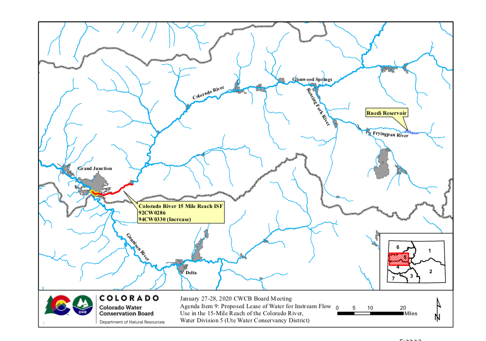
The Colorado River’s so-called 15-mile reach, near Grand Junction, is home to those four species of fish. This stretch often has less water than is recommended for these fish by Fish & Wildlife mainly because of two large irrigation diversions that pull water from the river to irrigate Grand Valley farms: DeBeque Canyon’s Grand Valley Project, which takes water from the river at a structure known as the Roller Dam, and the Grand Valley Irrigation Canal, which takes water from the river near Palisade.
Between these diversions and the confluence of the Gunnison River is a problem spot where water managers constantly work to bolster water levels through upstream reservoir releases. According to Chart, there is currently a total of about 250 cubic feet per second being released from Ruedi, Wolford and Granby reservoirs for the benefit of fish in the 15-mile reach.
With hot, dry weather, a weak monsoon season and the ongoing diversions for irrigation season, which continue into the fall, current river conditions are already stressful for the fish, Chart said. Water managers say they have seen fish using fish ladders to swim upstream and downstream of the 15-mile reach in search of deeper, cooler water.
“As far as concern about the ecological health of the 15-mile reach right now, we are very concerned about conditions there right now,” Chart said. “Native fish do move out of those dewatered stretches in search of better conditions.”
A debris flow on top of these already-challenging conditions could be devastating for fish populations.
“The potential with the Grizzly Creek Fire could be as bad as it gets if we get a rainstorm on top of a low baseflow,” Chart said. “You pray for rain, but at the same time this would be a tough time to get a flow of ash and retardant off the burned area.”
This map shows the 15-mile reach of the Colorado River near Grand Junction, home to four species of endangered fish. Experts are concerned that rain on the Grizzly Creek Fire burn area could create ash and sediment flows that could pose a threat to fish. Source: Colorado Water Conservation Board
Burned area assessment begins
The U.S. Forest Service’s Burned Area Emergency Response team has done a preliminary assessment of the severity of the soil burns to determine where debris flows would most likely occur, according to Lisa Stoeffler, deputy forest supervisor for the White River National Forest.
Areas of concern include Dead Horse Creek, Cinnamon Creek and No Name Creek, among others. More than an inch of rain in an hour — or a quarter-inch in 15 minutes, as occurs in a fast-moving thunderstorm — could trigger a debris flow, the BAER team found.
But this initial assessment, Stoeffler said, is mostly focused on potential impacts to Interstate 70, and water and power infrastructure, not on impacts to the aquatic environment.
“We may look at environment later on, once we have a final footprint of the fire,” she said. “The BAER process is really looking at things that we would need to address because it would cause an emergency-type situation.”
When the Grizzly Creek Fire first broke out, the city of Glenwood Springs switched its municipal water source from Grizzly and No Name creeks, which are near the burned area, to the Roaring Fork River.
“We are concerned about the ash and debris entering the water system and the costs we are going to incur because of this,” said Hannah Klausman, public information officer for Glenwood Springs.
The 15-mile reach of the Colorado River near 19 Road in Grand Junction is home to four species of endangered fish. The Colorado River Water Conservation District is discussing releasing water from upstream reservoirs to help dilute any ash and sediment flows from the Grizzly Creek Fire. (Brent Gardner Smith/Aspen Journalism)
Solution is dilution
Since preventing the dirty runoff from reaching the river would be difficult, if not impossible, in the steep, rocky terrain, the best bet, Chart said, would be tapping into upstream reservoir water to flush sediment and ash.
In other words: The solution to pollution is dilution.
The Roaring Fork River, which flows into the Colorado at Glenwood Springs, also would help dilute the ash and sediment before it got to the 15-mile reach. Some of it would probably settle out before it got there anyway. But that would do little to help native fish populations closer to the burn area. Although not listed as endangered, other species such as flannelmouth sucker, bluehead sucker and roundtail chub also could be impacted.
“We get concerned about the endangered fish the most, but it’s really the entire native fish community we need to be paying attention to,” Chart said.
The Colorado River Water Conservation District has some water in Wolford and Ruedi reservoirs that could potentially be used for a flushing flow. But it would take careful coordination between reservoir operators. And it could be a complicated juggling act to figure out how to accommodate all the different demands for that limited water supply, said River District chief engineer John Currier.
“I think we stand ready to try and figure out how to do something,” Currier said. “It will be a topic of discussion sooner rather than later.”
Managing the impacts of the burned landscape on the fish will be ongoing long after the fire is extinguished.
“I think this is going to be an issue for years to come,” Chart said. “That landscape is going to take a long time to heal.”
Aspen Journalism is a local, nonprofit, investigative news organization covering water and rivers in collaboration with The Aspen Times and other Swift Communications newspapers. This story ran in the Aug. 26 edition of The Aspen Times, the Vail Daily, and Aspen Journalism.
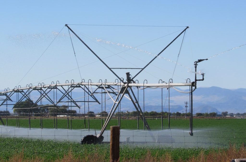
A center pivot irrigates a field in the San Luis Valley, where the state is warming farmers that a well shut-down could come much sooner than expected. Credit: Jerd Smith
The race against time continues for farmers in southern Colorado’s San Luis Valley, with the state’s top water regulator warning that a decision on whether hundreds of farm wells will be shut off to help save the Rio Grande River could come much sooner than expected.
July 28, at a virtual symposium on the Rio Grande River, the state warned growers that they were running out of time to correct the situation.
“We’ll see in the next couple of years if we can turn around this trick,” said State Engineer Kevin Rein. “If we’re not turning it around, we need to start having that more difficult conversation.”
The valley is home to the nation’s second-largest potato economy and growers there have been working voluntarily for more than a decade to wean themselves from unsustainable groundwater use and restore flows in the Rio Grande. Thousands of acres of land have been dried up with farmers paying a fee for the water they pump in order to compensate producers who agree to fallow land.
The San Luis Valley, which receives less precipitation than nearly any other region in Colorado, is supplied by the Rio Grande, but under the river lies a vast aquifer system that is linked to the river. It once had so much water that artesian springs flowed freely on the valley floor.
As modern-day farmers began putting powerful deep wells into the aquifer, aquifer levels declined, and flows in the river declined too as a result, hurting the state’s ability to deliver Rio Grande water downstream to New Mexico and Texas, as it is legally required to do.
Between July 2019 and July 2020 the valley’s unconfined aquifer, which is fed by the Rio Grande River, dropped by 112,600 acre-feet. All told the aquifer has lost around 1 million acre-feet of water since the drought of 2002.
Through a plan written by growers in the valley and approved by the state in 2011, farmers had 20 years, from 2011 to 2031, to restore the aquifer. But multiple droughts in the past 19 years have made clear that the region can’t rely on big snow years to replenish the valley’s water supplies because there are fewer of them, thanks to climate change.
“So what is the future, the short-term future, if we can’t count on climate? And let’s admit we can’t,” Rein said. “If climate’s not cooperating the only thing that can be done is consuming less water.”
Adding to pressure on the region is a proposal by Denver developers to buy thousands of acres of the valley’s farm land, leaving some of the associated water rights behind to replenish the aquifer, while piping thousands of acre-feet of water northeast to the metro area.
Rein said drastic steps, like drying up more fields and sharply limiting how much growers can pump, are needed. But this could result in bankruptcies and could cripple the valley’s $370 million agriculture economy, which employs the majority of workers in the region. Worse still, though, would be the shutdown of all wells in the region, which is what could occur if farmers aren’t able to make progress toward aquifer sustainability.
While the deadline to restore the aquifer is set for 2031, if it becomes clear before then that growers aren’t able to restore groundwater levels, Rein will be forced to take action early by turning off all wells.
Rein said his decision likely won’t come as early as next year. But, he said, “Do we wait until 2031, the deadline? Probably not.”
The groundwater challenges and associated deadline stem from Colorado’s historic 2002 drought which led to more groundwater pumping than ever before and resulted in a falling water table, decreases in water pressure, and failing wells.
Groundwater declines have been so severe that they’ve affected surface water levels in parts of the valley. In 2004, state lawmakers passed a bill requiring the state to begin regulating the aquifer to make it more sustainable.
Landowners within the Rio Grande Water Conservation District (RGWCD) responded by forming a groundwater management district known as Subdistrict 1—that was just the first of what will soon be seven approved subdistricts.
Subdistrict 1 set goals and developed a plan of water management in late 2011 that spelled out how to reduce groundwater depletions and recharge the aquifer.
In 2012 they began paying a fee for every acre-foot of water used. That revenue helps pay irrigators who elect to participate in voluntary fallowing programs and other efforts to replenish the river and reduce stress on the aquifer.
And by 2017, irrigators had restored 350,000 acre-feet of water in the aquifer, halfway to their goal. But drought and disaster struck in 2018. With less surface water available and high temperatures, irrigators pumped heavily to maintain their crops. And by September 2018, farmers had lost about 70 percent of the groundwater gains they had worked so hard to recover.
“2018 was extremely frustrating,” said Cleave Simpson, manager of the RGWCD who is also a fourth-generation grower. ”It really kind of set us back to where we were when we started this in 2012.”
It’s not over yet. Some of that groundwater lost in 2018 has been recovered and this year participation in the fallowing program is higher than ever, with more than 13,000 acres enrolled, according to Amber Pacheco who manages the RGWCD’s subdistrict programs—that’s in addition to the 8,800 acres fallowed through the conservation programs that have been running since 2012.
Simpson and others, faced with another severe drought year, are deeply worried about the success of their conservation efforts, but dire times are also boosting motivation to solve the problem, Simpson said.
“There’s a sense of urgency from the board of managers that we’ve got to keep doing more,” Simpson said. “We’ve got to get back what we lost.”
Caitlin Coleman is the Headwaters magazine editor and communications specialist at Water Education Colorado. She can be reached at caitlin@wateredco.org.
Fresh Water News is an independent, nonpartisan news initiative of Water Education Colorado. WEco is funded by multiple donors. Our editorial policy and donor list can be viewed at wateredco.org
This story originally appeared on Fresh Water News on August 5, 2020.
Water Desk Director Mitch Tobin talks to Cynthia Koehler, executive director of the Water Now Alliance, about the many challenges facing water providers and the solutions they are pursuing to make water systems more resilient and sustainable.
Episode highlights
Cynthia Koehler, WaterNow Alliance An environmental attorney and water policy expert, Koehler advises communities and water utilities on conservation and resilience.
Water Words: ‘Demand Hardening’ According to the Alliance for Water Efficiency, demand hardening happens when “prior conservation makes future demand reductions harder to achieve.” Starts at 22:11
If you’re interested in appearing on the show, please contact Water Desk Director Mitch Tobin at mitchtobin@colorado.edu. If you’d like to share your comments and questions, you can reach us at waterdesk@colorado.edu, or on Twitter and Facebook.
In the August installment of Our Land, environmental correspondent Laura Paskus revisits the Gold King Mine spill and the destructive impact of the toxic orange plume that went flowing down the Animas and San Juan rivers five years ago. The waste released when crews tried to reopen the abandoned mine killed fish and coated river banks with heavy metals. Paskus reports with help from a grant by The Water Desk, and independent journalism initiative based at the University of Colorado Boulder’s Center for Environmental Journalism.
A view of the popular Pumphouse campground, boat put-in and the upper Colorado River. The BLM and Forest Service recently approved an alternative management plan that acts as a workaround to a federal Wild & Scenic designation. Photo by Brent Gardner-Smith/Aspen Journalism.
Participants in a 12-year process to establish protections for a stretch of the upper Colorado River are calling the finished product — which amounts to a workaround of a Wild and Scenic River designation — a success.
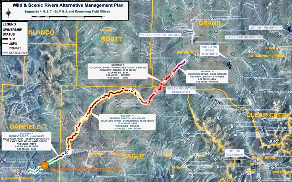
Last month, the Bureau of Land Management and the U.S. Forest Service formally approved the “Amended and Restated Upper Colorado River Wild and Scenic Stakeholder Group Management Plan.” The plan lays out a blueprint for protecting the “outstandingly remarkable values,” or ORVs, of the Colorado River from Kremmling to Glenwood Springs, with an emphasis on recreational floatboating and fishing.
The ORVs must either be a unique, rare or exemplary feature located on the river or shoreline; contribute to the functioning of the river ecosystem; or owe their existence to the presence of the river. The plan seeks to balance these ORVs with water development and use by Front Range water providers and Western Slope water users.
To ensure protection of the ORVs, the plan includes voluntary cooperative measures that the participants could take, such as the strategic timing of reservoir releases, enhancing spring peak flows and agreements with water users to acquire water rights, which would be used to preserve the natural environment.
The plan includes a provision that addresses two big uncertainties that would lead to more transmountain diversions from the Colorado River: Denver Water’s Moffat Collection System Project and the Northern Colorado Water Conservancy District’s Windy Gap Firming Project. The “poison pill” provision would allow any stakeholder to withdraw support for the plan if those projects — which are still in the permitting phase and mired in litigation, and which would provide a combined 48,000 acre-feet of water for the Front Range — negatively impact streamflows, especially for boating.
Six interest groups — conservation/environment/fishing; local government; recreational floatboating; state interests; Front Range water users; and Western Slope water users — have been working on crafting the plan since 2008. The Eagle River Watershed Council has been involved as a stakeholder since 2013, said executive director Holly Loff.
“It’s really exciting, and what a huge collaborative effort this has been, and I can’t really think of other situations that have been larger in scope and larger in the number of collaborators and all with very diverse interests — and we found a way to make it work,” Loff said. “It’s an amazing feat, really.”
The scenic, and sometimes wild, Rodeo Rapid, one of the few rapids on the upper Colorado River between Pumphouse and Dotsero. Photo by Brent Gardner-Smith/Aspen Journalism
Option to W&S
The alternative management planning process came about after the BLM in 2007 found that 54 miles of the upper Colorado River from Gore Canyon to just east of No Name Creek in Glenwood Canyon possessed enough ORVs that they were eligible for a federal Wild & Scenic River designation. Created by an act of Congress in 1968, the National Wild and Scenic Rivers System seeks to preserve rivers with outstandingly remarkable scenic, recreational, geologic, fish and wildlife, historic and cultural values in a free-flowing condition.
There are two ways that a river can be designated as Wild & Scenic: The secretary of the Interior can designate a river if a state governor requests it or Congress can designate a river, usually after a land-use agency conducts a study to see whether it’s eligible.
Designation as Wild & Scenic brings protection from development. For example, new dams cannot be constructed on the designated stretch and federal water-development projects that might negatively affect the river are not allowed.
But the possibility of federal government involvement and potential restrictions on water development on the upper Colorado doesn’t sit well with some groups. Municipal water providers such as Denver Water and Northern Water divert water from the Colorado’s headwaters to Front Range cities.
“A lot of members of the water community find the idea of a Wild & Scenic designation kind of frightening and prohibitive,” said Colorado Water Conservation Board Stream and Lake Protection Section Chief Linda Bassi. “It would prevent potentially new reservoirs along a Wild & Scenic river (and) certain types of structures, and that is why the water community has typically been a little leery of Wild & Scenic designation.”
In 2009, the Colorado General Assembly established the Wild and Scenic Rivers Fund. Despite what its name suggests, the fund is not dedicated to establishing Wild & Scenic designations of rivers, but to avoiding the federal designation through “work with stakeholders within the state of Colorado to develop protection of river-dependent resources as an alternative to wild and scenic river designation.”
The Upper Colorado River Wild and Scenic Stakeholder Group has been the recipient of money from the state fund, which is allocated up to $400,000 a year and administered by the Colorado Water Conservation Board. According to a CWCB memo from May, when staff reviews requests for these funds, they evaluate whether projects will promote collaboration among traditional consumptive water interests, including irrigation, and non-consumptive interests, including recreation and the environment, and whether the project will still enable Colorado to fully use water it is allocated.
“If we tried to go through designation, we don’t know if it would have ever made it past the state of Colorado,” said Kay Hopkins, outdoor recreation planner for the White River National Forest. “The state would have had to be supportive of our determination.”
Despite its renowned river rafting, fishing and scenic beauty, which contribute to the recreation-based economy of many Western Slope communities, Colorado has just 76 miles of one river — the Cache La Poudre — designated as Wild & Scenic. That’s less than one-tenth of 1% of the state’s 107,403 river miles.
Instead of a federal designation, the CWCB considers its instream-flow program to be a primary tool in the effort to protect ORVs. Instream flows are in-channel water rights aimed at preserving the natural environment to a reasonable degree. As a part of the alternative management plan process, the CWCB secured three instream-flow rights that date to 2011 on the upper Colorado River — from the confluence of the Blue River to Piney River; from Piney River to Cabin Creek; and from Cabin Creek to the confluence with the Eagle River.
Bassi, who runs the state’s instream-flow program, has participated in the state interests group since planning began in 2008.
“Those flow rates are designed primarily to meet the needs of fish,” Bassi said. “But they will help to maintain flows that provide for some levels of boating experiences.”
This map shows a stretch of the upper Colorado River, between Kremmling and Glenwood Springs, that is subject to a new framework designed to protect ecological and recreational values, in balance with the needs of water users on the Western Slope and Front Range. Map from Upper Colorado River Wild and Scenic Stakeholder Group.
Pragmatic discussions
The Forest Service and BLM approval of the alternative management plan means that the stretch of the upper Colorado River has been deferred from Wild & Scenic eligibility. But if the plan fails or any of the stakeholders enact the “poison pill” provision, the river could revert to being considered for eligibility, meaning it would once again be up for federal scrutiny, something some stakeholders want to avoid.
“That is the hammer behind the long-term commitments,” said Rob Buirgy, coordinator for the stakeholder group.
Eagle County Commissioner and Colorado River Water Conservation District Board member Kathy Chandler-Henry believes the strength of the alternative management plan is the input of its many participants.
“My first thought was the alternative management plan must be a lesser system of protection, but in my mind, it has not turned out to be that way because there are so many players at the table,” she said. “It doesn’t seem like a lesser process. It seems like a more publicly engaged process.”
Loff was more pragmatic.
“I don’t think (the alternative management plan) is better, but I don’t know that this group ever would have agreed to a standard Wild & Scenic designation. I don’t think that would have happened at all,” she said. “I think it’s better that we have this.”
Aspen Journalism is collaborating with the Aspen Times and other Swift Communications newspapers on coverage of water and rivers. This story was published online and printed in the Aspen Times on July 11, 2020 and published by Aspen Journalism on July 11, 2020.
Nearly one year after the state ordered Yampa River water users to begin measuring their diversions from the iconic river, local community groups have raised more than $200,000 to help cash-strapped ranchers and others install the devices needed to comply with the law.
According to Erin Light, the top water regulator in the region, roughly 60 percent of diversion structures, about 1,760 in total, remain out of compliance in what is known as Colorado’s Water Division 6, which includes the Yampa, North Platte, White and Green river basins.
Under state law, water users who do not measure their diversions can be subject to prosecution and have access to their water rights suspended, something the state has threatened to do but has not yet implemented.
Local groups, including the Upper Yampa Water Conservancy District and the Yampa/White/Green Basin Roundtable, have stepped up to help, creating a $200,000 grant fund to ensure those who are trying to comply can afford to do so.
“Everyone is interested in getting the best infrastructure we can into the river,” said Holly Kirkpatrick, who is overseeing the grant program for the conservancy district. “A lot of different organizations are working very hard on this.”
The Yampa River Fund, spearheaded by The Nature Conservancy, also plans to step in with funding should the need arise.
“I envision that there will be a request for funding,” said fund manager Andy Baur, “and we are here to help.”
This remote region in the northwest corner of the state for decades has had so much water that regulators rarely had to step in to ensure the rivers’ supplies were being properly distributed in accordance with state water law, something it does routinely in Colorado’s other major river basins. But as water shortages loom in the state, the Yampa is coming under increasing scrutiny.
“People need to understand that if we find ourselves in another administrative situation [where the Yampa runs dry as it did in 2018], people need to know they will be shut off,” said Light, who oversees the region for the Colorado Division of Water Resources.
The Yampa River in Northwest Colorado. Photo by Adobe Stock.
The picture is much different than even 20 years ago, when Yampa Valley ranchers and other water users with water rights were often able to divert as much as they wanted whenever they wanted because the river had huge flows and relatively few demands.
Light, who oversees the Yampa and North Platte basins, as well as the Green and White river sub-basins, said the White River region has the most work to do to comply with the state’s order, with 83 percent, or 596, of its diversion structures taking water that is not being measured.
On the Yampa River, 50 percent of diversion structures, or 900, remain unmeasured, Light said. In the North Platte, 34 percent, or 190, lack measuring devices, while in the Green 74, or 69 percent, of devices remain unmeasured, Light said.
Because the White and Green sub-basins are so remote, and installing measuring devices can cost thousands of dollars, Light said she is giving water users there another year to comply with the order.
At the same time, she said she has granted more than 100 extensions to water users who are trying to comply to give them more time to find funds and get the work done.
Light said she is hopeful ranchers and others will begin to understand that measuring is no longer optional, and that those who begin recording their water use will have new opportunities as the entire Colorado River system, to which the Yampa, White and Green rivers are tributary, moves into a water-short future.
Under at least one scenario now being studied, a large, statewide conservation program called demand management would pay ranchers and others to voluntarily forego their water diversions for a period of time. Options to receive payment for suspending use would only be available to those who have diversion records that demonstrate how much water they’ve historically used.
“If someday we have an opportunity to [temporarily] dry up lands under a demand management program, their [actual water] use will be greatly in question because they have not measured their water. As demands get higher in the Colorado River, it’s going to behoove them to measure,” Light said.
Jerd Smith is editor of Fresh Water News. She can be reached at 720-398-6474, via email at jerd@wateredco.org or @jerd_smith.
This story originally appeared on Fresh Water News, an independent, non-partisan news initiative of Water Education Colorado. WEco is funded by multiple donors. Its editorial policy and donor list can be viewed at wateredco.org.