By Gary Pitzer
Practically every drop of water that flows through the meadows, canyons and plains of the Colorado River Basin has reams of science attached to it. Snowpack, streamflow and tree ring data all influence the crucial decisions that guide water management of the iconic Western river every day.
Dizzying in its scope, detail and complexity, the scientific information on the Basin’s climate and hydrology has been largely scattered in hundreds of studies and reports. Some studies may conflict with others, or at least appear to. That’s problematic for a river that’s a lifeline for 40 million people and more than 4 million acres of irrigated farmland.
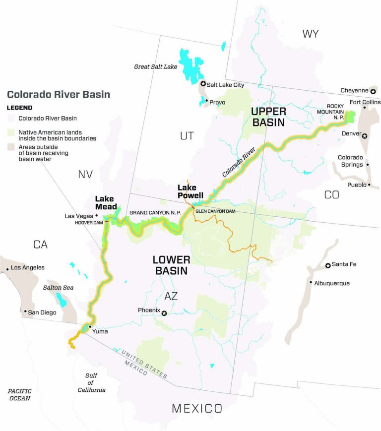
From the Upper Basin states of Colorado, Wyoming, New Mexico and Utah to the urban centers of Arizona, Nevada and California in the Lower Basin, water managers depend on that science to guide their decisions. More than ever, as those managers grapple with a hotter, drier Colorado River Basin and growing demand for a shrinking resource, they need an accessible scientific handbook as they get ready to draft a new set of rules for managing the river.
A new report synthesizes that science and puts it into context. Titled Colorado River Basin Climate and Hydrology: State of the Science, the report released earlier this year draws from about 800 peer-reviewed studies and agency reports on crucial topics – weather, streamflow, historical hydrology and climate change – to help navigate the future of river management. It doesn’t provide answers but offers a technical manual of sorts for a river system so vital to the Southwestern United States and Mexico.
“There is not now, and likely never will be, perfect weather and climate data. Producers of climate information need to communicate, and users should be cognizant of, the strengths and weaknesses of the data they choose and how climate data choices influence their conclusions.”
~State of the Science report
“It’s attempting to create that two-way dialogue, but to do so in a way that water managers aren’t having to go and read 20 different reports,” said Colby Pellegrino, deputy general manager of resources with the Southern Nevada Water Authority, which helped fund the report. “It’s a fabulous tool in that [it] is one guiding document to look at if you want to increase your understanding.”
Written by a veteran cadre of more than a dozen scientists and engineers, it pulls no punches in describing a river system in peril.
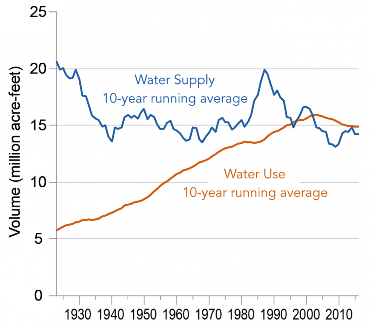
“The average conditions, over time and across the basin, suggest a (barely) sufficient supply and, by smoothing out the variability, mask existing and prospective shortages,” says the report, produced through the Western Water Assessment, an interdisciplinary research program based at the University of Colorado, Boulder.
The report notes that the ultimate aim of integrating new research into practice is to produce more accurate short- and mid-term forecasts of runoff and more meaningful long-term projections of expected water supply.
“The future is and always has been uncertain,” said Jeff Lukas, research integration specialist with the Western Water Assessment and co-lead author of the report. “Now, at a time in which the Basin’s water supply and depletions are in delicate balance at best, system storage is half-full, and climate change is increasingly impacting hydrology, these forecasts and projections have become even more critical.”
Improving forecasting tools
Funded by the Bureau of Reclamation and its partners in the seven Western states that depend on the river, the report emphasizes the need to improve hydrologic forecasts, projections and predictive tools in the Colorado River Basin, all the while acknowledging the need for resilience.
“There is not now, and likely never will be, perfect weather and climate data,” the report says. “Producers of climate information need to communicate, and users should be cognizant of, the strengths and weaknesses of the data they choose and how climate data choices influence their conclusions.”
Terry Fulp, regional director of Reclamation’s Lower Colorado Region, said the report emphasizes that Colorado River Basin hydrology is increasingly volatile and must be planned for accordingly.
“This made it very clear that we can’t rely on the 100-year record,” he said. “You can’t just look at the past and assume it’s replicated in the future. We all knew that, but it is good to have the body of science conclude that, too.”
Brad Udall, a senior climate and water research scientist at Colorado State University who was a technical reviewer for the report, said that while it covers an amazing breadth of material, it has key advice for water managers.
“At the broadest level, the take-home message is, a tremendous amount of science has been done in the Basin,” he said, “and while it may not give us the answers that tell us what to do, it strongly suggests we need to be prepared for a very different kind of future that’s hotter and drier.”
“This made it very clear that we can’t rely on the 100-year record. You can’t just look at the past and assume it’s replicated in the future.”
~Terry Fulp, Bureau of Reclamation Regional Director
The past 40 years have seen a substantial warming trend, the report says, noting that the period since 2000 has been about 2 degrees Fahrenheit warmer than the 20th-century average and likely warmer than at any time in the past 2,000 years.
Authors of the State of the Science report note they did not evaluate current Basin water management, address ecosystem needs or provide recommendations. Instead, they concentrated on assessing the chain of data and models that provide an understanding of the Basin’s hydrology, while recognizing how the rapid expansion of scientific knowledge and its increasing complexity parallel the growing uncertainties about how future climate will affect hydrology. Absent a dramatic increase in rain and snow, the Basin’s runoff and water supply are increasingly being affected by warmth.
With temperature, there is “a very clear signal and that trend … is significant enough that people have a fair amount of confidence it is impacting the hydrology in the Basin,” said lead co-author Liz Payton, Western Water Assessment’s Colorado River Basin assessment specialist.
Those effects were evident this year as a warm spring quickly erased what had been a robust snowpack leading up to April 1.
“I’m still stunned by the 100 percent snowpack and the 52 percent runoff,” Udall said. “That’s just mind-boggling.”
Adding the climate change factor
The State of the Science report comes at an important time. Fresh from completing unprecedented Drought Contingency Plans in 2019, key players in managing the river will next turn their attention to updating and renegotiating the river’s 2007 Interim Operating Guidelines, which expire in 2026. Crafted in the early stages of a two-decade drought, the 2007 guidelines along with the subsequent Drought Contingency Plans are a testament to managing the Basin’s extreme volatility.
Coming to terms on a new set of guidelines, including their length, will differ from 2007 because the last set of guidelines was based on limited modeling data that didn’t fully incorporate climate change projections, said Bill Hasencamp, manager of Colorado River resources with the Metropolitan Water District of Southern California.
While it is hard to predict specifically how the science report will inform the renegotiations, its recurring themes of increased temperatures, reduced streamflow and variable precipitation “will almost certainly arise in the context of the modeling efforts undertaken in the renegotiation,” said Amy Haas, executive director of the Upper Colorado River Commission.

New revelations about Colorado River Basin science appear with increasing frequency. In a lengthy July thread on Twitter, Udall noted the growing footprint of climate change in the Basin and how the expected pace of warming, which some models project could be as much as 5 degrees Fahrenheit by 2050, would greatly amplify the impacts seen in 2020. Scientists with the U.S. Geological Survey this year said warmer temperatures by 2050 could reduce the amount of water flowing in the river by as much as 30 percent.
“All of this has a name: aridification,” Udall wrote on Twitter. “Get used to it.”
The State of the Science report helps water managers understand key subjects, such as what climate monitoring is revealing and where uncertainty and errors exist.
Report contributor Carly Jerla, who manages Reclamation’s Modeling & Research Group, called it a “no-nonsense” scientific platform with a clear message. “We know we can’t just let history repeat itself,” she said. “This report clearly lays out that something else has to be done.”
Pellegrino, with Southern Nevada Water Authority, said the report provides a “one-stop shop” for busy river managers.
“If we knew next year was going to repeat the hydrology we saw in 2002, the driest year on record, would we make different water management decisions? I think the answer to that is yes at all time scales.”
~Colby Pellegrino, Southern Nevada Water Authority
“Of all the many hats water managers wear, we are not researchers and we are not innovators,” she said. “It’s difficult to have an eye on all of the things we are doing related to species and policy and water supply planning and also be able to comb through the various sources of new hydrologic or climate change data.”
Like many, Pellegrino would prefer a consistent pattern of climate and water supply projections from which to base management decisions.
“It’s really hard for somebody who wants predictability to acknowledge there is going to be wide range of variability that’s going to persist for a very long time,” she said. “But that’s where we are.”
The State of the Science report stems from the 2017 Colorado River Hydrology Research Symposium aimed at giving water resource managers a better understanding of new hydrologic research initiatives, and giving researchers a better understanding of the Basin water system and the tools used by managers. Together, they explored how research could help improve those tools. That was crucial because research not fully grounded in the particulars of the managed system can produce alarming results. Hasencamp recalled one study that gave Lake Mead an even chance of going dry by 2021, a finding that dumbfounded water managers.
“We all looked at it and said, ‘What assumptions are they making?’” he said. “This is not very good science because they didn’t talk to the people who are actually running the system and managing it.”
Reaching consensus on science
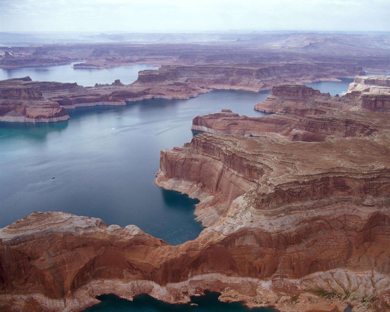
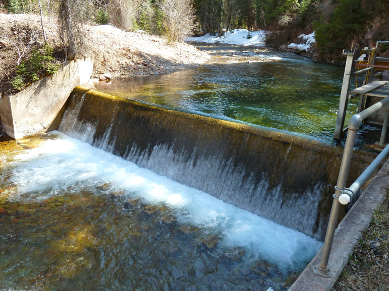
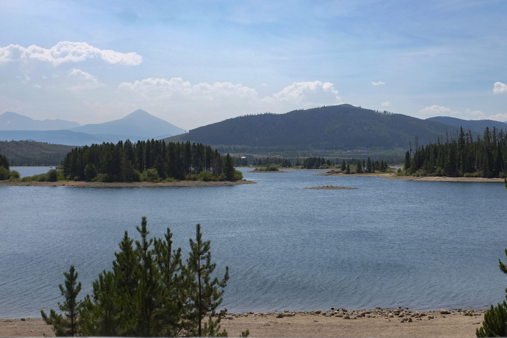
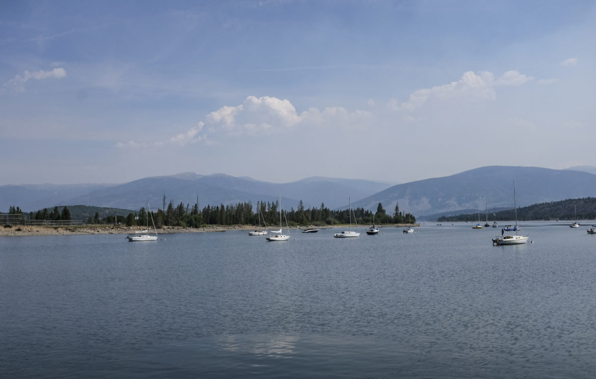
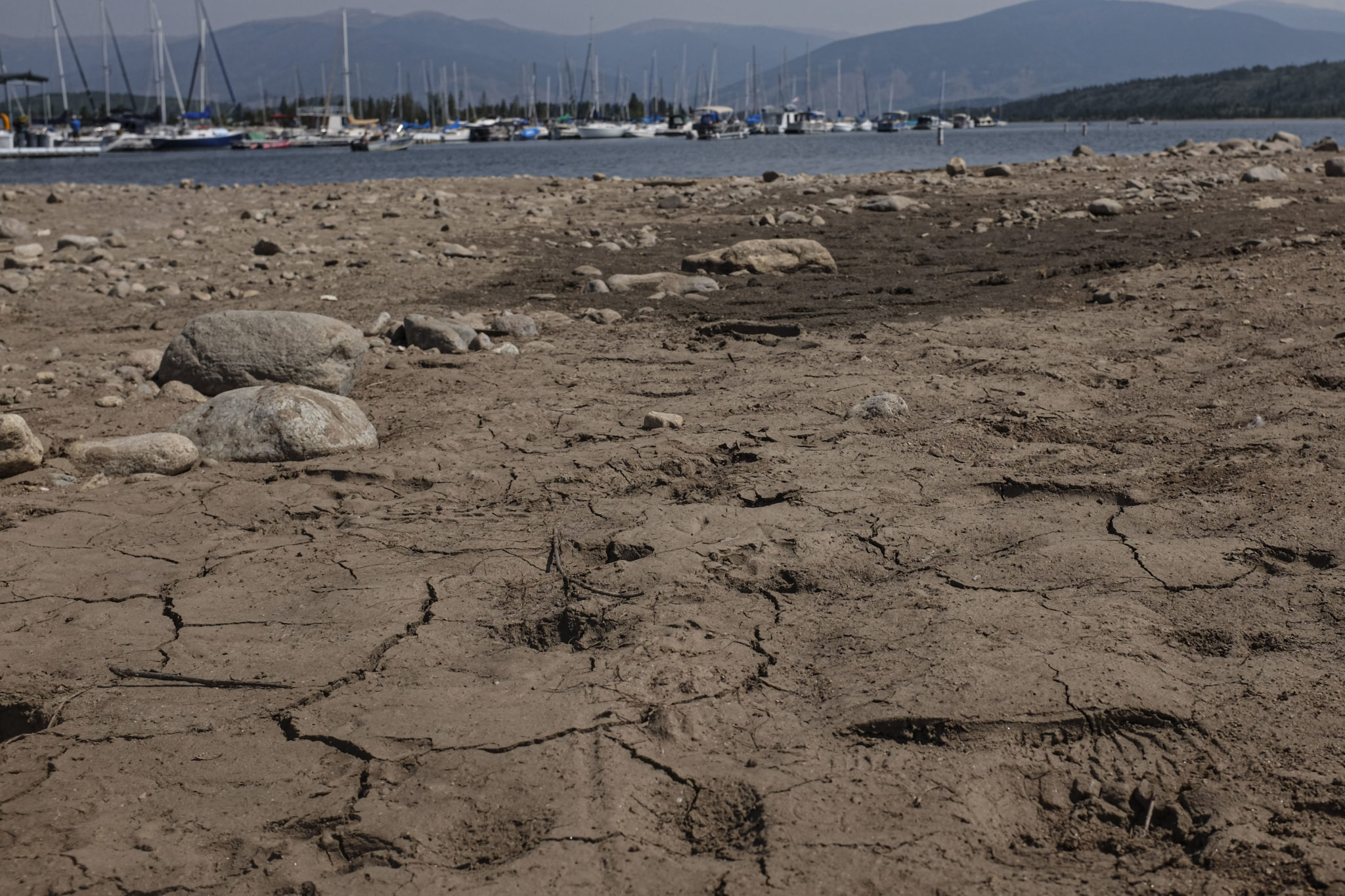
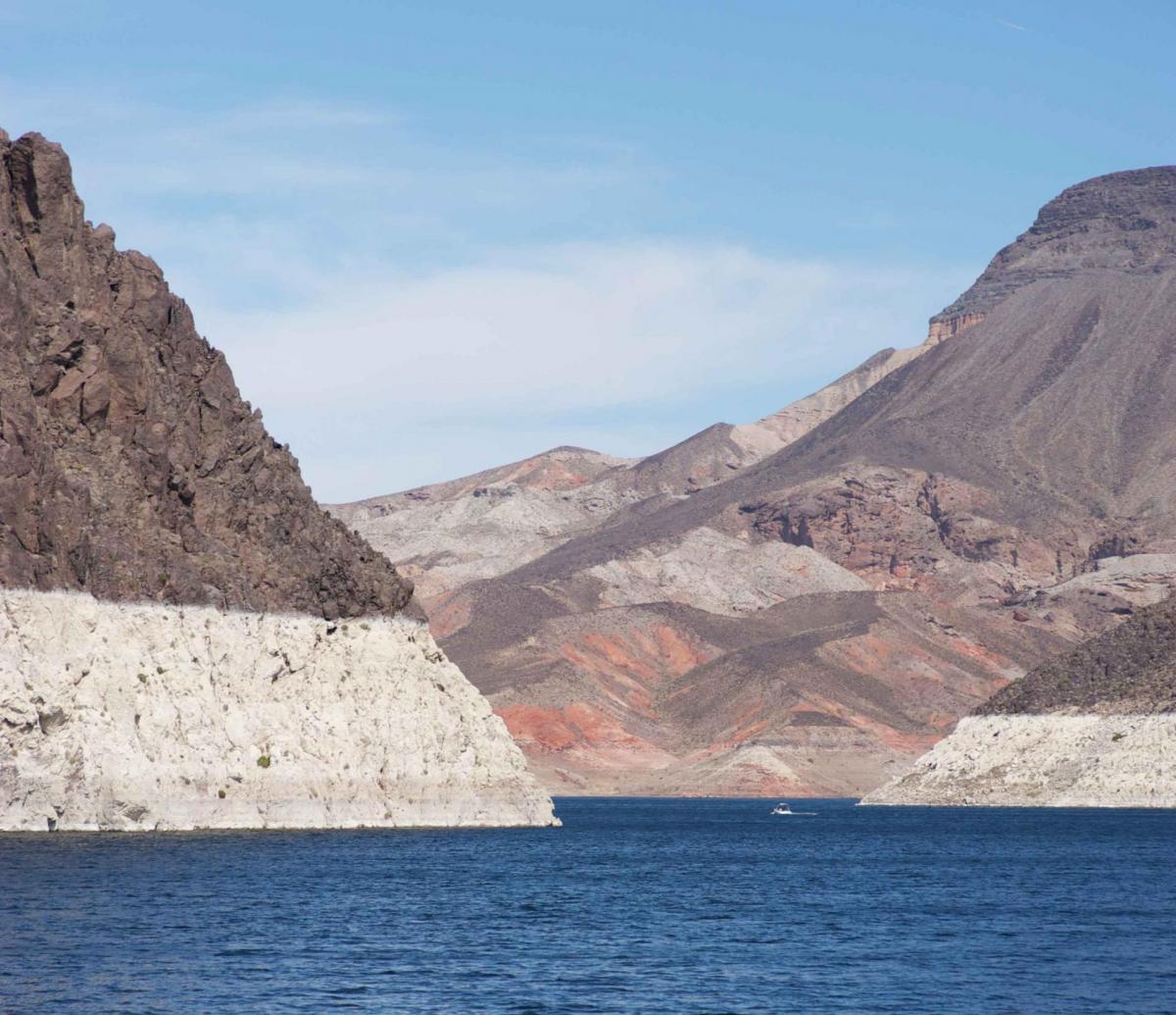
The historical record illustrates the dramatic swerves in Colorado River Basin hydrology. Some years the snow never stops. Other times, unseasonable warmth and dryness dominates as officials nervously watch lake levels plummet in the river’s two major reservoirs, Lake Powell and Lake Mead.

Scientists devote their careers to figuring how forecasts and projections can improve. On the ground, life can be more stressful for water resource practitioners charged with providing a reliable water supply. Report authors acknowledge the conundrum.
“Given the stakes involved, it is reasonable that Colorado River Basin planners and managers desire greater certainty in water supply forecasts and long-term projections,” the report’s authors wrote. “They need some sense of the likelihood of hydrologic shifts, especially shifts to the dry side.”
One area of possible improvement is the 24-month water supply forecasting system that is partly based on assumptions of average monthly inflows to the Colorado River between Lake Powell and Lake Mead, said Payton.
“That’s a significant reach because if there is a lot or not as much inflow as the monthly average, you could shift Lake Mead above or below one of the important thresholds” that determine how much water agencies can draw from the river, she said. “If Mead is right at a shortage threshold and you have underestimated the inflow, you may end up declaring a shortage when you didn’t have to.”
Improvements in forecasting are needed from months to years to even decades out, said Pellegrino, with Southern Nevada Water Authority.
“Obviously, the long-term time scale is probably the most relevant for policy decisions, but the short and mid-terms are just as important,” she said. “The question is, if we knew next year was going to repeat the hydrology we saw in 2002, the driest year on record, would we make different water management decisions? I think the answer to that is yes at all time scales.”
Faced with uncertainty, Pellegrino believes the prudent approach is to be “eyes wide open” to the implications of the wide range of variability.
“Instead of identifying the hydrology that’s problematic or exact streamflow record that’s correct, spend your efforts coming up with the benchmarks for your water management community or basin that really mean something,” she said.
Making better decisions
For an area such as Las Vegas, that means preparing for more heat and dryness. Pellegrino said her agency has calculated that the creeping temperature rise could increase per capita water use by nine gallons a day by 2035.

Outcomes like that mean agencies should prepare for as many scenarios as possible, aiming for maximum flexibility, “like a dimmer switch,” said Taylor Hawes, Colorado River program director with The Nature Conservancy. Waiting too long to act could be costly.
“We should consider this time before a full-blown crisis as a gift,” she said. “We are on ‘water time,’ and developing new water management tools takes years. We should not squander this time now, because we will never have a perfect picture of what the next year or two holds. Trying to develop these kinds of tools in the middle of the crisis will create chaos, social and economic impacts and unintended consequences. It is much more effective to have the tools ready to deploy before they are needed.”
“We should consider this time before a full-blown crisis as a gift. We are on ‘water time,’ and developing new water management tools takes years.”
~Taylor Hawes, Colorado River program director with The Nature Conservancy
Fulp, Reclamation’s regional director, said the report helps reframe the basis for near-term planning and gives a glimpse of what to expect further out, uncertainty and all.
“You’re talking about looking at hundreds, if not thousands of different futures and seeing what the statistics tell us,” he said. “Is one decision better under a lot of scenarios or is it only better under a few scenarios?”
The flow of scientific data about the Colorado River Basin will continue. Some reports will generate more response than others. Amid that, the depth and breadth of the Colorado River Basin Climate and Hydrology: State of the Science stands out.
“We hear about so many studies with dire predictions for the Colorado River but I think the bigger meta message is we have this great collaboration among water agencies to gather more information about the past, present and future of climate hydrology to make better decisions and planning,” said Lukas, with Western Water Assessment. “That’s the story I like to emphasize.”
Key Findings: Colorado River Basin Climate and Hydrology: State of the Science
The Colorado River Basin Climate and Hydrology: State of the Science synthesizes hundreds of studies on the Colorado River Basin, from historical hydrology and current climate change research to observations about streamflow, snowpack and weather, to the models used to inform water management decisions. The 531-page report doesn’t make recommendations but does highlight areas of uncertainty about science in the Basin and lays out challenges and opportunities to expand scientific knowledge and improve modeling that may aid water managers.
Among other things the State of Science report notes:
- On average, about 170 million acre-feet of precipitation falls over the Colorado River Basin each year, but only about 10 percent becomes natural streamflow available for use. Because the Basin has such high overall losses to evapotranspiration, its hydrology is more sensitive to changes in temperature than for watersheds in California and the Pacific Northwest.
- It is unclear whether the period of below-normal precipitation since 2000 is indicative of future precipitation, but unless average Basin precipitation increases substantially, system runoff and water supply are expected to decline over the next several decades due to warming alone.
- In general, there is not a simple way to measure the quality of the many models used to inform understanding of Colorado River Basin hydrology, but it is possible to assess their strengths and weaknesses. Continual improvements are being made by agencies and the academic community, but areas with inadequate data remain.
- The Basin lacks a complete picture of how much snow falls and where. That is still a major source of error in streamflow forecasts, especially in extreme years – a phenomenon that appears to be more frequent in a changing climate.
- Global climate models do not agree on the magnitude of warming and changes in annual precipitation to expect in the Basin, but they do agree that continued warming will tend to drive streamflow downward overall.
- The full range of future uncertainty in the Colorado River Basin includes not just climate but also land use, water demand, and the future state of institutions, economies, technologies and policies that influence and constrain water demand and allocation. Water resource practitioners in the Basin are trying to make the best decisions possible given the uncertainty in future water supply.
Further reading
- Western Water: Questions Simmer About Lake Powell’s Future As Drought, Climate Change Point To A Drier Colorado River Basin May 15, 2020
- Western Water: Can a Grand Vision Solve the Colorado River’s Challenges? Or Will Incremental Change Offer Best Hope for Success? Dec. 13, 2019
- Western Water: Could “Black Swan” Events Spawned by Climate Change Wreak Havoc in the Colorado River Basin? Sept. 12, 2019
- Western Water: With Drought Plan in Place, Colorado River Stakeholders Face Even Tougher Talks Ahead On The River’s Future, May 9, 2019
- Western Water: As Shortages Loom in the Colorado River Basin, Indian Tribes Seek to Secure Their Water Rights, Nov. 2, 2018
- Western Water: Despite Risk of Unprecedented Shortage on the Colorado River, Reclamation Commissioner Sees Room for Optimism, Sept. 21, 2018
- Aquapedia: Colorado River
Reach Gary Pitzer: gpitzer@watereducation.org, Twitter: @GaryPitzer
Know someone else who wants to stay connected with water in the West? Encourage them to sign up for Western Water, and follow us on Facebook, Twitter and LinkedIn.
This story was originally published by Western Water on September 11, 2020.