Research technician and Grand County rancher Wendy Thompson collects hay samples as part of a far-reaching experiment to see if ranchers can fallow hay meadows and conserve more water for the Colorado River. Credit: Dave Timko, This American Land. Aug. 12, 2020
Colorado’s high altitude hay meadows, a significant water user in the state, could be re-operated to yield more than 40 percent in water savings, according to a new report.
The report is based on a major high tech research initiative to see if ranch-scale water conservation techniques, in which farmers are paid to voluntarily stop irrigating their fields temporarily, could produce enough saved water to help protect the Colorado River from unplanned shortages due to drought and climate change.
The research is one of several efforts to find ways to ensure demand on the Colorado River doesn’t outstrip supply, resulting in mandated cutbacks in water use in Colorado to meet the legal rights of downstream states.
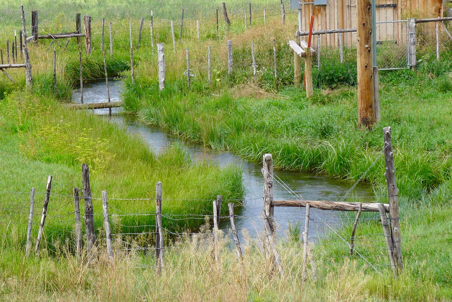
The report, released June 24, looked at how much water was saved across more than 1,000 acres of hay meadows spanning several ranches near Kremmling last summer.
Ranchers stopped irrigating their hay meadows for several months, allowing the water to stay in the river rather than being diverted and applied to the fields. Because Colorado’s regulatory system only allows so-called conserved consumptive-use water to be legally transferred to another user, it was critical to the study to understand how much the hay crop would have consumed and how much remained in the river system by foregoing irrigation.
The experiment showed that the fallowing project generated 42 percent of such legally transferrable conserved water.
Credit: Chas Chamberlin
As a multi-decadal drought ravages the Colorado River system, many are focused on how to more closely balance its dwindling supplies with demands. Across the American West, irrigated agriculture uses roughly 80 percent of water supplies, so any breakthroughs in finding ways to maintain productivity with less water are critical to the river system’s long-term viability.
“It’s pretty promising,” said Alex Funk, an agricultural water specialist with the Colorado Water Conservation Board. The CWCB has contributed $750,000 to the research, along with other funders including American Rivers, Trout Unlimited and The Nature Conservancy. The Colorado River Basin Roundtable, a public group charged with helping determine how best to manage the Colorado River’s supplies within state boundaries, is also a funder.
Funk and researchers, however, are quick to point out that the savings achieved is only one part of determining how to help agriculture reduce its water footprint while continuing to thrive, raise hay and cattle and other crops, and feed Coloradans.
An equally important finding, according to researchers, is that they were able to accurately use satellite imagery and remote sensing devices to collect data from hundreds of sites at different elevations where different types of hay were being grown.
That data was matched up against traditional tools, which were manually installed and monitored last summer, in order to verify on the ground the remotely collected data.
This is key to the research because traditional, manual data collection is too costly to conduct and cannot produce the vast amounts of detailed data such studies require.
Colorado State University’s Perry Cabot, who led the research initiative, said the experiment confirms that broad-scale, satellite-based data gathering combined with remote sensing devices produces reliable results.
“We now have a spatial model we can use to do an inventory of [water] use across fields.
“Farmers are spatial people. When they look at a map and see a water use inventory of their fields, that resonates with them,” Cabot said. (Editor’s note: Cabot serves on the Board of Trustees of Water Education Colorado, which sponsors Fresh Water News.)
“This opens up our ability to start talking about numbers that we can all look at without having to get into ‘do we need another study in another river basin,’” Cabot said.
But agricultural producers say much work remains to be done before they could commit to such a water-saving initiative, in part because they have to ensure any payments they receive will cover the costs of lost hay production, as well as the cost of buying hay for their cattle in the three-year period after they begin irrigating again.
“The big question is the recovery,” Funk said. “How long does it take to scale back your crop base and your relationships with your market? Ranchers are not lining up to do this. The bigger questions are still unanswered.”
Don Shawcroft, a producer and immediate past president of the Colorado Farm Bureau, said ranchers continue to watch the issue closely.
“Producers have got to know more than they know now,” he said. “What does it mean when we force the use of less water than we normally would? For an individual producer, the question is, ‘Will I forego my ability to produce in order to have water for the residents of Colorado?’” (Editor’s note: Shawcroft also serves on the Board of Trustees of Water Education Colorado, which sponsors Fresh Water News.)
For this season and the next two summers, researchers, growers and conservationists will continue to monitor the hay fields, to measure their health, and to see what hidden effects of a summer of going without water may have on the ranches and the Colorado River itself, and the wetlands that thread these hay meadows.
Aaron Derwingson oversees agricultural water projects for The Nature Conservancy, which is one of the conservation groups helping fund the research initiative.
“We’ve got to find ways to reduce our water footprint to bring things into balance and there is a huge question about what that means for agriculture,” Derwingson said.
“Our interest is across all of these questions. How can it work for agriculture? How can it work for the environment and what does it mean for the system as a whole?”
Jerd Smith is editor of Fresh Water News. She can be reached at 720-398-6474, via email at jerd@wateredco.org or @jerd_smith.
Fresh Water News is an independent, nonpartisan news initiative of Water Education Colorado. WEco is funded by multiple donors. Our editorial policy and donor list can be viewed at wateredco.org.
The Water Desk’s mission is to increase the volume, depth and power of journalism connected to Western water issues. We’re an initiative of the Center for Environmental Journalism at the University of Colorado Boulder. The Water Desk launched in April 2019 with support from the Walton Family Foundation. We maintain a strict editorial firewall between our funders and our journalism.
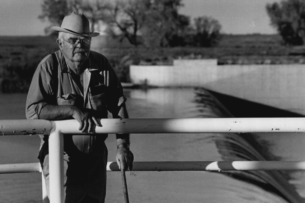
Wildlife biologist Bill Vetter watches and listens for birds in irrigated fields outside of Kremmling. Vetter is part of an avian monitoring program run by Audubon Rockies that aims to learn more about how birds use irrigated agriculture. CREDIT: HEATHER SACKETT/ASPEN JOURNALISM
By Heather Sackett
KREMMLING — In the gray light of dawn, hundreds of swallows darted over a pool of standing water in an irrigated field along the Colorado River. The birds were attracted to the early-morning mosquitos swarming the saturated landscape. Bill Vetter, a wildlife biologist with Wyoming-based Precision Wildlife Resources, methodically counted the birds. For six minutes, he marked down every bird he saw or heard at eight different locations across the ranch, 250 meters apart.
Vetter is part of an avian-monitoring program, headed up by Audubon Rockies, which aims to learn more about how birds use irrigated agricultural lands. In 2020, the fields near Kremmling where Vetter counted purposely did not irrigate as part of a state-grant-funded study on water use in high-elevation pastures. This year, irrigators are back to watering their usual amount and Vetter is tracking the trends in bird species and numbers.
This year, Vetter counted four or five additional species, including the yellow-headed blackbird, white-faced ibis and sora.
“I can say that for sure we got additional species this year that we didn’t have last year, and those species are largely associated with water habitat,” he said.
Across the Western Slope, birds and other wildlife have come to depend on these artificially created wetlands, a result of flood irrigation. But as the state of Colorado grapples with whether to implement a demand-management program, which would pay irrigators to temporarily dry up fields in an effort to send more water downstream, there could be unintended consequences for the animals that use irrigated agriculture for their habitat.
Learning more about how birds use these landscapes is a key first step, according to Abby Burk, Western rivers regional program manager with Audubon Rockies.
“Wetlands are the unsung hero for all the ecological services and functions they provide for wildlife,” she said. “Those low-field wetlands are good habitat for birds, for breeding, for migratory stopovers.”
In 2020, the bird count turned up 1,285 birds, comprising 39 different species, including great blue herons, meadowlarks, red-winged blackbirds, an osprey, a peregrine falcon, and several types of swallows, warblers and sparrows. The numbers are not yet tallied for this year, but the general expectation is that more water means more birds.
“Birds have adapted to how we have created these different habitat types,” Burk said. “We’ve really got to look at the larger effects of how we use water can impact birds and other wildlife. Where there’s water, birds also do thrive.”
This pool of standing water in a field near the Colorado River is a result of flood irrigation. It’s also great habitat for mosquito-loving swallows.CREDIT: HEATHER SACKETT/ASPEN JOURNALISM
Water-use study
The seven ranches where the avian monitoring is taking place are part of a larger water study that is evaluating conserved consumptive use in the upper Colorado River basin. Consumptive use is a measure of how much water is consumed by thirsty plants. Conserved consumptive use is the amount by which consumptive use is reduced as a result of changing irrigation practices.
Researchers from Colorado State University are studying the impacts of using less water on the high-elevation fields in Grand County and how long it takes them to recover once water returns. Researchers hope to fill in a data gap about the impacts of reducing irrigation water on high-elevation pastures.
In 2020, some participating landowners did not irrigate at all and some only irrigated until June 15. This year, landowners reverted to their historical irrigation practices. Remote sensors and ground-based instruments are monitoring the difference in plant and soil conditions, and will continue to do so through 2023. Early results found that the plants used about 45% less water in 2020 compared with the previous four years.
The first phase of the project received a $500,000 grant from the Colorado Water Conservation Board (CWCB) under its Alternative Agriculture Water Transfer Method program, which aims to find alternatives to “buy and dry” water transfers. The CWCB in September will consider another $60,000 grant request for Trout Unlimited to continue to do monitoring with a field technician.
This monitoring station is part of a research project by Colorado State University to track soil and plant conditions in irrigated pastures. The study aims to learn more about how using less water affects high-elevation fields. CREDIT: HEATHER SACKETT/ASPEN JOURNALISM
Demand management
Although the project is not directly related to the state’s demand-management feasibility investigation, the results could have implications for any potential program that the state eventually comes up with.
“We are hoping all this information and research is going to be used down the road if a program does develop,” said Mely Whiting, Colorado water project legal counsel with Trout Unlimited. Trout Unlimited is helping to fund and implement the research project.
At the heart of a demand-management program is paying irrigators on a voluntary and temporary basis to not irrigate and to leave more water in the river in an effort to bolster levels in Lake Powell and help Colorado meet its downstream obligations.
Under the Colorado River Compact, the Upper Basin (Colorado, Wyoming, Utah and New Mexico) must send 7.5 million acre-feet each year to the Lower Basin (California, Arizona and Nevada). Failure to meet this obligation could trigger a “compact call” where junior water users in the Upper Basin would have their water cut off. (An acre-foot is enough water to cover one acre of land one foot deep.)
As rising temperatures due to climate change continue to rob the Colorado River and its tributaries of flows and increase the risk of a compact call, finding solutions to water shortages is becoming more urgent. Lake Powell, the upper basin’s biggest reservoir, is just under 34% full and projected to decline further. Demand management would let the Upper Basin set aside up to 500,000 acre-feet in a special pool in Powell to help avoid a compact call.
Some still-unanswered questions remain: How much of the conserved consumptive water from high-elevation pastures would actually make it downstream to Lake Powell? And how much would local streams benefit from the added flows?
“One critical part of what we’re doing is looking at the stream and saying: Do we see any changes from one year to the next? How much water would actually make it to the stream?” Whiting said. “We are measuring to see if there’s any distinction between the year the conservation practices were applied and the following year.”
Wildlife biologist Bill Vetter and Western Rivers Regional Program Manager with Audubon Rockies Abby Burk walk along an irrigation ditch in Grand County. An avian monitoring program aims to learn more about how birds use irrigated agriculture. CREDIT: HEATHER SACKETT/ASPEN JOURNALISM
Trade-offs
The unintended consequences of different irrigation patterns under a demand-management program could be many and far-reaching. In 2018, the CWCB formed nine workgroups to examine some of these issues, including one that looked at environmental considerations.
In notes submitted to the CWCB last July, the environmental workgroup acknowledged there could be trade-offs, sometimes among species. For example, reducing irrigation and leaving more water in rivers would benefit fish and riparian habitats, but might negatively impact birds or other species that use wetlands created by flood irrigation. And with full irrigation, birds may thrive, but to the detriment of river ecosystems.
David Graf, water-resource specialist with Colorado Parks and Wildlife, participated in the environmental-considerations workgroup. He said irrigated agriculture provides a lot of diversity in forbes, grasses and insects — good sources of protein for birds. But fish need water too. And in the summer and fall, the more, the better. There is an environmental value in irrigated agriculture, but only if the streams aren’t suffering at its expense, Graf said.
“There is a whole bunch of wildlife that is dependent on irrigated agriculture,” he said. “I think we all recognize the value that irrigated agriculture brings to wildlife, but it’s at the expense of fisheries in a lot of cases. There’s a little bit of a trade-off on a local level. I think we get the balance wrong sometimes.”
This pool of standing water in a field near the Colorado River is a result of flood irrigation. It’s also great habitat for mosquito-loving swallows. CREDIT: HEATHER SACKETT/ASPEN JOURNALISM
Birds as indicator
Burk acknowledged that the usefulness of the bird count is limited by the absence of baseline data, because there was no bird monitoring on the fields before 2020. But trends are still important and, like the proverbial canary in the coal mine, birds can be an indicator of what’s happening on a landscape. Burk said she would like to do a bird-monitoring program on a larger scale at different locations around the Western Slope.
“As we learn more about how birds respond to water on the landscape, whether that’s in the river, in the fields, in the wetlands and adjacent habitats, it’s going to help give us a better picture of how the entire landscape and our natural systems are responding,” Burk said.
Colorado River water issues sometimes make for seemingly strange bedfellows. Nonprofit environmental groups such as Audubon are usually focused on keeping more water in the rivers, while irrigators traditionally take it out. In this case, interests align with keeping water on the landscape, with birds as the beneficiaries. Burk said those “us-versus-them” distinctions among water users are evaporating as people realize they are not facing the water crisis alone.
“When we drop the silos, drop the fences and walls between water users, we can see that this is one water — people, wildlife, the environment, the recreation industry — we all depend upon it,” Burk said. “So, how do we keep these natural systems so they can keep doing their job for everyone with reduced water? Water has to go further because there’s less of it.”
The Water Desk’s mission is to increase the volume, depth and power of journalism connected to Western water issues. We’re an initiative of the Center for Environmental Journalism at the University of Colorado Boulder. The Water Desk launched in April 2019 with support from the Walton Family Foundation. We maintain a strict editorial firewall between our funders and our journalism.
John Werner will be planting a pistachio grove on his land near Visalia after he lost his hay crop due to lack of rain. Photo by Shae Hammond for CalMatters
By Julie Cart
Severe drought is gripping most of California, but its misery isn’t spread equally. While most of the state compares today’s extreme conditions to previous droughts, people in Tulare County speak of drought — in the singular, as in a continuous state of being.
“The drought has never stopped in north Tulare County. It never left,” said county Supervisor Eddie Valero. “Domestic wells are drying up at an alarming rate.”
The entire West is suffering from extreme dryness, heat and fire risk, and the small, rural towns of northern Tulare County, outside of Visalia, are caught in its vortex.
While officials around the state are devising strategies to restrict or conserve water, here in the upper San Joaquin Valley there isn’t much in the way of water to begin with. The spigot, for farms and for households, has been constricted to a trickle. For many residents, water comes in a bottle, delivered year-round by a truck from a county or social service agency.
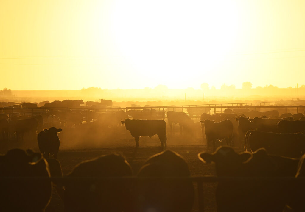
An oft-repeated phrase in Tulare County is that there are more cows than people, and it’s true, thanks to a long tradition of dairy farms. This is a lonely place: about 92 people per square mile compared to the state average of 240.
Early settlers in this region were Okies fleeing the 1930s Dust Bowl, pushed by drought into a valley that is now suffering its own insistent drought. For many, it’s a choice to live with elbow room, out of the reach of nosy neighbors or the government’s long arm. For others, it’s simply the place where they grew up and love. And some are here because they are trapped in a financial rut with barely enough money to stay and too little to move away.
About 50,000 residents of Tulare County — 10% of its population — are designated as “water insecure,” which means their drinking water supply is unreliable or nonexistent, according to county officials. Many are Latinos, who make up two-thirds of the county’s population. Entire communities have no connection to water systems, wells are old and failing and many water sources are contaminated by fertilizers and pesticides.
During the last statewide drought, more than 2,600 dry wells were self-reported by residents in California, about 50% of them in Tulare County. Many were in a single town, East Porterville. The largest proportion of failed wells are for residential use, not agriculture, so for many families, just taking a shower means using buckets or hooking hoses to neighbors’ homes.
The drought is an awful burden here, but it’s not the only factor adding to the county’s misery index. Its homes have half the value of California’s average, and they have less access to broadband or computers. More than a quarter of the county’s residents live in poverty, almost twice the national average. Tulare County ranks at the highest extreme for social vulnerability, according to a Centers for Disease Control and Prevention index that factors drought in its assessment.
For those whose fortunes depend on water, the debilitating drought of the last decade has been a bleak time.Suicide hotline numbers are listed on the webpage of Tulare County’s Agriculture Commission alongside the annual crop reports.
It’s a region that demands grit and rewards resilience. In the town of Orosi, a large sign in front of El Monte Middle School (Home of the Lobos) proclaims, “Let Obstacles Become Opportunities.”
A white pickup truck and a shovel
John Werner knew he was a bona fide farmer the first time he filled out an IRS Schedule F form, an option open only to those who farm as a business and can show a profit. He qualified for the first part: He grows olives, peaches, figs and hay on his own 60 acres. The profit part has proved more difficult.
“I grew up poor, out in the country,” said Werner, who lives outside of the small town of Seville in the Sierra Nevada foothills. “I thought the rich guys drove white pickup trucks and had shovels in the back.”
As a lifelong resident of Tulare County, Werner knew that scratching crops out of dry ground was never going to support his family of five. So he has worked as an adult education supervisor for two counties. “If I didn’t have a day job, I would’ve had to sell.”
Werner was lucky that his property sits on an aquifer so he drew water for his house and farm from two shallow wells. But his luck ran out, tracing the same path of the quickly depleted groundwater. His agricultural well went bad, and he drilled a new domestic well for his home that reaches as far down as it can go.
Today, the idea that water can be found at a 60-foot depth is not remotely feasible. He’s drilling a new agricultural well to bedrock, about 280 feet down. The digging and the pumps don’t come cheaply; they can set farmers back $60,000, and sometimes much more.
The unrelenting heat, which sucks moisture from the soil, makes matters even worse, negating even the most thorough watering. Hay can be dry-farmed, surviving on rain — if there is any. Werner has already lost his hay crop to drought this year.
“Normally I harvest around Easter,” he said. “The week prior I was standing out there and the hay, which should have been about three feet tall — in a good year I’ve had it up to five feet — was seven to eight inches. Turned into dust.”
Werner used groundwater from his house pump to survive the last drought, redirecting water from the laundry to keep the fruit trees alive. Limping along on subsistence amounts of water, the trees didn’t produce for three years, but they survived. In the meantime, there’s no crop to bring in money, but it still costs to pump water, prune the orchards and maintain equipment.
Werner is catching the tail of a pistachio trend, refinancing his property to raise money to put in the high-value trees, a decision he made before the last two dry years. Pistachios tolerate salty water and need less of it, but it’s costly to care for the orchards while waiting years for the nuts to come.
With less water for crops, farmers are struggling to keep orchards alive. Photo by Shae Hammond for CalMatters
“There’s going to be losers with this drought,” he said. “Those with money will hold on. The small farming operations will have to give way to the agribusiness outfits. They are more efficient than any of us are. I hope it doesn’t break the mom and pop farmers. It’s gonna affect a lot of poor rural communities, places like Ivanhoe and Seville, towns no one has ever heard of.”
Still, each young tree or tiny seed that’s put into the San Joaquin Valley’s dusty ground is a sign of optimism, a confident investment in the future. Farmers hoping for rain, even with no rain in sight.
“This is the place where we raised our kids. It’s our home,” Werner said. “Come hell or high water, I’ve got to plant.”
Water everywhere. Until there’s not enough.
Viewed through today’s lens of extreme water scarcity, it’s difficult to believe that the San Joaquin Valley has historically been notable more for its persistent and severe flooding. The backstory bears little resemblance to the Tulare region of today.
Until the turn of the century, steamboats plied Tulare Lake, the largest body of freshwater west of the Mississippi. In the 1940s homeowners in Visalia complained that cars driving through flooded streets threw up wriggling fish onto front porches. Artesian wells bubbled with warm water day and night. The valley once held a vast sea. The Kern River flowed to San Francisco.
“We still have sea mammals of different types trying to come up as far as they can on the San Joaquin, sea lions in particular,” John Austin, author of Floods and Droughts in the Tulare Lake Basin, said in an interview. “In Tulare Lake we had sea otters, harbor seals, and sea lions. We had chinook salmon runs here. When the Spanish showed up they saw the Indians swimming under water after salmon.”
It was a land of plenty, with plenty of water. Farming began to take hold when people passing through the valley to make their fortunes in the California goldfields lingered on their return trip south, busted and broken.
In time those 49ers began the water engineering that would transform the San Joaquin Valley. In the late 1800s, dryland farming produced the nation’s largest wheat crop. Then, with the New Deal, rural electrification, and the invention of centrifugal pumps, more and more water was siphoned from vast underground stores.
Using a local invention known as the Fresno Pan, farmers scraped out canals to redirect river water to thirsty crops. By 1906, the Kings River, the biggest of the valley’s four major rivers, was irrigating more than a million acres. And the irrigated land made farmers rich.
“They grew plums, cotton, grapes and citrus,” said Austin. “It was possible because they had land, children for labor, sunshine. And now they had water.”
Neighbors helping neighbors — with water tanks and hoses
An employee from Bubba’s Water Truck Service unravels a hose in preparation to pump water into Luzvianey Gonzalez’s new home water tank in Madera. Photo by Shae Hammond for CalMatters
The road to Jim Myers’ house offers a clue as to what has been taking place in the wide fields for decades: Rusting farm machinery, odd parts and plows, are repurposed into yard art. There’s a small broken-down tractor that’s a centerpiece in a cheerful new garden Myers created.
Most residents in the area are farmers, or used to be. Roads are defined on both sides by irrigation ditches. Regimented rows of trees pass like a dizzying kaleidoscope. Shimmering heat rises.
It’s 106 degrees outside at Myers’ home and he motors out to meet the delivery of a 2,500-gallon water tank, a service facilitated by Self Help Enterprises, a non-profit that will pay to keep the above-ground tank filled with water.
Myers is in the driveway, sitting sidesaddle on a small red ATV that he’s using as a motorized wheelchair. A former mechanic, Myers lost his foot in a workplace accident and is on disability.
Like everyone in his community near Madera, just northwest of Tulare County, he and his wife get their water from a well. And, like many people, his wells have failed to reach the sinking water table.
His first well, sunk to 200 feet, gave out in the last drought, and his second, at 300 feet, went dry last week. “We went to turn the water on, and, boom, it just ran out.”
The new water tank, while welcome, is not a long-term solution. Some valley residents are attempting to finance their way out of the drought through second mortgages and bank loans. Myers, 62, said he has been trying to pay down his mortgage but will have to get a personal loan to dig a new well.
But that isn’t sustainable, either. Experts say the efforts to drill deeper and deeper wells are depleting aquifers, and in many areas eventually will reach water too saline to drink or irrigate crops.
While they waited for their water delivery, Myers and his wife made do with a neighbor’s garden hose jury-rigged to bring water into their home, where they’ve lived for 20 years. To avoid running up his friend’s bills, the couple used the water sparingly and only during times when the rates were lowest — between midnight and 4 am.
“Everybody is suffering, it’s why I have all this gray hair,” he said with a laugh.
The drought response of local non-profit organizations has ramped up significantly, with daily deliveries of bottled water, assistance in getting new wells and help in connecting to water systems.
Calls to Self Help Enterprise’s water hotline have quadrupled in recent months, said Marliez Diaz, who oversees the group’s water program, which is partially funded by state grants.
“I don’t think many of our residents have the option to leave,” she said. “They’re just very grateful that they have our tank water and they’re trying to conserve as much as they can. They’re just holding on. We’re kind of their last and only hope.”
Luzvianey Gonzalez, who lives in Madera, in one of the 350 households that have received a water tank from Self Help in recent months. She has been showering at her sister’s house since May, when her well dried up.
Luzvianey Gonzalez is relieved when water is delivered to her home. Since May, when her well dried up, she’s been showering at her sister’s house. Photo by Shae Hammond for CalMatters
It’s a commonplace workaround. Diaz has her own firsthand experience with water insecurity. Her family’s well gave out during the last drought and they, like the Myers household, relied on a garden hose for a time. The family went to a relative’s house to shower, cook and do laundry, then went home to sleep.
Like others in the region, the Diaz family couldn’t afford to put in a new well so her father took a job with a drilling company.
The stress of drought seems to pile heavily on top of everything else. Myers said two of his grown children’s friends committed suicide. He’d move away if he could afford it.
“I know it’s nature, but I’m just tired of what’s been going on,” he said.
No Plan B when the water’s gone
Tulare County supervisors are housed in a streamlined, modern building in Visalia, the county seat. The lobby displays various historical artifacts, among them a framed, yellowing 19th century map of the county, a lavishly illustrated sales pitch for the nation’s agricultural powerhouse that boasted: “Bounteous stores of water. Abundant streams of surface water and untold volumes subject to Artesian flow. The greatest Artesian Basin in the world.”
All true but, alas, all gone.
Denise England is attempting to get a handle on what’s left, mapping and measuring the county’s aquifers and wells. As water resources planning director, part of her job is to quantify the local water supply and use.
It’s surprisingly difficult. Given water’s central role, England is not happy to say that she’s still “getting my arms around” groundwater in a region where four counties share a single unconfined aquifer. What maps there are have proven inaccurate. This is not a region connected to networks of municipal pipes and treatment plants like much of urban California. Most communities get their water from wells, and there’s no reliable count of how many have gone dry.
“A lot of our wells have gone dry,” England said. “I don’t know what the future holds.”
Dryness here has become so omnipresent that England quickly reconstituted a drought task force disbanded after the last drought with hardly a noticeable pause. Emergency services instituted during the last drought remain in place.
“Even when the (last) drought ended we still had bottled water delivery, ran a tanks and hauled-water program and private well assistance,” she said. “We know communities are already struggling with this drought. A lot of people are white-knuckling it.”
The entirety of Tulare County is classified as being in extreme drought, and last month the Board of Supervisors declared a drought emergency.
“What that gets us, how that helps, we don’t know,” said board chair Amy Shuklian. “What’s our battle plan? It’s not a battle against any one entity, it’s a battle against the drought.”
In many places, the drought is already winning.
“You see people pulling up orchards, or just not farming land because they don’t have water anymore,” Shuklian said. “I know dairies that have sold out, and they’re planting trees where the cows were. The oldest dairy in the state sold everything last year. I have a friend who in the last couple of years sold off all his farming land and used the money and went into commercial real estate — yeah, out-of-state commercial real estate.
Signs of entrenched drought are everywhere, she said.
“These areas that have gone fallow, we’re seeing huge solar farms. We have the most fertile land around and it’s going to solar panels. But if you don’t have the water for the crops in this great fertile land, what do you do? You have to make a living.”
The drought-driven stressors are innumerable, county officials say: an uptick in the need for social services, mental health services and food assistance programs, while unemployment rises and the tax base falls. The region’s fiscal fortunes are intertwined with agriculture, a tenuous tether as drought intensifies.
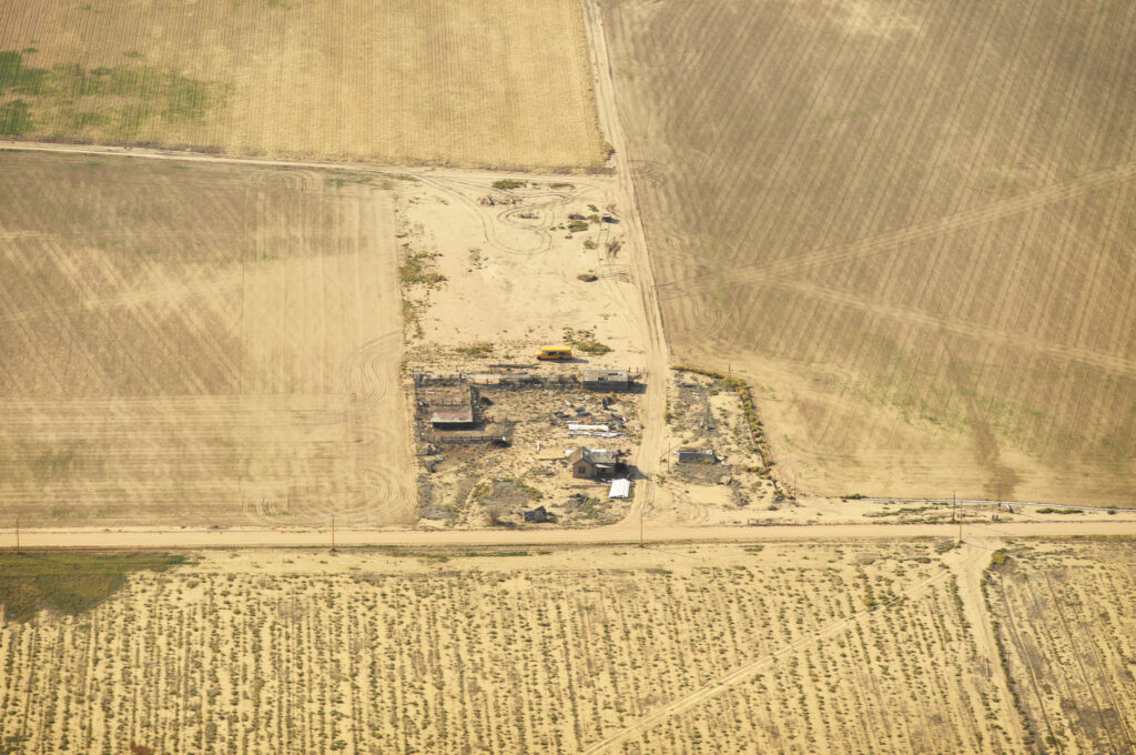
County Supervisor Dennis Townsend said he’s heard estimates that as much as 20% of the region’s farmland is being fallowed because of lack of water.
“Agriculture is our economy. You harm it and you harm every industry in the valley,” he said. “It’s the probability of what’s going to happen that worries me. If we do lose farmland, what is Plan B?”
The Water Desk’s mission is to increase the volume, depth and power of journalism connected to Western water issues. We’re an initiative of the Center for Environmental Journalism at the University of Colorado Boulder. The Water Desk launched in April 2019 with support from the Walton Family Foundation. We maintain a strict editorial firewall between our funders and our journalism.
In this era of climate change and water scarcity, one dry winter can change everything. As of this week, 95 percent of California is in a state of extreme or exceptional drought. Sierra snowpack is rapidly fading to rock, and reservoirs across the state are at a fraction of their normal levels. This has dire consequences for the state’s waterways.
In early June, water administrators who manage the San Joaquin River watershed announced that they will curtail flows from Friant Dam into the San Joaquin River until September, allowing it to dry up in a long section that environmentalists and federal water managers have worked hard over the past decade and a half to restore. The reduction in water doesn’t bode well for the river’s spring-run Chinook salmon, which spend the summer in the river below Friant Dam before laying their eggs in the fall. Adequate water is the key ingredient in an ambitious restoration program that, for the past 15 years, has sought to remake the river and bring back its vanished runs of Chinook salmon.
The loss of water impacts other animals as well. “The drying river is an unfortunate loss to the downstream reaches where riparian vegetation has started to take root and other non-salmon fish species have begun to repopulate the [once] dry sections,” said Don Portz, the manager overseeing the San Joaquin restoration for the Bureau of Reclamation. “These fish species have sustained intermittent drought conditions for centuries. But it’s man’s intervention that makes it more sudden and drastic—and that affects them the most.”
In a little over 350 miles—from its headwaters in the Sierra to its endpoint at the San Francisco Bay Delta—the San Joaquin River passes through some of the most intensively cultivated, hydrologically altered, and polluted landscapes in the world. In the few places where it runs freely in this terrain of 10,000-acre farms, it is a whisper of the wild river that, a century ago, could accommodate steamboats and held salmon runs so prolific that people living along its banks were said to have been kept awake at night by the sound of fins slapping on the water.
I wanted to see for myself what this intensively managed waterway looked like and how the restoration efforts had changed it, so last July I toured the San Joaquin with river guide and activist Tom Biglione. At the time, the state’s reservoirs and rivers were faring far better. There was enough water for us to traverse 25 miles by canoe. I discovered a river that is heavily damaged—particularly in its lower reaches—but that to my surprise, still has natural stretches that feel almost wild, evoking the faint promise of what the river could be like when the restoration project is completed—that is, if there’s the water to sustain it.
I met Biglione on a hot July morning at a dirt pullout on the outskirts of Fresno. A volunteer “river ambassador” for the Sacramento-based nonprofit Friends of the River, Biglione is a large man, 6’2″, with the baritone voice of a newscaster. He grew up near the San Joaquin’s banks, on a ranch in the town of Clovis. For the past five years, since retiring from the insurance industry, he’s led river trips to help the public understand the story of the San Joaquin. He believes that the more people get to know the river’s hidden beauty, the more likely they are to become advocates for its protection and restoration. “Most people assume that it is nothing but an agricultural ditch,” he said. “You’ll see after we’re done that this is not the case.”
The two of us hoisted his canoe from the top of his truck and carried it into a wide stretch of the river. The water was surprisingly cold and clear. Less than a mile upstream, the concrete curtain of Friant Dam towered above us—a stark reminder that the river here was carefully controlled and moderated by the Bureau of Reclamation.
We loaded our gear into the boat, and Biglione made a few short strokes, pulling us into the flow. Suddenly, the canoe caught the current and we charged ahead, toward a small rapid. “Draw right, draw right!” Biglione barked as the boat surged through a brief section of churning whitewater and into a stretch of calm, deep water. Below us we could see the outlines of darting fish. “We’re through,” he said, dragging an oar through the blue-green water.
The canoe glided downstream and into a lovely tree-lined section of the San Joaquin. The river here had the feel of a large creek rather than that of California’s second-largest waterway. Its flow during our journey, a modest 400 cubic feet per second, is a tiny fraction of what the San Joaquin carried before the great impoundment and irrigation projects of the 20th century. And yet it was a marked improvement of the San Joaquin of years past, which was reduced to little more than a trickle filled with agricultural pollutants. For years, one 60-mile stretch of the river (the same section set to go dry again this summer) had been erased entirely, its water siphoned away by unchecked agricultural withdrawals.
“It’s actually amazing that we can even get a canoe out here,” Biglione said. He mentioned the landmark 2006 settlement that forced the Bureau of Reclamation to provide enough water to sustain Chinook salmon populations downstream of Friant Dam and to restore critical sections of spawning habitat. “Before the Bureau of Reclamation was forced to put water back into the channel, this would have involved dragging the canoe through long stretches of river. A lot of time you’d end up in the blackberry bushes.”
Though pleasant, the section we were drifting through was a far cry from the upper San Joaquin River—an idyllic waterway, born of hundreds of small alpine streams, each fed, in turn, by rivulets of snowmelt. The river’s official birthplace is Thousand Island Lake, considered by many a backpacker on the John Muir Trail to be the gem in the ragged crown of the High Sierra. At 10,000 feet, one has the sense of being in a connected and ecologically intact system. “When you’re up there standing on the Sierra crest, looking down on the creeks feeding into the main stem of the San Joaquin, it all makes sense,” said Peter Vorster, a hydrologist with the Bay Institute who was involved in the 2006 settlement. “It’s easy to forget what happens to the river just a short distance downstream.”
Unlike the upper river, the lower San Joaquin leaves one with disparate images and impressions rather than a holistic sense of a connected and ecologically functional waterway. But here and there the river retains traces of its wild past. Ahead of Biglione and me, a great blue heron launched from the riverside vegetation. Tall sycamores and oaks shade the river and provide roosts for kingfishers and ospreys. These small riparian sections, which comprise critical spawning habitat for salmon, are also understandably coveted by people, many of them living in low-income communities lacking access to nature.
In one deep run fed by a fast riffle—a stretch that seemed particularly well suited to spawning salmon—we watched a group of roughly a dozen teenagers launch wildly from a rope swing into the river. Just downstream, beneath an overpass, three men in snorkels armed with spear guns patrolled the river. Further on, in a beautiful, slow-moving part of the river, we spoke with two bikini-clad women on horseback who coaxed their thousand-pound animals into the flow. “It’s so hot,” one woman said. “This is really the only place in town to escape the heat.”
Within an hour, the silhouette of the Highway 99 bridge loomed, and we paddled through a long stretch of slack water toward our exit point. As we dragged the canoe out of the water and onto shore, I told Biglione that I was sad to be leaving the river.
“I told you it was beautiful,” he said.
The next day, Biglione and I abandoned the canoe. To see the sections below the Highway 99 bridge downstream to the San Joaquin’s confluence with the Merced River, we drove a maze of roads winding through agricultural lands.
In one section accessible only by a dirt road running along the perimeter of a sprawling almond orchard, the river surged through heaps of garbage and homeless encampments. We pressed on, to the outskirts of the farming community of Mendota, where subsistence fishermen were defying warning signs—one read “Prohibido El Paso”—and casting their lines into murky irrigation canals.
The farther downstream we went, the more disorienting and dehumanizing the landscape became. On the outskirts of Los Banos, Biglione and I tried to decipher a knot of side channels, several of them completely dry, before realizing that the river’s flow had been shunted into an arrow-straight channel called the Eastside Bypass, which faded to a vanishing point in an endless sea of almond orchards.
On our last stop, near the San Joaquin’s confluence with the Merced River, we parked on the narrow shoulder of a two-lane highway as a steady stream of cars whooshed unnervingly past us. Biglione and I ducked onto a path littered with garbage and picked our way carefully down an embankment. Below, the San Joaquin slithered beneath an overpass, its flow almost imperceptible. The water was tinged a eutrophic green and smelled stagnant, almost dead. I could hardly believe this was the same crystalline, wilderness waterway I’d hiked and fished in the High Sierra numerous times over the years.
We walked over heaps of broken concrete to the river’s edge. On a piece of clear plastic lay a weathered knife and several mutilated baitfish teeming with flies. I told Biglione that it felt like we had stumbled onto a crime scene.
“It is a crime—a crime against nature,” he said. “The question is whether or not anyone cares if justice is served.”
In this series
Can we save the San Joaquin’s salmon?
Tour the San Joaquin River
Floating down the San Joaquin River
Jeremy Miller is a writer in Richmond, California. His recent work has appeared in publications including Harper’s, Orion, and Pacific Standard. Follow him on Twitter @jeremyj_miller.
FRIANT DAM, just outside Fresno, California, is a sprawling structure, 319 feet tall and two-thirds of a mile across. It’s not the tallest or the longest dam in the United States, but measured by the impact on the river that it constrains, it looms larger than most.
Constructed just after the Great Depression, Friant Dam was devised to control the San Joaquin River, California’s second-longest waterway. The river’s raucous flow, fed by snowmelt from the Sierra Nevada, was corralled in a 4,900-acre reservoir called Millerton Lake (named for the small town it drowned). From there, it was divvied up and shunted into a vast network of canals to supply water for millions of acres of farmland and the Central Valley’s growing cities. For decades, one 60-mile section—beginning 38 miles downstream of Friant Dam and stretching to the San Joaquin’s confluence with the Merced River—ran dry. Parts of the river where water still flowed were blighted with pesticides and fertilizer, creating massive algal blooms and dead zones.
The intensive engineering of the river exacted a huge toll on its native ecosystems. No species suffered more than the Chinook salmon, whose epic migration from the Pacific Ocean to its spawning grounds in the High Sierra was cut short by numerous choke points, not the least of which was Friant’s impenetrable barrier of concrete.
Millerton Lake as seen from the top of Friant Dam. Smoke from the nearby Creek Fire cloaks the Sierra Nevada.
In 1988, environmental groups including the National Resources Defense Council, the Bay Institute, and the Sierra Club used a statute in the California Fish and Game Code to argue that the US Bureau of Reclamation had failed in its duty to maintain flows below Friant Dam to support Chinook salmon. In 2006, a landmark settlement was reached, allocating nearly $900 million to repair 150 miles of river below the dam and to reestablish a self-sustaining population of Chinook salmon.
Rife with compromises, the settlement mandated that a mere fraction of the San Joaquin’s historic flow be restored. The river’s many dams would remain, but alternative passages would be built and new spawning areas added in the lower river. In other words, the settlement sought to give the salmon a chance to survive within a massive water management scheme that favors industrial-scale farming.
Last October, I visited Friant Dam to meet Don Portz, the restoration program manager at the Bureau of Reclamation, to see how, nearly 15 years later, the restoration was coming along. Portz’s job is to ensure that the terms of the settlement are met—namely, that the salmon, which were reintroduced to the river in 2012, can get around the many obstacles on their way up to the stretch below Friant Dam where they can spawn.
We stood at the top of Friant Dam looking out at Millerton Lake, which was swathed in smoke from the Creek Fire. Portz told me that the point of the restoration is not to remake the river of the past but to create something new—a human-mediated river capable of supporting fish while also delivering farmers and cities their share of water. “The goal of all these projects,” Portz said, “is to allow the volitional passage of adult Chinook salmon and other fishes upstream to spawning habitat below Friant and the successful return of their offspring back to the ocean.”
In plain terms, “volitional passage” means that the fish can migrate and complete their life cycle without human intervention. Ironically, accomplishing that goal has required—and will continue to require—major human intervention. Some of the projects planned for the years ahead will rival in scale and complexity the construction of Friant Dam. As California’s population grows, water shortages deepen, and the impacts of climate change intensify, the restoration program is an expensive and resource-intensive gamble. Can the San Joaquin and its salmon really be engineered back into existence?
—
Map by Simone Tieber
IN THE MID-19TH CENTURY, an estimated 1 million salmon would swim up the San Joaquin River each year to spawn as part of North America’s southernmost salmon run. They were exquisitely adapted to survive the extremes of the 300-plus-mile journey from the Pacific Ocean and the maze of tidal channels in the Sacramento–San Joaquin Delta, along the slow, meandering waterways and oxbow lakes of the Central Valley, to the frigid streams of the Sierra thousands of feet above the valley floor. To endure the grueling migration, the salmon ate voraciously at sea and could weigh up to 50 pounds.
Come spring, the San Joaquin, swollen with snowmelt, would overtop its banks and spill out onto the valley floor. “In June 1847,” wrote the explorer John Charles Frémont, “the Joaquin was nowhere fordable. . . . All the large tributaries, the [Merced], To-wal-um-ne, Stanislaus, and Mo-kel-um-ne, required to be boated and were pouring down a deep volume of water from the mountains, one to two hundred yards wide.” In these vast marshes and shallow lakes, baby Chinook, known as fry, found refuge from predators, and juvenile salmon on their way to sea gained in size and strength. The Chinook swam high into the Sierra foothills—to a minimum of 1,500 or 2,500 feet, depending on the time of year. Historical accounts suggest that they may have traveled much higher. “It is a fact well known to the fish culturists,” reads an 1890 report from the California Fish Commission, “that the winter and spring run of salmon, during the high, cold waters, go to the extreme headwaters of the rivers, if no obstructions prevent, into the highest mountains.” Chinook in the Merced River swam deep into the granite canyons on the western margins of today’s Yosemite National Park, and might have even reached as far as Yosemite Valley, to lay their eggs in the crystalline pools below Vernal Falls.
For centuries, the Miwok, whose territory encompassed several major tributaries of the San Joaquin, relied on the delicate flesh of the kosum—the Miwok word for salmon. Early European explorers found it easier to shoot the hefty fish with rifles than to bother with trying to snag them on a hook or a spear. During the gold rush, Chinook salmon provided miners with an easy-to-harvest food source, and by the 1860s a flourishing fishery had sprung up, with 175 boats supplying 19 canneries in the delta. But the practice of hydraulic mining, which relied on water cannons to blast hillsides into a slurry, unleashed sediment and other toxic materials into the rivers, and this, along with overfishing, agriculture, and logging at higher altitudes, had greatly diminished salmon stocks by the late 1880s. The destruction of the San Joaquin’s salmon fishery followed a human holocaust along the river that had begun in the 1830s, when cholera and smallpox brought by white settlers wiped out an estimated 60,000 people, roughly three-quarters of the Indigenous population of the San Joaquin Valley.
In less than a century, the San Joaquin River was transformed from a free-flowing salmon superhighway into a corridor of agriculture and commerce.
The large-scale water-engineering schemes of the early- and mid-20th century—what writer Marc Reisner called “the worst disruption of salmon habitat you can find anywhere on Earth”—were the fatal blow to California’s salmon runs. The California State Water Project and the Central Valley Project rejiggered California’s natural hydrology on a mass scale, delivering water from the wetter and sparsely populated northern reaches of the state to the arid but highly populated southern reaches. The San Joaquin’s sinuous meanders were straitjacketed in concrete channels, and its massive wetlands and lakes were drained to make way for farms. The final cataclysmic stroke came with the commissioning of Friant Dam in 1942.
In less than a century, the San Joaquin River was transformed from a free-flowing salmon superhighway into a corridor of agriculture and commerce. By 1950, its salmon were all but extinct. George Warner, an employee of the California Fish and Game Department (today’s Department of Fish and Wildlife), recounted trying to save the last members of the San Joaquin’s spring run that year:
Only thirty-six salmon were counted at the ladder, and many of these were so weak they could barely swim from one pool to the next. . . . Some could just make it to the ladder, and I had to use a dipnet to carry them, one at a time, up the bank to release them in the canal. Probably none of the thirty-six lived to spawn.
—
“THE DAMAGE DONE in the last century to this river is extensive,” Portz said, peering out at the San Joaquin where it snaked through a parched landscape of golden hillsides. “There’s no easy fix.”
Together we walked Friant’s long promenade, the dam dropping away from us like a tombstone-gray curtain. Tall and affable, Portz has angular features and closely cropped hair. His accent is inflected with traces of upstate New York, where he grew up along the banks of the Hudson River. A self-proclaimed fish geek with a PhD in fish ecophysiology from the University of California, Davis, Portz took a job as a fish biologist with the Bureau of Reclamation almost 20 years ago. While the bureau was focused on operating and maintaining its vast and aging inventory of dams, Portz was devising better ways to help fish get around them. In 2018, he assumed the role of restoration manager. “I think it says a lot about where we want to go as an agency that they entrusted a fish biologist to take over the helm of the restoration,” he said.
Fish biologist Don Portz oversees the San Joaquin River Restoration Program.
Portz gestured to where a concrete channel diverges from the San Joaquin’s main waterway. This is the beginning of the 152-mile-long Friant-Kern Canal, which delivers irrigation water to a million acres of farmland and drinking water to a quarter million people in the southern region of the Central Valley. Though its flow varies depending on the demand of farms, the canal siphons as much as 5,300 cubic feet per second from Millerton Lake—more than 13 times the amount of water flowing through the San Joaquin’s main channel on the day of my visit.
One of the critical early successes, Portz explained, has been eliminating the San Joaquin’s long dry stretch. In all but the driest years, water now flows along the entirety of the river’s length. But the amount of water is still far less than what is called for in the 2006 settlement, which dictates that the San Joaquin eventually be returned to a maximum flow of 4,500 cubic feet per second. The problem is that the San Joaquin’s network of channels and levees was built to handle intermittent flooding but not a constant volume of water. A steady flow of 4,500 cubic feet per second from Friant Dam could cause a catastrophic failure of the earthen dikes or damaging “seepage” into the root zones of orchards planted along the river.
The insufficient flow has meant that fish need a lot of help navigating the San Joaquin’s lower reaches. Since the salmon’s reintroduction in 2012, California Department of Fish and Wildlife (CDFW) workers have captured fish in the lower river each spring and hauled them by truck around the river’s various choke points to a roughly 25-mile stretch below Friant. Portz pointed to a pool of water at the dam’s base. No more than a hundred yards across, it is continuously refreshed by cold water coursing from the bottom of Millerton Lake, providing an area where salmon can “hold” through the heat of summer until they are ready to lay eggs in the fall. The surge from the dam’s penstocks also supplies what elevation used to—water cold enough to sustain salmon eggs, which perish at water temperatures higher than 60°F. It was unnerving to realize that the survival of this once-mighty species now depended on such a minuscule pool of water.
Last spring, fish biologists captured juvenile salmon and tagged them with dye and tiny microchips to track their progress through the lower river and delta.
In spite of the limitations, the salmon have shown tantalizing signs of revitalization. In 2014, 60,000 juvenile spring-run salmon, raised in a hatchery on the Feather River, were introduced below Friant Dam. Three years later, something incredible happened: Heavy runoff transformed large stretches of the San Joaquin’s lower floodplain into a massive wetland. In this watery landscape, some of these Chinook salmon made it on their own, without the aid of traps and trucks—volitionally—from the Pacific Ocean to the base of Friant Dam for the first time in more than a half century. The river was so swollen that year that biologists were not able to capture these fish, but their journey was verified through genetic analysis of their offspring, which began to show up in Bureau of Reclamation traps in late fall 2017. The presence of these baby salmon marked another critical milestone—the first time spring-run Chinook had successfully spawned in the San Joaquin in more than 60 years.
There is a lot more being protected here than salmon. It’s other animals and endangered species. It’s ecosystems. It’s water quality. It’s everyone living in the valley.
Portz and I left the dam and headed about a mile downstream to see a short section of the river used by salmon for spawning. At a dirt pullout we met Mike Grill, a CDFW environmental scientist, dressed in well-worn hip waders. The three of us walked over a bridge on Route 206 that vibrated unnervingly with each passing car. Below us, near a massive slab of cast-off concrete, we saw what looked like a ribbon of clear plastic undulating in the blue-green water. Then the outline revealed itself, bone white, defiantly wriggling against the current. “That one is pretty beat-up,” Grill said. “It’s probably done spawning and on its last legs.”
To Grill, the nearly expired fish was an indication of the river’s improving ecological health. Earlier in the season, the CDFW had captured 57 adult fish near the San Joaquin’s confluence with the Merced River and released them below Friant Dam. An additional 285 “brood stock” (biological jargon for hatchery-raised adults) were added to the population of spawning fish. Grill said that in the previous weeks, his team had counted close to 75 fish nests called redds: concavities of river stones cleared by female fish to deposit their eggs. Those numbers, however, were down sharply from 2019, when biologists had counted 200 redds.
Portz suspects that this year’s lower numbers were the result of several factors, including a lower survival rate of juvenile fish in the delta and poor ecological conditions in the Pacific, but that the main variable was low precipitation. By comparison, the number of redds was higher in the 2016–17 and 2018–19 seasons, when surplus snowpack significantly boosted the San Joaquin’s flow. But lower snowpack and rainfall in 2017–18 led to a reduced runoff, which translated to a more arduous upstream journey for salmon.
When the hatchlings emerged in spring, Portz told me, some of them would be captured and tagged with dye and tiny microchips to track their progress through the lower river and delta. “We’re still trying to figure out how to create conditions in the river that are best for salmon,” he said. “But every year we are learning and getting better at it.”
The point of the entire effort is to establish a self-sustaining population of 500 Chinook salmon—a tiny fragment of a population that once numbered in the hundreds of thousands. The hope is that these fish will multiply until their numbers resemble the great schools of the past.
Later that day, Portz and I traveled farther downstream to look at another major impediment for migrating salmon—an antiquated structure called Mendota Dam. We drove an hour west of Fresno, through tangles of new construction in the town of Mendota and then across a large public park filled with rusting picnic tables. A few hundred yards beyond, the river channel appeared. Myriad side channels were hacked into the dirt, each carrying a fraction of the San Joaquin to an individual water district miles away.
Built in 1919, Mendota Dam is an ungainly edifice of concrete. Portz noted the primitive concrete fish ladder extending from the dam’s midsection. “It’s poorly designed,” he said. “Totally useless. No way a salmon is getting up through that.” In all but the largest floods, salmon and other fish become marooned at the base of the dam. To make matters worse, on the upstream side of the dam, its small reservoir was covered in an impassible tangle of invasive bright-green water hyacinth. And juvenile fish easily become lost in the side channels. “They feel all of these canals and say, ‘Hey, that way is to the delta; that way is to the ocean.’ But it’s not,” Portz said.
The bureau is in the process of acquiring land to build a nearly mile-long bypass channel that will be wider than the San Joaquin itself and will allow salmon and other native fish, including sturgeon, to circumvent Mendota Dam and its reservoir entirely. Known as Reach 2B, it is the largest and most technically complicated part of the San Joaquin restoration, as well as the most expensive—carrying an estimated price tag of $336 million.
To ensure that fish choose the correct path and don’t get trapped in the side channels or sucked into pumps, Reach 2B will incorporate an intricate series of passageways, pipes, and screens; nevertheless, it’s meant to be intuitive and easy to navigate. “This is a two-way street,” Portz said. As spawning adults are migrating upriver, juveniles from the previous year are swimming out to the Pacific. “You’ve got to let the fish and Mother Nature do it on their own.”
Portz’s prediction, that with the right human ingenuity the salmon will someday be able to “do it on their own,” seems to be bearing itself out. This past April, he called me to share the news that the restoration team had once again captured adult Chinook at the confluence of the Merced and the San Joaquin. I could hear the excitement in his voice. Despite a disappointingly dry winter and subsequent reduced flows from Friant, returning salmon had, for the fourth time in five years, made it across the delta and up to the confluence. “We’re seeing a lot of resilience,” Portz said, “even in years with less water.”
—
BYPASSES WON’T MATTER much if the fish can’t reach them, so recovering some of the Central Valley’s former wetlands is also a crucial part of the restoration. The largest and most promising of these efforts is the Dos Rios Ranch project—a 2,100-acre parcel roughly 50 miles downstream from Mendota Dam that was acquired in 2012 with $21.8 million in federal, state, and local funds.
The Mendota Dam is virtually impassable for salmon. A soon-to-be-built bypass channel is the restoration program’s most complicated project to date.
To date, 1,600 acres of the Dos Rios allotment have been restored. On a chilly, overcast day in February, I drove out to the property to meet with Julie Rentner, president of the Chico-based River Partners, the nonprofit heading up the project. The restoration, she explained, involves breaching and in some cases removing infrastructure such as levees and berms in order to put water back onto the land. A similar effort is underway at the Yolo Bypass. But unlike the Yolo, which provides habitat in the midst of active farms, the Dos Rios project aims to retire farmland and “give it back to the river,” Rentner said.
The property sprawls along the floodplain of the Tuolumne and the San Joaquin—the eponymous dos rios. Former farm fields had been stripped of crops and were dotted with small plastic sleeves, each encasing a hand-planted native grass, shrub, or tree, a mosaic including sedge, willow, and valley oak. “We’re just sort of throwing it all out there and seeing what takes,” Rentner said.
We snaked atop a series of levees to a vantage point upstream of the confluence. The area was once part of a sprawling Mexican land grant known as El Pescador (“the fisherman”), a not-so-subtle historical reminder of the aquatic life that once thrived here. Rentner hopes that the Dos Rios project will be the first in a series of strategically placed wetlands for juvenile Chinook along the course of the San Joaquin, providing critical habitat for them to grow and gather strength. “Wetlands are full of nutrients and insect life,” Rentner said, “all the things young salmon need to prepare for their eventual journey to the Pacific.”
California’s San Joaquin River below the salmon barrier of Friant Dam.
The benefits, however, extend far beyond salmon, Rentner said. Since restoration work began here nine years ago, many dozens of species of birds and mammals have returned, a number of which are listed as endangered. The riparian brush rabbit was rediscovered a few years ago, after it was thought to have been extirpated by the New Year’s Day flood in 1997. (The rabbits survived that and subsequent floods, Rentner speculated, by climbing to elevated parcels specially designed for wildlife in the preserve.) Dos Rios is also located along the Pacific Flyway and provides critical habitat for the endangered Aleutian cackling goose.
While our side of the river was being given back to nature, across the water we could see the self-interested, slapdash engineering that, over the decades, has transformed much of the valley into an agricultural wasteland. Huge slabs of concrete and asphalt had been dumped onto the Tuolumne’s steep riverbank in an attempt to stave off erosion. “It’s well known around here that if you have concrete debris, you give it to farmers on the riverbank,” Rentner said. “Of course, this violates at least eight environmental-protection laws on the books in California, but there is zero enforcement capacity.”
Wetlands like these benefit not only animals, Rentner said, but also the surrounding human communities—even the concrete-dumping farmer across the river. We stood at the epicenter of the New Year’s Day flood, one of the worst in state history, which inundated much of the Central Valley and left parts of the nearby city of Modesto under 15 feet of water. A more robust array of floodplains could have mitigated the damage. Wetlands also moderate a river’s behavior, making it less susceptible to wild swings of drought and flood. And while groundwater monitoring and models are still evolving, permanently retiring farmlands to restore wetlands may be key to addressing two of the Central Valley’s most pressing problems, groundwater overdraft and land subsidence, particularly as climate change bears down. “If we really think about all the public outcomes of moderating floods and improving environmental conditions for wildlife and enhancing water quality,” Rentner said, “it’s likely they will greatly surpass the value of the crops produced in those fields.”
The salvation of the San Joaquin and its salmon, Rentner believes, will ultimately depend on replacing the “siloed and segregated” water policy that has dominated California for decades with a more holistic, ecosystem-based form of management. “Somehow we need to get past the idea that putting water in the river for the fish is ‘too expensive,'” Rentner said. “There is a lot more being protected here than salmon. It’s other animals and endangered species. It’s ecosystems. It’s water quality. It’s everyone living in the valley.”
As inspiring as the work to restore the San Joaquin River is, the truth remains that it is unfolding in a human-ravaged landscape, one that forces Chinook salmon to spawn at elevations lower than what they have adapted to. In the meantime, attitudes about the West’s big dams have started to shift. Numerous dams in the Pacific Northwest—including those on the Elwha, Sandy, and Rogue Rivers—have been demolished, leading to an almost immediate rebound in salmon populations. Earlier this year, Representative Mike Simpson, an Idaho Republican, proposed a $33.5 billion plan to begin removing four major dams on Idaho’s Snake River in 2030. If federal regulators are serious about saving the San Joaquin’s salmon runs, is it time to begin thinking about removing the largest obstacle on the river, Friant Dam?
I followed up with Portz by email to ask this question. He replied with an emphatic no, noting that above Millerton Lake the San Joaquin does not flow unobstructed but is interspersed with a series of other dams and reservoirs. “Spawning habitat is poor, and the risk of stranding for summer holding is high in this stretch,” he wrote. “Dam removal on the San Joaquin River would be cost-prohibitive, eliminate water storage in an already drought-prone environment of the state, and impact thousands of acres of farmland with no guarantee of a fully rebounded, self-sustained Chinook salmon population.”
All of which means that for the foreseeable future, the Chinook of the San Joaquin will be swimming upstream against a nearly insurmountable flow of human self-interest, striving to sustain themselves in the whisper of river we have left them.
Mette Lampcov is a Danish documentary photographer based in Los Angeles. Funding for this story was provided through a fellowship at the University of Colorado Boulder’s Water Desk.
Funding for this story was provided through a fellowship at the University of Colorado Boulder’s Water Desk.
To learn more about today’s San Joaquin and the restoration challenges, go to sc.org/san-joaquin.
Fifteen years ago, a landmark legal settlement brought almost a billion dollars in funding to revitalize a badly degraded San Joaquin River. Take a tour of ongoing efforts by the US Bureau of Reclamation, an unlikely savior, and conservation groups to ease the passage of salmon and trout from the Pacific Ocean to a vital 150-mile stretch of the river below the Sierra Nevada. This interactive map was produced in collaboration with The Water Desk at the University of Colorado Boulder.
The San Joaquin
Reimagining a River
California’s San Joaquin River flows from the Sierra Nevada to the Pacific Ocean. At just over 350 miles, it is California’s second-longest waterway. But by the measure of the ecological damage it has sustained, it has no rival.
This map is a visual narrative of that history and the ambitious effort to restore the river and its iconic species, the Chinook salmon.
Scroll to continue.
The San Joaquin
America’s Most Endangered River
In 2014, the environmental group American Rivers named the San Joaquin “America’s Most Endangered River.” The river has been devastated by dams and water diversions delivering the bulk of the river’s flow to the region’s farms and cities.
This change has been devastating to migratory fish populations like salmon, steelhead, and sturgeon and other species dependent on wetland ecosystems.
The lower San Joaquin flows through a mosaic of farmlands in the Central Valley. Water Education Foundation
Friant Dam
The Great Barrier
Friant Dam is the ultimate barrier to salmon on the San Joaquin River. Constructed in the late 1930s as part of the Central Valley Project, the dam dramatically altered the hydrology of the San Joaquin, shunting most of the river’s flow into the Friant-Kern Canal, which today delivers water to more than a million acres of farmland and a quarter of a million people in the Central Valley.
Construction of Friant Dam, a centerpiece of the Central Valley Project, began in 1939 and finished in 1942. Friant Water Authority
Millerton, California
A Town, Drowned
In the late 1800s and early 1900s, steamboats could pass up the San Joaquin River as far as this now-vanished settlement. Before its impoundment, the river could reach spring flows of 10,000 cubic feet per second or more.
The former riverside town of Millerton was submerged under the reservoir that bears its name. Millerton Lake State Recreation Area
Upper San Joaquin River and Tributaries
Denied Access
The construction of Friant Dam cut the San Joaquin River in two, denying Chinook access to their historic spawning grounds in the river’s high-elevation tributaries. This loss of habitat led to a calamitous crash in salmon populations.
Thousand Island Lake, a favorite destination of backpackers, marks the spectacular headwaters of the San Joaquin. Flickr User Marty B
Bureau of Reclamation Restoration Area
A Landmark Restoration
In 2006, a landmark settlement was reached between environmental groups and the Bureau of Reclamation requiring the agency to restore a self-sustaining population of Chinook salmon below Friant Dam.
Fifteen years on, the effort has met resistance, particularly from agricultural interests in the valley. But the San Joaquin and its salmon have also shown tantalizing signs of rebirth.
Restoration scientists check a rotary screw trap for migrating salmon. San Joaquin River Restoration Program
Reach 1A
New Spawning Grounds
The 25-mile stretch of river below Friant Dam is a key part of the San Joaquin restoration. Known as Reach 1A, this stretch of river is supplied with cold water coursing from the bottom of Friant Dam and provides restored salmon populations with viable spawning habitat.
A verdant stretch of the San Joaquin known as Reach 1A is critical spawning habitat for Chinook salmon. Jeremy Miller
Scout Island
A Vital Refuge for Fish and People
Along Reach 1A are small areas of riparian vegetation that once filled the lower reaches of the San Joaquin River. These areas provide habitat for spawning salmon and dozens of other species of birds, mammals, and plants. They are also coveted by locals, who flock to the river in large numbers during summer to escape the heat.
Recreationists enjoy the cold waters of the San Joaquin River on the outskirts of Fresno. Jeremy Miller
Mendota Dam
Giving Salmon a Way Around
Mendota Dam, built in 1919, is among the most serious barriers facing salmon and other migratory fish species in the lower river. It is also the site of the priciest and most complex project of the San Joaquin River restoration. When complete, Reach 2B will incorporate a large bypass channel that will allow spawning salmon upstream and juvenile fish to avoid the dam.
Mendota Dam is an antiquated structure on the lower San Joaquin that blocks the passage of salmon and other migratory fish. Mette Lampkov
Eastside Bypass
Loosening the Straitjacket on the San Joaquin
Over the years, engineers transformed large stretches of the river, including the Eastside Bypass, from a meandering waterway into a linear water conveyance system. These changes had drastic consequences for salmon as well as dozens of other wetland species. In low-water years, salmon must be captured and hauled in trucks around these choke points to Reach 1A, below Friant Dam. While the restoration does not call for the removal of the bypass altogether, it seeks to make it more navigable for fish.
Along much of its lower section, the once sinuous riverbed of the San Joaquin has been hemmed into linear concrete canals. Jeremy Miller
Confluence with Tuolumne River
A Watery World
One can get a sense of the pre-engineered San Joaquin in the writings of John Muir. In a journal entry from November 1877, Muir wrote of a watery landscape in which “salmon in great numbers … [made] their way up the river for the first time this season.” Muir also noted the presence of “mud” from hydraulic gold mining operations miles upstream, hinting at the multitude of impacts to come.
The confluence of the Tuolomne and San Joaquin Rivers was once part of a Mexican land grant called El Pescador (the fisherman). David Rumsey Map Collection
Dos Rios Wetland Restoration
Remaking the San Joaquin’s Wetlands
Today, at the confluence of the San Joaquin and Tuolumne Rivers, an ambitious restoration project is underway to restore the kind of wetland habitat that Muir would have seen nearly 150 years ago. The Dos Rios Ranch Preserve, overseen by the nonprofit River Partners, seeks to restore a 2,100-acre parcel of wetland. Since acquiring the property in 2012, River Partners has restored 1,600 acres of the Dos Rios allotment.
The Dos Rios Restoration encompasses 2,100 acres of riverside farmlands being transformed into wetland habitat. River Partners
San Joaquin–Sacramento River Delta and Beyond
Challenges Beyond
The perils for salmon extend beyond the river and into the great estuary, or delta, formed at the confluence of the San Joaquin and Sacramento Rivers. Massive pumps delivering water to the aqueducts of the State Water Project have altered the river’s salinity and harmed migrating salmon, which depend on water chemistry for navigation. Collapsing marine ecosystems in San Francisco Bay and the Pacific Ocean—driven by climate change, overfishing, and pollution—have also seriously imperiled the recovery of the San Joaquin’s salmon population.
A coproduction of Sierra Magazine and The Water Desk
Written and produced by Jeremy Miller and Geoff McGhee/The Water Desk
Supported by a grant from The Water Desk, part of the Center for Environmental Journalism at the University of Colorado Boulder.
Map sources: United States Bureau of Reclamation; River Partners
Ed Johnson smokes a cigarette in Hasty, Colorado, on Sept. 22, 2020. “I am hightailing it out of here,” he said. In the morning, he planned to start driving to South Carolina and move in with his brother. Johnson said he is not leaving because of the water issues in the area, even though the water has been bad for as long as he could remember. “It tastes like there is sweat in it,” he said. “That is nothing new. No, I’m leaving because this place is just plain hard.” RJ SANGOSTI, THE DENVER POST
Sunlight tunneled into the room and danced with smoke from Ed Johnson’s cigarette. He sat thinking of his mother.
In 2013, he moved back to the two-bedroom home in Hasty, on the southeastern plains of Colorado, to take care of her. Johnson, 62, remained in the house after her death in 2016.
The home is located at the entrance of John Martin Reservoir in Bent County. The town has a small general store, a post office, a bait shop and a campground that hosts guests visiting the reservoir mostly in the summer months. Several homes, similar in size to Johnson’s, are gridded along blocks of dirt roads that make up the township.
In the 1940s, the Arkansas River was dammed south of town to build the reservoir, a place locals call the Sapphire on the Plains. The reservoir was tied up in a 40-year battle until Colorado and Kansas came to an agreement, in 2019, to provide an additional water source to help keep the levels high enough for recreation and to support fish.
Forty years may seem like a long time to develop a plan to save fish and improve water levels for a reservoir, but southeastern Colorado is used to long fights when it comes to water.
Pelicans gather on a small island exposed by low water levels at John Martin Reservoir in Hasty, Colorado, on Oct. 3, 2020. In 2019, Colorado and Kansas came to an agreement to provide an additional water source to feed the reservoir, which the Colorado Department of Wildlife calls a conservation pool. It took 40 years for this agreement to come to fruition to help with fish loss and keep the reservoir levels high enough for recreation. RJ SANGOSTI/THE DENVER POST
For nearly a century, leaders in southeastern Colorado have worked on plans to bring clean drinking water to the area through the proposed Arkansas Valley Conduit, but progress on the pipeline project stalled after a major push in the 1960s. Pollution, water transfers and years of worsening drought amid a warming climate continue to build stress for water systems in the area. Adding to that, the area continues to see population decline combined with a struggling economy.
The water needed for the conduit will be sourced from melting snowpack in the Mosquito and Sawatch mountain ranges. Under the Fryingpan-Arkansas Project Act, passed in the early 1960s, the water has been allocated for usage in the Lower Arkansas Valley. The water will be stored at Pueblo Reservoir and travel through existing infrastructure to east Pueblo near the airport. From there, the conduit will tie into nearly 230 miles of pipeline to feed water to 40 communities in need.
Renewed plans to build a pipeline to deliver clean drinking water to the Lower Arkansas Valley are bringing hope for many people in southeastern Colorado. But in an area that is inextricably linked to its water, the future can seem unclear.
One thing that was crystal clear were Johnson’s plans for the next morning.
“I am hightailing it out of here,” he said.
His black sedan was parked outside, and his belongings were piled past the windows. In the morning, he planned to start driving to South Carolina. “I’m gonna move in with my brother,” he said.
Johnson said he is not leaving because of the water issues in the area, even though the water has been bad as long as he could remember.
“It tastes like there is sweat in it,” he said. “That is nothing new. No, I’m leaving because this place is just plain hard.”
Hasty can feel like one of those places where time stopped. “You stand outside the post office, and you hear the same people say the same things,” Johnson said. For him, that was the hardest part of living there.
LEFT: A truck drives past Valley Grocery in Hasty, Colorado, on March 9, 2021. RIGHT: Bill Yates drinks a cup of coffee at Valley Grocery. Yates, at 81 years old, believes he may be the living resident who has lived in Hasty the longest. “For as long as I can remember, water has been an issue around here,” Yates said. RJ SANGOSTI, THE DENVER POST
“Always talk and never action,” he said.
“Look at this dirt. You know how many times I heard them say they were going to pave the roads (in Hasty)?”
Johnson figured the plans to fix the drinking water were the same. Just talk with no action, and, for him, he’d had enough. Hasty, and its 144 residents, are now minus one.
“Deliver on that promise”
“It was nearly 100 years ago, in the 1930s, that the residents of southeast Colorado recognized that the water quality in the lower valley of the Arkansas River was quite poor,” said Bill Long, president of the Southeastern Colorado Water Conservancy District and a former Bent County commissioner.
Water systems in the district, which includes Pueblo, Crowley, Bent, Prowers, Kiowa and Otero counties, have two main issues affecting drinking water.
The first is that a majority of those systems rely on alluvial groundwater, which can have a high level of dissolved solids. This can include selenium, sulfate, manganese and uranium, which are linked to human health concerns.
Second, the remaining systems in the water district rely on the Dakota-Cheyenne bedrock aquifer that can be affected by naturally occurring radionuclides. Radium and other radionuclides in the underlying geologic rock formation can dissolve into the water table and then be present in drinking water wells, also carrying health risks.
In 1962, residents in southeastern Colorado thought President John F. Kennedy was delivering a solution to their drinking water problem during a ceremony in Pueblo. Congress had passed the Fryingpan-Arkansas Project Act, and Kennedy came to Pueblo to authorize the construction of a pipeline to deliver clean drinking water.
President John F. Kennedy delivers remarks in Pueblo, Colorado, to commemorate the Fryingpan-Arkansas Reclamation Project in 1962. ROBERT KNUDSEN, WHITE HOUSE PHOTOGRAPHS, JOHN F. KENNEDY PRESIDENTIAL LIBRARY AND MUSEUM, BOSTON
Kennedy said, “I hope that those of us who hold positions of public responsibility in 1962 are as far-seeing about the needs of this country in 1982 and 1992 as those men and women were 30 years ago who began to make this project possible. The world may have been built in seven days, but this project was built in 30 years.”
Residents of the 1930s began working on ideas to deliver clean drinking water to southeastern Colorado. By the 1950s, they were selling gold frying pans to raise money to send backers to Washington, D.C., to encourage Congress to pass the Fryingpan-Arkansas Project Act. But it wasn’t until 1962 that the pipeline authorization became a reality.
Fast forward 58 years, and two more politicians came to Pueblo to address a crowd about the same pipeline project. This time, on Oct. 3, 2020, it was at the base of Pueblo Dam. Because of funding shortfalls, the Arkansas Valley Conduit was never built after it was authorized in 1962.
The Colorado communities could not afford to cover 100% of the costs, as initially required, so in 2009, the act was amended to include a 65% federal share and a 35% local cost share. Additionally, in 2020, Congress appropriated $28 million more toward the project, according to the water conservancy district.
That October day, Sens. Michael Bennet and Cory Gardner took turns talking about the importance of the project. They told a small crowd that when the pipeline is built, it will provide clean drinking water to 50,000 residents in southeastern Colorado.
LEFT, CENTER: Shovels and chairs are lined up at the base of the Pueblo dam during a groundbreaking ceremony for the Arkansas Valley Conduit in Pueblo, Colorado on October 3, 2020. RIGHT: Colorado Senators Michael Bennet and Cory Gardner attended the groundbreaking ceremony Both senators spoke about the importance of the conduit that would provide clean drinking water to 50,000 residents in Southeastern Colorado. RJ SANGOSTI, THE DENVER POST
With dignitaries beside them, the two senators drove shiny new shovels into dirt to mark the day the Arkansas Valley Conduit construction began.
“In 1962, President Kennedy came to Pueblo, Colorado, and promised that we would build the Arkansas Valley Conduit. Here we are in 2020, and we’re beginning construction for the first time to actually deliver on that promise,” Gardner said.
The water conservancy district estimates the pipeline project’s cost will range from $546 million to $610 million.
“This is important to those 40 communities. They can no longer afford to treat their drinking water,” Gardner said.
Bennet said, “We got an important decision to make in this country about whether we’re gonna have a rural America or not. You can’t have a rural America if you don’t have clean water.”
In a statement, the Bureau of Reclamation said “a reliable source of clean, safe water is needed for the area’s health and welfare.”
Physical construction of the pipeline won’t start until 2022, according to the water district.
Map provided by Southeastern Colorado Water Conservancy District and done by the Bureau of Reclamation. The map was modified to add locations referenced in the story.
“They are the ones with the knowledge”
“Uncle Frank was a big shot on the Fryingpan project. He met Kennedy when he came to Pueblo,” said Steve Milenski, referring to JFK’s visit in 1962.
Frank Milenski stands by the Catlin Ditch near Rocky Ford, Colorado, on Nov. 3, 1985. Damian Strohmeyer, Denver Post file
Milenski’s wife, Sandy, helped him maneuver his electric wheelchair into place at the dining room table before taking a seat next to him. The Milenskis talked about their family’s long history with water, and both took moments during the conversation to peer out of a window from their red brick ranch-style home near Las Animas, in Bent County.
Milenski was a longtime cowboy who grew up in Rocky Ford and was in the area most of his life. At 74 years old, he was living with Parkinson’s disease.
With help from his wife and friends, Milenski wrote down stories about working at a feedlot in Rocky Ford and about being a cowboy. They were stories he wanted to pass down.
The sun sets over cattle at Rocky Ford Livestock in Rocky Ford, Colorado, on Oct. 13, 2020. Steve Milenski said he was a cowboy for the feed yards in Rocky Ford when he was younger. RJ SANGOSTI, THE DENVER POST
“In 1964, I got out of high school and drifted into the real world of digging post holes, driving trucks and breaking horses,” he wrote in one of the stories. He talked about learning to drive at 8 years old while helping his father feed cattle.
In another story, he wrote about the pain he had from Parkinson’s. “My personal belief is that pain and Parkinson’s disease go hand and hand with each other,” he wrote.
Milenski served during the Vietnam War in 1967 and ‘68. It was one of only a few times he was away from the Arkansas Valley, he said.
Milenski believed that his Parkinson’s was a result of his time in the Vietnam War, but still he and his wife wondered if his exposure to groundwater in the Arkansas Valley also played a part.
Steve Milenski heads into the kitchen to join his wife Sandy in Las Animas, Colorado, on Oct. 12, 2020. At 74 years old, he was living with Parkinson’s disease. Steve believed that his Parkinson’s was a result of his time in the Vietnam War, but still he and his wife wondered if his exposure to groundwater in the Arkansas Valley also played a part. RIGHT: Sandy Milenski holds a photo of her husband Steve working as a cowboy when he was younger. RJ SANGOSTI, THE DENVER POST
“It worries me a lot. It’s starting to show up in people’s health,” Sandy said, referring to the groundwater.
Milenski, a man who liked telling stories from his past, began to tell one about hunting turtle doves when he was a young man. He recalled telling the same story to his son. It was a memory about hunting near Rocky Ford, cleaning and dressing the birds in an irrigation ditch, and cooking them over a campfire. “You can’t do that anymore. The ditch is full of chemicals,” he told his son.
The irony that people in the area who work in agriculture are not able to return home to clean drinking water was not lost to Milenski. He emphasized that many people in agriculture deal with water on a daily basis as part of their livelihood. “They know more about water than most water managers,” he said.
“You have to give the freedom back to the farmers. They are the ones with the knowledge,” Milenski said.
Milenski died at home on Jan. 20, leaving his family with the stories he wrote down. He dedicated the handmade book filled with his stories and poems to his children. In a passage he wrote to Sandy, he said: “Two people are automatically admitted to heaven: a cowboy for putting up with all the weather and nature’s spiteful ways, and his wife for putting up with him.”
A flag marks where Steve Milenski was laid to rest at Valley View Hillcrest Cemetery in Rocky Ford, Colorado, on March 9, 2021. Before Milenski passed away from Parkinson’s disease, he wrote down stories about his life. In a passage he wrote to his wife Sandy, he said, “Two people are automatically admitted to heaven: a cowboy for putting up with all the weather and nature’s spiteful ways, and his wife for putting up with him.” RJ SANGOSTI, THE DENVER POST
“They wanted the water”
“We’ve had enough,” said Roger Wilson. Somehow, they just knew the timing was right, he said. Wilson and his three brothers decided to auction off their parents’ farm in Olney Springs.
The auction list included 40 acres of farmland, the three-bedroom house, several outbuildings, tractors, tools, 40 shares of irrigation water from the Colorado Canal, and another 40 shares from Lake Meredith Reservoir.
A painting of Jesus walking on water is the only item that remains in the home where Roger Wilson was raised in Olney Springs, Colorado, on Oct. 12, 2020. The family is auctioning off the farm after Wilson’s father, Walter, died in 2019 of heart complications while sitting on his recliner in his three-bedroom farmhouse where he and his wife Emma raised four boys. Emma died of Parkinson’s disease and dementia a year later in 2020. RJ SANGOSTI, THE DENVER POST
“My dad must’ve had a separate set of wrenches for every piece of farm equipment he owned,” Wilson joked as he sorted five-gallon buckets full of his father’s tools while they got ready for the auction. Sockets went in one bucket, while open-ended wrenches went into another.
LEFT: Roger Wilson prepares to auction off his parents’ farm in Olney Springs, Colorado, on Oct. 12, 2020. “Everything sold,” Wilson later said about the auction. “Crowley County Water Association bought the house, the farmland and everything on it,” he said. “They wanted the water.” CENTER: “My dad must’ve had a separate set of wrenches for every piece of farm equipment he owned,” Roger Wilson joked as he sorted his father’s tools while they got ready for the auction. RIGHT: Roger Wilson heads back to his house for lunch after spending the morning preparing items for auction at his parents’ farm. The auction list included 40 acres of farmland, the three-bedroom house, several outbuildings, tractors, tools, 40 shares of irrigation water from the Colorado Canal and another 40 shares from Lake Meredith Reservoir. RJ SANGOSTI, THE DENVER POST
“Everything sold,” Wilson later said. “Crowley County Water Association bought the house, the farmland and everything on it. They wanted the water.”
He wasn’t sure what the association’s managers planned to do with the home or the farmland, but he guessed they would hold onto the water rights until the time came when they really needed it. Crowley County has sold much of its water to the city of Aurora for municipal use.
Wilson said most of the town showed up for the auction. Things like that become big news in small towns like Olney Springs.
Doug Kenney, director of the Western Water Policy Program at the University of Colorado Boulder, said when a farmer has to downsize, for whatever reason, there are big consequences.
A dried-up and abandoned farm in Crowley County, Colorado, on Oct. 3, 2020. Crowley County sold much of its water to the city of Aurora for municipal use. RJ SANGOSTI, THE DENVER POST
If a rural community sees water sold off voluntarily by farmers who no longer find the lifestyle viable, that can be “a real problem for all those that depend on the jobs, revenues and even the cultural identity that comes with living in a farm town,” Kenney said.
LEFT: A resident put up a sign asking people to pray for the town outside their home in Olney Springs, Colorado, on March 9, 2021. Olney Springs is one of six water systems in Crowley County that plans to have a delivery point, known as a spur, to the future Arkansas Valley Conduit. RIGHT: Copper pipes and wiring are stripped from an abandoned home in Olney Springs. RJ SANGOSTI, THE DENVER POST
Richard Pasquarello walks past a hand-painted sign with stenciled letters that welcomes travelers on Highway 96 into the town of Olney Springs, Colorado, on March 9, 2021. Olney Springs is one of six water systems in Crowley County that plans to have a delivery point, known as a spur, to the future AVC. RJ SANGOSTI, THE DENVER POST
“The solution to pollution Is dilution”
A hand-painted sign with stenciled letters welcomes travelers on Highway 96 into Olney Springs. The highway cuts across four blocks that make up the width of the small town with around 340 residents.
Olney Springs is one of six water systems in Crowley County that plans to have a delivery point, known as a spur, on the Arkansas Valley Conduit. The plans for the pipeline call for two spurs in Pueblo County, three in both Bent and Prowers counties, and one in Kiowa County. Out of the 40 total participants, the remaining 25 are in Otero County.
Located along the Arkansas River about 70 miles east of Pueblo, La Junta is the largest municipality in Otero County. With its population around 7,000 and a Walmart Supercenter, a Holiday Inn Express and Sonic Drive-In, La Junta can feel like a metropolis when compared to Olney Springs.
La Junta is one of two Arkansas Valley Conduit participants, along with Las Animas, that uses reverse osmosis to remove potentially harmful and naturally occurring toxins from the water. Reverse osmosis is a process that uses pressure to push water through a membrane to remove contaminants. According to the Department of the Interior and the Bureau of Reclamation’s Arkansas Valley Conduit Environmental Impact Statement, reverse osmosis can treat source water to meet standards, but the brine from the process “is an environmental concern, and operation costs are high.”
AVC PROJECT PARTICIPANTS
Story continues below table
Pueblo County Boone Avondale
Crowley County 96 Pipeline Company Crowley County Water Association Town of Crowley Town of Olney Springs Town of Ordway Town of Sugar City
Bent County Hasty Water Company City of Las Animas McClave Water Association
Prowers County City of Lamar May Valley Water Association Town of Wiley
Kiowa County Town of Eads
Otero County Beehive Water Association Bents Fort Water Company Town of Cheraw East End Water Association Eureka Water Company Fayette Water Association Town of Fowler Hancock Inc. Hilltop Water Company
Holbrook Center Soft Water Association Homestead Improvement Association City of La Junta Town of Manzanola Newdale-Grand Valley Water Company North Holbrook Water Patterson Valley Water Company Riverside Water Company City of Rocky Ford South Side Water Association South Swink Water Company Town of Swink Valley Water Company Vroman Water Company West Grand Valley Water West Holbrook Water
Source: Southeastern Colorado Water Conservancy District
The other participants use conventional methods to treat water. The environmental impact statement said those methods can be as simple as adding chlorine for disinfection and filtration or adding chemicals to remove suspended solids, but that those treatments “…cannot remove salt or radionuclides from water.”
Tom Seaba, director of water and wastewater for La Junta, said out of a total of 24 water districts in Otero County, 19 were in violation with the state due to elevated levels of radionuclide.
Four of the 19 came into compliance with the state’s drinking water standards after La Junta brought them onto its water system. The remaining 15 are still in violation with the state, according to Seaba.
La Junta spent $18.5 million to build a wastewater treatment plant that came online in 2019 to help meet water standards for its community. But the city’s water treatment came with its own issue: selenium.
After La Junta treats its water using reverse osmosis, the water system is left with a concentrate, which is safe drinking water. However, it’s also left with a waste stream high in selenium. “That wastewater has to go somewhere,” Seaba said. It goes to the city’s new wastewater treatment plant.
LEFT: Inside the water treatment facility in La Junta, Colorado, on Sept. 23, 2020. La Junta is one of two Arkansas Valley Conduit participants, along with Las Animas, that uses reverse osmosis to remove potentially harmful and naturally occurring toxins from the water. RIGHT: Outside the water treatment facility in La Junta. Tom Seaba, director of water and wastewater for the city, said that after La Junta treats its water it is left with a waste stream high in selenium. Seaba is looking to the future Arkansas Valley Conduit as a possible answer. “The solution to pollution is dilution,” he said. RJ SANGOSTI, THE DENVER POST
“Same city, different department, same problem,” said Seaba, explaining how the waste now becomes a problem for the treatment plant. “They’re the ones that will end up taking the hit for a high selenium content being discharged into the King Arroyo (stream) first and then into the Arkansas River.”
Water flows out of a pipe into the King Arroyo stream from the treatment plant in La Junta, Colorado, on March 9, 2021. “Same city, different department, same problem,” said Tom Seaba, director of water and wastewater for the city of La Junta. He was explaining how the waste now becomes a problem for the treatment plant. “They’re the ones that will end up taking the hit for a high selenium content being discharged into the King Arroyo first and then into the Arkansas River.” La Junta is one of two Arkansas Valley Conduit participants, along with Las Animas, that uses reverse osmosis to remove potentially harmful and naturally occurring toxins from the water. RJ SANGOSTI, THE DENVER POST
According to the environmental impact statement, “La Junta’s wastewater discharge makes up about 1.5% of average annual flow in the Arkansas River.” The study goes on to say that during drought or low-flow events, the wastewater discharge can contribute up to half of the streamflow downstream from the gage.
Seaba is looking to the Arkansas Valley Conduit as a possible answer. “The solution to pollution is dilution,” he said. The water from the pipeline will not have a selenium problem, Seaba explained. By blending water from the conduit with the selenium waste from reverse osmosis, La Junta hopes to reduce costs and stay compliant with Environmental Protection Agency standards to discharge into the river.
The environmental review studied a section of the Arkansas River from where Fountain Creek runs into the river east to the Kansas border. The study found that a section of the river was impaired by selenium. “High amounts of selenium and other metals are toxic to fish. High levels of selenium can also result in human health problems,” the report noted.
A braided section of the Arkansas River, seen from the air, flows east toward Kansas in Pueblo County, Colorado, on Oct. 3, 2020. RJ SANGOSTI, THE DENVER POST
Seaba said “the expectation of systems to discharge water that is several times lower than what is naturally occurring can be frustrating and also exceptionally expensive. That cost can be a very difficult burden for citizens and systems that are in a recognized, economically depressed area.”
“I sure don’t drink it”
The EPA sets a maximum contaminant level in drinking water at 5 picocuries per liter of air for combined radium and 30 micrograms per liter for combined uranium. If contaminant levels are above those numbers, the water system is in violation of drinking water regulations, which the state enforces.
According to data provided by the Colorado Department of Public Health and Environment, the Patterson Valley Water Company in Otero County, one of the 40 pipeline participants, had the highest result of 31 picocuries per liter for combined radium in 2020. In that same county, Rocky Ford, another pipeline participant, had a high result of 0.2 picocuries per liter for combined radium. According to the state health department, Rocky Ford’s combined radium sample numbers were last recorded in 2013.
A truck is parked on Main Street in Rocky Ford, Colorado, on March 9, 2021. RJ SANGOSTI, THE DENVER POST
Manzanola, also in Otero County and a pipeline participant, topped the list with the highest result of 42 micrograms per liter for combined uranium in 2020. In contrast, 19 other pipeline participants, from across the valley, had results of 0 micrograms per liter for combined uranium, according to the most recent numbers from the state health department.
Levels of the two carcinogens are sporadic throughout the valley. The average of the highest results of all 40 participants in the pipeline for combined radium is roughly 8 picocuries per liter and combined uranium is roughly 5 micrograms per liter. According to Seaba, averaging the members’ highest results might seem unfair to some individual water systems because it brings their numbers up, but what those averages do show is that water in Pueblo Reservoir, which will feed the future conduit, is approximately three times less affected by combined radium and combined uranium than the average of current water used by pipeline participants. In 2020, the highest result of combined radium in the Pueblo Reservoir was 2.52 picocuries per liter, and the highest result of combined uranium was 1.7 micrograms per liter.
The EPA warns that long exposure to carcinogens like radium and uranium can lead to an increased risk of cancer, along with other health issues.
Data provided by Colorado Department of Public Health and Environment
“I sure don’t drink it,” said Manny Rodriquez. “I don’t think anybody in town drinks the water.”
Rodriquez, who grew up in and still lives in Rocky Ford, was not sure if the water at his apartment was in violation of the state’s clean drinking water act or not. State data showed at that time his water was not in violation. Colorado is required to notify residents if their water system is in violation of the clean drinking water act.
Rodriquez watched as his girlfriend Shasta Nieto gave the couple’s 3-week-old baby Jakobe a bath in the kitchen sink at Rodriquez’s apartment.
Shasta Nieto gives her 3-month-old baby, Jakobe Rodriquez, a bath in the kitchen sink at her boyfriend’s apartment in Rocky Ford, Colorado, on Feb. 18, 2021. Nieto and her boyfriend Manny Rodriquez, Jakobe’s father, grew up in the area. Rodriquez, who has other children, said he buys bottled water for his family to drink, but they have no option but to bathe with the tap water. “I don’t think anybody in town drinks the water,” Rodriquez said. RJ SANGOSTI, THE DENVER POST
“(In the shower), sometimes I look up and wonder what is spraying on me,” he said. While Rodriquez buys bottled water for his family to drink, he said they have no option but to bathe with the tap water.
It can be hard for residents to keep track of it all. Especially in Otero County, where at the start of 2021, the county had 421 outstanding water violations listed on the state health department’s website.
MaryAnn Nason, a spokesperson for the Colorado Department of Public Health and Environment, used an example to show how violations can add up: “If a public water system has two entry points that fail for both combined radium and gross alpha (measures of radionuclides), and they have those same violations for 10 years each quarter, that is going to appear as 160 violations on the website. But really, it is one naturally occurring situation that exists for a relatively long time,” Nason said.
For some residents like Ruby Lucero, 83, it makes little difference to her if her water is in violation with the state or not. She plans to buy her drinking water no matter what the results say about her tap water.
Lucero opened her change purse and pulled out exactly $2.80. She knew the amount well. It is what she spends every week filling up eight one-gallon bottles of clean drinking water at a water fill-up station outside of Rocky Ford Food Market.
“I’ve been doing this for over 20 years,” she said. For Lucero, buying clean drinking water has become just part of normal life living in Rocky Ford.
The environmental impact statement said, “The largest increase in median dissolved-uranium concentrations occurs between Rocky Ford and La Junta, where it more than doubles.” The statement goes on to say the probabilities of exceeding the primary drinking water standard for uranium in groundwater are high in counties like Otero.
Ruby Lucero, 83, fills up eight one-gallon bottles of clean drinking water at a water fill-up station outside of Rocky Ford Food Market in Rocky Ford, Colorado, on Feb. 17, 2021. “I’ve been doing this for over 20 years,” she said. For Lucero, buying clean drinking water has become just part of daily life in Rocky Ford. RJ SANGOSTI, THE DENVER POST
“The struggling farmer”
In the past decade, Otero County has seen a 2.9% drop in population. Residents have a ballpark difference of $38,000 in the median household income compared to the rest of the state, and the county is not alone. All six counties that are part of current plans for the Arkansas Valley Conduit are seeing economic hard times.
Adding to those factors is drought. Years of drought keep hitting the area’s No. 1 industry: agriculture.
This roadside market sells the melons that Rocky Ford is known for during melon season, but otherwise is empty as seen on March 9, 2021. In 1878, the area started celebrating its agricultural history with the annual Watermelon Day. RJ SANGOSTI, THE DENVER POST
Glenn Hirakata, a fourth-generation farmer in Otero County, knows all too well the effect drought is having on his family’s farm. Hirakata and his cousin Michael co-own Hirakata Farms in Rocky Ford, where they are known for growing mostly melons. During the season, the farm has between 80 and 100 employees.
“We have basically one shot every year to make a crop,” Hirakata said.
But drought has made that one shot harder.
Farmworkers take a break to eat lunch at Hirakata Farms in Rocky Ford, Colorado, on Sept. 23, 2020. During the season, the farm has between 80 to 100 employees. RJ SANGOSTI, THE DENVER POST
“You can plan out everything, how you wanted it to go, but as you see the water situation dwindle, you have to make adjustments. It will keep you up at night,” he said. “As the snowpack dwindles and the runoff starts to slow down, you’ll start losing your irrigation water. Your crops will start burning up. Why put money into a crop, and then just let it fail? You have to make a decision. We ended up leaving some ground open, not planting every acre.”
In 2020, the cousins made a decision not to plant on 30% of their available land due to drought.
Looking out his truck window at land where nothing was planted, Hirakata said, “We’ve lost water at an earlier stage than normal. We are all out of water right now.”
From the truck, you could see rows of empty dirt going east to west as far as the eye could see. Hirakata said a year before, near the same time, the field was full of watermelons.
In 2020, Hirakata Farms made a decision not to plant on 30% of its available land due to drought. A Hirakata Farms field is pictured on Sept. 23, 2020, in Rocky Ford. RJ SANGOSTI, THE DENVER POST
“As far as the agriculture and the farming side, the (pipeline) project doesn’t have a lot of effect on us. It mostly helps municipalities, but I’m not sure if I’ll ever see it finished in my lifetime,” he said.
The Arkansas Valley Conduit project falls fairly low on the long list of things Hirakata thinks about when it comes to water on the farm. The proximity of Rocky Ford Ditch, which runs near Hirakata Farms, acts as a constant reminder of what is high on his list.
“The ditch down here below us sold off to Aurora,” he said.
The Rocky Ford Ditch’s water rights date back to 1874, making them some of the most senior water rights in the Arkansas River system. In the early 1980s, Aurora was able to buy a majority of those water rights. Over time, Aurora acquired more shares and has converted them to municipal use.
“It’s not if it’s going to happen, it’s when. The Front Range keeps growing and growing, and the pressure for water grows with it. Who will they go to? They will go to the struggling farmer,” Hirakata said.
A dust storm blows through southern Otero County on March 10, 2021. RJ SANGOSTI, THE DENVER POST
“Little bites of an apple”
From a ridge at Kevin Karney’s ranch in southern Otero County, you can see all the way into New Mexico.
At the ranch, Karney tucked himself tight up to a fence as a strong wind blew from the west. A mixture of dust and wind caused his eyes to water while he watched one of his heifers give birth. Karney said it was moments like that when he knows he is doing things right.
Kevin Karney feeds cattle as his ranch in southern Otero County on March 10, 2021. The fourth-generation rancher is the current chairman of the Arkansas Valley Conduit committee for the Southeastern Colorado Water Conservancy District. RIGHT: Kevin Karney ear tags a new calf. RJ SANGOSTI, THE DENVER POST
The former Otero County commissioner and current chairman of the Arkansas Valley Conduit committee for the Southeastern Colorado Water Conservancy District is passionate about agriculture being the cornerstone of southeastern Colorado.
The fourth-generation rancher, and water manager, has been fighting to keep water from being transferred out of agriculture. Recently, he opposed the transfer of water from the Fort Lyon Ditch to Colorado Springs Utilities. Fort Lyon Ditch, nearly 100 miles long, is the largest ditch in the state, and Colorado Springs, one of the largest communities in Colorado, wants the ditch’s water to support its growing municipality.
“Take little bites of an apple. Cumulatively, over time, it’s gone,” Karney said.
The cumulative effect of these water transfers has Karney worried that over time, there may be little water left for agriculture in rural Colorado.
Michael Ortiz works part-time at Kevin Karney’s ranch in southern Otero County on March 10, 2021. Ortiz moves a new calf as a dust storm blows through the area. RJ SANGOSTI, THE DENVER POST
The future in the Lower Arkansas River Valley is also worrisome to water experts like Doug Kenney.
“In a region where water is scarce, water issues are typically a zero-sum game,” said Kenney, director of the Western Water Policy Program. “Those with power — either financial, political or legal — will prevail over those without.
“Over the last 50 years, one of the biggest issues has been the transfer of water out of agriculture into municipal uses, which raises all sorts of socioeconomic issues that the water management rules are poorly equipped to deal with. In an era of water scarcity, it’s about competition, and it’s about winners and losers,” Kenney said.
Back on the ranch, Karney worries those transfers can lead to more “buy and dry scenarios” for the Lower Arkansas River basin. When water is bought and transferred out of an area and leaves it dry, agriculture loses, he said. Without agriculture, Karney feels that rural populations will continue to dwindle, and there may be few people remaining to benefit from the pipeline project.
Kevin Karney checks on a newly born calf at night on his ranch in southern Otero County on March 10, 2021. The fourth-generation rancher is the current chairman of the Arkansas Valley Conduit committee for the Southeastern Colorado Water Conservancy District. RJ SANGOSTI, THE DENVER POST
“We in rural (southeastern Colorado) don’t depend on Amazon. We depend on each other,” he said. The rancher hopes the benefits of the pipeline are not lost. “The conduit is important to us as ag producers because it supports our municipalities. Our services are there — our gas stations, our hospitals, our schools and grocery stores,” Karney said.
He is positive that the pipeline project is more than a pipe dream. Unlike Hirakata, who questioned whether the conduit will be finished in his lifetime, Karney believes the project will be finished according to plans, which call for completion in a 15-year period. Thirty million dollars will need to be appropriated each year during those 15 years.
“We still have a heavy lift before us”
Planned off the main trunk of the Arkansas Valley Conduit, a pump station near Wiley will push water along a spur to support Eads in Kiowa County. Water that ends up in Eads will have traveled the longest distance of the pipeline project. The majority of the pipeline will be gravity-fed, but this section will need to be pumped uphill.
LEFT: Tumbleweeds are caught up in a barbed wire fence as the sun sets in Eads, Colorado on October 12, 2020. Eads is one of 40 participants planning a spur to the future AVC. RIGHT: A car drives through the town of Eads, Colorado on October 12, 2020. RJ SANGOSTI, THE DENVER POST
The journey is a good representation of Eads’ battle with water. Not only is clean drinking water needed, but the area is also desperate for relief from years of drought exacerbated by climate change.
When looking at the U.S. Drought Monitor map at the start of 2021, Eads is easy to spot. On the map, a dark circle surrounds the town. The circle is shaded a burnt red color, representing exceptional drought condition — the highest level. Exceptional drought is defined by the U.S. Drought Monitor as an area seeing dust storms, widespread topsoil removal and high agricultural and recreational economic losses.
“These folks are so stoic,” said Dawn Beck, a physician’s assistant at Eads Rural Health Clinic who grew up in a ranching family in rural Colorado. “Their entire livelihood is based on outcomes that they really have no control over.”
This animation consists of close-up images acquired by the Sentinel 2 satellite about a year apart over Eads, Colorado. One image is from Jan. 14, 2020, when skies were clear. The other is from Jan. 15, 2021, when a sprawling dust storm all but obscured the skies over the struggling high plains agricultural town. The scene is about 16 miles across. (Copernicus Sentinel 2 data processed by Tom Yulsman)
If patients talk about their mental health, Beck just listens. She said they have a cowboy mentality.
“You can see it in their eyes and in their behaviors,” she said. “They went through a drought before. They will get through this again. They are very resilient. They are able to pick themselves up, brush themselves off and move forward. They don’t dwell on things. They really do think positive about the future.”
It is a positive future that Long, president of water conservancy district, hopes the pipeline will help ensure for communities like Eads in rural Colorado.
Will Crow, 16, stocks water at Crow’s Stop and Shop Food Market in Eads, Colorado, on Feb. 16, 2021. Will is the grandson of the owners of the market. The owners said they sell a pallet of water every week and sometimes more in a town with a population of less than 800 people. RJ SANGOSTI, THE DENVER POST
Long said that Eads is different from a majority of the other participants in the project because it is not located along the Arkansas River.
“Their opportunities are even fewer than those opportunities that may exist in communities along the river,” he said. “There’s no irrigation right out of the river.”
The domestic water that will be delivered via the conduit is even more important for a town like Eads, said Long. “It’s very difficult to attract new industry when you have a limited supply of very poor water.”
Long believes the conduit will make a huge difference to support communities in the Lower Arkansas River Valley.
A storefront window in an abandoned building is shattered and left on the ground, seen in Eads, Colorado, on Oct. 12, 2020. Eads is one of 40 participants planning a spur to the future Arkansas Valley Conduit. RJ SANGOSTI, THE DENVER POST
“Economic development and future growth are extremely difficult with the current water supply,” Long said. “If you don’t have good water, you don’t have much of anything.”
Long has been working on the Arkansas Valley Conduit project for nearly 18 years.
“After such a long fight, to finally be where we are feels good, but honestly I can say it doesn’t feel as good as I thought it would. Only because I know we have so much work still to do, and I know how difficult the past 18 years have been,” Long said. “We still have a heavy lift before us.”
This story originally appeared in The Denver Post on June 27, 2021.
River rafters, fishermen and SUP users float on the Gunnison River on June 20, 2021. The Boatable Days Web Tool developed by Kestrel Kunz, American Whitewater’s Southern Rockies associate stewardship director, along with the Upper Gunnison River Conservancy District and Trout Unlimited, forecasts flows for an upcoming boating season based on historic wet and dry years and will help river managers better manage rivers in a time of drought and climate change. Credit: Dean Krakel
Kestrel Kunz is surfing, Colorado style, in her kayak among the waves at the Gunnison Whitewater Park a few miles west of town. The waves are more than recreational play for Kunz. Flowing water is an important part of the work she does for American Whitewater as the organization’s Southern Rockies associate stewardship director. For Kunz, the Gunnison River is like a watery crystal ball that gives her a glimpse into a future increasingly threatened by drought and climate change.
Kunz is the mastermind behind a prototype web tool developed by American Whitewater and the Upper Gunnison River Conservancy District that may change the future of river management across Colorado and eventually the West. The tool, the Upper Gunnison Basin Boatable Days Web Tool, is based on historical wet and dry year flows and other data and gives river users and water managers the ability to check an entire season’s flow forecast.
The Boatable Days Web Tool, Kunz said, “shows the relationship between river flow and recreational opportunities. With a little research we can use historic flows to project how a dry or wet year, a new diversion project, a climate change scenario, or reservoir operations can positively or negatively impact river recreation opportunities and thus Colorado’s robust outdoor economy.”
Being able to look ahead is an especially important feature for the state’s fishing and rafting outfitters, Kunz said. “The web tool will give an estimation on what flows are going to look like and how that is going to affect the number of commercial operating days in an upcoming season and help them plan in advance.” If outfitters know they’re not going to have sufficient boatable flows in September and October they might bring employees in earlier or may have to shift the way they do business and when they do it.
Kunz sees the tool as an opportunity for water managers both locally and at the state level to use the information to better balance flows for recreation with other needs. “This tool provides an important snapshot into how recreation opportunities are going to be impacted by drought. The web tool in no way is going to solve our drought problem, but it’s a critical piece of the puzzle that’s been missing before now.”
Kestrel Kunz surfs in her kayak at the Gunnison Whitewater Park in Gunnison, Colo. on May 24, 2021. Kunz is American Whitewater’s Southern Rockies associate stewardship director and is the creator of the Boatable Days Web Tool, which helps forecast river flows. Credit: Dean Krakel
Kunz and American Whitewater are currently working to fit other pieces of Colorado’s river puzzle together by finalizing boatable days studies on the Roaring Fork, Crystal, and Poudre rivers and creating similar web tools.
“I think the biggest thing the tool does is give us a perspective on how climate change and drought are impacting our rivers,” said Sonja Chavez, general manager of The Upper Gunnison River Water Conservancy District. Chavez believes the next step will be to gain a better understanding of how changing river flows affect the local economy.
“Gunnison has been discovered,” Chavez said. “We have a lot of people visiting and a lot more people on the river.” As river flows drop, rafters, boaters, and other water users are concentrated into certain segments of the river with more frequency, impacting the fishery and wildlife, boat ramps, wetlands and the boating experience. You can see in water short years how that recreation season is shortened and that’s important for a community like Gunnison that is dependent on recreation.
This web tool is going to be a good model for how communities can come together and identify how their rivers are functioning,” said Trout Unlimited’s Dan Omasta. Omasta was TU’s grassroots coordinator during the development stage of the Boatable Days Water Tool and worked with Kunz and American Whitewater to identify ideal flow ranges for fishing and floating, and the high and low thresholds for navigation.
“When is the river too low to float for a dory or raft with clients?” said Omasta. “The tool will especially help identify sections of river that become unnavigable at certain flows. The Taylor and Gunnison rivers are seeing a lot of pressure. They get busier every year and one of the ways to tackle that challenge is to spread people out and encourage them to be floating and fishing different sections.
“More people are recreating on rivers and that’s awesome to see. We just need to be smarter about how we manage it and hopefully this tool can play a part in that,” Omasta said.
Dean Krakel is a photographer and writer based in Almont, Colo. He can be reached at dkrakel@gmail.com.
Fresh Water News is an independent, nonpartisan news initiative of Water Education Colorado. WEco is funded by multiple donors. Our editorial policy and donor list can be viewed at wateredco.org.
The Water Desk’s mission is to increase the volume, depth and power of journalism connected to Western water issues. We’re an initiative of the Center for Environmental Journalism at the University of Colorado Boulder. The Water Desk launched in April 2019 with support from the Walton Family Foundation. We maintain a strict editorial firewall between our funders and our journalism.
Colorado lawmakers approved four new bills this session designed to funnel millions in Covid-related relief funds to help finance the Colorado Water Plan, protect watersheds, mitigate wildfires and recover from drought.
Funding Colorado’s Water Plan
The General Assembly cut $3.5 billion from the state’s budget last year, anticipating major revenue shortfalls caused by Covid-19. But tax receipts bounced back quicker than anticipated, improving revenue forecasts for the state’s Fiscal Year 2022, which begins July 1. This allowed lawmakers to set aside $800 million in a stimulus package for use in the year ahead.
One of the bills benefitting from this jolt is House Bill 1260, which transfers $15 million in state general funds to the Water Plan Implementation Cash Fund to be spent by the Colorado Water Conservation Board on grants to help meet the plan’s goals. The bill was sponsored by House Speaker Alec Garnett, D-Denver, and Rep. Marc Catlin, R-Montrose.
It also moves $5 million into CWCB’s Water Supply Reserve Fund for the state’s basin roundtables. Garnett noted that “this is the biggest investment from the general fund we’ve ever made in Colorado’s Water Plan” and said that it will help move the state toward meeting the annual commitment necessary to avoid future water shortfalls. Catlin echoed that sentiment, emphasizing the bill “will allow the state to speed up so more projects are looked at and more [river basin] roundtables can do the work that they were statutorily given.”
While pleased with the improved fiscal outlook and supportive of funding water projects, Sen. Bob Rankin, R-Carbondale, a member of the Joint Budget Committee, cautioned, “The one thing to keep in mind with HB 1260 and other bills like it is that they are one-time funding. What comes next, what’s our long-term plan? We should have sustainable programs.”
Watershed protection and wildfire mitigation
Senate Bill 240, sponsored by Sen. Jessie Danielson, D-Wheat Ridge, and Sen. Cleave Simpson, R-Alamosa, also takes advantage of stimulus money and transfers $30 million in general fund revenue to the CWCB Construction Fund for grants to restore, mitigate and protect watersheds from wildfire-induced erosion and flooding.
House Bill 1008, sponsored by former Rep. Jeni Arndt, D-Fort Collins, and Rep. Catlin, also helps fund watershed protection efforts by authorizing local governments to band together and form special improvement districts empowered to levy property taxes for wildfire mitigation and forest health projects. It also makes those districts eligible for $50 million from a Colorado Water Resources and Power Development Authority bond program and expands the program’s life another 10 years through 2033.
Drought resiliency
Senate Bill 234 creates the Agriculture and Drought Resiliency Fund in the Colorado Department of Agriculture to help the state prepare for and respond to drought. Sponsored by Sen. Sonya Jaquez Lewis, D-Lafayette, and Sen. Jerry Sonnenberg, R-Sterling, it transfers $3 million in general fund revenue to the new fund to support agricultural water projects and recovery of grazing lands affected by wildfires.
What’s next?
In addition to looking at more sustainable funding options for Colorado’s Water Plan, the 2021 interim legislative Water Resources Review Committee is likely to study anti-speculation laws and demand management. The committee will receive recommendations from a work group convened by the Department of Natural Resources exploring ways to strengthen anti-speculation laws.
In calling for the DNR study, Sen. Kerry Donovan, D-Vail, chair of the Senate Agriculture and Natural Resources Committee, said, “We want to make sure that water is put to beneficial use and not used by out-of-state entities trying to make a quick buck on our impending drought situation.”
Demand management, which would involve temporary, voluntary and compensated reductions in consumptive use to bank water in Lake Powell as a hedge against future shortfalls on the Colorado River, is being assessed by CWCB as one option to ensure that Colorado and the three other upper basin states comply with Colorado River Compact delivery obligations.
Larry Morandi was formerly director of State Policy Research with the National Conference of State Legislatures in Denver, and is a frequent contributor to Fresh Water News. He can be reached at larrymorandi@comcast.net.
Fresh Water News is an independent, nonpartisan news initiative of Water Education Colorado. WEco is funded by multiple donors. Our editorial policy and donor list can be viewed at wateredco.org.
The Water Desk’s mission is to increase the volume, depth and power of journalism connected to Western water issues. We’re an initiative of the Center for Environmental Journalism at the University of Colorado Boulder. The Water Desk launched in April 2019 with support from the Walton Family Foundation. We maintain a strict editorial firewall between our funders and our journalism.
The Ella Ditch, in the Crystal River Valley, placed a call for the first time ever during the drought-stricken summer of 2018. That meant the Town of Carbondale had to borrow water from the East Mesa Ditch under an emergency water supply plan. CREDIT: BRENT GARDNER-SMITH/ASPEN JOURNALISM
Representatives from the Colorado River Water Conservation District say their efforts to develop a solution to a water shortage on the Crystal River will probably include natural fixes before a dam and reservoir and that the plan should not impact a future Wild & Scenic designation.
Staff from the Glenwood Springs-based Colorado River Water Conservation District presented some preliminary findings of a study of a back-up water supply plan, known as an augmentation plan, to Pitkin County commissioners Tuesday. They said their preference is to find and develop natural infrastructure like aquifer recharge or wetlands restoration before proposing a dam and reservoir.
Water could be diverted and stored in an underground aquifer during peak flows and then be allowed to slowly seep back into the river when it’s needed. Restoring wetlands can raise the water table throughout the valley floor, creating a sponge that holds water.
River District staff said they would absolutely not consider storage on the main stem of the Crystal — any potential small reservoir would be on a tributary — and that whatever solutions they come up with shouldn’t affect the long-held goal of some residents to get a federal Wild & Scenic designation to protect the free-flowing nature of the river.
River District Director of Government Relations Zane Kessler said the River District is working with environmental groups like American Rivers to find a solution to the shortage.
“We see a real opportunity to do something cool here and think outside the box,” he said. “I don’t know that natural infrastructure could take care of all of it, but we want to prioritize that first and look at opportunities.”
The Crystal River in August 2018 was running at 8 cfs near the state fish hatchery. Colorado River Water Conservation District staff said a study of a back-up water supply will look at natural infrastructure before dams and reservoirs to address a water shortage. CREDIT: HEATHER SACKETT/ASPEN JOURNALISM
Water shortage
The River District, along with Rifle-based West Divide Water Conservancy District, undertook the study, paid for by a state grant, to examine a problem that became evident during the summer of 2018: that in dry years there may not be enough water for both irrigators and residential subdivisions.
“2018 was a wake-up call for water users on the Crystal,” Kessler said.
That August, the Ella Ditch, which irrigates land south of Carbondale, placed a call on the river for the first time ever. That meant that junior water rights holders upstream were supposed to stop taking water so that the Ella Ditch, which has water rights dating to 1902, could receive its full amount. Under Colorado’s prior appropriation system, those with the oldest water rights have first use of the river.
The Colorado Division of Water Resources did not enforce the call by turning off water to homes, but instead told water users they must work together to create a basin-wide augmentation plan.
Most junior water rights holders have augmentation plans, which allows them to continue using water during a call by replacing it with water from another source, like releasing it from a reservoir. The problem on the Crystal is that several residential subdivisions don’t have augmentation plans.
Until water users come up with a permanent solution, DWR has said it may not allow outdoor water use when a senior call is on as a temporary fix. Water managers expect once-rare calls by irrigators to become more frequent as rising temperatures result in less water in streams.
Sprinklers irrigate land on the east side of the Crystal River (in foreground) in August 2018, one of its driest years in recent history. A call by a downstream senior water rights holder during the drought of 2018 illustrated a long-simmering problem: several subdivisions in the Crystal River Valley don’t have back-up water plans.C REDIT: HEATHER SACKETT/ASPEN JOURNALISM
Demand quantification
River District staff presented the first step in the study: a demand quantification or putting numbers on the amount of water needed for different uses throughout the year.
Engineers found 90 structures — many of them wells for in-house water use — that take water from the river system and which would need to be included in the augmentation plan. These 90 structures deliver water to 197 homes, 80 service connections in Marble, nearly 23 irrigated acres, Beaver Lake and Orlosky Reservoir in Marble, 16,925 square-feet of commercial space, plus some water for livestock.
In order for these water users to keep taking water during a downstream call by an irrigator, they would have to replace about 113 acre-feet of water in the Crystal River per year. The amount of extra flow that would need to be added to the river is small — just .58 cubic feet per second during July, the peak replacement month.
Some commissioners asked if simply using less water — instead of creating a new supply of water — especially by irrigators on the lower Crystal, could solve the problem.
“I’d love to see an analysis of the conservation opportunities,” said Commissioner Kelly McNicholas Kury. “What can we do that’s not taking the water out, but preserving it in the stream?”
River District General Manager Andy Mueller acknowledged there may be more “aggressive” irrigators on the Crystal, but that in addition, climate change is decreasing the amount of water available. He said he wants the River District to work more closely with Pitkin County to find conservation opportunities.
“I think those types of opportunities require identifying the potential for them but then developing relationships with the water users,” Mueller said.
Tuesday’s meeting was a chance for board members from both organizations, which have not historically seen eye to eye on water issues, to work together and ask questions. Next steps include public outreach and education, coordinating with water managers and eventually developing a basin-wide augmentation strategy.
“We are going to continue to evaluate alternatives and try to get some additional expertise in the realm of natural infrastructure or aquifer recharge,” Kessler said. “We are going to do our best to make sure that this effort aligns with the Wild & Scenic values that the community supports.”
The Water Desk’s mission is to increase the volume, depth and power of journalism connected to Western water issues. We’re an initiative of the Center for Environmental Journalism at the University of Colorado Boulder. The Water Desk launched in April 2019 with support from the Walton Family Foundation. We maintain a strict editorial firewall between our funders and our journalism.

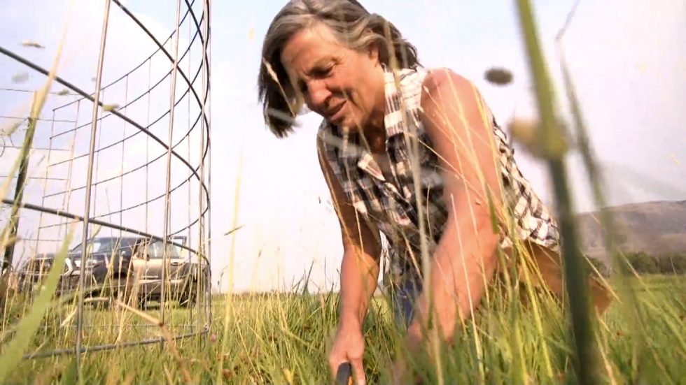
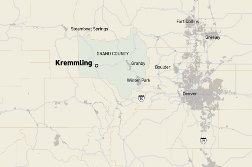

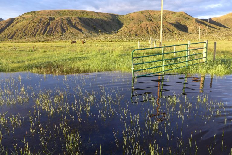

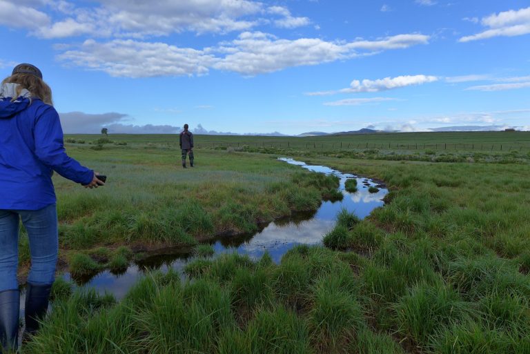
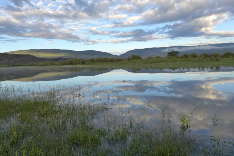


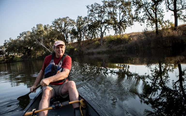
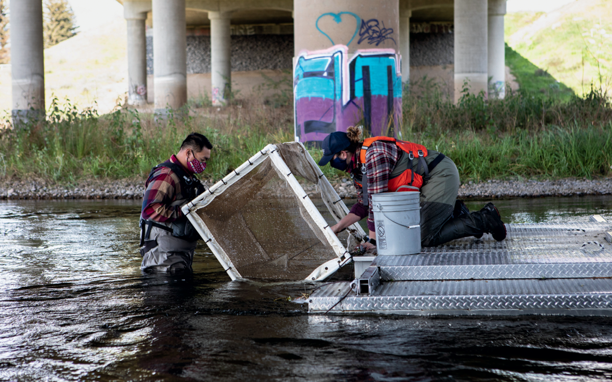
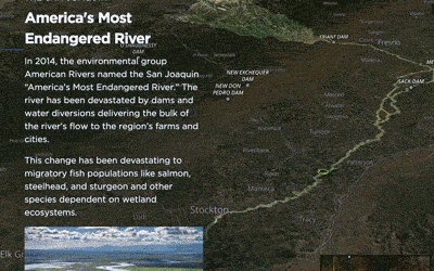
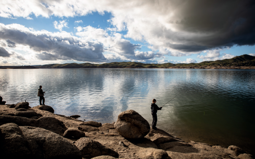

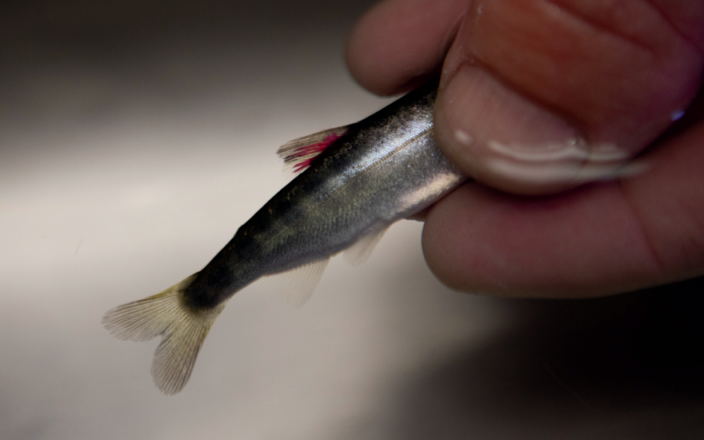
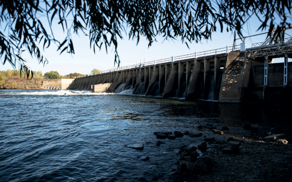
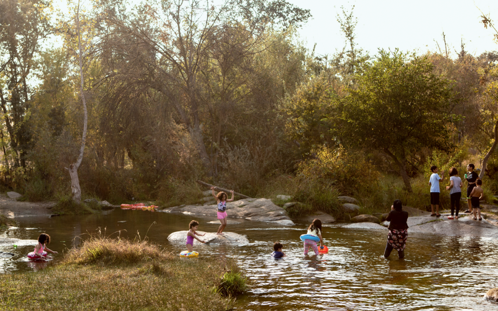
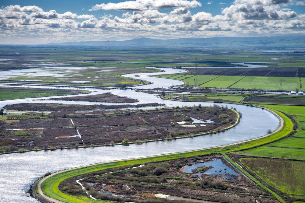
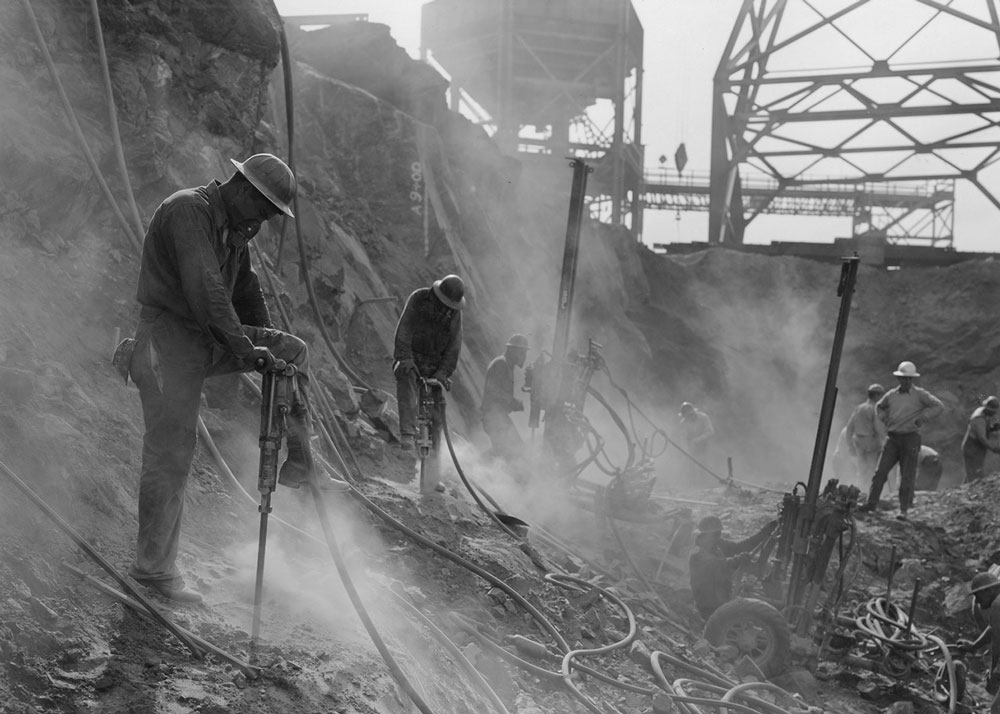

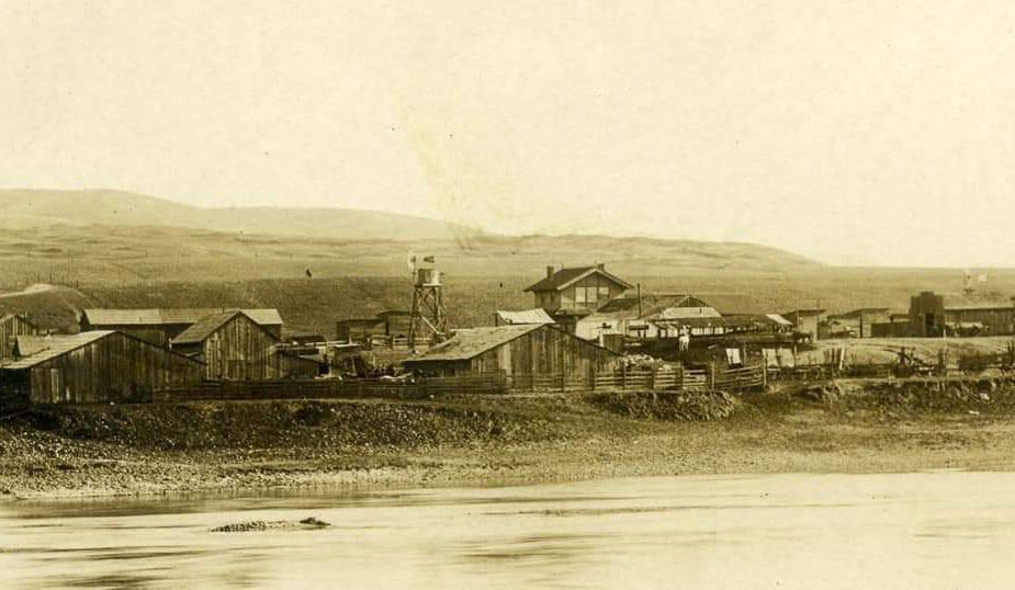

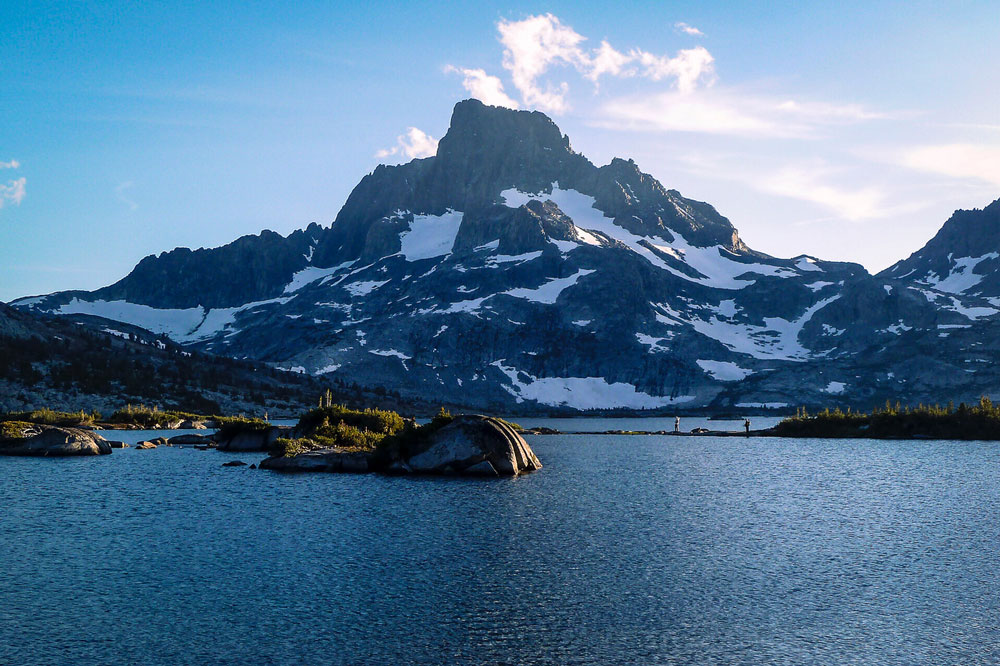

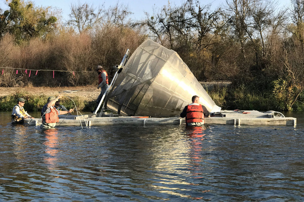
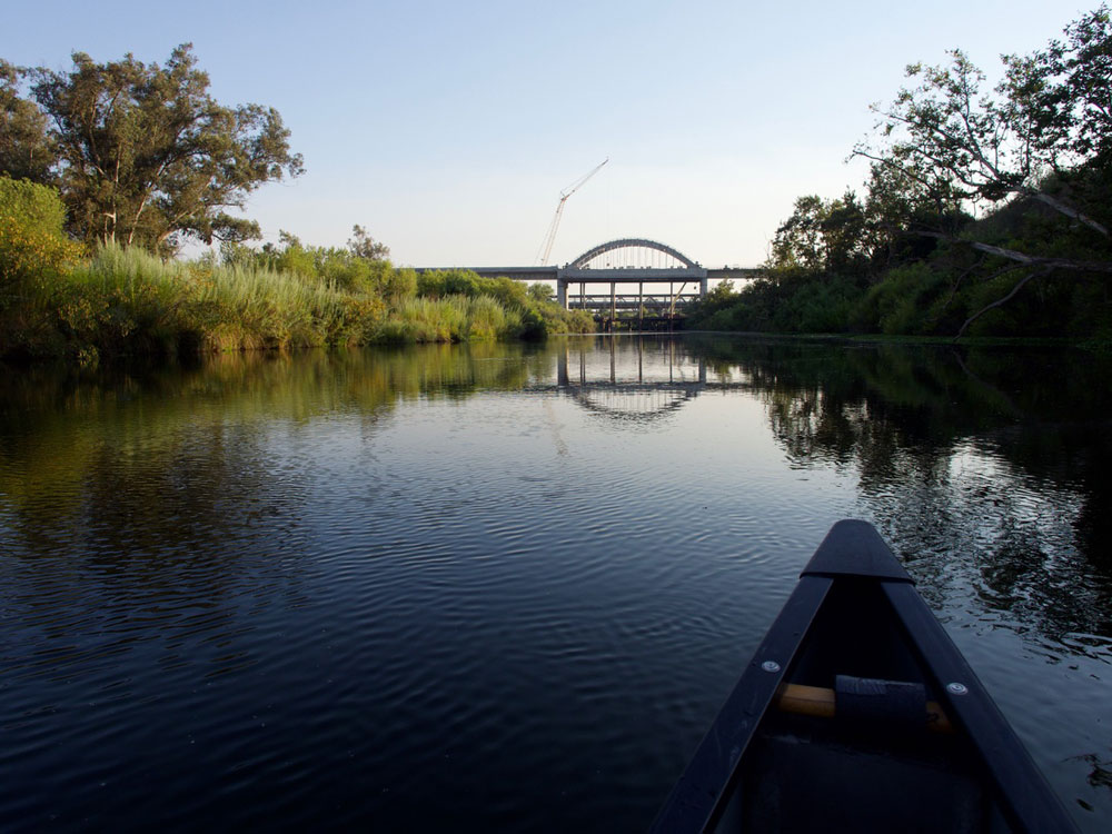
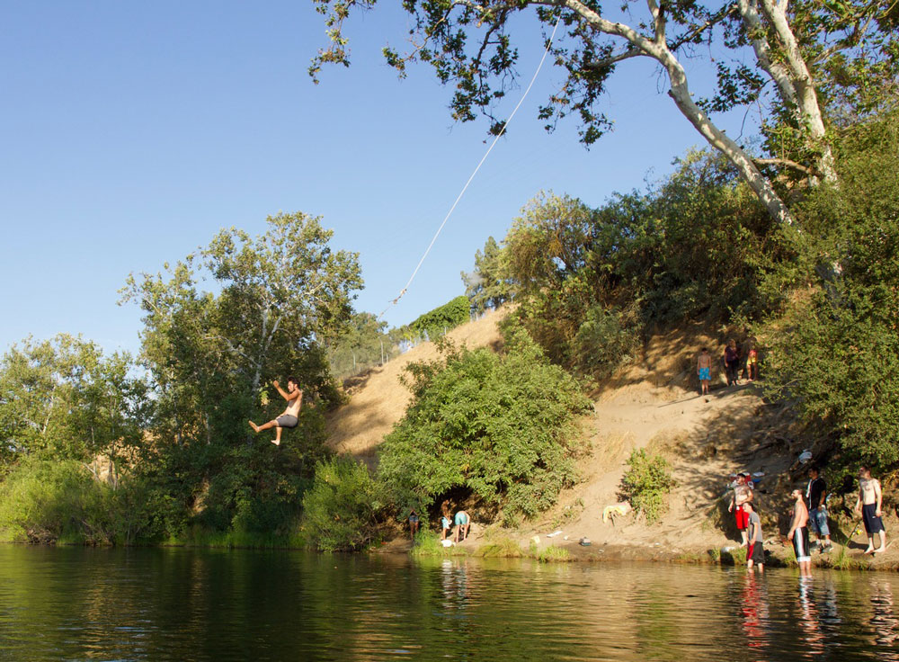
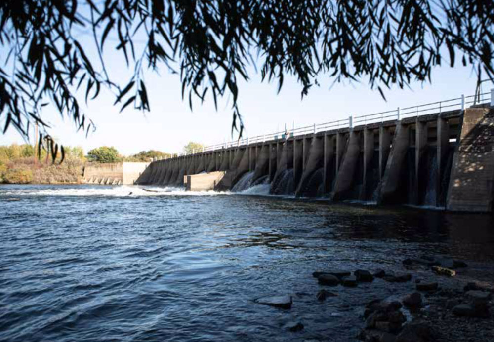
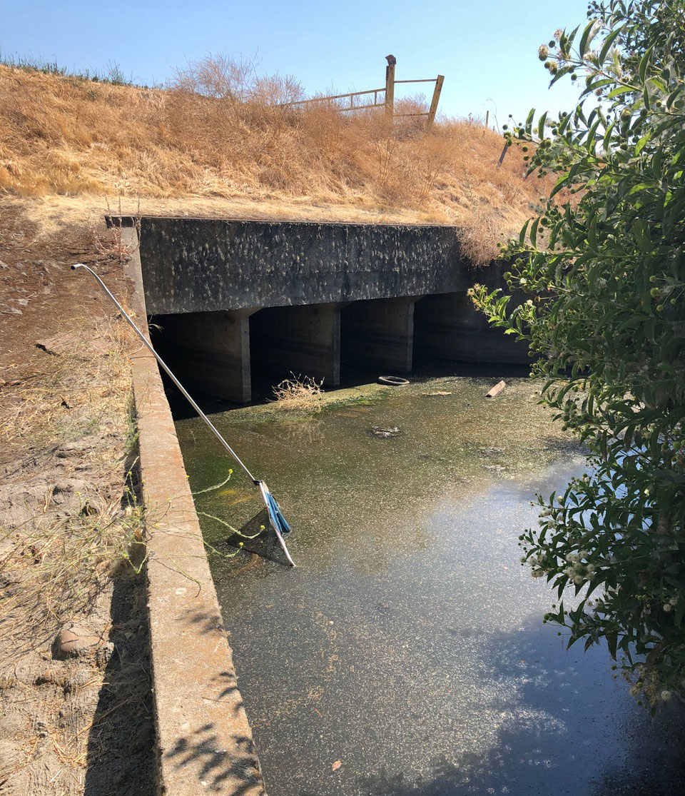
 Along much of its lower section, the once sinuous riverbed of the San Joaquin has been hemmed into linear concrete canals. Jeremy Miller