Boaters at Cedar Springs Marina on Flaming Gorge Reservoir. The reservoir’s levels are expected to drop 2 feet a month under an emergency release of water designed to keep Lake Powell’s hydropower system operating. July 22, 2021 Credit: Jerd Smith
A series of emergency water releases from federally owned Flaming Gorge, Blue Mesa and Navajo reservoirs, which began in July and are designed to bolster hydropower production at the ailing Lake Powell, will end late this year and will be replaced by a program that instead reduces the amount of water being released from Powell.
“The U.S. Bureau of Reclamation prefers not to initiate emergency action again unless absolutely necessary to do so,” said Becki Bryant, a Reclamation spokesperson. “If additional water releases are needed, Reclamation will consider monthly release adjustments at Lake Powell first before releasing additional water from the upstream initial units to Lake Powell.”
The distinction is an important one in the Upper Colorado River Basin. The so-called Colorado River Storage Project reservoirs constitute a critical liquid savings account for Colorado, Utah, New Mexico and Wyoming, one designed to protect the states’ own Colorado River supplies from Arizona, California and Nevada in case Lake Powell drops so low that Upper Basin legal delivery obligations cannot be fulfilled.
In July, Upper Basin water managers were surprised at Reclamation’s quick decision to begin the emergency releases without consulting them, and they were concerned the releases would continue next year, further depleting their savings account. That the federal agency is embracing a different approach that will better protect the Upper Basin reservoirs is a relief, they said.
“That’s an important step in the right direction,” said Jim Lochhead, CEO of Denver Water.
Under the terms of the Upper Basin Drought Contingency Plan, Reclamation in July ordered emergency releases from upper basin reservoirs to Powell that will extend through December. Graphic: Chas Chamberlin
All told, 181,000 acre-feet of water are to be sent to Lake Powell by the end of December. Powell has dropped so low that its hydropower plants, which supply millions of homes with electricity and generate revenue for such things as a critical Colorado River endangered species program, could be forced to shut down as early as next year if water levels continue to drop as they have been. The U.S. Bureau of Reclamation estimates there is a 3% chance of this occurring next year and a 29% chance of this occurring in 2023.
Held by the federal government for the benefit of the Upper Basin states, the amounts of water specified in the release plan are: 125,000 acre-feet from Flaming Gorge; 36,000 acre-feet from Blue Mesa; and 20,000 acre-feet from Navajo. An acre-foot of water is enough to cover one acre of land to a depth of 12 inches.
If that same amount of water were going to Colorado cities, it would be enough to serve more than 362,000 homes for one to two years. If going to the state’s farms, it could irrigate more than 113,000 acres, depending on the crop.
Reclamation has said the releases will help create a buffer in Lake Powell to keep its hydropower operations working. Already with the reservoir’s ultra-low level — Powell is less than one-third full — pressure on Powell’s turbines has been dramatically reduced, meaning that less electricity is being produced now, even though the turbines are still operating. As a result, the Western Area Power Administration, which distributes the electricity, will spend millions of dollars buying extra power so it can meet its contractual obligations to its customers.
The emergency releases will end late this year. In the interim, Reclamation is consulting with the states and water managers to develop a new operating plan as part of its drought contingency operations. What happens if levels at Lake Powell continue to drop next year isn’t clear.
“It’s an open question,” Bryant said. “The best solution would be optimal hydrology — particularly snowpack and efficient runoff. The goal is to have a plan ready but wait and see what nature brings in the months ahead.“
Jerd Smith is editor of Fresh Water News. She can be reached at 720-398-6474, via email at jerd@wateredco.org or @jerd_smith.
Fresh Water News is an independent, nonpartisan news initiative of Water Education Colorado. WEco is funded by multiple donors. Our editorial policy and donor list can be viewed at wateredco.org.
The Water Desk’s mission is to increase the volume, depth and power of journalism connected to Western water issues. We’re an initiative of the Center for Environmental Journalism at the University of Colorado Boulder. The Water Desk launched in April 2019 with support from the Walton Family Foundation. We maintain a strict editorial firewall between our funders and our journalism.
The boat ramp at Elk Creek Marina had to be temporarily closed so the docks could be moved out into deeper water. Colorado water managers are not happy that emergency releases from Blue Mesa Reservoir are impacting late summer lake recreation. CREDIT: HEATHER SACKETT/ASPEN JOURNALISM
BLUE MESA RESERVOIR — In an effort to prop up water levels at the declining Lake Powell, federal water managers are negatively impacting recreation on Colorado’s biggest man-made lake.
That’s the message from Colorado water managers and marina operators at Blue Mesa Reservoir in Gunnison County. On Aug. 1, the Bureau of Reclamation, which operates the reservoir, began emergency releases. By the time the releases are finished the first week of October, Blue Mesa is projected to fall to its second-lowest level ever, just 215,000 acre-feet, or 22.8% of its 941,000-acre-foot capacity.
As of Sept. 1, the reservoir was 37% full, which is about 68 feet down from a full reservoir, and a ring of muddy shoreline was growing. Parking lots and boat slips sat empty, and Pappy’s Restaurant was closed for the season. The dwindling water levels are first impacting Iola, the easternmost of Blue Mesa’s three basins. Iola is where the Gunnison River now cuts through a field of mud.
Eric Loken, who operates the reservoir’s two marinas (Elk Creek and Lake Fork), said he was given only nine days’ notice to empty Elk Creek Marina’s 180 slips. The dock system’s anchors, which are not built for low water, had to be moved deeper. He said about 25 people lost their jobs six weeks earlier than normal and the marinas lost about 25% of its revenue for the year.
“There are tons of people who would like to be out here boating and are very disappointed,” Loken said. “Normally on Labor Day weekend, you can barely find a place to park. So it’s definitely been a big hit to us as a business for sure.”
The Elk Creek Marina and restaurant are closed for the season, although the boat ramp is still open and is expected to be accessible through the end of the month. The Lake Fork Marina is open through Labor Day, but the boat ramp has closed for the season. The Iola boat ramp is restricted to small boats only and is scheduled to close after Labor Day.
“We are just trying to make it through the holiday weekend and then we will be shutting up this marina too,” Loken said.
The Bureau announced July 16 that it would begin emergency releases through early October from three Upper Basin reservoirs: 20,000 acre-feet from Navajo, on the San Juan River; 125,000 acre-feet from Flaming Gorge, on the Green River; and 36,000 acre-feet from Blue Mesa, on the Gunnison River. The goal of the releases is to prop up water levels at Lake Powell to preserve the ability to make hydropower at Glen Canyon Dam. The 181,000 acre-feet from the three upstream reservoirs is expected to boost levels at Powell by about 3 feet.
The three reservoirs are part of the Colorado River Storage Project, and their primary purpose is to control the flows of the Colorado River; flatwater recreation has always been incidental. But the releases at Blue Mesa illustrate the risks of building an outdoor-recreation economy around a highly engineered river system that is now beginning to falter amid a climate change-fueled drought.
The boat ramp at the Lake Fork Marina closed for the season on Sept. 2 due to declining reservoir levels. The Bureau of Reclamation is making emergency releases out of Blue Mesa Reservoir to prop up levels in Lake Powell and preserve the ability to make hydropower. CREDIT: HEATHER SACKETT/ASPEN JOURNALISM
Timing concerns
Although the secretary of the Interior can authorize emergency releases without coordination from the states or local entities, Loken, along with some Colorado water managers, is not happy about the timing or the lack of notice from the bureau. Under normal drought-response operations, the federal government would consult with state and local water managers before making releases.
“We had very little time to handle this decision that was made that none of us have any power over,” Loken said.
John McClow, general counsel for the Upper Gunnison Water Conservancy District, said Colorado should make noise and complain about what he called a clumsy execution of the releases. McClow has also served on the Colorado Water Conservation Board and is an alternate commissioner on the Upper Colorado River Commission.
“There’s no reason they couldn’t have waited another couple weeks or another month to release that water from Blue Mesa to get it to Lake Powell,” McClow said. “It goes back to consultation and timing. Had they even asked, it would have been easy to say, ‘Hey, can you wait so you don’t kill our business?’”
Last month at Colorado Water Congress’ summer conference — a gathering of water managers, researchers and legislators in Steamboat Springs — Rebecca Mitchell, CWCB’s executive director and the state’s representative to the UCRC, told the audience that the impacts of ending the boating season early at Blue Mesa trickle down to all Coloradoans.
“That means dollars in Colorado. That is who we are in Colorado,” she said. “It’s definitely had an impact in that local community when we talk about the recreation. That is heavy.”
Mitchell said water managers in the Upper Basin states (Colorado, Utah, New Mexico and Utah) will be carefully monitoring the impacts of the reservoir releases and figuring out how to quantify those impacts, which she called devastating. The states will work with the bureau to develop a plan for how to send water to Lake Powell in future years, taking into consideration the timing, magnitude and duration of the releases, she said.
“Where can the states and the bureau make the best decisions to lessen the impacts?” she said.
The National Park Service operates the Curecanti National Recreation area, including the campsites, picnic areas, visitors centers and boat ramps that run the 20-mile length of the reservoir. According to numbers provided by the Park Service, Curecanti gets nearly a million visitors a year. The reservoir is popular among anglers for its trout and Kokanee salmon fishing. Blue Mesa is one of three reservoirs — along with the much smaller Morrow Point and Crystal reservoirs — on the Gunnison River, collectively known as the Aspinall Unit.
Gunnison Country Chamber of Commerce Director Celeste Helminski said her organization is planning an event later this month: the world’s largest snow dance. A big winter would help refill Blue Mesa.
“The water definitely has me concerned for the future,” she said. “We see a lot of summer recreationists who come and spend the whole summer at several of the campgrounds. It’s just going to take a lot to replace that water. It’s going to take awhile to get back to levels of what recreationists come for.”
Bureau spokesperson Justyn Liff could not provide any insight into how the timing decision for the releases was made, but pointed out that although lake recreation was impacted, downstream rafting and fishing in the canyon are getting a boost from the roughly 300 cubic-feet-per-second extra water that the releases provide. The Gunnison River below the Gunnison Tunnel diversion, which takes a large portion of the river’s outflow from the Aspinall Unit for delivery to downstream irrigators, was running around 600 cfs the first few days of September, according to USGS stream gauge data. This is a critical data point for boaters running the Black Canyon or Gunnison Gorge sections of the river, which are below the stream gauge. At 600 cfs, the river is flowing 11% above the median for this time of year.
“If we had waited six weeks, that would have been six weeks less of commercial rafting/guided fishing on the Gunnison River downstream from Aspinall,” Liff said.
Some boats were still in the water the first week of September at the Lake Fork Marina. Across Blue Mesa Reservoir, the Elk Creek Marina’s boat slips were emptied early because of declining water levels in the reservoir. CREDIT: HEATHER SACKETT/ASPEN JOURNALISM
Hydropower production
Although the local impacts to recreation are acute, the impacts of not being able to make hydropower at Lake Powell would probably be much worse. The dams of the CRSP are known as “cash register” dams. The power they produce is used to repay the costs of building the project, maintain operations and provide power to millions of people.
The Western Area Power Administration distributes Lake Powell’s electricity, including to some power providers in Colorado. According to Water Education Colorado, electric costs will surge as Glen Canyon Dam struggles to produce hydropower because of declining water levels.
The bureau’s target elevation for Lake Powell is 3,525 feet, in order to provide a buffer that protects hydropower generation; if levels fall below 3,490, all power production would stop. Lake Powell is currently about 31% full, at 3,549 feet, which is the lowest surface level since the reservoir began filling in the 1960s and ‘70s. According to projections released by the bureau in July, Lake Powell has a 79% chance of falling below the 3,525 threshold in the next year. The emergency releases are intended to address this.
“A loss of power generation is a pretty significant issue compared to a few months of boating on Blue Mesa,” McClow said. “Locally, yes, it hurts, but in the big picture, I don’t know if you can make a fair comparison.”
As water levels at Blue Mesa continue to fall, Loken worries that this may be just the beginning of an era of empty reservoirs.
“(The releases) don’t solve the long-term problem,” Loken said. “We are just going to end up with an empty Lake Powell and a bunch of empty reservoirs upstream. I think the powers that be really need to put pencil to paper and figure this out.”
The Water Desk’s mission is to increase the volume, depth and power of journalism connected to Western water issues. We’re an initiative of the Center for Environmental Journalism at the University of Colorado Boulder. The Water Desk launched in April 2019 with support from the Walton Family Foundation. We maintain a strict editorial firewall between our funders and our journalism.
Water from the Colorado River environmental release flows into the El Chausse restoration site in Baja California, Mexico. (Source: Jesus Salazar, Raise the River)
By Gary Pitzer
Water is flowing once again to the Colorado River’s delta in Mexico, a vast region that was once a natural splendor before the iconic Western river was dammed and diverted at the turn of the last century, essentially turning the delta into a desert.
In 2012, the idea emerged that water could be intentionally sent down the river to inundate the delta floodplain and regenerate native cottonwood and willow trees, even in an overallocated river system. Ultimately, dedicated flows of river water were brokered under cooperative efforts by the U.S. and Mexican governments.
The first intentional flows happened for about eight weeks in 2014. This year, the flows will be much longer despite an ongoing drought that sparked first-ever declared shortage on the river earlier this month. The flows started May 1 and will continue through October. They are supported by myriad groups, including the International Boundary and Water Commission (IBWC), created by the two countries 132 years ago.
“The United States is committed to meeting its environmental commitments to Mexico,” Daniel Avila, the IBWC’s acting U.S. commissioner, said in a statement. “I’m pleased to see the environmental water deliveries this year as part of our effort to improve wildlife habitat in the region.”
Avila’s counterpart in Mexico, Humberto Marengo, said in a statement that environmental cooperation on the Colorado River in Mexico is very important for both countries, as reflected by the agreed-upon use of water to help replenish parts of the riparian corridor leading to the Gulf of California.
It’s an audacious experiment, part of a multifaceted agreement that helps the two countries share the river. But it comes this time despite shortages elsewhere on the drought-stressed Colorado River, which supplies water to millions of people in the Southwest and large swaths of farmland in the U.S. and Mexico.
Amy Witherall, binational program manager with the U.S. Bureau of Reclamation, said the current flow for the delta has a lower peak volume and is spread across a longer time period than the 2014 experimental flow. And by using Mexico’s irrigation canals, water is moving more effectively to restoration sites.
“As a result of the binational coordination and collaboration that has developed, we were able to design a creative solution to maximizing the benefits of the environmental water available,” she said.
Learning from the Flows
The dedicated environmental flows delight conservation advocates who see ample opportunity to bring back some of the ecosystem benefits for birds, plants and wildlife.
“One really interesting thing to report is that it’s working,” said Jennifer Pitt, Colorado River program director with the National Audubon Society. “There’s definitely been reports and visual confirmation of the connection of those flows to the sea.”
Raise the River, a partnership of six U.S. and Mexican nongovernmental organizations (NGOs), is leading the work to reimagine parts of the Colorado River Delta to establish pockets of wildlife-friendly habitat and recreational opportunities for local communities. It’s an iterative process that reveals how the landscape responds when it gets water from the Colorado River.
Habitat restoration work (the projects are named in yellow) extends along the main channel of the Colorado River from the US-Mexico border to the upper estuary of the Gulf of California. (Source: Sonoran Institute)
It’s likely the lessons learned from the coming months will influence how water is applied during a future flow release – sometimes through the dry reaches and sometimes around them. “We are going to collect data and have lots of conversations about the tradeoffs,” Pitt said.
The flow that began this year will be one in a series of rewatering efforts on the delta’s riparian corridor through 2026. The U.S. and Mexican governments provide the water in tandem with coalition of conservation groups. From the time the first flows began in 2014, those living near the river have been profoundly affected.
“I have grown up watching a river die and today I see a river revived,” Antonia Torres Gonzalez, a member of the Cucapá tribe indigenous to the lower Colorado River, said in a video produced by the Sonoran Institute of Mexico, one of the NGOs involved with the river. “We have been taught that the river is like a person that we have to love and respect.”
Jennifer Pitt, the National Audubon Society’s Colorado River Program Director, paddles a kayak through a restoration site. (Source: Jesus Salazar, Raise the River)
Even with a drought-stressed Colorado River on the brink of severe use restrictions that limit water for all purposes, water is flowing to restoration sites and will continue to do so under addendums to an international treaty. Still, those restoration flows are expected to be pared back – though not halted – next year as a result of the Bureau of Reclamation’s Aug. 16 declaration of a shortage in 2022 that will reduce water supplies for Arizona and Nevada.
“You can’t just sort of take one part of it and say, oh we’re going to do this part, not this other part,” said Karl Flessa, professor of geosciences at the University of Arizona who closely monitors the delta flows. With Reclamation’s shortage declaration, “Mexico is going to share that shortage and there’s going to be a comparable shortage or sharing of the water that goes towards the restoration projects.”
Bringing Back the Delta
Across the Colorado River Basin, climate change is upending the expected patterns of hydrology. Reduced Rocky Mountain snowpack and rising temperatures are stressing the system, leaving less runoff flowing downstream to reservoirs, farms and cities. Those working to restore delta habitat using river flows hope that their efforts will help.
Tree nurseries at Raise the River restoration sites provide the seedlings to expand native vegetation along the Colorado River corridor in Mexico. (Source: Jesus Salazar, Raise the River)
“We are trying to mitigate [climate change] in the areas with restoration, as we help to lower the temperature with the trees planted,” said Gabriela Caloca Michel, restoration project coordinator with Pronatura Noroeste, the oldest and largest conservation nonprofit in Mexico that manages several restoration sites.
The Colorado River once traveled all the way to the Gulf of California – an estuary of about 2 million acres. Dams and aqueducts moved water to irrigate farms, including those in Mexico and seven western U.S. states, and provide drinking water. As a result, the river made it all the way to the mouth of the estuary only during high flow years.
But people have come to realize that it’s possible to bring back a portion of the Colorado River Delta with relatively small contributions of river water. The first experimental pulse flow of Colorado River water – 105,000 acre-feet of water in total – into the delta was delivered to mimic the flood flows that used to naturally reach the delta with spring snowmelt. Some water was routed to established restoration sites along the river corridor to nurture newly planted native trees, such as cottonwoods and willows.
Much was learned from that 2014 flow. Even though the river would sometimes flood the delta, the 2014 release helped foster knowledge about water movement (including infiltration) that is aiding the current effort.
Pronatura’s Caloca Michel, who has worked on the delta since 2015, said the aim with the 2021 water release is to carefully map out the design of restoration sites, factoring irrigation infrastructure, plant selection and local nursery production, soil type and water table and water rights to be able to irrigate.
Getting To the Green-Up
Under the terms of a 2017 agreement, the United States, Mexico and the coalition of NGOs each agreed to provide one-third of the 210,000 acre-feet of water for environmental purposes in the delta through 2026. The NGOs have provided 26,369 acre-feet of water between 2018 and 2020.
A closeup of the white fluff that gives cottonwood trees their name. Native cottonwood trees are back in large numbers in some sections of the Colorado River Delta. (Source: Jesus Salazar, Raise the River)
The plan is to move water to different locations at different rates and times to realize the most ecosystem advantages. It’s a give and take between providing open water habitat for birds and moving releases to specific restoration sites that have been cultivated with native vegetation. Some flows are carried via established irrigation canals to limit the amount that seeps into the ground.
Infiltration of the flows into the ground isn’t a loss, Flessa said.
“If you’re pumping groundwater or a Mexican farmer, that’s a good thing. Groundwater does sustain a lot of vegetation along the way,” he said. “But if you want to deliver water to some of the more downstream restoration sites you really need to find a way to make sure that you maximize the efficiency of the water delivery so you don’t lose as much of the delivery as you would by putting water in the main channel.”
Teams constantly measure how the flows affect the groundwater table, the established vegetation and the new acreage plots established by the conservation groups.
Having water available through summer helps, given the harsh desert heat.
“It is a pretty stressful time for everybody,” Flessa said. “For the plants, if there is lack of irrigation or lack of support, those trees don’t like it.”
A common refrain is the surprise about how quickly vegetation such as cottonwoods and willows respond to what Pitt called “a drink of water.” But it’s not just water. The foundation established by conservation groups provides jobs for the community and re-establishes a connection to the riparian environment.
“I see a very big impact that the ecosystem is working well and the work we do has paid off,” said Celedonia Alvarado Camacho, who supervises tree preparation and planting for the Sonoran Institute.
Long-term, the question remains how to reimagine the delta with relatively small amounts of water. The flows were included as part of a pair of recent amendments to the 1944 Water Treaty with Mexico. Conservationists expect that a commitment for environmental flows will be included in future treaty agreements.
“I have every reason to believe an environmental program will be part of [a new agreement], in part because we had it in the last two … and because both countries have made enormous investments in restoring habitat,” Pitt said.
Still, a sense of perspective is needed for the ancient delta. “We are not going to bring the whole river delta back, that’s for sure,” Flessa said. “But I do think we could sort of get a green ribbon from the border to the Gulf of California.”
Please send any comments on the article to Doug Beeman, Deputy Director, News & Publications. Know someone else who wants to stay connected with water in the West? Encourage them to sign up for Western Water, and follow us on Facebook, Twitter, LinkedIn and Instagram.
The Water Desk’s mission is to increase the volume, depth and power of journalism connected to Western water issues. We’re an initiative of the Center for Environmental Journalism at the University of Colorado Boulder. The Water Desk launched in April 2019 with support from the Walton Family Foundation. We maintain a strict editorial firewall between our funders and our journalism.
Ouray County Water Users Association wants to build a 260-foot dam at this location on Cow Creek that would hold about 25,000 acre-feet of water. One goal would be to lessen daily flow fluctuations, especially during spring runoff. CREDIT: HEATHER SACKETT/ASPEN JOURNALISM
Water users in Ouray County are hoping to satisfy water shortages with what they say is a multi-beneficial reservoir and pipeline project. But the Ram’s Horn reservoir, Cow Creek pipeline and exchange are facing opposition from the state of Colorado and others.
The complicated, three-pronged project proposes to take water from Cow Creek and pipe it into Ridgway Reservoir, take water from local streams via ditches and store it in the reservoir, and build a new dam and reservoir on Cow Creek. This stored water would eventually be sent downstream to be used by the Uncompahgre Valley Water Users Association (UVWUA).
The project applicants — Ouray County, Tri-County Water Conservancy District, Ouray County Water Users Association and the Colorado River Water Conservation District — say they need 20 cubic feet per second of water from Cow Creek. Cow Creek is a tributary of the Uncompahgre River with headwaters in the Cimarron mountains. Cow Creek’s confluence with the Uncompahgre River is below Ridgway Reservoir, which is why an upstream pipeline would be needed to capture the water and bring it into the reservoir.
The applicants are also seeking to build Ram’s Horn Reservoir on the upper reaches of Cow Creek, which would hold about 25,000 acre-feet of water behind a 260-foot-tall and 720-foot-long dam. Ram’s Horn would help regulate what are known as diurnal flows during spring runoff — streamflows are higher during the day as the snow melts with warming temperatures, and lower at night as snow re-freezes. UVWUA says they can’t adjust their headgates to capture the high point of this daily fluctuation in flows, leaving the water to run downstream unused. The project would capture these diurnal peaks.
Ouray County Water Users Association wants to build Ram’s Horn Reservoir on the upper reach of Cow Creek, shown here. Colorado Parks and Wildlife opposes the project, in part, because of its potential impact to fish. CREDIT: HEATHER SACKETT/ASPEN JOURNALISM
Goal to prevent a call
The goal of the project is to prevent the UVWUA — one of the big senior water rights holders in the Gunnison River basin — from placing a call on the river.
When the UVWUA, which owns the Montrose & Delta Canal and has a 1890 water right, is not able to get its full amount of water, it places a call on the river. This means upstream junior water rights holders, like Ouray County Water Users, have to stop using water so that UVWUA can get its full amount. According to a state database, the M&D Canal has placed a call three times this summer, most recently from July 12 to 22. In 2020, the call was on for nearly all of July and August. Under Colorado water law, the oldest water rights have first use of the river.
By releasing the water stored in either Ridgway or Ram’s Horn reservoirs to satisfy a UVWUA call, Ouray County Water Users Association would then be able to continue using its own water.
The Glenwood Springs-based River District, which advocates to keep water on the Western Slope, is a co-applicant of the project.
“This (project) is consistent with the River District’s goals and objectives with supporting our constituents and making sure they have a reliable water supply,” said Jason Turner, River District senior counsel.
Ridgway Reservoir, on the Uncompahgre River in Ouray County, is popular with boaters. A proposed pipeline project that would bring water from Cow Creek into the reservoir is being met with opposition for environmental reasons. CREDIT: HEATHER SACKETT/ASPEN JOURNALISM
Potential impacts to fish, instream flows
But some state agencies, environmental groups and others have concerns about the project. Colorado Parks and Wildlife and Colorado Water Conservation Board have both filed statements of opposition to the application, which was originally filed in December 2019, amended in January and is making its way through water court. CPW claims that its water rights in the basin, which it holds for the benefit of state wildlife areas, fisheries and state parks, could be injured by the project. CPW owns nearly a mile of access to Cow Creek on the Billy Creek State Wildlife Area.
Between August 2019 and January 2020, CPW recorded water temperatures of Cow Creek and found they exceeded a state standard for trout. A report from CPW aquatic biologist Eric Gardunio says that the proposed project would likely cause an even bigger increase in water temperatures, resulting in fish mortality.
“The flow and temperature analysis for Cow Creek indicates that the water rights application has the likelihood to damage or eliminate the native bluehead sucker population as well as the rest of the fishery in the downstream end of Cow Creek through the degradation of water quantity and quality,” the report reads.
While less water in Cow Creek could result in temperatures that are too high for trout, water released from the proposed Ram’s Horn reservoir could be too cold for bluehead suckers.
“There’s going to be some changes to temperature and what our temperature data has outlined is that the species are at their extreme ends,” Gardunio said. “It’s nearly too cold for bluehead sucker and it’s nearly too warm for trout, so changes in temperature are going to have an impact to one or the other of the fishery.”
The Colorado Water Conservation Board opposes the project because they said it could injure the state’s instream flow water rights. Instream flow rights are held exclusively by the CWCB to preserve the natural environment to a reasonable degree. Ram’s Horn reservoir would inundate a section of Cow Creek where the CWCB currently holds an instream flow right.
“The application does not present sufficient information to fully evaluate the extent to which the CWCB’s instream flow water right may be injured,” the statement of opposition reads.
Environmental group Western Resource Advocates also opposes the project. Ram’s Horn Reservoir, with conditional water rights owned by Tri-County Water Conservancy District, is one of five reservoirs planned as part of the U.S. Bureau of Reclamation’s Dallas Creek Project, which dates to the 1950s. Ridgway Reservoir is the only one of the five that has been built.
This map shows the potential location of Ram’s Horn Reservoir, as well as other reservoirs originally conceived as part of the U.S. Bureau of Reclamation’s Dallas Creek Project. Only Ridgway Reservoir has been built. CREDIT: MAP COURTESY WRIGHT WATER ENGINEERS
Complex exchange
The third piece of the proposed project is what’s known as an exchange, where water would be conveyed via existing ditches connecting tributaries above Ridgway Reservoir. The exchange water would be stored there and released when senior downstream water users need it, which would benefit upstream water users. In addition to Cow Creek, the applicants are proposing to take water from Pleasant Valley Creek, the East and West Forks of Dallas Creek, Dallas Creek and the Uncompahgre River to use in the exchange.
Colorado Division of Water Resources Division 4 Engineer Bob Hurford laid out the issues his office has with this exchange in his summary of consultation. He recommended denial on the exchange portion of the application until the applicants list the specific ditches participating in the exchange and their locations, and agree that they are responsible for enlarging the ditches so they can handle the increased capacity of water.
“I have to have actual ditch names, the owners of the ditches have to be willing to participate and it has all got to be tracked to a tenth of a cfs,” Hurford said. “It’s not a loosey-goosey thing. It has to be dialed in and defined precisely.”
Another criticism of the project is that it won’t provide water directly to water users in Dallas Creek, which according to a report by Wright Water Engineers, is the most water-short region of the Upper Uncompahgre basin. Even if Dallas Creek water users participate in the exchange, in dry years still there may not be enough water in local creeks for them to use.
“This project has been sold as the savior of agriculture in Ouray County but this project will not provide wet water that would not otherwise be available to anybody that is an ag producer,” said Ouray County water rights holder and project opponent Cary Denison. “I don’t know one irrigator who is saying we need to build Ram’s Horn Reservoir.”
The project application is making its way through water court and applicants say they are continuing to negotiate with opposers. A status report is due in October. Attorney for the Ouray County Water Users Association and River District board representative Marti Whitmore said they want to make sure it’s a multi-purpose project that benefits everyone.
“Fish flows and recreation uses are important, so we are just trying to work out terms and conditions that are a win-win for everyone,” she said.
Aspen Journalism covers water and rivers in collaboration with The Aspen Times and other Swift Communications newspapers. This story ran in the Aug. 30 edition of The Aspen Times and the Sept. 2 edition of the Ouray County Plaindealer.
The Water Desk’s mission is to increase the volume, depth and power of journalism connected to Western water issues. We’re an initiative of the Center for Environmental Journalism at the University of Colorado Boulder. The Water Desk launched in April 2019 with support from the Walton Family Foundation. We maintain a strict editorial firewall between our funders and our journalism.
Lake Powell’s Glen Canyon Dam is used to produce hydropower that is delivered over a 17,000-mile transmission grid, reaching six states and 5 million people. Photo courtesy Western Area Power Administration.
The federal agency that distributes electricity from hydropower plants in the Upper Colorado River Basin will ask its customers, including more than 50 here in Colorado, to help offset rising costs linked to Lake Powell’s inability to produce as much power due to drought.
The Western Area Power Administration (WAPA), which distributes Lake Powell’s electricity, is gathering public comments and asking its customers how best to cope with long-term drought conditions that have pushed Powell and other reservoirs to historically low levels.
As flows in the Colorado River have declined due to climate change and a 20-year megadrought, there is less water in its storage reservoirs and, therefore, less pressure to power the turbines, causing them to generate less electricity.
WAPA has had to nearly double the amount of extra power it has had to buy this year to ensure it can meet its contract obligations to its customers.
“It’s all bad news, but it isn’t necessarily unexpected,” said WAPA spokesperson Lisa Meiman.
WAPA power is among the most sought-after in Western states because it is sold at cost and because it is a renewable power resource, something highly valued in places such as Colorado, where utilities are working to reduce their reliance on fossil fuels.
WAPA often buys extra power if for some reason its customers’ electricity needs don’t match up with its hydropower production on a given day. It delivers power over a 17,000-mile transmission grid to six states and 5 million people.
But as flows in the Colorado River have shrunk, those purchases have become larger and more frequent.
Last year it bought an extra 413,000 megawatts of power. This year it has already purchased 833,000 megawatts of additional power, according to Meiman, and the agency expects that number to grow this year and likely again next year as the drought continues with no relief in sight.
These turbines at Lake Powell’s Glen Canyon Dam are at risk of becoming inoperable should levels at Powell fall below what’s known as minimum power pool due to declining flows in the Colorado River. Photo courtesy U.S. Bureau of Reclamation.
This year, because of the power demands of the West’s growing population and the need for air conditioning to combat ultra-high temperatures, power costs are already soaring.
Last year WAPA paid $25 per megawatt for its replacement power, Meiman said. This year it is paying $33 per megawatt, a 30% jump.
In Colorado, WAPA sells power to some of the state’s largest electric utilities, such as Tri-State Generation and Transmission, as well as cities, small towns and rural electric co-ops.
“We’re watching the situation closely,” said Natalie Eckhart, a spokesperson for Colorado Springs Utilities, which is a WAPA electric customer and which also draws a significant portion of its water from the Colorado River system.
“The bottom line is we care about this on all fronts,” Eckhart said.
Few expected power generation at Lake Powell to decline so quickly. The Colorado River Basin serves seven U.S. states and 30 Native American Tribes. For months, the U.S. Bureau of Reclamation and the Upper Colorado River Basin states of Colorado, New Mexico, Utah and Wyoming have been nervously watching what’s known as the minimum power pool level at Powell, the lowest elevation at which power can be produced, which is 3,490 feet. If the reservoir drops lower than that, all hydropower production will stop.
In July, as water levels at Powell continued to plummet, the U.S. Bureau of Reclamation, as part of the Upper Basin’s Drought Contingency Plan, began emergency releases of water from Utah’s Flaming Gorge, Colorado’s Blue Mesa, and New Mexico’s Navajo reservoirs to boost levels and protect Powell’s hydropower production.
Credit: Chas Chamberlin
And while those releases are expected to help keep the turbines functioning, the releases won’t be enough to restore them to full production, leaving WAPA little choice but to look at restructuring the way it sells power and to raise its prices.
WAPA is forecasting a 35% increase in its costs, but is working to minimize the impact on utilities that purchase its power and anticipates a 12% to 14% rate increase as early as December. Some utilities are preparing to buy power elsewhere, when possible, to reduce their costs.
Holy Cross Energy, a rural electric co-op based in Glenwood Springs that is also a WAPA customer, has spent years converting its power portfolio from fossil fuels to renewable energy sources including wind, solar and biomass, as well as hydropower.
While WAPA electricity comprises just 3% of its power portfolio, Holy Cross CEO Bryan Hannegan is worried that this renewable, low-cost power source is in jeopardy if flows from the Colorado River into Lake Powell continue to decline, as they are projected to do.
“It’s one of the cleanest and lowest-cost sources of power for a whole range of utilities,” Hannegan said. “It’s been a bedrock on which we built the West. For it not to be available … it’s a big deal.”
Correction: An earlier version of this story misstated the last name of the spokesperson for Colorado Springs Utilities.
Jerd Smith is editor of Fresh Water News. She can be reached at 720-398-6474, via email at jerd@wateredco.org or @jerd_smith.
Fresh Water News is an independent, nonpartisan news initiative of Water Education Colorado. WEco is funded by multiple donors. Our editorial policy and donor list can be viewed at wateredco.org.
The Water Desk’s mission is to increase the volume, depth and power of journalism connected to Western water issues. We’re an initiative of the Center for Environmental Journalism at the University of Colorado Boulder. The Water Desk launched in April 2019 with support from the Walton Family Foundation. We maintain a strict editorial firewall between our funders and our journalism.
A farmer uses a center pivot to battle drought on a field in Center, Colo., in the San Luis Valley on Aug. 24, 2020. A plan to export water from the valley was one of the reasons the state and some water interests are examining whether Colorado needs to strengthen existing anti-speculation laws. Credit: Allen Best
Expect legislation next winter in the Colorado General Assembly that would seek to curb potential speculation in Colorado water. But whether water speculation actually poses a problem remains hotly debated.
A report released Aug. 13 by a state work group charged with studying how to strengthen Colorado anti-water-speculation law identifies eight concepts to thwart possible water hoarding that should be studied further.
One would eliminate or reduce the agricultural tax benefit for lands from which water is removed following a water rights purchase and transfer. Another would fund or create a right of first refusal for the purchase of water rights for long-term irrigation use for public benefit. Still another idea is to establish a maximum rate of water right price increase and impose higher taxes when that is exceeded.
The report delivers no recommendations to legislators.
“This is such a complex and controversial issue that we don’t have a recommendation—and that is OK,” said Joe Frank, general manager of the Lower South Platte Water Conservancy District and one of the 22 work group members. “I think people will have to dig further into this.”
Don Coram, R-Montrose, said he’s dissatisfied with the report and plans to introduce legislation that would broaden the legal definition of those injured by the sale or transfer of water rights. When a farm community loses the water that is the basis for its economy, for instance, it loses its vitality. He wants to broaden the definition of those injured to include those farm communities.
Colorado law from the beginning has sought to stop water speculation and hoarding. It’s founded on the concept that waters of natural streams belong to the people and should be available only to those with actual needs and should not be hoarded by those without legitimate needs.
Court cases in 1979 involving the Vidler Tunnel and another case in 2004 from southeast Colorado further clarified that a water rights buyer had to have clear evidence of beneficial use before a sale could be consummated.
“You can buy a car and put it in your barn and leave it there for 50 years without ever using it. You can’t do that with water,” said Peter Fleming, general counsel for the Colorado River District and another member of the work group.
The new worry, described in the report as “investment water speculation,” was provoked by purchases by non-traditional water buyers. Water export proposals in the San Luis Valley as well as the purchase of large, water-rich ranches in the Grand Valley on the West Slope by investment banks are behind current efforts to strengthen Colorado law.
The state work group spent hours this past year trying to establish what constitutes a non-speculative sale of water and what constitutes an effort to hold, or hoard water, in order to profit off of future shortages.
It’s accepted that there can be profit in the sale of water rights. But how much is too much? And should state government care?
“Some people perceived those businesses to be more concerned with generating a profit based on changes in the market value of water rights than with using the water, and hence described those purchases as ‘speculative,’” says the executive summary of the state’s report.
If that potential financial reward to a speculator hasn’t happened yet, Fleming said, in theory it could.
Coram sponsored the 2020 bill that resulted in formation of the anti-speculation work group. After reading the 66-page report, Coram said he doesn’t intend to interfere with the right of a farmer to sell their water.
But he said the potential for speculation is real and growing.
Most of the attention in Colorado’s discussion has been focused on the Grand Valley. There, New York-based Water Asset Management owns 2,300 irrigated acres and 2,800 acres, according to James Eklund, the founder and chief executive of Eklund Hanlon, a Denver-based legal firm representing the company. Eklund is former director of the Colorado Water Conservation Board.
Coram and Eklund both have Western Slope roots in agriculture, and both believe the state report comes up short. “It was a gigantic waste of time,” said Eklund. He describes the worries about speculation as a “manufactured crisis.”
“We have been seeking ways to devalue people’s water rights. That’s what I read in the 66 pages,” he said. And the narrative that triggered their deliberations was a false one that relies upon a fear of outsiders, “people who don’t look like us or talk like us, who aren’t from around here.”
Alexandra Davis, also a work group member, said water should be treated differently than other common items. “We are talking about a critical resource, something everybody needs. It’s not like oil and gas. It’s not like gold. It’s not like steak because there are different types of food,” said Davis, deputy director of water resources for Aurora Water.
Farmers and ranchers want to ensure they can realize price gains on water, just as home buyers hope to see appreciation in their investment. But there is a difference between house-flipping and flipping water rights.
“Poor people need it, rich people need it, fish need it, farmers need it, and we need for farmers to have it to grow our food,” said Davis. “There is something different about water because it’s a critical resource.”
If left entirely to market mechanisms, she said, that leave the possibility that a critical resource can be cornered by those of greatest wealth, “because it’s water, that’s unacceptable.”
Long-time Colorado journalist Allen Best publishes Big Pivots, an e-magazine that covers energy and other transitions in Colorado. He can be reached at allen@bigpivots.com and allen.best@comcast.net.
Fresh Water News is an independent, nonpartisan news initiative of Water Education Colorado. WEco is funded by multiple donors. Our editorial policy and donor list can be viewed at wateredco.org.
The Water Desk’s mission is to increase the volume, depth and power of journalism connected to Western water issues. We’re an initiative of the Center for Environmental Journalism at the University of Colorado Boulder. The Water Desk launched in April 2019 with support from the Walton Family Foundation. We maintain a strict editorial firewall between our funders and our journalism.
The Government Highline Canal flows past Highline State Park in the Grand Valley. Water Asset Management, a New York City-based hedge fund, has been buying up parcels of land that are irrigated with water from the canal. CREDIT: BETHANY BLITZ/ASPEN JOURNALISM
After nearly a year’s worth of meetings, a work group has not reached a consensus about what Colorado should do to prevent investors from profiting off of speculating on the state’s water.
A report released last week by a group of water managers, policy experts and users — who were convened to explore ways to strengthen current anti-speculation law — lays out a list of concepts but does not give clear direction to state legislators about which concepts to pursue.
“Due in part to the drawbacks that the Work Group identified for each of the brainstormed concepts in Section 5, and a lack of consensus, the Work Group does not recommend any of the concepts for implementation,” the report reads.
The work group was made up of representatives from across water sectors, including Front Range municipal-water providers, Western Slope agricultural-water users, nonprofit organizations and others. At the direction of state lawmakers, the work group looked into how legislation could be enacted or amended to crack down on investment water speculation. The group defined investment water speculation as the purchase of water rights with the primary purpose of profiting from the increased value of the water in a future sale.
The lack of consensus or recommendations underscores how difficult it is to answer the thorny question at the heart of the issue: How can the government balance protecting a public resource from profit-seeking investors without infringing on private-property rights?
“The lack of consensus is informative in and of itself,” said state engineer Kevin Rein, who co-chaired the work group. “That tells the (Water Resources Review) Committee a lot right there.”
This irrigated parcel in Fruita is owned by Water Asset Management, a private equity group that has been accused of water speculation. A state work group has released its report on investment water speculation, but failed to come to a consensus or make recommendations to lawmakers. CREDIT: BETHANY BLITZ/ASPEN JOURNALISM
Eight concepts
Under Colorado law, a water-rights holder must put their water to “beneficial use,” meaning they must use the water for what it was decreed, such as irrigating crops. But Colorado also treats the right to use water as a private-property right. People can buy and sell water rights and change what the water is allowed to be used for by getting the approval of the water court.
This system creates an opening for investors who see water as an increasingly valuable commodity in a water-short future, driven by climate change. A New York City-based private equity fund, Water Asset Management, is now the largest landowner in the Grand Valley Water Users Association, which provides water from the Colorado River to the farmland of Fruita, Mack and Loma. Concern about WAM’s activity in the Grand Valley was a main reason that legislators convened the anti-speculation work group through 2020’s Senate Bill 48.
Of the 19 concepts presented in the report, eight were identified as having the potential to reduce investment water speculation on a large scale. These include taxing profits from the sale of water rights; eliminating agriculture tax benefits when water is removed from the land; encouraging local governments to police speculation through their 1041 powers; and creating a right of first refusal for a public entity to purchase water rights for long-term irrigation use for public benefit.
The most ambitious of the concepts, Concept J, is creating a statewide process to identify and prohibit investment water speculation. State Rep. Dylan Roberts, who represents Eagle and Routt counties and sits on the Water Resources Review Committee, said this concept has a lot of merit.
“I think it’s clear there are a lot of ways people could slip through the cracks of our current system if they did want to speculate in water,” he said. “If we created a statewide process, we might get a better handle on some of this activity that’s happening and find ways to work on a case-by-case basis to prevent it.”
A lateral brings water from the Grand Valley Irrigation Company canal to this parcel of land, which is owned by private equity firm Water Asset Management, a company that has been accused of water speculation. A state work group has released its report on investment water speculation, but failed to come to a consensus and did not make recommendations to lawmakers. CREDIT: BETHANY BLITZ/ASPEN JOURNALISM
Concept drawbacks
All of the concepts had major drawbacks, the most common of which were high implementation costs and potential impacts to all water users, even those who are not speculative investors. According to the report, the drawbacks also include potentially reducing the sale price of water rights and, therefore, their value as property, which presents a risk to the current owners of irrigation water rights.
“The Work Group wants to stress to the Committee the complexity and nuance of the problem identified in SB 20-048 and the fact that any concept that would be effective in reducing or preventing Investment Water Speculation also comes with significant drawbacks,” the report reads.
Peter Fleming, general counsel for the Colorado River Water Conservation District and a member of the work group, said one reason the group couldn’t come to a consensus was because some members were uncomfortable with concepts that peered too closely at water-rights transactions between willing buyers and sellers.
“I do think the (concepts) that are most likely to be met with the least amount of opposition from existing water rights holders might be those that don’t penalize the private-property transaction itself,” Fleming said. “Don’t focus on the transaction. Focus on how the water is used or not used to figure out if there is speculation going on. Even then, it’s not an easy task.”
The Government Highline Canal, near Grand Junction, delivers water from the Colorado River, and is managed by the Grand Valley Water Users Association. Prompted by concerns about outside investors speculating on Grand Valley water, the state convened a work group to study the issue.
Comprehensive report
Although the work group couldn’t find consensus, Fleming and Rein said that doesn’t mean they were unsuccessful. The 66-page report presents a lot of information and the group now leaves the issue in the hands of the Water Resources Review Committee. The report is on the committee’s agenda for discussion at the Colorado Water Congress summer convention next week in Steamboat Springs.
“I think the simple fact that there aren’t consensus recommendations doesn’t mean the report doesn’t contain good information; I think it does,” Fleming said. “It’s up to the legislature at this point whether they want to pick anything up.”
Roberts said the committee should carefully consider all eight of the concepts that have the potential to reduce investment water speculation on a large scale. He called the report comprehensive and said he was not surprised that the work group could not come to a unanimous agreement, especially when members represented so many varied and sometimes conflicting interests.
“I commend them for giving us everything that they considered even if they didn’t reach consensus,” he said. “At the end of the day, that’s not their job to formally propose changes in law; that’s the job of us at the legislature now. I’m glad we have this resource.”
The Water Desk’s mission is to increase the volume, depth and power of journalism connected to Western water issues. We’re an initiative of the Center for Environmental Journalism at the University of Colorado Boulder. The Water Desk launched in April 2019 with support from the Walton Family Foundation. We maintain a strict editorial firewall between our funders and our journalism.
A stock pond that is normally full of water stands dry because of drought on the Little Bear Ranch near Steamboat Springs, Colo., on Aug. 11, 2021. Due to low snowpack, warming temperatures and dry soil during the past two years, followed by the same in 2021, Northwest Colorado is in a severe drought. Credit: Dean Krakel, special to Fresh Water News.
A low snowpack, absent monsoon rains, dry soils, record-high temperatures and thirsty crops made 2020 the third-driest year on record in Colorado, and, according to the Colorado Climate Center, it was the first time since 2012 that 100 percent of the state was in drought for some portion of the year.
A repeat of similar conditions in 2021 is making Colorado’s continuing drought across broad swaths of the state’s Western Slope even more devastating.
“At any given time you can find drought somewhere in our state,” said Assistant State Climatologist Becky Bolinger during a state Drought Task Force tour in Northern Colorado last week. “This may not be the worst drought we’ve ever had, but what makes this year particularly bad is that it follows on the tail of two other droughts [in 2019 and 2020]. We don’t have enough time [between droughts] to recover from the previous drought before we’re in the next one.”
Nowhere is that more clear than in the seven-state Colorado River Basin, where Monday the U.S. Bureau of Reclamation declared the drought situation so extreme that for the first time in history Arizona and Nevada will see their annual water supplies drawn from Lake Mead dramatically reduced.
Closer to home in Colorado, west of the Continental Divide, the state has experienced 50 consecutive weeks of category D4 drought, the most extreme drought condition, according to the U.S. Drought Monitor.
Whether the fall and winter will bring any relief isn’t clear yet.
“I’m not particularly optimistic, unfortunately, about the coming winter,” said Peter Goble, a climatologist with the Colorado Climate Center in Ft. Collins. Goble said La Niña conditions will return for the fall and winter, bringing the potential for more moisture in the north and western parts of the state, but there is little indication that the Four Corners region will get any benefit. In addition, because 2022 is shaping up to be a second La Niña year, “events tend to be warmer and dryer,” he said.
Bolinger described the Colorado River Basin as being at a breaking point and the current drought affecting Colorado, Utah and Arizona as “the final straw that might break the camel’s back.” Lake Powell and Lake Mead, the downstream catchalls, have dropped to historic low levels. The lakes will never be 100 percent full again, said Bolinger, “unless we have 10 amazing winters in a row. The amount of water we have isn’t enough to meet expected demands so in the next 5-10 years we’re going to have to rethink how all of these states are supposed to equally share the water.”
Ranchers across Western Colorado are witnessing water shortages never seen before.
Cattle and sheep are being sold off early. There hasn’t been enough water to grow enough hay. Normally full stock ponds are dry. Grasses are dying. Weeds and grasshoppers are rampant.
“In 40 years this is the first time we’ve had to haul water to our cattle,” said Chad Green, owner of the Little Bear Ranch in the Yampa River Basin. “Usually our irrigation water runs until July 1. This year it was shut off on May 29. We harvested our wheat crop for hay. The past two years have been bad. But this year,” Green paused, “this year is horrible.”
But it’s not just farmers who are suffering. Those who rely on the state’s iconic rivers for recreation are also seeing the devastation this multi-year drought cycle has imposed.
“This river is critical to our community’s health,” said Kara Stoller, CEO of the Steamboat Springs Chamber. Like other mountain communities, Steamboat is home to an array of outdoor gear companies and tubing and rafting companies. And the ski resort relies on the river for snowmaking.
This summer the river has been closed to recreation on multiple occasions to relieve stress on the fish population.
“Our water resources are our lifeblood,” said Stoller.
Bolinger doesn’t feel the “doom and gloom on a state level” that she feels for the entire Colorado River Basin. “But when people talk about drought, they talk about the new normal. We haven’t gotten to the new normal yet. We’re on the climate change train and things are still changing. Where we land will ultimately dictate what things look like.”
A rancher digs a boot heel into the dry ground of the Little Bear Ranch near Steamboat Springs, Colo., during the Northwest Colorado Drought Tour on August 11, 2021. Credit: Dean Krakel, special to Fresh Water News.
To Marsha Daughenbaugh, a 4th generation rancher near Steamboat Springs, the relentless dry spells are about much more than the condition of the local ranching economy.
“This is just one ranch, one county, one region, one state, but really, this is the story of the whole West,” Daughenbaugh said.
Dean Krakel is a photographer and writer based in Almont, Colo. He can be reached at dkrakel@gmail.com.
Fresh Water News is an independent, nonpartisan news initiative of Water Education Colorado. WEco is funded by multiple donors. Our editorial policy and donor list can be viewed at wateredco.org.
The Water Desk’s mission is to increase the volume, depth and power of journalism connected to Western water issues. We’re an initiative of the Center for Environmental Journalism at the University of Colorado Boulder. The Water Desk launched in April 2019 with support from the Walton Family Foundation. We maintain a strict editorial firewall between our funders and our journalism.
State work to improve wildlife habitat and tamp down dust at California’s ailing Salton Sea is finally moving forward. Now the sea may be on the verge of getting the vital ingredient needed to supercharge those restoration efforts – money.
The shrinking desert lake has long been a trouble spot beset by rising salinity and unhealthy, lung-irritating dust blowing from its increasingly exposed bed. It shadows discussions of how to address the Colorado River’s two-decade-long drought because of its connection to the system. The lake is a festering health hazard to nearby residents, many of them impoverished, who struggle with elevated asthma risk as dust rises from the sea’s receding shoreline.
And in a state where most of the historic wetlands are gone, the sea is seen as an important stopover for migratory birds on the Pacific Flyway.
For years, the state has been obligated to do something about the sea but has struggled to take ownership of a restoration plan. Money has been spent on studies, consultants and community outreach while conditions deteriorated.
But there is movement. The state this year began work on a major 4,100-acre Species Conservation Habitat Project at the south end of the sea, the first part of its 10-year management plan issued in 2018. Michael Cohen, senior researcher with the Pacific Institute, called the state’s restoration work “a huge step forward” because it is the first time a project of its kind has turned dirt. The Pacific Institute monitors the sea’s daily fluctuation and has long advocated for a durable management plan.
The state also is examining proposals to bring in ocean water to the sea, which is twice as salty as the ocean. Meanwhile, growing interest in extracting the naturally occurring lithium beneath the crusty desert ground near the sea offers an enticing economic opportunity that could bring a windfall to fund restoration projects.
Now, the challenge is ensuring that the hundreds of millions of dollars in existing and prospective funds for the sea are directed toward actions that achieve results.
“It almost seems like securing the money is getting easier than getting these projects off the ground, and for many years getting the money was the hardest part for any effort along the Salton Sea,” Assemblyman Eduardo Garcia (D-Coachella) said during an online May 25 Salton Sea roundtable.
Creating a sustainable sea
Thirty-five miles long and 15 miles wide, the Salton Sea is California’s largest and most unique lake. Its surface area of about 325 square miles is almost twice that of Lake Tahoe in the Sierra Nevada.
It’s an ancient lakebed that filled more than a century ago when a levee break unleashed a torrent of Colorado River water into a basin that the river had naturally reached at times in the past. More than 230 feet below sea level, it has no natural outlet. After the flood flows from the river stopped, the Salton Sea relied on the irrigation runoff from the farm-rich Imperial Valley. Today, the sea is often at the center of contentious issues involving the Colorado River.
A historic 2003 plan for sharing Colorado River water featured the nation’s largest agriculture to urban water transfer, providing the Imperial Valley with water conservation improvements and sending the saved water to coastal Southern California.
The water transfer required the Imperial Irrigation District (IID) to provide mitigation flows for the sea to buy time until the state’s restoration effort got under way, but those flows ended in 2018. Since 2003, the sea’s elevation has dropped by about 10 feet and its surface area has shrunk by about 38 square miles.
As less farm runoff flowed to the sea, more of the shoreline was exposed to the desert winds, resulting in swirling clouds of dust that fouled the air in nearby communities. The dust has been blamed for driving up asthma-related emergency room visits to twice the state average. Rep. Raul Ruiz, whose constituents live near the sea, said toxic elements such as selenium in the playa dust represent a known health risk. “As an emergency medicine physician, I know firsthand the effects that particulate matter has on the human body,” he said at a recent congressional hearing.
State and local agencies are trying to solve the problem. Last year, the state completed 755 acres of dust control projects and more work is underway.
Funding opportunities
The Salton Sea has benefited from millions of dollars in past budgetary allocations and bond funding, but the money has never been enough to yield visible progress. That’s changing, and the queue of potential new funding is impressive. Garcia is carrying a bond measure in the state Legislature intended for the June 2022 ballot that includes $240 million for sea-related projects. The state budget enacted earlier in July does not contain any new funding explicitly for the sea, but it does include $730 million for water and drought activities, some of which could be earmarked for the sea.
On the federal side, Ruiz is carrying legislation to increase the amount the Bureau of Reclamation is able to spend at the sea from $10 million to $250 million. Ruiz’s colleague, Rep. Juan Vargas (D-San Diego), is moving a bill that authorizes $3.2 million for various Salton Sea projects.
The prospect of an improved financial picture is encouraging to those long-accustomed to the inertia.
“We are definitely heartened to see all this attention has resulted in increased money,” said Tina Shields, water department manager with Imperial Irrigation District. The largest user of Colorado River water, the district has constantly urged the state to live up to its obligation to help the sea as required by the 2003 Quantification Settlement Agreement (QSA).
An intriguing possibility that could contribute to sea restoration funding has emerged because the area around the Salton Sea is rich in lithium, a metal that is a key component of electric vehicle technology. Lithium extraction fees could be directed to Salton Sea improvement projects and greater dust control.
Indeed, it appears the prospect of lithium extraction has merit. In early July, automotive giant General Motors announced a multimillion-dollar investment for a lithium project at the Salton Sea Geothermal Field near Imperial. The project could be the largest of its kind in the United States if it begins producing in 2024 as planned.
Building a sustainable Salton Sea
State officials know they have some catching up to do. “Our focus now every day is to make demonstrable progress,” Resources Secretary Wade Crowfoot said at the May roundtable. The state aims to complete 30,000 acres of projects by 2028, with at least half of those habitat projects, such as ponds and wetlands. “We have to catch up to those acreage goals,” Crowfoot said.
The state’s 4,100-acre Species Conservation Habitat Project at the mouth of the New River anchors the 10-year Salton Sea management plan. The aim is to create aquatic habitat through a series of ponds to support fish-eating birds. The ponds will be filled by pumping water from the Salton Sea and mixing it with fresh water from the New River, providing a tolerable salinity level. The project also includes an interception ditch that will connect agricultural drains to support desert pupfish, listed as an endangered species by the state of California and the federal government.
While much attention is focused on improving the Salton Sea near-shore habitat, some want to improve the sea itself – raising its elevation and halting its plunge toward hyper salinity.
For decades, the idea of importing ocean water to the sea has been seen as a tantalizing possibility – but also a complicated and costly one. Nonetheless, the state has pledged to review the feasibility of several importation proposals and respond by the end of 2022.
Crowfoot said “there is obviously an attractive benefit” if one of the proposals pencils out but that the state needs to plan for managing the sea if water importation is not feasible.
Cohen with the Pacific Institute called the idea “aspirational and not really grounded in reality.”
Garcia, the state assemblyman, said the idea of importing ocean water from the Sea of Cortez to the Salton Sea is a distraction to more promising projects that could aid the sea. He added that in his conversations with Mexican lawmakers, the idea is not greeted warmly.
But any attempts to restore the Salton Sea defy easy implementation. The sea is crisscrossed with different landowners and agency jurisdictions. The Torres Martinez Desert Cahuilla tribe, for example, is the largest private landowner in and around the Salton Sea. And the array of agencies responsible for enforcing the many environmental laws and regulations means the pace of securing the necessary agreements and permits is slow.
Planning, designing and implementing work at the sea is rarely easy, said Shields with IID. What’s surprising, she said, is that the environmental work done for the ag-to-urban water transfer was only one step in managing the sea.
“I had no idea that we have to mitigate the mitigation,” she said. “It seems to me as long as you are doing something better than what’s out there, that should be good enough. But the permitting agencies don’t necessarily agree with that.”
What’s Next
While officials decide how state funds will be allocated and what the details of a long-term sea management plan look like, state and local officials will continue to triage the sea long enough to preserve its ecosystem functions and to limit dust emissions.
“Our focus on the species habitat conservation project is to show we can get projects done on the ground at the sea,” said Crowfoot, the resources secretary. “That demonstrates we can move forward. Frankly, we have to move forward on multiple projects at once.”
Cohen with the Pacific Institute said the state’s 2018 10-year plan for Salton Sea management is good in concept but needs more detail. The best approach, he said, is to expand the practice of capturing water and spreading it for habitat creation and dust control.
Patrick O’Dowd, executive director of the Salton Sea Authority, which works with state and federal agencies to revitalize the sea, said the sea needs a future that emphasizes how agencies can help make the area a safe place to live.
“We can’t look at it like we’re going to wake up tomorrow morning and all the problems are solved,” O’Dowd said. “We start with being honest and transparent about where the problems are and being able to demonstrate to the communities around the sea that [the problems] are being addressed.”
Shields, with Imperial Irrigation District, cautions people to be realistic and not expect a return of the sea’s glory days. Furthermore, the path between funding and work on the ground is often circuitous.
“I get it that folks are frustrated because there’s all this money and not a project to put it in,” she said. “It’s just a time lapse that has to occur.”
She added: “There’s nothing about the Salton Sea that is easy, or it would have been done decades ago.”
The Water Desk’s mission is to increase the volume, depth and power of journalism connected to Western water issues. We’re an initiative of the Center for Environmental Journalism at the University of Colorado Boulder. The Water Desk launched in April 2019 with support from the Walton Family Foundation. We maintain a strict editorial firewall between our funders and our journalism.
The boat ramp at Ruedi Reservoir allows motor boats to access the water. The Bureau of Reclamation is projecting that the reservoir will fall to 55,000 acre-feet this winter. CREDIT: HEATHER SACKETT/ASPEN JOURNALISM
Water levels at Ruedi Reservoir could fall so low this winter that the city of Aspen could have difficulty making hydro-electric power and those who own water in the reservoir could see shortages.
That’s according to projections by the Bureau of Reclamation, which operates the reservoir near the headwaters of the Fryingpan River. At the annual Ruedi operations meeting on Aug. 5, officials estimated the reservoir will fall to around 55,000 acre-feet this winter, what’s known as carry-over storage. According to Tim Miller, a hydrologist with the Bureau of Reclamation who manages operations at Ruedi, the lowest-ever carry-over storage for the reservoir was just over 47,000 acre-feet in 2002, one of the driest years on record. Last year’s carry-over was about 64,000 acre-feet.
At 55,000 acre-feet, the elevation of the water is about 7,709 feet. That’s about two feet lower than Aspen officials would like.
“We don’t like being below 7,711,” said Robert Covington, water resources/hydroelectric supervisor for the city.
That’s because the hydro plant needs a certain amount of water pressure to operate. The higher the water elevation, the more water pressure there is.
According to Covington, power providers Xcel Energy and Holy Cross Energy sometimes temporarily and quickly shut down the hydro-electric plant when there are problems with transmission lines or they need to do repairs.
“It’s very common for these types of plants to automatically shut down,” Covington said.
The problem is that restarting the plant requires a larger amount of water than the 40 cubic feet per second that is roughly the minimum amount required to operate the plant efficiently.
“It’s very difficult for us to get back online so we end up pushing more water through for a very short period of time,” he said.
If Aspen has to shut down the plant because flows are too low, the city could purchase more wind power to maintain its 100% renewable portfolio.
“When we go lower on hydro, we go with wind, which is generally the most cost-effective,” said Steve Hunter, utilities resource manager with the city.
Anglers dock at Ruedi Reservoir on Aug. 5. Bureau of Reclamation officials project that low carry-over storage combined with another low runoff year could lead to shortages for water contract holders. CREDIT: HEATHER SACKETT/ASPEN JOURNALISM
Shortages to contract holders
Another consequence of low carry-over storage means that Ruedi will start out even lower next spring when the snow begins to melt and the reservoir begins to fill again. That means if there is below-average runoff again, some contract holders who own water in Ruedi could have to take shortages, something that has never happened before, Miller said.
There are 32 entities that have “contract water” in Ruedi, which the bureau releases at their request. This is water that has been sold by the bureau to recover the costs of building and operating the reservoir. The contract pool is separated into two rounds and contract holders will take a previously agreed upon shortage amount depending on which round they are in.
“If we get another similar type of runoff this year, there will be shortages most likely to the contract pool,” Miller said.
But there are still uncertainties in predicting how low the reservoir will go. The biggest of these is how much water will be released for the benefit of the endangered fish in the 15-mile reach of the Colorado River near Grand Junction.
There is a 10,412 acre-foot pool available for the fish, but in dry years entities that store water in Ruedi will sometimes coordinate to release more fish water in the late summer and fall. This would draw down the reservoir even further. It’s still not clear how much water will be released this fall for the four species of endangered fish.
“The release defines the carry-over,” Miller said.
Despite initial bureau forecasts in April that projected Ruedi could probably fill to its entire 102,373 acre-foot capacity, Ruedi ended up only about 80% full this year. July 11 was the peak fill date at 83,256 acre-feet and an elevation of 7,745 feet.
“It was probably a little over-optimistic,” Miller said of the April forecast. “But at the time our snowpack was average. It was a reasonable forecast given the conditions.”
As climate change worsens the drought in the Western U.S., Ruedi is not the only reservoir to face water levels so low that they threaten the ability to produce hydroelectric power. Last month, the bureau began emergency releases from Upper Basin reservoirs, including Blue Mesa on the Gunnison River, to prop up levels in Lake Powell and preserve the ability to produce hydropower at Glen Canyon Dam.
The Water Desk’s mission is to increase the volume, depth and power of journalism connected to Western water issues. We’re an initiative of the Center for Environmental Journalism at the University of Colorado Boulder. The Water Desk launched in April 2019 with support from the Walton Family Foundation. We maintain a strict editorial firewall between our funders and our journalism.

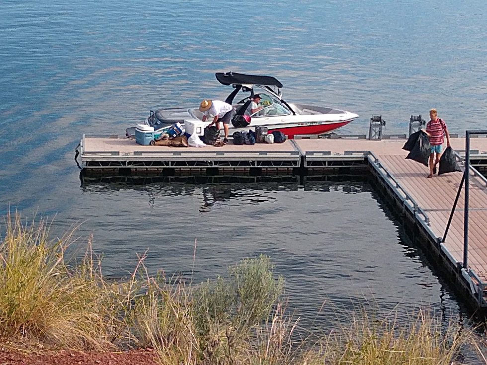

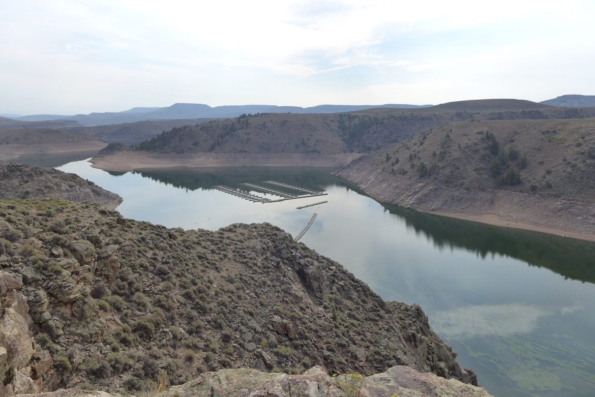

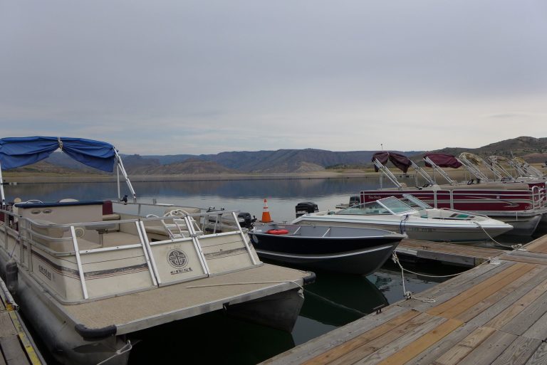
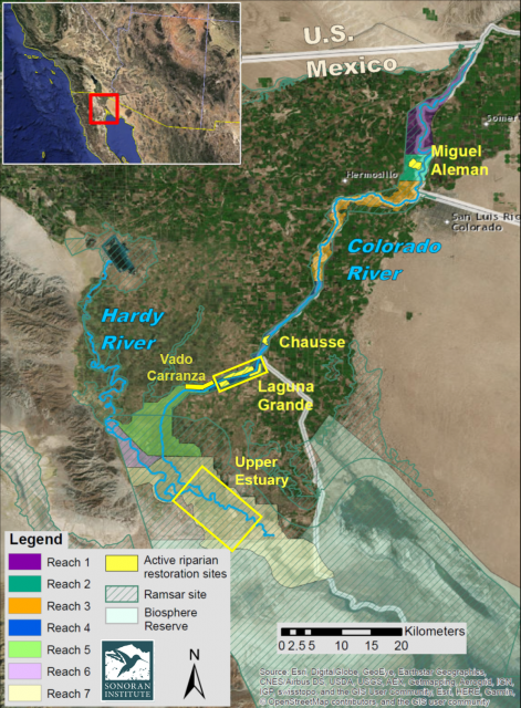
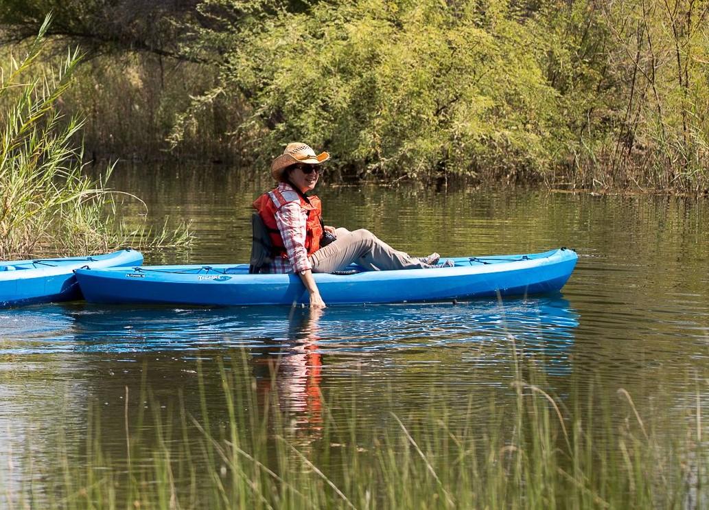
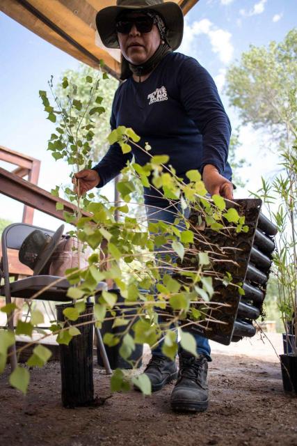
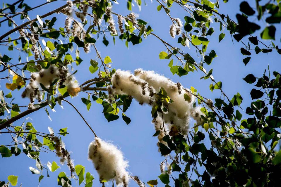
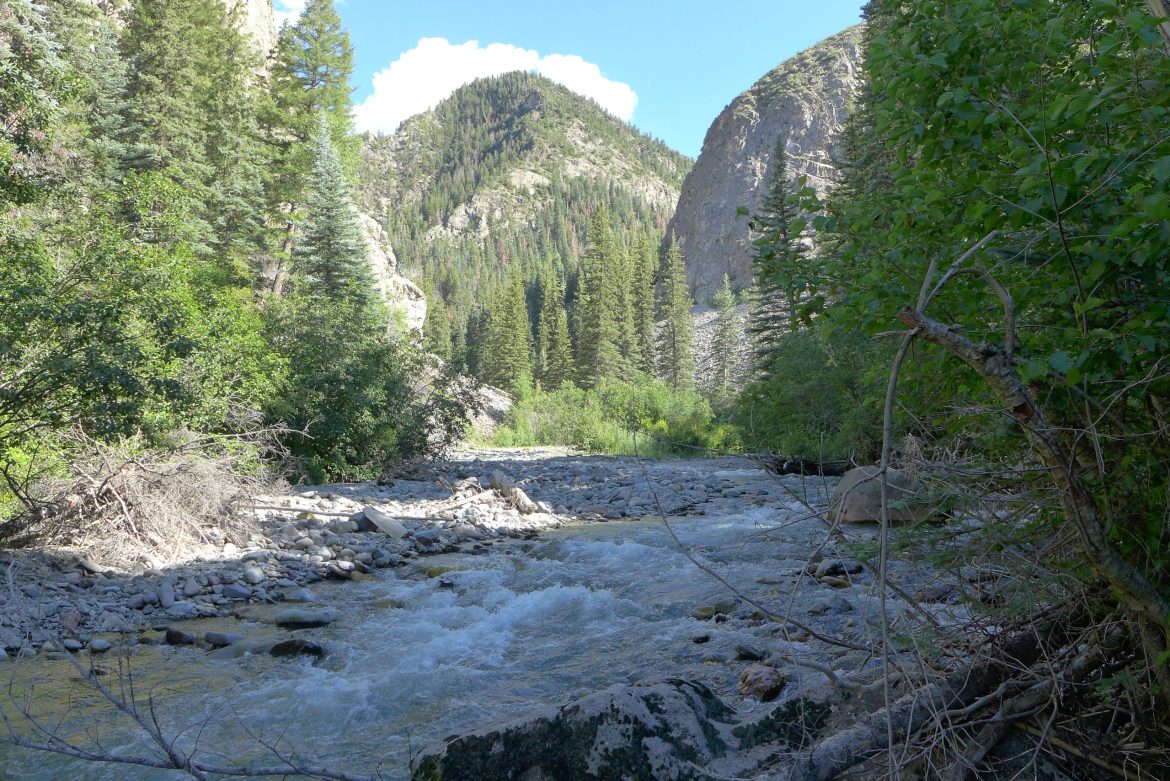
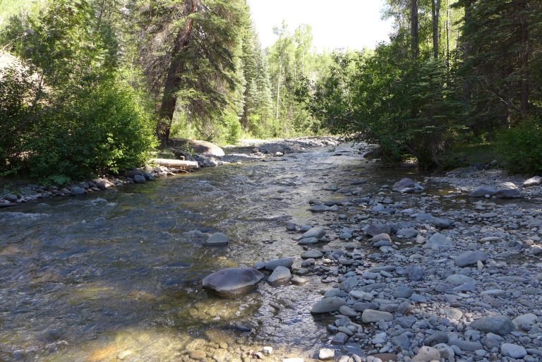
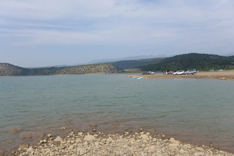
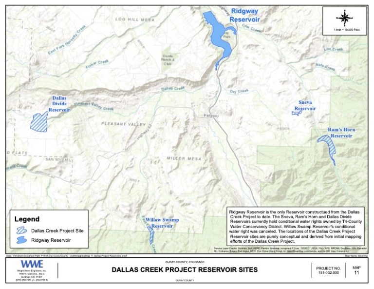
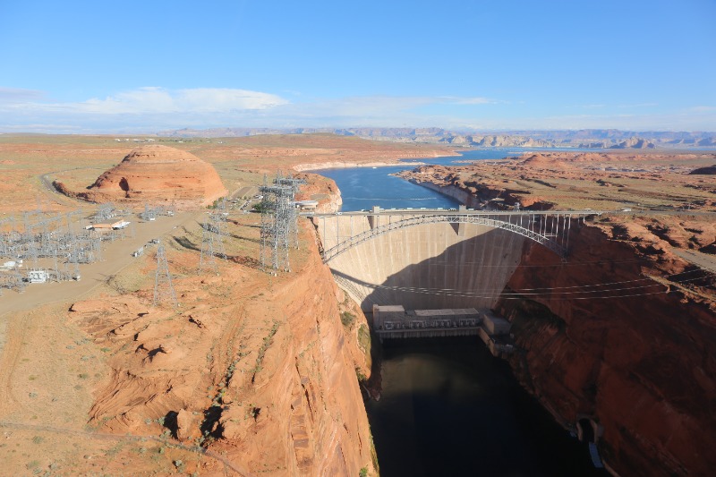
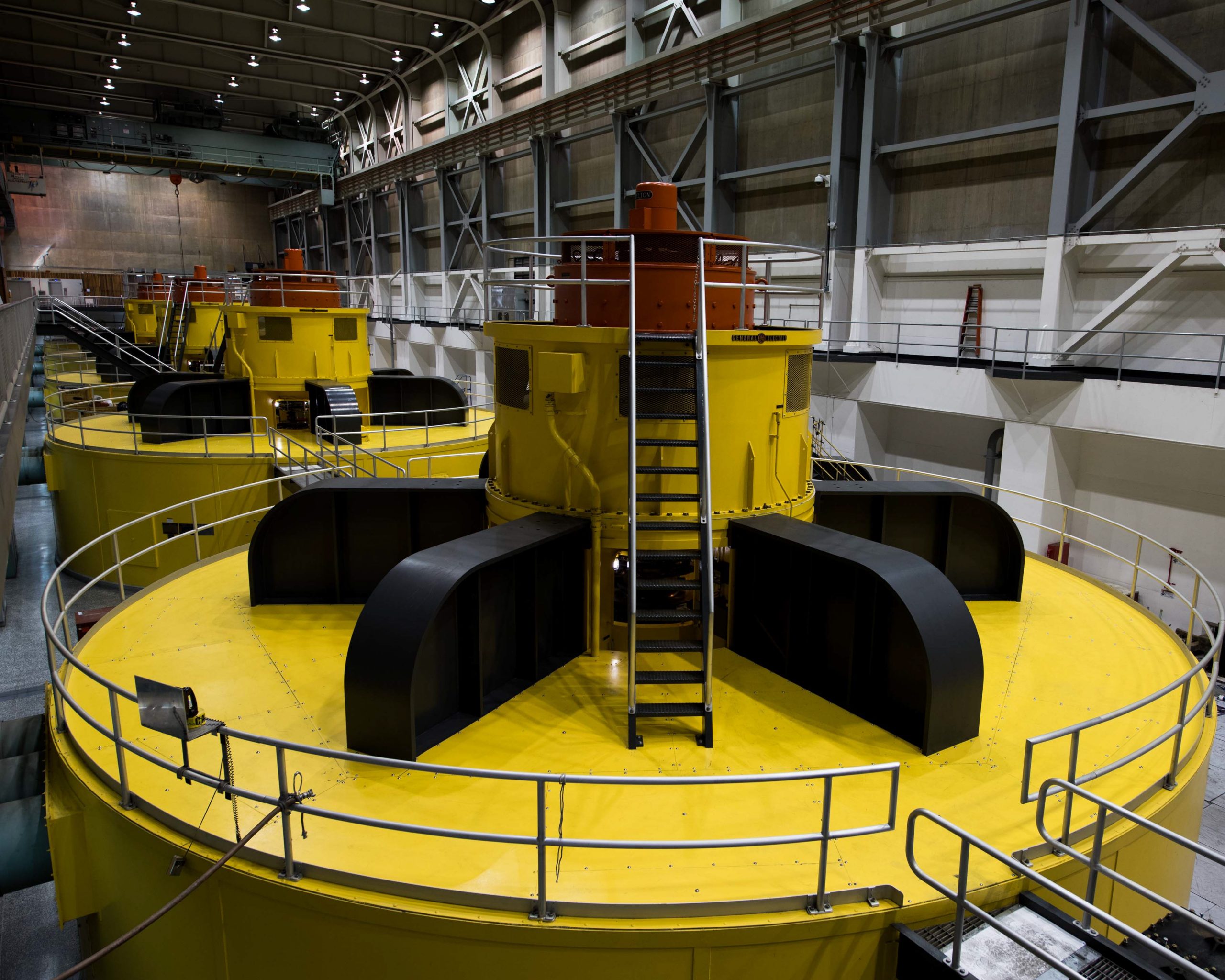
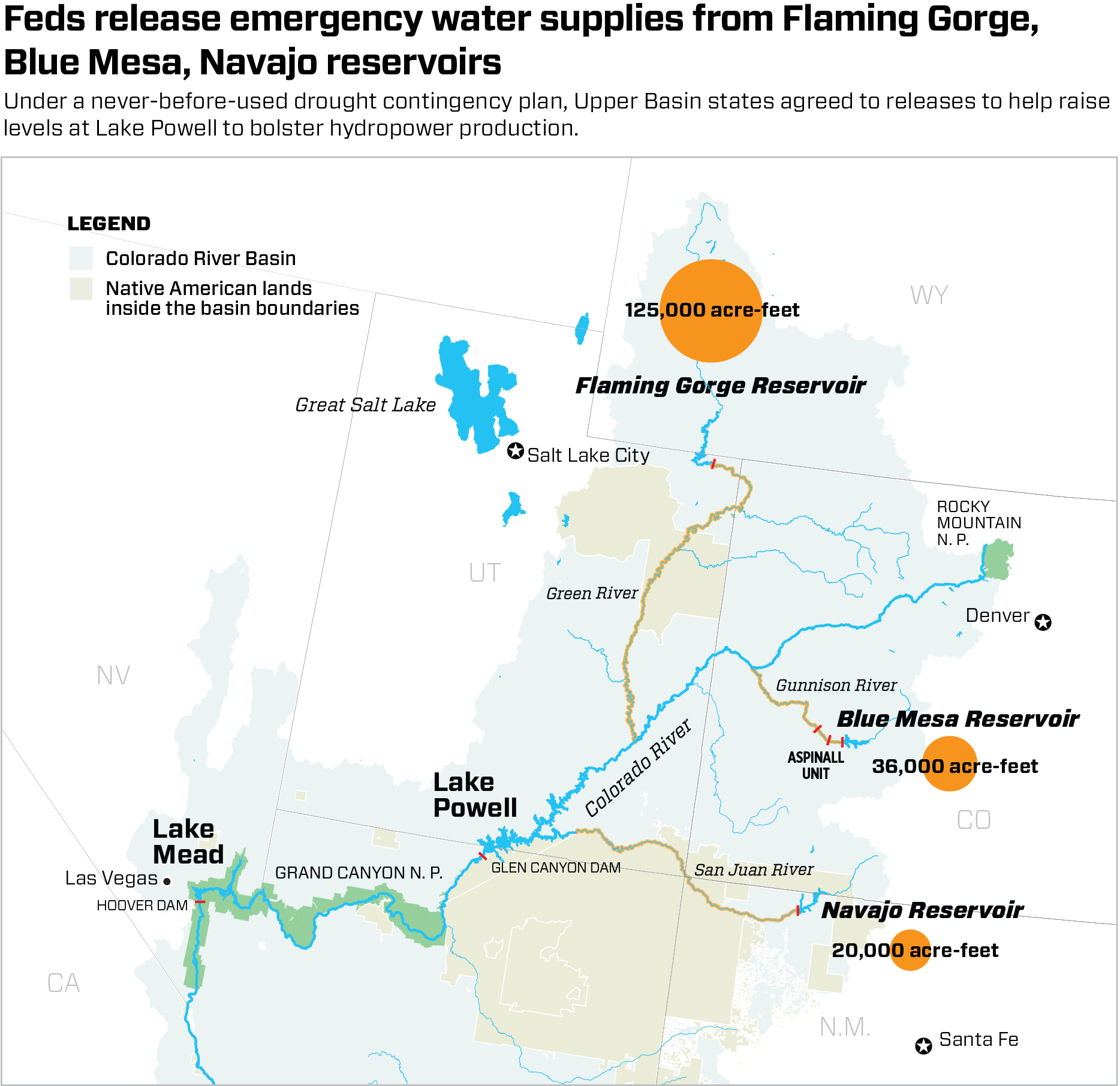
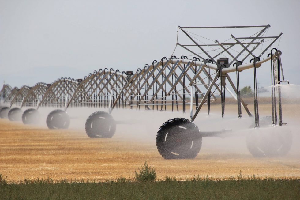
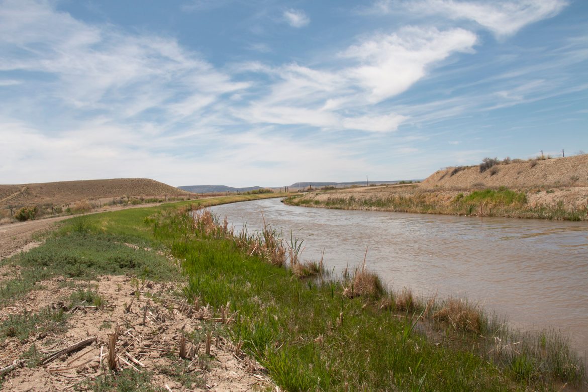
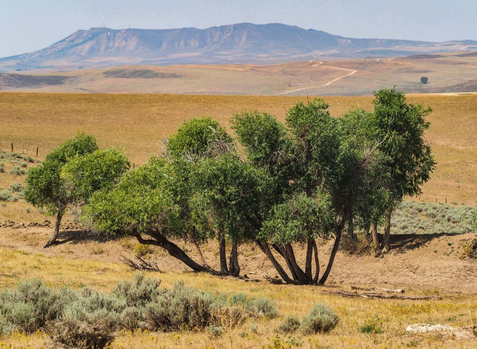
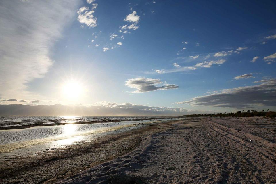


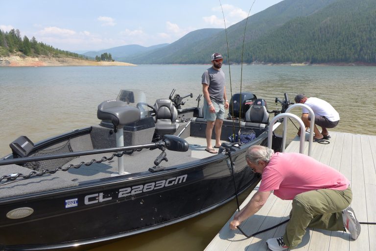


