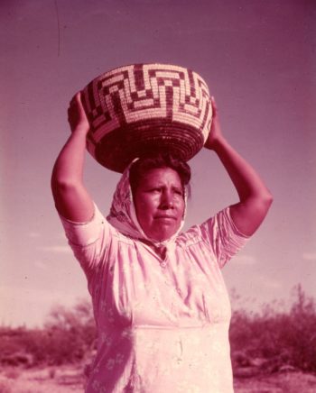
By Keith Schneider
CASA GRANDE, Ariz. – Tales of personal anguish are the typical start of serious articles about Arizona’s conspicuous confrontation with scarce water. The distraught Chino Valley homeowner buying water out of a truck because her well dried up. The Pinal farmer losing income because his water-starved fields lie fallow. The Phoenix golf course operator, burdened by high irrigation costs and declining revenue, selling out to a home developer.
This report, the first of three on how Arizona copes with a drought more serious than any in 1,200 years doesn’t start there. Instead it begins with this: A brief on how adept engineering for dams and aqueducts, government subsidy, technological development for pumps and water recycling, surpassing marketing, and an advantageous assemblage of natural resources – sun, warmth, blue sky, and open spaces – produced one of the greatest desert civilizations in human history.
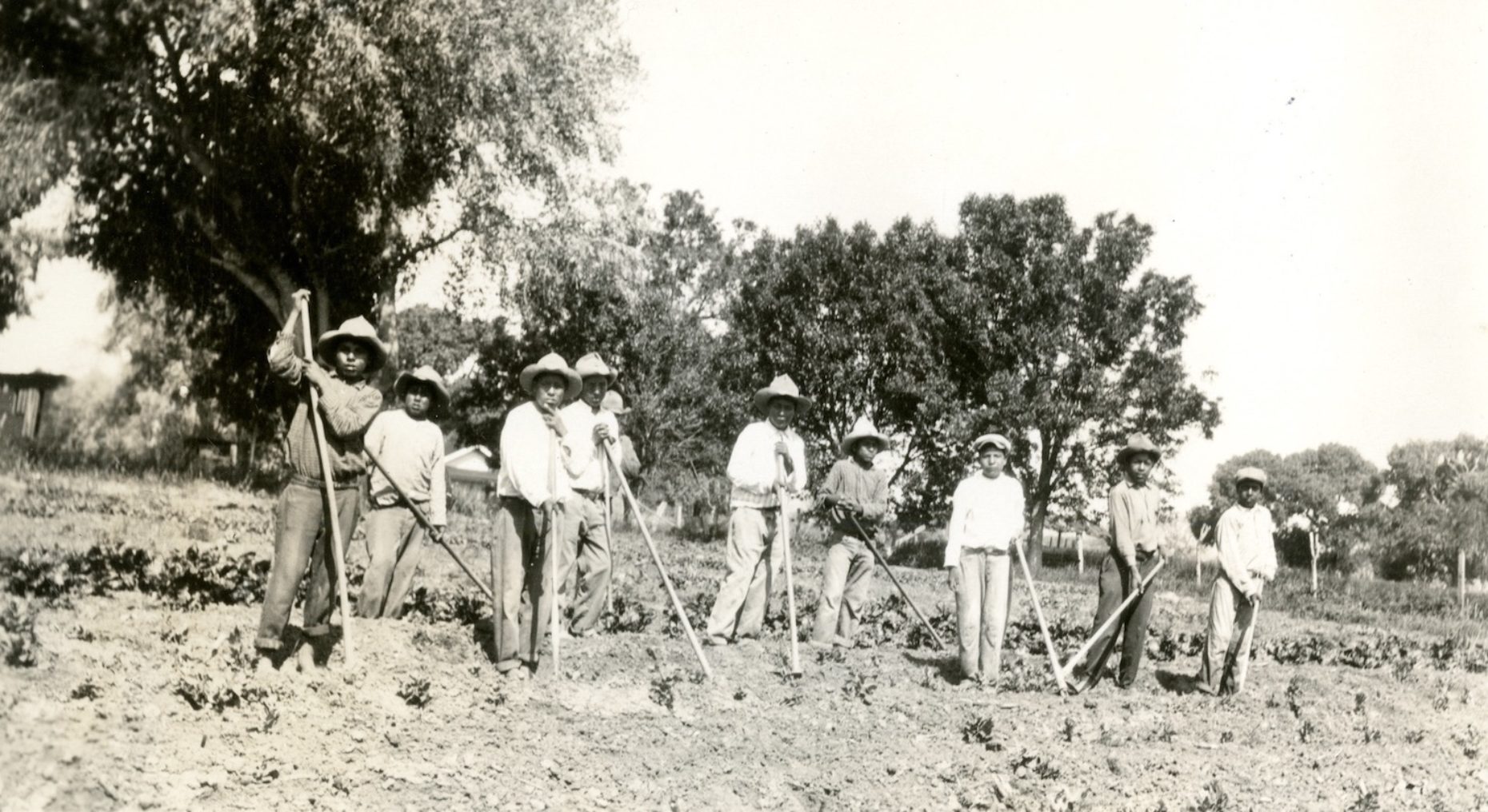
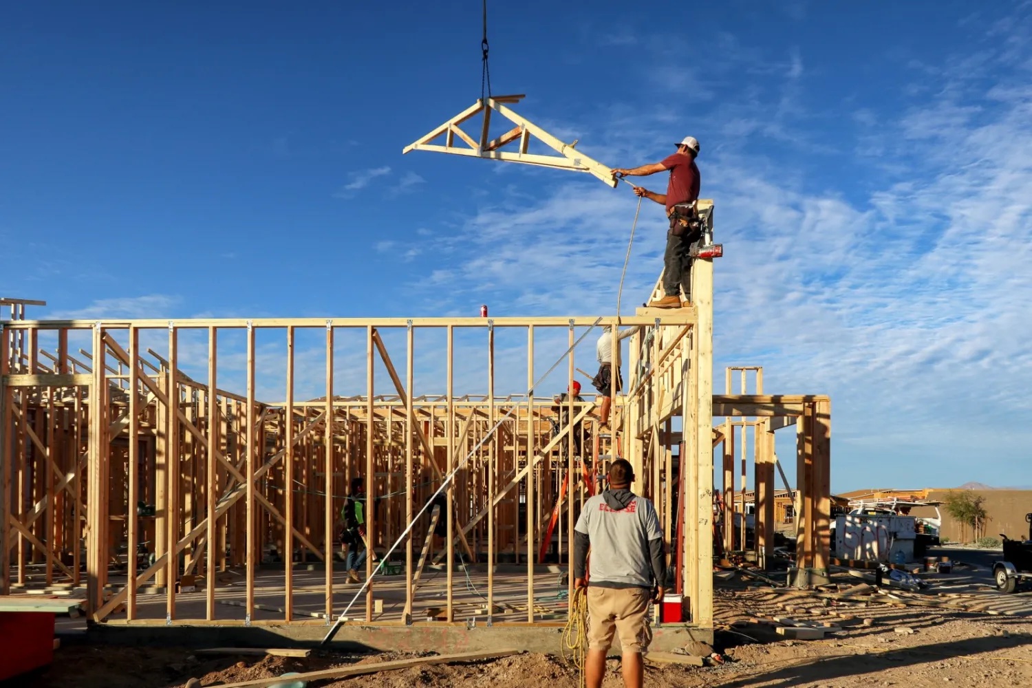
Arizona’s population, 7.1 million, has increased by an average of 1 million people a decade since the 1950s, when the five C’s ruled the state: cattle, copper, cotton, citrus, and climate. Even as the first four have declined in relative importance, the appeal of warmth and sunshine has not diminished. In fact, it’s boom times. Phoenix, with 1.7 million residents, is now the nation’s fifth largest city. To spend time in Arizona is to understand why it’s been one of the fastest growing states for four generations. The state embodies a century of pure American capitalist exuberance.
Arizona’s annual gross domestic product, nearing $380 billion, has more than doubled since 2000. New solar installations, electric vehicle makers, computer chip manufacturers, data centers, and corporate farming companies are piling into the state.
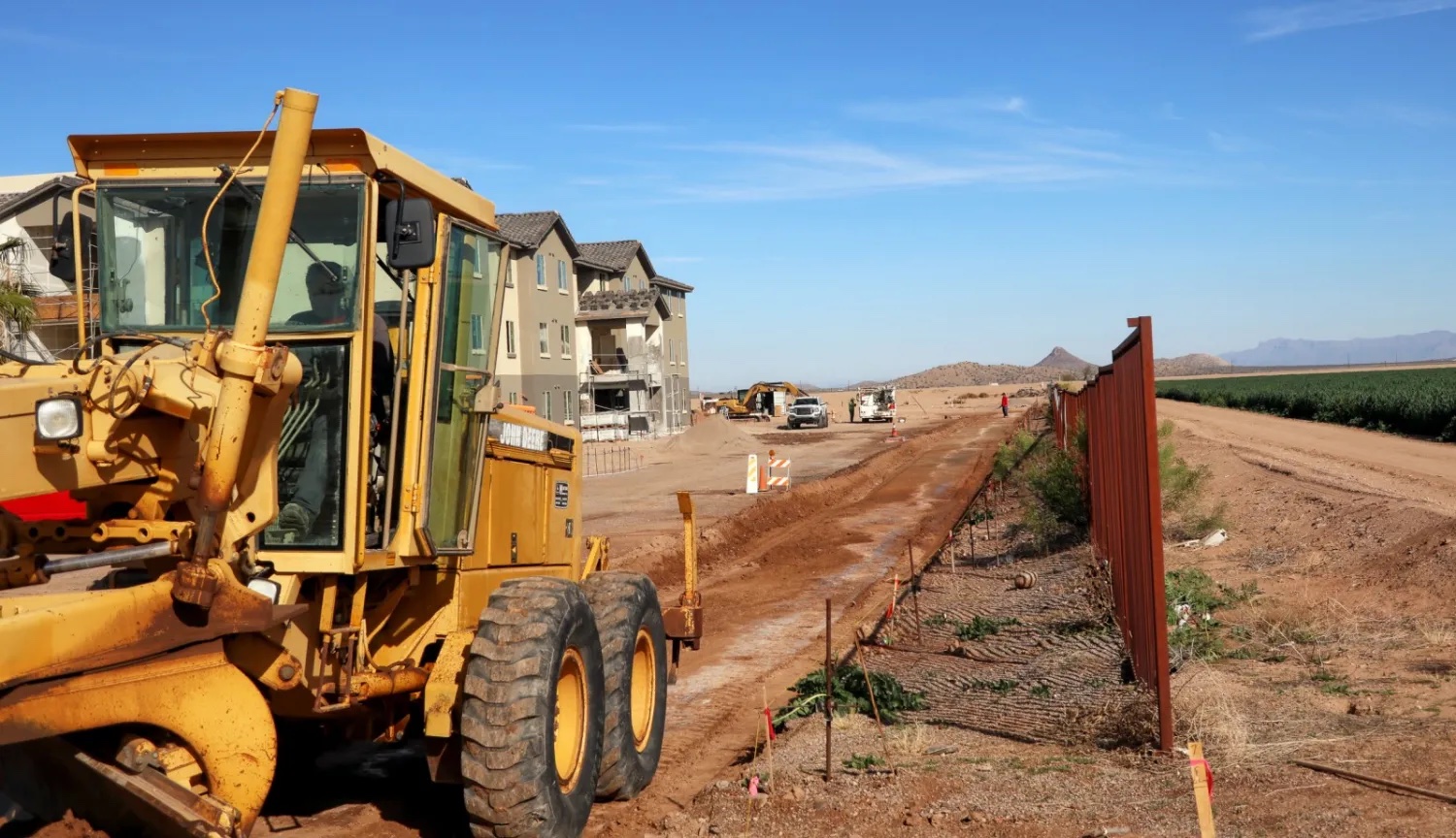
Arizona added nearly 200,000 new jobs last year and issued construction permits for 65,000 new homes, according to state and federal figures.
State government has amassed a budget surplus every year since 2016. The general fund last year, in an unmistakable rebuke to the pandemic, collected $2 billion more in tax revenues than it did in 2020. State economists forecast a $4 billion budget surplus over the next three years.
The economic boom transformed the landscape. Arizona built an impressive array of beautiful homes, attractive neighborhoods, wide highways, thriving businesses, fine universities, high-tech manufacturers, and state-of-the-art irrigated farms. All of it — 114,000 square miles, 73 million acres — is saluted by cactus forests, towering mountains, mesquite desert, and transcendent vistas that touch the horizon.
Arizona, in other words, reveled in its location in a mighty desert, commanded the contemporary 20th century rules of the development game, and reached the pinnacle of its lifestyle appeal and economic influence in the first decades of the 21st.
The question now, as it has been since 1911 when the first big reservoir was completed to supply Phoenix with water, is one of longevity. Can this desert bounty be sustained for another 100 years, or even another 50? That question is more urgent and more relevant than ever. Climate change is disrupting the rules of the development game. Drought and extreme heat are emptying rivers and reservoirs, fallowing tens of thousands of acres of farmland, forcing thousands of homeowners to secure water from trucks and not their dead wells, and pushing Arizona ever closer to the precipice of peril.
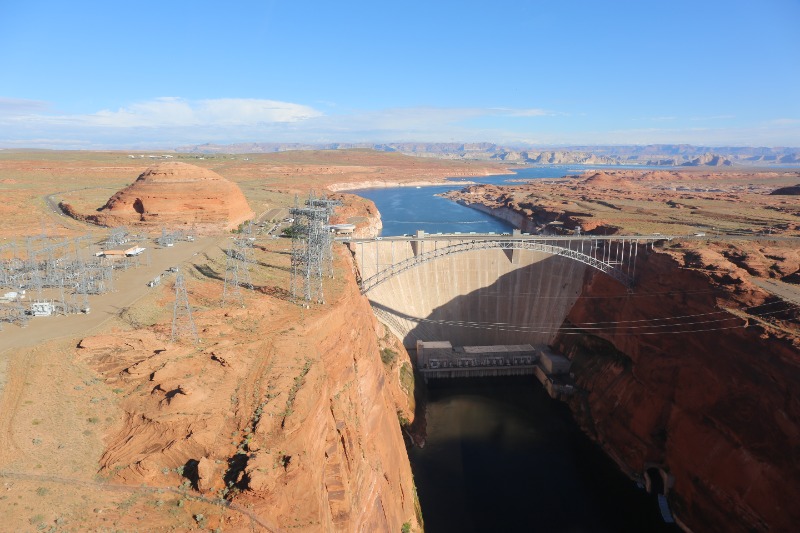
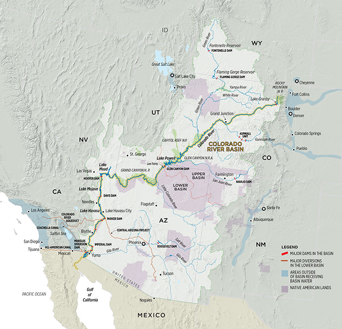
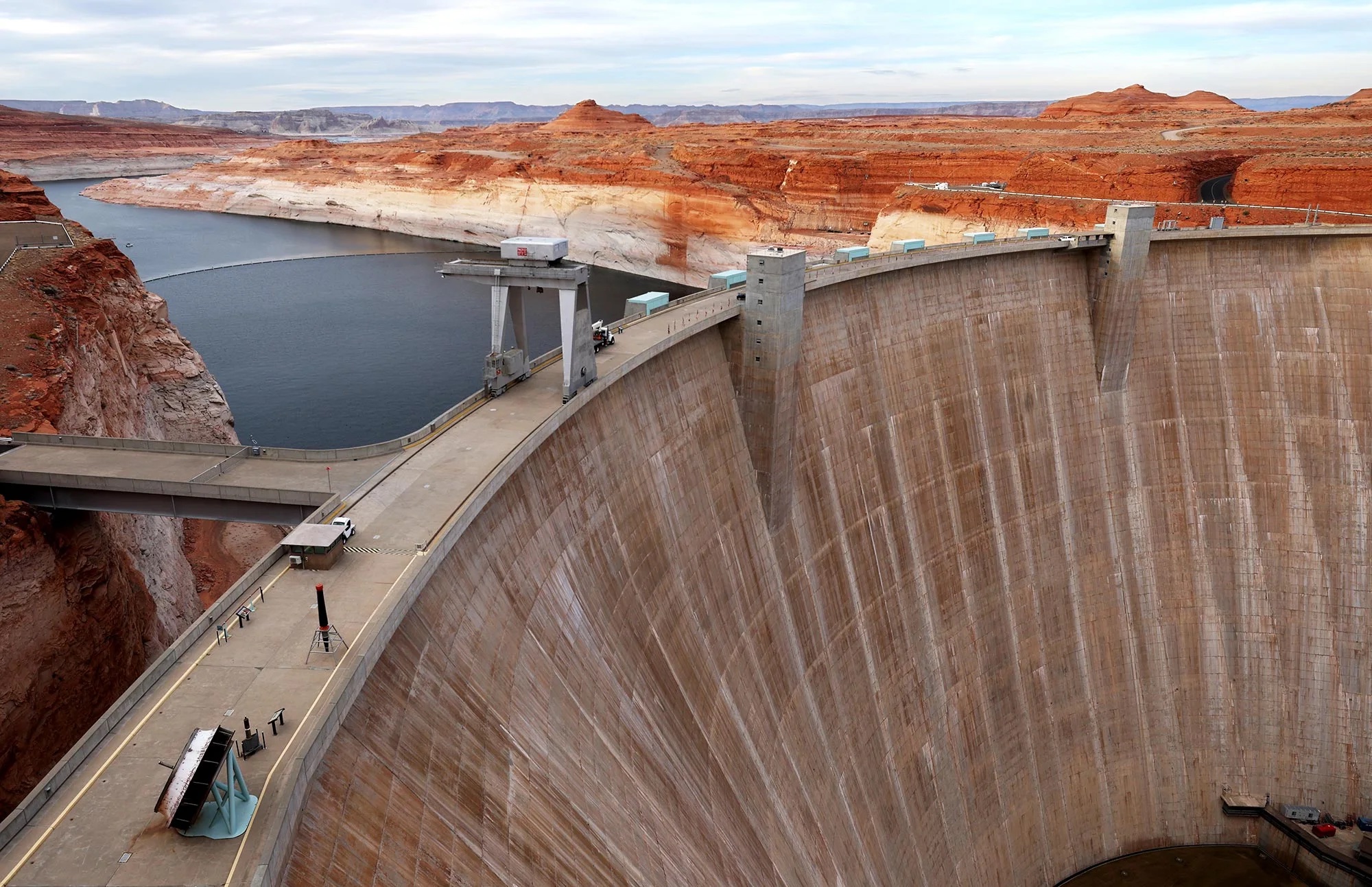
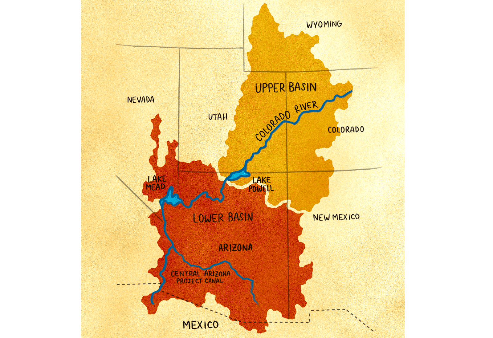
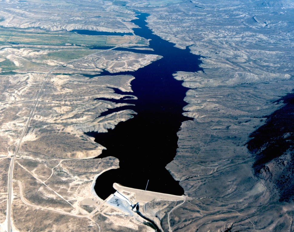
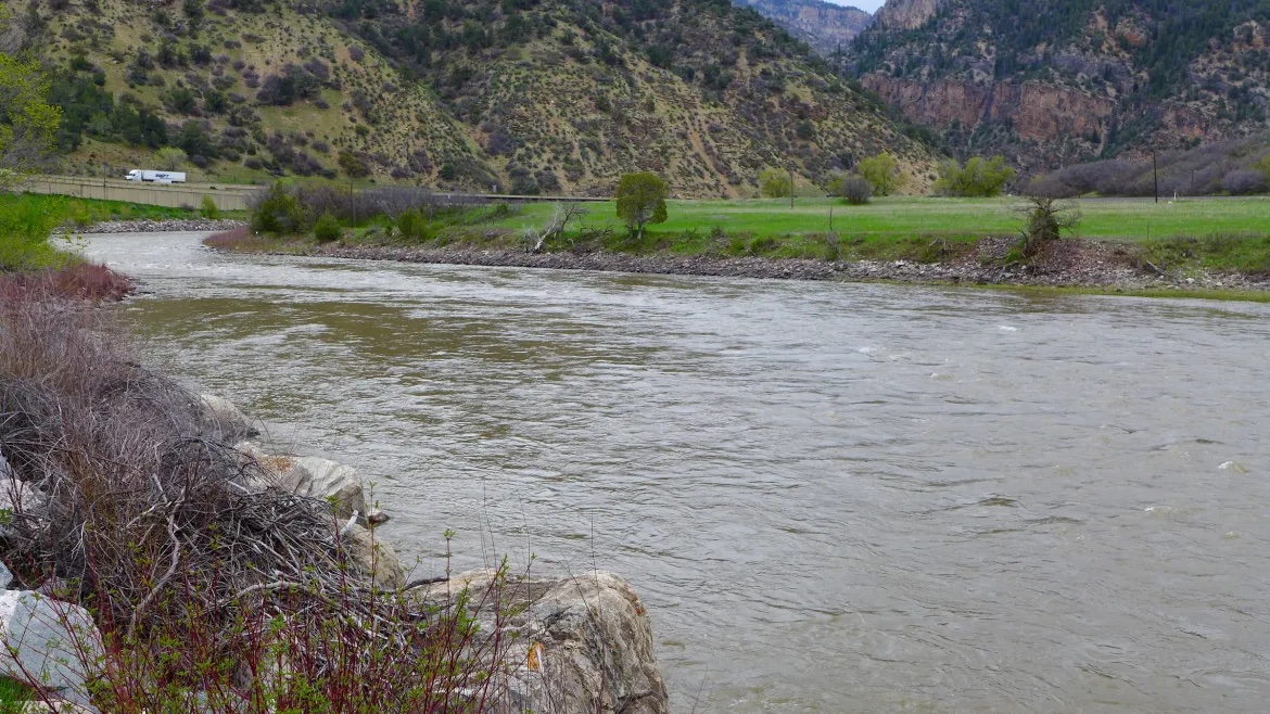
The most revealing and menacing evidence of that fact has emerged on the Colorado River, which supplies 36 percent of the state’s water. The river’s flow is 20 percent lower than it was in the 1990s. The country’s two largest reservoirs — Lake Mead, which opened in 1934, and Lake Powell, in 1963 — are on the river and were designed to hold 55 million acre-feet of water. (One acre-foot equals 325,852 gallons.) At 30 percent of capacity combined, they now hold less water than at any time since soon after they were opened. In total, 36 million acre-feet, or nearly 12 trillion gallons, of storage space is empty.
Last August, as extreme heat and drought dropped the lake levels further, the federal government issued a formal declaration of water shortage. Translated into the legal details of the pact involving two countries, seven states, and 30 tribes that guides the river’s management, the declaration meant that Arizona’s share of the river will be cut by 512,000 acre-feet this year, or 166 billion gallons.

River Water Lost
It’s a lot of water on paper, amounting to 8 percent of the 7 million acre-feet of water that Arizona uses annually. And it’s almost 20 percent of the 2.8 million acre-feet that Arizona is legally entitled to receive each year from the Colorado River.
Arizona was already using less Colorado River water in the years before the declaration, and there is wiggle room in the math for how much the state will actually go without. Nevertheless, the federal declaration was a body blow. It formalized what the state has managed to avoid for a century. Arizona’s demand for water in metropolitan regions and industry has crossed the line delineating diminishing water supply. The consequence is a slow motion collision that puts Arizona’s desert economy and way of life, along with its governing capacity to adjust and evolve, in the direct path of nature’s power to drive out and dry up much of what was built.
State lawmakers and business executives have anticipated the confrontation for nearly a decade and insist that there is no immediate crisis. More than 13 million acre-feet of water — a nearly two-year supply — has been purposefully stored in underground reserves specifically for use in emergencies. Republican Gov. Doug Ducey has convened expert committees. He’s also urging the Legislature to establish a new state agency, the Arizona Water Authority, and commit over $1 billion to a new strategy for securing additional sources of water, like building desalination plants and harvesting flood waters from the Mississippi River. Arizona and the six other Colorado River Basin states have a 2026 deadline to reach a new agreement on sharing the river’s water.
Invoking words of assurance principally designed to quell anxiety in the markets for housing and new business starts, state leaders display determined allegiance to the message that Arizona has sufficient supply and know-how to continue to thrive. As Gov. Ducey likes to say: “Arizona is open for business.”
That’s true, for the time being, for the more than 5 million people in Phoenix and its suburbs, and the 1 million residents of metropolitan Tucson. Both cities have developed secure sources of water, and applied effective techniques of water conservation, recycling, and reuse.
But both cities also are served by the Colorado River. Phoenix receives 40 percent, and Tucson 60 percent of their water from the river. Climatologists project the worst is yet to come and the river could lose 3 million more acre-feet from its flow by mid-century, or another 20 to 30 percent. If that occurs, water supplies for Phoenix and Tucson would be substantially cut. Residents and businesses will contend with dramatic shifts in lifestyle and water consumption. Green grass, swimming pools, golf course water hazards, even golf courses would be amenities of the past. The price of water could rise well above the cost of electricity and thereby influence all sorts of economic outcomes like changes in housing values, residential construction, and business starts.

Drier Conditions Projected
If those meteorological projections are accurate, and if decades can be described as a race for time, Arizona has about a generation to figure out, finance, and execute a new resilience strategy. The state appears to have two paths, and just two, to pursue. One that rallies federal, state, tribal, and local governments to unify opposing forces and bring water supply and demand into balance in the era of accelerating climate change. The second path is more perilous, strewn with impediments of politics, civic disagreement, financing, litigation, and inaction that yields a catastrophe where everything goes wrong.
“Most of the press, it’s the second one not the first one,” said Tom Buschatzke, director of the Arizona Department of Water Resources. “There’s hard policy choices to be made. For instance, how much farming do we need? Where will you get your farm products? Are we going to rely on another country for our food? There’s that kind of debate that’s going on.
“Part of our mission statement actually has the words ‘lifestyle.’ So what lifestyle do you want? Do you want not one green thing in the city? City environments to the point where use is 18 gallons per capita? We need a different, more holistic look at how everything fits together. It’s conservation. It’s about augmentation. It’s about a whole bunch of things.”
“We’ve got 20 or 30 years,” added Grady Gammage Jr., an attorney who’s written extensively about water and is distinguished fellow at Arizona State University’s Morrison Institute for Public Policy. “We’re still so addicted to growth as the solution to everything. But where’s the water going to come from? I used to tell people, ‘Relax. We don’t need to worry about that for a long time.’ Not anymore. Now is the time that we need to worry about that.”
Outside Metro Areas The New Sound of Alarm
That message is starting to penetrate more deeply. There’s a reason. A dress rehearsal for contending with serious water shortage is in process for 1 million residents who don’t live in Arizona’s two big metro regions. During a month of frontline reporting in Arizona, Circle of Blue encountered unmistakable signals of extreme water stress:
- Wells have run dry for thousands of residents who rely on groundwater for drinking, from Cochise County in the southeast, to Maricopa County north of Phoenix, to the Chino Valley north of Prescott.
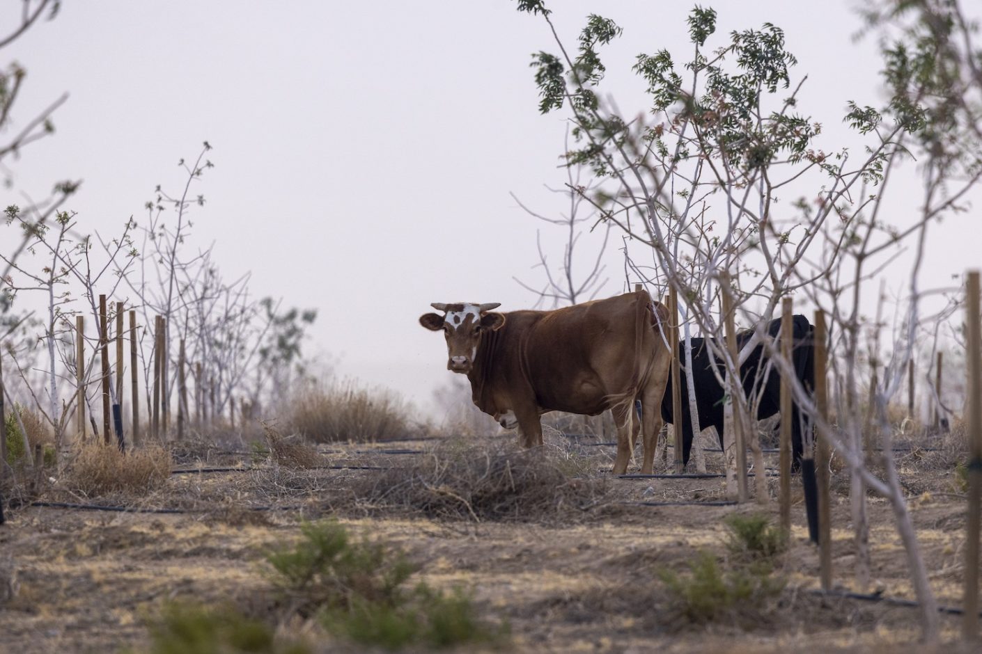
- Industrial livestock and nut farms have settled in Cochise County, and in Mohave County in the north. Because demand has increased, and moisture to recharge groundwater reserves has diminished, aquifers are dropping 5 feet a year. Irrigation wells on existing farms already have gone dry and more are in jeopardy of going dry.
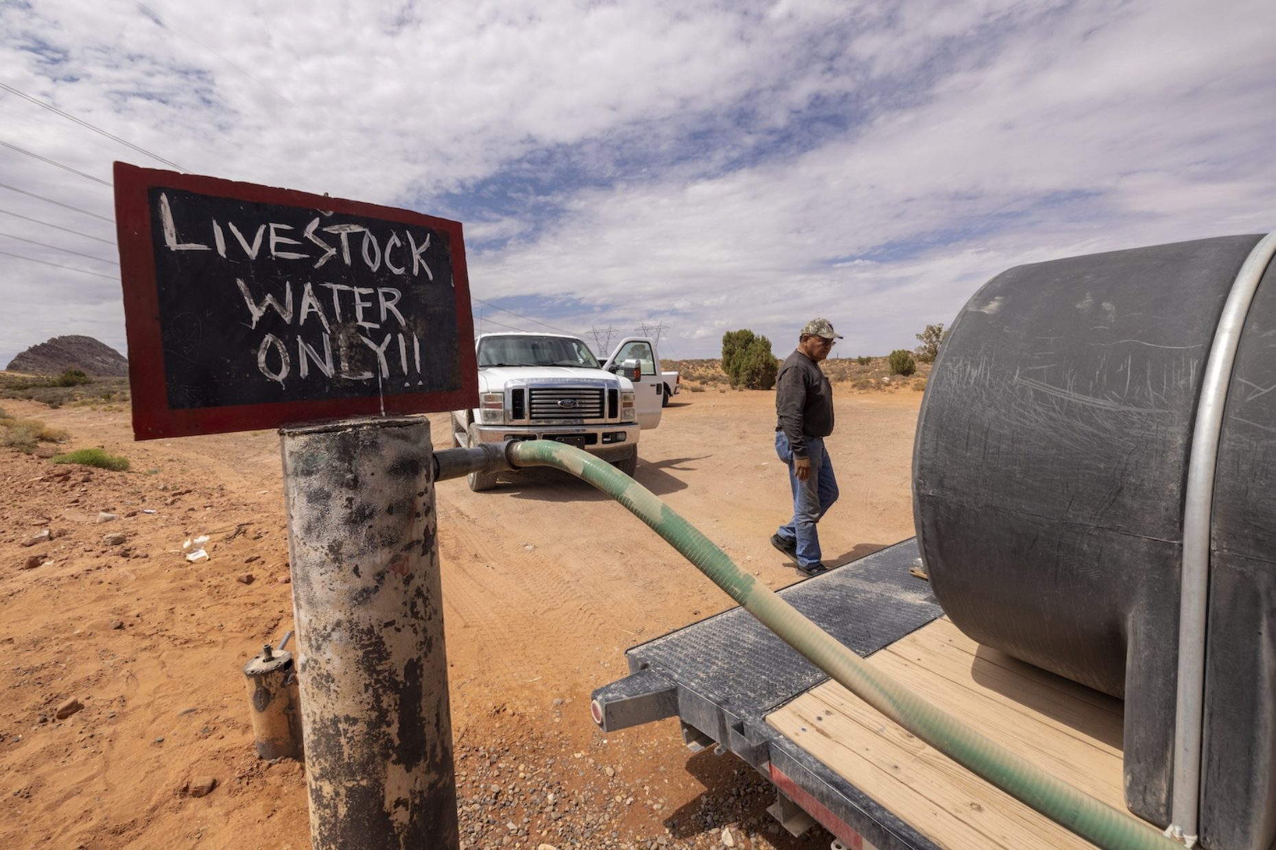
- Water scarcity is driving two of Arizona’s fastest growing business sectors. Water hauling companies are adding trucks and drivers to keep pace with demand. And water well drilling companies, prompted by customer lists so long that orders are filled six or more months after they are made, are buying new equipment and hiring more staff.
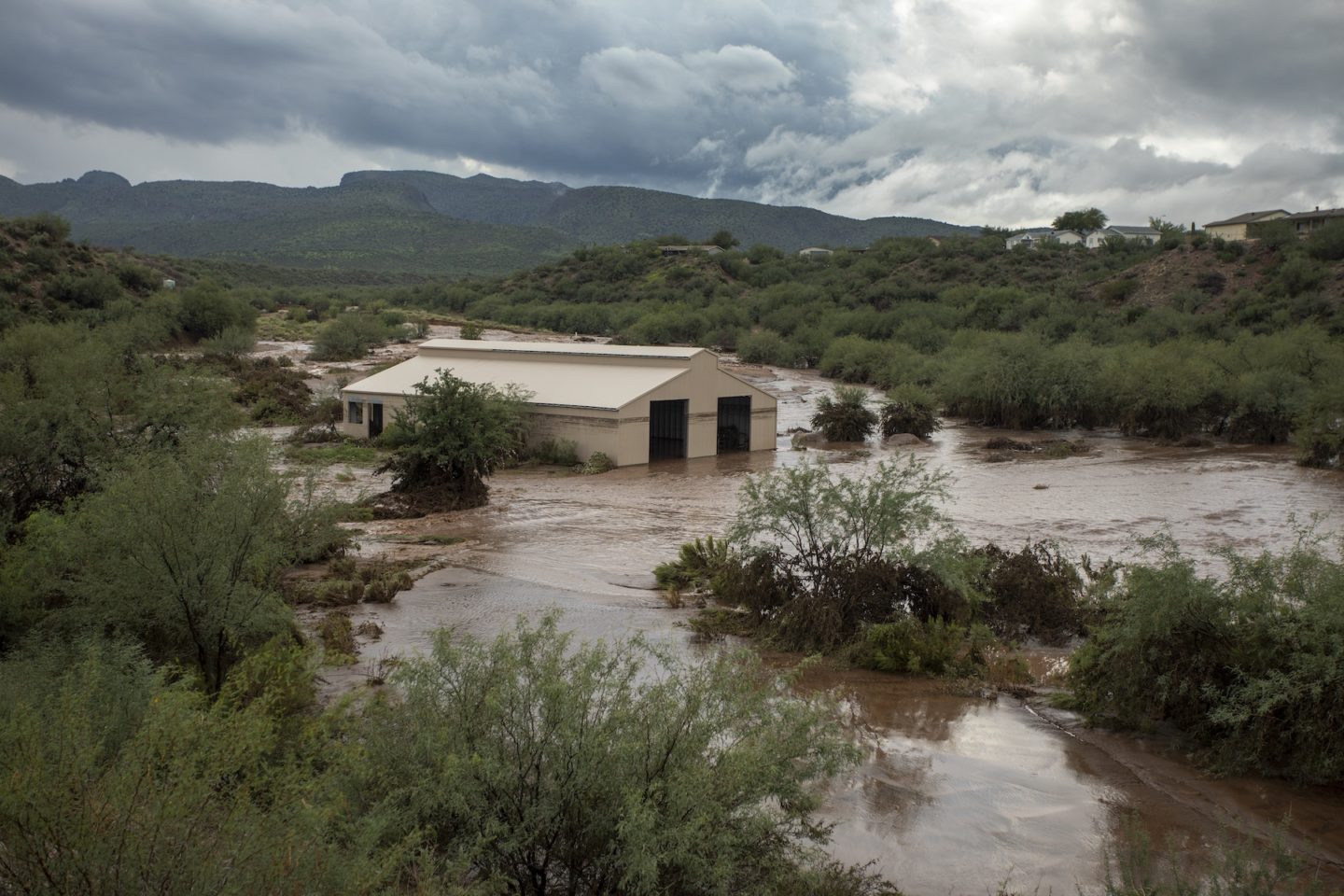
- The San Carlos Reservoir, formed by 92-year-old Coolidge Dam, is designed to store 1 million acre-feet of water from the Gila River to irrigate 100,000 acres of farmland between Phoenix and Tucson. Rain and snow melt in the high desert where the reservoir is located have been so altered by climate change that it’s filled only once since 1980 and now holds a mere 37,000 acre-feet.
- Though 40 of its 140 miles are protected in a national conservation area famed for wildlife and migrating birds, the San Pedro River in southeast Arizona is hardly a river at all. The aquifers that sustained its flow have been drawn down by extreme heat, drought, and hundreds of wells drilled for housing. Once promoted as one of the state’s last “free flowing” rivers, the San Pedro is now but a trickle, and altogether dry along much of its path.
- The dollar value of water is climbing to heights never before seen in the state or hardly anticipated. Arizona last year approved the sale of 2,083 acre-feet of Colorado River water annually to Queen Creek, a Phoenix suburb. The cost of the deal: $21 million or $10,000 per acre-foot. Queen Creek is anxious to pay. It needs the water. The city’s population — 60,000 — is 15 times higher than in 2000. Its water demand is 10 times higher.
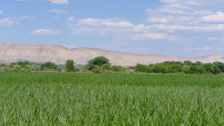
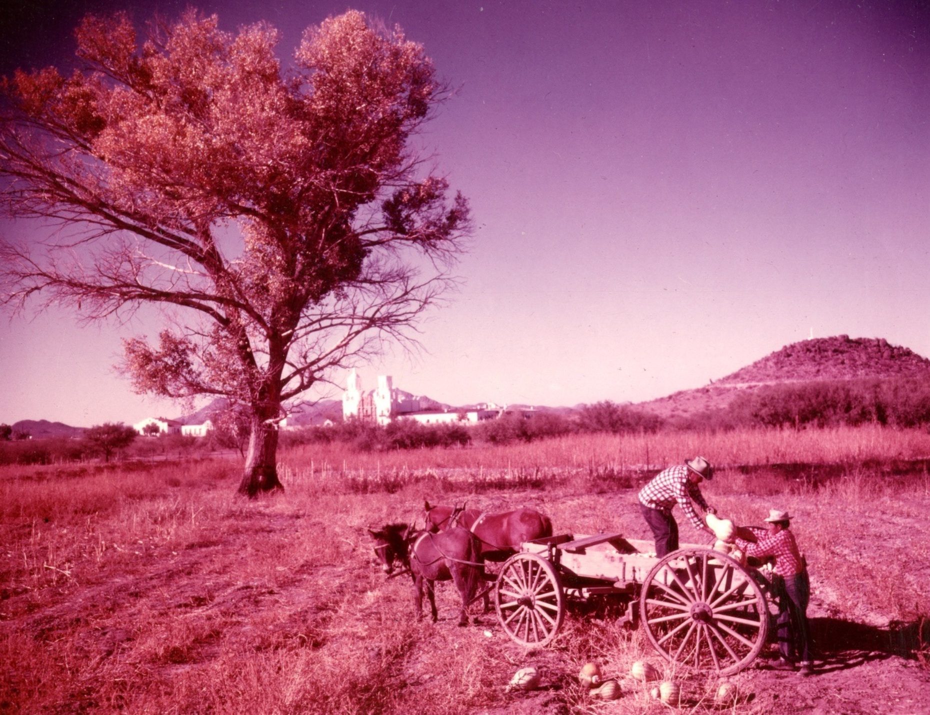
The tightening supply of water, in effect, is testing Arizona’s growth-focused operating system, and producing losers and winners. That is especially true in Pinal County, a Connecticut-size expanse of mountains, desert, farmland, copper mines, Native American reservations, and growing cities set between Phoenix and Tucson. One other feature distinguishes Pinal: about 100 miles of the 336-mile-long Central Arizona Project, one of the country’s longest aqueducts that transports Colorado River water from Lake Havasu to south of Tucson. At its peak in the early 1990s the project delivered 550,000 acre-feet of Colorado River water annually to irrigate a $2.3 billion dairy-alfalfa-cotton-melon farm sector, one of the most prosperous in the country.
Because of agreements that Arizona reached from 2004 to 2019 as the river waned, the federal shortage declaration last August cut the water supply to Pinal County’s four irrigation districts from more than 200,000 acre-feet in the 2000s to 31,000 acre-feet in 2022. The state has promised $40 million to drill or rehabilitate groundwater wells to make up a portion of the loss.
Pinal’s Pain
On a crisp January morning, Atanacio “Nacho” Gonzalez returned from a distant field to his Pinal County farm headquarters, within sight of the treeless Table Top mountains, and described what drought and water shortage are doing to 1,500 acres of Bermuda grass and alfalfa that he raises for horses and livestock.
“I’ll give you an idea of where we are,” said Gonzalez, who is 62 years old and has farmed this piece of ground since 2002. “Before the cuts I order 18 CFS for 1,000 acres.” (That’s 18 cubic feet per second or 36 acre-feet per day.) “I apply that nonstop for about two weeks at a time, then alfalfa grows or grass grows. We do that, usually, nine times out of a year.
“What am I going to get this year?” he continues. “Very little, according to what my water companies tell me.”
A University of Arizona analysis published last year projected that because of the federal water declaration Pinal farm income would drop $100 million annually. It’s not a killing blow. It is, however, the latest of the economic hits steadily driving the Pinal farm community to threatened status. Between 2012 and 2017, according to the U.S. Agricultural Census, almost 180 Pinal farms went out of business, a nearly 20 percent reduction. Some 100,000 fewer acres were farmed, an 8 percent decline.
Gonzalez is one of 176 farmers who receive water from the San Carlos Irrigation and Drainage District, all of whom are contending with a double dose of water shortage. First is the loss of all Colorado River water delivered by the Central Arizona Project. Second is what’s happening with the San Carlos Reservoir, which is 97 percent empty. Turning on wells to supply groundwater will not make up the difference.
“Our wells don’t put out so much water,” Gonzalez said. “I’m thinking that I’ll grow on 600 acres, not 1,000. How many cuttings can we do on 600? I’m hoping to do seven to nine. But that’s yet to be seen. We’ll have a 40 percent reduction in the crop.”
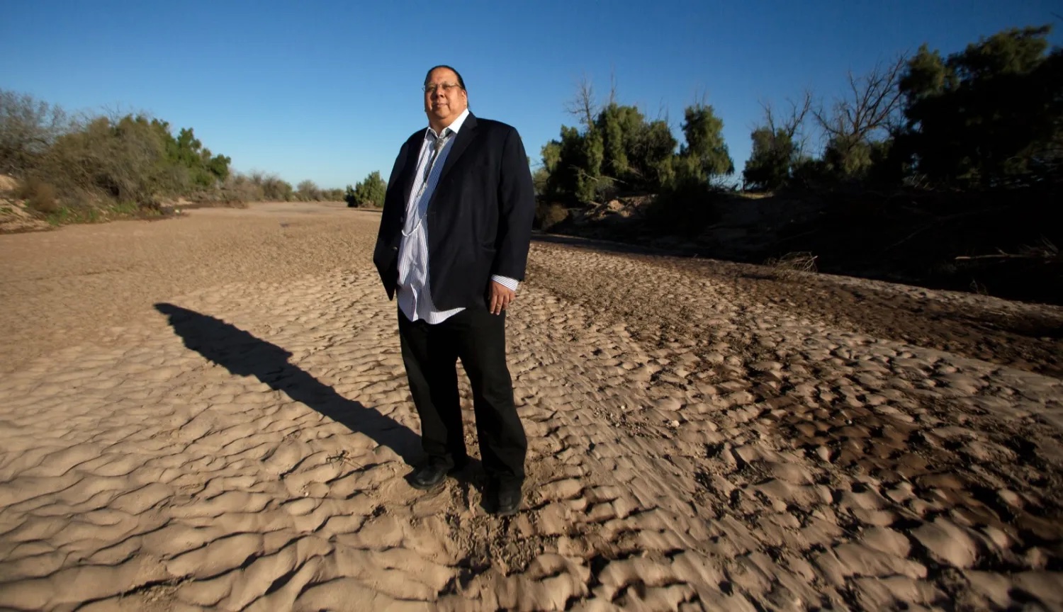
Photo © J. Carl Ganter / Circle of Blue
Tribal Water Abundance
The federal shortage declaration also produced winners, especially the Gila River Indian Community. Most of the tribe’s 372,000-acre reservation is spread across the northern section of Pinal County. In 2004 Congress approved a huge water settlement that confirmed the tribe’s right to more than 650,000 acre-feet of water, about half from the Colorado River. The long-term goal of the tribe, whose ancestors date back to the people who inhabited the region 8,000 years ago, is to restore its ancestral farming ground to about 75,000 acres. It currently farms about 35,000 acres. A $92 million appropriation from the Interior Department is funding the expansion of the tribe’s irrigation network.
In the meantime, the nearly 23,000-member tribe is marketing some of the 311,800 acre-feet of Colorado River water it is entitled to each year. It agreed to lease 33,000 acre-feet annually for 25 years, starting this year, to operators of the Central Arizona Project to support residential development. As a requirement of the 2004 settlement, it leases 41,000 more acre-feet annually to supply drinking water to cities in the Phoenix region.
Since 2016, it’s also kept 370,000 acre-feet in Lake Mead to help slow the reservoir’s decline. And though the August shortage declaration cut its Colorado River water supply by 41,000 acre feet, the tribe agreed to leave nearly 130,000 more acre-feet in Lake Mead this year. That amount is most of Arizona’s share of 500,000 acre-feet that the state, California, and Nevada agreed to keep in the lake last December. The price for that water: $274 an acre-foot, or $35.6 million. In effect, water has become an annual revenue item nearly as significant as the tribe’s three casinos.
Tribal officials did not make themselves available for an interview. But Gov. Stephen Roe Lewis, the tribal leader, said in a 2019 news release that the tribe’s goal in leasing water was to “protect Lake Mead,” and “ensure that water supplies are available for an important sector of Arizona’s economy.”
By economy, Lewis principally meant real estate construction, the engine that has propelled the state’s growth for 70 years. Pinal is an example. In 1950, just as the post-war population boom started, Pinal was still a lightly settled farm and mining county with 43,000 residents, nearly 1,200 farmers, 2.5 million acres of farmland, and 13,000 homes.
By 2020 the shrinking agriculture sector counted less than 800 farms and 1.1 million acres of farmland. But the county’s population soared to 425,000 people living in 181,000 homes, most of them built on former farmland.
Pinal County’s long-term plan forecasts that 5 million more residents could show up. At current rates of Arizona’s growth, that means that by mid-century virtually all new state residents will settle in the county. They potentially could if there is sufficient water.
The following data points are important. In 2020, the latest year for complete figures, Pinal’s annual water demand was 950,000 acre-feet; 40 percent from the Central Arizona Project and almost all of the balance from groundwater, according to state data. Farming used most of it, 750,000 acre-feet per year. Cities and industry used just 35,000 acre-feet.
The county anticipates that at current rates of water use serving 5 million more residents, equivalent to 1.5 million new residences, would require 840,000 to 1.7 million acre-feet of additional water supplies every year.
Where’s that water coming from? The Colorado? Not likely. And the state Department of Water Resources has changed its view of how much groundwater will be available.
In 2019 the agency took a fresh look with new groundwater models and announced it made a mistake. Its newest assessment of supply and demand showed that Pinal’s water demand over the next few decades would be 8 million acre-feet over and above the available supply.
Last year the state halted issuing water supply certificates for housing subdivisions. The announcement, though, hasn’t curtailed new construction for housing. Yet. From January 2019 to December 2021, according to the St. Louis Federal Reserve, Pinal’s municipal authorities issued construction permits for 161,519 new homes that already had been approved.
This project was made possible by a fellowship awarded by Stanford University’s Bill Lane Center for The American West.
The Water Desk’s mission is to increase the volume, depth and power of journalism connected to Western water issues. We’re an initiative of the Center for Environmental Journalism at the University of Colorado Boulder. The Water Desk launched in April 2019 with support from the Walton Family Foundation. We maintain a strict editorial firewall between our funders and our journalism.