

ASPEN — The city of Aspen is hoping some grant money can help it collect more data on snow and streams in the high country so it can better predict and plan for droughts.
Aspen has applied for a $59,000 Bureau of Reclamation WaterSMART grant to install a new streamflow gauge on Castle Creek and a new site for snow telemetry, or SNOTEL, somewhere in either the upper Castle Creek basin or upper Maroon Creek basin. The city draws its water from the two creeks. Aspen would use the grant money to fund materials and supplies for both measurement sites.
Having two additional measuring devices at critical points for the municipal water supply will help the city monitor snowpack conditions and streamflows in real time and allow staff to modify operations early in the case of drought.
“Just having a real representation of what’s happening in that basin with the snow will help us to anticipate the drought,” said Steve Hunter, the city’s utilities resource manager.
For the second time ever, Aspen is in Stage 2 water restrictions; the first time was in 2018. Those restrictions aim to cut water use by 15% to 20% by limiting how often lawns and gardens can be watered; and by banning the washing of sidewalks and the refilling of swimming pools with municipal water, while implementing rate increases for some users, among other rules.
Tracking snowpack
SNOTEL sites have automated, remote sensors that collect weather and snowpack information across an extensive network in Colorado’s mountainous, high-elevation watersheds. These sites, which are installed, owned and maintained by the Natural Resources Conservation Service, provide a snapshot of basin conditions and are used to predict streamflows.
Without a SNOTEL site at the source of its water supply, Aspen has had to rely on the nearest ones — Independence Pass and Upper Taylor — which might not give an accurate picture of conditions in the Castle Creek and Maroon Creek watersheds.
“I was using Independence Pass as kind of a surrogate for Castle and Maroon, which actually melted out a lot quicker than Castle and Maroon, due to localized climate, aspect, wind (and) vegetation around those sites,” Hunter said.
In typical years, streamflow closely mirrors snowpack. But this year, even though snowpack in the Roaring Fork River headwaters was slightly above average, spring runoff was below average because dry soils, still parched from last year’s dry summer and fall, absorbed more of the snowmelt before it got to streams.
“Having better monitoring in these basins is always going to improve the ability to forecast, but it doesn’t change the fact that there’s significant uncertainty due to what the future weather is going to do,” said Gus Goodbody, a senior hydrologist and forecaster with NRCS, referencing extremely dry conditions in last year’s summer and fall.
According to Goodbody, 43 of Colorado’s 115 SNOTEL sites measure soil moisture, a data point that can slightly improve the accuracy of streamflow forecasts. Soil-moisture sensors became standard for new installations in the early 2000s and Aspen’s new site would have one, he said.
Choosing a new SNOTEL site can be tricky, said Karl Wetlaufer, assistant snow-survey supervisor with NRCS. The ideal location would be on public land, be accessible by vehicle and be on flat, forested terrain. And there are other benefits besides streamflow forecasts.
“Just having that information there can be beneficial for a lot of things, like avalanche forecasting,” Wetlaufer said. “It’s great for locals to know what the weather, snowpack, precipitation is like, so it’s always exciting to pursue a new site.”
Better to gauge the flows
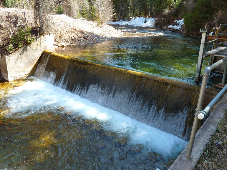
Aspen would use improved streamflow data from Castle Creek to manage its municipal diversion, which is just downstream from the planned location of the new stream gauge. The goal is for the gauge to better inform the city about stream conditions and availability of supply. According to the application, a gauge will give the city critical information to support drought declaration and inform the city about potential drought severity.
The city would provide annual funding to the U.S. Geological Survey, which would maintain and operate the new gauge. The information would be publicly available online in real time.
The measuring device will also be used to ensure that the city’s diversion doesn’t encroach on the state’s minimum instream-flow requirement. The Colorado Water Conservation Board has a minimum instream-flow right on lower Castle Creek for 12 cubic feet per second, which aims to preserve the natural environment to a reasonable degree.
The city has two water rights — one for 60 cfs and another for 100 cfs — on Castle Creek. The rights give the city the ability to divert a total of 160 cfs from Castle Creek; however, the city’s diversion pipe can take a maximum of 25 cfs. Castle Creek is the city’s main source of potable water.
According to an intergovernmental agreement between the city of Aspen and the CWCB, the city must leave enough water in the river between its diversion at the Midland Flume and the confluence of the Roaring Fork River — a span of 4.5 miles — to meet the 12 cfs minimum requirement. The agreement, however, has a loophole that allows Aspen to draw the creek down below the minimum flow in emergency conditions such as extraordinary drought.
Hunter said even though the city is in Stage 2 drought restrictions, officials are still maintaining the instream flow, and city crews regularly take manual measurements of the creek below the diversion to ensure this.
“We had a little rain, which bumped up the hydrograph,” Hunter said. “We are not there yet. That’s not saying we couldn’t get there.”
According to Hunter, Castle Creek on Wednesday was flowing at 38.5 cfs below the city’s diversion and the city was diverting 7.6 cfs.
Pitkin County submitted a letter in support of Aspen’s grant application.
“(The county’s) interest in the Castle Creek stream gauge is just for the health of the creek itself,” said Pitkin County Attorney John Ely. “This year was nuts, and data like this would help out a lot. In fact, any data up there helps fill in the gaps and tells you a little more about what to expect.”
Aspen Journalism is a local, nonprofit, investigative news organization covering water and rivers in collaboration with The Aspen Times and other Swift Communications newspapers. This story ran in the Sept. 3 edition of The Aspen Times.
The Water Desk’s mission is to increase the volume, depth and power of journalism connected to Western water issues. We’re an initiative of the Center for Environmental Journalism at the University of Colorado Boulder. The Water Desk launched in April 2019 with support from the Walton Family Foundation. We maintain a strict editorial firewall between our funders and our journalism. The Water Desk is seeking additional funding to build and sustain the initiative. Click here to donate.


