One year after it launched one of the largest lead treatment programs in the United States, Denver Water is slightly ahead of schedule, having installed 4,500 new service lines, a key factor in eliminating lead in the water supplies of thousands of area homes.
The Colorado Department of Public Health and Environment said the program is showing significant, early reductions in lead in tap water thanks to the pipe replacements and the distribution of thousands of free water filters.
“It was going to be daunting even in a non-pandemic year,” said Denver Water CEO Jim Lochhead. The original first-year goal had been 4,477 installations.
Lead isn’t present in the water treated by the Denver utility, but like in other cities, the contaminant leaches into tap water as it travels through aging service lines owned by customers.
Denver, which is Colorado’s largest municipal water utility, has known lead was present at the tap in customers’ homes since it appeared in routine sampling in 2013. The levels exceeded the benchmarks set under the Safe Drinking Water Act.
For several years, the utility ran pilot tests and negotiated with the Colorado Department of Public Health and Environment (CDPHE) and the U.S. Environmental Protection Agency over how best to eradicate the harmful metal. Though the amounts of lead found in Denver’s tap water samples varied, no amount of lead is considered safe to ingest, especially for young children.
Cities across the country, including Pittsburgh, Newark, N.J., and Washington D.C., have been dogged by an increase in lead contamination as service lines age and corrode, allowing the lead to seep into residential water lines, eventually reaching taps.
The CDPHE issued an order in 2018 requiring Denver to begin adding phosphorous to its water, one of the most effective ways to reduce corrosion in pipes. But phosphorous is also a pollutant and causes problematic algae blooms in lakes and rivers. Adding it to the municipal drinking water supply would also make it harder for waste water treatment operators to meet their own obligations to keep phosphorous out of rivers and streams.
Due to those concerns, Aurora, the Metro Wastewater Reclamation District, The Greenway Foundation, and eventually Denver, sued the CDPHE in 2018 to stop the order from taking effect.
The dispute was settled after Denver was able to obtain a rare variance under the federal Safe Drinking Water Act in exchange for agreeing to invest some $75 million over 15 years to replace lead service lines, offer free water filters to residents as they wait for the new lines to be installed, conduct community education programs, and increase the pH of the water supply to also help reduce corrosion in pipes.
In earlier negotiations the utility had proposed replacing the lines at a much slower rate that would have taken decades to complete.
Ron Falco, safe drinking water program manager at the CDPHE, said he’s pleased with the progress Denver has made.
“The pH control and the lead levels have come down, so it’s been a terrific year, especially considering that they had to face this pandemic,” Falco said.
Denver has two more years to demonstrate to the EPA that it is meeting all the goals of the variance, at which point the program will continue through the final 12 years.
“Even if you haven’t had your lead service line removed, you still have the opportunity to consume very little lead,” Falco said, pointing to the distribution of roughly 100,000 filters and a use rate of nearly 80 percent. “Overall exposure should be dramatically less than it was just a year ago.”
Denver estimates it may have as many as 84,000 customer-owned lead service lines throughout its system. Replacing them can cost $5,000 to $10,000, according to Denver Water, and usually requires digging up streets and yards. Johnny Roybal, a water distribution supervisor who oversees one of the replacement crews, said the work varies from site to site.
On a good day, he said, the crew can complete work on four homes. On a more complicated day, if access is limited, or equipment malfunctions, completing one home’s service line replacement can take all day.
The lines identified for replacement exist largely in some of the city’s older neighborhoods, where they can date back to the late 1890s.
The utility has created a searchable map that allows anyone to insert an address to see if the business or residence has or is likely to have a lead service line.
Fernando Pineda-Reyes is CEO of CREA Results, a firm that specializes in educating underserved, low-income communities on public health issues.
CREA is one of the contractors hired by Denver Water to help educate non-English speaking customers and others about the benefits of the water filters and the lead service line replacement program.
“When you tell people there is going to be a big hole in their front yard, they’re not usually excited about it,” Pineda-Reyes said. “But when they find out what is going on, we haven’t found anyone who objects. It is free to them and they know they’re children will be protected.
“So many programs stop at awareness and education,” Pineda-Reyes said. “With this one we have the privilege to see it start and end with prevention.”
Jerd Smith is editor of Fresh Water News. She can be reached at 720-398-6474, via email at jerd@wateredco.org or @jerd_smith.
This story originally appeared on Fresh Water News, an independent, non-partisan news initiative of Water Education Colorado. WEco is funded by multiple donors. Its editorial policy and donor list can be viewed at wateredco.org.
The Water Desk’s mission is to increase the volume, depth and power of journalism connected to Western water issues. We’re an initiative of the Center for Environmental Journalism at the University of Colorado Boulder. The Water Desk launched in April 2019 with support from the Walton Family Foundation. We maintain a strict editorial firewall between our funders and our journalism.
One option for the White River storage project would be an off-channel dam and reservoir at this location. Water would have to be pumped from the White River into the reservoir site. Photo by Heather Sackett/Aspen Journalism.
By Heather Sackett
Six years after the application was filed, a judge has granted a water conservancy district in northwest Colorado a water right for a new dam-and-reservoir project that top state engineers had opposed.
Rio Blanco Water Conservancy District now has a 66,720 acre-foot conditional water right to build a dam and reservoir between Rangely and Meeker, known as the White River storage project or the Wolf Creek project. The conservancy district is proposing an off-channel reservoir with a dam 110 feet tall and 3,800 feet long, with water that will be pumped from the White River.
But the decree, while granting Rangely-based Rio Blanco the amount of storage it was seeking, doesn’t allow the district all the water uses that it initially wanted. The decree grants Rio Blanco a water right for municipal use for the town of Rangely; augmentation within its boundaries; mitigation of environmental impacts; hydroelectric power; and in-reservoir use for recreation, piscatorial and wildlife habitat. The conservancy district will not be able to use the water for irrigation, endangered fish or augmentation in the event of a compact call.
For more than five years, state engineers had argued that the project was speculative and that Rio Blanco couldn’t prove a need for the water. Engineers had asked the court to dismiss Rio Blanco’s entire application in what’s known as a motion for summary judgment. Division 6 Water Judge Michael O’Hara III agreed in part with state engineers and dismissed some of Rio Blanco’s requested water uses in an order filed Dec. 23. That left the fate of just three water uses to be determined at trial: Colorado River Compact augmentation, endangered fish and hydroelectric power.
After seeing his order, the parties asked O’Hara if they could postpone the trial, which was scheduled for Jan. 4, while they hammered out a settlement agreement. The final decree and a stipulation, filed Thursday night, cancel and replace O’Hara’s Dec. 23 order and let the parties avoid a trial.
“When you come to agreements, you are much more likely to live with those than having the judge force you to do things you didn’t really want to do,” O’Hara told the parties in a Dec. 31 conference call.
Both sides said they are happy with the terms of the decree. Conservancy district Manager Alden Vanden Brink said that after six years of working out issues, the decree brought a sense of elation and a sigh of relief to the community of Rangely. The district is very pleased with the final result, he said.
“Folks kept holding their breath,” Vanden Brink said. “And now we’ve got a step forward for drought resiliency.”
This map shows the potential locations of the proposed White River storage project, also known as the Wolf Creek project, on the White River between Rangely and Meeker. Rio Blanco Water Conservancy District on Jan. 7 secured a conditional water storage right for 66,720 acre-feet.
Settlement and stipulation
The main issue for state engineers, who were the sole remaining opposer in this case, was whether Rio Blanco could prove it needed the water. According to Colorado water law, new conditional water rights cannot be granted without a specific plan and intent to put the water to beneficial use. State engineers maintained that the conservancy district had not proven that water rights it already owned wouldn’t meet its demands.
But Rio Blanco said its existing water rights in their current locations were insufficient and that it needed a new reservoir on Wolf Creek to meet current and future needs. And district officials said they were wary of seeking to transfer these rights and uses to a new reservoir because that requires a water-court process whose outcome is not guaranteed; therefore they needed the new conditional storage right. Even if a water court approved the changes, Rio Blanco still said there was not enough storage in the White River basin to meet demands during a drought or for future uses.
State engineers and Rio Blanco disagreed about how much, if any, water Rio Blanco needed for Rangely, irrigation, endangered fish and other uses. Rio Blanco agreed to give up two of the three water uses left to be determined at trial: Colorado River Compact augmentation and endangered fish.
According to the decree, if Rio Blanco in the future is successful at moving any of their existing water rights to the Wolf Creek project, the same portion of water granted by the decree will be canceled, eliminating duplicate water rights in the reservoir.
A stipulation agreed to by both parties lays out further restrictions on the water use.
According to the stipulation, annual releases from the reservoir will be limited to 7,000 acre-feet for municipal and in-basin augmentation uses. Up to 20,720 acre-feet of water can be used for mitigation of the environmental impacts of building the project. But once the exact amount of water needed for future mitigation is determined, the difference between that amount and the 20,720 acre-feet will be canceled, reducing the total amount of water decreed.
A view of the White River between Meeker and Rangely. The Rio Blanco Water Conservancy District on Jan. 7 secured a conditional water storage right for 66,720 acre-feet for the Wolf Creek Reservoir. Photo by Brent Gardner-Smith/Aspen Journalism
Compact compliance
State Engineer Kevin Rein said the final decree is a good outcome, reached in the spirit of cooperation. Even so, state engineers were never willing to compromise on giving Rio Blanco water for Colorado River Compact compliance.
“That’s something that we would have held fast on in trial and we held fast on discussing it with them,” Rein said. “It’s more a matter of something that does not legally occur right now with the state of Colorado water law.”
Rio Blanco had proposed that 11,887 acre-feet per year be stored as “augmentation,” or insurance, in case of a compact call. Releasing this replacement water stored in the reservoir to meet downstream compact obligations would allow other water uses in the district to continue and avoid the mandatory cutbacks in the event of a compact call.
Many water users in the White River basin, including the towns of Rangely and Meeker, have water rights that are junior to the 1922 interstate compact, meaning these users could bear the brunt of involuntary cutbacks. Augmentation water would protect them from that.
State engineers said augmentation use in a compact-call scenario is not a beneficial use under Colorado water law and is inherently speculative. This doesn’t seem to be a settled legal issue, and O’Hara said in his motion that he would not rule on whether compact augmentation was speculative.
“We believe the augmentation for compact compliance was very difficult to allow just due to the complexities of the Colorado River Compact and the Upper Colorado River compact, and it’s gratifying that Rio Blanco listened to us and we were able to get a final decree that didn’t include that component,” Rein said.
The water-right decree represents just the first step toward constructing the project, which will need approvals from federal agencies. Every six years, in what’s known as a diligence filing, Rio Blanco must show the water court that it is moving forward with the dam and reservoir in order to keep its water right. Fort Collins-based environmental group Save the Colorado has already said it will oppose the project.
Aspen Journalism is a local, nonprofit, investigative news organization covering water and rivers in collaboration with The Aspen Times and other Swift Communications newspapers. This story ran in the Jan. 9 edition of The Aspen Times.
A coalition of high-profile businesses, including Coors Seltzer and Coca-Cola, as well as the nonprofit Colorado Water Trust have signed up to add additional water for fish, farmers and hydropower generation to a key segment of the drought-stressed Colorado River known as the 15-Mile Reach.
This stream segment begins just east of Grand Junction, Colo., and ends west of town where the Gunnison River merges with the Colorado River.
For decades this reach has been under intense scrutiny, in part because it is a key source of water for Western Colorado ranchers and fruit growers, and it is also considered critical habitat for four endangered fish species: the razorback sucker; the humpback chub, the bonytail and the Colorado pikeminnow.
Dec. 15, the Colorado Water Trust unveiled a 10-year funding commitment from Business for Water Stewardship that will help ensure that there is more water in the river during dry times to keep irrigators, a small federal hydro plant, and the fish healthy.
The Colorado Water Trust is a Denver-based nonprofit dedicated to helping secure water rights through purchase, lease or donation to benefit the environment. Business for Water Stewardship is a program of the Portland, Ore.-based Bonneville Environmental Foundation that brings companies together to aid the environment.
Bringing in corporate funders, who have the resources to commit to a multi-year effort is key, according to Todd Reeve, the founder of Business for Water Stewardship. Danone and Intel Corp. are also funders.
“Companies are increasingly realizing the state of our water resources,” Reeve said. “And they are stepping up to support these environmental water solutions.
“This project stands up as an important example of all of these entities coming together. We’d like to see more of them,” Reeve said.
How much money and water will be provided under the agreement isn’t clear yet, according to the Colorado Water Trust, in part because it will depend on weather conditions and the condition of the river each year.
To date nearly $100,000 has been raised to buy water, according to the water trust.
Efforts to preserve Colorado’s 15-Mile Reach are coordinated by the Upper Colorado River Endangered Fish Recovery Program, a federal initiative launched in 1988 that also includes Utah and Wyoming. But because the river has multiple users, from growers to rafters and anglers, to power generators, dozens of other agencies, water users and towns are also involved, according to Kate Ryan, an attorney for the water trust.
The hope, according to Ryan, is that this long-term commitment to the area will build on and add more durability to what others have begun.
Under the agreement, the Colorado Water Trust each year will buy water from upstream sources for delivery to the Grand Valley Power Plant near Palisade. The power plant produces electricity to pump irrigation water to members of the Grand Valley Water Users Association and is operated by the Orchard Mesa Irrigation Company (OMIC).
After the water moves through the plant, it will continue downstream to the 15-Mile Reach.
“The water that comes down through the hydropower plant makes my system work better,” said Max Schmidt, OMIC’s manager. “But it’s also good for the fish.”
As the Colorado River Basin continues to dry out, natural flows in the river will have to be supplemented by water that can be obtained from those who have water in storage that they don’t need and are willing to sell or lease on a temporary or permanent basis.
Ryan said she is pleased the water trust was able to secure the agreements and funding that will allow it to be a long-term contributor to the health of the 15-Mile Reach.
“What was amazing and sobering this year is that the dry-year targets for flow are 650 cubic feet per second (cfs). But most of the summer they were down at 300 cfs,” Ryan said.
Despite the dire water forecasts, the potential for more cooperative efforts on the river appears to be growing.
Schmidt can reel off a list of cities, irrigation districts and water agencies that have stepped up in recent years to help, including the Colorado Water Conservation Board, the Colorado River District, and the cities of Aspen, Snowmass, Palisade and Grand Junction.
That doesn’t count the cash and operating support from the U.S. Fish and Wildlife Service, which runs the recovery program, and the U.S. Bureau of Reclamation, or the new contributions from the Colorado Water Trust and Business for Water Stewardship.
“When everybody wins, everybody wins,” Schmidt said. “I don’t care if it’s power water, irrigation water or fish water, wet water in the river makes everybody’s lives better.”
Jerd Smith is editor of Fresh Water News. She can be reached at 720-398-6474, via email at jerd@wateredco.org or @jerd_smith.
This story originally appeared on Fresh Water News, an independent, non-partisan news initiative of Water Education Colorado. WEco is funded by multiple donors. Its editorial policy and donor list can be viewed at wateredco.org.
Missouri lakes in Holy Cross Wilderness Area near Vail. Credit: Creative Commons
By Jerd Smith
The U.S. Forest Service said it is just weeks away from deciding whether a high-profile request to explore the geological feasibility of a new reservoir site in Colorado’s Eagle County that would capture water flowing from the iconic Holy Cross Wilderness should be granted.
The request comes from Aurora and Colorado Springs, among others, who want to be able to capture more of the water flowing from the wilderness area to meet their own growing needs.
David Boyd, a spokesman for the U.S. Forest Service, said a decision is expected “early this year.”
Proponents had hoped for a decision late last summer, but Boyd said the delay wasn’t unusual and was triggered in part by last summer’s Grizzly Creek Fire.
Aurora and Colorado Springs, which own and operate the only reservoir in the area, Homestake I, hope to demonstrate that they can divert more water and build another reservoir to serve Front Range and West Slope interests without damaging the delicate wetlands and streams in the mountain forests there.
But in advance of any request to build an actual reservoir, they have asked the Forest Service for a special use permit to survey the area and to bore several test holes to determine soil conditions and areas best suited to build the proposed Whitney Reservoir.
If a reservoir were to be built, it would also require that the 122,000-acre-plus wilderness area shrink by 500 acres, an action that will require congressional approval.
Significant opposition to the exploratory permit erupted almost as soon as the proposal became public last year. The U.S. Forest Service received more than 500 comments on the proposal last summer. The majority of those were opposed to it, citing the need to protect the wilderness and the need to preserve as much of the region’s water as possible. The Eagle River, a part of the Colorado River system, is fed in large part by the Holy Cross watershed.
Warren Hern, a co-founder of the Defenders of the Holy Cross Wilderness, said the plan would do irrevocable damage to the rare bogs and wildflowers that populate the area.
He also noted that the proposed reservoir site lies along a major fault line.
“We will do everything in our power to stop this,” Hern said.
Greg Baker, a spokesman for Aurora Water, said his agency is well aware of the special relationship thousands of Coloradans have with the Holy Cross and its spectacular wetlands and hiking trails.
Baker declined to comment for this article, saying the agency would wait until the Forest Service issues a decision.
But in a recent interview, Baker said the cities had little choice but to pursue additional water supplies to meet growing demand.
“Water is a rare commodity and it needs to be used very carefully,” Baker said.
He also said any environmental damage that might occur could be successfully mitigated.
“What you do is wetlands rehabilitation, where you develop wetlands in other areas on a two- or three-to-one basis so you’re restoring additional wetlands for those you may lose,” Baker said.
The new proposal comes under a 1998 agreement known as the Eagle River Memorandum of Understanding, which allows the reservoir proponents to develop enough water to serve environmental, municipal and industrial interests.
Parties to the 1998 agreement include Aurora, Colorado Springs, the Colorado River District, the Eagle River Water and Sanitation District, and the Upper Eagle Regional Water Authority.
Located west of Vail between Minturn and Leadville, the Holy Cross Wilderness Area was the subject of a significant battle in the 1980s when Aurora and Colorado Springs sought to build a second major reservoir there known as Homestake II.
After the case made it all the way to the U.S. Supreme Court, Homestake II was defeated in 1994.
In exchange, however, the cities were granted permission to develop a smaller amount of water in the future in partnership with Western Slope interests, resulting in the permit request now being considered by the Forest Service.
Correction: An earlier version of this article incorrectly listed Vail Associates as a participant in the Whitney Reservoir proposal.
Jerd Smith is editor of Fresh Water News. She can be reached at 720-398-6474, via email at jerd@wateredco.org or @jerd_smith.
Fresh Water News is an independent, nonpartisan news initiative of Water Education Colorado. WEco is funded by multiple donors. Our editorial policy and donor list can be viewed at wateredco.org
One option for the White River storage project would be an off-channel dam and reservoir at this location. Water would have to be pumped from the White River into the reservoir site. Photo by Heather Sackett/Aspen Journalism
By Heather Sackett
A water court judge has agreed with state engineers and dismissed several of a water conservancy district’s claims for water for a dam and reservoir project in northwest Colorado.
Division 6 Water Judge Michael A. O’Hara III, in a Dec. 23 order, determined that Rio Blanco Water Conservancy District has not provided enough evidence that its current existing water rights won’t meet demands in the categories of municipal, irrigation, domestic, in-reservoir piscatorial, commercial and augmentation for Yellow Jacket Water Conservancy District.
The Rangely-based conservancy district is seeking a conditional water-storage right to build an off-channel reservoir using water from the White River to be stored in the Wolf Creek drainage, behind a dam 110 feet tall and 3,800 feet long. It would involve pumping water uphill from the river into the reservoir.
Rio Blanco initially applied for a 90,000 acre-foot water-storage right but later reduced that claim to 66,720 acre-feet for the off-channel reservoir, which would be located between Rangely and Meeker.
According to Colorado water law, new conditional water rights cannot be granted without a specific plan and intent to put the water to beneficial use. For more than five years, top state water engineers have repeatedly said the project is speculative because Rio Blanco has not proven a need for water above its current supply.
State engineers asked the court to dismiss Rio Blanco’s entire application in what’s known as a motion for summary judgment. The court agreed to dismiss only some of Rio Blanco’s requested water uses.
“The applicant has failed to demonstrate that its existing water rights for municipal, irrigation, domestic, in-reservoir piscatorial, and commercial uses are insufficient to meet its needs and are therefore dismissed,” O’Hara wrote in his order.
The town of Rangely’s water needs and whether water was needed for irrigation were two main topics of questions from state engineers in hundreds of pages of depositions in the case.
O’Hara’s order said there are three water-use claims left to resolve at trial: whether Rio Blanco can get a water right for augmentation in the event of Colorado River Compact curtailment, water for endangered species and water for hydroelectric power.
The trial is scheduled to begin Monday, but the parties could still reach a settlement agreement before then.
“We are involved in productive settlement discussions with the engineers and both sides hope that produces a settlement rather than a trial,” said Alan E. Curtis, an attorney for Rio Blanco.
Even if the parties reach a settlement, the judge will still have to approve the final water-right decree. Curtis said parties often reach settlements at the last minute, sometimes even after a trial has begun.
Ducks swim on Kenney Reservoir, which sits near Rangely, in late October. The reservoir is silting in and approaching the end of its useful life, according to the Rio Blanco Water Conservancy District, which wants to build a new reservoir with water from the White River. hoto by Heather Sackett/Aspen Journalism
Compact curtailment
If the case goes to trial next week, a main point of contention will be whether Colorado River Compact compliance is a valid beneficial use of water stored in the White River project. Rio Blanco is proposing that 11,887 acre-feet per year be stored as “augmentation,” or insurance, in case of a compact call. Releasing this replacement water stored in the proposed reservoir to meet these compact obligations would allow other water uses in the district to continue and avoid the mandatory cutbacks in the event of a compact call.
According to the 1922 Colorado River Compact, the upper-basin states (Colorado, Utah, New Mexico and Wyoming) must deliver 7.5 million acre-feet a year to Lake Powell for use by the lower-basin states (Arizona, California and Nevada). If the upper basin doesn’t make this delivery, the lower basin can “call” for its water, triggering involuntary cutbacks in water use for the upper basin.
Water managers are especially worried that those with junior water rights, meaning those later than 1922, will be the first to be curtailed. Many water users in the White River basin, including the towns of Rangely and Meeker, have water rights that are junior to the compact, meaning these users could bear the brunt of involuntary cutbacks in the event of a compact call. Augmentation water would protect them from that.
State engineers argue that augmentation use in the event of a compact call is not a beneficial use under Colorado water law and is inherently speculative. But O’Hara disagreed, saying there is sufficient legal authority for Rio Blanco to develop an augmentation plan for a compact call.
“While it is tempting for the court (to) rule, as a matter of law, that the requested augmentation use is speculative because it is based on an event that may or may not occur, it chooses not to do so here,” O’Hara’s motion reads.
This map shows the potential locations of the proposed White River storage project, also known as the Wolf Creek project, on the White River between Rangely and Meeker. A water court judge has dismissed several of the Rio Blanco Water Conservancy District’s claims for water.
Endangered fish water
Rio Blanco says it needs 60,555 acre-feet of water per year for maintenance and recovery of federally listed and endangered fish. Releases from the proposed reservoir could benefit endangered fish downstream, including the Colorado pikeminnow and razorback sucker.
But the gauge used to measure these flows — the Watson gauge — is located downstream in Utah. State engineers say this violates Colorado’s law regarding exporting water across state lines. Rio Blanco says the water will benefit fish in the White River within Colorado and that they use the Watson gauge because there isn’t one between Taylor Draw dam in Rangely and the state line. Where exactly the fish will benefit from reservoir releases is a matter to be hashed out at trial.
“The court finds that the location of beneficial use is a material fact in dispute,” O’Hara’s order reads. “The expert reports conflict and the characterization of how and where water is to be used vary.”
Another point the parties can’t agree on is how much water from the proposed reservoir would be used by the Upper Colorado River Endangered Fish Recovery Program. The program has not committed to a specific amount of water.
A May 2019 letter from program director Tom Chart says the recovery program “does not know whether, or how much, allocated storage in the project or other White River basin projects may be needed in order to offset depletion effects to the endangered species to assist in the recovery of the endangered fish.”
But, as O’Hara points out, the letter does not say the program will not need water from a future Wolf Creek reservoir.
“The letter creates a material fact in dispute, one more suitable for resolution at trial,” O’Hara’s order reads.
Also to be decided at trial is water use for hydroelectric power. State engineers say hydropower is not an independent use and depends on the court granting the other water uses. They say that if the other uses are dismissed, then hydropower should be dismissed too. But Rio Blanco says water should be stored in the reservoir specifically for hydropower generation and should not be contingent on other uses.
The trial is scheduled to begin Monday in Routt County District Court in Steamboat Springs.
Aspen Journalism is a local, nonprofit, investigative news organization covering water and rivers in collaboration with The Aspen Times and other Swift Communications newspapers. This story ran in the Dec. 31 edition of The Aspen Times.
Kenney Reservoir, located just east of Rangely in late October, has a picnic area. Kenney Reservoir is silting in, and the Rio Blanco Water Conservancy District is proposing building a new off-channel reservoir upstream on the White River, but the state’s top engineers are opposed to the project. Photo by Heather Sackett/Aspen Journalism.
By Heather Sackett
RANGELY — As its trial date in water court approaches, hundreds of pages of depositions obtained by Aspen Journalism reveal state engineers’ sticking points regarding a proposed reservoir project they oppose in northwest Colorado.
Over a few days in November, state attorneys subpoenaed and interviewed several expert witnesses and the Rio Blanco Water Conservancy District manager in the White River storage-project case, also known as the Wolf Creek project. Their questions centered on the town of Rangely’s water needs and on whether water is needed for irrigation.
The documents, obtained through a Colorado Open Records Act request, also underscore the extent to which fear of a compact call is shaping this proposed dam and reservoir project between Meeker and Rangely.
The Rangely-based Rio Blanco Water Conservancy District is applying for a conditional water-storage right to build a 66,720-acre-foot, off-channel reservoir using water from the White River to be stored in the Wolf Creek drainage, behind a dam 110 feet tall and 3,800 feet long. It would involve pumping water uphill from the river into the reservoir.
There also is an option for a 72,720-acre-foot on-channel reservoir, although this scale of project is now rare in Colorado. Rio Blanco has said they prefer the off-channel option.
For more than five years, top state water engineers have repeatedly said the project is speculative because Rio Blanco has not proven a need for water above its current supply.
Despite Rio Blanco reducing its claim for water by more than 23,000 acre-feet from its initial proposal of 90,000 acre-feet, state engineers still say the water-right application should be denied in its entirety. After failing to reach a settlement, the case is scheduled for a 10-day trial in January. Division 6 Engineer Erin Light and top state engineers Kevin Rein and Tracy Kosloff are the sole opposers in this case.
This map shows the potential locations of the proposed White River storage project, also known as the Wolf Creek project, on the White River between Rangely and Meeker. State engineers oppose the project, saying the applicants have not proven a need for the water.
Irrigation needs?
A main point of contention between Rio Blanco and state engineers is whether there will be an increased need for irrigation water in the future. Rio Blanco claims it needs 7,000 acre-feet per year for irrigation.
During the depositions, state attorneys questioned Rio Blanco manager Alden Vanden Brink about the need for irrigation water. He claimed there is a local boom in agriculture and that there is high-value farmland that is not being irrigated simply because of a lack of water. Vanden Brink said happiness for residents on the lower White River will increase with access to irrigation water from the proposed reservoir, adding that if irrigation water is made available, demand for it will increase.
“It will make water available in the lower White River so that people can increase their quality of life and have a garden, you can have a few pigs,” Vanden Brink’s deposition reads. “It’s just going to be improvement all the way around.”
But details were sketchy on what specific lands would be irrigated and the district’s plan to get water from the reservoir to irrigators. State engineers, in a subsequent trial brief, say that just because there are lands that might benefit from irrigation doesn’t mean there will be future increased demand. If you build it, they won’t necessarily come.
“Instead, the premise that there will be a demand for water if the water right is granted is exactly the sort of ‘self-fulfilling prophecy of growth’ prohibited under Colorado’s anti-speculation doctrine,” the state’s trial brief reads.
Engineers also say Rio Blanco has not identified how the reservoir, situated low in the White River basin, would serve the majority of irrigated acres located upstream.
Taylor Draw Dam holds back the White River to form Kenney Reservoir, located near Rangely. The reservoir is silting in, and a water conservancy district is proposing building a bigger, upstream, off-channel reservoir, a project that is opposed by the state of Colorado. Photo by Heather Sackett/Aspen Journalism
Rangely’s water needs
Rio Blanco and the state also disagree about the amount of water needed for Rangely, a high-desert town of about 2,300 people near the Utah border. Rangely takes its municipal water from the White River.
In their depositions, Vanden Brink and Gary Thompson, an expert witness and engineer with W.W. Wheeler and Associates, refer to “cow water” as the source of Rangely’s water issues.
According to Vanden Brink, who also is the town’s former utilities supervisor, when flows in the White River drop to around 100 cubic feet per second, water quality becomes impaired. That can include increased algae growth, decreased dissolved oxygen, increased alkalinity and increased mineral contaminants, which require more treatment, he said.
“If you want to look at that water and how you can take that water and make it potable, forgive me, but it looks worse than cow water,” Vanden Brink said in his deposition. “I know if I was a cow, I wouldn’t want to drink it. It’s pretty degraded; it’s pretty muddy, it’s bubbly, it’s gross. And there’s a reason Rangely’s got the extensive treatment that it does.”
In an April letter to Rio Blanco, Town Manager Lisa Piering and Utilities Director Don Reed said Rangely would commit to contract for at least 2,000 acre-feet of storage for municipal use after the reservoir is built. According to expert reports, Rangely’s current demands are 784 acre-feet per year.
Project proponents say that increased flows from reservoir releases will dilute contaminants and improve water quality at the town’s intake.
But this argument doesn’t work for state engineers, who say that the water Rio Blanco says Rangely needs is not based on projected population growth and that Rio Blanco has not analyzed whether the town’s existing water supplies would be sufficient to meet future demands.
One option for the White River storage project would be an off-channel dam and reservoir at this location. Water would have to be pumped from the White River into the reservoir site. Photo by Heather Sackett/Aspen Journalism
Colorado River Compact influence
Depositions and water court documents reveal how water managers’ and experts’ fear — and expectation — of a compact call could influence the project proposal.
According to the 1922 Colorado River Compact, the upper-basin states (Colorado, Utah, New Mexico and Wyoming) must deliver 7.5 million acre-feet a year to Lake Powell for use by the lower-basin states (Arizona, California and Nevada). If the upper basin doesn’t make this delivery, the lower basin can “call” for its water, triggering involuntary cutbacks in water use for the upper basin.
Water managers and policymakers admit that no one knows how it would play out just yet, but risk of this hypothetical scenario becoming reality is increasing as drought and rising temperatures — both fueled by climate change — decrease flows into Lake Powell.
Water managers are especially worried that those with junior water rights, meaning those later than 1922, will be the first to be curtailed. Senior water rights that existed prior to the compact are generally thought to be exempt from compact curtailment.
Many water users in the White River basin, including the towns of Rangely and Meeker, have water rights that are junior to the compact, meaning the users could bear the brunt of involuntary cutbacks in the event of a compact call.
Rio Blanco is proposing that 11,887 acre-feet per year be stored as “augmentation,” or insurance, in case of a compact call. Releasing this replacement water stored in the proposed reservoir to meet these compact obligations would allow other water uses in the district to continue and avoid the mandatory cutbacks in the event of a compact call.
According to Rio Blanco’s trial brief, “there is significant risk of a compact curtailment in the next 25 years that could negatively impact 45% of the water used in the district.”
In his deposition in response to questions from Rio Blanco attorney Alan E. Curtis, Thompson said drought scenarios will get worse in the future, the White River will be more strictly administered and a compact call is likely to occur.
“Things are — in my opinion — drought conditions are increasingly pervasive,” he said.
But state engineers say that augmentation use in the event of a compact call is not a beneficial use under Colorado water law and is inherently speculative. Compact compliance and curtailment are issues to be sorted out by the Upper Colorado River Commission and the state engineer, not individual water users or conservancy districts, they say. The state of Colorado is currently exploring a concept called demand management, which could pay water users to use less water in an effort to boost levels in Lake Powell.
According to their trial brief, state engineers say that while the desire to plan for compact administration is understandable, “the significant uncertainties involved in future compliance under the Colorado River Compact mean that Rio Blanco cannot show a specific plan to control a specific quantity of water for augmentation in the event of compact curtailment.”
The trial is scheduled to begin Jan. 4 in Routt County District Court in Steamboat Springs. Among the witnesses that Rio Blanco plans to call are Colorado River Water Conservation District Manager Andy Mueller, Colorado Water Conservation Board Chief Operating Officer Anna Mauss and Rio Blanco County Commissioner Gary Moyer.
Aspen Journalism is a local, nonprofit, investigative news organization covering water and rivers in collaboration with The Aspen Times and other Swift Communications newspapers. This story ran in the Dec. 26 edition of The Aspen Times and the Vail Daily, and the Dec. 28 edition of Steamboat Pilot & Today.
Radically transformed from its ancient origin as a vast tidal-influenced freshwater marsh, the Sacramento-San Joaquin Delta ecosystem is in constant flux, influenced by factors within the estuary itself and the massive watersheds that drain through it into the Pacific Ocean.
Lately, however, scientists say the rate of change has kicked into overdrive, fueled in part by climate change, and is limiting the ability of science and Delta water managers to keep up. The rapid pace of upheaval demands a new way of conducting science and managing water in the troubled estuary.
There is much at stake. Never static, the Delta is central to California’s water conveyance system. For decades, stakeholders have wrangled about the best way to manage it for water supply reliability and ecosystem protection. Rapid change adds another layer of complexity to that problem.
“This is a big issue,” said Jeff Mount, senior fellow with the Public Policy Institute of California. “It’s all changing so rapidly that our traditional approach to scientific inquiry [observation, hypothesis, testing and theory] is being outstripped by the pace of change. It’s damn difficult and it’s made worse by the fact that we are in this increasing volatility.”
“The accelerating speed of change means that ecological systems may not hold still long enough for scientists to understand them, much less use their findings to inform management.” ~Report: Preparing for a Fast-forward Future in the Sacramento-San Joaquin Delta
The Delta is the source of drinking water for 29 million Californians from the San Francisco Bay Area to San Diego and irrigation for 3 million acres of farmland that help feed the nation. But the ecosystem challenges in the Delta itself are daunting – invasive aquatic species, more frequent toxic algal blooms, bare minimum stocks of native fish, warming air temperatures, sea-level rise that could imperil levees and seasonal precipitation that swings sharply from drought to flood and back to drought. These challenges frustrate water supply management and attempts to “fix” the health of the West Coast’s largest freshwater tidal estuary.
Declining estuary health could impair the ability of the State Water Project and federal Central Valley Project to pull water with their massive pumps from the south end of the Delta and send it to cities and farms across a wide area of central and Southern California. Science underpins decisions about water management and ecosystem protection. There is also the need to acknowledge the Delta’s sense of place and unique cultural value.
Found only in the Delta estuary, the Delta smelt is an indicator species that demonstrates the health of the ecosystem. Recent trawling surveys have been unable to find any of this species in the wild. (Source: California Department of Water Resources)
Challenging assumptions
The tensions surrounding whether science and management can keep pace with the changes in the Delta were highlighted in a paper prepared by the Delta Independent Science Board, which evaluates science programs that support adaptive management of the Delta. The paper has been submitted for publication in the journal San Francisco Estuary and Watershed Science.
“The accelerating speed of change means that ecological systems may not hold still long enough for scientists to understand them, much less use their findings to inform management,” the report says. “Faced with these challenges, science and management must adapt and change, anticipating what the systems may be like in the future.”
As a result, a business-as-usual approach will not be appropriate.
“We cannot assume that traditional management approaches will be sufficient to deal with the surprises that lie in store,” the paper says. “The need for strategic initiatives is urgent. Without a concerted effort, science and management may be overtaken by the rapidity of changes and find themselves constantly reacting rather than getting ahead of the changes.”
The paper is framed around the ideas of how the Delta responds to rapid changes, or “disturbances,” and the effects on species. It challenges assumptions surrounding the study of a natural environment that is simply “out there” and unchanging, said former Science Board member Richard Norgaard, professor emeritus with the Energy and Resources Group at the University of California, Berkeley.
With human influence such a dominant force on the climate and environment, a revised approach is necessary, the scientists argue.
“We need to reorient our thinking to a changing future,” Norgaard said. “If we continue with old expectations about the world and try to act on and achieve old goals, we are going to be even less effective under more rapid change than we have to date.”
Those with a stake in the Delta say a shift in focus is needed with the aim of learning about ecosystem change to enable a more agile response.
The Sacramento-San Joaquin River Delta is a 1,300 square-mile estuary and habitat for more than 500 species of wildlife. (Source: U.S. Geological Survey)
“As conditions become more complex, if we can’t be reactive to what we are learning every year and if we are not setting up our research to learn … then we are not going to be taking advantage of the hundreds of millions of dollars we spend every year in the Delta on research and the needs to manage for species and water supply,” said Jennifer Pierre, general manager of the State Water Contractors, a group of 27 public agencies that receive water from the State Water Project, including those in Southern California.
Those living and working in the Delta say they see ample evidence that conditions are evolving quickly. Invasive aquatic vegetation is spreading rapidly and harmful algal blooms are “off the charts,” said Erik Vink, executive director of the Delta Protection Commission, a state agency charged with protecting the Delta’s natural and economic values. This year, Vink said, the downtown Stockton waterfront received danger warnings from state water quality regulators because of the appearance in three different areas of algal blooms that state regulators say had higher levels of toxins than in past years.
Vink credited the Science Board’s recognition that people’s actions are an important aspect of the Delta ecosystem equation. The paper notes how changes in the Delta have been human-driven for more than a century and that the state has long tried to resolve Delta problems through natural-science analysis and remedies, while giving less emphasis to systematically addressing the human drivers of Delta problems.
Egeria densa, an invasive South American aquarium plant, covers thousands of acres of the Delta’s open water, floating at or just below the surface and entangling boats and swimmers. (Source: California Department of Water Resources)
Consequences of accelerating change
Conditions in the Delta change daily, affected by numerous factors inside and outside the region. The Delta drains the Sacramento and San Joaquin river watersheds and upstream diversions affect water quality and other factors. The health of the ecosystem is dogged by multiple stressors, among them changing water use, changing water quality and invasive species.
According to the Science Board, what’s not widely appreciated are the consequences of the accelerating speed of change, of more frequent and larger extreme weather events, and of increasing encounters with tipping points.
Tipping points, such as the decline of pelagic (open water) fish such as Delta smelt, longfin smelt and threadfin shad, show a system blinking red.
“Any observer, any fisherman, anyone who lives in the Delta or anyone who has studied it will tell you there is an accelerated ecological timescale that is swirling now into an ecological crisis,” said Jay Ziegler, director of external affairs and policy with The Nature Conservancy.
Harmful algal blooms highlight the Delta recent troubles, Ziegler said, noting “they are literally strangling the Delta and deoxygenating freshwater systems.”
“We are doing a lot of really great science as we adapt to the changing conditions. And while it’s hard to keep up, we are moving faster every day.” ~Rosemary Hartman, California Department of Water Resources
Rosemary Hartman, environmental program manager with the California Department of Water Resources, said the pace of environmental change makes it more difficult to understand the already complex Delta ecosystem.
“In many cases we are transitioning from basic status-and-trends monitoring to more targeting research to answer specific questions related to rapid change,” she said.
Those questions include how endangered Delta smelt respond to warmer temperatures and how the expansion of invasive weeds is affecting the ecosystem.
The Delta has been taken over by invasive aquatic vegetation during the past 30 years, according to Hartman. The area of submersed vegetation doubled between 2005 and 2015, she said, taking up more than 30 percent of the area of all waterways. Floating vegetation (chiefly water hyacinth and water primrose) has also expanded in recent years.
The weeds provide habitat for invasive predatory fish, such as largemouth bass, and get caught in boat propellers and water facility intakes. They also create more habitat for mosquitoes that spread diseases such as West Nile virus, Hartman said.
California Department of Water Resources environmental scientist Morgan Martinez checks specialized netting and water collection containers while taking water samples from the Sacramento-San Joaquin Delta. (Source: California Department of Water Resources)
Nimbler water management?
Scientists adhere to a methodical process for conducting research. But that process has been upended in the Delta by extreme events such as the 2012 to 2016 drought, marked by hot temperatures and the driest three-year period ever recorded. The drought’s effects in the Delta were sweeping — rising salinity, stress to native fish populations, and a growing abundance and distribution of invasive aquatic plants.
The drought of 2012 to 2016 was followed by record rainfall in 2017, then by alternating dry, wet and dry years.
“It’s a precipitation whiplash, which adds to all the complexity of trying to understand this,” said Mount, with the PPIC. “It takes years to understand it and by that time, conditions may have changed. Therein lies a really significant problem.”
Ziegler said the drought “brought all of this to our doorstep in a way that is no longer avoidable.” He noted how managers took the extraordinary step of transporting hatchery-raised fish to release near Suisun Marsh, at the Delta’s edge, because temperatures in rivers upstream of the Delta where they normally migrate from were too warm for the smolts.
“Any observer, any fisherman, anyone who lives in the Delta or anyone who has studied it will tell you there is an accelerated ecological timescale that is swirling now into an ecological crisis.” ~Jay Ziegler, director of external affairs and policy with The Nature Conservancy
People look to science to help bridge the gap between knowledge and action. The buzzword is adaptive management – changing responses as conditions change. It’s touted by many as a remedy but is sometimes hard to define and implement.
“Adaptive management can be a good thing to the extent that it works both ways and we have the science that enables it,” said Chris Scheuring, managing counsel with the California Farm Bureau Federation. “If we invest in the science to keep pace with rapid change, that could present us with opportunities to be nimbler in water management so we can deconflict species needs and human needs.”
What’s needed, said Michael George, Delta Watermaster, is forward-looking science. “What is the Delta going to be like as a result of climate change and what are we going to want to know in 20 years to plan for the long-term health of this estuary?” he said. “We’ve got to organize the science to inform decisions that allow us to understand and then test hypotheses about what the tradeoffs are.”
Moving beyond ‘crime scene science’
Achieving water quality standards and effective fish protection in the Delta while allowing for steady water exports for farms and cities is a perpetual challenge that defies ready-made solutions. State water quality plans for the Delta have been regularly delayed and heavily litigated. Negotiations have stalled over voluntary agreements – championed as a more versatile option rather than having strict state-imposed regulatory flows that would significantly cut water from Delta tributaries to farms and cities. Meanwhile, the clash between the state and federal governments continues regarding the validity of biological opinions assessing potential fishery impacts from the Central Valley Project and State Water Project.
Throughout the struggle there has been a mighty effort to accurately measure and describe Delta conditions at any given time. With rapid change, formulating the right response requires collaboration and a willingness to break free of silos, said Susan Tatayon, chair of the Delta Stewardship Council.
“Whether we’re talking about biological opinions, the Bay-Delta Water Quality Control Plan, or incidental take permits, we’ve got to move beyond institutional rigidity and muster the courage to create the conditions that allow us to experiment with new tools and technologies,” she said.
Mount with the PPIC pointed to the beleaguered Delta smelt, the tiny fish native to the region that is emblematic of the struggle to manage water in the Delta. Despite extraordinary efforts, the endangered smelt edges closer to extinction. Surveying efforts found no smelt in 2018 and 2019.
Research is continuing to examine the relationships between turbidity, habitat and Delta smelt movement. (Source: California Department of Water Resources)
“Each time we think we understand them better, they get fewer and fewer,” Mount said.
The Delta, he said, is a place of “crime scene” science, a process that looks at the causes and effects of undesirable outcomes in a post-mortem manner. “We don’t spend a lot of time trying to prevent the next crime.”
This happens because investment in Delta science is driven largely by the web of water quality and species management rules that dominate management of the Delta and its watershed. The Endangered Species Act, Mount said, “is our emergency room, consuming all of the light, all of the money and all of the time.”
Ziegler said the Independent Science Board’s paper raises critical questions about the Delta’s ecological conditions and whether institutions such as the Delta Science Program are geared to tackle the changing Delta environment. Created as part of sweeping Delta reform legislation in 2009, the Delta Science Program was created to provide unbiased scientific information to support water and environmental management in the Delta.
“We need to take a hard look at whether [Delta scientists] have the capacity they need and to rethink how that science is applied in governance of the Delta,” Ziegler said. “In designing the science process, we need to make sure that science is actionable – both when the system is stressed and in big water years.”
In an August briefing paper, “Building an Effective Delta Science Enterprise,” the Delta Stewardship Council noted that science in the Delta is “vigorous and fragmented,” with much of the work funded to serve specific management domains.
“The absence of an overall governance mechanism to draw together the various programs and fill gaps has brought various challenges, which hinder the Bay-Delta science enterprise and make it less efficient and less able to decisively address the system’s hardest problems,” the paper said.
Monitoring and research results must be translated into understandable terms and communicated to managers and decision-makers, according to the Delta Independent Science Board. (Source: California Department of Water Resources)
Responding to rapid change
The Delta ecosystem has been under the microscope for generations and the amount of data gathered and applied to its management is substantial. However, a long-standing problem is that much of the science is done independently and sometimes in a one-off manner that is often driven by budgeting and regulatory compliance among water users, said George, the Delta Watermaster, whose duties include overseeing water rights among in-Delta water users.
Furthermore, while there is a substantial amount of Delta research done by water users, academics and nongovernmental organizations, it is not collected, synthesized and housed in one place. To what extent the Delta Science Program becomes a hub for that information remains to be seen.
Pierre, with the State Water Contractors, said Delta science has to frame what the necessary Delta management questions are and what studies can help inform those questions. The existing approach to science, she said, tends to pile up data without providing an overall estimation of whether changes in water management are helping the Delta’s ecosystem.
Mount said a course of what he called “preemptive ecology” is needed, anticipating future conditions and acting upon them instead of pursuing the status quo.
“We have got to scramble now and start identifying strongholds – areas that species can persist in under a changing climate,” Mount said. An example of that, he said, can be seen with the efforts to reestablish endangered winter-run chinook salmon into Battle Creek, a tributary of the Sacramento River in Shasta and Tehama counties about 200 miles upstream of the Delta. The ongoing project, steered by federal and state resource agencies and the Pacific Gas and Electric Company, aims to restore about 42 miles of prime salmon and steelhead habitat on Battle Creek, plus an additional six miles on its tributaries.
One response to rapid change involves establishing habitat where species such as salmon can persist under a changing climate. (File photo)
Adjusting to a new reality
The Delta will be the hub of California’s water supply for the foreseeable future. The conflict about its management will continue as will the ambiguity about proceeding even as conditions rapidly change.
“There is currently a lot of uncertainty as to how to protect, conserve and enhance the environment while also providing a clean and reliable water supply,” said Roger Patterson, who oversees strategic water initiatives in the Delta for the Metropolitan Water District of Southern California. The agency bought all or some of five Delta islands in 2016 with an eye toward restoring habitat and improving water supply reliability. Patterson added that water managers “should probably concentrate on the immediate need to address our already identifiable challenges, while also trying to develop contingency plans … that could be implemented if and when needed in the future.”
Communicating the complexities of Delta science to the public must change as new information arrives. Scientists need to help the public understand what’s changing and why, said Norgaard with UC Berkeley. “The public is not going to adjust themselves; they are going to need signals from the scientists as to what’s happening.”
That could mean rethinking invasive species.
“The term implies the species does not belong in that ecosystem,” Norgaard said. “But with rapid change, species need to move if they can in order to survive. So, if we fight every new species that arrives in the Delta, we will in some cases be reducing that species chances of surviving.”
Responding to rapid change requires a willingness to break free of silos, according to Susan Tatayon, chair of the Delta Stewardship Council. (Source: Delta Stewardship Council)
Norgaard noted that some invasive species will still not be welcomed, such as the nutria, a burrowing South American rodent that can damage levees and is the focus of intense eradication efforts. But, he added, “we might consider helping some species that are coming to the Delta, and we might assist existing species to move somewhere more suitable.”
A modified approach demands a sound scientific foundation.
Part of that means putting scientific inquiry into perspective. “An issue that bedevils us is how to synthesize all of this in a way that’s helpful to understanding what’s going on,” said George, the Delta Watermaster. “How do you understand the forest when every study looks at the trees?”
State government is tackling rapid ecological change through efforts such as the Natural Resources Agency’s Cutting Green Tape initiative, which aims to make it easier to get permits and funding for ecological restoration and stewardship projects. The initiative meshes with the crux of the Science Board’s paper through its emphasis on swift adaptation to changing conditions.
Whether the Delta Independent Science Board’s paper leads to further discussion or action remains to be seen. Its premise, however, seems to resonate.
“Forward-looking science is vital to this more nimble, flexible, dynamic and adaptive approach for managing ecosystems and water,” said Tatayon with the Delta Stewardship Council. “We must find ways to more reliably fund and support science that goes beyond status-and-trends monitoring or science needed to show compliance with regulations.”
DWR’s Hartman said there is a positive end to the many resources dedicated to understanding the Delta.
“We are doing a lot of really great science as we adapt to the changing conditions,” she said, “and while it’s hard to keep up, we are moving faster every day.”
The Sacramento-San Joaquin Delta is the largest freshwater tidal estuary on the West Coast of the continental United States. (Source: Water Education Foundation)
Key findings: Preparing for a Fast-forward Future in the Sacramento-San Joaquin Delta
The Delta Independent Science Board’s article, Preparing for a Fast-forward Future in the Sacramento-San Joaquin Delta, was derived from several public discussions by current and former members of the science board. The 27-page article suggests that the Sacramento-San Joaquin Delta ecosystem is changing rapidly, extreme events are becoming more frequent and thresholds are likely to be crossed more often, creating greater uncertainty about future conditions. It has been submitted for publication to the journal San Francisco Estuary and Watershed Science.
Its key findings:
As the effects of climate change gain force, the environment is changing more rapidly. Extreme events — droughts, heat waves, forest fires and floods — are becoming more frequent and more extreme.
Snowpack from the Sierra Nevada, which accounts for most of the water entering the Delta, has been becoming more variable with greater extremes.
The pelagic organism decline of 2002 (including Delta smelt) was a rapid change between a prior and subsequent regime – a tipping point. Delta scientists were caught by surprise and were not in a position to inform a management response before a threshold was crossed.
The 2012 to 2016 drought had profound effects on water flows and salinity levels in the Delta, affecting not only water management but native fish populations and the abundance and distribution of invasive aquatic plants.
For half a century, it has been known that solutions require multidisciplinary efforts and stakeholder cooperation. Too often, however, the cultures, methods, languages, and infrastructure of different disciplines, agencies, and stakeholder groups create barriers that impede cooperation.
Sustaining Lake Mead for the benefit of downstream water users in the Lower Colorado River Basin has been a key objective of agreements reached in 2007 and 2019. (Source: Lighthawk via The Water Desk)
By Gary Pitzer
Twenty years ago, the Colorado River Basin’s hydrology began tumbling into a historically bad stretch. The weather turned persistently dry. Water levels in the system’s anchor reservoirs of Lake Powell and Lake Mead plummeted. A river system relied upon by nearly 40 million people, farms and ecosystems across the West was in trouble. And there was no guide on how to respond.
So key players across the Basin’s seven states, including California, came together in 2005 to attack the problem. The result was a set of Interim Guidelines adopted in 2007 that, according to a just-released assessment from the Bureau of Reclamation, mostly worked. Stressing flexibility instead of rigidity, the guidelines stabilized water deliveries in a drought-stressed system and prevented a dreaded shortage declaration by the federal government that would have forced water supply cuts.
At full pool, Lake Mead is the largest reservoir in the United States by volume, but two decades of drought have dramatically dropped the water level behind Hoover Dam as can be seen in this photo. (Source: U.S. Bureau of Reclamation)
Those guidelines, formally called “Interim Guidelines for Lower Basin Shortages and the Coordinated Operations for Lake Powell and Lake Mead,” are set to expire in 2026. As stakeholders in the Colorado River Basin — including water agencies, states, Native American tribes and nongovernmental organizations — prepare to renegotiate a new set of river operating guidelines, Reclamation’s assessment is expected to provide a guide for future negotiations.
Carly Jerla, one of the review’s authors. (Source: U.S. Bureau of Reclamation)
“We find that the guidelines were largely effective,” said Carly Jerla, modeling and research group manager with the Bureau of Reclamation’s Lower Colorado River region and one of the report’s authors. However, the Interim Guidelines could not solve all of the challenges brought by what has become a two-decade-long drought in the Basin. Said Jerla: “We saw risk getting too high and needed additional assets.”
Preserving Lake Mead
With the guidelines as a foundation, those assets arrived in 2019 through drought contingency plans for the Upper and Lower Basin – voluntary reduction commitments that built a firewall against the likelihood of Lake Mead dropping to critically low levels.
Chris Harris, executive director of the Colorado River Board of California, said the guidelines achieved their objective, considering that the drought has essentially persisted since 2000. Even with the severity and longevity of the drought, the guidelines kept the two reservoirs at about 50 percent of capacity since 2007.
“To my mind that’s a pretty good marker that we were generally successful,” Harris said.
Reclamation’s review of the Interim Guidelines was released for public comment in October. It is expected to be finalized in December. After that, discussions are expected to begin to hammer out a new set of operating rules that would be ready to take effect when the existing guidelines expire in 2026.
Reclamation’s review, which was required under the guidelines, focused solely on how effectively the Interim Guidelines managed water shortages and storage in Lake Powell and Lake Mead. It did not include existing environmental management programs such as the Glen Canyon Dam Adaptive Management Program that are independent of the guidelines. The 2026 guidelines should take a broader view, said Matt Rice, director of American Rivers’ Colorado River Basin Program.
Matt Rice, who directs American Rivers’ Colorado Basin Program, argues that future river operating guidelines should factor in environmental considerations. (Source: American Rivers)
“Not just looking at the two big buckets [reservoirs], but how do we ensure the river is healthy and has water for its environmental needs,” he said.
“How do we ensure that communities are considered, certainly the tribes, and how do we evaluate additional future demands, projects like the Lake Powell pipeline (a proposed project to deliver Lake Powell water to Southern Utah).”
Ensuring tribal participation
Tribal water rights are a key consideration to future Colorado River water use. Ten federally recognized tribes in the Upper and Lower Basins have reserved water rights, including unresolved claims, to divert about 2.8 million acre-feet of water per year from the river and its tributaries, according to Reclamation’s 2018 Tribal Water Study. These tribes anticipate diverting their full water rights by 2040.
“We hope that the review will … underscore the importance of meaningful and sustained participation of the Lower Basin tribes in any future guidelines development regarding management of the Colorado River.” ~Jon Huey, chair of the Yavapai-Apache Nation
Reclamation’s review emphasizes the need for listening to all voices, most notably tribes. Tribal representatives were largely overlooked in the development of the 2007 Interim Guidelines and tribes want to make sure their voices are heard when the next set of operating rules are drawn up.
“We hope that the review will remind Reclamation of the importance that Indian tribes have played in the stewardship of the Colorado River and underscore the importance of meaningful and sustained participation of the Lower Basin tribes in any future guidelines development regarding management of the Colorado River,” Jon Huey, chair of the Yavapai-Apache Nation in Arizona, wrote in a letter to Reclamation.
Jerla said Reclamation recognizes how important it will be to include the tribes in future discussions.
“We definitely heard that loud and clear,” she said. “I think the critical role that tribes have played in the activities since the Guidelines … their desire to be more involved and more included, they will absolutely be a key part of efforts going forward, no question.”
Balancing water uses
Lake Powell, behind Glen Canyon Dam, shows the effects of persistent drought in the Colorado River Basin. (Source: U.S. Bureau of Reclamation)
There is inherent tension in balancing Colorado River water uses between the two basins. Part of the problem is users in the Lower Basin can use Lake Mead as a bank account, having water released downstream to them as they need it. Lake Powell, on the other hand, sits at the bottom of the Upper Basin’s drainage and water that flows into Powell is largely beyond reach of Upper Basin users.
“The guidelines have been partially successful in that they have achieved their principal objective of preventing Lower Basin shortage, as well as establishing a Lower Basin conservation mechanism and avoiding litigation in the Basin,” said Amy Haas, executive director of the Upper Colorado River Commission. “However, from the standpoint of the coordinated operations of Lakes Powell and Mead, a secondary objective of the Guidelines, they have come up short.”
Haas pointed out that between 2015 and 2019, Lake Powell was required to release 9 million acre-feet of water annually under the Guidelines, even with poor inflows into Powell and below-average hydrology in the Upper Basin watershed. That’s more than has historically been required.
“Meanwhile, Lake Mead elevations have not substantially increased under the Guidelines due in large part to overuse in the Lower Basin, also known as the structural deficit,” she said. “These issues must be addressed in the post-2026 operational criteria.”
Protecting the Colorado River
Drought wreaked havoc on the Colorado River Basin between 2000 and 2004, with record dryness that depleted the combined storage of Lake Powell and Lake Mead. Conditions worsened quickly. At the beginning of the 2000 water year, the review said, the combined storage in Lake Powell and Lake Mead was 55.7 million acre-feet. After the worst five-year period of inflow on record ended in 2005, that storage fell to 29.7 million acre-feet – a striking loss of nearly half of the water in the two anchor reservoirs.
Something new had to be done. The business-as-usual approach of determining drought conditions for the Basin on a yearly basis was not going to provide long-term stability or prevent conflict under such historic dryness.
After the worst five-year period of inflow on record ended in 2005, [storage in Lake Powell and Lake Mead] fell to 29.7 million acre-feet – a striking loss of nearly half the stored water. ~Review of the Colorado River Interim Guidelines
“Failing to develop additional operational guidelines would make sustainable Colorado River management extremely difficult,” Reclamation’s review said.
The Interim Guidelines in 2007 opened the door for Lower Basin water users and Mexico to get creative about how water is managed and used. One example that grew out of the guidelines is Intentionally Created Surplus, allowing downstream parties to bank water in Lake Mead that they could draw upon later.
The Colorado River winds 1,450 miles from mountaintop to sea in a basin that includes seven American states and two Mexican states. (Source: U.S. Geological Survey)
“One result of this new flexibility was that critical Lake Mead elevations could be protected through the conservation of this water in the lake,” said Tom Buschatzke, director of the Arizona Department of Water Resources. “The Basin states, meanwhile, continued to seek ways to protect reservoir levels and the health of the Colorado River system.”
Saving Intentionally Created Surplus water in Lake Mead turned out to be a critical drought response tool, said Reclamation’s Jerla, ensuring that the lake’s water level did not drop to where water users would be required to take cuts.
Reclamation’s review of the Interim Guidelines notes that there are other areas of interest beyond its scope that should be considered in future discussions, such as impacts of river operations to environmental, recreational and hydropower resources, and more meaningful engagement of Basin partners, stakeholders, tribes and states.
The review notes that since the Interim Guidelines were adopted, Reclamation has expanded its long-term modeling assumptions and worked to identify appropriate methods for analyzing uncertainty.
“Even though the true probability of any combination of conditions … cannot be assessed, a wider range of hydrology and demand assumptions and attention to those ranges … are useful for supporting a common understanding of system vulnerability,” the review says.
The next set of guidelines
The 2007 Interim Guidelines have set the table for the next version of a Colorado River operations agreement. In retrospect, things have generally occurred as expected, Jerla said.
“In terms of where the reservoirs landed, what types of releases Powell made and how successful the Intentionally Created Surplus mechanism became, that is all within the range of what we were projecting,” Jerla said. “It’s informative to know that now and use that thinking about how risk influenced our decisions and how that translates into the next set of action levels.”
The Interim Guidelines instilled a degree of greater cooperation and innovation on the river and that has fostered partnerships, initiatives and actions that demonstrate what can be done in a Basin that is steadily getting drier.
“Those things have to continue,” Jerla said, adding that Reclamation’s review is one of many sources officials will consult as they draft the next set of guidelines.
Rice, with American Rivers, said he’s optimistic about the prospects of a broad group of stakeholders building the next set of Interim Guidelines.
“I am not suggesting that it’s going to be easy or straightforward by any means,” he said. “We certainly hope there will be greater participation from more stakeholders. The tribes are at the top of the list, but also nongovernmental organizations, which traditionally have not been part of these interbasin negotiations.”
The talks are likely to be frank and will explore thorny issues related to equitable water management.
Amy Haas, executive director of the Upper Colorado River Commission, says the Lower Basin’s structural deficit must be addressed. (Source: UCRC)
Arriving at a satisfactory operational plan beyond 2026 means the Lower Basin’s structural deficit has to be addressed and balancing releases between Lake Powell and Lake Mead should be revisited to reflect actual hydrology, said Haas, with the Upper Colorado River Commission. “Also, the new guidelines should contain a mechanism whereby operations can be adapted and adjusted to meet changing conditions, something the current guidelines are not equipped to do.”
How the next set of river operating guidelines will take shape remains to be seen, but Reclamation’s review suggests the 2007 Interim Guidelines proved their worth in showing how water users can work together and think creatively, lessons that will be invaluable for the future.
The 2007 Interim Guidelines, the review said, “created the operational stability that became the platform for the collaborative decision-making that protected the Colorado River system from crisis.”
Dust clouds roll across drought-ridden fields near eastern Colorado’s Lamar in spring 2013. Credit: Jane Stulp
By Jerd Smith
The State of Colorado has activated the municipal portion of its emergency drought plan for only the second time in history as several cities say they need to prepare for what is almost certainly going to be a dangerously dry 2021.
Last summer, the state formally activated the agricultural portion of the plan, calling on government agencies that serve farmers and livestock producers to begin coordinating aid efforts among themselves and with growers.
Now a similar process will begin for cities, according to Megan Holcomb, who oversees the drought work for the Colorado Water Conservation Board, the state’s lead water policy agency.
Holcomb said the state’s decision to sound the alarm on municipal water supply came in response to requests from several cities, who believe the drought has become so severe that they need to prepare quickly for whatever 2021 may bring. Normally cities don’t make decisions about whether to impose watering restrictions until the spring, when it becomes clear how much water will melt from mountain snows and fill reservoirs.
But not this year.
“Even with an average snowpack we will still be in drought in the spring,” Holcomb said.
Colorado Springs, just last summer, enacted permanent three-days-per-week outdoor watering restrictions.
Kalsoum Abbasi oversees the city’s water delivery system and its reservoirs. She said the state’s decision to activate phase III drought planning makes sense.
“Personally I think it’s a good move for the state to move forward because it will help keep these drought conditions at the forefront of the conversation,” she said.
According to the U.S. Drought Monitor, the state is now blanketed in drought, with more than two-thirds of its terrain classified as being in extreme or exceptional drought, the worst condition.
Colorado has experienced four severe droughts since 2000, but the trend has intensified with the drought of 2018 barely lifting before 2020 began seeing searing temperatures and dry weather again.
Going into 2021 soils across the state are desperately dry. As mountain snows melt and runoff makes its way to streams, a large share of the moisture will be absorbed by the thirsty landscape, leaving less for reservoirs and cities to collect.
“Soil moisture is a huge part of this story,” Holcomb said. “I also think 2020 is likely the hottest year on record globally. Long-term forecasts for temperatures show January through October of next year being extremely warm again.”
Colorado is divided into eight major river basins, with the four to the west of the Continental Divide feeding the bigger Colorado River Basin, which extends from the Never Summer Mountains in Rocky Mountain National Park to Mexico.
Federal forecasts for this system over the next several months have been dropping sharply. Paul Miller, a hydrologist for the Colorado River Basin Forecasting Center in Salt Lake City, said the amount of water predicted to be generated by this winter’s mountain snows dropped to 5.6 million acre-feet in December, down from 6.45 million acre-feet just one month earlier.
“Even before this recent change there was cause for concern because this past year was very dry and reservoir levels fell,” Miller said.
Local city water officials such as Jerrod Biggs, deputy director of utilities in Durango, said there is little time to waste.
Durango lies in the southwest corner of the state. The region has been hardest hit by the current drought and was similarly hard hit in 2018.
“All the groundwork we can lay today is worth it. Everybody hopes it’s not needed. But sticking our heads in the sand isn’t going to do anybody any good. It’s ugly and it’s getting uglier,” Biggs said.
Correction: An earlier version of this article stated incorrectly that the Colorado River flows to the Gulf of Mexico.
Jerd Smith is editor of Fresh Water News. She can be reached at 720-398-6474, via email at jerd@wateredco.org or @jerd_smith.
Fresh Water News is an independent, nonpartisan news initiative of Water Education Colorado. WEco is funded by multiple donors. Our editorial policy and donor list can be viewed at wateredco.org
This portion of the 58-mile mainstem of the Gunnison River just south of Whitewater has been designated as critical habitat for the Colorado pikeminnow and razorback sucker, which are two species of endangered fish. Programs aimed at reducing salt and selenium in the waterway are showing signs of success. Photo by Natalie Keltner-McNeil/Aspen Journalism
By Natalie Keltner-McNeil
State water-quality officials will soon evaluate whether two water-improvement programs in the Gunnison River basin have successfully reduced a chemical that is toxic to endangered fish.
The Colorado Department of Public Health and Environment’s Water Quality Division is analyzing five years of data on selenium levels in the Gunnison, where heightened selenium and salinity have harmed Colorado pikeminnow and razorback sucker populations.
If selenium levels stay at or below the state standard of 4.6 micrograms per liter in any of the segments of river that are analyzed by division staff, those segments will be reclassified from a water body that threatens aquatic life to one that meets state water-quality standards, said Skip Feeney, assessment workgroup leader for the Water Quality Control Division.
After analyzing selenium data, the division will submit a proposal after the first of the year to the CDPHE Water Quality Control Commission recommending a status change if necessary, Feeney said.
“Our goal is to provide an accurate, defensible proposal to the commission and let the commission make an informed decision,” Feeney said. In an October interview, he said he didn’t yet know “what the water-quality status is looking like.” He added: “That’s just part of the process — we’re just getting started.”
Reclassifying the river has been a goal since the establishment nearly a dozen years ago of the Selenium Management Program, a collaboration among government agencies, nonprofits and stakeholders.
Observers have found elevated selenium levels throughout the basin, but a key river segment of focus is the main stretch of the lower Gunnison that winds for 58 miles from Delta to the confluence with the Colorado River in Grand Junction. This section, which begins at the confluence with the Uncompahgre River, was designated in 1994 as essential to pikeminnow and razorback survival by the U.S. Fish and Wildlife Service.
A map showing the main segment of the Gunnison River, between Delta and its confluence with the Colorado River, which has been designated as essential habitat for two endangered fish species.
Historically, this segment, which runs through the basin’s most populated and developed corridor, has contained selenium levels toxic to the two species of fish, according to Dave Kanzer, deputy chief engineer for the Colorado River Water Conservation District and a member of the Selenium Management Program.
During the last regulation cycle, which used data gathered from multiple different entities from 2010 to 2015, the calculated level for selenium in the mainstem of the Gunnison was 6.7 micrograms per liter, a level that is 2.1 micrograms above the state standard, according to MaryAnn Nason, the communications and special-projects unit manager at CDPHE.
Yet, the past five years of U.S. Geological Survey data show that selenium levels have stayed below 4.6 micrograms. Each yearly average was below 4.6, with the average for all five years sitting at 3.2, according to an analysis by Aspen Journalism.
Kanzer cautioned that the calculation using only USGS data was “not directly applicable to the CDPHE listing methodology” — because it doesn’t take into account all available data — but he said “it does tell a good story.”
To calculate the final selenium load for each segment in the Gunnison River, CDPHE is analyzing data from the past five years from the USGS; Colorado River Watch, an environmental advocacy organization; the state; and United Companies, a Grand Junction-based construction company that is required by the state to monitor selenium levels near the gravel pits that the company operates.
These are hills of exposed Mancos shale in Delta County. Selenium is a natural element found in the soil type that is common in the Uncompahgre and Grand valleys. Photo by Natalie Keltner-McNeil/Aspen Journalism
Selenium’s origins and pathway to the rivers
Selenium is a natural element found in Mancos shale, a soil common throughout the Uncompahgre and Grand valleys in the Gunnison River basin. When irrigators transport water to and through their farms in open canals, selenium dissolves in the water and either percolates into groundwater or gets carried into drainage ditches that discharge into the Gunnison.
“Where we have good flows of water, (selenium) concentrations are not an issue because of dilution,” Kanzer said. “But smaller tributaries, smaller water areas or backwater areas where you don’t have good circulation, you get selenium that can accumulate in the ecosystem, really in the sediment and in the food web.”
Colorado pikeminnow and razorback sucker exist only in the Colorado River basin, said Travis Schmidt, a research ecologist for the Wyoming-Montana Water Science Center. The species are able to swim between the Colorado and Gunnison rivers with the aid of a fish passage at the Redlands Diversion Dam on the lower Gunnison, accumulating selenium and transferring the element to their offspring.
Selenium gathers in fish tissues when females ingest algae or smaller fish. It then is transferred to offspring during the egg-laying process, Schmidt said.
“Selenium replaces sulfur in protein bonds, so anything that lays an egg can transfer a lot of selenium to its progeny,” he said.
Once transferred to fish eggs, the element causes neurological, reproductive and other physiological deformities in a significant proportion of both species of fish, Schmidt said. A study that analyzed fish-tissue samples collected by federal and state agencies from 1962 to 2011 found that 63% of Colorado pikeminnows and 35% of razorback suckers exceeded healthy selenium tissue concentrations in the upper Colorado River basin.
Delta County farmer Paul Kehmeier kneels by gated pipes in his family’s alfalfa field. He received funding to replace an unlined canal with the pipes in 2014 from the U.S. Department of Agriculture’s Natural Resources Conservation Service. Piping unlined canals, which is one of the primary methods used to prevent salt and selenium from leaching into the water supply, is critical to the protection of endangered fish in the Gunnison and Colorado river basins. Photo by Natalie Keltner-McNeil/Aspen Journalism
A happy, fringe benefit of salinity control’
Selenium was first addressed by the Fish and Wildlife Service in 2009 in a document written for the Bureau of Reclamation. The document analyzed the effects of the Aspinall Unit — a series of three dams on the upper Gunnison River — on Colorado pikeminnow and razorback sucker recovery. In the document, the service concluded that in order to comply with the Endangered Species Act, the Bureau of Reclamation had to increase spring flows downstream of the Aspinall Unit and initiate a management program to reduce selenium in the Gunnison. As a result, the Selenium Management Program was founded in 2009.
“It’s a two-prong type of plan,” Kanzer said of the program’s goals.
The first objective is to meet the state standard for dissolved selenium throughout the Gunnison River basin, particularly for the 58-mile main segment, Kanzer said. The second goal is to help transition the pikeminnow and razorback sucker from endangered populations to self-sustaining populations, Kanzer said.
Program members help irrigators obtain funding from the Bureau of Reclamation and Department of Agriculture, said Lesley McWhirter, the environmental and planning group chief for the bureau’s Western Colorado Area Office. Individual farmers can apply for funding for on-farm irrigation projects through the Department of Agriculture, and ditch companies can apply for funding projects that deliver water to farms through the Bureau of Reclamation’s Salinity Control Program.
The goal of the salinity program, which was started in 1974, is to reduce salt loading into the Colorado River basin. The program awards grants to ditch companies every two to three years. In the last grant cycle, in 2019, the Bureau of Reclamation awarded 11 ditch companies a combined $37 million to line irrigation systems. Of the 11 companies, eight are located in Mesa, Montrose and Delta counties, where the Gunnison River runs, according to McWhirter.
Mancos shale is rich in salt and selenium. So, when farmers receive funding to reduce salt loads, selenium often decreases as well. This is exemplified by a USGS analysis that found selenium loads had decreased by 43% from 1986 to 2017 and by 6,600 pounds annually from 1995 to 2017.
“The selenium control is a happy, fringe benefit of salinity control,” said Delta County farmer Paul Kehmeier.
Delta County farmer Paul Kehmeier stands atop a diversion structure that was built as part of a project to improve irrigation infrastructure completed between 2014 and 2019. Kehmeier served as manager for the ditch-improvement project, which was 90% funded by the Bureau of Reclamation and serves 10 Delta County farms with water diverted from Surface Creek, a tributary of the Gunnison River. Lining and piping ditches, the primary methods used to prevent salt and selenium from leaching into the water supply, are critical to the protection of endangered fish in the Gunnison and Colorado river basins. Photo by Natalie Keltner-McNeil/Aspen Journalism
CDPHE plans to submit proposal in January
CDPHE plans to submit its proposal to the Water Quality Control Commission in early January, Nason said.
If the main segment of the Gunnison River is found to have selenium levels below the state standard, it would mean the Selenium Management Program is closer to obtaining the dual goals of fish protection and selenium reduction, Kanzer said.
Even if the main segment of the Gunnison is reclassified, the Selenium Management Program will continue efforts to reduce selenium in the Gunnison basin, Kanzer said. These efforts include data gathering and analysis and facilitating meetings among government agencies, nonprofits and stakeholders.
The Colorado pikeminnow and razorback sucker depend on the entire Gunnison basin, so other segments containing toxic selenium levels require reduction efforts. If any new research shows that fish are harmed by selenium at levels lower than 4.6 micrograms per liter, the state could lower the selenium standard, reclassifying segments of the Gunnison as a danger to aquatic life, Kanzer said.
“The jury’s still out — we’re still trying to understand what levels are acceptable and not acceptable,” he said. “There’s always room for refinement of that standard, and that dialogue is ongoing.”
After the division submits its proposal to the commission, the proposal will be released to stakeholders and anyone who has applied to receive hearing notices or track Colorado’s regulations. The public can submit their own proposals or comments by emailing the commission. In May, the commission will review all proposals and comments to make a decision on the river segment’s 2020 status, Feeney said.

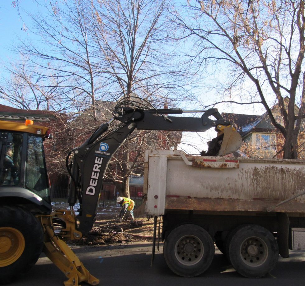
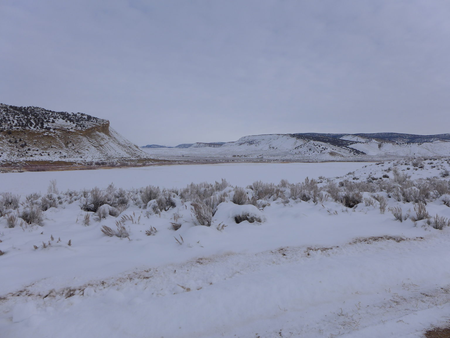


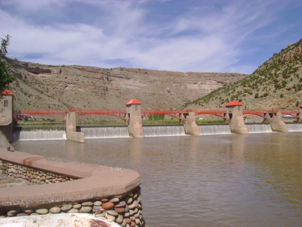


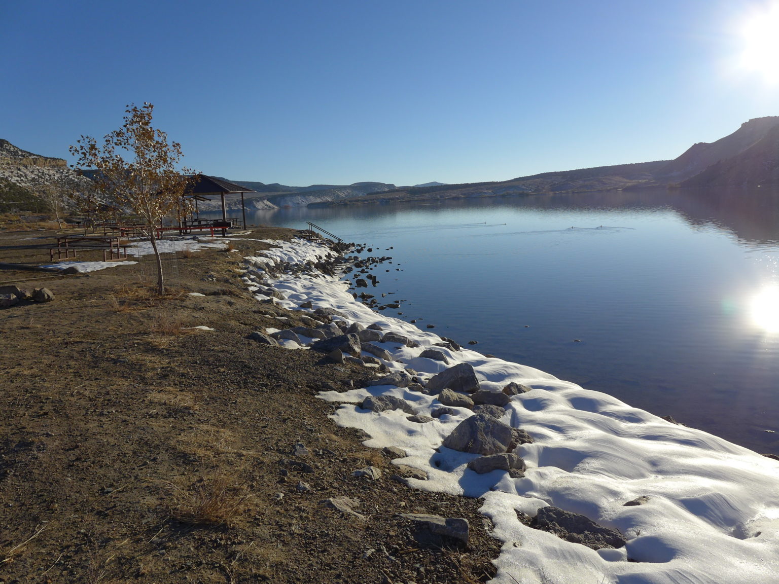
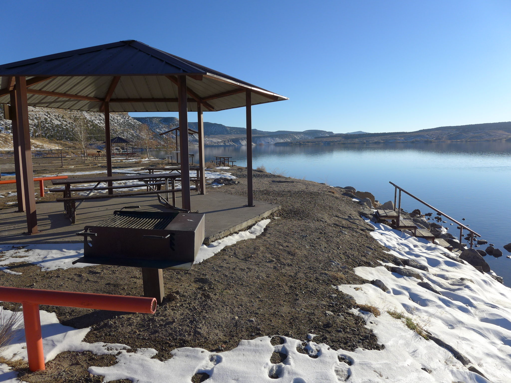
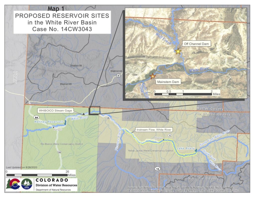

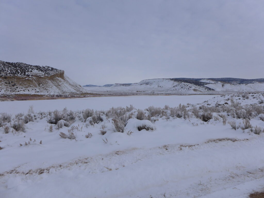

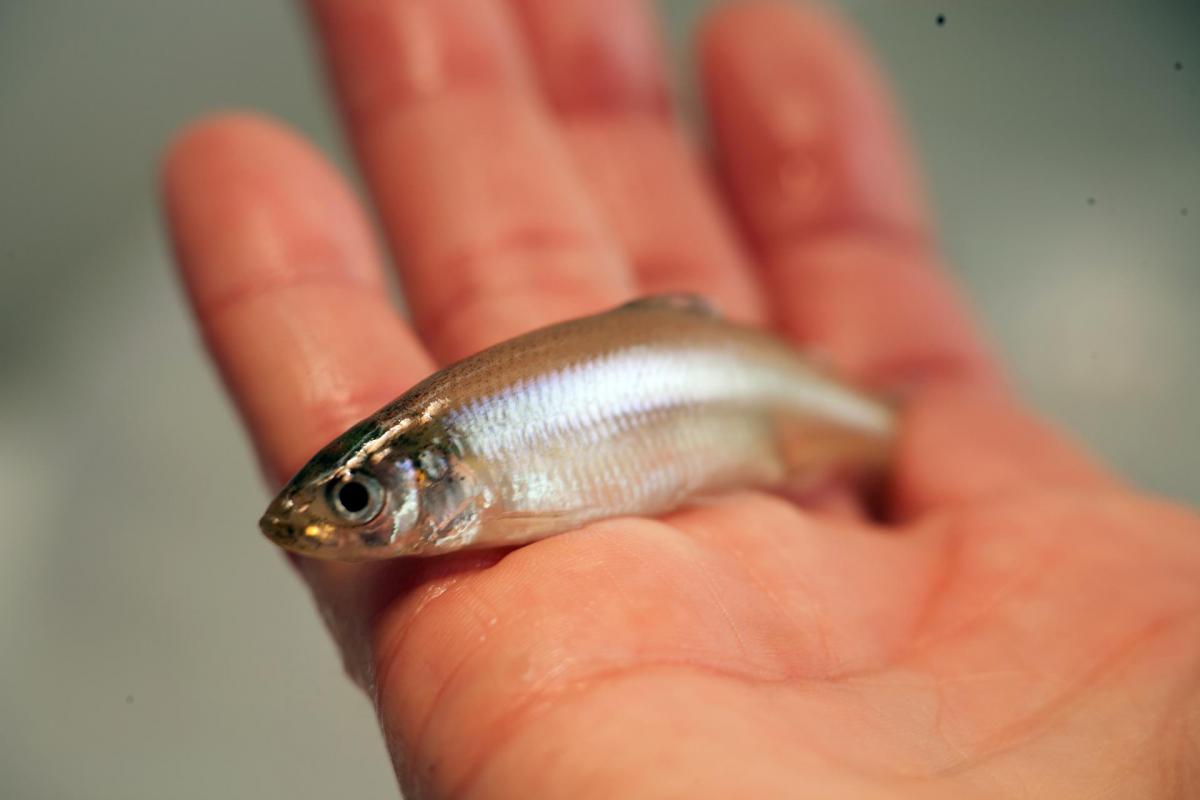
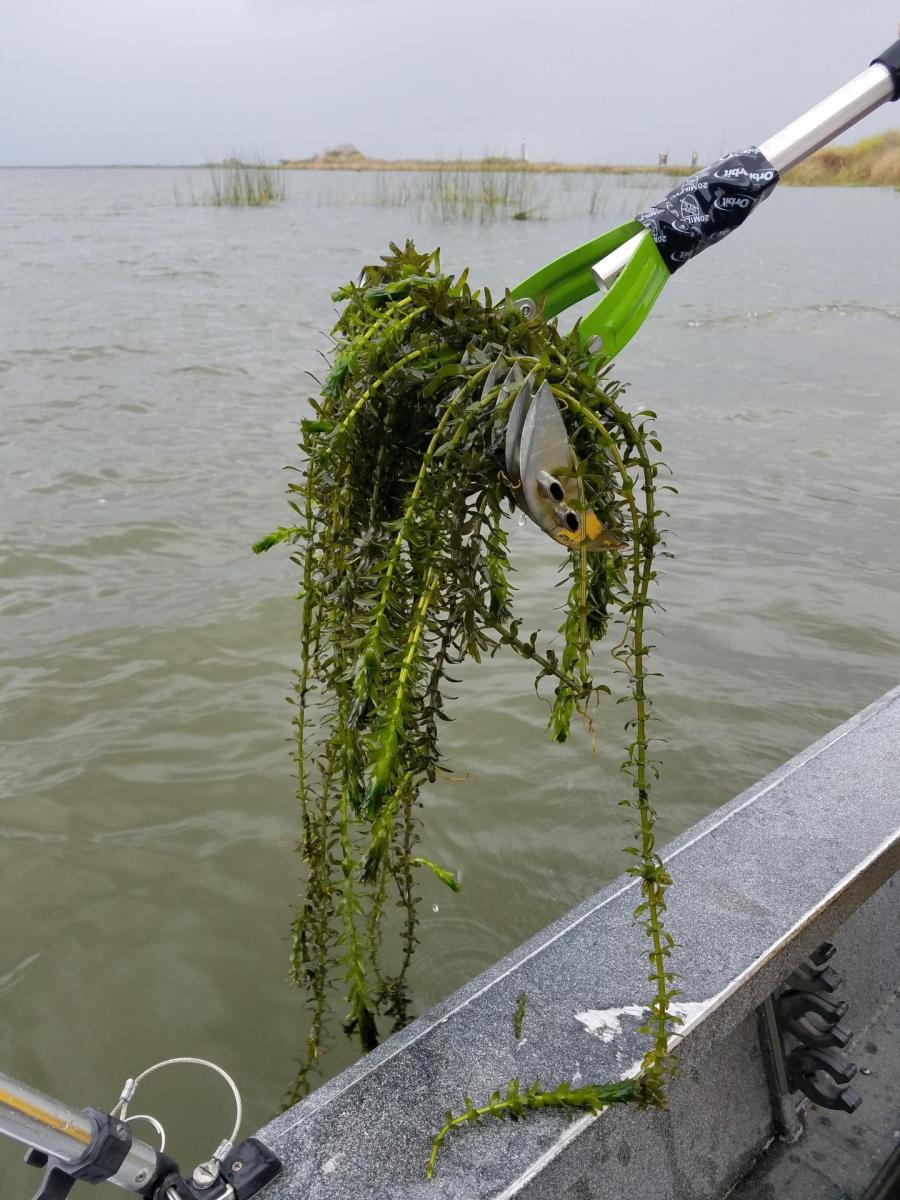
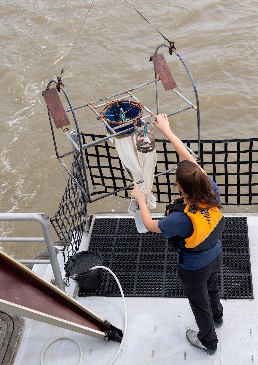
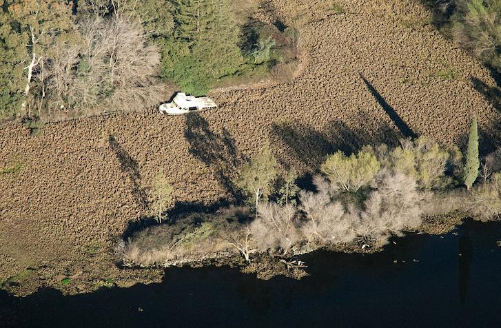


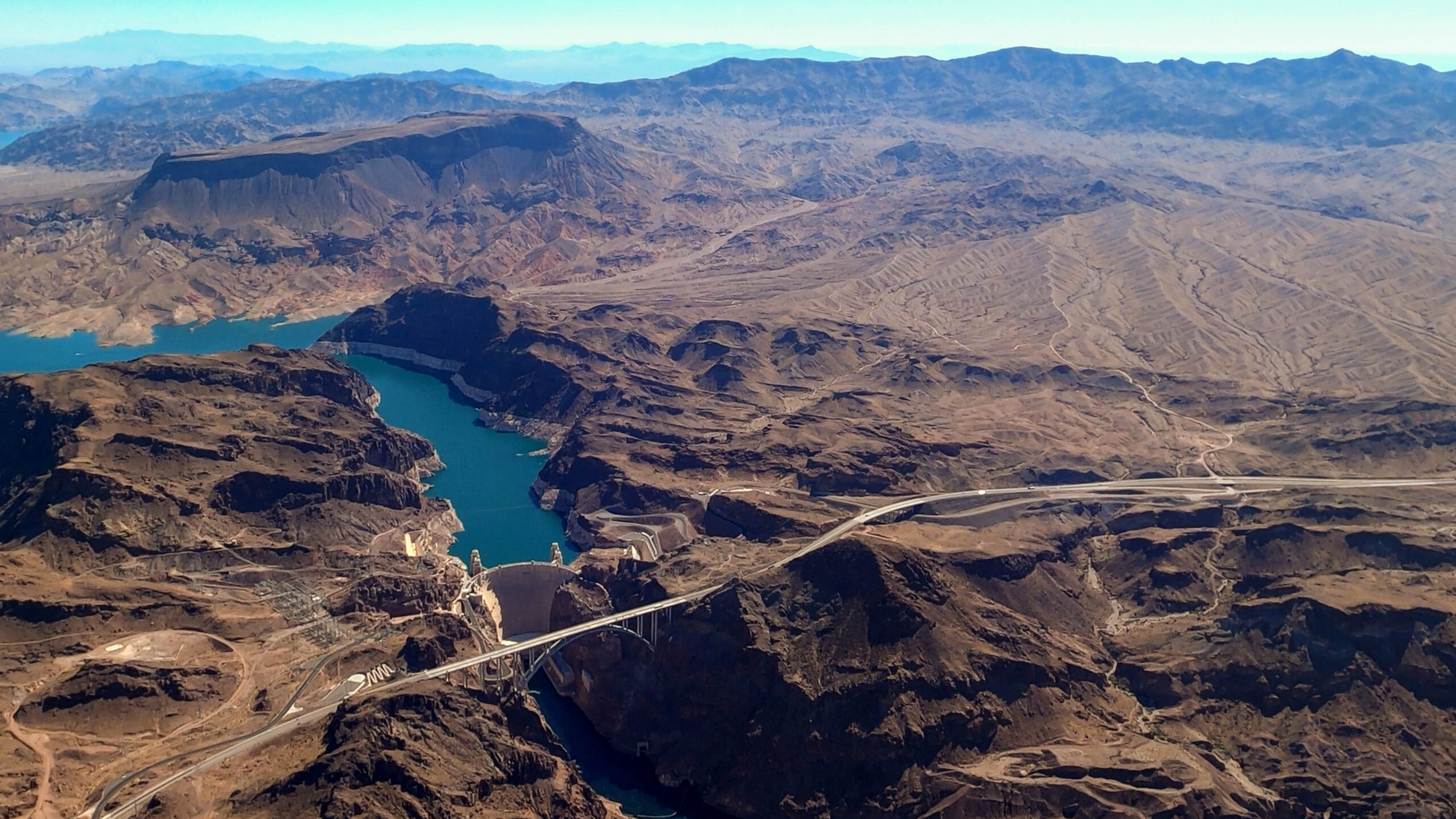
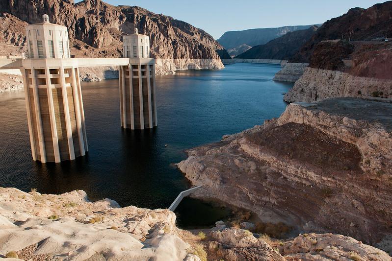


