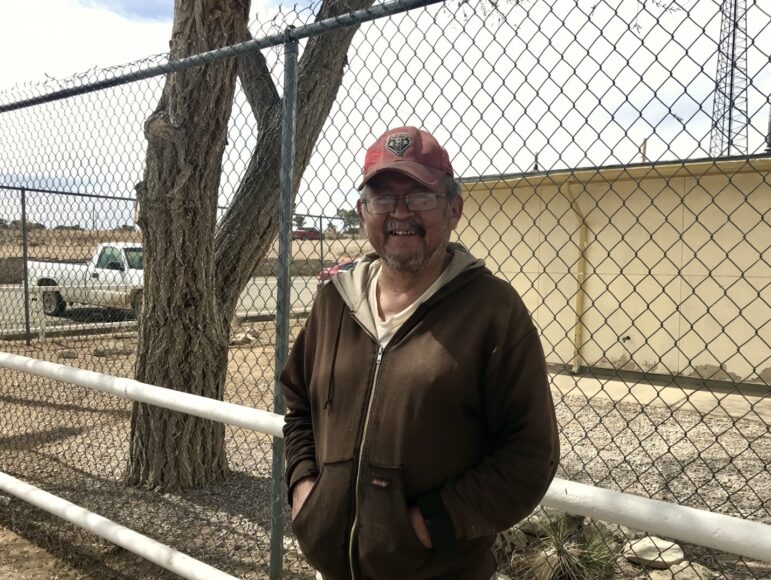
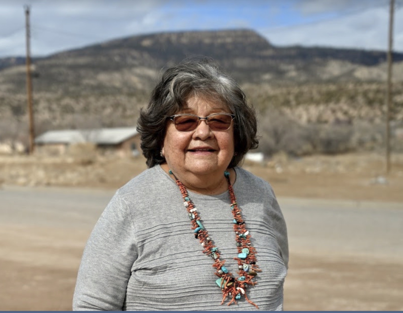
When Julie Badonie was growing up in the small Navajo community of Tohatchi in the 1940s, her father drove a horse-drawn wagon early each morning to a nearby spring. There, he filled wooden barrels with water the family would use that day to drink, cook, and wash.
Badonie, the youngest of seven children, including brothers who fought in World War II and the Korean War, or one of her siblings would go along. She remembers it as fun. At home, a hose siphoned the water into buckets to bring into the house.
Badonie left for boarding school in kindergarten, first just a few miles across town, then several days’ travel away in Crownpoint, where an older sister worked as a cook, and eventually, all the way to Albuquerque for high school. Coming home meant coming back to life without flushing toilets, running faucets, or lights that turned on with a switch, but she didn’t mind.
“We just enjoyed being home with our parents, our sisters, our brothers, you know, so that didn’t really matter,” Badonie said. “When you go home, you’re free.”
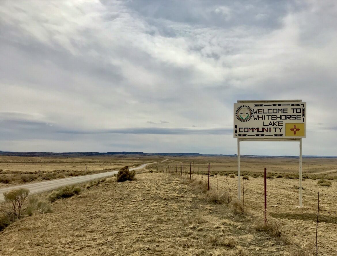
Tó’háách’ih means “One Who Digs for Water,” a reference to a seep near the Chuska (Ch’ooshgai) or “White Pine” Mountains.
The community tucks between the blue ridges of Ch’ooshgai Mountain, frosted with snow in winter. When that snow melts or rain falls, water runs off the peaks into a canyon where horses browse among junipers. Erosion and rockfall have so narrowed the dirt road up the canyon that, today, an ambulance can’t reach the few houses higher on the ridge, and even the propane trucks struggle.
A chapterhouse the color of cream trimmed with maroon houses local government offices near a senior center, where staff hand meals into car windows as lunchtime approaches, and a preschool with a playground, quiet this year with schools closed by the pandemic. Across the street, boxy houses with stucco walls and peaked roofs line up in rows.
For the last eight years, Badonie has visited the chapterhouse almost every day. After her retirement, she became more involved, running for office and serving as chapter vice president and president. Her term ended in December, but she’s still a frequent presence, helping new officials with ongoing projects.
Among those concerns is connecting more of Tohatchi’s residents with utilities, and ensuring a long-term, abundant water supply for the community itself.
“The population is growing, and we need to have water,” Badonie said.
Badonie’s house, like most homes close to Tohatchi, now has running water and electricity. But the 800 to 900 people in Tohatchi, and another 600 to 800 in Mexican Springs, eight miles to the west, all depend on a single well and single pump.
If the pump running it fails, or if the water level in it drops — both issues that have troubled nearby Gallup this year — water will cut out for the homes, the head-start center, the schools, the clinic, the senior center, five churches, and the convenience store and gas station.
It’s a tenuous situation common across the Navajo Nation, and one that also keeps Tohatchi from growing.
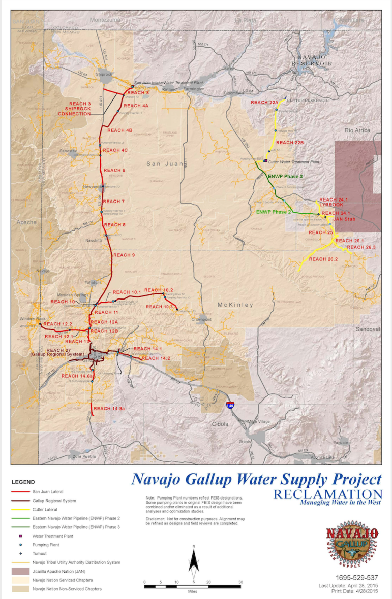
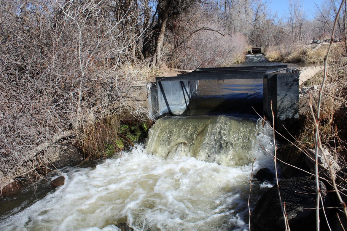
But there’s promise in the community’s location along the route for the Navajo-Gallup Water Supply Project, which will draw water from the San Juan River and deliver it to communities on the eastern side of the Navajo Nation.
The project consists of two pipelines. A 200-mile pipeline, called the San Juan Lateral, will move 37,700 acre feet of water each year as far south as Gallup, an economic center in western New Mexico surrounded by a patchwork of Navajo Nation and private land whose long-term water supply is in jeopardy due to groundwater depletion. Another smaller pipeline, called the Cutter Lateral, branches east about 100 miles and was completed in the fall of 2020.
Because of delays, the San Juan pipeline likely won’t distribute its first water until 2028, nearly 20 years after Congress approved the plan and nearly a quarter of a century after the Navajo Nation and New Mexico agreed to it.
But it promises a drastic improvement. The new water would relieve the single well and pump in Tohatchi. In other places, the pipeline will provide running water to some of the 30 to 40% of Navajo Nation residents who still live without it in their homes.
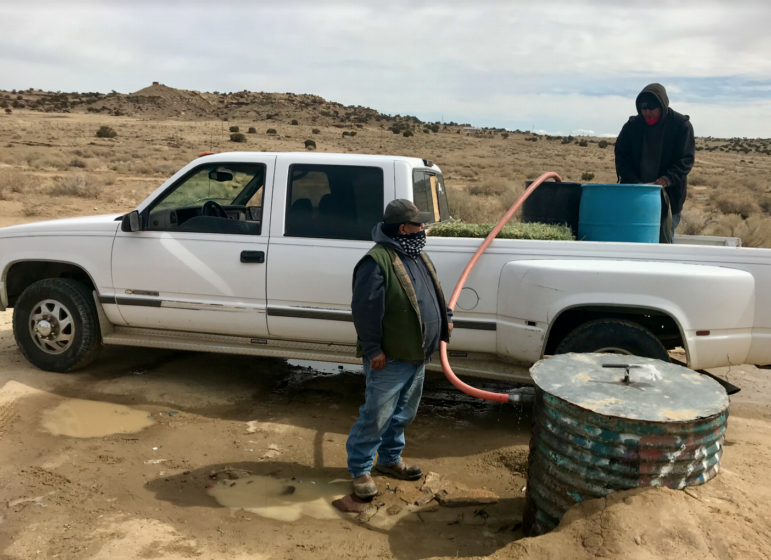
For those people, often elders, water to cook with, to wash their hands or splash over their faces, comes from barrels and jugs.
Refilling those barrels can mean driving tens of miles over dirt roads that stay slick for days after it rains or snows and paying for it by the gallon. They might use closer, unregulated water sources, which can carry contaminants and create health concerns.
Indian Health Service reports estimate 10% of American Indian and Alaska Native homes lack potable water, compared to a national average of 1%. The largest share of these homes scatter through remote Alaskan Native villages. The second largest is in the Navajo Nation, an area that covers 27,000 square miles in western New Mexico, southern Utah, and eastern Arizona and is bigger than 10 of 50 U.S. states.
When COVID-19 reached the Navajo Nation last spring, infections spiked to the highest per capita rate in the United States. The absence of a fundamental tenet of life in America — clean drinking water in every home — exacerbated conditions that spread the virus.
“Every Navajo member has family members who live remotely and don’t have running water — We knew this was going to be an issue from the beginning,” said Andrew Curley, a member of the Navajo Nation and an assistant professor at the University of Arizona who has studied indigenous water use, water laws, and settlements. “There is a strange, worrying correlation and overlap: You see that the places we know have less running water, and have all these problems … are also the same places that have high infection rates.”
Repeated academic and government agency reports have pointed to the lack of water as a failure of the federal government, which pledged to create viable communities for the Diné (Navajo people) in exchange for their 1868 treaty agreement to live on a fraction of their historic homeland. In shorthand, this is called the federal trust system.
Despite the federal responsibility, the Navajo Nation has waited more than a century for pipes and water treatment plants that would bring drinking water to all of its people while watching nearby off-reservation cities and farms grow, swallowing up water from the Colorado River Basin that the tribe has a claim to.
In 2009, the U.S. Congress signed off on an agreement between the Navajo Nation and the state of New Mexico that settled Navajo claims to water for drinking and household use. For the first time since the treaty was signed, the tribe had a number for how much water they were owed.
Had they taken the question through the legal system, the tribe might have won far more water, but in working with Congress, they made a deal that appeased all sides. The Navajo Nation secured both an official amount of water and federal funding to build a pipeline to move that water toward communities. In exchange, they agreed to less water than a judge might have awarded and assured Congressional representatives from other states along the Colorado River that adding tribal water use in the strained river basin would not someday force the likes of Phoenix and Las Vegas to turn off their taps.
The agreement brought more water into the Nation. But it left communities, like Tohatchi, with the burden of finding ways to build lines to connect to the new pipeline.
“The problem is not a Navajo problem; it’s a government problem and it’s a bureaucracy problem and it’s a problem that continues to center corporate interests or large-scale development schemes over the needs of everyday citizens,” said Janene Yazzie, co-founder of Sixth World Solutions, a business that works with Navajo Nation communities on sustainable development. “We’re considered a democracy and the leader of the free world, but we don’t have a human right to water in our own country.”
The longstanding link between water and health
“A homeland for the Navajo people is not merely a piece of land between our four sacred mountains, but is a place where our culture, our language, and our way of life and our people can live and grow,” former Navajo Nation president Joe Shirley, Jr. testified to Congress in 2007. “Without water, viable economic and social communities wither and die.”
Nothing comes without water. The tribal housing authority won’t build homes if there’s no water to plumb them. Schools, health clinics, administrative offices, restaurants, and businesses cannot be constructed or continue to operate without it.
The first U.S. Public Health Service survey of Native American health in 1913 found alarming rates of contagious diseases, linked to the absence of basic sanitary facilities. For decades since, lack of clean water for handwashing and hygiene has correlated to the spread of and deaths from influenza, pneumonia, and some of the highest rates of tuberculosis in the nation, as well as waterborne illnesses like cholera, typhoid, and dysentery.
In the 1950s, when 80% of American Indian and Alaska Native families were still hauling water to drink from ditches, creeks, stock ponds, and other unprotected sources, they were also dying of gastrointestinal diseases at more than four times the rate found in the rest of the U.S. That situation was particularly deadly for infants and the elderly.
In the early months of the COVID-19 crisis, though 11% of New Mexico’s population is Native American, tribal communities reported roughly 60% of the state’s COVID-19 cases. A year later, Native Americans accounted for 28% of all deaths in the state, and as of early April, the Navajo Nation’s 173,600 residents had weathered 30,182 cases and 1,259 deaths.
COVID-19’s transmission among Navajo communities was propelled in part by the reality that it’s impossible to stay home when having water to drink, cook, or clean means driving to a community watering point and filling 50-gallon barrels or going into a border town and purchasing water there every few days. When every ounce poured out counts down to the next trip down rough, dirt roads to haul barrels that weigh up to 400 pounds, water is precious. Running it to wash hands for half a minute feels like an exorbitant use.
Insufficient federal funding has left myriad unmet basic needs, including health care, education, public safety, housing, and rural development, according to the United States Commission on Civil Rights. The Commission found “significant disparities” between funding for Native Americans and other groups in the country.
“Native Americans living on tribal lands do not have access to the same services and programs available to other Americans, even though the government has a binding trust obligation to provide them,” the commission reported in 2003.
Again in 2018, the Commission found not only had the federal government failed to address the housing crisis that left 10 times as many Native Americans in homes without adequate plumbing as the national average, the number of Native Americans living in overcrowded houses or without complete kitchens or plumbing had grown by 21%.
On a tour around town, Badonie, wearing a brilliantly patterned wool jacket, strings of turquoise and spiny urchin, and a pale blue mask, pointed out the landmarks that bear witness to decades of uneven progress, in which gains are made only to be lost: The scraped foundations of the Bureau of Indian Affairs boarding school, the former health clinic closed by mold, and the Women, Infant and Children center also shut down when it was deemed unsafe.
She paused longer to take in the new post office, the new health clinic fronted by a tent for COVID testing, and the new elementary and middle schools that educate children bussed in from surrounding communities. She caught up with her son, a special education teacher, on his way back to school after lunch from the new teachers’ housing.
Badonie paused, too, where the road overlooks the cemetery. The field of silk flowers was scattered with American flags, snapping in the breeze, marking the many veterans’ graves. Since COVID-19 hit, the cemetery has nearly run out of space.
When the chapter sent requests for funding during New Mexico’s legislative session this year, the need to dig more wells or lay pipes to connect to the San Juan lateral was edged out by the need for a new backhoe. The old one quit working, leaving one family to dig a grave by hand.
The chapter also prioritized constructing a warehouse to store that equipment, so maintenance staff don’t have to park it in their yards, and improved emergency services. With no fire station in town, when part of the chapterhouse caught fire, staff used fire extinguishers to put out the flames themselves. If Tohatchi residents call for police, it can take hours for officers to arrive from the nearest station. Sometimes, they don’t show at all.
Federal funding and oversight gaps left tribes a century behind
An expansive and complex federal government bureaucracy has shorted Native Americans on basic provisions for their welfare for more than a century.
Seven federal agencies have programs to lay pipes or fund construction for tribal communities: the Indian Health Service, U.S. Environmental Protection Agency, U.S. Department of Agriculture, Department of Housing and Urban Development, the Department of Interior’s Bureau of Reclamation, the U.S. Army Corps of Engineers, and the Department of Commerce’s Economic Development Administration.
According to the Government Accountability Office, confusion among the agencies around roles and responsibilities, inaccurate reporting, and absent plans have all contributed to leaving so many Native American homes without water.
The lapses span decades.
For instance, a 1980 GAO report found that the Environmental Protection Agency failed to effectively implement a drinking water program on the Navajo Reservation and needed to improve recordkeeping, reporting, sampling, and public notification, as well as correct public water system violations. When GAO staff tested 32 drinking water wells for bacteria and radionuclides for that report, they found six with excessive levels of radionuclide contamination.
The New Mexico Department of Health has also documented contaminants in groundwater wells in northwestern New Mexico. It’s these kinds of wells that remote communities continue to rely on while they wait for water from the Navajo-Gallup Project.
“There are many rural communities that lack, or have lacked potable water supplies. We have that all over New Mexico in a number of areas,” said Rolf Schmidt-Petersen, director of New Mexico’s Interstate Stream Commission, which oversees how New Mexico’s waters are developed. “Over the last 20 years, there have been multiple different efforts through the state with the drinking water program to try to address those pieces.”
The Indian Health Service tracks the need for water, sewer, and solid waste projects in tribal communities. In the first years after taking up that task in 1960, the agency used low-cost, fast projects to replace dried-up wells, contaminated springs, or seasonally inaccessible watering points.
Engineers worked in remote, water scarce areas, amid harsh climates, and while facing finite budgets. They revived old wells instead of drilling new ones, and utilized gravity, solar power, and wind power where electricity wasn’t available. The most complex project added a 5,000-gallon water storage tank and five miles of plastic piping for 80 homes in Twin Lakes, New Mexico. Homeowners dug the trenches for their own house service lines.
“The population is growing, and we need to have water.”
Julie Badonie, Tohatchi
A growing population, rising construction costs, inflation, and stagnant funding impaired the goal of connecting every home with water, as did aging infrastructure and increasingly stringent environmental standards, according to the agency’s 50th anniversary report.
When the IHS considers projects to address poor quality water sources, upgrade existing systems, or construct plumbing to houses for the first time, the most expensive projects score in such a way as to deprioritize them. These projects, 523 of 1,837 on the Service’s list, are deemed “economically infeasible.” More than 80% of them are in Alaska Native and Navajo areas.
Research commissioned by the Colorado River Basin Water and Tribes Initiative has spent about eight months studying clean water access on tribal lands, and investigating why nearly 48% of tribal homes among the Colorado River Basin’s 29 tribes do not have access to reliable water sources, clean drinking water, or basic sanitation. A review of the Indian Health Service’s list of water and sanitation projects for tribal communities found a funding gap of around $3.1 billion
“So it will take big money to solve this problem, but it’s also shameful that the federal government that has a responsibility to provide a permanent homeland to tribes in exchange for the land that was taken for them has not fulfilled that responsibility,” said Anne Castle, who served as assistant secretary for water and science in the U.S. Department of the Interior from 2009 to 2014 and co-leads the initiative on Universal Access to Clean Water for Native Americans.
Most Americans are unaware of the problem, and that contributes to “lackadaisical efforts” to address it.
“Our country’s collective ignorance of this lack of fundamental life support need is an example of environmental injustice and institutional racism,” Castle said.
The initiative has begun sharing their findings with Congressional staffers, and on March 26, 10 senators, including New Mexico Sen. Martin Heinrich, cited that research when announcing a resolution to reaffirm the federal government’s responsibility for providing clean drinking water to tribal communities.
Public officials interviewed for this story agreed the Navajo Nation would have been better off had the Navajo-Gallup Water Supply Project been finished before the pandemic hit.
“This project was an important project before the pandemic in that it settles the Navajo claims in the San Juan Basin and it’s going to provide a firm drinking water supply for a region that desperately needs it,” said Pat Page, manager of the U.S. Bureau of Reclamation’s Four Corners office, which is overseeing the project’s construction. “The pandemic has raised awareness for how important this project is.”
Construction remains underway on the main pipeline, but design changes are pushing the estimated date for completion from 2024 to 2028. Residents born the year the state and tribe agreed to this plan —2005 — would have time to finish college before the water runs in the pipeline.
“We are making progress putting pipe in the ground,” Page said. “The San Juan Lateral may not help with this pandemic, but it hopefully will put the Navajo Nation and this part of the country in a better position if and when there’s an issue like this in the future.”
Whether that water reaches their communities or homes, some of which have already spent a lifetime on the waiting list for plumbing, remains to be seen.
Water within sight, but out of reach
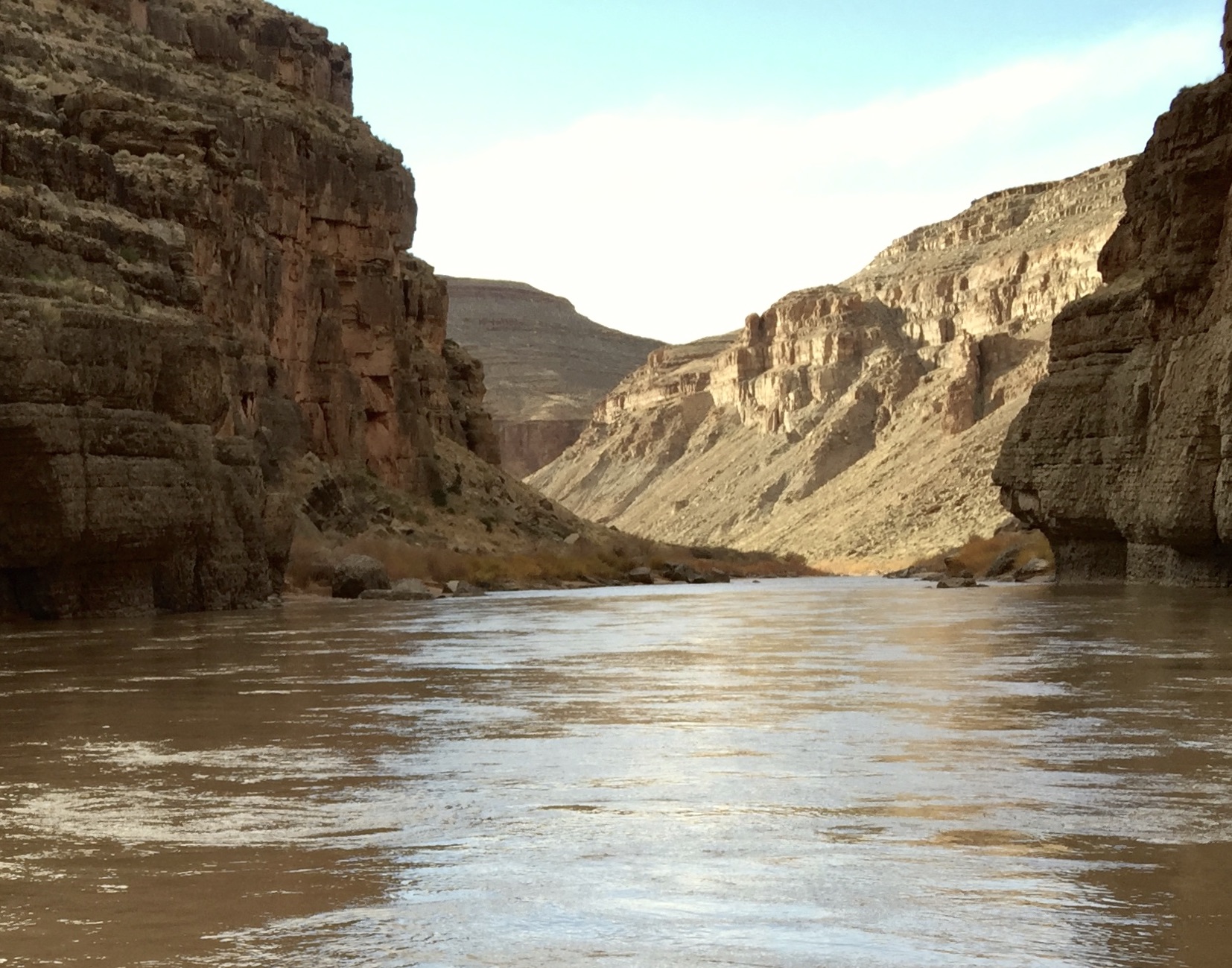
The Colorado, Little Colorado, and San Juan rivers wend through red mesas, creating ribbons of green river valleys that run up against the Navajo Nation’s boundaries and occasionally cut through pieces of tribal lands. Water is both right at hand, and unavailable to tribal members.
Navajo people, who call themselves Diné, which means “the people”, have made their homes for centuries in the high desert of what’s now the Navajo Nation by shaping their lives around when and where water became available in a homeland they call Dinétah. For more than a century, they’ve watched water run by, downstream to cities and other farmers’ fields, waiting for a way to access what’s rightfully theirs.
More than 100 communities and settlements tuck along fins of sandstone and rise out of fields spotted with junipers. They crop up on stretches of flat scrublands, too, where trees rarely interrupt the sky or obscure views of distant spires like Shiprock, which floods with morning sun before the light touches any other piece of the landscape. Water threads sandy washes, the swooping corners of canyons, and the depressions where cottonwoods grow.
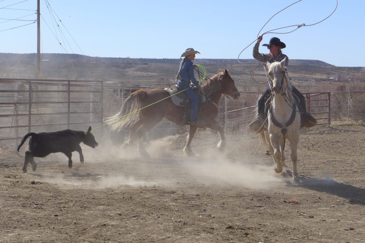
Livestock validate a family’s occupancy of the land, according to custom and Navajo law. Livestock also lay an economic and food security baseline people built on by hunting, farming, and gathering. When they had access to all of their historic homeland, Diné ranchers moved herds of sheep, goats, and cattle, and horses too, to graze rangelands shared among extended families, their presence shifting with moisture.
The practice has been greatly reduced, but for some, still keeps people in touch with the needs of the land and deities to whom they pray for rain and grass.
“People presently living on these Native lands are unique in American society as their traditional lifestyle requires intimate knowledge of the ecosystem, knowledge that has been passed on for generations through oral traditions,” reads a 2011 report on disaster risks from drought in the Navajo Nation, research for which was led by the U.S. Geological Survey and included interviewing 50 Navajo elders.
But the reservation system has impeded that practice. When some families moved herds north of the San Juan River, into Utah, during a drought in the 1950s, nearby white ranchers took the issue to the courts, which ruled Diné ranchers were trespassing. They then rallied U.S. Bureau of Land Management employees to remove Diné families who’d lived on the north side beyond reservation boundaries for generations. The employees posted notices first — written in English, neither read nor spoken by some of the Diné — and then rounded up and hauled away or killed livestock, handcuffing Diné ranchers and marching others south across the river, and setting their hogans and shade houses on fire.
Historically, the Diné relied on shallow aquifers in sand and gravel along rivers and floodplains, where water fluctuated with the season’s snow and rainfall. Some of the drier lowlands receive just 150 millimeters of rain a year; wetter areas might see twice as much.
When the federal government established the reservation in 1868, Anglo and Hispanic settlers carved out the best rangelands for themselves, while the tribe retained the Chuska and Lukachukai Mountains. The federal government added to the reservation over the coming years, with it finally covering one-third of the traditional Dinétah, the driest, hottest piece of it.
An already delicate balance around water has only become more tenuous.
Decades of drought have turned year-round streams into seasonal pulses, dried out historic springs, and concentrated groundwater so wells become so saline that they corrode their own pipes and pumps. Vegetation has died, leaving loose sand that feeds dust storms thick enough to turn the sky red. The Navajo Nation now sees less than half the snowfall it did decades ago.
The San Juan River also flows with half the water it did a century ago, and the entire Colorado River Basin is expected to dry further as the climate continues to change.
As colonists moved into this arid country, where rainfall could not be relied upon for water and rivers were turned to instead, they imported a “first in time, first in right” principle for allocating water that prioritized its earliest users. The U.S. Supreme Court read that “first in time” right as transferring to tribal nations in 1908, when it issued what’s now called the Winters decision in a dispute over water for the Fort Belknap Reservation.
The Winters decision stated that when Congress created reservations, it implied that water went with the land. That dates tribal water rights to the reservation’s establishment.
“This doctrine is grounded in the principle that in ceding millions of acres of land to the United States, tribes in no way intended to relinquish their ability to use water for the benefit of their homelands and reservations,” water rights attorney Jay Weiner summarized to Congress in 2015, testifying as assistant attorney general for Montana, home of the lawsuit that led to the Winters decision.
In water rights parlance, the Navajo Nation has “paper water” — rights to some unquantified amount of water — but not “wet water.”
The Colorado River Compact, which allocates Colorado River Basin water, splits estimated annual river flows in two, half for upper basin states and half for lower basin states. No tribal members were represented when those negotiations were finalized in 1922.
In deference to Winters, the compact allows for separate dealings on indigenous water rights. New Mexico’s allocation of the Upper Colorado River Basin — 11.25%, or 669,000 acre feet per year — was granted with the expectation that the state would someday have to share a then-unquantified amount of water with tribes.
The federal government left tribes and states to determine how much, from where, and how to access that water through settlements approved by Congress or in the court system. That meant the Navajo Nation needed to negotiate with three different states — Arizona, Utah, and New Mexico — to settle how much the tribe acquired from each state’s allocation.
“This has the effect of pitting tribal nations against the states and all of the interests the states represent,” said Yazzie, with Sixth World Solutions. “There’s so many layers of conflicts this has created.”
States often treat tribal water rights as a subtraction from what’s theirs to use, instead of a provision for some of their most financially strained communities. Meanwhile, they’ve built farms and cities reliant on water tribes could claim as their own, and now, the looming prospect of tribal water rights clouds their future.
As tribes have negotiated settlements with states on how much water is theirs to use, lawmakers essentially trade money to build pipelines, pumping stations, and treatment plants to access “wet water” for an agreement that reduces tribal water claims and defers to current water users.
Water allocations also estimate need based on census population, rather than tribal membership, ignoring the possibility that if homes on reservations had running water and electricity, more people might want to live there.
“It’s just manipulation of information and data to further minimize our claims,” Yazzie said. “They know that we really need water and we really need water infrastructure, and we can’t get that water infrastructure until we settle our claims. … It’s this way of manipulating this urgent need, this human right, in order to put in these conditions that further minimize tribal sovereignty.”
When the Navajo Nation and New Mexico signed a settlement in 2005, it directed the federal government, with some money from the state, to fund and construct the Navajo-Gallup Water Supply Project to move water from rivers to homes
“A ‘paper’ water right does not benefit people who must haul their drinking water,” Shirley explained when the settlement went before Congress to approve in 2007. “The Navajo Nation is foregoing a large paper water right in exchange for a smaller paper water right, [and] conditions on the wet water development outlined in the settlement legislation.”
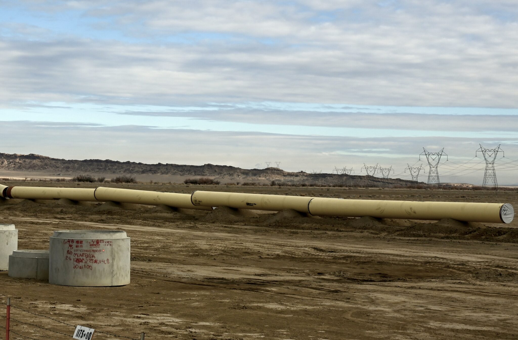
The Navajo-Gallup Project includes 300 miles of pipeline, multiple pumping plants, and two water treatment plants that will reach 43 Navajo chapters. The project splits into two major components. The Cutter Lateral serves Navajo communities along Highway 550 and reaches Jicarilla Apache communities near Teepee Junction. The San Juan Lateral parallels Highway 491 through a series of Navajo communities before a terminus at Gallup, where the city’s tapped-out groundwater wells are putting long-term viability of their water supplies in question.
Spokes would stretch from Gallup to nearby Navajo communities, some with more than half of their residents without water at home. Spur lines will reach Crownpoint, farther east into New Mexico, and Window Rock, the Navajo Nation capital just across the state line into Arizona. The project will serve a population expected to reach 250,000 by 2040.
During congressional hearings in 2007, Bush administration staffers testified in opposition, calling the project too expensive. Then New Mexico Senator Jeff Bingaman, a co-sponsor on the legislation, was quick to point out that the $714 million requested was less than a third of the $2.3 billion the Bush administration spent on water infrastructure and management in Iraq. Shirley also pointed out that after Hurricane Katrina, Congress authorized billions to rebuild water systems for New Orleans residents. Now, the tribe was asking Congress to do the same for Navajo people.
Assistant Secretary for Indian Affairs Carl Artman, an enrolled member of the Oneida Tribe of Wisconsin, said the administration hadn’t thoroughly analyzed the matter or completed their search for a more affordable option, even though a federal team had been investigating it for years.
“It’s just not a credible response,” Bingaman replied. “The Federal Government’s been AWOL is essentially what you’re saying.”
Arizona’s water resources department director, Herbert Guenther, also objected. He argued that piping San Juan River water, from the Upper Basin of the Colorado River, to Window Rock and Gallup, which lie in the Lower Basin, violated the Colorado River Compact. He also said supplying Navajo communities across the state line in Arizona would compromise Arizona’s pending settlement with the Navajo Nation. He argued all of the Navajo Nation’s claims to Colorado River water should be resolved before the project advanced.
Shirley disagreed: “We are disappointed that the Arizona testimony talks about the need to resolve litigation with the Navajo Nation, but no acknowledgment of the real needs of the Navajo Nation to obtain sufficient water rights to create a permanent homeland.”
Still, Senator Jon Kyl, R-Ariz., inserted a clause that bars communities in Arizona from tapping into the Navajo-Gallup supply line until Congress approves a settlement for Navajo claims on the Little Colorado River and the Lower Basin of the Colorado River. That clause has stalled out the spur line to Window Rock for a decade and effectively trapped 6,411 acre feet of water, the amount the Navajo-Gallup project would have delivered to Navajo communities in Arizona.
An omnibus public land management act finally approved the New Mexico settlement in early 2009. It was signed by President Barack Obama just weeks into his first term. That passed a milestone Congress had foreseen a need for as early as 1971, when they authorized a feasibility study on the project.
A settlement between Utah and the Navajo Nation passed Congress this year, dedicating funding for 5,000 people living without reliable water supplies or relying on wells contaminated with heavily mineralization, including arsenic. The largest part of the reservation and the greatest share of its population live in Arizona. That state has yet to reach a settlement with the Navajo Nation for its water rights. Now the federal government is facing litigation for this failure.
“The United States Supreme Court has characterized these responsibilities as ‘moral obligations of the highest responsibility and trust,’” Shirley told Congress in 2007. “The federal government should not be allowed to shirk its trust responsibility or its treaty commitments with Indian nations by hiding behind a veil constructed of legalese that can be applied to the detriment of the poorest of the poor in America.”
More than what flows from the faucets
With water would come a greater chance of development in economically depressed communities in a corner of the state that is threatened with significant job losses due to the shuttering of several major employers. Tohatchi could add a supermarket, a restaurant, a fire department, a police station, or emergency services. The start-up Red Willow Farm could produce crops that would spare people a drive to Farmington, 90 minutes away. The footprint of an old boarding school could be converted into an office complex or housing for doctors and nurses who drive from Gallup to work in the clinic. A laundromat could open. A restaurant could move into the empty half of the new post office building, giving residents an option other than the heated shelves at the convenience store, where customers can pick up a small pizza, burrito, or pre-made burger.
These aren’t just conveniences. Unable to buy goods and services locally, tribal members spend their money outside their communities, and it rarely cycles back. This economic “leakage” keeps communities from becoming self-sustaining.
That development would also curtail the flow of young people off the reservation, a trend Badonie’s own life followed. Leaving for school led to staying away for work. She took a job as a bookkeeper in the Navajo Nation’s finance department, but didn’t own a car, so she couldn’t commute from Tohatchi, which straddles Highway 491. Instead, she lived in Gallup, about 25 miles south, where a bus ran to and from Window Rock on a schedule that matched her work hours.
After she married, her husband’s job moved them around, but she was able to buy a car and keep her job in Window Rock, where she became an accounting clerk, then a supervisor. By the time she retired in 2003, she and her husband had built a log-sided house on land his grandmother owned three miles north of Tohatchi and they had moved home.
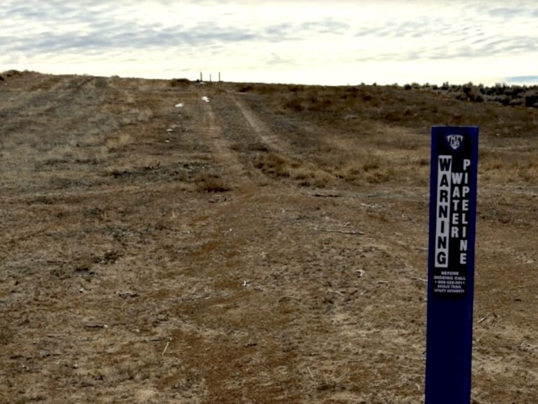
A house or business can’t be plumbed into a 48-inch trunk line. It would be like plumbing a fire hose into a kitchen sink. Smaller pipes must be installed for water to flow from kitchen taps and shower heads, to run laundry machines and flush toilets.
“The water is useless if that isn’t done,” the late New Mexico Sen. Pete Domenici said when the settlement went before Congress.
More than a decade after Congress agreed to this settlement, communities along the pipeline are still seeking funds to construct those smaller pipes, or waiting to reach the top of the Indian Health Service’s project list. When there was no water to fill water lines, the Indian Health Service lacked incentive to build them. Now, the service could face the inverse of that problem.
“The problem is not a Navajo problem; it’s a government problem and it’s a bureaucracy problem and it’s a problem that continues to center corporate interests or large-scale development schemes over the needs of everyday citizens.”
Janene Yazzie, co-founder of Sixth World Solutions
Tohatchi’s officials secured enough money from the state to plan and design a pipeline, but nothing to construct it.
A binder inches thick describes the design, and maps of both the entire project and the local pipes hang on the chapterhouse wall. The price tag to build pipe from the trunkline to the community is estimated at $9 million to Tohatchi and another $4 million to Mexican Springs, which relies on Tohatchi’s well.
New Mexico has distributed tribal infrastructure and capital outlay funds to help some communities, and the Navajo Nation has pitched in as well. Some communities, but not all, have secured the money to pipe water from the San Juan Lateral at least to a central watering point people can haul water from, if not to pipes that reach individual homes.
“We are finding some monies to do the connections to the system and right now, we’re estimating we need about $50 million to do these, to build these smaller regional systems to connect the project to existing systems,” said Jason John, director of the Navajo Nation Department of Water Resources.
That’s for communities that have water lines and will see improved quality or supply from the Navajo-Gallup Water Supply Project.
The Indian Health Service also lists thousands of homes across the Navajo Nation that don’t have water at all, John said, and about $500 million needed to deliver water there, which far outpaces annual funding.
“We’re constantly tackling a huge list with just a limited amount of money,” he said
But this is also the piece that will matter most in the face of the next pandemic.
“If you want to think about this in the context of, how do you get water to people’s homes like we do in other areas, there’s a lot more work that needs to be done,” said Schmidt-Petersen, director of New Mexico’s Interstate Stream Commission. “From a pandemic standpoint, in the future, that’s where we all want to be, but it’s still a ways away. But the first thing we have to do is get the trunkline in.”
When the Navajo Nation received $600 million from the first emergency stimulus package after the pandemic, the CARES Act, its leaders talked about spending as much as $300 million on water projects. The latest stimulus package, which President Joe Biden signed in March, also includes $20 billion for tribal governments and another $11 billion for federal programs that help support them.
The Secretary of the Treasury will determine how much money goes to each tribe. President Jonathan Nez has said he hopes the secretary considers the size, population, and devastating effects the Navajo Nation faced from COVID-19 last spring in deciding their allocation.
The Bureau of Indian Affairs has directed $20 million to providing potable water. An upcoming major infrastructure package provides another opportunity to fund projects that could make a difference for generations.
The CARES Act money came with a spending deadline of Dec. 30, forcing permanent water projects to be shelved in favor of temporary fixes. It was the kind of stipulation that continues to impede tribes’ abilities to do what local leaders, especially, recognize as the greatest needs for their community members.
“It takes years to build a water line. You can’t get it done in months or weeks,” John said. “The money did go toward some water projects, those that could be completed in a few weeks, like installing cistern systems. Maybe only one hundred of them were completed, and we’re talking about thousands of homes that don’t have water.”
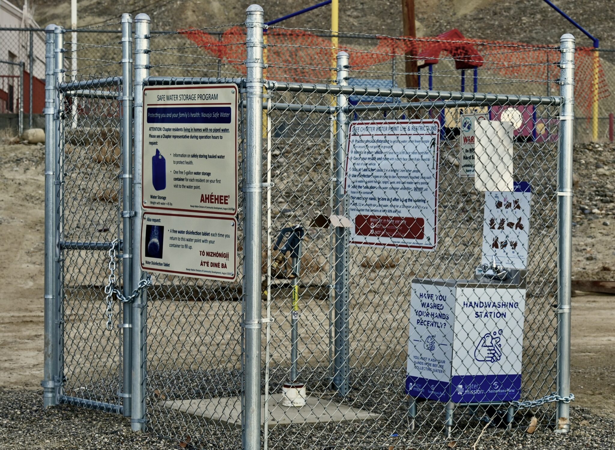
The Navajo Safe Water Project, developed specifically to increase water access during the pandemic, reported spending $5.2 million in CARES Act money to install 59 transitional water points. Gravel and cement cover the ground under a water spigot and hose where people can fill barrels with potable water, alongside a small hand washing sink and jug of hand sanitizer. People can fill barrels there for free.
The Navajo Tribal Utility Authority and Navajo Engineering Construction Authority received about $20 million to work on water systems, but delays meant some of that money had to be returned to Navajo Nation leaders. A lot of it went to a hardship fund to give money directly to people, John said.
When Badonie heard talk of giving that money out as $1,500 to each family, she was incensed.
“What’s $1,500 to a family, when that money is going to be gone in no time, compared to a waterline or a bathroom addition?” she asked.
Often, people who need water are scattered, their homes remote. It’s a few people per chapterhouse, maybe 25 people in Tohatchi, Badonie said, and in the next chapter north, Naschitti, another 15 to 20.
“It’s like that at every chapter on up the highway,” she said.
Some of these people may be out of reach indefinitely for any water pipeline. Indian Health Service staff told Badonie that if a few houses are grouped together, a water line can reach them. But for a single, remote homestead, it’s not feasible, even if more water is brought into the central part of the community.
“These are elders that don’t want to live in a town. They want to live where they were raised, in the rural areas,” Badonie said. “They have livestock still out there. They don’t want to leave where they were born. They want to keep their area, and live there, where they’re happy. So we’re just going to go ahead and drill wells for them in the rural areas.”
“Our elders need to live a quality of life also,” she added. “We’d like to have the same quality of life as other U.S. citizens have.”
A deal climate change could bust
As part of the settlement that made the Navajo-Gallup Project a possibility, the Navajo Nation shifted its priority date from 1868, when the reservation was established and among the earliest rights in the Colorado River Basin, to 1955.
“That’s yesterday, in terms of water rights,” said Brad Udall, senior water and climate research scientist at Colorado State University.
Given that the system puts the newest rights at the top of the list to cut when faced with a shortage, that puts Navajo water supplies in the crosshairs when faced with ongoing drought and increasing aridification of the Southwest.
Flows in the entire Colorado River Basin are down by 20%, at least half of which is attributed to climate change. That exacerbates the ongoing over-allocation of water in the Colorado River, which counts on seeing 17 million acre feet per year of water in a basin that has reported only about 12.6 million acre feet in recent years. Water managers have been scrambling to avoid a brewing crisis for the millions of people who depend on the river for water, and for the river itself.
“There’s a tenuous balance that exists between supply and demand right now, so if you add demands or reduce supply, you’re going to knock the system out of balance,” Udall said. The more factors climate change researchers consider, the more dire that situation becomes.
Lower Basin States have grown to use their full allowable water, or even a little more. But Upper Basin states still use just about 4.3 million acre feet per year.
“For New Mexico, we take our settlement with the Navajo Nation and Jicarilla Apache Nation very seriously, and the water we’re talking about here for human uses is a really big piece of that,” said Schmidt-Petersen, director of New Mexico’s Interstate Stream Commission. “It’s human uses in this area, potential for economic development in those areas, and potential for reducing human health and safety risks, so we see that as being really, very important, and because we’re still using well less than our Upper Basin compact agreement, that’s still reasonable to do.”
The Navajo Nation has said that if water runs short, under certain circumstances, they’ll reduce diversions to their farms to leave more water for downstream users, he added. The settlement also committed the Navajo Nation to add $45 million in water conservation measures to the Navajo Indian Irrigation Project so annual water needs there could shrink.
The agreement protects the water supply for farms, power plants, and residents of Albuquerque and Santa Fe.
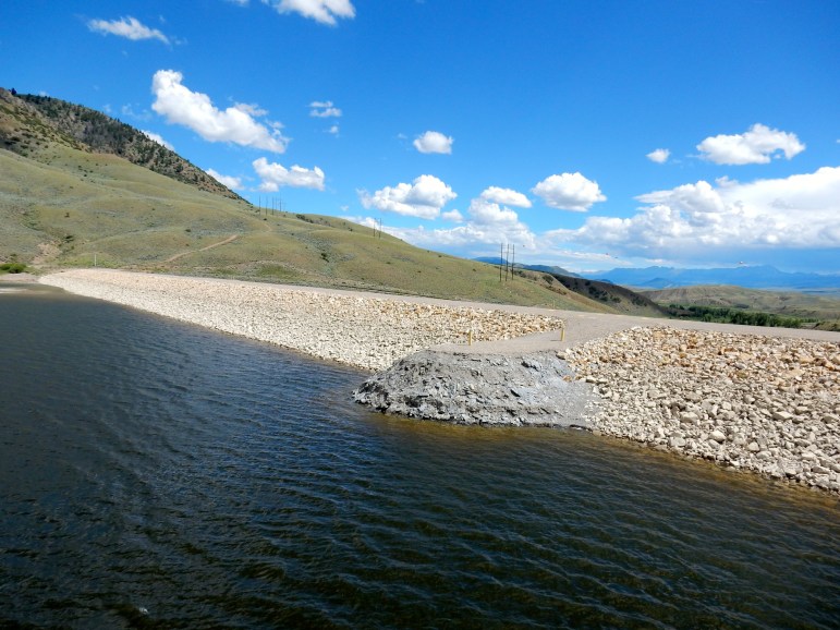
Even faced with diminished river flows, water managers point to the Navajo and Cutter reservoirs, which will supply the San Juan and Cutter laterals.
“To the extent they rely on reservoir water, it’s going to be more reliable than most sources on the river,” said Eric Kuhn, former general manager of the Colorado River Water Conservation District and co-author of Science Be Dammed: How Ignoring Inconvenient Science Drained the Colorado River. “I’d rather be below Navajo Reservoir and relying on Navajo Reservoir than below Lake Mead and relying on Lake Mead.”
But Yazzie contends the whole system may need to be rethought.
“We assume there’s plenty of water out there, we just need the infrastructure to bring it to us,” she said. “I think what would be important in this time is to recognize how unsustainable our demand has become and how important it is for us to build collective consciousness and collective power around restoring our responsibility to maintaining these water systems.”
Reporting for this story was supported by grants from the National Geographic Society’s Covid-19 Emergency Fund for Journalists and The Water Desk at the University of Colorado’s Center for Environmental Journalism.
Elizabeth Miller is an independent journalist based in Santa Fe, New Mexico who writes about energy and the environment, the outdoors, and a range of public policy issues. Contact her at: elizabethmmiller@gmail.com
The Water Desk’s mission is to increase the volume, depth and power of journalism connected to Western water issues. We’re an initiative of the Center for Environmental Journalism at the University of Colorado Boulder. The Water Desk launched in April 2019 with support from the Walton Family Foundation. We maintain a strict editorial firewall between our funders and our journalism.