

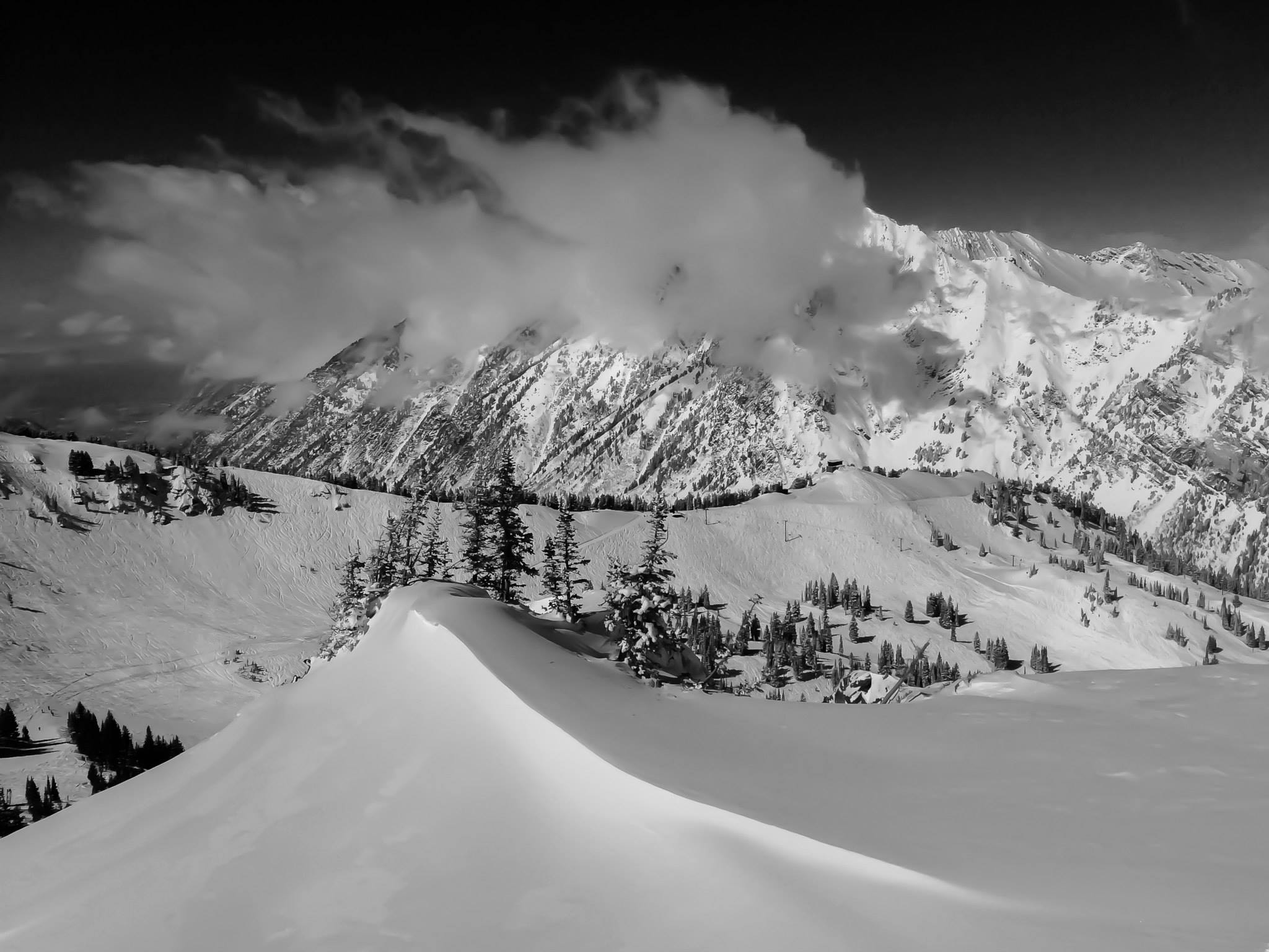
Sometimes snow is light, fluffy and easy to shovel. Skiers and snowboarders crave this kind of fresh powder and may call it “blower.” You can scoop some up in your glove and blow it into the wind like dust.
At other times, snow is thick, heavy and backbreaking to remove from a sidewalk or driveway. These storms may be great for making snowballs, but on ski slopes near the West Coast, the dense snow is known derisively as “Sierra cement” or “Cascade concrete.”
The factor that explains the difference is a metric known as the snow-to-liquid ratio, or SLR, which compares the depth of freshly fallen snow with the amount of liquid water it would produce if melted.
Forecasters have long struggled to predict SLR because it depends on a complex mix of atmospheric conditions, including temperature, humidity and wind. Yet SLR shapes how snowstorms affect road safety and avalanche danger, making better forecasts potential lifesavers. SLR also impacts winter recreation and the distribution of snow across the West’s watersheds, where many basins experienced a record-low snowpack this winter.
Now, scientists are using machine learning, a form of artificial intelligence, to better forecast SLR and the resulting snowfall totals. To train their computer models, researchers relied on snow data collected the old-fashioned way: by hand.
“For a good snowfall forecast from weather prediction models, you need a good snow-to-liquid ratio forecast,” said Peter Veals, a research assistant professor in the Department of Atmospheric Sciences at the University of Utah. He described SLR as “a really ripe thing to tackle” and “a huge source of error in snowfall forecasts in the West.”
A common rule of thumb assumes that 1 inch of water produces 10 inches of snow—an SLR of 10-to-1. In reality, each inch of liquid precipitation may yield far more—or far less—than 10 inches of snow. One 2003 study said the SLR of freshly fallen snow “can vary from on the order of 3:1 to (occasionally) 100:1.”
“This issue of snow-to-liquid ratio is an interesting one because it’s maybe the most difficult thing to actually measure and forecast correctly when it comes to snow,” said Russ Schumacher, Colorado state climatologist and a professor in the Department of Atmospheric Science at Colorado State University. “Usually, what our weather prediction models predict is the amount of precipitation—the liquid—but then if you want the inches of snow that is falling, you need the SLR.”
Two recent scientific studies found that machine learning—a technique with roots in the 1950s—could improve SLR predictions and provide better answers to the age-old question people ask before every storm: How much is it going to snow?
The two studies shared some co-authors, and both used machine learning to better predict SLR, but the papers examined different geographies and relied on different data sources.
One study, published online in August 2025 in Weather and Forecasting, focused on mountains in the West. This paper was based on high-quality data collected manually at 14 sites, primarily by avalanche professionals working for transportation departments or ski resorts.
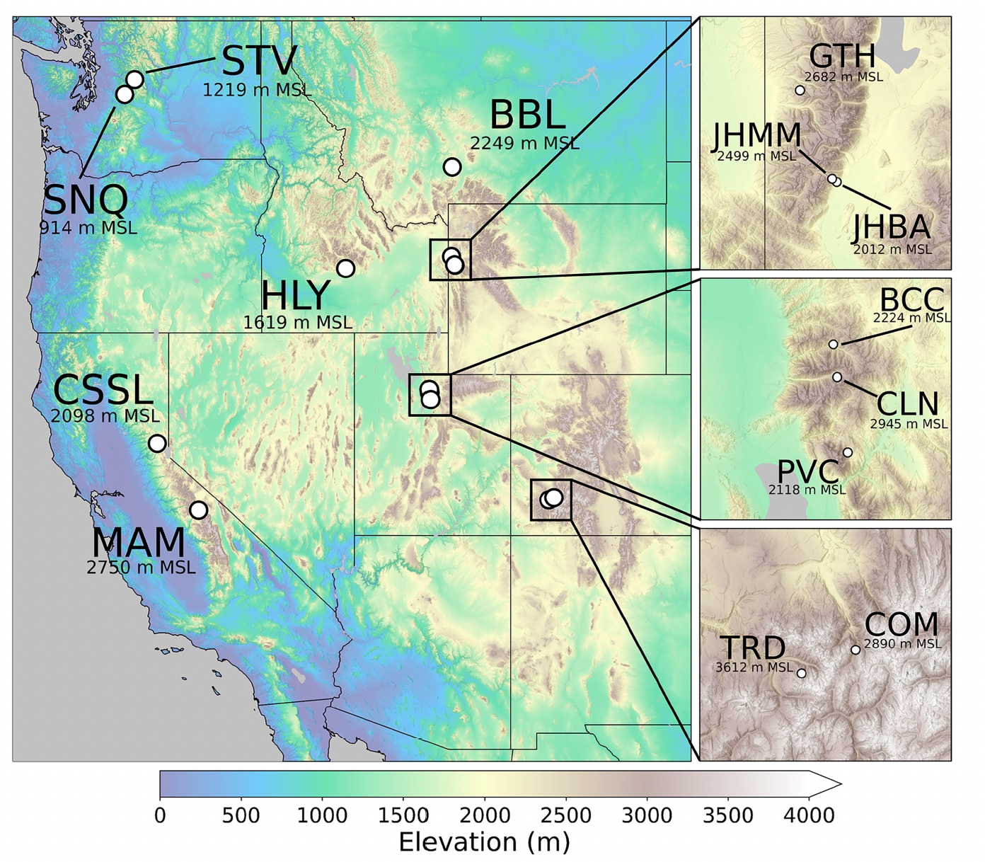
The study found that machine learning predicted SLR with “considerably more skill” than existing approaches, even when the models used only “a simple combination of wind speed and temperature.” When trained on a more extensive set of atmospheric variables, forecast skill improved further.
“The algorithms built in this paper can drastically improve SLR prediction over the mountains of the western United States,” the authors wrote.
The second study, published online in January 2026 in Weather and Forecasting, examined SLR across the contiguous United States, not just the mountainous West. The authors found that their machine-learning method “outperforms existing methods” used by the National Weather Service.
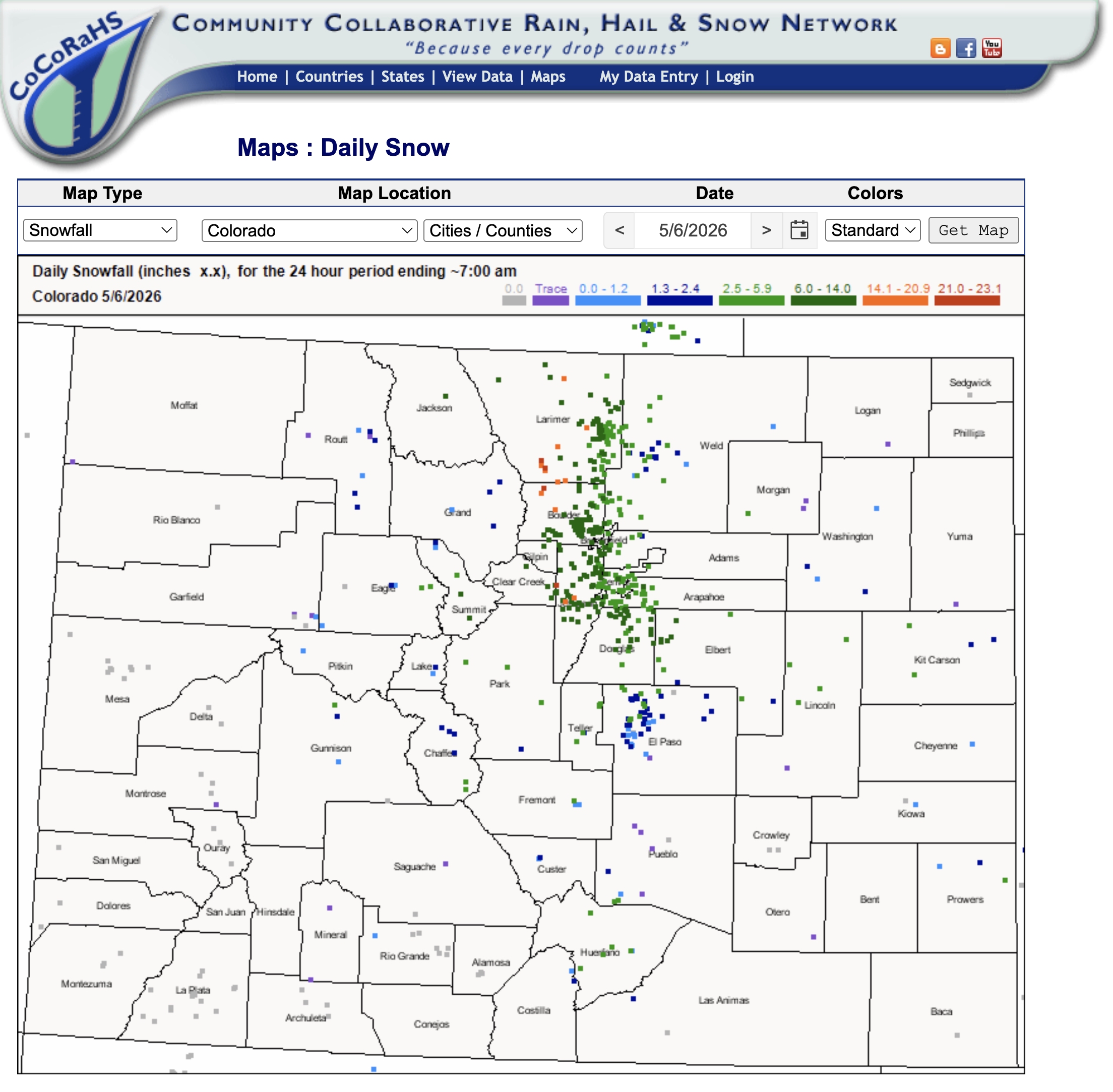
For this study, researchers used data from nearly 1,000 observers in the Community Collaborative Rain, Hail and Snow Network (CoCoRaHS), a grassroots program of volunteers who measure precipitation in their yards and at other sites.
“The neat thing about it is, as long as you get the proper equipment and you receive the proper training, anybody can do this, so we thought that was pretty cool,” said Michael Pletcher, a data scientist at Flash Weather AI who recently completed his Ph.D. in atmospheric sciences at the University of Utah. He was lead author of the national study and a co-author of the Western mountain paper.
Protecting the public with better snow forecasts
More accurate snowfall forecasts would not only satisfy public curiosity and help skiers plan powder days. They could also save the lives of motorists and backcountry travelers because SLR affects road conditions and avalanche danger.
“Winter storms are among the costliest natural disasters in the U.S. and are responsible for upwards of a thousand deaths during aviation and vehicle accidents during winter storms each year,” Pletcher said. “Our hope for this research was to just generally improve forecasts of snowfall so that we could hopefully reduce financial and human-related losses during these winter storms.”
Both studies used advanced computing power, but they relied on old-school, hand-collected snow measurements because automated gauges can struggle to measure snowfall accurately. The insights gleaned from machine learning now help inform forecasting products available to meteorologists across the nation.
“This will directly improve everyone in America’s snowfall forecast by a small amount,” said Veals, who was lead author of the Western study and co-author on the national paper.
Bart Geerts, a professor in the Department of Atmospheric Science at the University of Wyoming who wasn’t involved in the studies, called the machine-learning research a “great, somewhat novel way of thinking about snow.”
“What is new here is really the ability to predict SLR based on ambient environmental conditions. When I say environmental, I mean the atmosphere at the location or in a broader region, and that includes the cloud conditions, the cloud properties,” Geerts said.
Schumacher, who also wasn’t an author of the papers, described the recent research as a “pretty big step forward” beyond current methods.
“It’s been a longstanding challenge, a variable that’s been challenging to predict, and they’ve made a huge amount of progress here by collecting the right datasets, by using modern methods, and thinking about the applications,” Schumacher said.
The SLR studies are examples of a growing trend in meteorology: harnessing AI to make better predictions of snowfall and other weather.
“AI and machine learning is having all sorts of big advances in weather forecasting, and really they’ve come really quickly over the last five years or so,” Schumacher said. “We have now a whole suite of different models that are making weather predictions out to two weeks that are driven essentially entirely by AI algorithms. At least for the large-scale weather patterns, they’re competitive with—if not better than—the traditional weather prediction models.”
Why SLR is tricky to predict
SLR lies at the heart of snowfall forecasts and winter storm impacts, but it varies so much from storm to storm and from place to place that the rough estimate of 10-to-1 is often far from reality.
The origin of the 10-to-1 ratio is likely a 1965 study that used 19th-century snow density data from Toronto, Canada, according to a 2000 paper. An average SLR of 13 would actually be more appropriate for much of the contiguous United States, a 2005 study concluded.
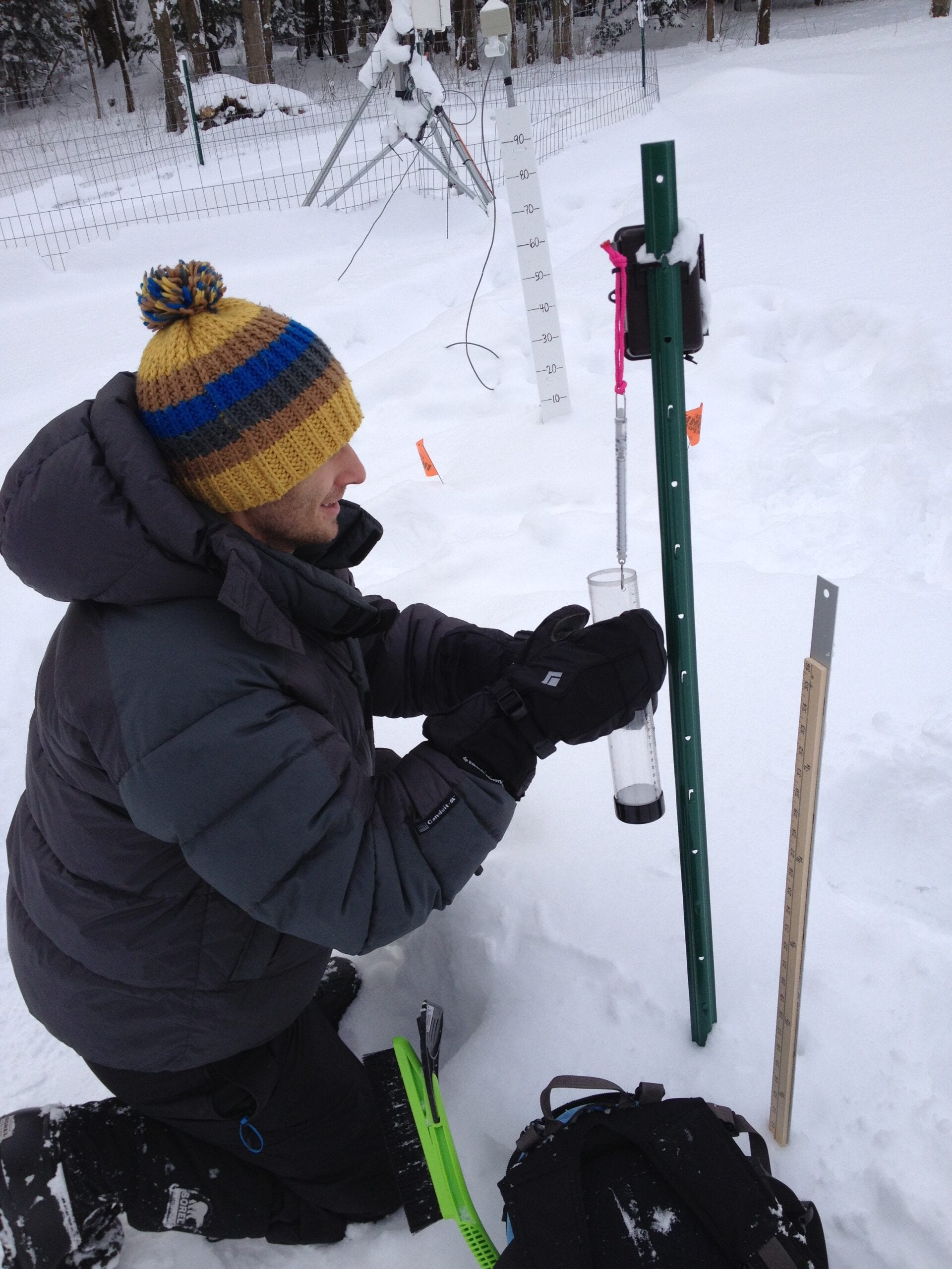
A major obstacle to studying SLR is the lack of high-quality data on the depth and water content of fresh snow—the two measurements needed to calculate the ratio.
“It’s a challenge to predict, in part, because it’s a challenge to observe,” said Jim Steenburgh, a professor of atmospheric sciences at the University of Utah and author of “Secrets of the Greatest Snow on Earth.” Steenburgh was a co-author of both machine-learning papers.
In his book, Steenburgh highlights Utah’s Alta ski area as a hotspot for light powder, but he said SLR at the resort in the Wasatch Range can vary dramatically, from 3-to-1 or 4-to-1 on the low end, up to 40-to-1 in extreme events.
“That’s a factor of 10 difference, and you can just imagine how that affects the snowfall forecast—it’s by a pretty big amount,” Steenburgh said. “Other parts of the country, the variability is not that large, but it still can be pretty substantial, so it’s an important part of the forecast equation.”
Alta’s powder is legendary, but other Western ski areas also boast about their low-density snow. Montana’s Bridger Bowl markets the “cold smoke” that riders stir up, while Colorado’s Steamboat Ski Resort has trademarked Champagne Powder® to describe its high-SLR snow.
“Your light, perfect Colorado or Utah powder that people go nuts for is typically anything with an SLR greater than 20,” Veals said. “That’s a good benchmark for the kind of snow that people really lose their minds over and wait for four hours in traffic for.”
The “habit” of ice crystals
SLR is hard to predict because snow crystals can form in many shapes and sizes, depending on atmospheric conditions.
“Winter storm forecasting is really hard,” Steenburgh said. “I look at winter storm forecasting as kind of a grand challenge for our field.”
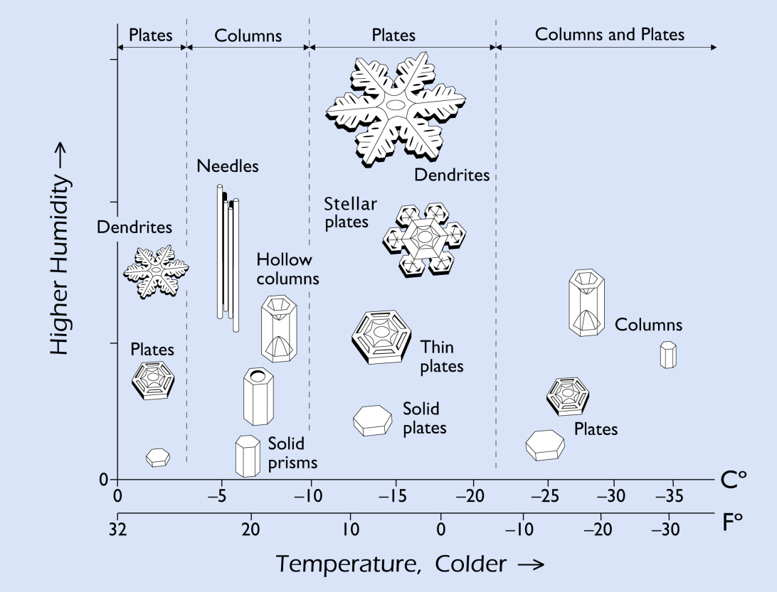
Nearly a century ago, Japanese scientist Ukichiro Nakaya helped pioneer the study of snowflakes by creating artificial ice crystals in a laboratory and studying how changes in temperature and humidity influenced their shapes. Nakaya likened snowflakes to letters from the heavens because they revealed conditions in the clouds where they formed.
“Ultimately, the density of the snow on the ground depends on what we call the crystal habit—that’s the shape of the snow crystals,” Steenburgh said. “What makes it really hard is ice crystals form at different elevations in the storm. They experience different pathways as they fall. And so it’s a really complicated problem when you look at it on a very microscopic level.”
Some clouds produce the iconic six-armed dendrites that have come to symbolize snowflakes. At other times, storms produce more humble forms such as needles, columns, plates and prisms. If enough supercooled liquid droplets freeze onto falling snow crystals—a process known as riming—the result can be graupel, which looks like tiny Styrofoam beads.
“Typically, dendrites will result in high-SLR or low-density snows because when those ice crystals settle on the ground, then there’s a lot of pore space in between them,” Pletcher said. Other types of ice crystal habits pack more closely together and yield higher-density snow.
“The temperature, the moisture, the wind speed, is what influences the crystal habit, which is what then influences the snow-to-liquid ratio on the ground,” Pletcher said.
If conditions are right, clouds can produce the ornate, delicate dendrites adored by skiers and other snow lovers, but a lot can happen to a snowflake as it falls to earth. The wind can break elegant ice crystals into fragments that pack more tightly on the ground.
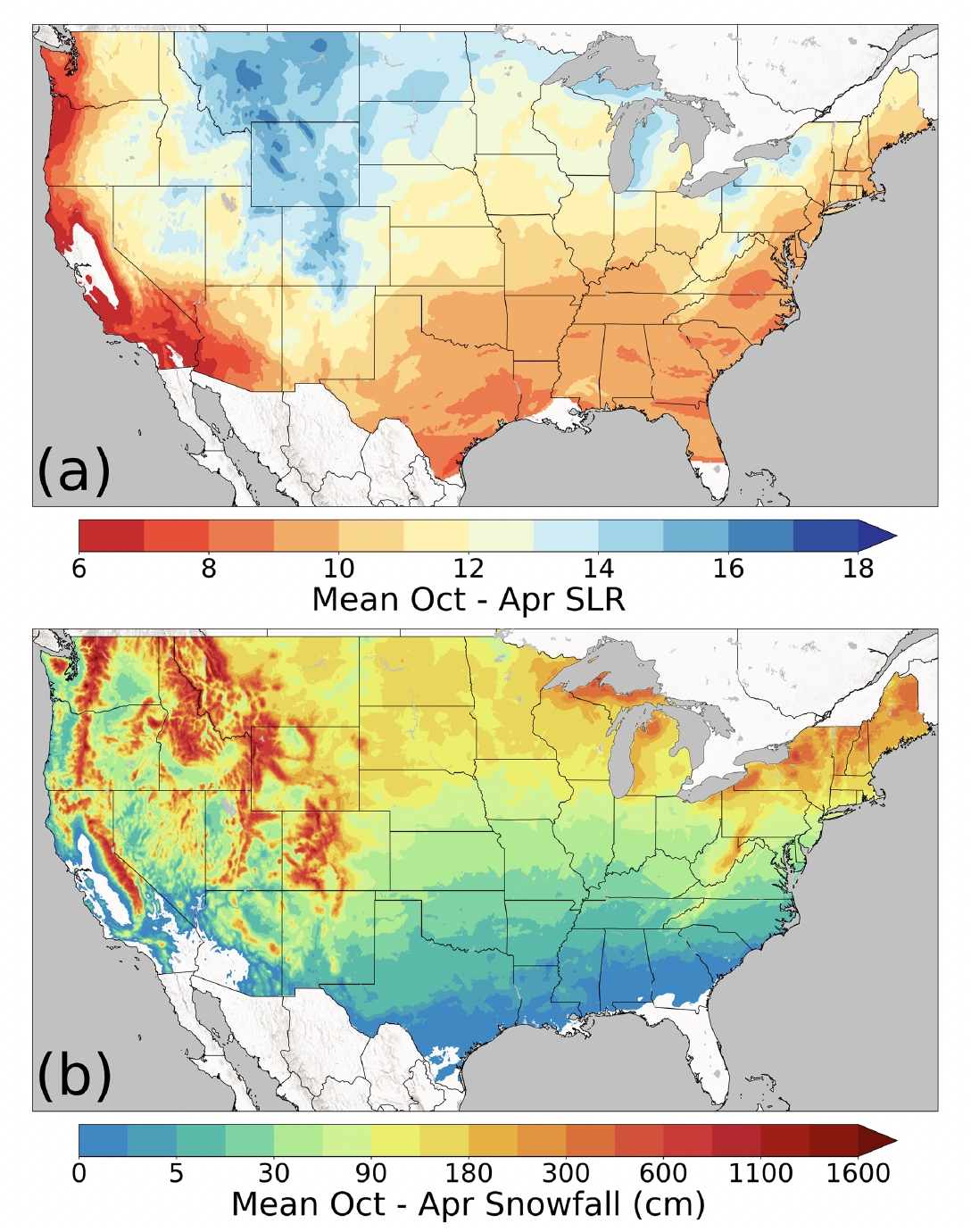
Colder conditions are often associated with lower-density snow, which helps explain why snowfall closer to the coast tends to be denser than snow in the interior West. But Veals said one of the biggest myths about SLR is that cold temperatures automatically produce light, fluffy snow. In reality, “our research shows if you have really high wind speeds and you get a lot of snowfall, it’s actually going to densify quite a bit,” Veals said.
“The single biggest influence on snow-to-liquid ratio is the total amount of water you have in your snowfall that day because it compacts under its own weight,” Veals said. “Basically, the more snow you have, the more it will densify itself.”
Frigid temperatures can also inhibit the formation of the dendrites associated with blower conditions, cold smoke and Champagne Powder®.
“Once you get to really, really cold temperatures,” Veals said, “your snow actually starts getting more dense with decreasing temperature because you stop producing these dendrites, which are like the star-shaped crystals we’re used to seeing, and you start producing other types of crystals like plates or needles that stack really more densely together.”
If snowflakes are like letters from the heavens, the machine-learning approach offers a new way to read the handwriting in the clouds.
Deciphering those messages from the sky—and predicting ice-crystal habits—is especially difficult in the mountains, where topography exerts such a strong influence on the weather. Yet many existing SLR algorithms “were trained using observations mostly or completely from nonmountainous regions,” according to the 2025 study.
“It’s not even just the SLR,” Pletcher said. “Just forecasting the liquid amount of precipitation that’s going to come out of these storms over complex terrain is incredibly challenging.”
Temperatures and precipitation depend heavily on elevation. Winds are steered, lifted and disrupted by the rugged landscape. But the geographic resolution of weather models may be too coarse to capture the stark differences between ridges and valleys.
One widely used model—NOAA’s High-Resolution Rapid Refresh—divides the landscape into a grid of squares with 3-kilometer (1.9-mile) edges, so each pixel must describe weather conditions over 2,224 acres.
“You think of some of the sharp topography of the West, you could fit a mountain in there that’s got anywhere from 7,000 feet of elevation to 13,000 feet of elevation in a grid box like that,” Veals said. “You could have anywhere from really cold temperatures up at the highest peak that’s in that grid box, and then you could have really warm, dense snow falling down below, and it’s all going to be averaged into that pixel.”
Measuring snowfall by hand
The two studies used advanced computing power to train machines to recognize patterns in atmospheric conditions that shape ice crystals and snow density. But the snowfall data they relied on wasn’t collected by automated gauges, satellites or other high-tech instruments—it was painstakingly measured by hand.
A major barrier to studying SLR is that automated weather gauges can struggle to accurately measure the two key ingredients: the depth of newly fallen snow and its water content. As a result, calculating SLR can be like “dividing unknown chaos by unknown chaos,” Veals said.
“We wanted to focus on high-quality datasets because for any machine-learning model, they can only make predictions as good as the data that they’re trained on,” Pletcher said. “If either study were to have incorporated automated gauges, those are susceptible to a phenomenon called undercatch, where they don’t reliably report the amount of liquid precipitation captured in the gauge. Air can flow over the instrument, and it kind of blows the rain or snow away from the gauge, and so it underreports the amount of precipitation.”
Wind speed is a major driver of undercatch.
“For zero wind—completely calm—it will probably catch almost 100% of the snow that fell. But as the wind speed picks up, you could get down to 50% or less,” Veals said.
For the 2025 study of the West’s mountains, the scientists relied on professionals with extensive experience measuring snow, but the dataset covered only 14 sites. For the 2026 national study, the researchers turned to the CoCoRaHS network of volunteer observers. (You can apply to join CoCoRaHS online.)
Researchers sent a survey to CoCoRaHS volunteers to screen the observations and improve the data quality. The scientists only included measurements from observers who recorded the depth of new snowfall on a board and determined its water content by melting the snow or weighing it on a scale. Of the 1,182 sites that responded to the survey, 921 were included in the study.
“The big advantage of something like CoCoRaHS with the volunteer observers is strength in numbers. You get a lot more observations than what you can get in a lot of other environments,” Schumacher said. “The potential downside is while the observers are trained, to some extent, they’re not doing this as their job or as sort of professionals in the field necessarily.”
Schumacher was not a co-author of either study, but the CoCoRaHS headquarters is located at the Colorado Climate Center, which he directs, and Schumacher helped connect Veals to CoCoRaHS.
CoCoRaHS volunteers may be amateurs, but their ranks include current and former meteorologists and atmospheric scientists, Veals said.
“The thing that always impresses me is how diligent and careful a lot of the observers are,” Schumacher said. “In the study, they sent out a survey to try and find the observers who actually are making the measurements the right way. And so I think that helps mitigate some of those limitations of measurements that might be of less quality or more questionable quality.”
While the hands-on approach can yield more accurate SLR data than automated gauges, it’s not without its hurdles.
“If you take the measurement after the snow’s been settling for a while, then you get a different snow-to-liquid ratio than if you took it sort of right away after the snow ended,” Schumacher said.
CoCoRaHS recommends using a 16-inch-square white board to measure snow depth, but wind can scatter snow unevenly across the board.
“If there’s drifting on the board, it’s hard to know what you want to call the actual measurement of snow on the board, so those aren’t perfect either,” Veals said. “But they’re by far the best way of measuring snow, is just a person taking a core and weighing it with a little scale.”
Ultimately, every approach to measurement has limitations because snow is constantly changing as it settles, drifts and melts.
“We have a saying in atmospheric sciences,” Steenburgh said. “All observations are bad, but some are useful. Every observation has uncertainty with it, and it has error with it.”
Better forecasts for roads and avalanches
The machine-learning research has led to the creation of forecast tools available to the public through the University of Utah’s Department of Atmospheric Sciences.
“The practical implications of these products is they’re widely used by meteorologists across the United States” at National Weather Service offices, Pletcher said. “They’re also used by avalanche forecasters and just by the general public to gauge how to better prepare for impending winter storms.”
Schumacher said the SLR papers avoided the so-called “valley of death” that often separates scientific research from day-to-day forecasting.
“In this case, they’ve done the work to also make it useful more broadly than just among researchers or just among technical specialists,” Schumacher said.
Better SLR forecasts could help transportation officials navigate treacherous storms that clog roadways and generate dangerous whiteout conditions.
“The snow removal piece is a big part of it because that’s a huge factor in how easy or how difficult it is to be plowing the snow off of roads,” Schumacher said. “The lighter snow, if it’s windy, is more likely to turn into blowing snow, which in some places that can be very hazardous.”
While snowfall benefits the West’s water supply and snow sports industry, winter storms can be deadly for motorists and other travelers.
According to a 2015 study, winter precipitation was a factor in nearly 28,000 aviation and motor vehicle accidents between 1975 and 2011, resulting in more than 32,000 fatalities—an average of nearly 900 per year. “Fatality totals from winter-precipitation-related vehicle accidents far eclipse fatality totals from other, more prominent weather hazards, such as tornadoes, flooding, and hurricanes,” the researchers wrote.
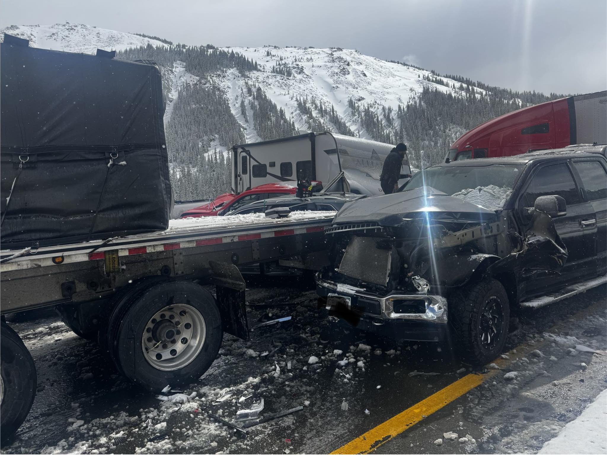
A potent April snowstorm along Colorado’s Continental Divide provided a stark example of the perils: between 60 and 70 vehicles were involved in a massive pileup on icy I-70 as drivers faced limited visibility due to whiteout conditions.
Avalanches are another realm in which snowfall can have life-or-death consequences. SLR is of keen interest to avalanche forecasters because it can influence the snowpack’s structure and stability.
“How that snow-to-liquid ratio changes during a storm can strongly affect avalanche conditions,” Steenburgh said. Storms in which SLR decreases over time—piling higher-density snow over lower-density snow—are generally more dangerous for avalanches. “We call those upside-down storms rather than right-side up,” Steenburgh said.
In the 2025-26 season, 23 people have died in U.S. avalanches, including nine in a February incident near Lake Tahoe, according to Avalanche.org, a partnership between the American Avalanche Association and the U.S. Forest Service National Avalanche Center. During the prior 10 seasons, avalanches claimed an average of about two dozen lives per year in the United States, according to data from the Colorado Avalanche Information Center.
Avalanches, road closures, traffic accidents—and the quality of a skier’s powder day—can all hinge on snow’s shape-shifting nature and what happens to flakes as they fall from the sky.
“Snow is a really remarkable substance. It comes in all kinds of different forms, and sometimes those forms really do matter for societal impacts,” Steenburgh said.
Water, warming and snow density
Hydrologists focus less on SLR and more on how much water is stored in the snowpack—what’s known as the snow water equivalent. SWE (pronounced “swee”) is the depth of the liquid you’d get by melting a column of snow. If a storm drops the equivalent of 1 inch of water, a low SLR could yield a few inches of snow, while a high SLR could produce a couple of feet—but when melted, either would still produce an inch of liquid water.
“From the perspective of a hydrologist, the SLR is less important directly,” Geerts said, “yet the driver there, the snow distribution across the terrain, is impacted by SLR.”
Lower-density snow with a high SLR is more susceptible to being blown around, and “strong wind events will carry that fluffy snow across watershed boundaries,” Geerts said. “So from that perspective, it does matter for hydrologists.”
While SLR could influence which watershed snow winds up in, “that’s a pretty small-scale effect,” Steenburgh said. “If you’re looking at the entire Colorado [River] Basin, that’s not going to matter too much.”
Climate change is already transforming the West’s snowpack, as warmer temperatures shift more precipitation from snow to rain and shorten the snow season. Neither SLR study examined climate change effects, but scientists said higher temperatures are generally expected to make snowfall denser on average.
“We haven’t looked specifically at the change in SLR over time because our SLR datasets don’t extend far enough back,” Veals said. “But because we found these strong linkages between temperature and SLR, we can expect that in a warming climate, the snow is going to get more dense, so there will be an increase in the average density of the snow.”
There is already data showing that snow densities are increasing and SLR is declining, but “not dramatically,” Steenburgh said.
“It’s not like Alta is going from the greatest snow on earth to Sierra cement or Cascade concrete. But there is a shift, for example, to higher-density snow, and we’re seeing more higher-density snow events. So I think in the continental United States, that’s something that I would expect to see more of,” Steenburgh said. “The hard part is really nailing down exactly what that trend is, just because the observations are so difficult to do.”
AI revolution in weather forecasting
The machine learning used in the SLR studies is part of today’s AI boom, but the technique itself is hardly new.
“Machine learning is basically a more specialized version of statistics,” Pletcher said.
In a seminal 1959 study, “Some Studies in Machine Learning Using the Game of Checkers,” IBM scientist Arthur L. Samuel reported that “a computer can be programmed so that it will learn to play a better game of checkers than can be played by the person who wrote the program.”
“I like to tell people that machine learning has been around for a long time,” Steenburgh said. “Meteorologists have been using statistical methods to improve computer forecast models since really the late 1950s. What’s changing now is the ability to do real deep learning using enormous datasets.”
Machine learning excels at spotting patterns in data and using them to make predictions about how similar conditions will play out in the future.
“You give it all these situations and say, ‘For all these different snowfall events, these were the temperatures and the humidities and wind speeds that were observed, and take all that into account, know that, and then the next time we give you a wind speed and a temperature and a humidity, tell us what the snow-to-liquid ratio is going to be,’” Veals said. “That’s what machine learning does really, really well, and that’s why it’s revolutionized a lot of things in the weather and climate space.”
While machine learning is not new, successful applications still depend on high-quality training data and humans who understand the subject matter—what scientists often call “domain knowledge.”
“We know snow. We understand the measurement issues. We know how to build forecast systems,” Steenburgh said.
The recent SLR studies are part of a wave of AI applications in weather forecasting, with researchers using the approach to predict everything from large-scale weather patterns to local snowfall.
“I think it’s definitely the most transformative period of weather prediction of my entire career,” Steenburgh said. “Things are happening really fast.”
Traditionally, weather models have relied on powerful computers to simulate the ever-evolving atmosphere, using complex physics equations to predict conditions on the ground.
Some AI-based forecasting systems have taken a very different path, Veals said. Instead, they’ve “gone back to the drawing board and just said, ‘Let’s feed in just past weather maps and have these AI models predict what the map will be in 10 days or whatever as the forecast.’ And so that’s the big revolution that’s going on right now.”
Even with better SLR forecasts, scientists said snowfall will remain tough to predict, especially in the mountains, because it varies so widely over short distances and is shaped by complex atmospheric dynamics within clouds. But machine learning and other AI technologies are giving researchers new ways to probe a substance that has fascinated—and confounded—people for ages.
“It’s definitely a really exciting time to be an atmospheric scientist at the intersection of data science and meteorology, and specifically for winter weather,” Pletcher said. “Machine learning is great because it’s allowing atmospheric scientists to really push the boundaries of not only improving snowfall prediction, but just weather prediction in general.”
This story was produced by The Water Desk, an independent journalism program at the University of Colorado Boulder’s Center for Environmental Journalism.