By Heather Sackett
A consultant working for the city of Aspen is presenting both new sources and storage as part of its water future.
Denver-based Carollo Engineers is working on Aspen’s Water Integrated Resource Plan, which aims to predict and plan for water needs through 2070.
A main goal of the plan is figuring out how to address what they say are potential future water shortages, especially in late summer under hotter and drier conditions fueled by climate change. Carollo expects to submit a final IRP with recommendations and a plan to implement them in late spring or early summer.
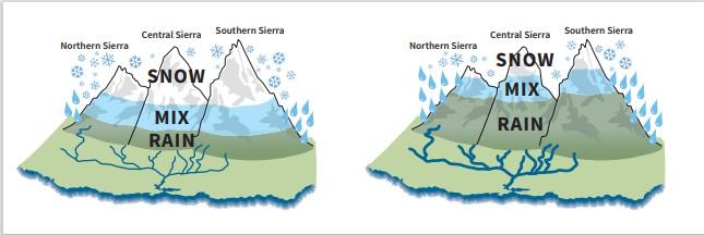
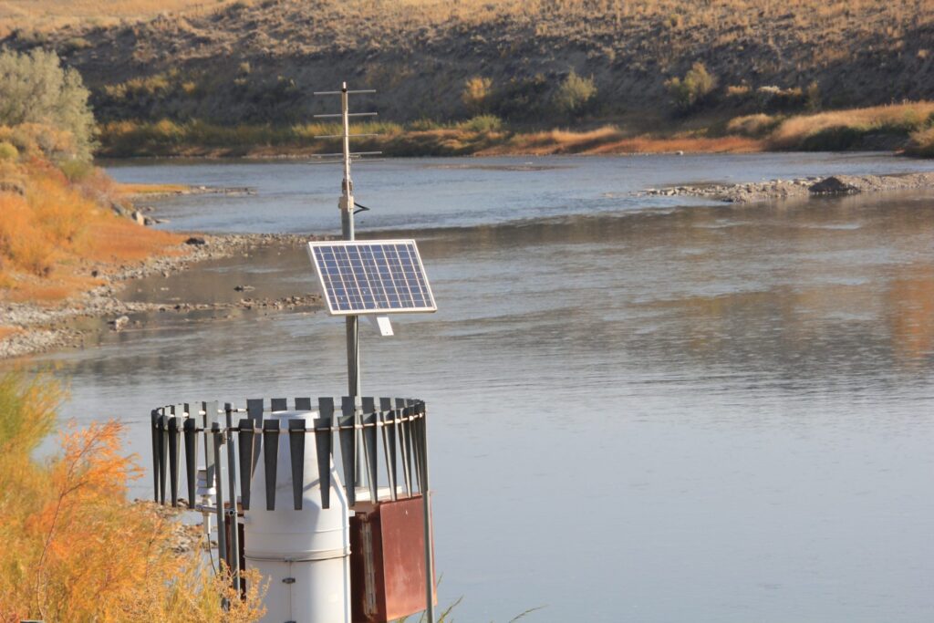
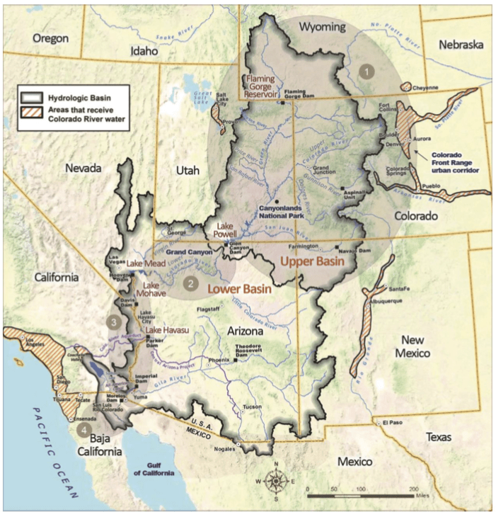
Engineers define a shortage as the inability to meet all water uses — potable, irrigation, goals for instream flow (ISF), and hydropower generation — at the same time. ISF water rights are held by the state of Colorado and set a requirement for minimum flows between specific points on a stream. They are aimed at improving the natural environment to a reasonable degree. The ISF for the creeks that provide Aspen’s municipal water is 14 cubic feet per second on Maroon Creek and 13.3 cfs on Castle Creek.
The city’s consultants calculated future water demands using the variables of population, occupancy rates, climate change, water-use efficiency and unmetered water use. They claim that Aspen’s future water demand for the next 50 years, depending on these variables, could be between 4,900 and 9,300 acre-feet per year, according to a slide show presented at a public engagement meeting March 3.
Consultants say they are planning for the worst and, instead of hoping for the best, making the IRP flexible and adaptable. The factors that, according to the consultants, would contribute to Aspen having 9,300 acre-feet of water demand would include a 3.6 degree (Celsius) increase in temperature due to climate change and an annual population increase of 1.8% by 2070, according to John Rehring, senior project manager and vice president of Carollo Engineers.
This demand forecast already includes conservation measures and drought restrictions, which would decrease indoor use by 2% and outdoor use by 5% to 15% by 2070.
Rehring said that even under stage-three drought restrictions limiting water use, his firm’s projections show future supply gaps.
For the past several years, Aspen’s water demands have hovered between about 4,000 and 5,000 acre-feet per year. A 2016 study by Wilson Water concluded that Aspen did not need any storage, although drought years could cause the creeks to dip below the ISF standard without more water conservation.
Looking for storage locations
In this month’s earlier public meeting, consultants presented six different portfolios for meeting a potential projected shortage. Five of the six — all except the current status quo — included storage as a component.
The city has identified five potential reservoir sites: the city golf course; the Maroon Creek Club golf course; Cozy Point open space; the Woody Creek gravel pit; and a 63-acre parcel of land next to the gravel pit. Officials believe water could be stored underground at some of these sites.
A map included in the presentation with city officials and Carollo representatives on March 3 included three new possible sites: the Aspen airport, Zoline Open Space and North Star Nature Preserve.
But Aspen Utilities Resource Manager Steve Hunter said it’s highly unlikely the city would pursue water storage at these locations. Hunter said they were included on the map because the consultant used a geographic information system (GIS) mapping tool to pick out large tracts of city-owned land that would be big enough to store water.
“The three are low if not off the list,” he said. “I don’t see the city pursuing any of these three.”
According to Hunter, Zoline is probably too small and the airport too fraught with logistical challenges. North Star is valued for its natural beauty and important riparian habitat, and building city water infrastructure there is something Hunter said won’t happen.
“I don’t ever see it happening in my lifetime due to the pushback they would get,” Hunter said. “I’m almost 100% confident that is not going to fly.”
The pushback to which Hunter is referring would be of the same sort Aspen faced when it attempted to hang onto conditional water rights to build dams and reservoirs in the Castle and Maroon valleys. The Maroon Creek Reservoir would have held 4,567 acre-feet of water and the Castle Creek Reservoir would have held 9,062 acre-feet of water.
After a lengthy water court battle in which 10 entities opposed the city’s plans, the city gave up its water rights, which date to 1965, in those particular locations. The final water court decree in the case granted Aspen the right to store up to 8,500 acre-feet from Castle and Maroon creeks combined.
Now that the Castle and Maroon valleys are out of the question, part of the IRP process is figuring out where the city should store the water granted by those conditional water rights.
Consultants are proposing two different storage pools: seasonal/operational and emergency.
The seasonal/operational pool would be used as a traditional reservoir to retime flows by capturing spring runoff and saving it for use later in the summer, when creek flows have dwindled but demands — especially outdoor watering — are still high.
Emergency storage would be left untouched most years and only tapped if there was a disaster such as a wildfire or a flood that made the city’s water sources temporarily unusable. The two pools could be combined in the same reservoir or stored in two different locations.
Diversified supply of water encouraged
Consultants are also working toward a recommendation that the city develop additional sources of water in order to protect supply.
The city takes nearly all its water from Castle Creek and some from Maroon Creek, which consultants say makes Aspen vulnerable to drought, wildfire or avalanches. In addition to storage, the portfolio options included combinations of new sources from groundwater wells, tapping the flows of Hunter Creek, reuse of wastewater and enhanced conservation measures.
“We see strength in diversity, when we diversify the supply sources,” Rehring said.
Each of the six portfolios were ranked based on six criteria: supply availability; supply resilience; community and environmental benefits; affordability; ease of implementation; and ease of operations. (Supply availability is the most important of these.) Portfolio 6 — which includes storage, groundwater wells, enhanced conservation and reuse, in addition to current supplies from Castle and Maroon creeks — scored the highest.
The portfolios did not include an “everything but storage” option; storage was a part of all the portfolios except for the “do nothing” option. Rehring said storage is an effective way of helping the city use its current sources of Castle and Maroon creeks and avoid or defer bringing another water source online as quickly.
Hunter said he sees conservation, wells and reuse leading the charge on the front end, but he adds that the city will also use storage.
“Yes, storage will be a component,” he said. “It’s a phased approach — we don’t need to go out and put in … a 2,500 acre-foot reservoir and fill it up tomorrow.”
Stakeholder input
In addition to holding three public-engagement sessions on the IRP, the city also formed a technical working group — with representatives from Pitkin County, the Bureau of Reclamation, Western Resource Advocates, Aspen Global Change Institute, Colorado Parks and Wildlife, and other entities — to provide input.
Laura Belanger, a senior water-resources engineer and policy adviser with Western Resource Advocates and a member of the technical working group, said the city is doing a good job getting input from stakeholders, including those who have been opposed to some of Aspen’s water plans in the past. WRA was one of the 10 opposing parties in the city’s conditional water-rights case.
Belanger said it’s encouraging that the city is considering enhanced conservation and reuse as part of the IRP.
“I think we actually like the way the city is approaching this,” Belanger said.
Aspen Journalism covers rivers and water in collaboration with The Aspen Times. This story ran in the March 20 edition of The Aspen Times.
The Water Desk’s mission is to increase the volume, depth and power of journalism connected to Western water issues. We’re an initiative of the Center for Environmental Journalism at the University of Colorado Boulder. The Water Desk launched in April 2019 with support from the Walton Family Foundation. We maintain a strict editorial firewall between our funders and our journalism.