
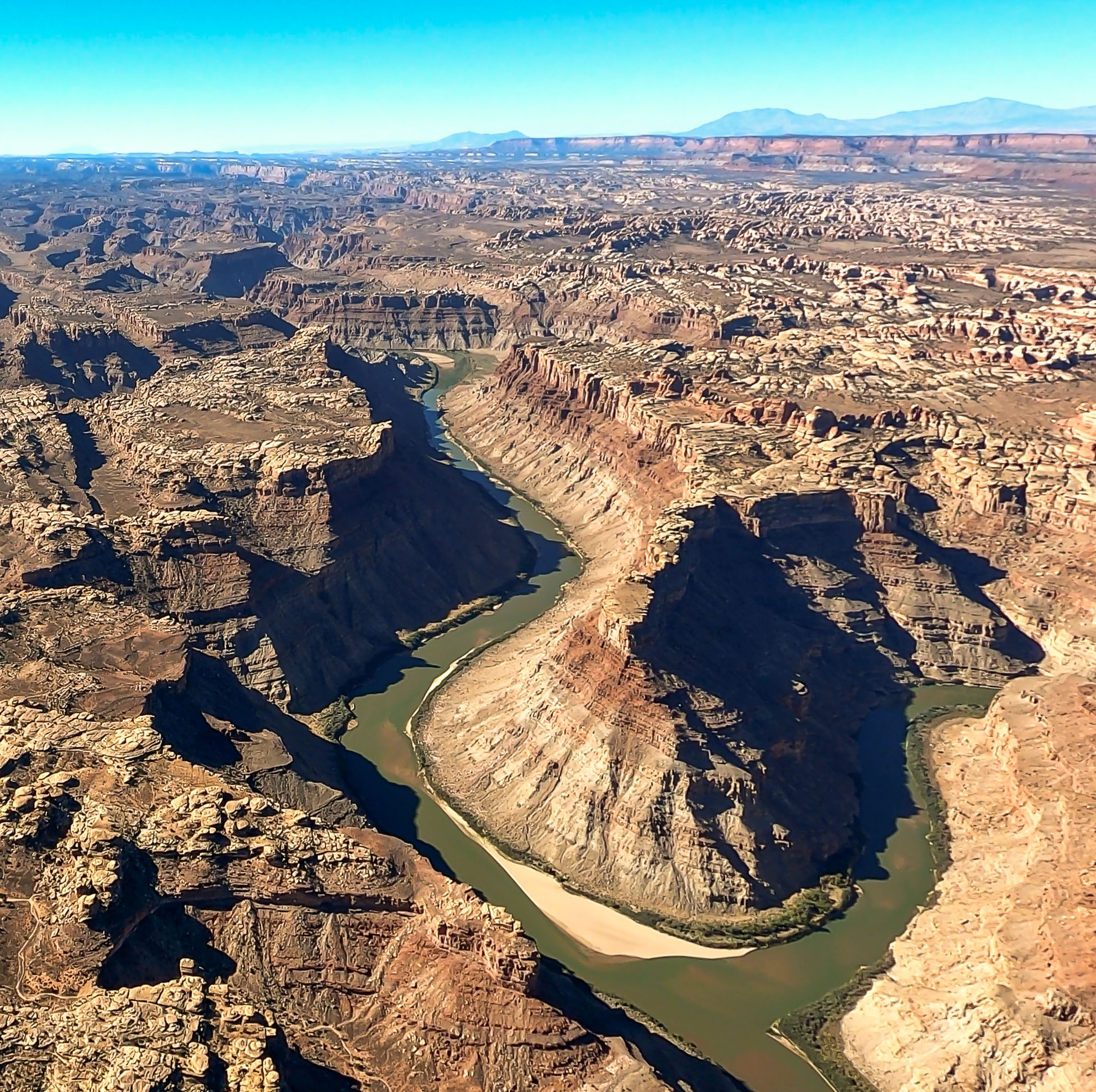
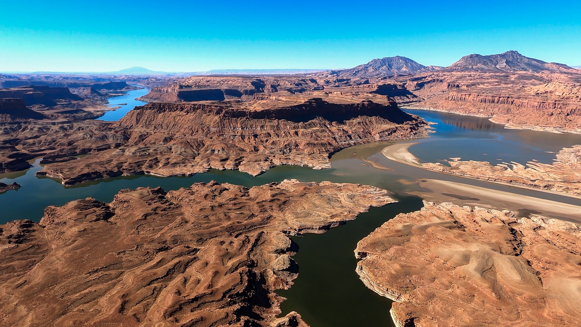
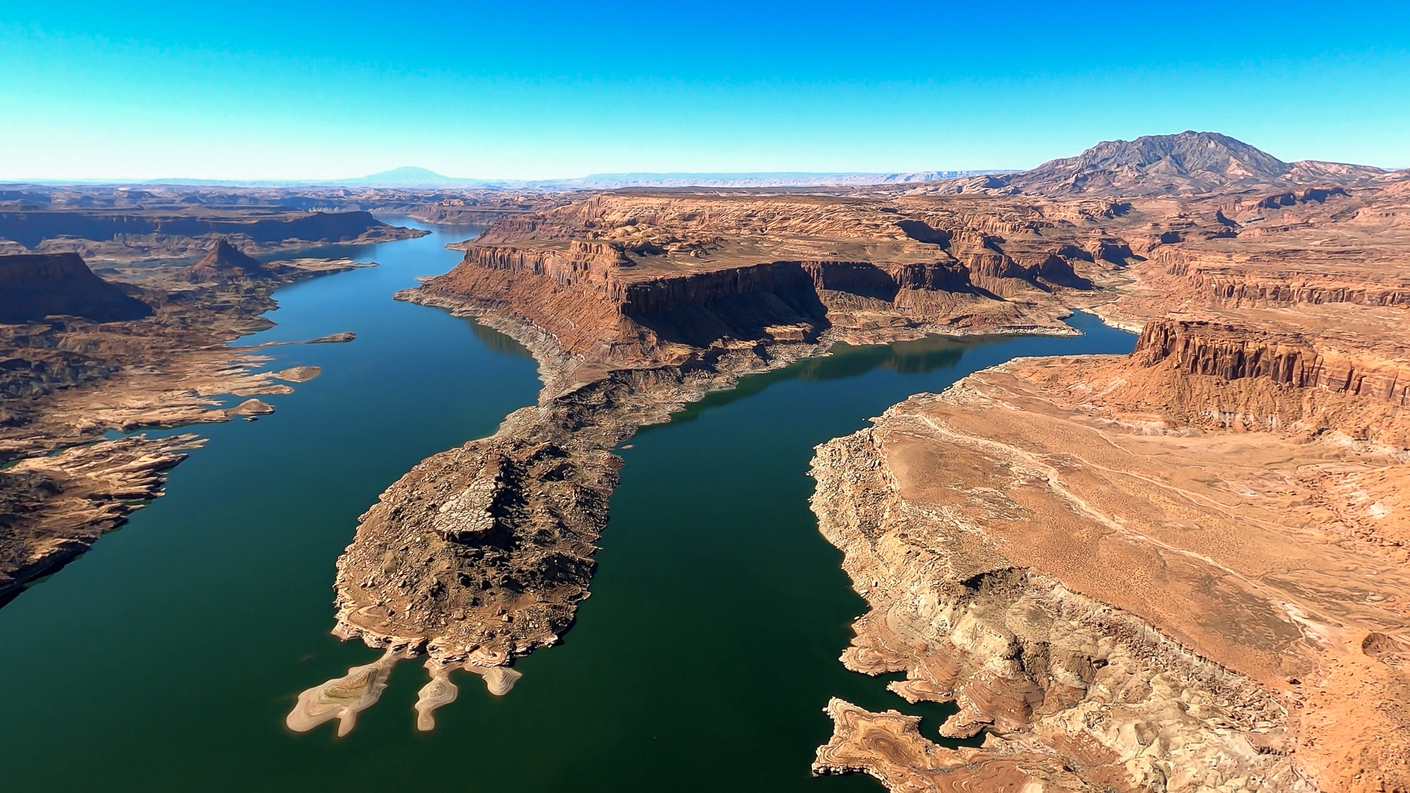
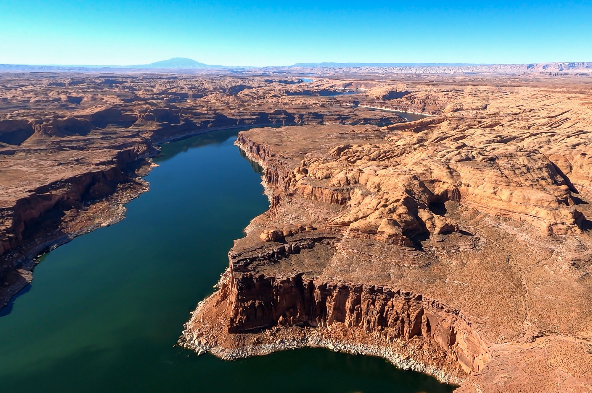
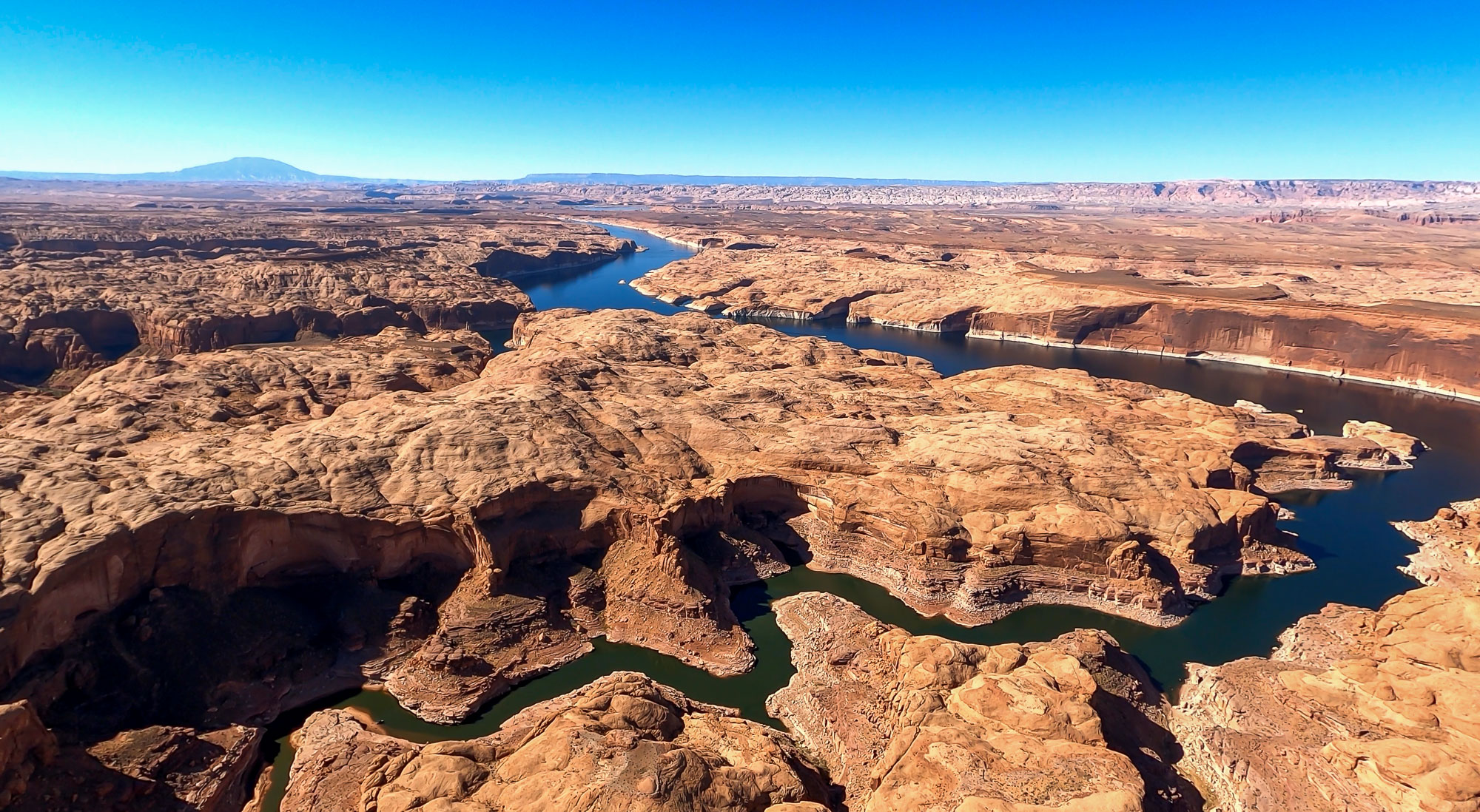
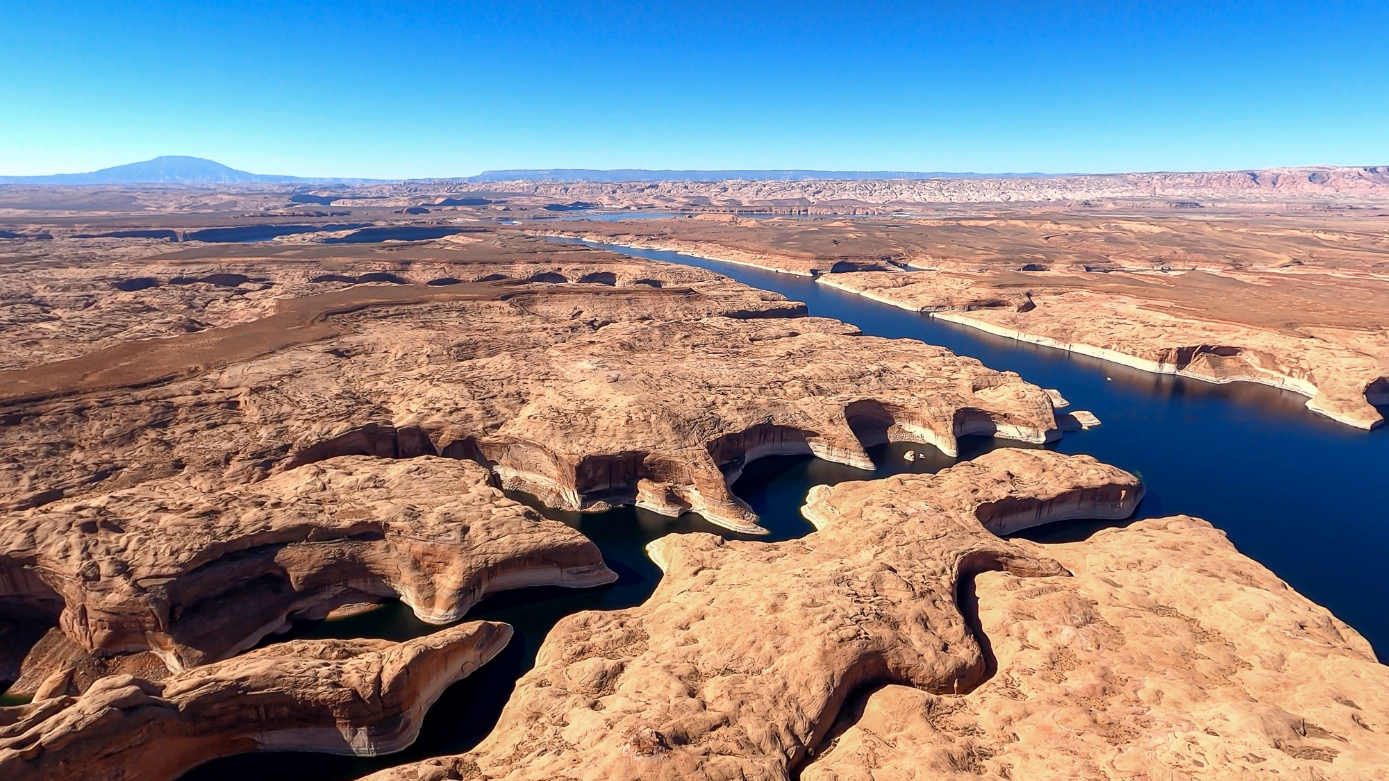
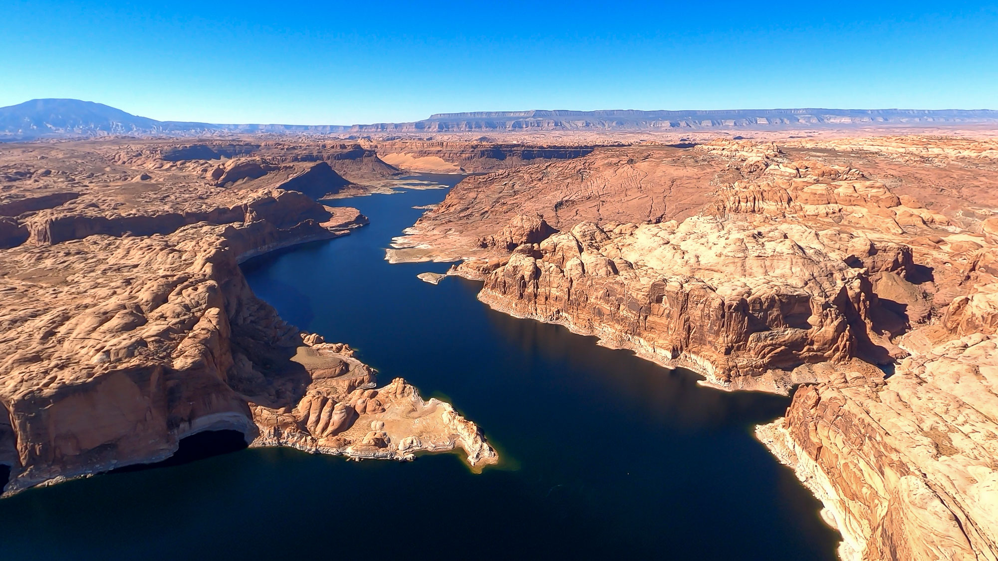
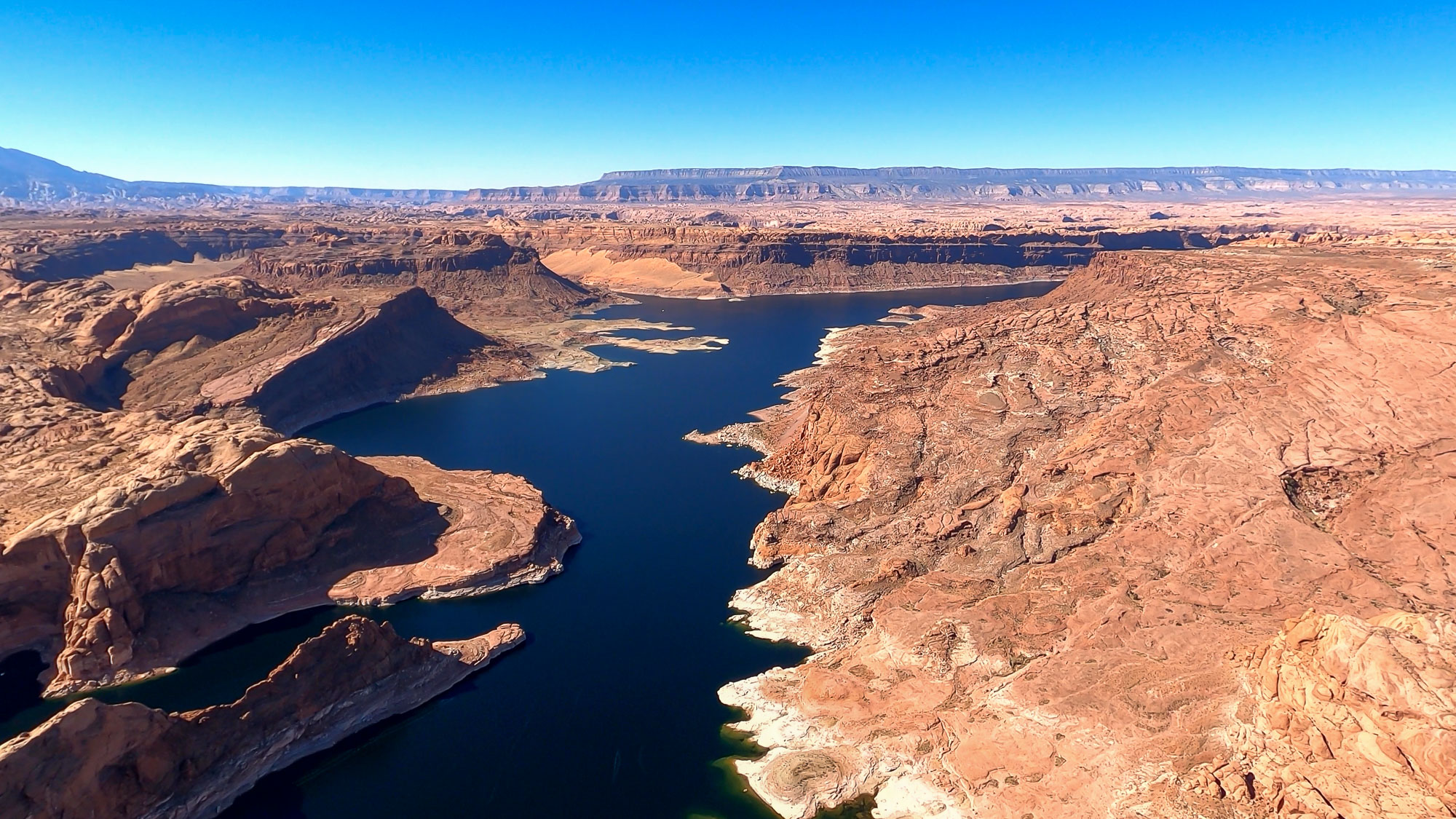
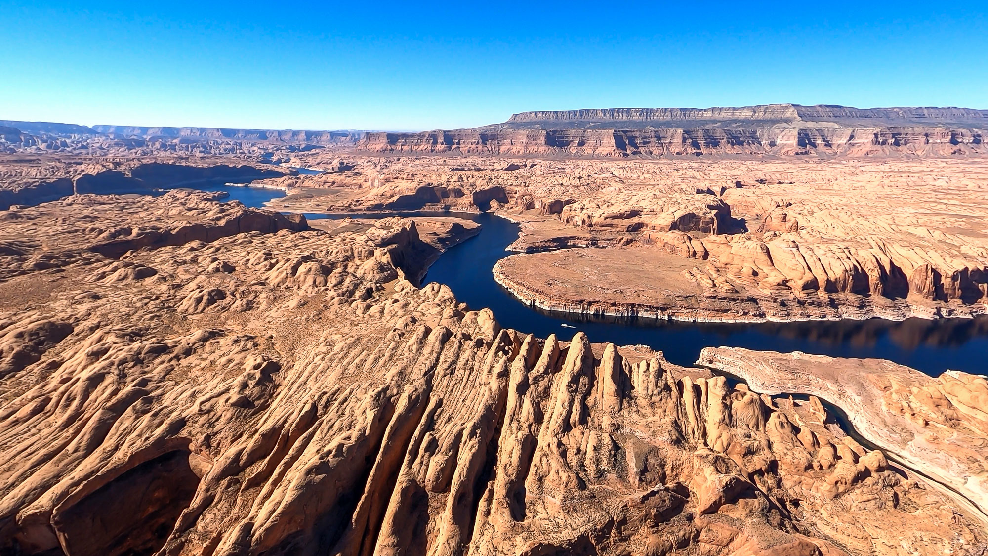
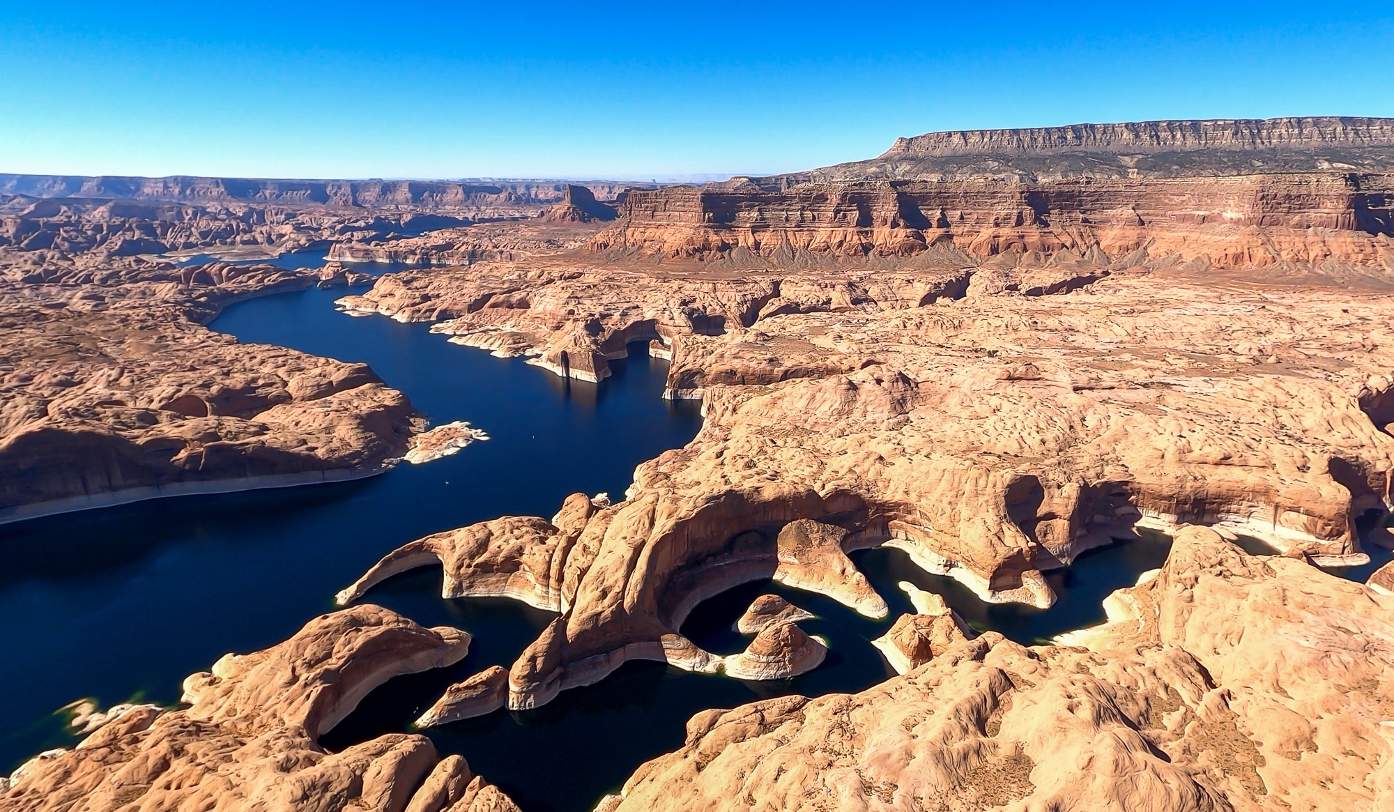
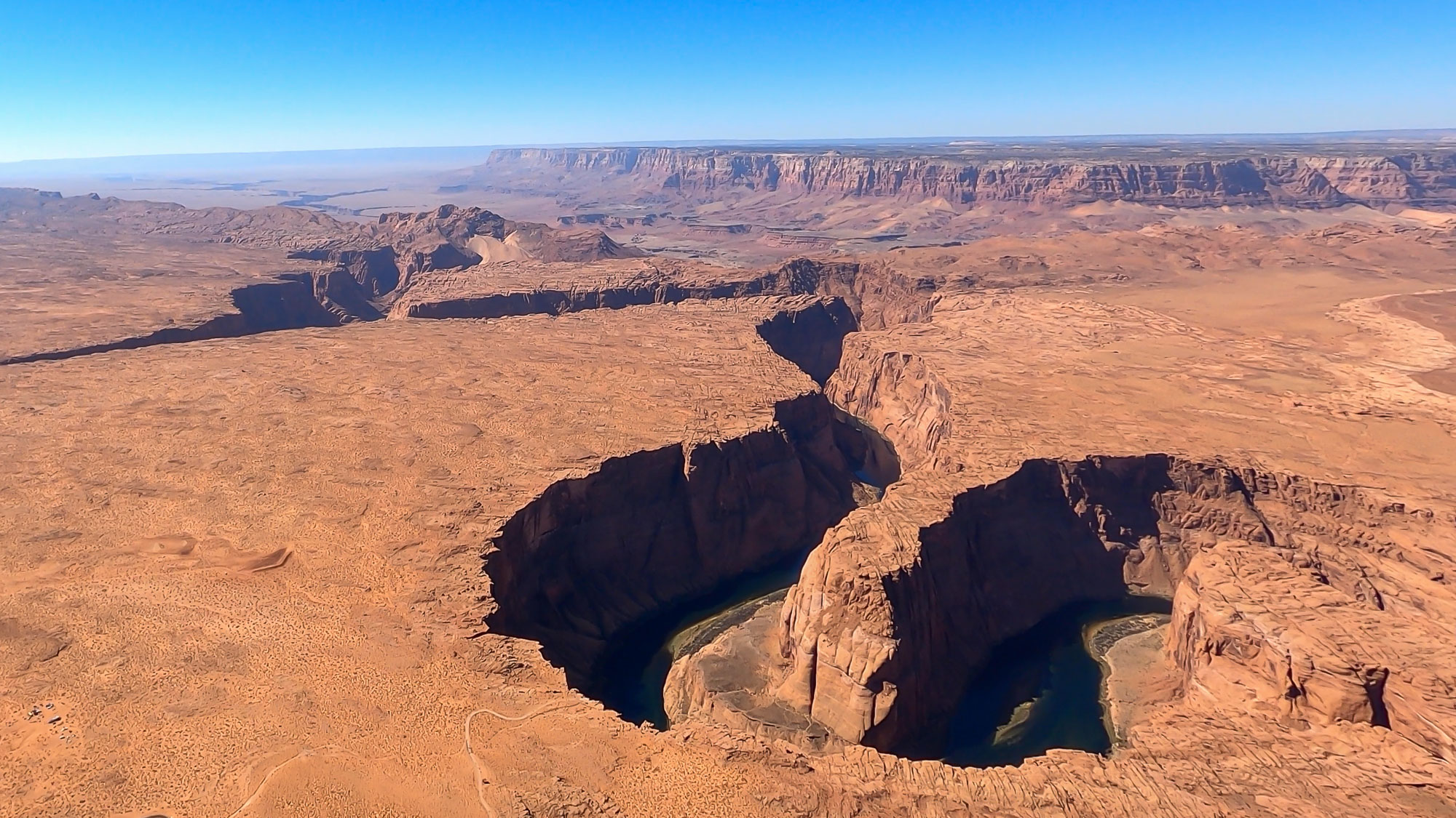
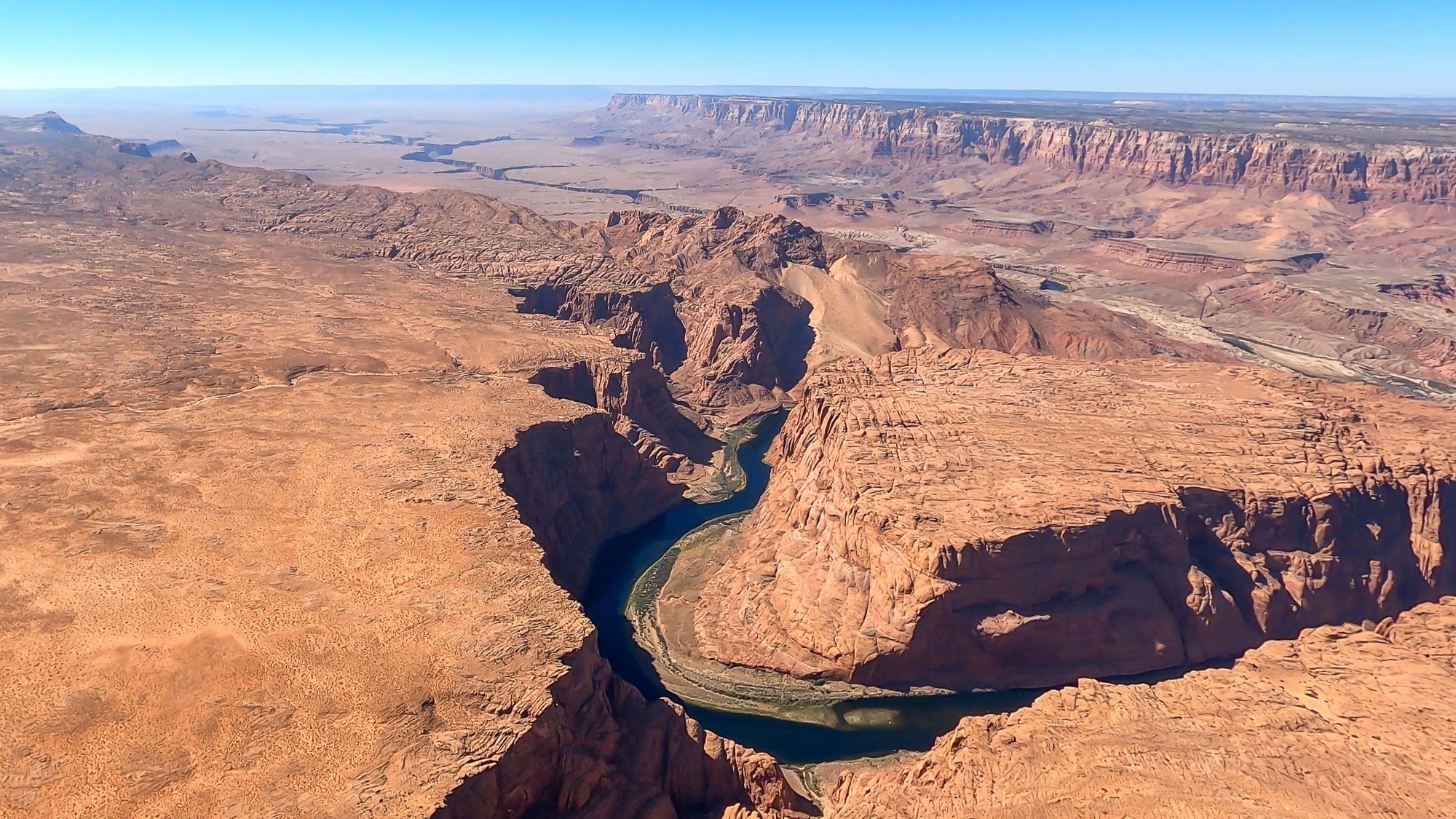
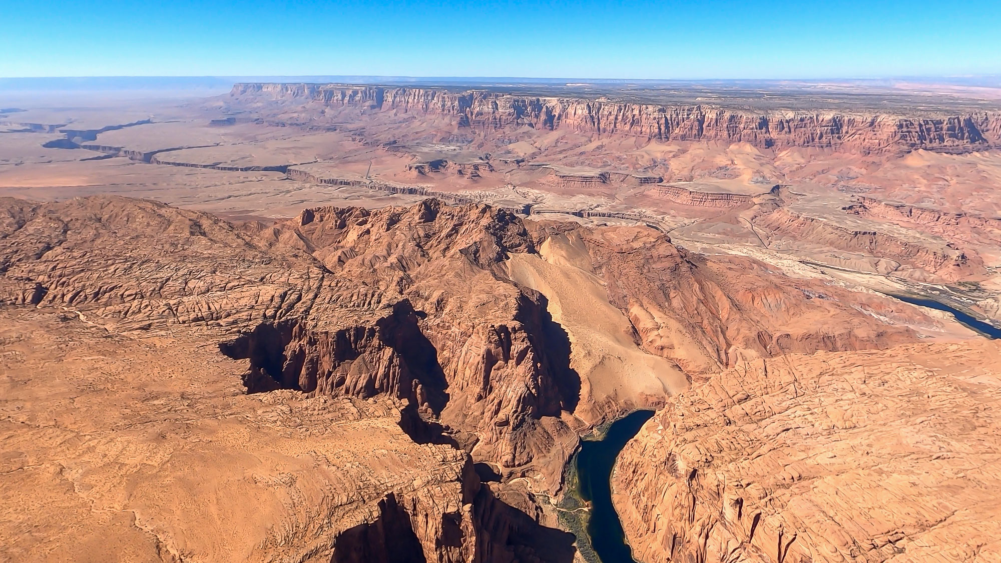
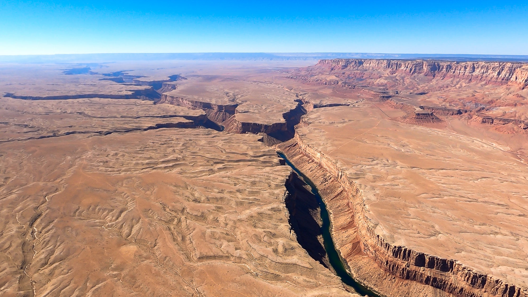
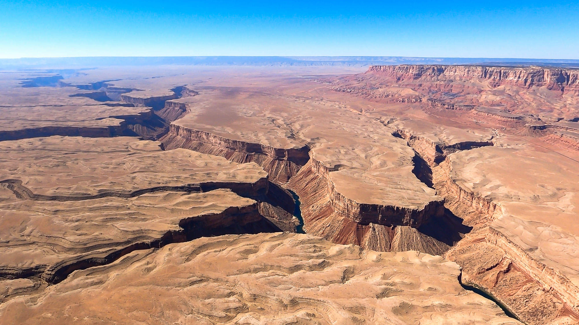
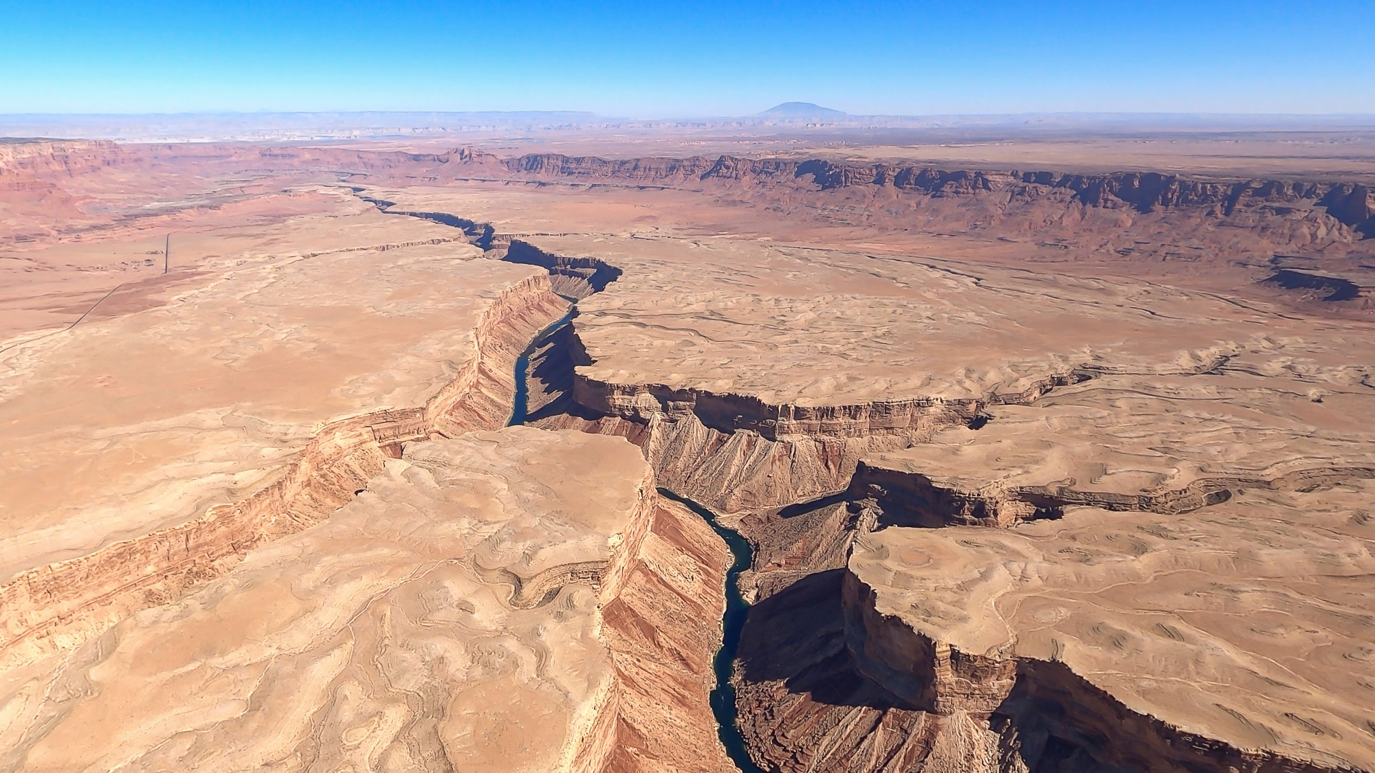
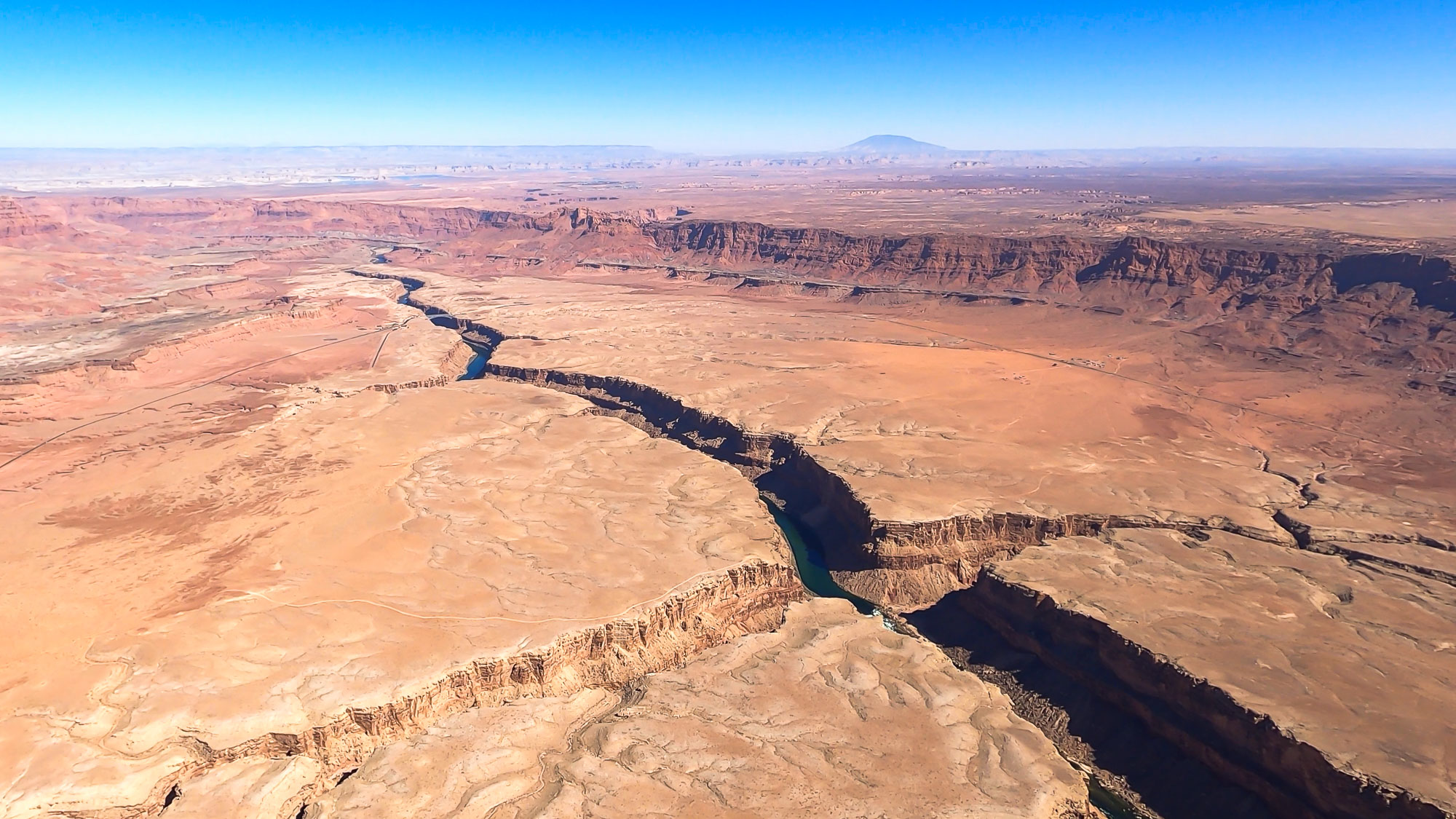
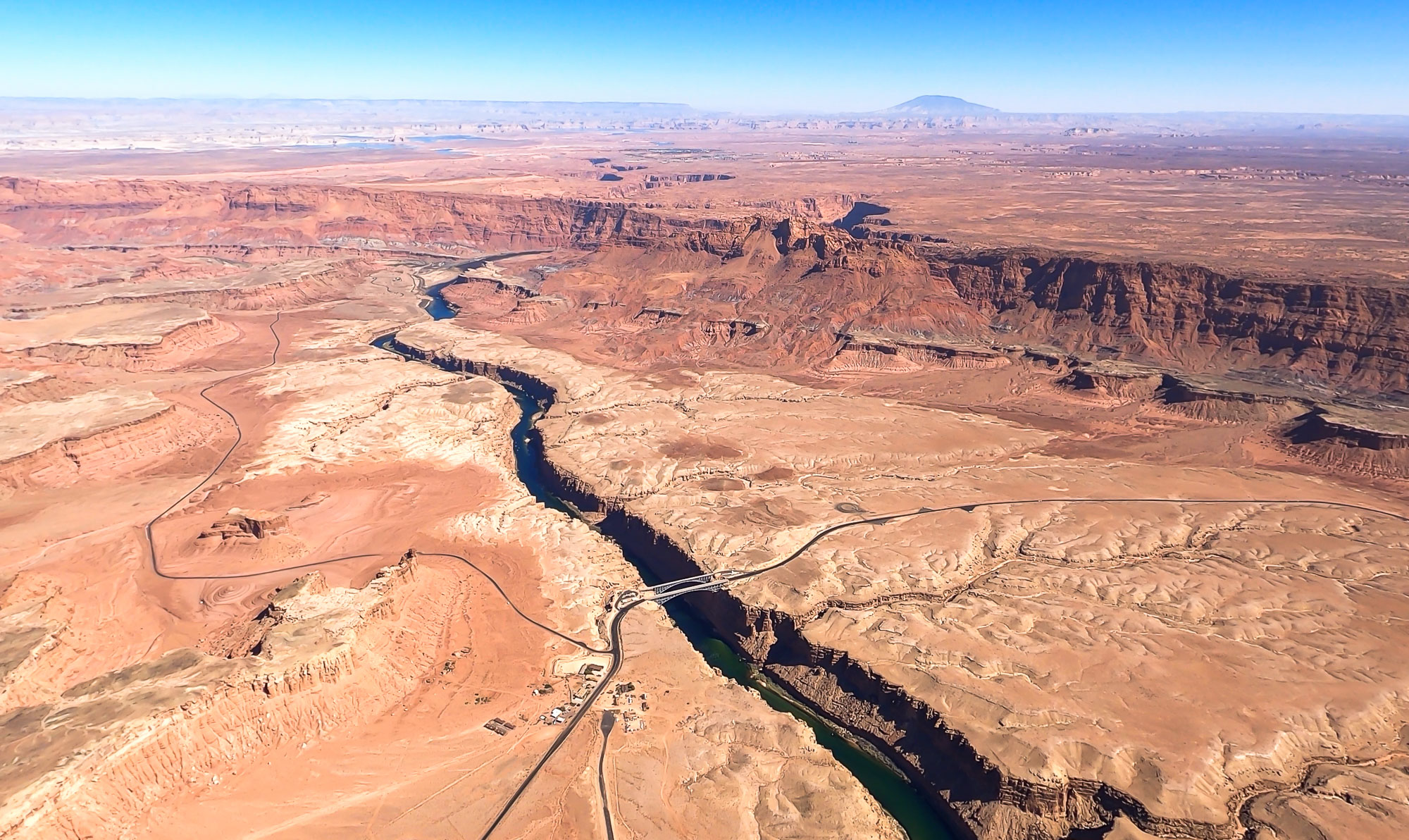
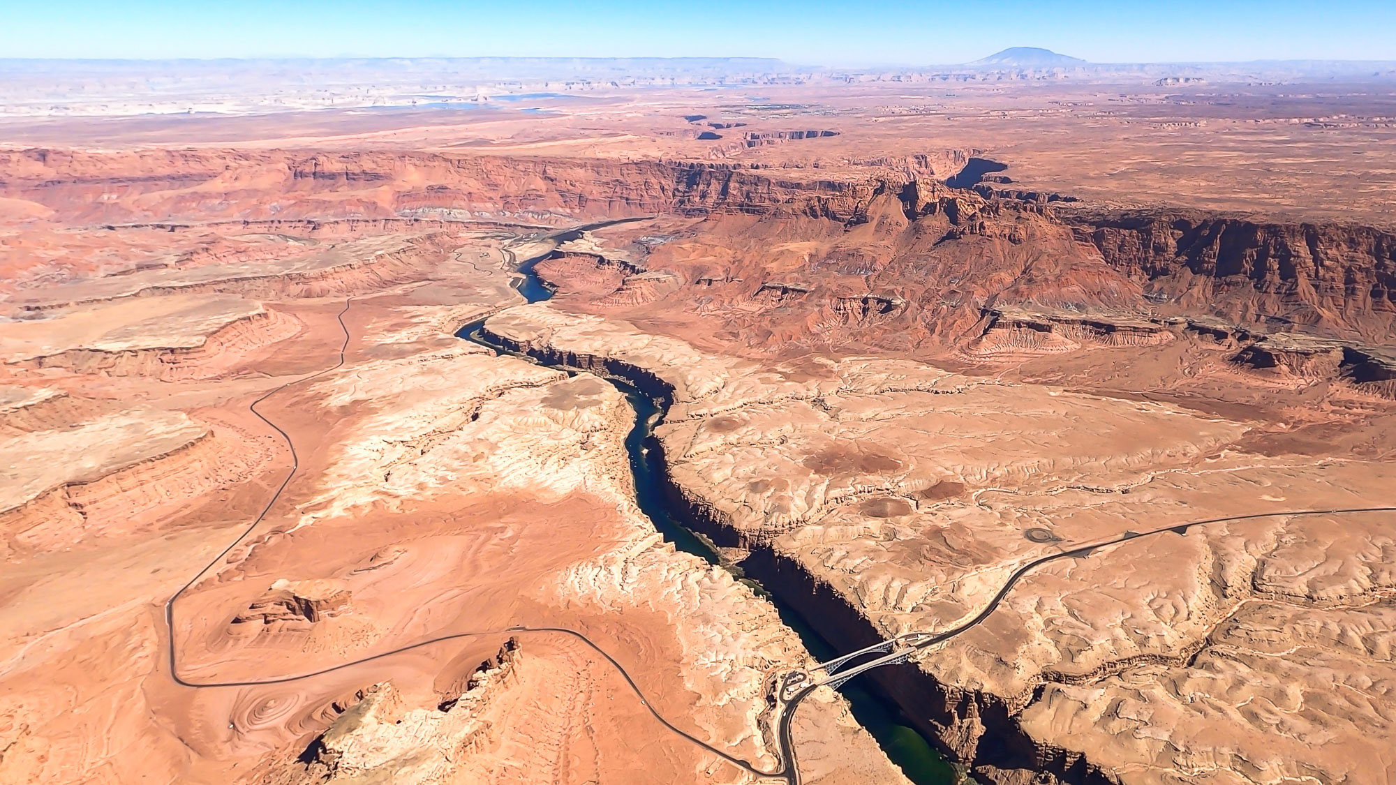
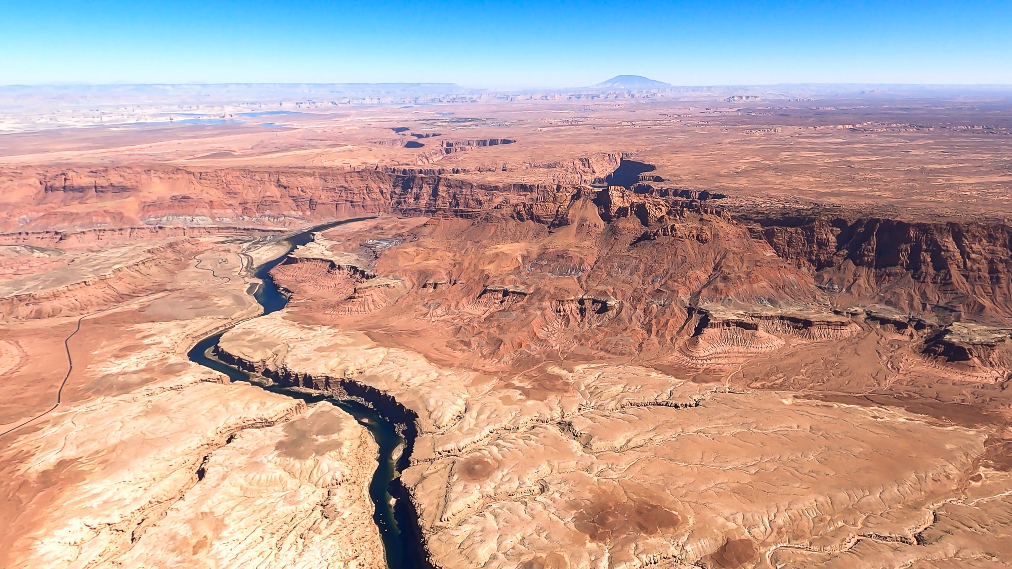
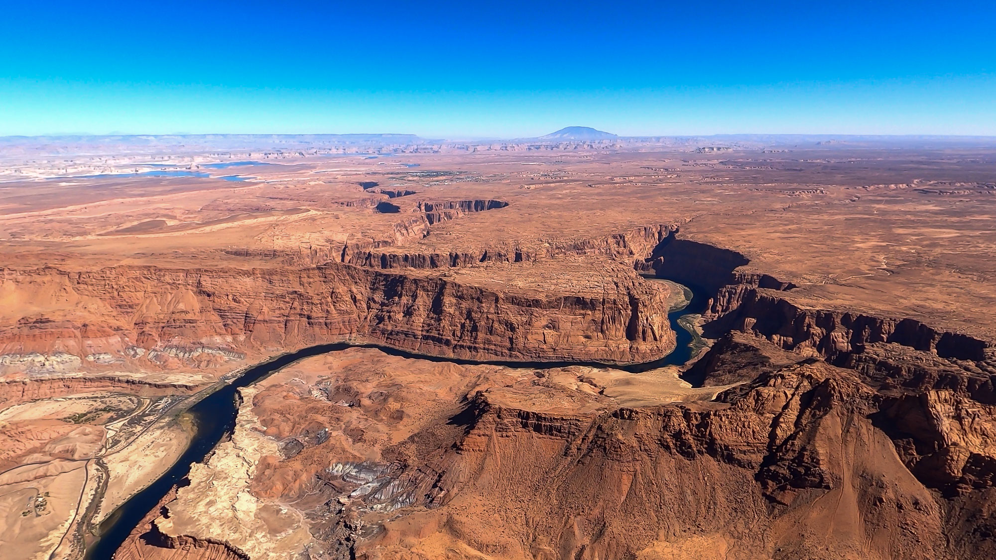
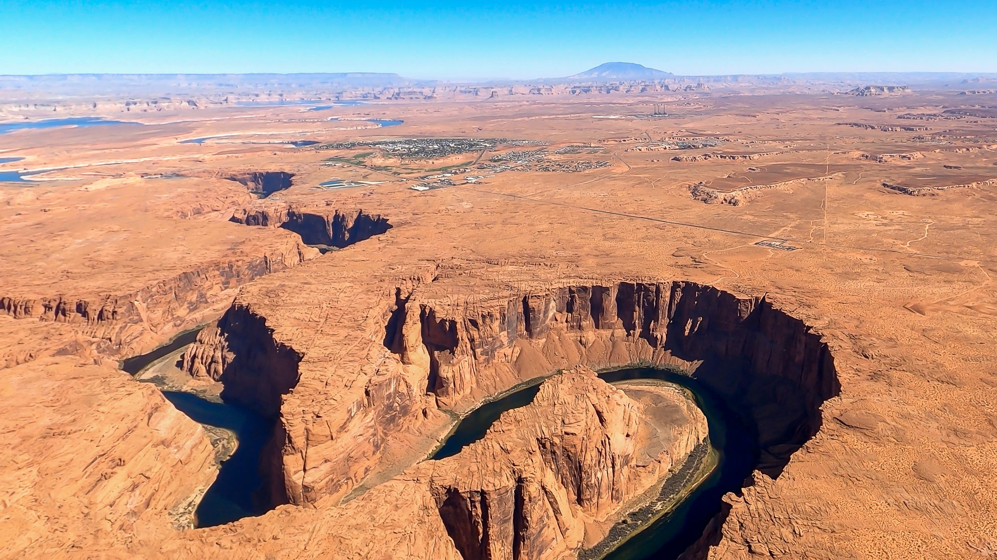
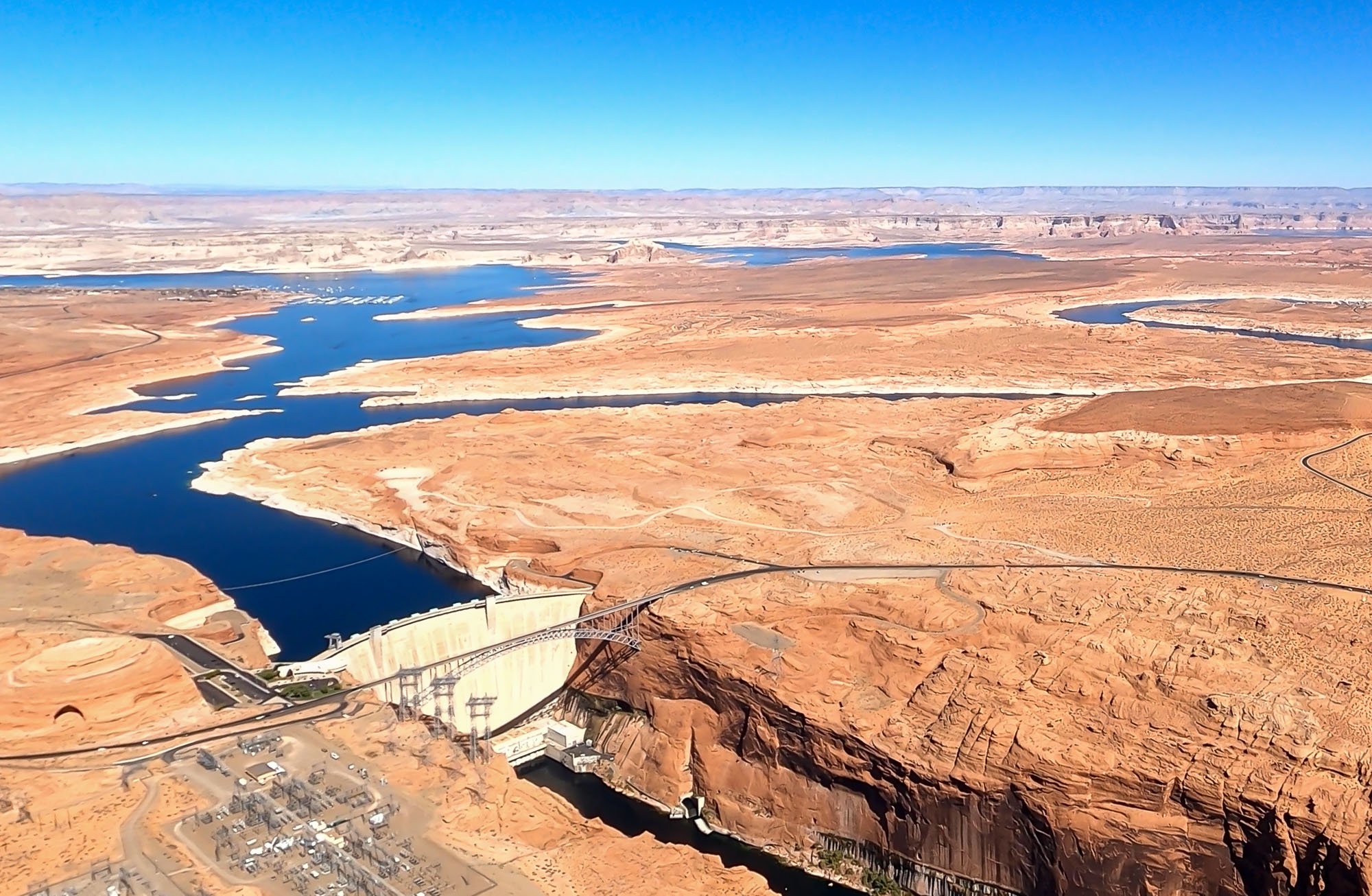
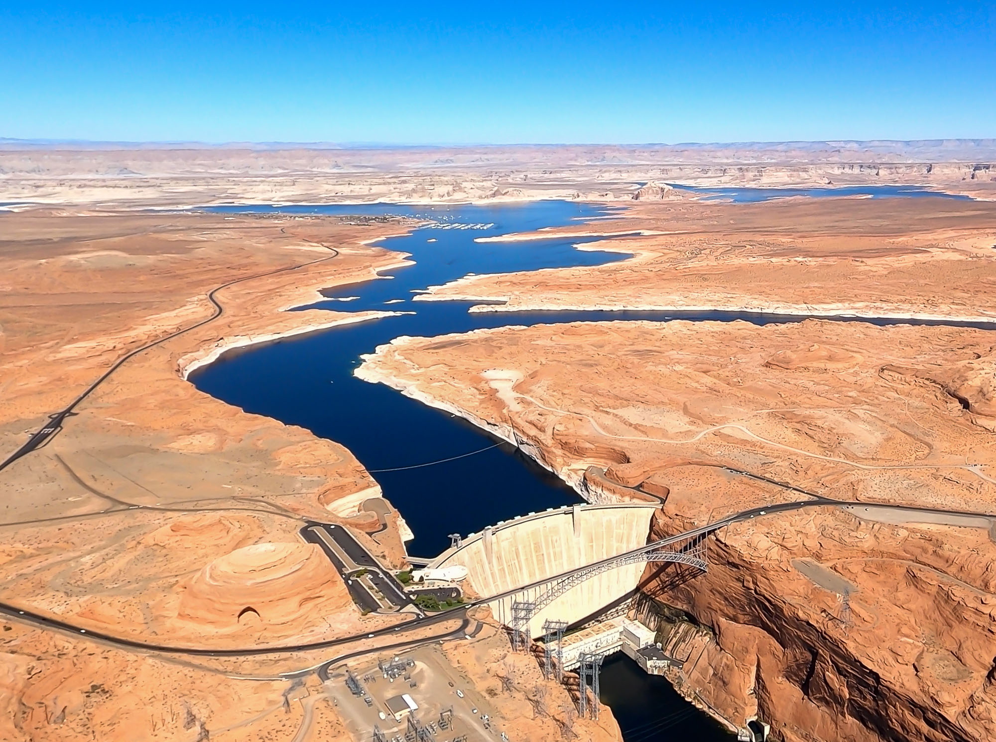
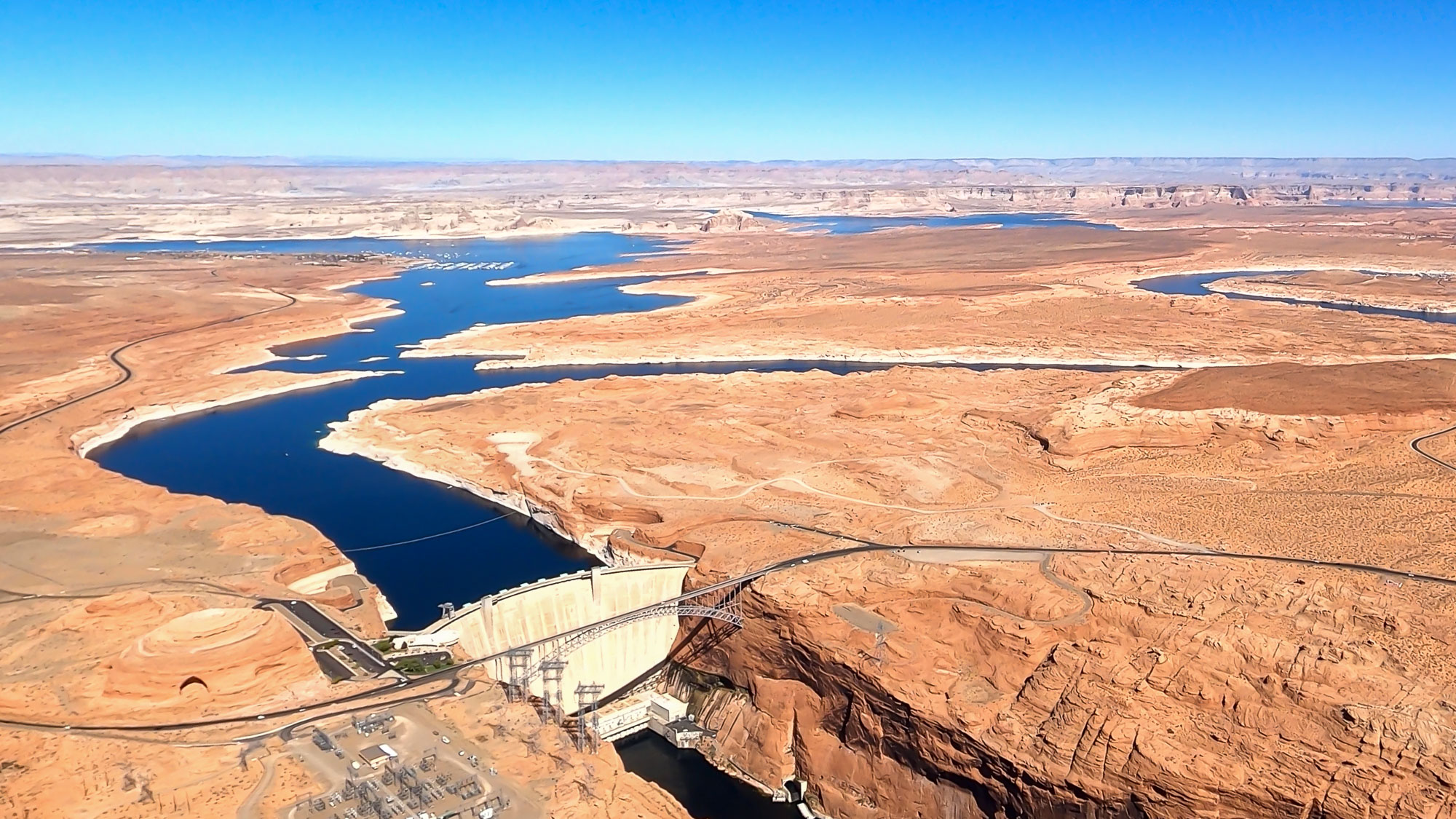
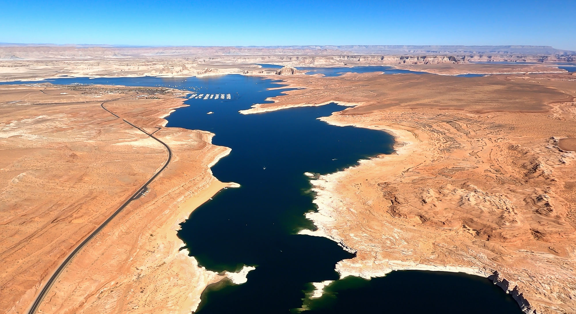
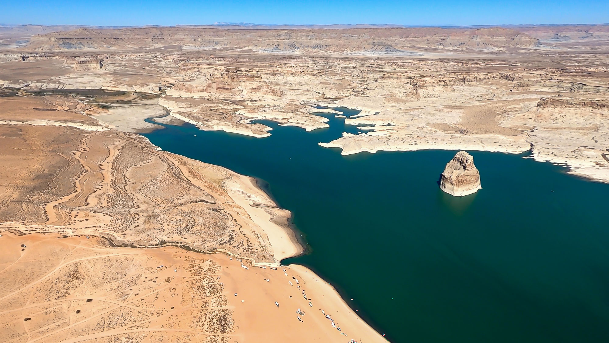
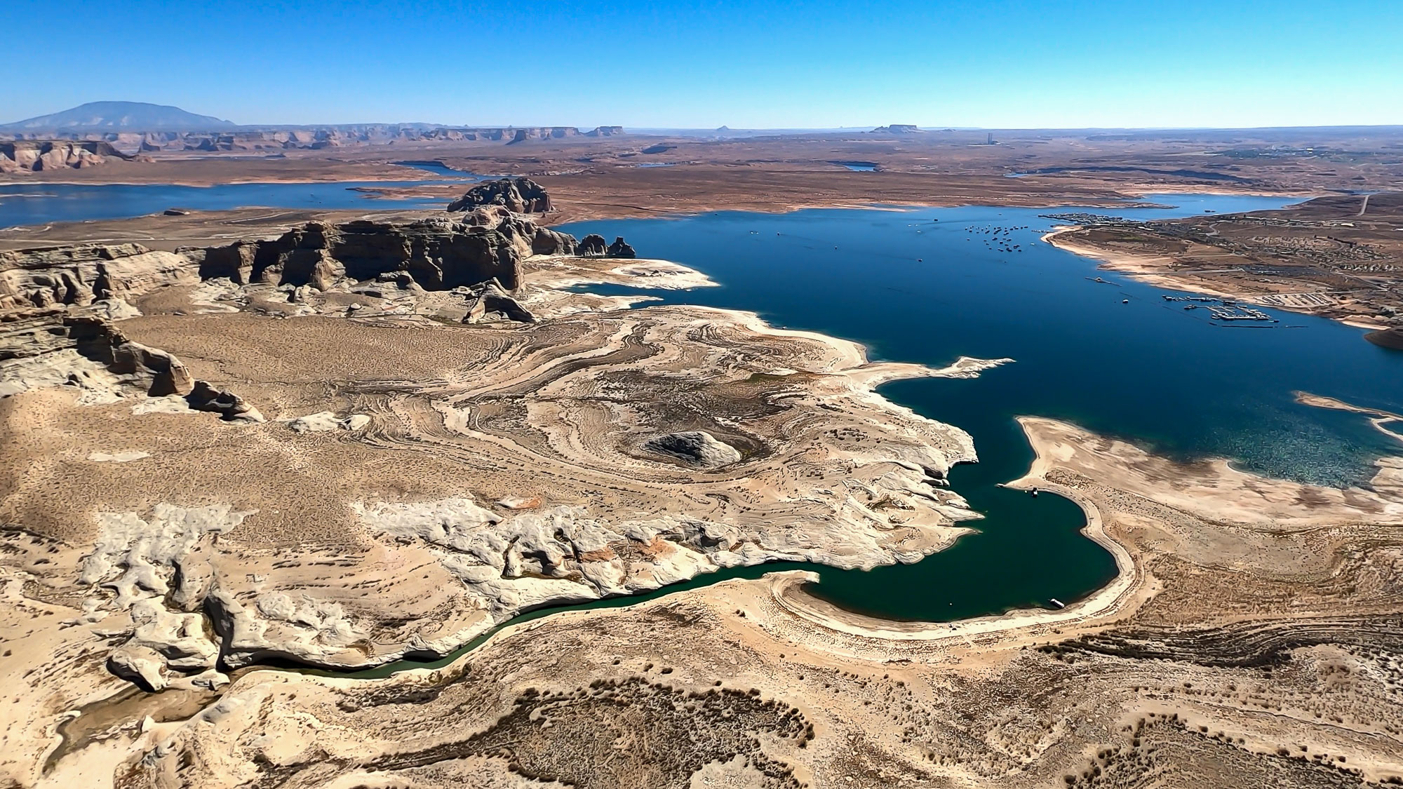
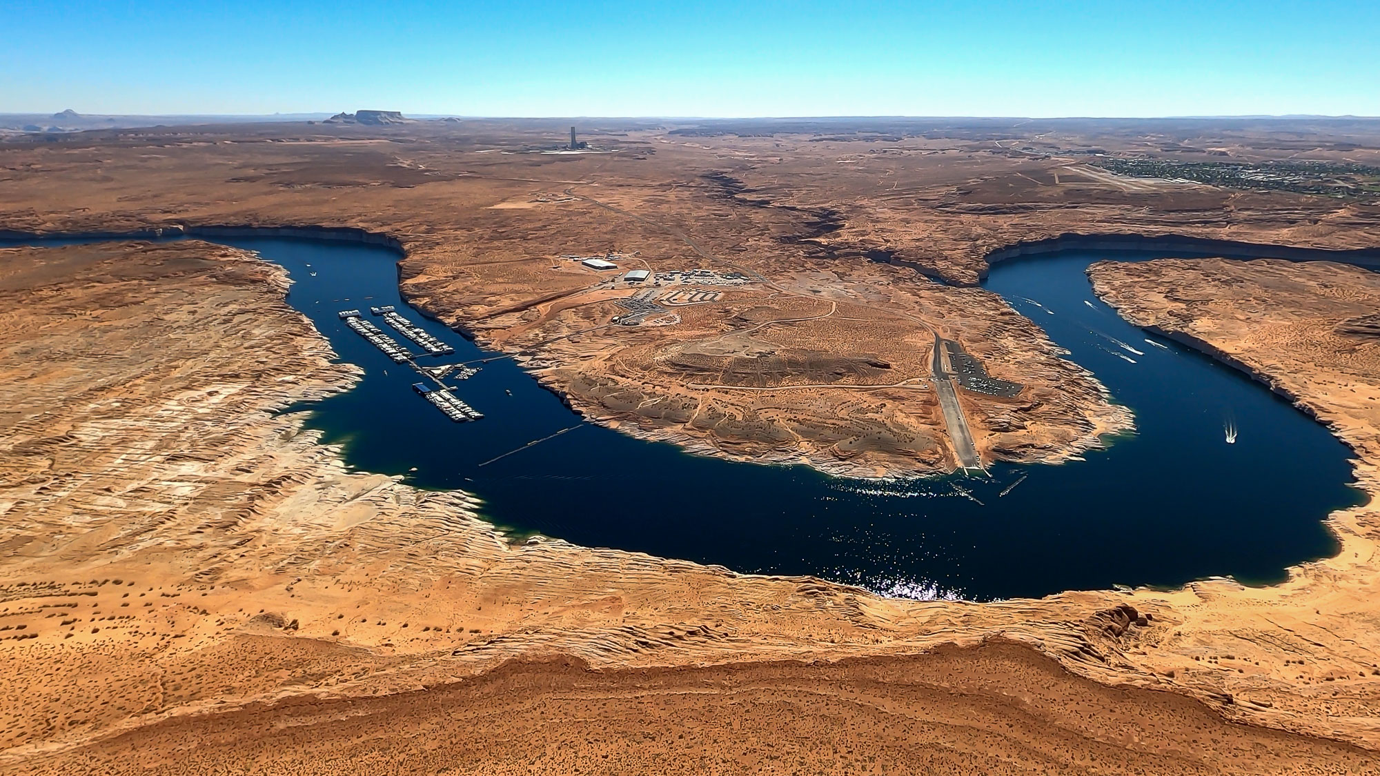
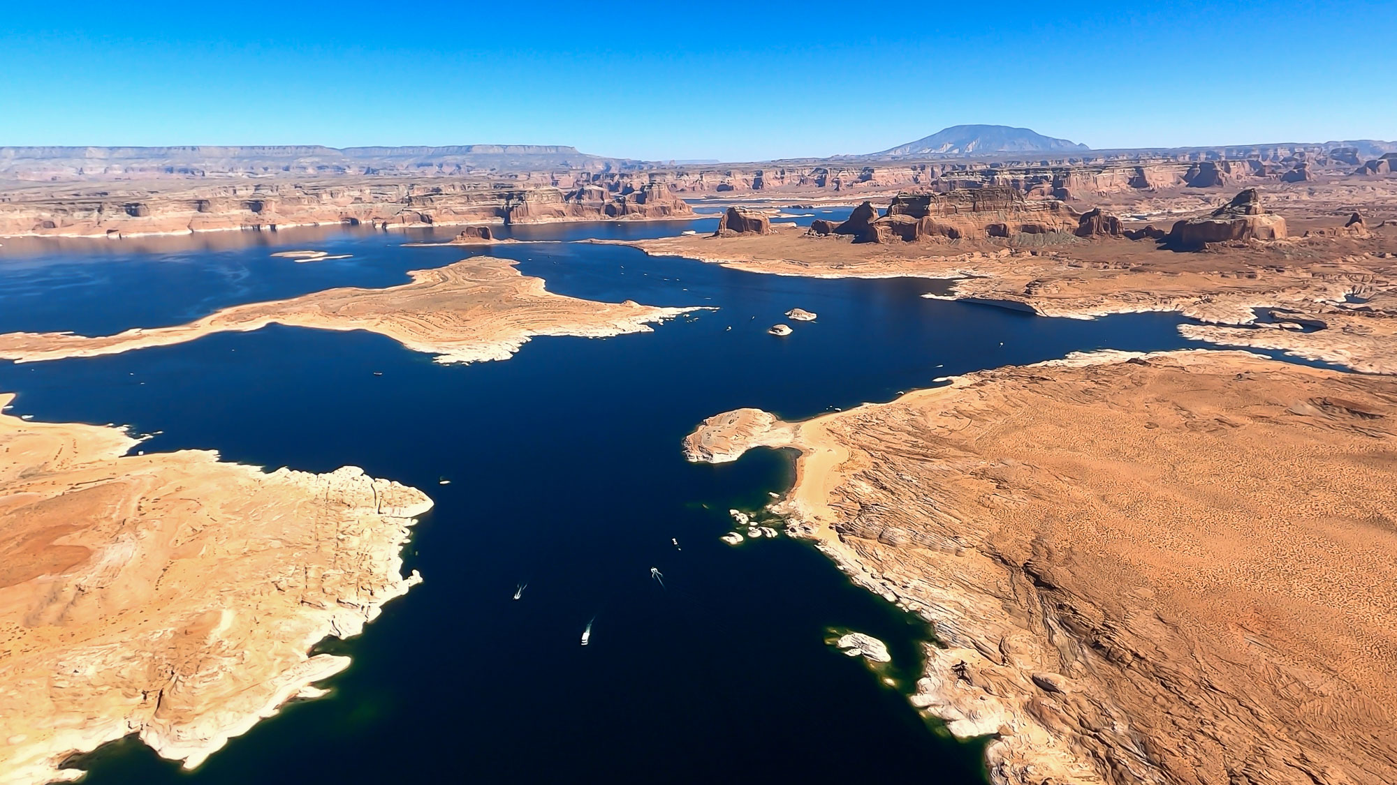
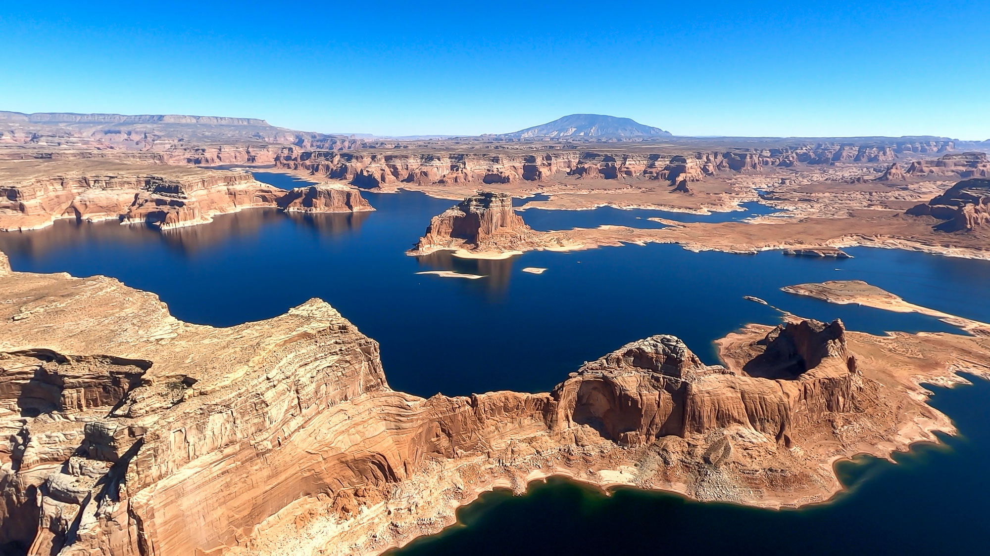
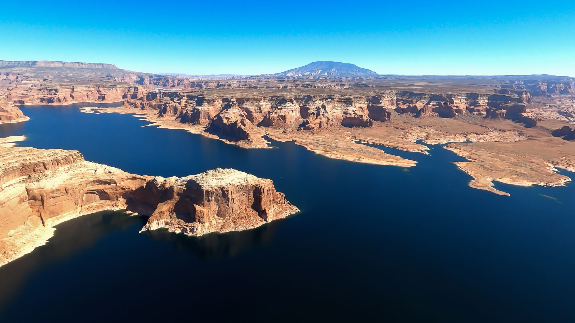
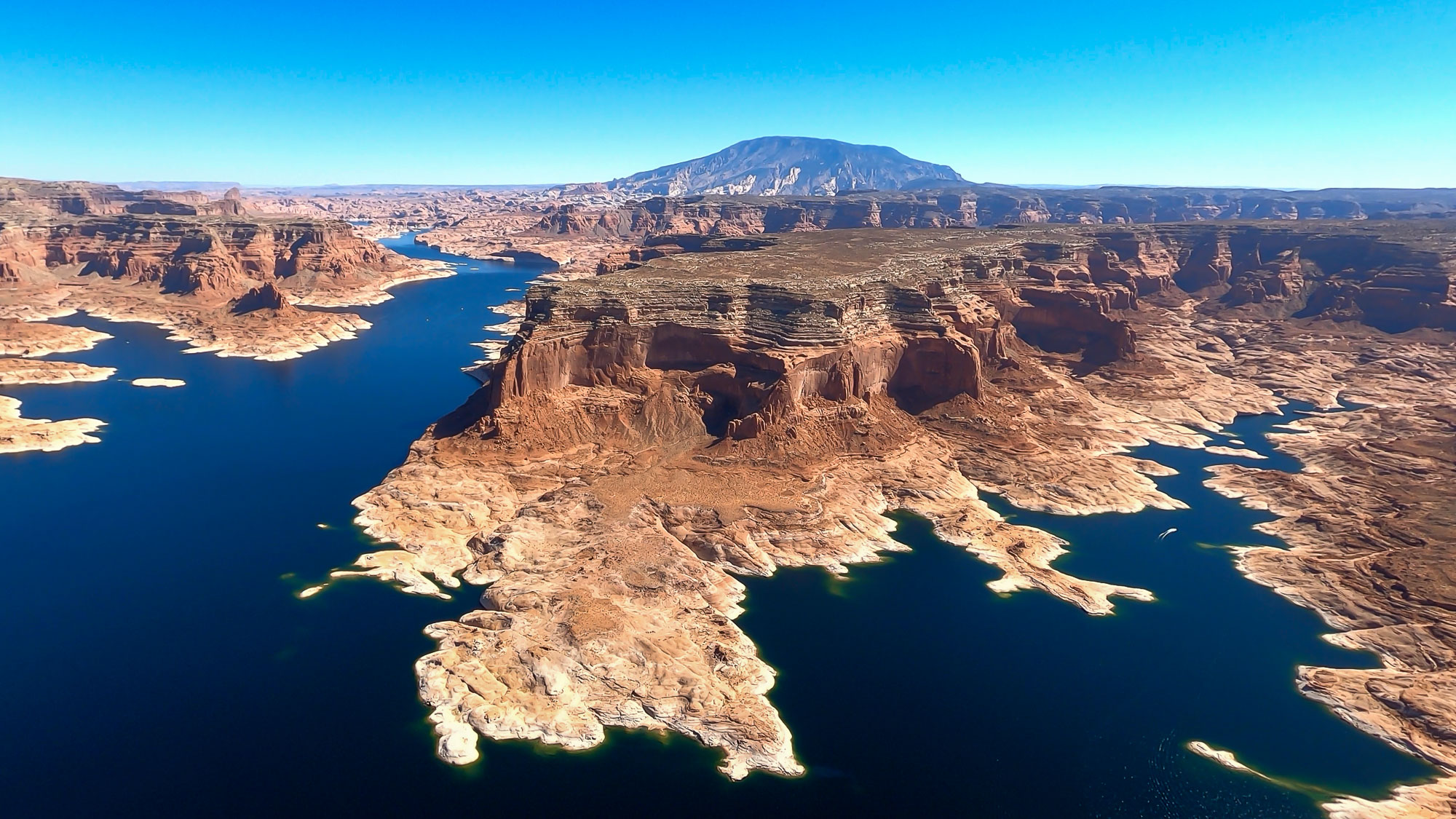
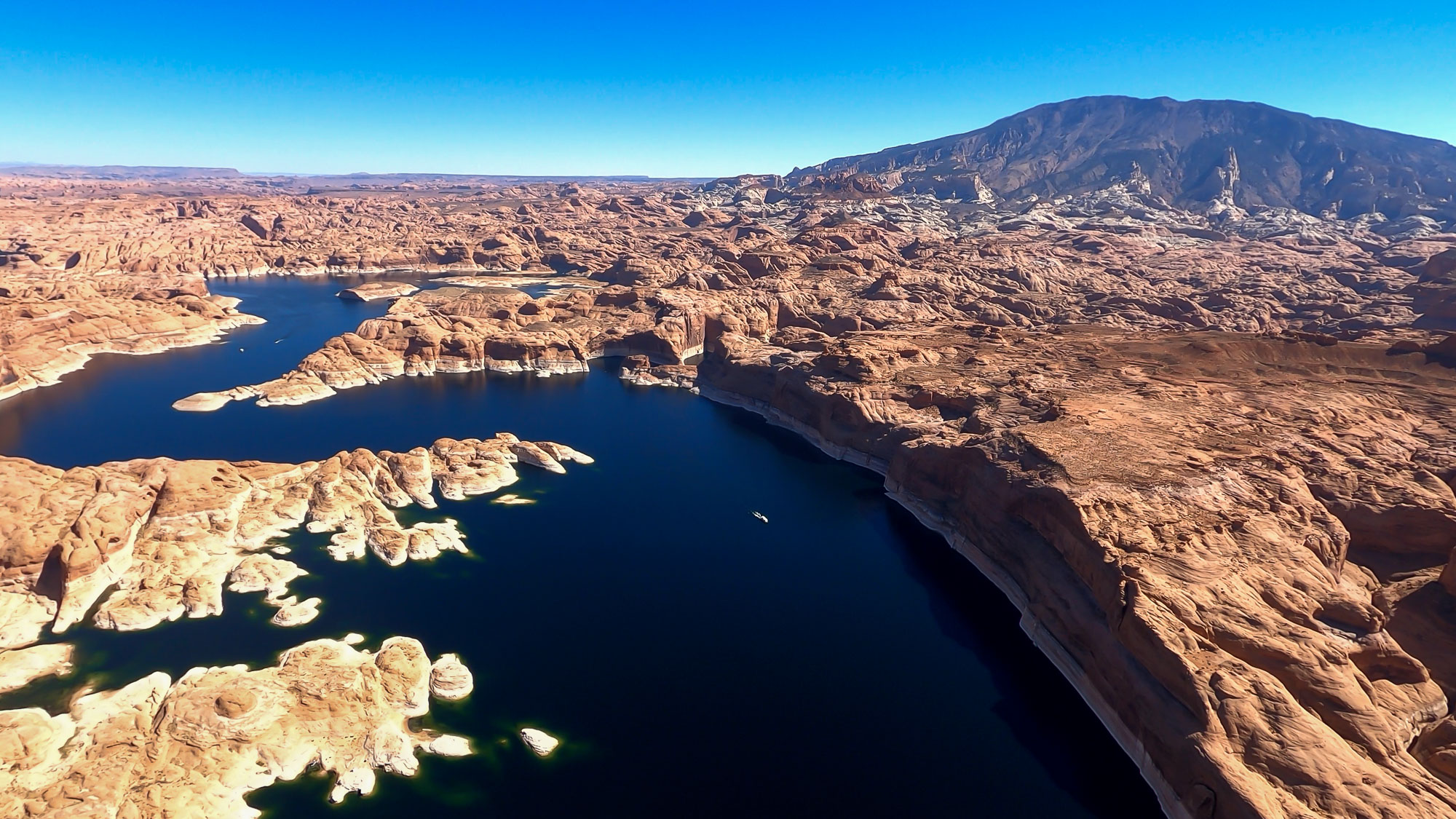
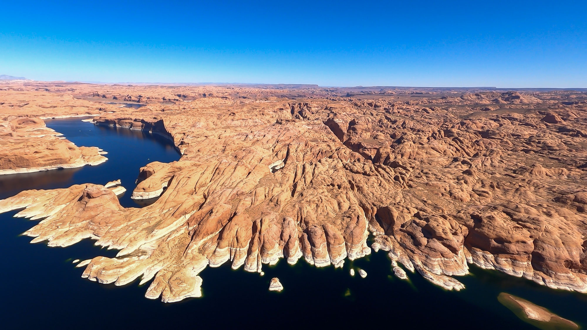
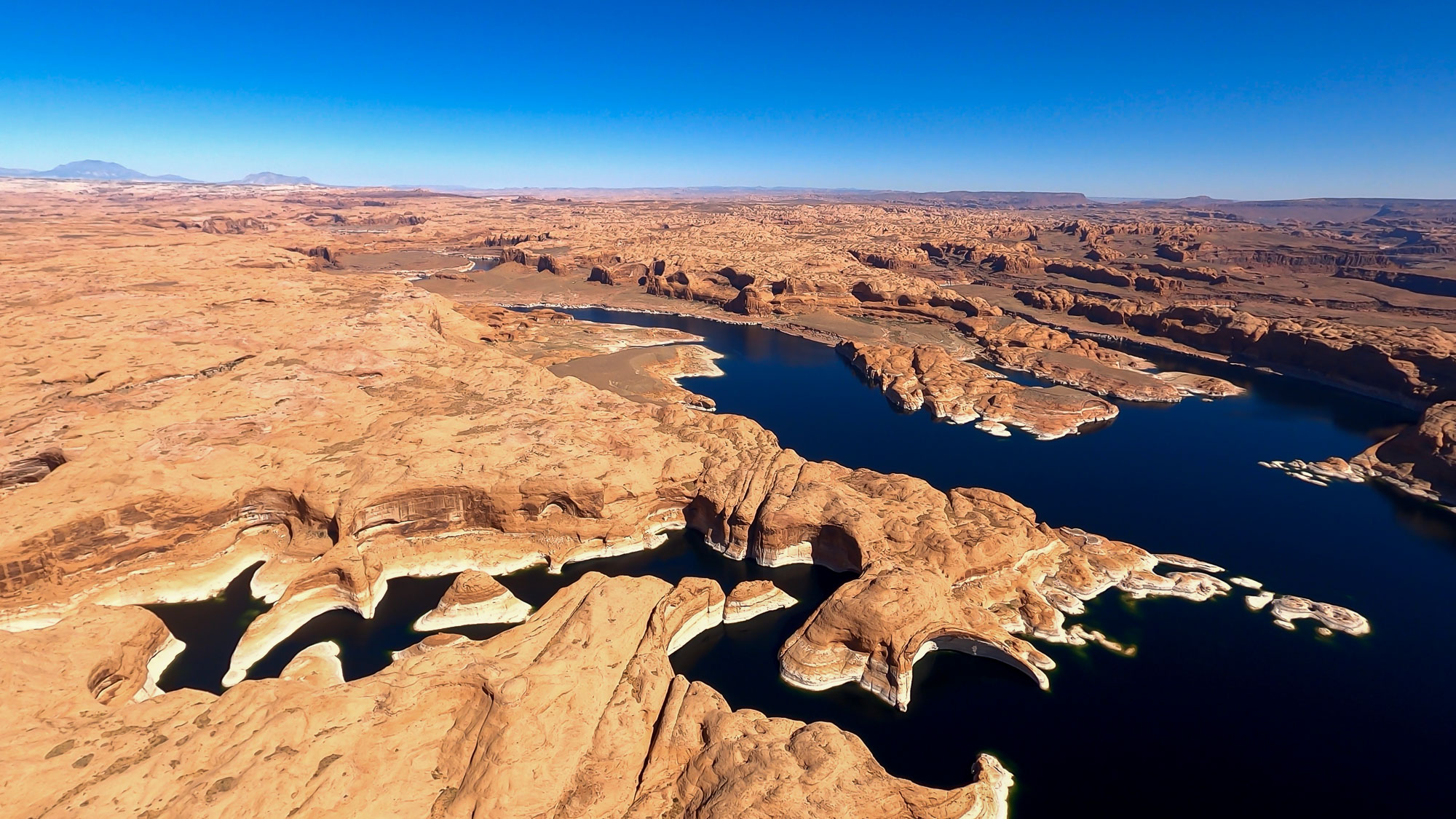
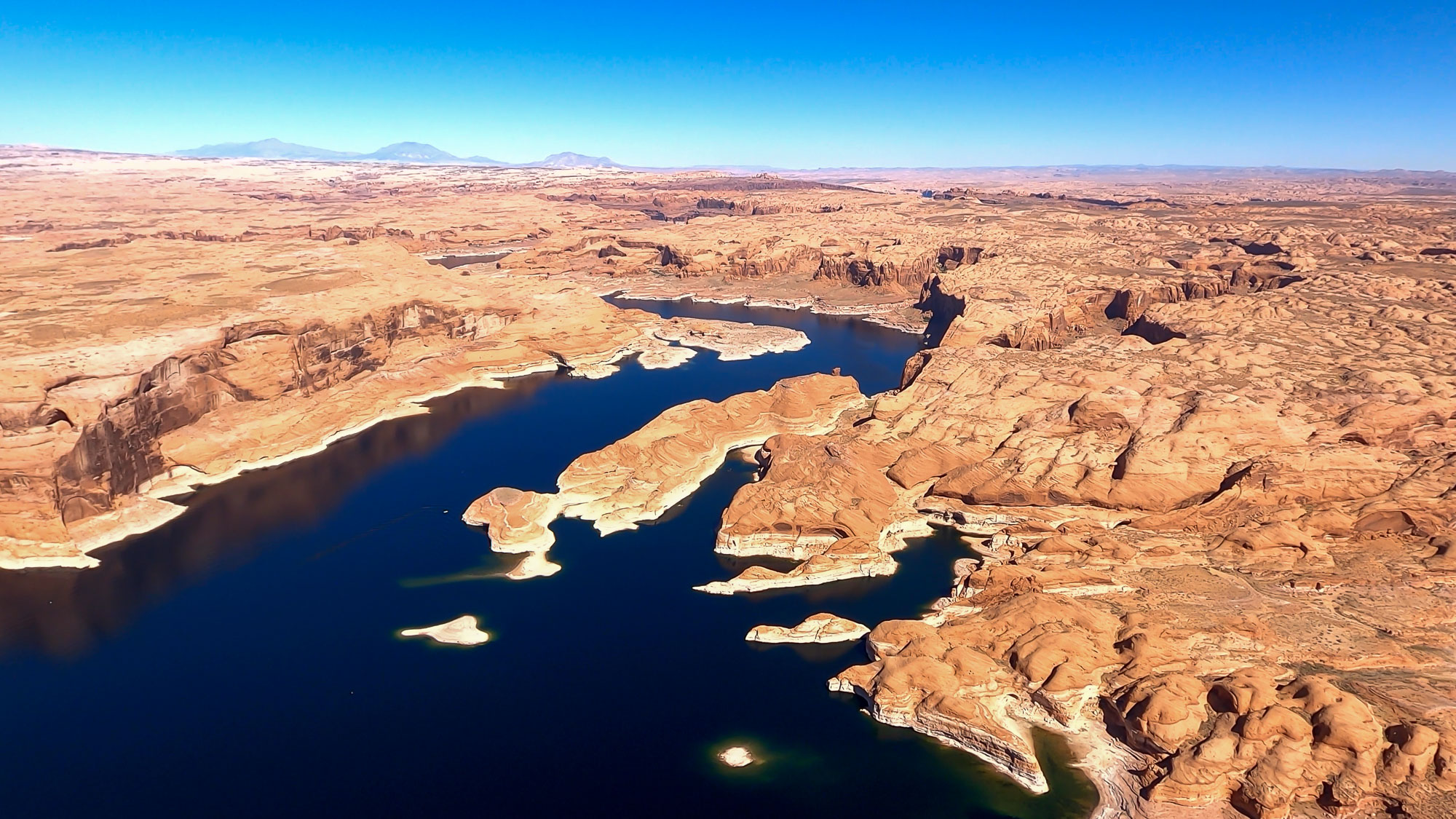
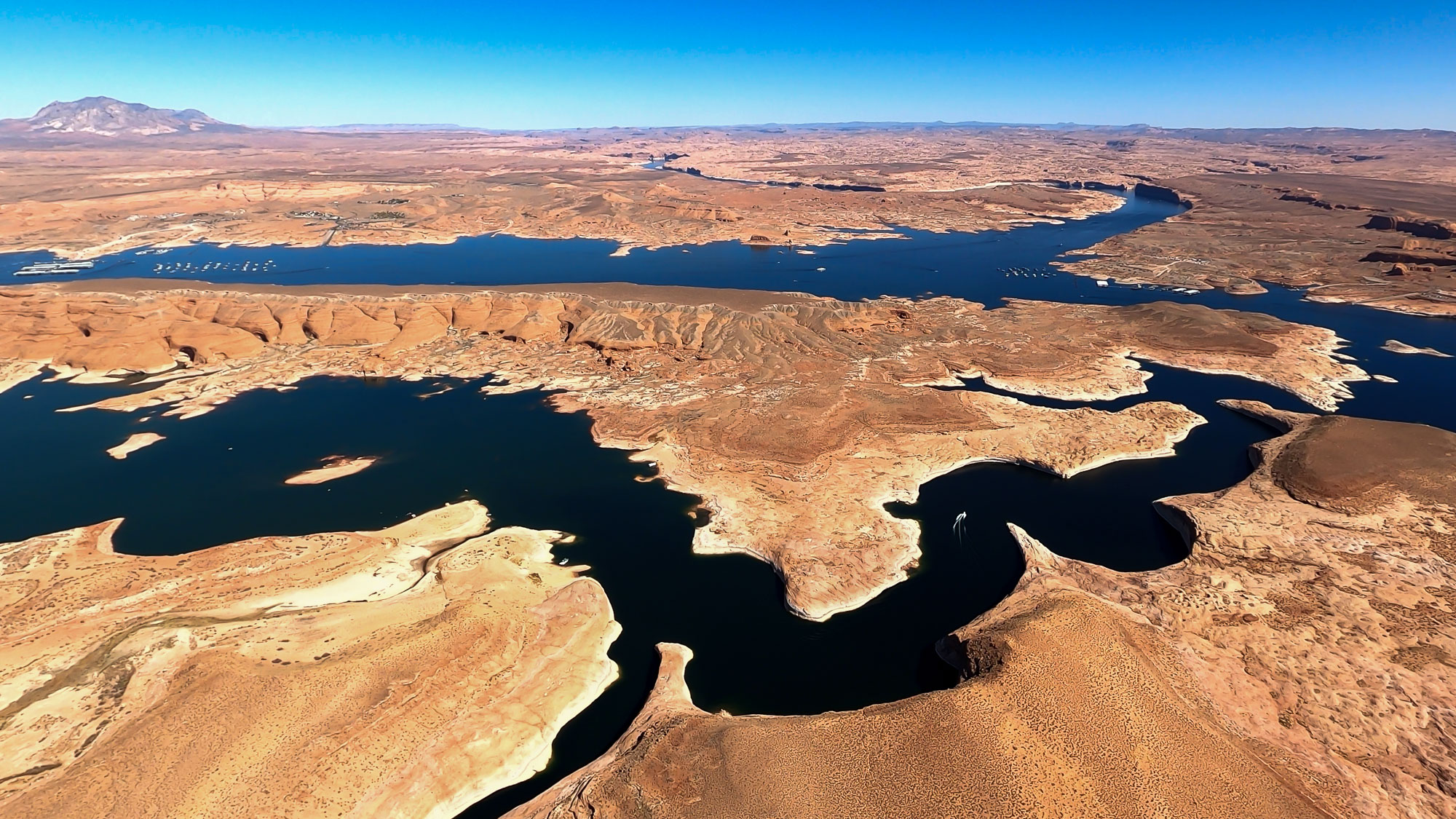
This page features images and footage shot with a GoPro camera during a Lighthawk flight above the Colorado River and Lake Powell in Utah and Arizona.
The flight included views of the confluence of the Colorado River and Green River in Canyonlands National Park, Lake Powell in Glen Canyon National Recreation Area, Glen Canyon Dam, Horseshoe Bend, Marble Canyon, Navajo Bridge and Lees Ferry.
The footage was captured using a GoPro Hero 8 and the still images are frames exported from the video.
| Date | October 12, 2020 |
| Locations | Colorado River, Green River, Canyonlands National Park, Lake Powell, Glen Canyon National Recreation Area, Glen Canyon Dam, Horseshoe Bend, Lees Ferry, Marble Canyon, Navajo Bridge. |
| Photographer | LightHawk volunteer pilot Ross Rice |
| Organization | The Water Desk and Lighthawk |
| Rights | Free to reuse under Creative Commons license, with credit to “waterdesk.org / lighthawk.org” |
Selected images from the gallery
Click to enlarge


To use these images
Please read and consent to the terms and license below for access to the download page.
The Water Desk’s photo and video resources are part of our efforts to aid and enrich news coverage of Western water issues. Our imagery is shot by professional photojournalists and is available for free reuse under a Creative Commons noncommercial license.
To help us continue to offer this free material, we ask that you please:
To help us continue to offer this free material, we ask that you please:
- Credit the original photographer and the Water Desk as the source
- Email us a link to the published story at waterdesk@colorado.edu
- Consider sending The Water Desk your ideas for future content that we could add to the library
- Keep supporting professional photojournalists by hiring them for assignments
All of the content in our multimedia library is available for free download and reuse under a Creative Commons license.


