
Participants in a 12-year process to establish protections for a stretch of the upper Colorado River are calling the finished product — which amounts to a workaround of a Wild and Scenic River designation — a success.
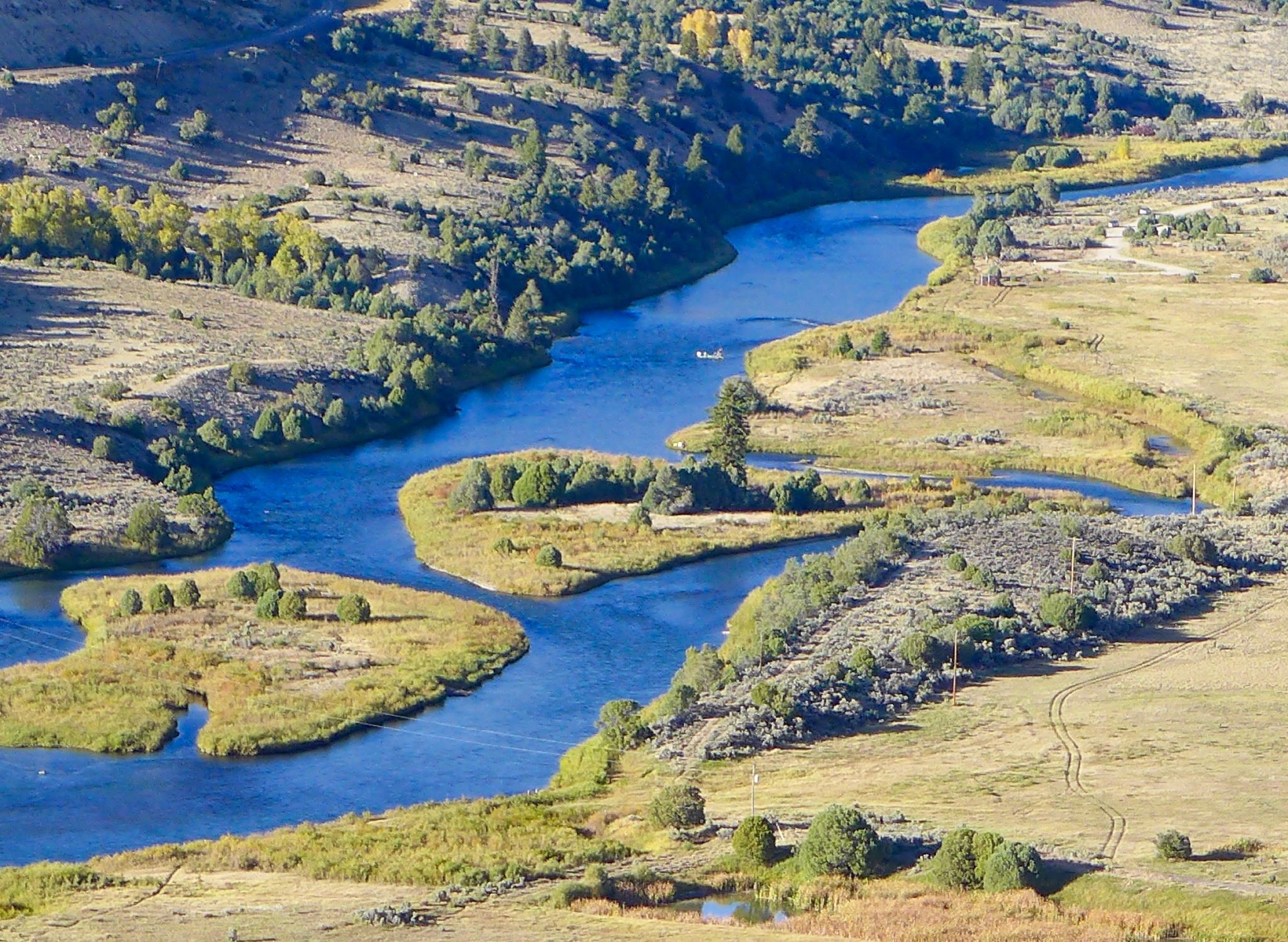
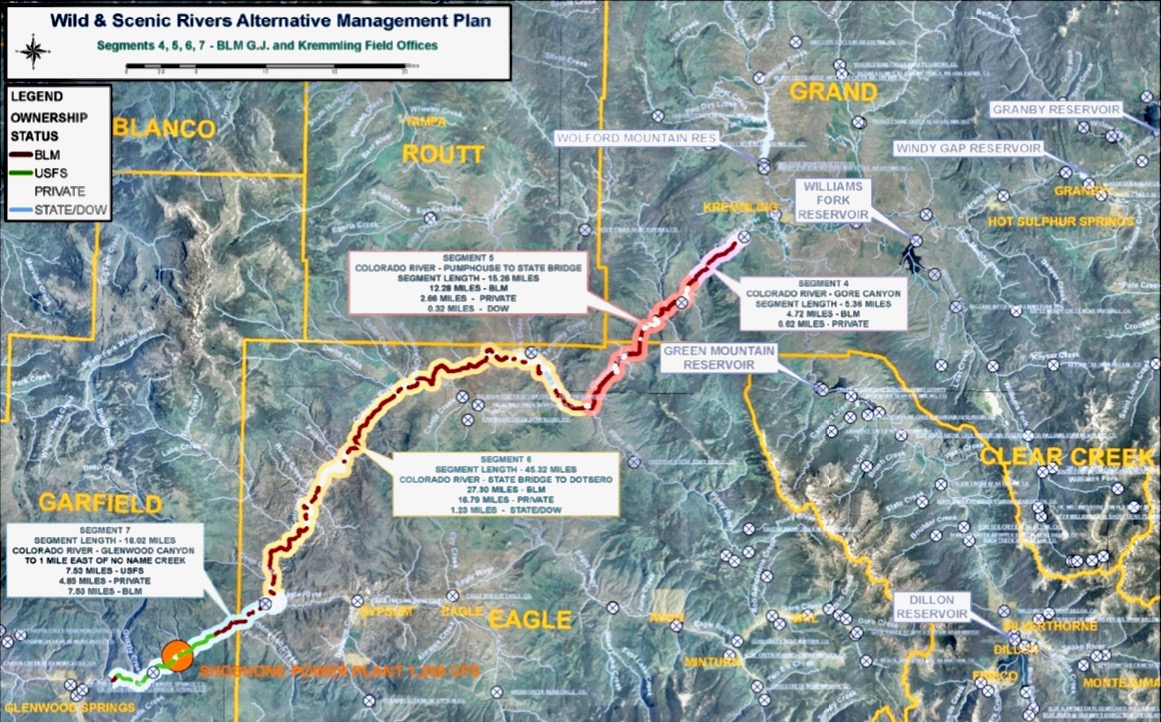
Last month, the Bureau of Land Management and the U.S. Forest Service formally approved the “Amended and Restated Upper Colorado River Wild and Scenic Stakeholder Group Management Plan.” The plan lays out a blueprint for protecting the “outstandingly remarkable values,” or ORVs, of the Colorado River from Kremmling to Glenwood Springs, with an emphasis on recreational floatboating and fishing.
The ORVs must either be a unique, rare or exemplary feature located on the river or shoreline; contribute to the functioning of the river ecosystem; or owe their existence to the presence of the river. The plan seeks to balance these ORVs with water development and use by Front Range water providers and Western Slope water users.
To ensure protection of the ORVs, the plan includes voluntary cooperative measures that the participants could take, such as the strategic timing of reservoir releases, enhancing spring peak flows and agreements with water users to acquire water rights, which would be used to preserve the natural environment.
The plan includes a provision that addresses two big uncertainties that would lead to more transmountain diversions from the Colorado River: Denver Water’s Moffat Collection System Project and the Northern Colorado Water Conservancy District’s Windy Gap Firming Project. The “poison pill” provision would allow any stakeholder to withdraw support for the plan if those projects — which are still in the permitting phase and mired in litigation, and which would provide a combined 48,000 acre-feet of water for the Front Range — negatively impact streamflows, especially for boating.
Six interest groups — conservation/environment/fishing; local government; recreational floatboating; state interests; Front Range water users; and Western Slope water users — have been working on crafting the plan since 2008. The Eagle River Watershed Council has been involved as a stakeholder since 2013, said executive director Holly Loff.
“It’s really exciting, and what a huge collaborative effort this has been, and I can’t really think of other situations that have been larger in scope and larger in the number of collaborators and all with very diverse interests — and we found a way to make it work,” Loff said. “It’s an amazing feat, really.”
Option to W&S
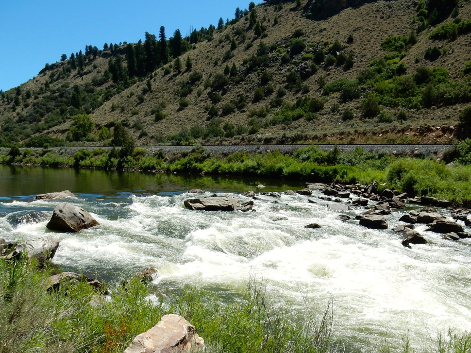
The alternative management planning process came about after the BLM in 2007 found that 54 miles of the upper Colorado River from Gore Canyon to just east of No Name Creek in Glenwood Canyon possessed enough ORVs that they were eligible for a federal Wild & Scenic River designation. Created by an act of Congress in 1968, the National Wild and Scenic Rivers System seeks to preserve rivers with outstandingly remarkable scenic, recreational, geologic, fish and wildlife, historic and cultural values in a free-flowing condition.
There are two ways that a river can be designated as Wild & Scenic: The secretary of the Interior can designate a river if a state governor requests it or Congress can designate a river, usually after a land-use agency conducts a study to see whether it’s eligible.
Designation as Wild & Scenic brings protection from development. For example, new dams cannot be constructed on the designated stretch and federal water-development projects that might negatively affect the river are not allowed.
But the possibility of federal government involvement and potential restrictions on water development on the upper Colorado doesn’t sit well with some groups. Municipal water providers such as Denver Water and Northern Water divert water from the Colorado’s headwaters to Front Range cities.
“A lot of members of the water community find the idea of a Wild & Scenic designation kind of frightening and prohibitive,” said Colorado Water Conservation Board Stream and Lake Protection Section Chief Linda Bassi. “It would prevent potentially new reservoirs along a Wild & Scenic river (and) certain types of structures, and that is why the water community has typically been a little leery of Wild & Scenic designation.”
In 2009, the Colorado General Assembly established the Wild and Scenic Rivers Fund. Despite what its name suggests, the fund is not dedicated to establishing Wild & Scenic designations of rivers, but to avoiding the federal designation through “work with stakeholders within the state of Colorado to develop protection of river-dependent resources as an alternative to wild and scenic river designation.”
The Upper Colorado River Wild and Scenic Stakeholder Group has been the recipient of money from the state fund, which is allocated up to $400,000 a year and administered by the Colorado Water Conservation Board. According to a CWCB memo from May, when staff reviews requests for these funds, they evaluate whether projects will promote collaboration among traditional consumptive water interests, including irrigation, and non-consumptive interests, including recreation and the environment, and whether the project will still enable Colorado to fully use water it is allocated.
“If we tried to go through designation, we don’t know if it would have ever made it past the state of Colorado,” said Kay Hopkins, outdoor recreation planner for the White River National Forest. “The state would have had to be supportive of our determination.”
Despite its renowned river rafting, fishing and scenic beauty, which contribute to the recreation-based economy of many Western Slope communities, Colorado has just 76 miles of one river — the Cache La Poudre — designated as Wild & Scenic. That’s less than one-tenth of 1% of the state’s 107,403 river miles.
Instead of a federal designation, the CWCB considers its instream-flow program to be a primary tool in the effort to protect ORVs. Instream flows are in-channel water rights aimed at preserving the natural environment to a reasonable degree. As a part of the alternative management plan process, the CWCB secured three instream-flow rights that date to 2011 on the upper Colorado River — from the confluence of the Blue River to Piney River; from Piney River to Cabin Creek; and from Cabin Creek to the confluence with the Eagle River.
Bassi, who runs the state’s instream-flow program, has participated in the state interests group since planning began in 2008.
“Those flow rates are designed primarily to meet the needs of fish,” Bassi said. “But they will help to maintain flows that provide for some levels of boating experiences.”
Pragmatic discussions
The Forest Service and BLM approval of the alternative management plan means that the stretch of the upper Colorado River has been deferred from Wild & Scenic eligibility. But if the plan fails or any of the stakeholders enact the “poison pill” provision, the river could revert to being considered for eligibility, meaning it would once again be up for federal scrutiny, something some stakeholders want to avoid.
“That is the hammer behind the long-term commitments,” said Rob Buirgy, coordinator for the stakeholder group.
Eagle County Commissioner and Colorado River Water Conservation District Board member Kathy Chandler-Henry believes the strength of the alternative management plan is the input of its many participants.
“My first thought was the alternative management plan must be a lesser system of protection, but in my mind, it has not turned out to be that way because there are so many players at the table,” she said. “It doesn’t seem like a lesser process. It seems like a more publicly engaged process.”
Loff was more pragmatic.
“I don’t think (the alternative management plan) is better, but I don’t know that this group ever would have agreed to a standard Wild & Scenic designation. I don’t think that would have happened at all,” she said. “I think it’s better that we have this.”
Aspen Journalism is collaborating with the Aspen Times and other Swift Communications newspapers on coverage of water and rivers. This story was published online and printed in the Aspen Times on July 11, 2020 and published by Aspen Journalism on July 11, 2020.
The Water Desk’s mission is to increase the volume, depth and power of journalism connected to Western water issues. We’re an initiative of the Center for Environmental Journalism at the University of Colorado Boulder. The Water Desk launched in April 2019 with support from the Walton Family Foundation. We maintain a strict editorial firewall between our funders and our journalism. The Water Desk is seeking additional funding to build and sustain the initiative. Click here to donate.


