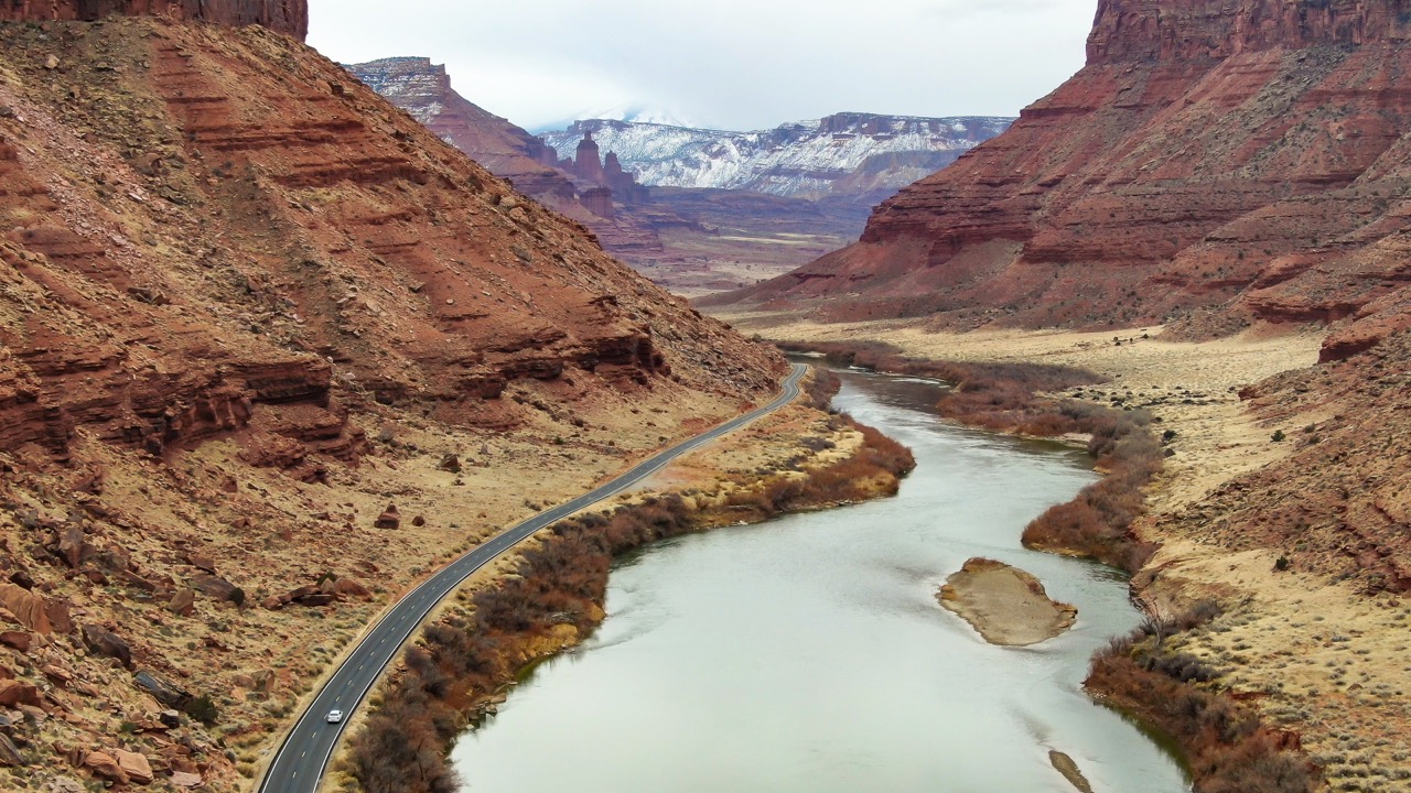
Drones can provide a fascinating perspective on the world, revealing views that are impossible to see from the ground.
My new website, dronereporters.org, provides practical advice for using drones for photography.
For journalists and others, drones can engage and educate audiences by offering helpful or unusual vantage points.
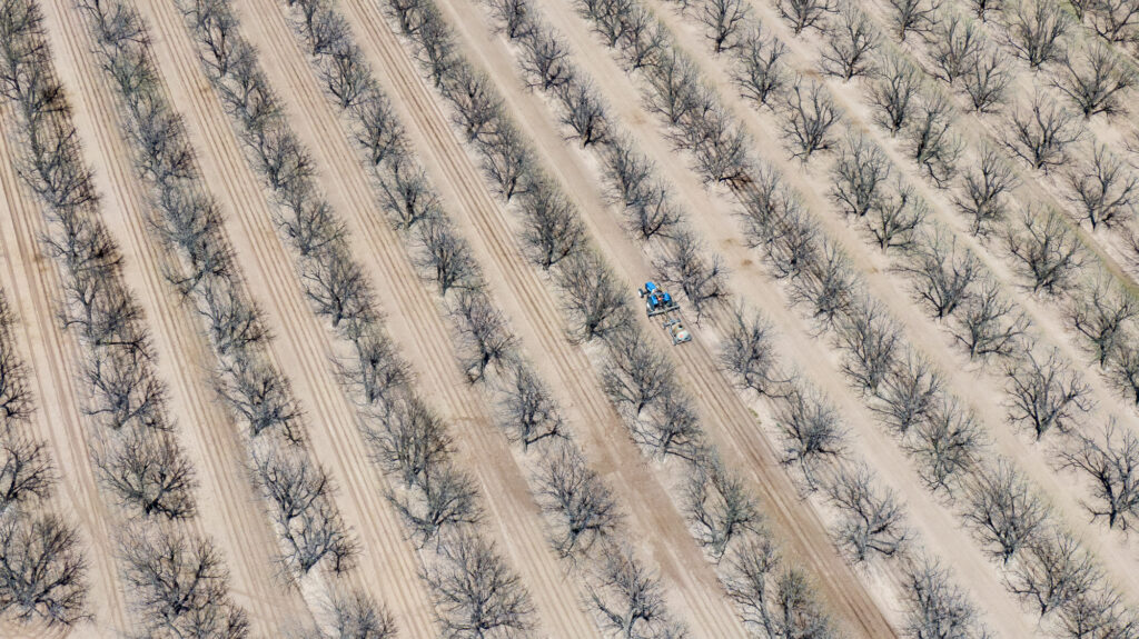
In my own specialty of Western water issues, I’ve found the drone’s-eye view invaluable for telling the story.
For the past seven years, I’ve used a drone to capture photos and videos of key water-related locations in the American Southwest as part of my work for The Water Desk. This imagery is available for free download through our multimedia library.
I created dronereporters.org to share lessons learned while flying my drone in the Four Corners states of Colorado, Utah, Arizona and New Mexico. Although my portfolio focuses on water issues, nearly all of my advice applies to any subject matter.
While the site is primarily geared toward journalists, I believe it will also be of value to anyone who flies drones.
dronereporters.org is organized around four themes:
Principles: the basics of flying a drone, such as getting certified by the FAA, finding interesting locations to photograph and operating your system in a safe, ethical manner.
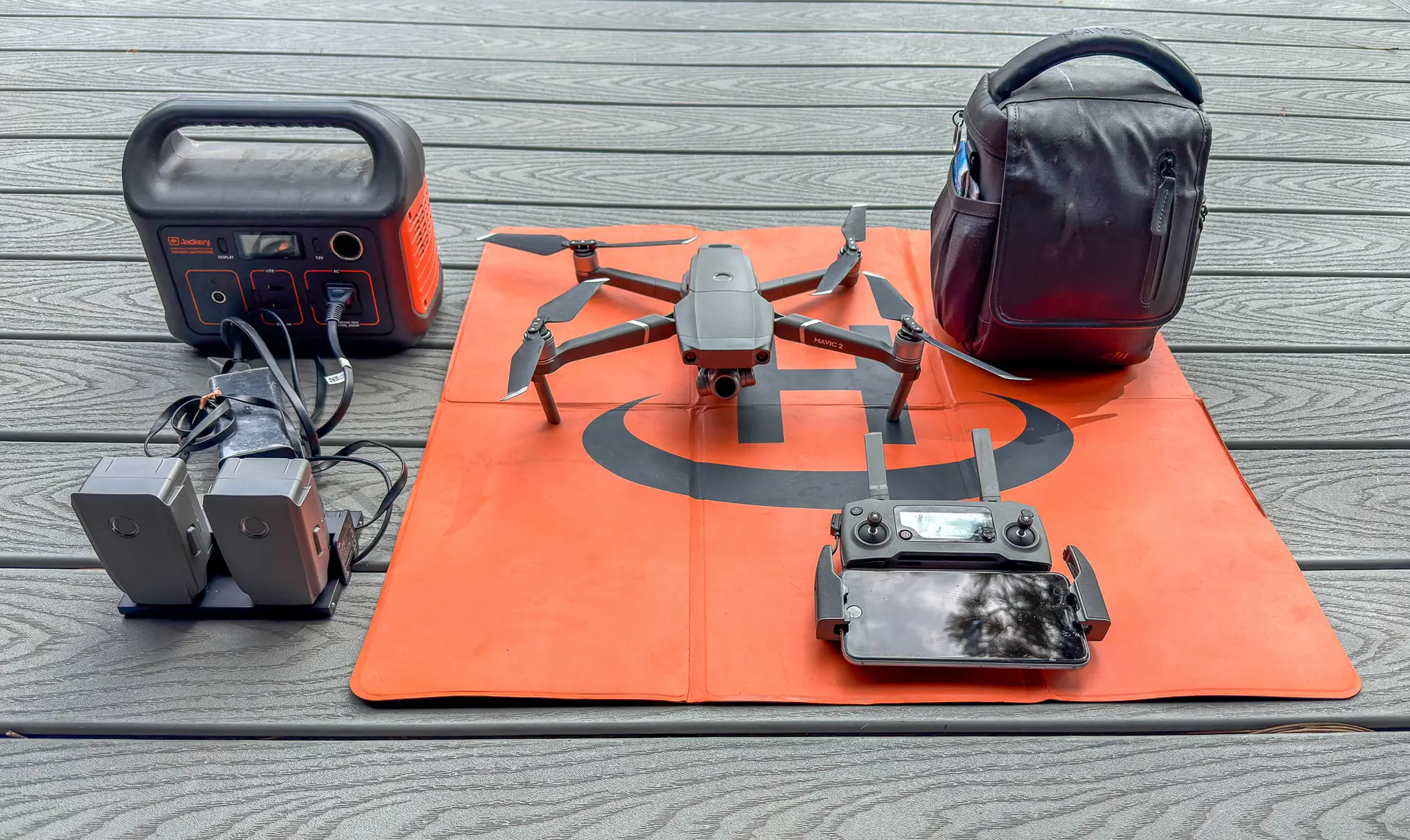
Gear essentials: a description of the equipment that I’ve been using, from the pre-flight checklist to the landing pad, plus other pieces of technology that are helpful.
Photography tips: the basic concepts of photography still apply when using a drone, but some ideas are especially important when your camera is flying.
Video tips: there are many ways to move your drone and steer the viewer’s attention, so I offer examples of useful techniques.
To see more drone (and ground-based) imagery of key water locations in the Southwest, please visit The Water Desk’s multimedia library on this site or consult our full library of high-resolution photos at waterdesk.photos.
I welcome suggestions and questions. You can email me at mitchtobin@colorado.edu