
Confession: I’m a map junkie.
My office walls are plastered with them. Some of my favorite publications are gazetteers. Given my cartographic obsession, it should be no surprise that I’ve picked maps to launch a new feature of The Water Desk: creating, aggregating and sharing data visualizations related to water issues.
We’re building a multimedia library that includes photos, videos, charts, graphics, maps and other visual content that can help tell the story of water, especially in the American West and Colorado River Basin. In addition to creating our own multimedia material and data visualizations, we’ll be pulling together public domain imagery from government agencies as well as platforms that offer content with a Creative Commons license, such as Wikipedia.
In this post, I’ve collected a variety of maps depicting the Colorado River Basin, the region that we’re initially focusing on at The Water Desk. Covering nearly a quarter-million square miles, the basin supplies water to around 40 million people and supports $1.4 trillion in annual economic output.
Click the maps below to see and download full-size versions of the images.
U.S. Bureau of Reclamation maps
The U.S. Bureau of Reclamation has created several maps of the Colorado River Basin, including this one:
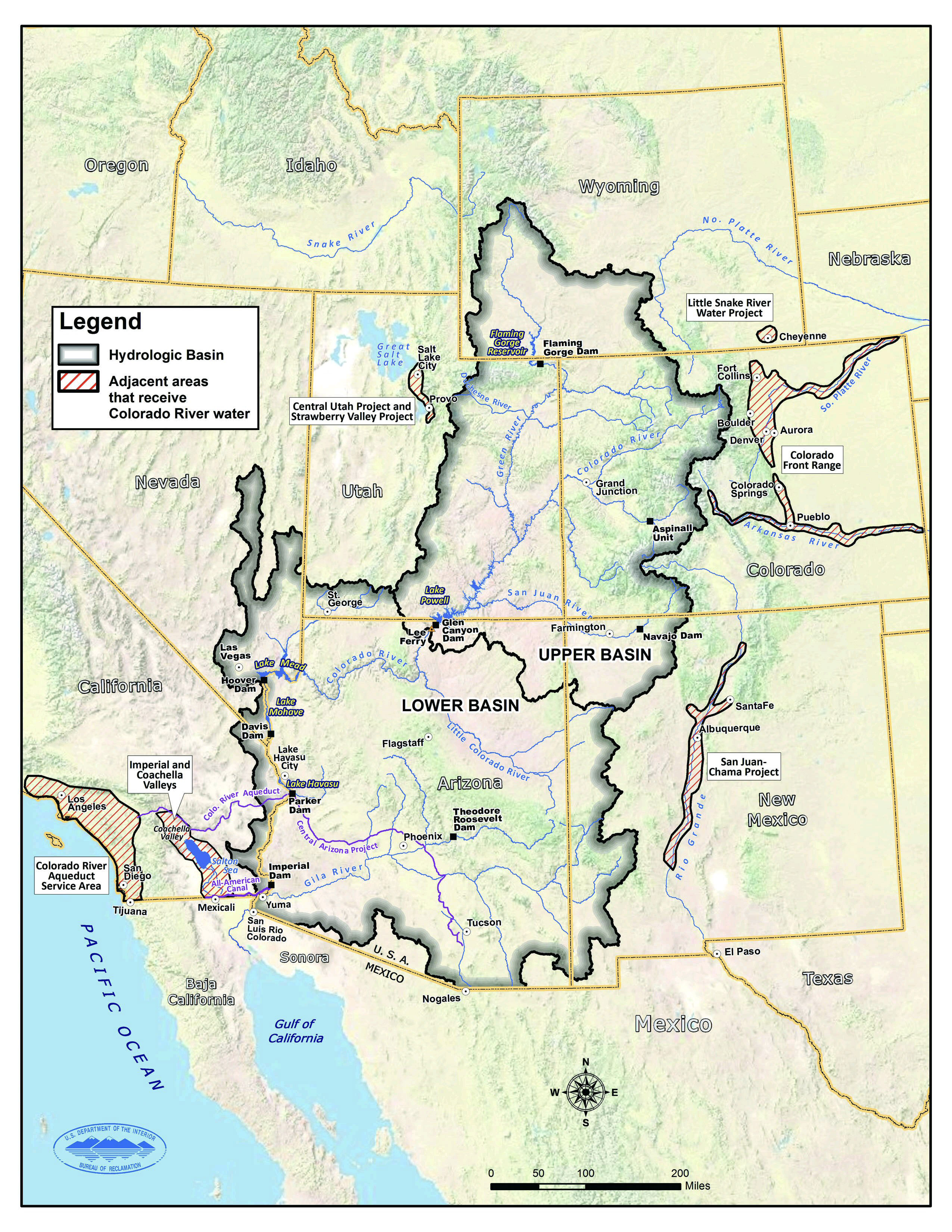
The map above not only shows the boundaries of the hydrologic basin but also adjacent areas that receive Colorado River water thanks to massive water works such as the Colorado River Aqueduct, Central Arizona Project, Central Utah Project, San Juan-Chama Project and the many transmountain diversions under Colorado’s Continental Divide.
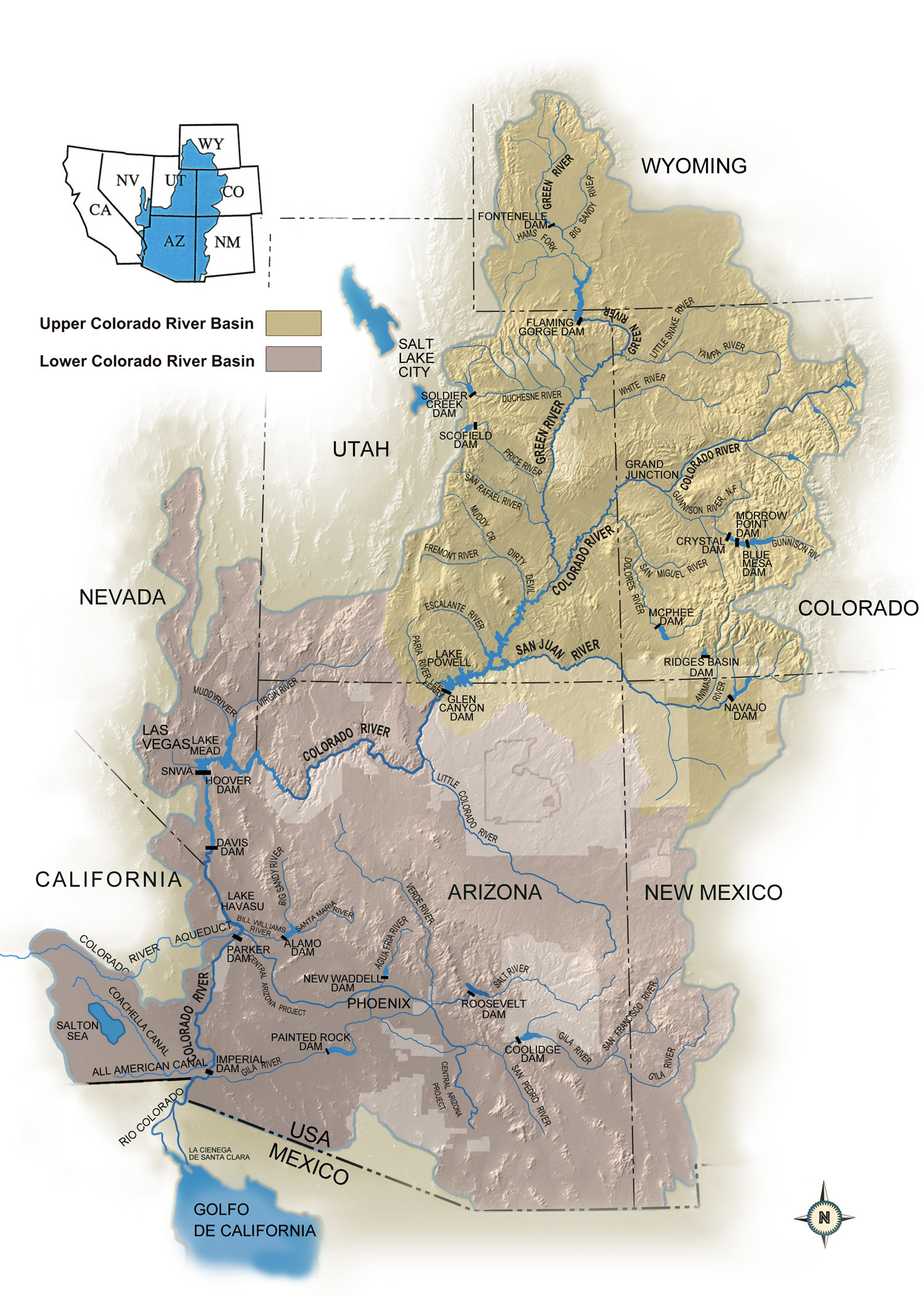
Here’s a map from Reclamation showing many of the tributaries and major dams in the basin:
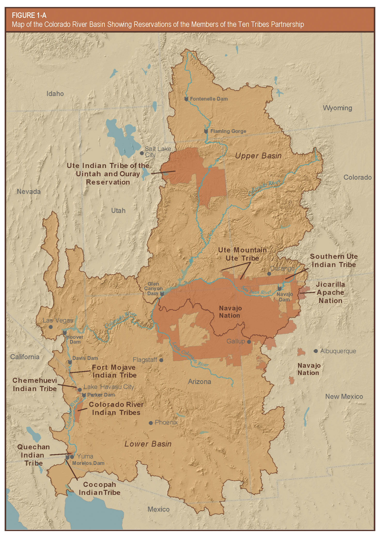
Native American tribes hold significant water rights in the Colorado River Basin. The map below from Reclamation shows reservations of members of the Ten Tribes Partnership, an organization that represents the federally recognized tribes with reserved water rights in the basin.
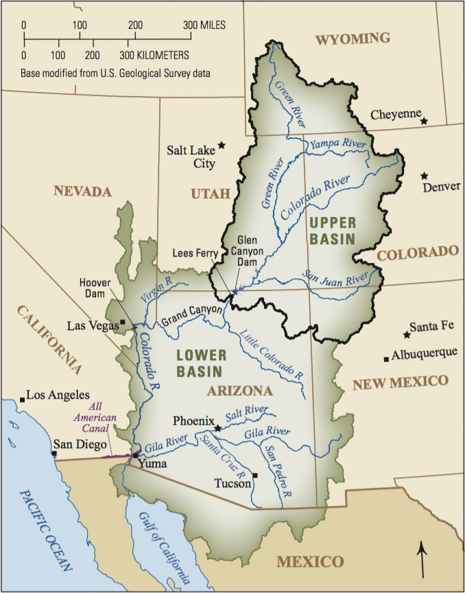
U.S. Geological Survey map
If you’re looking for a simpler map of the basin, the U.S. Geological Survey offers this image:
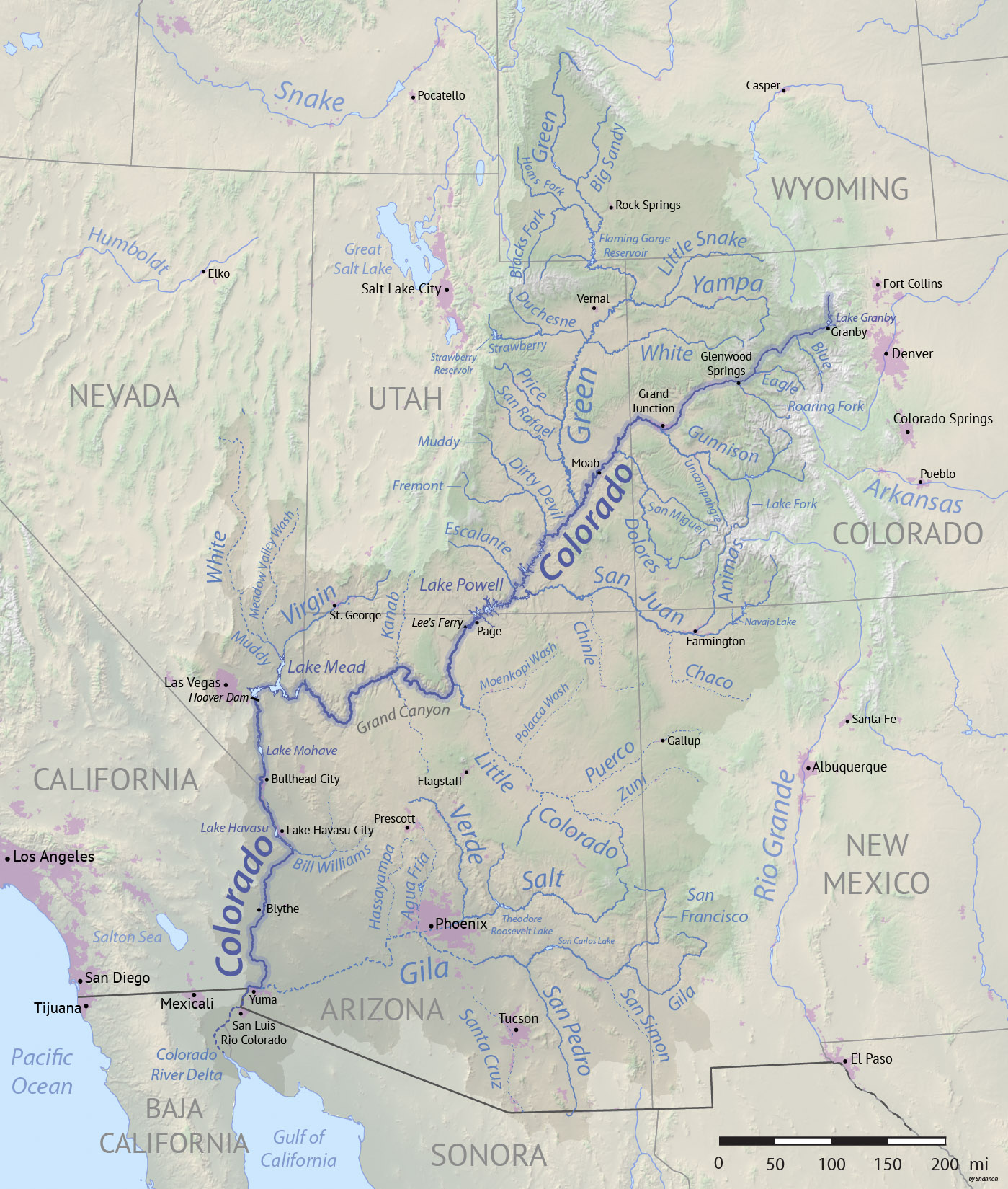
A user-created map from Wikipedia
Wikipedia’s Colorado River page offers an overview map of the basin created by user Shannon1, who has created a variety of river-related maps.
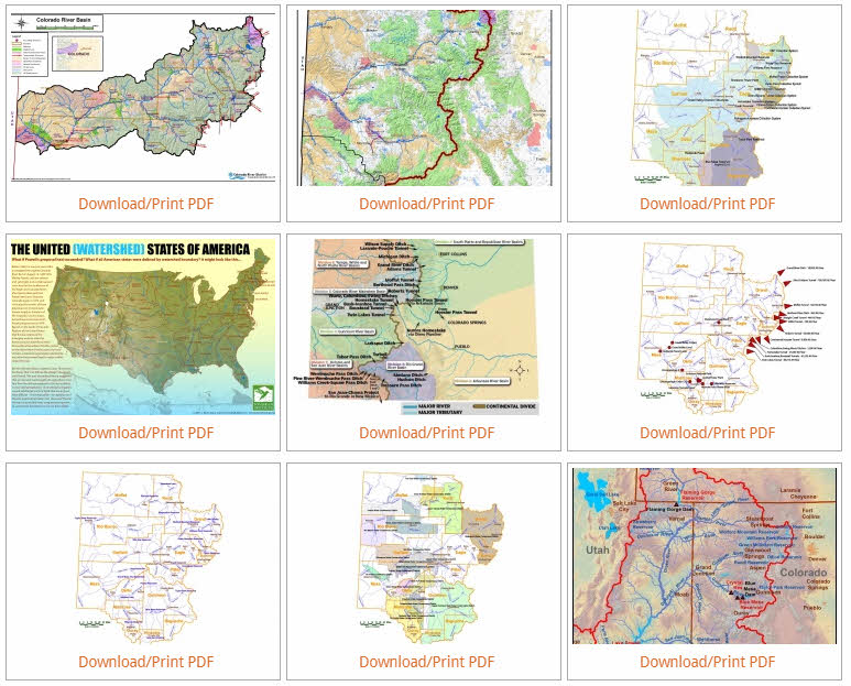
Dams and water providers: an interactive map
If you’d like to search for dams and water providers in the basin, the Colorado River Water Users Association offers an interactive map:

Another good source for Colorado River maps is a gallery created by the Colorado River District. Here’s a screenshot:
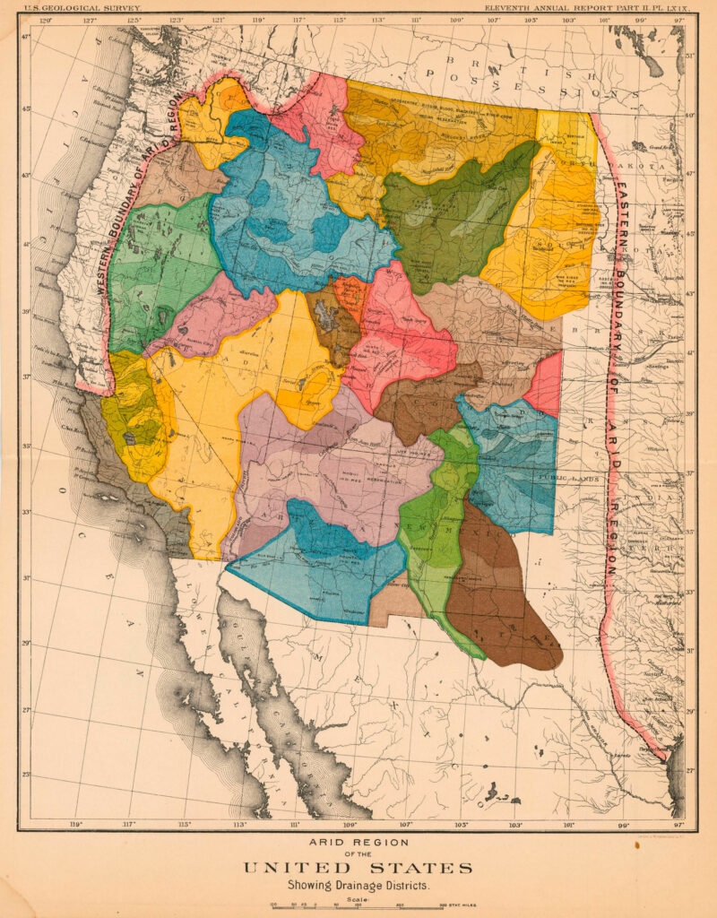
John Wesley Powell’s basin map
Finally, I would be remiss in writing a post about these Colorado River maps and not include one from famed explorer John Wesley Powell that outlines the boundaries of river basins throughout the West.
The map below, from an 1891 U.S. Geological Survey report that Powell authored as the agency’s second director, not only shows the watershed boundaries but also demarcates the arid region he explored and explained. On the east side, the boundary of the region approximates the 100th Meridian; to the west, the arid region excludes the very wet areas between the Pacific Ocean and the crest of the Sierra Nevada and Cascade mountain ranges.
Do you know of other helpful Colorado River Basin maps? Please contact us so we can add them to this page and our multimedia library.


